v. Yuzhnaya, along the edge of the NW wall of Ganal'skiye Ostryaki Ridge, Kamchatka. Led by Bichenko A.N. Climbed on May 3, 1995, report compiled on May 25, 2000.
Passport
- Category — rock.
- Kamchatka, Ganal'skiye Ostryaki ridge.
- v. Yuzhnaya, along the edge of the northwest wall.
- Assumed 5B cat. diff., second ascent.
- Height difference — 480 m, length — 695 m, length of sections with 5th and 6th cat. diff. — 247 m.
- Pitons left on the route — 11 (including 3 bolted).
- Climbing hours — 12.
- Leader — Bichenko Alexander Nikolayevich (CMS). Team members — Alekseev A.B. (CMS), Bekrin I.A. (CMS).
- Coach — Karpenko V.N. (MS).
- Departure for the route — May 3, 1995. Time — 6:00. Summit — 18:00, return — 23:00.
- Organization — year-round training camp of the "Kuth" climbing club.
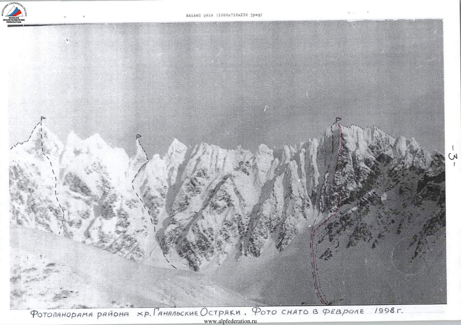
Photopanorama of the Ganal'skiye Ostryaki Ridge area. Photo taken in February 1998.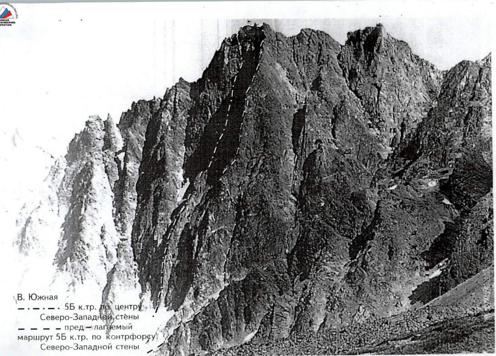
Brief overview of the ascent area
Ganal'skiye Ostryaki Ridge is located in the center of the Kamchatka Peninsula, as part of the larger Eastern Ridge system.
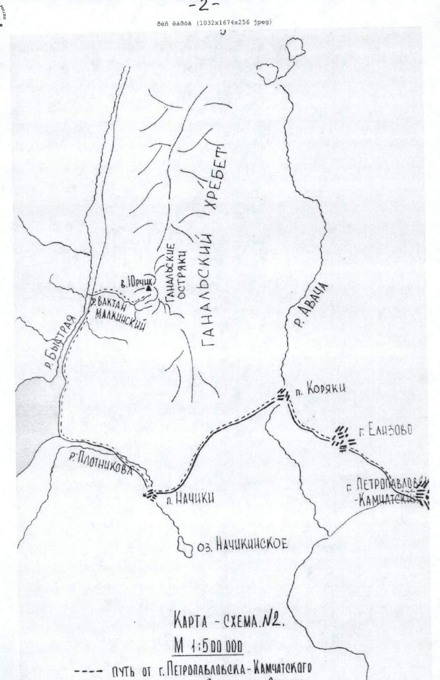
It is convenient to approach the climbing object from Petropavlovsk-Kamchatsky by high-clearance vehicle. From the city, take the Milkovo highway to the bridge over the Vakhtang Malkinsky river between 145 and 146 km (see Map-diagram No. 2).
Beyond the bridge:
- Turn onto a forest road.
- Drive along it for 8–10 km along the river through the valley to a large clearing where the forest road ends.
From the clearing:
- To the left of the road, in the alder bushes, a pedestrian trail begins.
- Follow the trail along the left side of the gully (do not turn left uphill).
- Continue to the exit onto a terrace.
- Reach a dry riverbed that crosses the trail at the boundary between forest and shrubland.
- Cross to the other bank of the riverbed.
- Ascend along it for 50–70 m.
- Then the trail turns right — follow it to a stream flowing from Yurчик mountain.
- Cross the stream and walk along it downstream for 100–150 m to a terrace above the stream flowing from the Ostryaki cirque.
- Follow the trail on the terrace for 800 m to the cedar thickets on the moraine cushions.
There is a good campsite for a base camp.
The hiking part of the route is 4 km, 1.5–2 hours with a load. Time from the city — 4–5 hours.
It is possible to land a helicopter in the Ganal'skiye Ostryaki cirque. Flight time — 20–25 minutes.
Approach from the base camp to the route:
- Upstream along the stream.
- Then along the stony moraine for 1 km to a snowfield lying in the cirque between Yurчик mountain and Ostryaki.
- Move right across the snowfield, cross the stream, and ascend the steep snow to the wall of v. Yuzhnaya (see Map-diagram No. 1).
Tactical plan for the ascent
5:00 — departure from the base camp. 6:00 — start working on the route. 12:00 — rest, lunch. 13:30 — start working on section R9–R10. 18:00 — reach the summit.
In case of the following situations:
- Deteriorating weather — descend from the route via the ascent route.
- Late departure from the summit and inability to descend in daylight — possible overnight stay on the summit.
Team's tactical actions
There are practically no deviations from the tactical plan, as the group is well-acclimated and all participants work equally as first on key sections, quickly and competently organizing stations, belays, and removing them. When passing the spurs, the recommendations of Farberov and Panyukhin were taken into account, and sets of "friends" were taken for the relief of open crevices directed downwards. For passing complex sections where IT was used, ladders were employed. The first person climbed without a backpack.
The observation team was located below on the glacier. Observation of the climbing group was carried out using:
- binoculars
- radio communication ("Dragon").
Food taken on the route:
- dried fruits
- lard
- crackers
- smoked sausage
- chocolate
- tea. Total weight — 2.5 kg.
Fuel — 1 gas canister — 250 g. Gas burner. Cookware set.
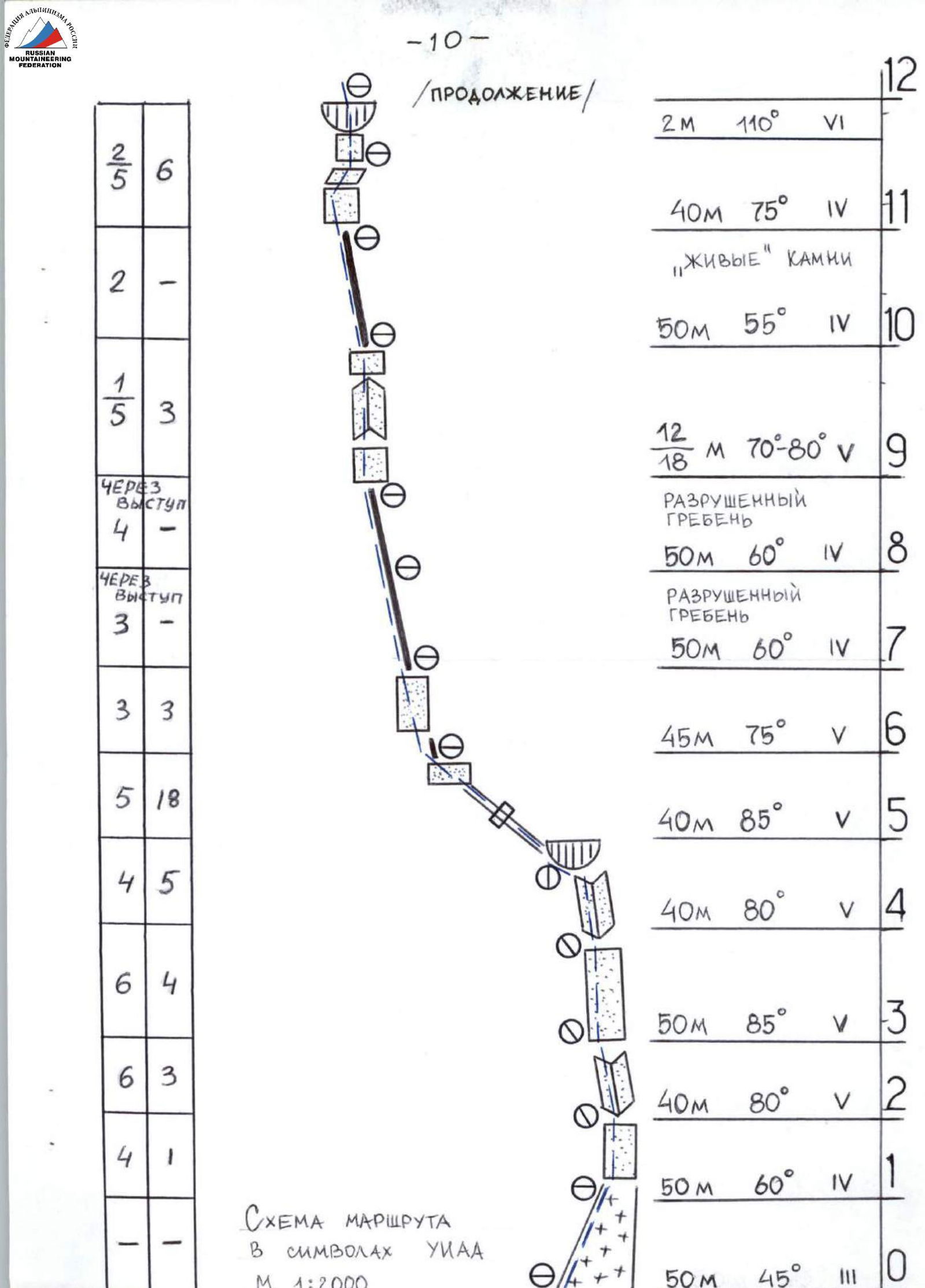
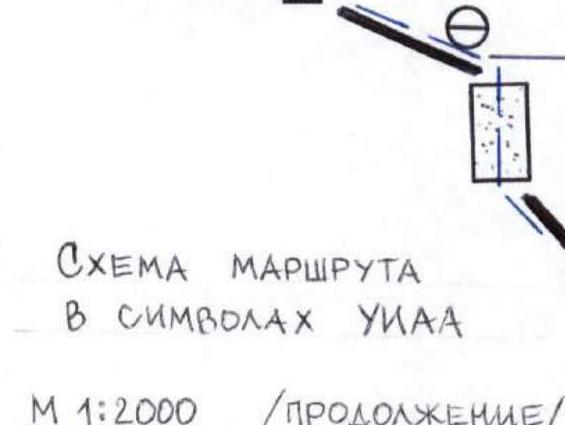
Route description
Approach to the wall via an ice-snow gully 50 m 45° along rocks, from it exit onto the wall, one rope to an extended inclined internal corner 90 m 80° with small overhanging exits (R3, photo 2). Ascend the corner (R4, photo 3). The corner leads to overhanging rocks, from under them exit left onto IT traversing under a small cornice along an oblique crack about 25 m 80° (the entire crack is traversed on IT). Then the crack turns into smoothed slabs 15 m (small cracks for short thin pitons), exiting onto the sharp edge of a spur. From it begins a ridge alternating with smoothed slabs (climbing in shoes). After passing the slabs, the spur becomes less steep, up to 60°. Rocks on it are heavily destroyed (objectively dangerous). For 100 m, belay is ensured through outcrops and large-sized pitons. Then the route meets a basalt wall of smoothed rocks with a steepness of 80°. The first 15 m — IT. Exit onto an inclined slab, from it a vertical wall with a protruding monolithic corner 10–12 m (at the beginning, a bolted piton is driven — belay). Passage directly upwards. Microrelief (R9, photo 4). The corner meets a small wall and turns into a ridge (live rocks). Along the ridge 50 m to solid slabs covered with lichen. Climbing in shoes is difficult due to cleaning the lichen (in rain, climbing is practically impossible, only IT). All cracks are blind. Then the slabs turn into a wall (R11, photo 5), leading under a cornice 1.5–2 m, the cornice is overcome directly (2 bolted pitons are driven). Behind it, exit onto an inclined slab (R12, photo 6). Then along the ridge under a bastion with a small wall (R13, photo 7), exit into a pre-summit knife-edge (R15, photo 8), along it to the summit. Exit onto the summit via a 3-meter wall directly. The summit is an inclined slab. Descent from the summit along the summit ridge to the right to a pronounced gully, descend 100 m rappelling into a snow gully. Then along the rocks, piton belay, down to the glacier (see photopanorama of the area).
 www.alpfederation.ru↗
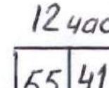

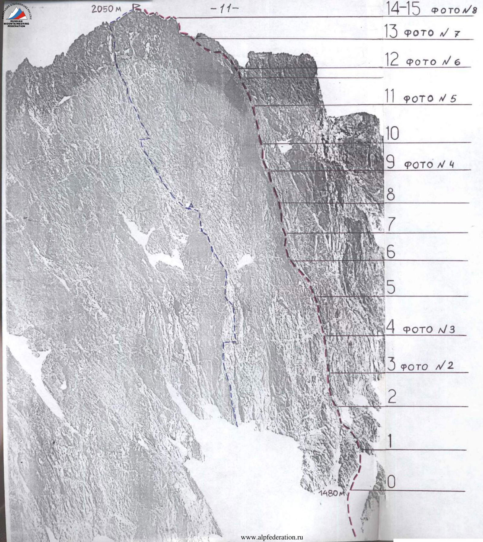 14–15, photo 8
13, photo №7
12, photo №6
11, photo №5
10
9, photo №4
8
7
6
5
4, photo №3
3, photo №2
2
1
0
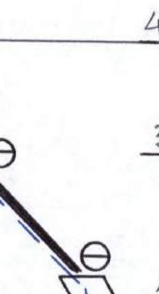
v. Yuzhnaya, 2050 m. Photo. Jupiter 130 mm lens. 1991. Farberov F. (5B cat. diff. along the center of the NW wall). Proposed route along the edge 5B.
14–15, photo 8
13, photo №7
12, photo №6
11, photo №5
10
9, photo №4
8
7
6
5
4, photo №3
3, photo №2
2
1
0
v. Yuzhnaya, 2050 m. Photo. Jupiter 130 mm lens. 1991. Farberov F. (5B cat. diff. along the center of the NW wall). Proposed route along the edge 5B.
Photo №2, section R3. Smoothed slabs with small overhangs. May 3, 1995. "KODAK" ("Point-and-shoot").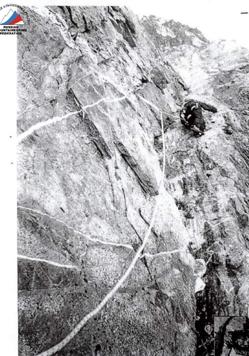
Photo №3, section R4. Passage along the internal corner under a cornice. May 3, 1995. "KODAK" ("Point-and-shoot").
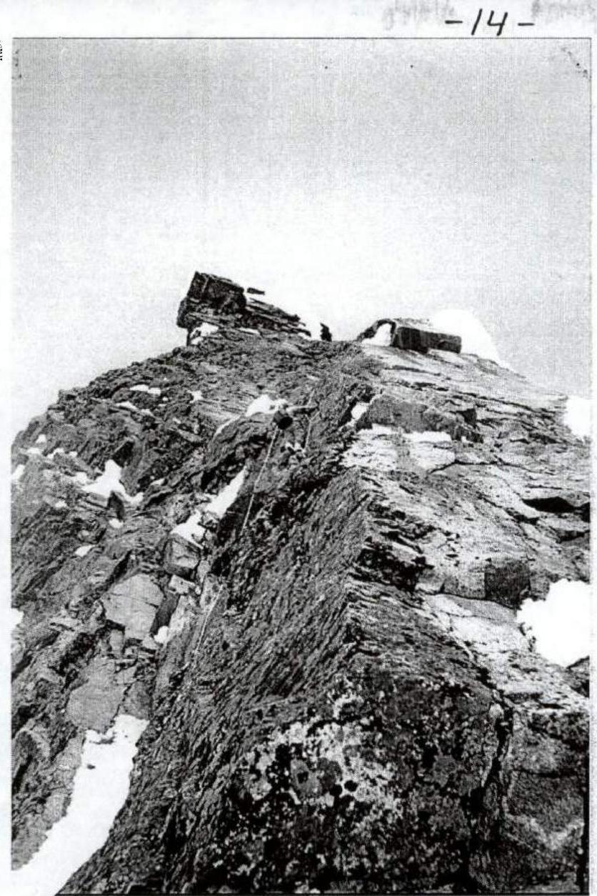
Photo №5, section R11. Passage along the wall under a cornice. May 3, 1995. "KODAK" ("Point-and-shoot").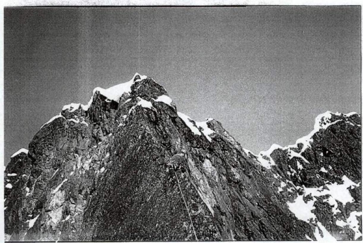
Photo №4, section R9. Exit in the upper part along the outer corner. May 3, 1995. "KODAK".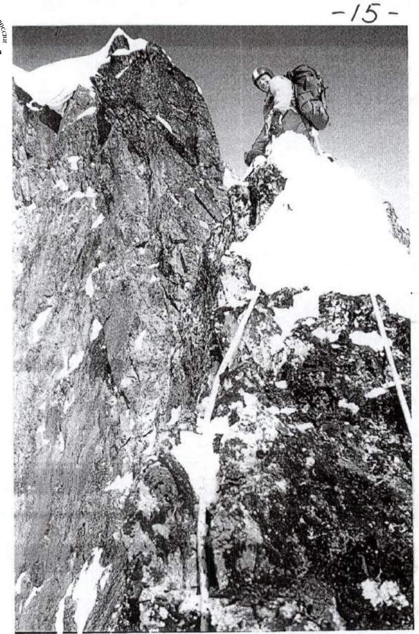
Photo №8, section R13. Approach along the ridge under the wall, leading to the pre-summit ridge. May 3, 1995. "KODAK".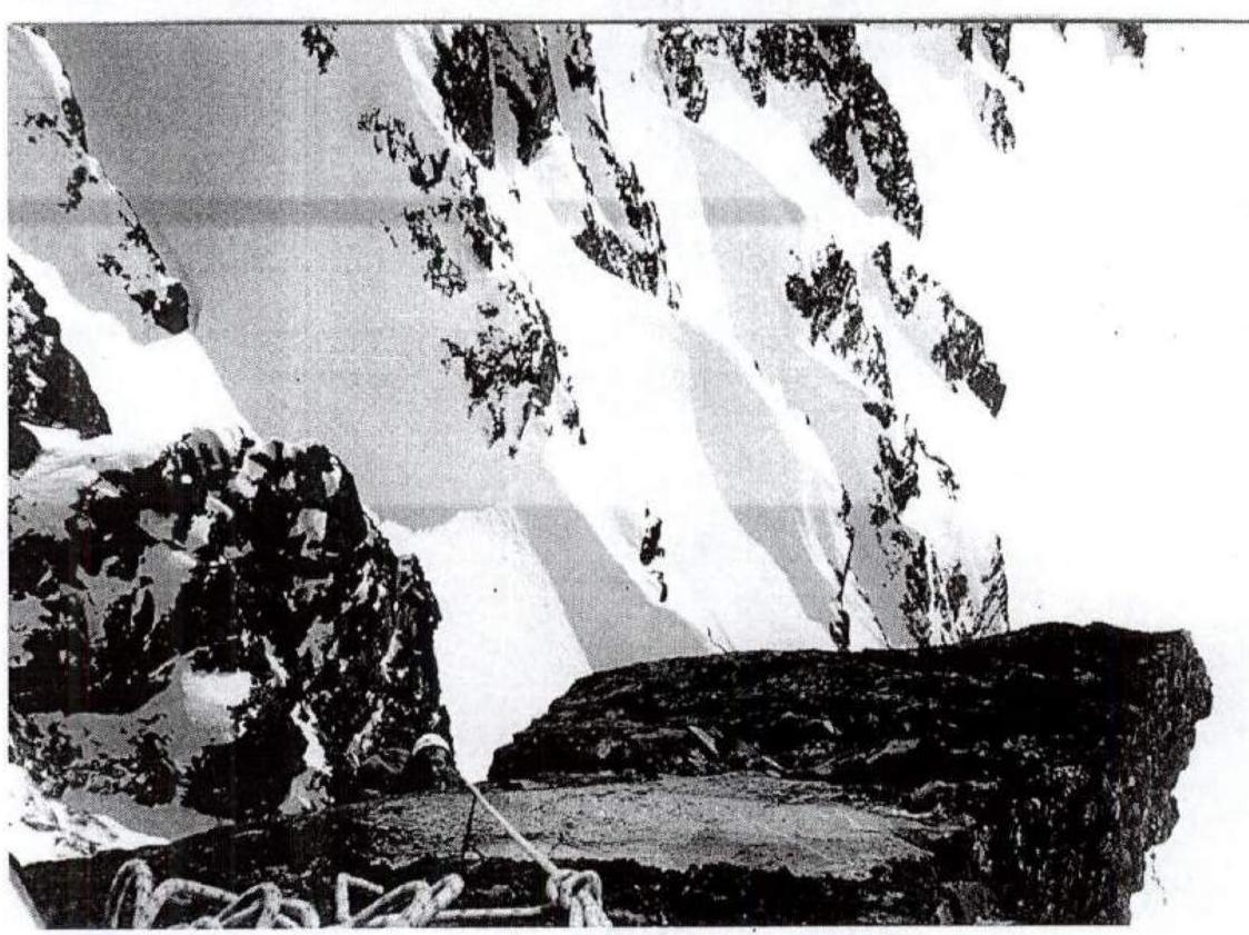
Photo №6, section R12. Exit from under the cornice onto a smooth slab. IT. May 3, 1995. "KODAK".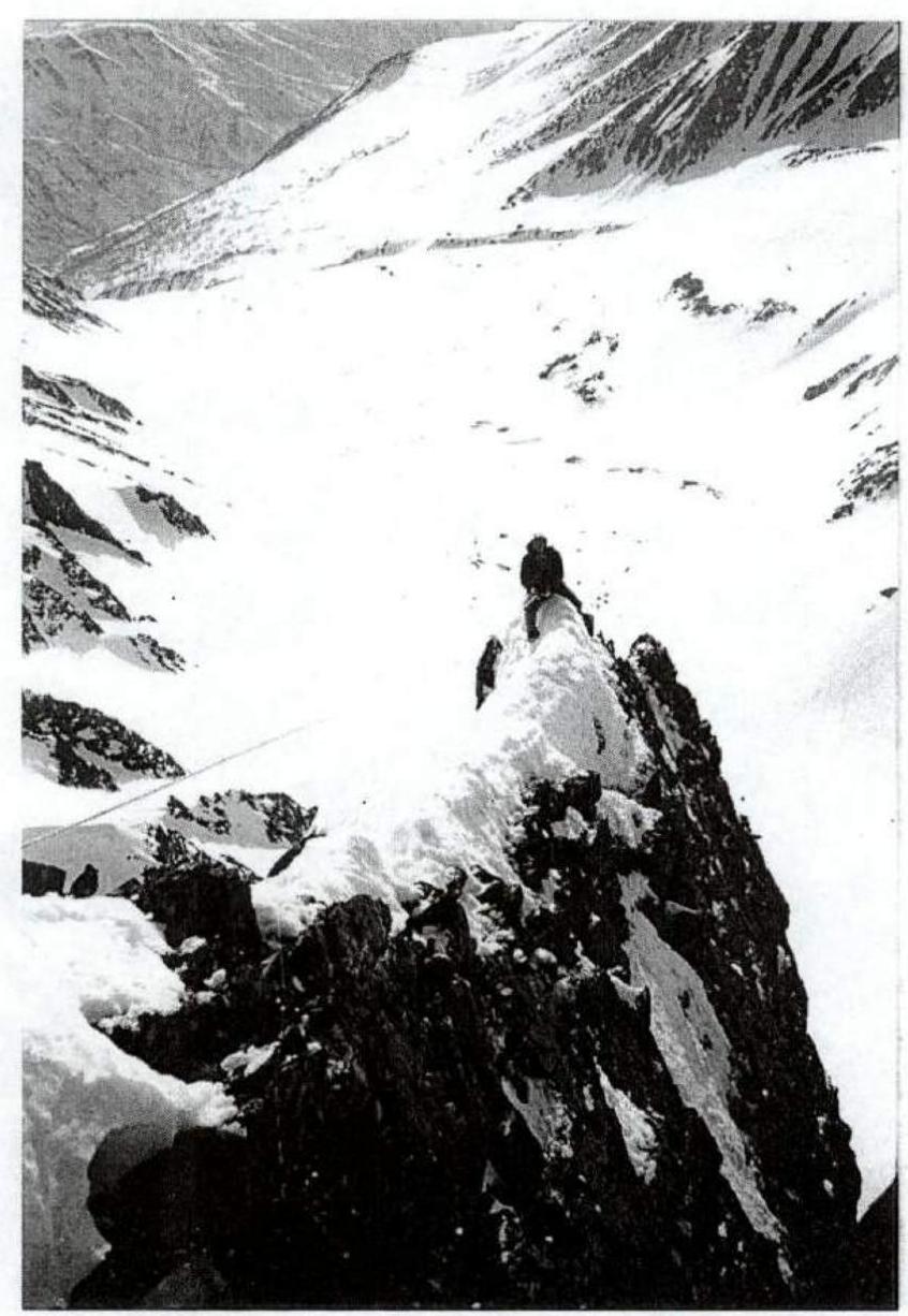
Photo №9, section R15. On the pre-summit ridge. May 3, 1995. "KODAK".