25
DESCRIPTION OF KAZEL'SKII VOLCANO TRAVERSE FROM EAST TO WEST, CATEGORY 3B DIFFICULTY.
1. General Description of the Summit and its Location
For a general description of the summit and its location, see the description of the ascent of Kozel'skii volcano via the Western Ridge, category 2A difficulty.
2. Approach to the Climbing Site
a/ Traveling by vehicle.
Travel to the settlement Rodygino is described in the ascent route description of Kozel'skii volcano, category 2A difficulty, via the Western Ridge.
From the settlement Rodygino, continue further along the dirt road (see map) through Kozel'skii stream. 12–15 km from Rodygino, turn left and continue along the road to the workers' houses near the quarry. Set up camp in the quarry area:
- There is plenty of firewood;
- Water is available until mid-July.
The absolute height above sea level at this location is 570 m.
3. Route Description by Sections
The total height gain from the camp to the "tooth" summit is 1640 m.
Section 1
Height gain — 400 m.
Steepness — 15°.
The path goes through the slag base of the volcano, heavily dissected by gullies 8 to 30 m deep.
Keep the direction of movement towards the ridge ascent (see photo 1).
Travel time — 2 hours 00 minutes.
Section 2
Height gain — 1050 m. There are rock anchors (3 pieces). On a monolithic rock, 15 m above the lower platform, there is a control note. Travel time — 3 hours 00 minutes. On this section:
- Initially, use piton anchors to ascend to a rock ledge;
- Then move left to reach the summit (15 m).
Be cautious, as the rocks are loose.
Steepness is 20–25°, with some areas reaching 30°. The ridge ascent consists of medium and large talus, simple rocks. There are small perennial snowfields at the beginning of the section.
Travel time — 4 hours 00 minutes. When crossing a snowy couloir, be aware that rocks may be falling from above.
This section ends at a wide snowy ridge running from northeast to southwest.
Section 3
Height gain — 150 m. Overall steepness is about 25°, with gendarme steepness at 45–60°. The rocky ridge consists of several basalt gendarmes. The rocks are strong and moderately difficult.
Move in rope teams with alternating protection through rock outcrops. Travel time — 1 hour 30 minutes.
At the beginning of this section, there is a control cairn. The control cairn is a note tied to an anchor driven into a large standalone rock on a snowy slope.
This section ends at a small platform below the wall of the "tooth" (see photo 2/3).
Section 4
Height gain — 40 m. Steepness is 60°. Over a distance of 4 meters from the platform, there is a wall with a negative angle of 15° for a short distance. The "tooth" (see photo 3) at this location is a monolithic basalt rock. The uppermost part of the rock is loose.
Move in rope teams with alternating protection using piton anchors (7 pieces).
Section 5
Height gain — 50 m. Steepness is initially 20°, and 80–90° on the wall. The summit ridge consists of loose rocks, which are simple. The wall is made of large monolithic basalt blocks.
Move in rope teams with alternating protection using an ice anchor. When descending down loose rocks, organize a belay. Then descend using a rappel to a connecting ridge.
Travel time — 1 hour 00 minutes. On the wall of this section, there is a control note on a rock anchor. See photo 4.
Section 6
Further on:
- Return via the category 2A difficulty route in the reverse direction along the Western Ridge.
- Alternatively, follow the category 3A difficulty route along the Southwest Ridge.
See the corresponding descriptions. Travel time — 6–8 hours.
4. Route Timing Calculation
R1 . . . . . 2 hours 00 minutes. R2 . . . . . 4 hours 00 minutes. R3 . . . . . 1 hour 30 minutes. R4 . . . . . 3 hours 00 minutes. R5 . . . . . 1 hour 00 minutes. R6 . . . . . 8 hours 00 minutes.
Total — 19 hours 30 minutes.
5. Recommendations for Climbers
- The number of participants — 4 people.
- Departure time from the bivouac — no later than 3:00 AM.
- Special equipment for a group of 4: a/ Main rope — 2×40 m; b/ Rock anchors — 5 pieces; c/ Piton anchors — 10 pieces; d/ Drill — 2 pieces; e/ Ladders — 2 pieces; f/ Ice anchors — 3 pieces; g/ Carabiners — 12 pieces; h/ Rock hammers — 2 pieces; i/ Prusik cord for loops — 5 m; j/ Crampons — 4 pairs.
- It's better to undertake this route with a partner group. In this case, an additional overnight stay at the Kozel'skii stream camp can be avoided.
Description compiled by /S. Grinkevich/
November 24, 1969
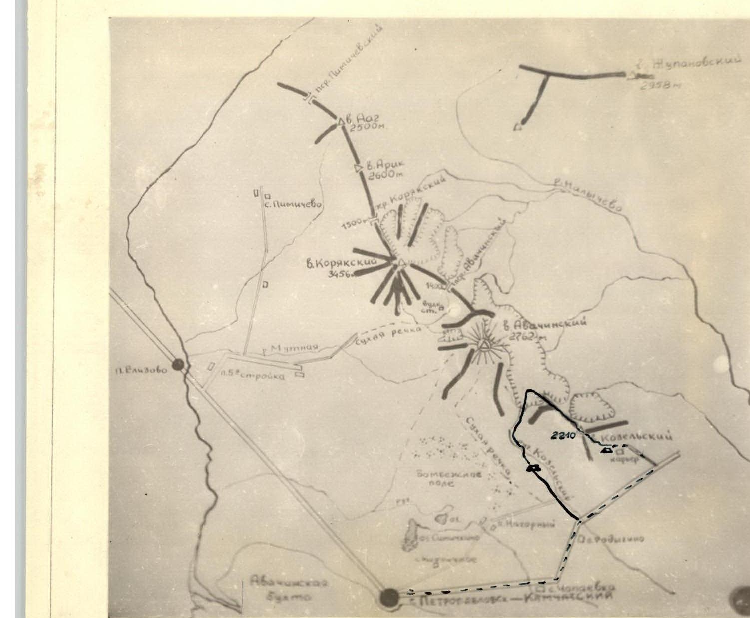
Map of Avachinskaya volcanic group
- approach route
- ascent route
- overnight locations
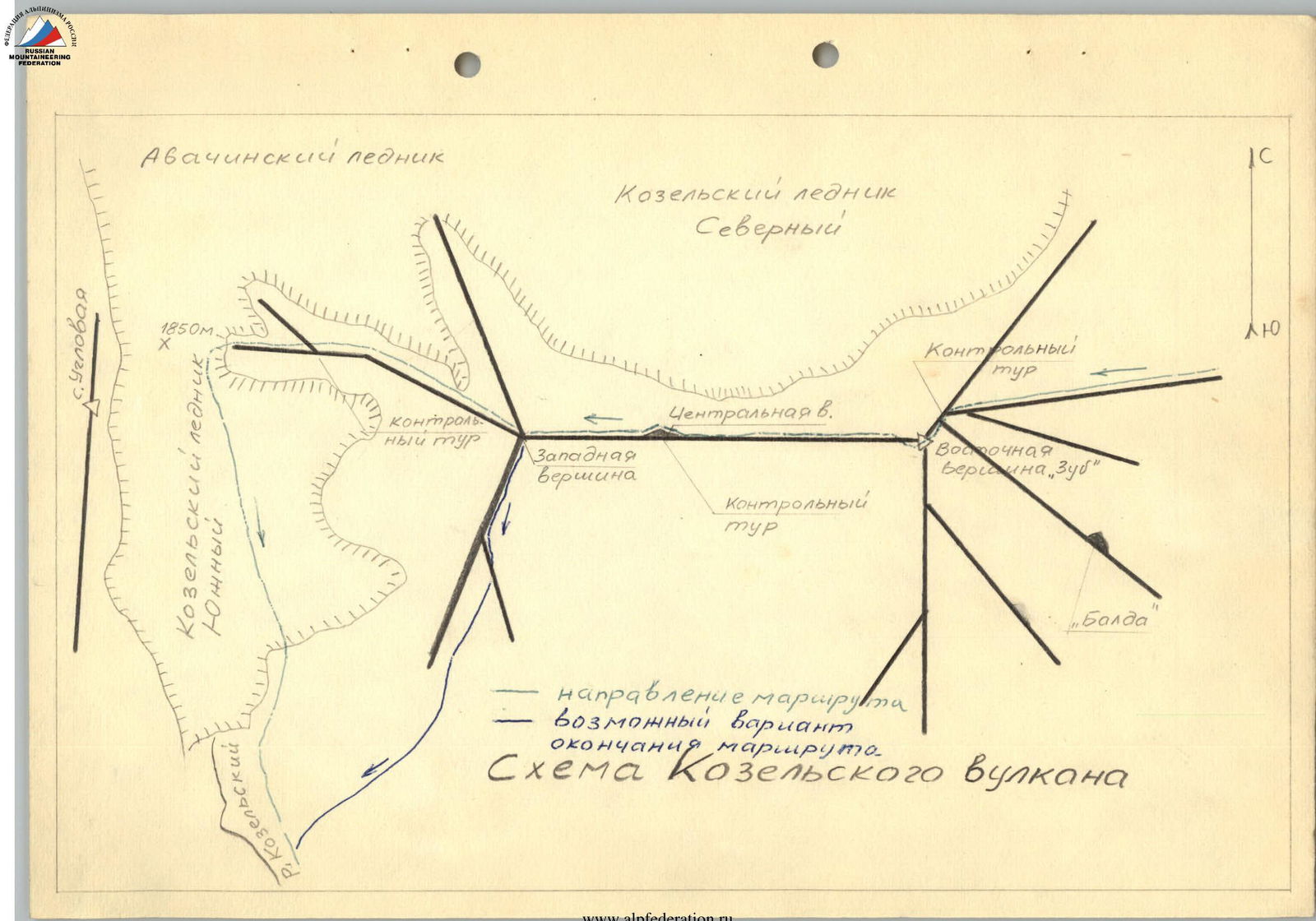
Diagram of Kozel'skii volcano
- route direction
- possible alternative ending
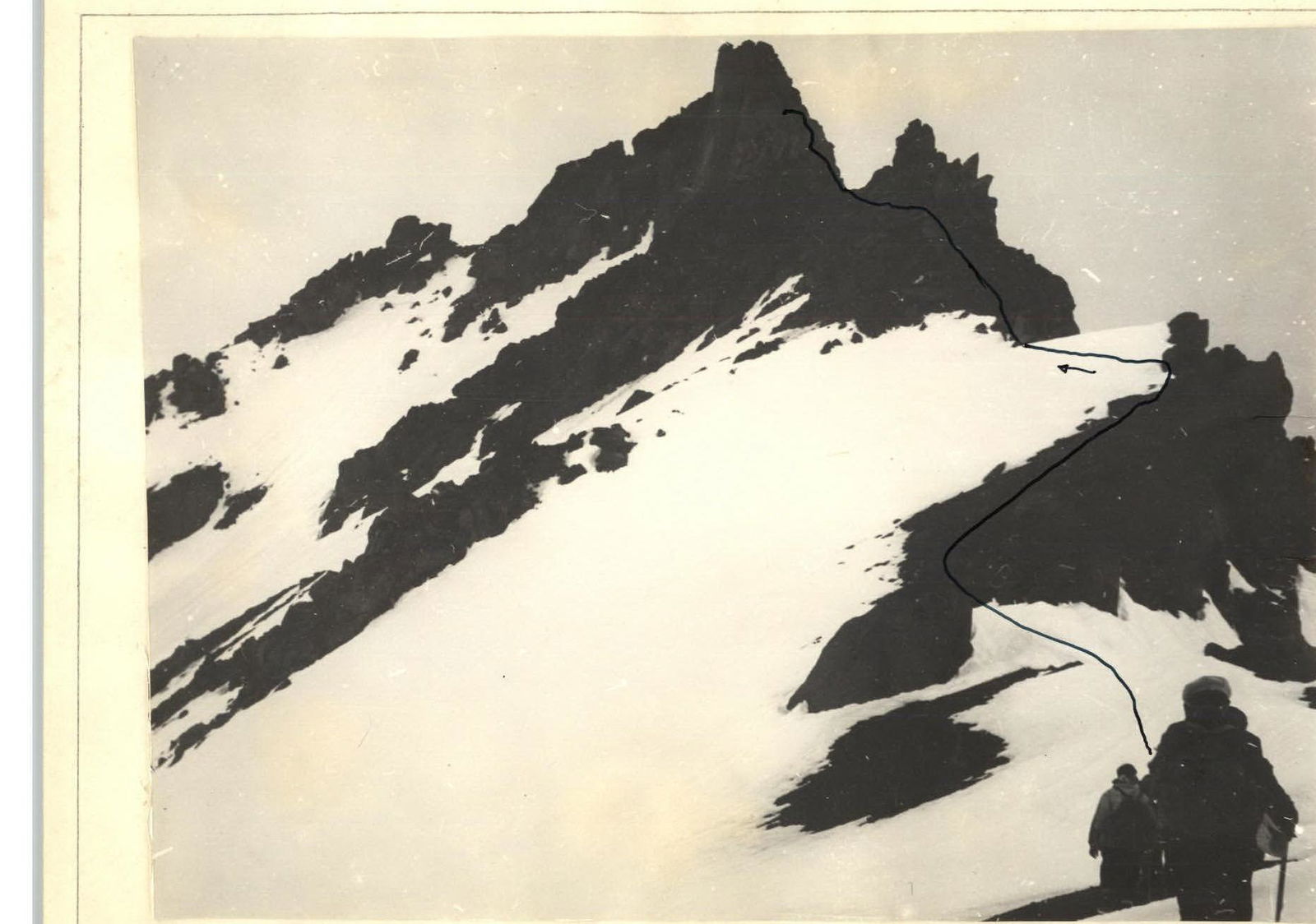
Photo 2a
Route of Section 3
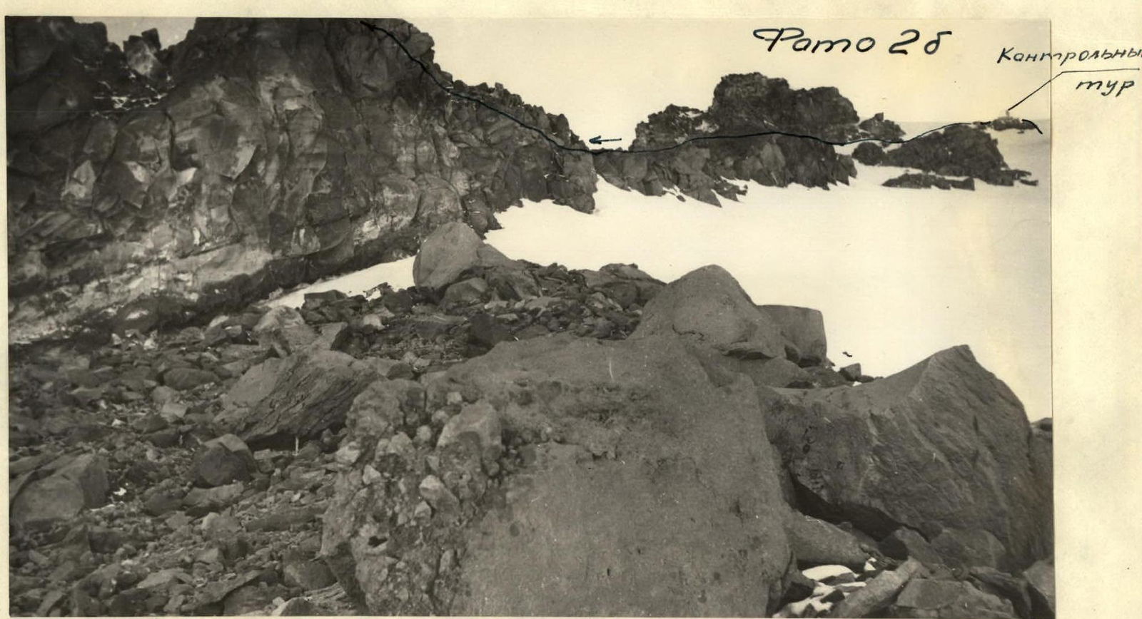
Photo 2b
Control cairn
Initial route of Section 3.
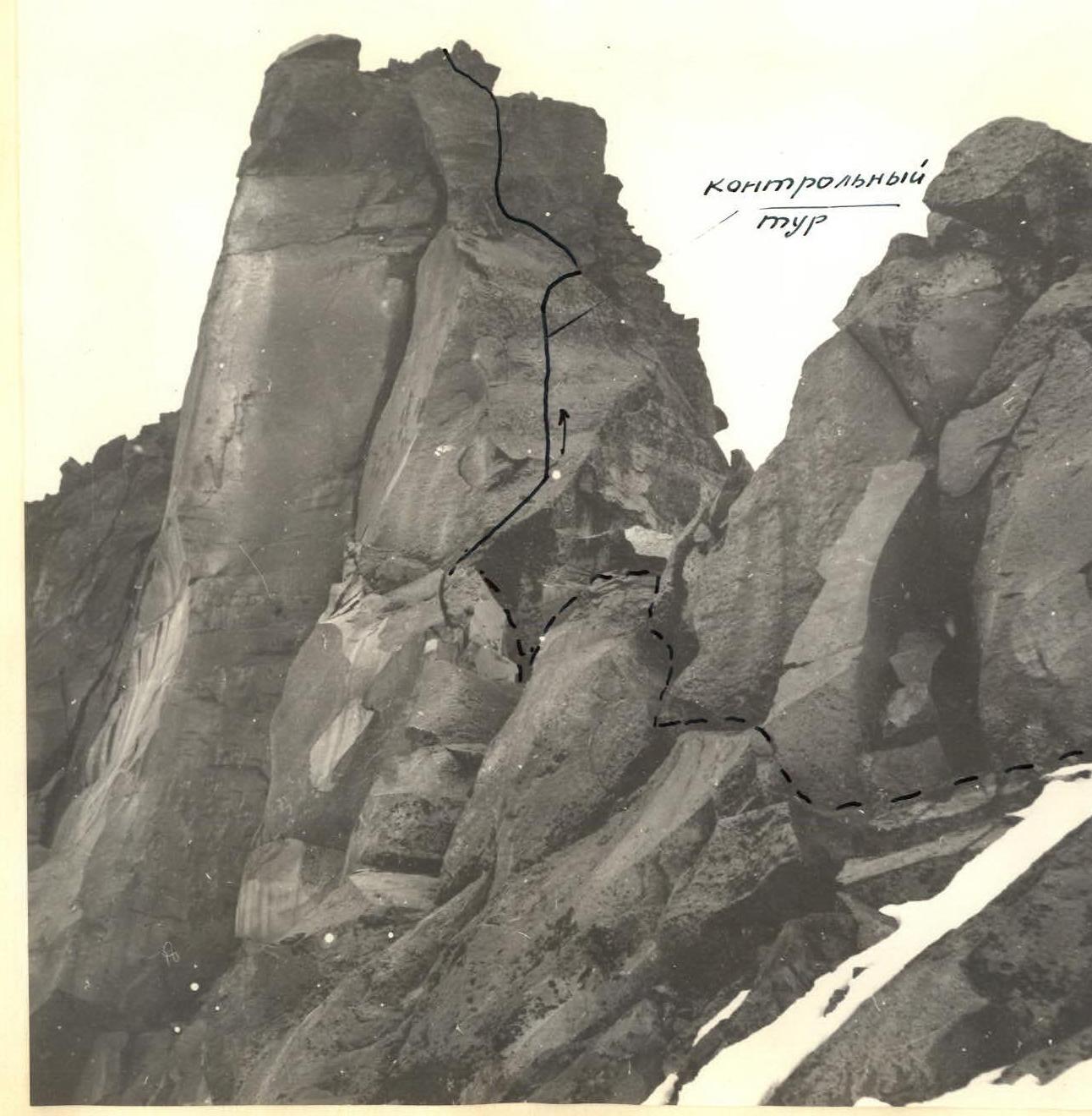
Photo 3
- route of Section 4
- final part of Section 3