KAMCHATKA V. Aag
Via the South Edge, category 3A difficulty
Material on the first ascent of the route to Mount Aag. Height 2500 m, via the southern edge, category 3A difficulty.
Route Description
Mount Aag is located in the northwestern part of the Avachinskaya group of volcanoes, 50 km from the city of Petropavlovsk.
The path to the volcano begins from the settlement of 5th Stroika. In good weather, the summit serves as a landmark; in poor visibility, the direction is taken by compass — 37° NW.
The journey from the settlement to the initial bivouac takes 10 hours.
The initial bivouac is set up on a plateau near a triangular rock.
The height of the plateau is 700 m.
Departure at 2 am to avoid the snow getting soggy on the plateau during the day.
Crossing the plateau, approach the snowy slope (steepness 35–40°, length 500 m) and reach the ridge.
Along the heavily destroyed ridge with rare rocky pinnacles (steepness 20–25°, length 300 m), approach the snowy ascent with a steepness of 40–45° and a length of 250 m (with protection).
Reach two rocky pinnacles, which are bypassed on the right via destroyed rocks (steepness 20–25°, length 300 m), and approach the tongue of the glacier on its right side (length 300–350 m, steepness 15–20°).
The glacier is traversed in teams; at the beginning of the glacier, steps are cut, and 1–2 ice axes are hammered in.
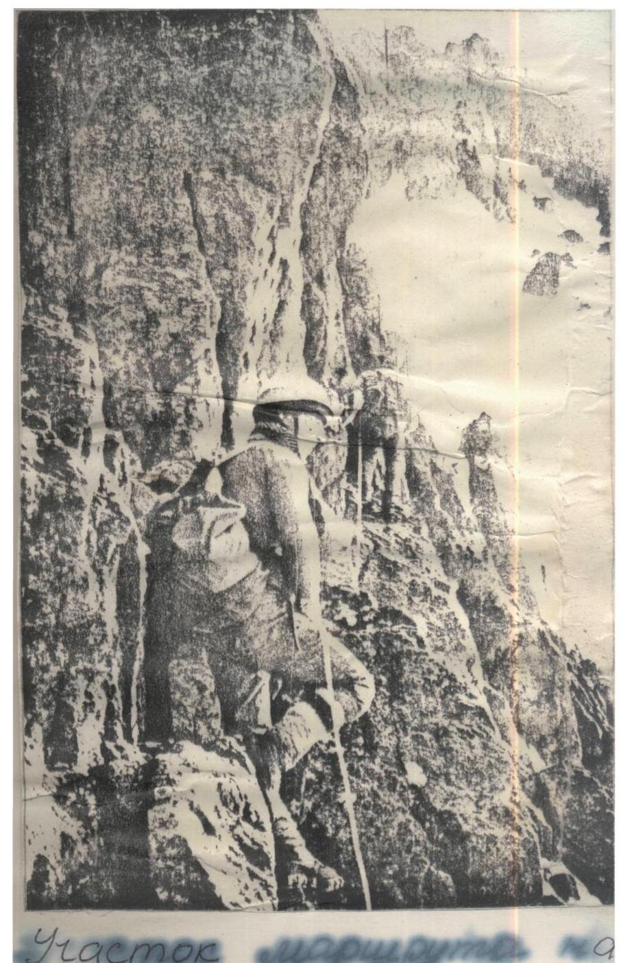
After crossing the glacier, reach a steep firn ascent with a steepness of 45° and a length of 200 m (with protection), then cross a rocky outcrop and approach the wall (length 80 m, steepness 65–70°, with piton protection).
Overcoming the wall, traverse the ridge via simple and moderately difficult rocks (length 100–150 m), reach a snowy ascent with a steepness of 40–45° and a length of 100 m (with protection), after which traverse a rocky wall with a steepness of 65–70° with "live" stones (with protection, length 300 m).
From the wall, reach the beginning of the rocky "saw". The "saw" is traversed with protection via ledges (length 100 m).
Further, via rocks of moderate difficulty (length 60 m, steepness 55–60°, with protection), reach a snowy saddle (with protection).
From the saddle, reach the pre-summit ridge. Along the ridge with simultaneous protection (length 600–700 m, steepness 20–25°), approach the summit ascent. Further, via a rocky chimney with a height of 5 m and a snowy ascent with a length of 50–60 m and a steepness of 35–40° (with protection), reach the summit.
Descent is via category 1B difficulty. Total length of the route is 3100 m.
Participants of the first ascent:
- Shevtsov V.I., CMS
- Krinitskiy I.I., CMS
Observation group:
- Teplyakov V., III sports category
- Korbanov S., III sports category
- Pogorelova T., badge holder
Equipment used during the ascent:
- Main rope 1 piece — 30 m.
- Repschnur expendable 2–3 m
- Carabiners 8 pieces
- Hammers 2 pieces
- Rock pitons 8 pieces
- Ice pitons 2 pieces
- Crampons 2 pairs
- Helmets 2 pieces
REPORT COMPILED BY (SHEVTSOV V.)
1B–3 slope
3A south ridge