ASCENT CERTIFICATE
I. Climbing category — rock.
-
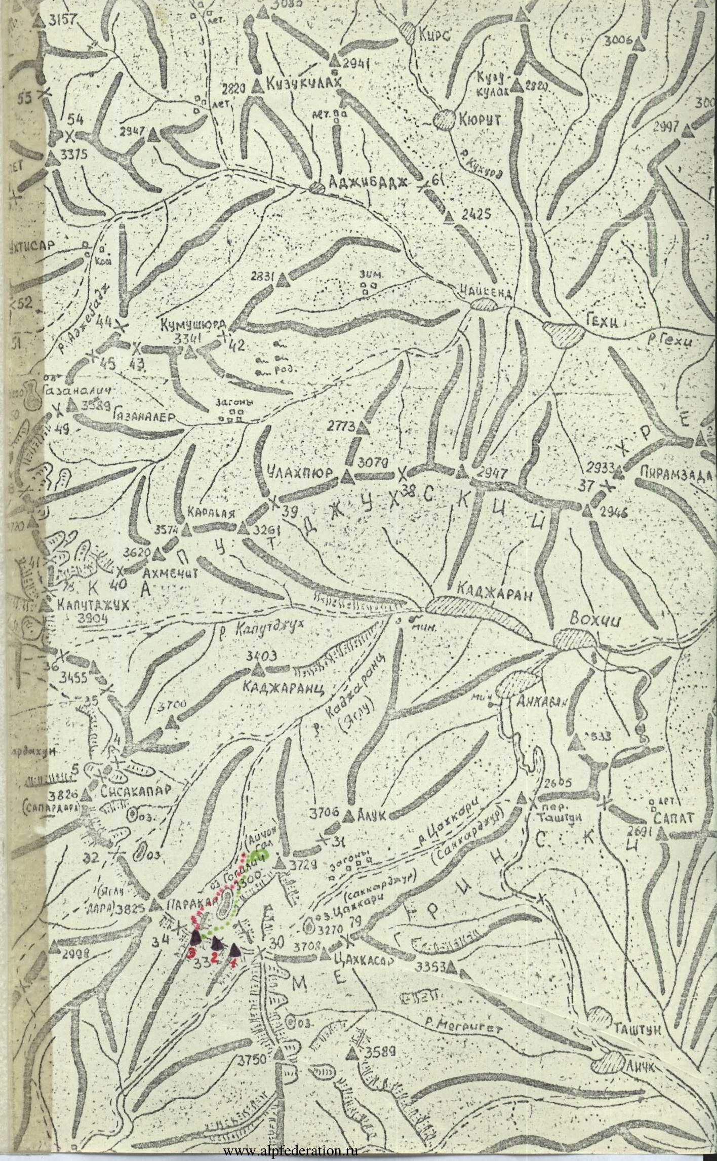
Region, mountain range — Lesser Caucasus, Zangezur mountain range.
-
Peak, its height, ascent route — U. Avetisyan peak, 3685 m, via the eastern ridge.
-
Proposed category of difficulty — 3B.
-
Route description:
height difference — 220 m, length of sections with 5B–6 category of difficulty — 5 m, average steepness — 45°.
- Pitons hammered:
for belay — 18 (0); rock pitons — 2 (0); ice screws — 4 (0); chocks — 3 (0).
-
Total climbing time — 11 hours.
-
No overnight stays on the route.
-
Leader — S.G. Arutyunyan, 1st category.
Team members: F.S. Grigoryan, 1st category, G.G. Mantashyan, 1st category, N.G. Tamamyan, 1st category, G.N. Khachatryan, 1st category.
-
Team coach — N.G. Tamamyan.
-
Date of departure and return — October 12, 1984.
-
Organization — Republican Climbing Club "Aragats" Armenian SSR, Yerevan, Paronyan str., 13.
| 3157 | 3085 |
|---|---|
| 54 | 294 |
| 5375 | 2997 |
| 1110 | 2425 |
| 52 | 30 |
| 44 | 42 |
| 4543 | |
| 49 | 2773 |
| 3070 | |
| 3947 | |
| 2773 | |
| 2933 | |
| 3946 | |
| 2773 | |
| 3455 | |
| 3204 | 3003 |
| 3455 | 3700 |
| 3204 | 3700 |
| 3204 | 3700 |
| 3204 | 3700 |
| 3204 | 3700 |
| 3589 |
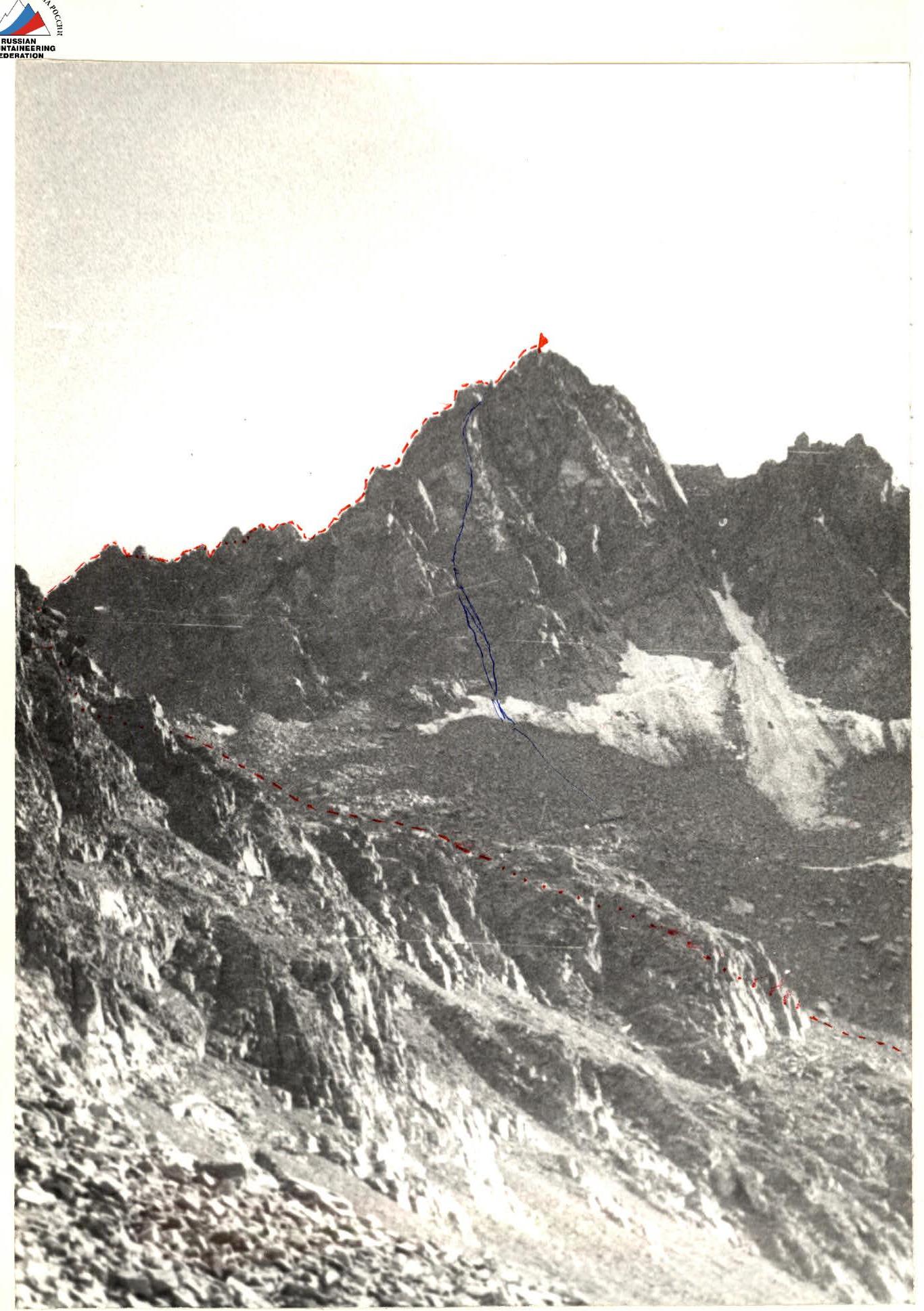
"Photo of the summit". U. Avetisyan peak via the eastern ridge. Combined route by S. Arutyunyan. October 12, 1984. 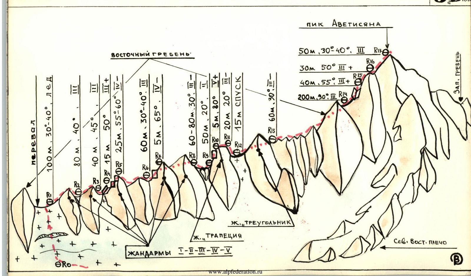
Approach to the Route Description
From Kajaran town, Armenian SSR, up the Kajaran river gorge to the picturesque Gogelich (Gogigel) lake, altitude — 3120 m. Bypassing the lake on the left along the shore, exit onto a large scree slope descending from U. Avetisyan peak (3685), and into a stone cirque on the Eastern shoulder of this peak. Turning left, exit onto a saddle in the cirque and then into a snow-ice cirque under the pass between U. Avetisyan peak and Tsakhkasar peak. The route begins with an ascent to this pass via a steep glacier tongue.
| 3157 | 3063 | 3041 | 3006A | 3003 |
|---|---|---|---|---|
| 33 | 32 | 32 | 3041 | 3006A |
| 3375 | 3375 | 3375 | 3006A | 3003A |
| 2997A |
Exit to the pass on the eastern ridge