Tfan Glavny via North-East wall Mamedov E.S. East Caucasus 2.11.15 11
Passport
-
Route type — ice and snow
-
East Caucasus, Makhmudchai river gorge
-
Tfan Glavny via North-Eastern wall
-
Claimed category — 3B ice and snow, first ascent
-
Height difference — 690 m, route length — 1230 m
Length of sections with category 3–4 difficulty — 15 m category 4 difficulty — 200 m category 5 difficulty — 5 m
Average steepness of the main part of the route — 56.5°
-
Moving hours — 7 hours
-
Leader — Mamedov Elchin Soltan oglu
Participants — Ragimov Elman Mubariz oglu
- Singin Dmitry Gennadievich
-
Coach — Jafarov Rasim Pashaevich
-
Departure — summit — return — September 21, 1994
-
Organization — Azerbaijan Republican Mountaineering Club

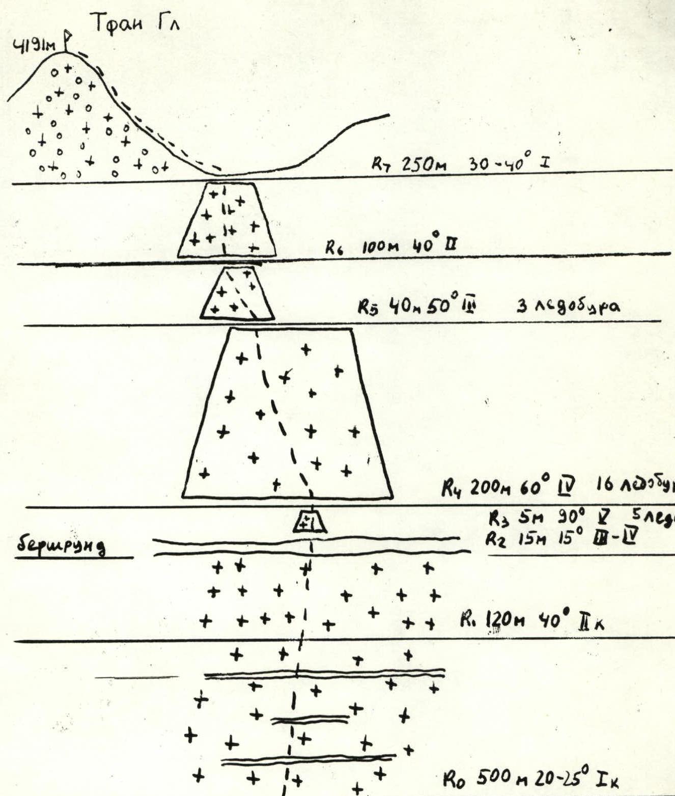
Tfan Gl. 4191 m
R7 250 m, 30–40° 1 R6 100 m, 40° 2 R5 40 m, 50° 3, 3 ice screws R4 200 m, 60° 4, 16 ice screws R3 5 m, 90° 5, 5 ice screws R2 15 m, 15°, 3–4 Bergschrund R1 120 m, 40° 2 R0 500 m, 20–25° 1
Tfan Glavny category 3B ice and snow via NE wall Ice screws used — 24 — visible part of the route moving hours — 7 hours
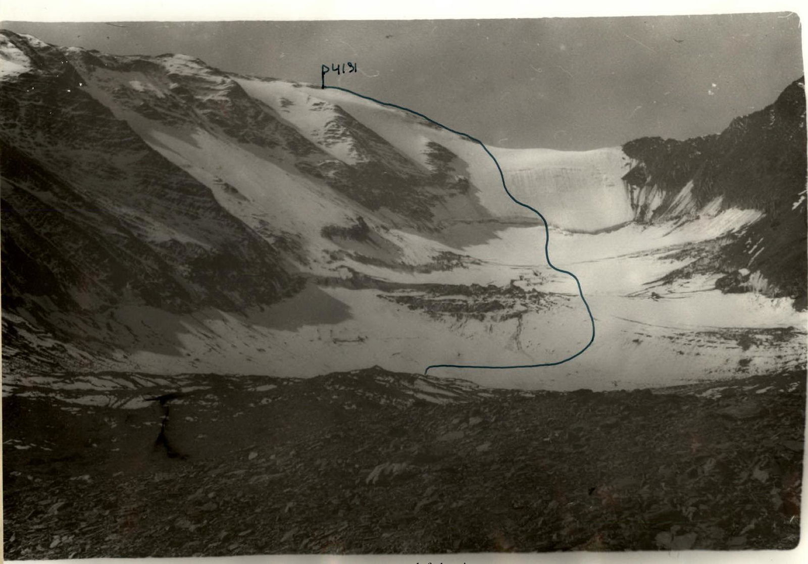
Tfan Glavny (4191 m) via North-Eastern wall, category 3B ice and snow
Brief description
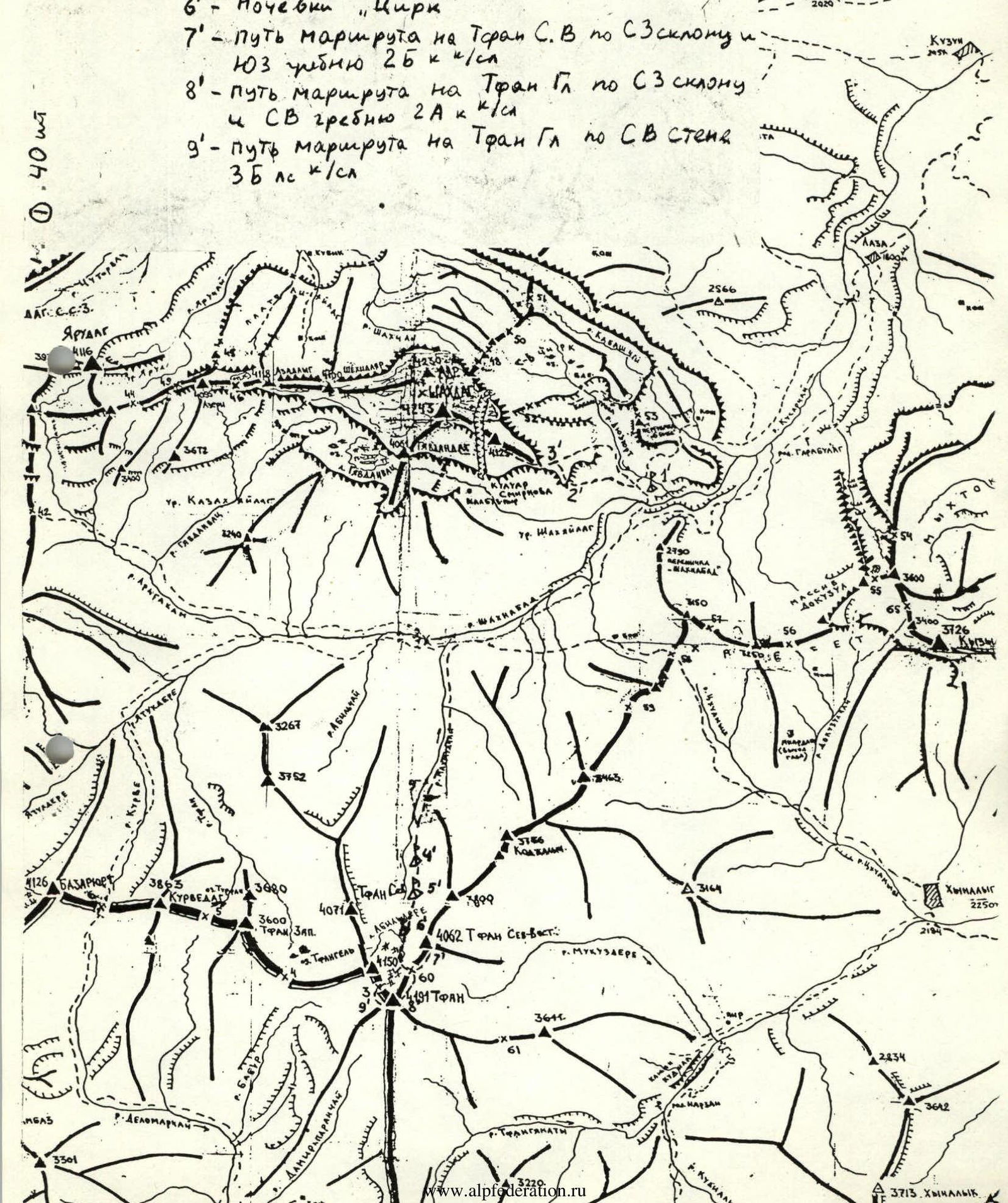
From Kuzun village, take a dirt road to Laza village (about 7 km). From Laza village, follow a good trail on the left side of the Kusarчай river, then along the Shakhnabad river to the entrance to the Shakyaylag tract. From Kuzun village, it takes 8–9 hours. From the entrance to the tract, move along the left side, following the Shakhnabad river, then along the left side of the Makhmudchai river. Reach the end of the grassy slopes. Convenient campsite (Lower Tfan campsite). From the entrance to the Shakyaylag tract to the Lower Tfan campsite, it takes 2–2.5 hours.
From the campsite, move along the left side of the river, up the gorge, reach the glacier covered with stones and go to the waterfall. There's a place for several tents. From the Lower Tfan campsite, it takes 40 minutes. From the waterfall, bypassing the gentle rocks on the left, reach a weakly defined saddle. 600 m from the waterfall. Upper Tfan campsite. From the Lower to the Upper Tfan campsite, it takes 2–3 hours. Then, along the glacier covered with small scree (in some places, exposed ice), following the left scree ridge, move towards the central part of the glacier. Approach the bergschrund in its middle part, 400 m, 30–40°. Cross the bergschrund via an ice bridge. Then, up the gentle, broken rocks and open glacier, 100 m, 30–35°. Along the glacier covered with stones, reach the cirque, 500 m, 10–20°. "Tsirk" campsite. From the Upper Tfan campsite, it takes 2–3 hours. From the "Tsirk" campsite, move along the glacier covered with stones towards Tfan Glavny peak. 300 m, 0°. Approach the open part of the glacier. Start of the route.
Along the glacier, bypassing a series of crevices on the right, then center, reach the bergschrund, 500 m, 20–25°, category 1, in the upper part, 120 m, 40°, category 2. Cross the bergschrund in its central part via a snow bridge, 15 m, 15°, category 3–4. Then, overcome the ice wall of the bergschrund, 5 m, 90°, category 5. Climb the ice and snow wall of the route with a slight traverse left-upwards, following the movement, and reach the pre-summit ridge. Then, along the wide snow-scree ridge, reach Tfan Glavny summit. From the start of the route to the summit, it takes 7 hours. Descent via the route, then to Tfan (Gl.) via NE wall and NE ridge.
Footnotes
-
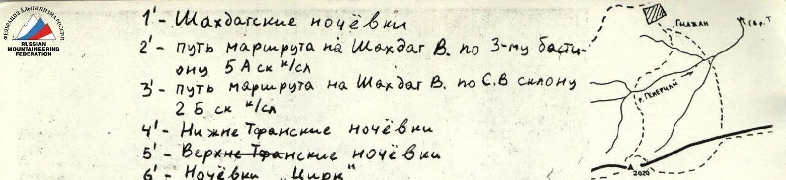
1' — Shakhdag campsites 2' — route path on Shakhdag E. via 3rd bastion, category 5A 3' — route path on Shakhdag E. via N-E slope, category 2B 4' — Lower Tfan campsites 5' — Upper Tfan campsites 6' — "Tsirk" campsite 7' — route path on Toran N-E via NW slope and SW ridge, category 2B 8' — route path on Tfan Gl. via NW slope and NE ridge, category 2A 9' — route path on Tfan Gl. via NE wall, category 3B ice and snow ↩