Bazaryurt
via NW ridge by Baranov S. N. East Caucasus 2.11
PASSPORT
- Route type — combined
- East Caucasus, Yatukh-Dere, Shakhnabad, Kusar-Chay gorges
- Bazaryurt via North-West ridge
- Presumably 1B category of complexity — first ascent
- Height difference — 926 m, length — 2450 m Average steepness of the main part of the route — 25°
- Moving time — 5 hours
- Leader — Baranov Sergey Nikolayevich
Participants:
- Bondarev Aleksandr Evgenievich
- Gamidov Niyaz Sabirovich
- Kerimova Irada Kerimovna
- Asadova Zemfira Ismail kyzy
- Coach — Jafarov Rasim Pashaevich
- Departure — summit — return — August 28, 1993
- Organization — Azerbaijan Republican Mountaineering Club
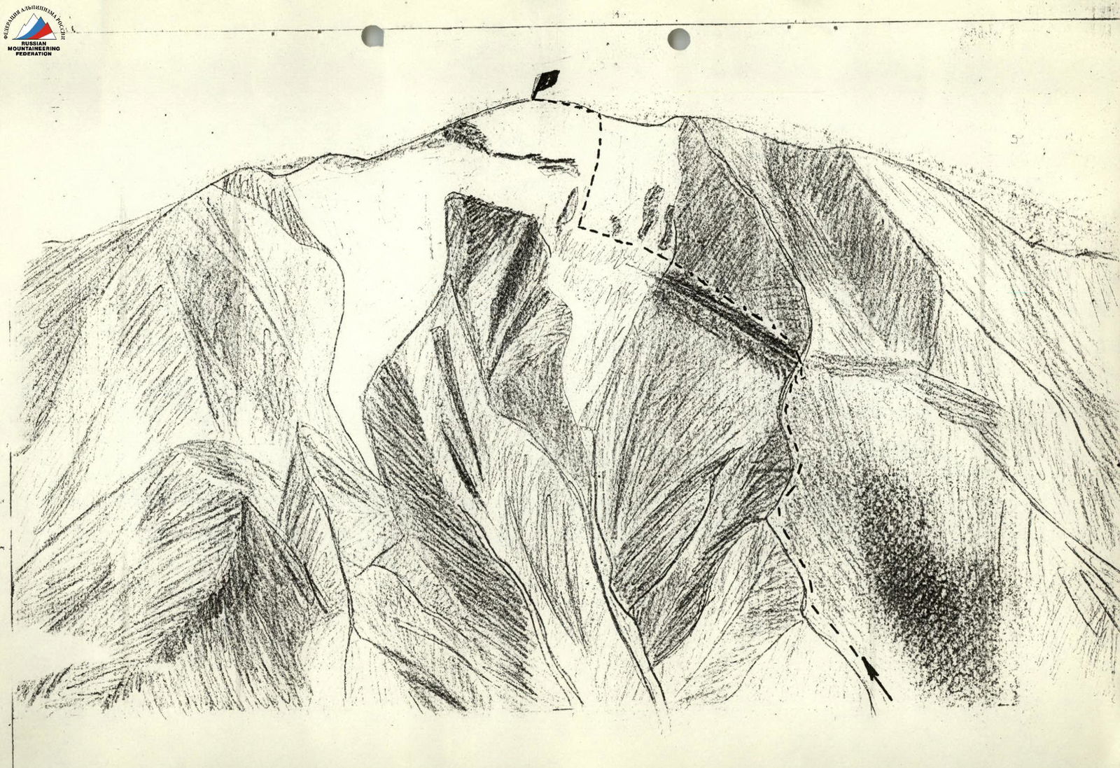
Mt. Bazaryurt (4126 m) via NW ridge, 1B category of complexity.
Brief Description
From the village Kuzun along a dirt road to the village Laza (about 5 km). From Laza, along a good trail on the left side of the Kusar-Chay River, then along the Shakhnabad River to reach the Shahyaylag tract. Cross the Shakhnabad River via a bridge. From the village Kuzun to the bridge — 9–12 hours.
Then move upstream along the right side of the Shakhnabad River. Cross the river flowing from the Kurush Pass. Continue upstream along the right side of the Yatukh-Dere River. 200–300 m before the Yatukh Pass, on a grassy clearing at the foot of a rocky hill — good camping spots. From the bridge to the campsite — 6–8 hours.
In the upper part of the Yatukh-Dere River, it is possible to pass along its left side (crossing the river via a snowfield). From the bridge to the Yatukh Pass, there is a good trail.
From the campsite, cross the Yatukh-Dere River via a snowfield towards the nearest ridge. Then, on the right side of the ridge, upwards, avoiding destroyed rocky outcrops, head towards the visible lowering of the ridge at 20°–30°, along talus slopes — 1200 m. From the lowering, left and down to a snow plateau — 15°, 100 m. Across the snow plateau towards the first rocky outcrop at 20°–30°, 900 m, snow. Reach the ridge, avoiding the rocky outcrop on the right. Along the ridge, left to the summit — 250 m, 15°.
Descent via the ascent route.