2.11.2.
AZERBAIJAN REPUBLIC ALPCLUB.
REPORT
on the ascent /first ascent/ to the summit 4095 m in the western ridge of the SHAHDAG massif, Eastern Caucasus, via the northwestern bastion of the northern wall.
Rocky, 5A category of difficulty. Leader: A. M. KHVASHCHENKO. Coach: Yu. V. GORIN. September 25–26, 1990.
BAKU, 1990.
 Summit 4095 m, in the western ridge of the Shahdag massif, via the northwestern bastion of the northern wall, 5A category of difficulty, rocky.
BRIEF DESCRIPTION
From the village of Sudur:
- through the village of Elikh along the trail to the bridge over the Sudurchai River;
- then through the nomad camp Balaeilag along the passage between two "remnants";
- exit to the "Shayba" bivouac (a large flat stone at the confluence of two streams, see photo).
From the village of Sudur — 6 hours.
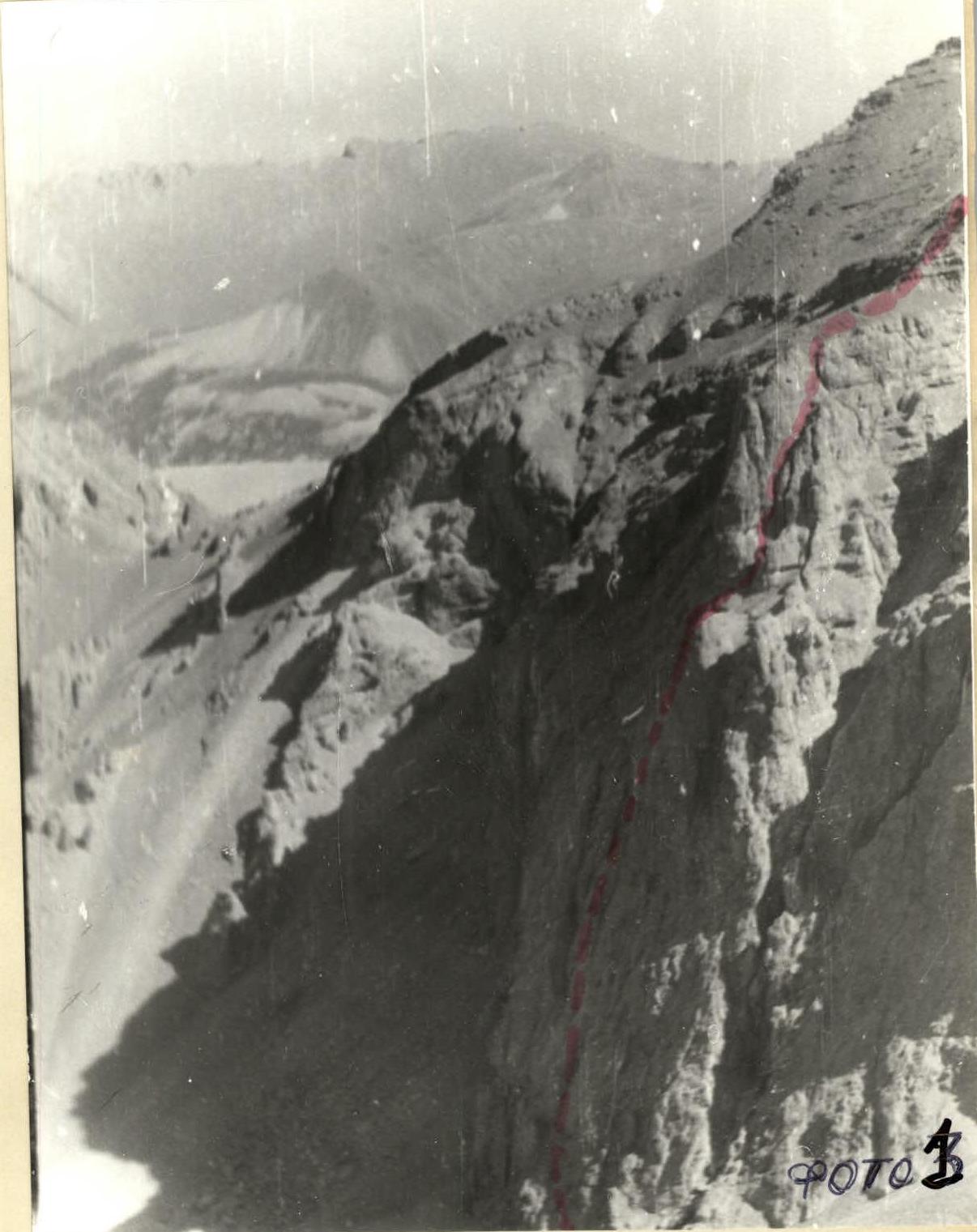
From the bivouac, bypassing the drop-offs of the first rocky belt, along the scree to the base of the northwestern bastion. The location of the route is shown on the panorama, photo I.
- In photo 2 — view of the bastion from the north (around 15:00)
- In photos 3, 4 — view from the west
- In photo 5 — from the direction of the water inflow 3–10–10.
It was not possible to take a single shot of the entire route.
The start of the route is 10 m to the right of the cave-niche (Ta in photo 2). From the scree upwards 10 m along the slab and ledge to the base of the chimney with a plug (21), then along the ledge and inner corner to the steep smoothed slab, along it 40 m to the crevice with an exit further along the slab, in places with a slight overhang (convenient holds) under the cornice (R6) and through it to the scree ledge.
Further: From the ledge along the steep crevice turning into a chimney. From it to the scree ledge, traverse left and along the steep slab 50 m upwards to a wide inclined ledge. Comfortable bivouac. From the start of the route — 8–10 hours.
From the bivouac along the smoothed rocks-slabs to the base of the upper part of the bastion. Traverse right along the heavily destroyed rocks and then upwards along the system of ledges, walls, and scree couloirs to the top of the bastion (214) and further along the snow-scree slope 800 m to the summit. From the bivouac to the summit — 5–6 hours.
Descent: having moved along the ridge in the direction of the summit 4118 about 100 m, left to the slope and along the scree and small walls to the upper right part of the wide scree terrace. Further, two options:
- left along the path along the walls and couloirs under the start of the route
- right along the path along the terrace under the slope of the summit 4118, where along the stream there is a simple descent from the lower rocky belt.
(Initial part of the 3B routes to the summits 4100 and 4118).
On safety: the route is in principle not prone to rockfall, but it is possible to dislodge rocks with a rope from the ledges, including when passing both chimneys.
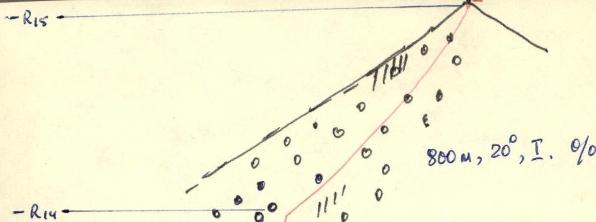
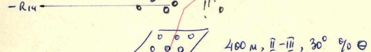
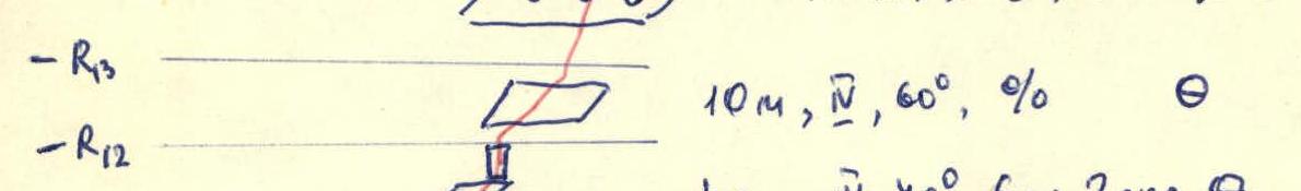
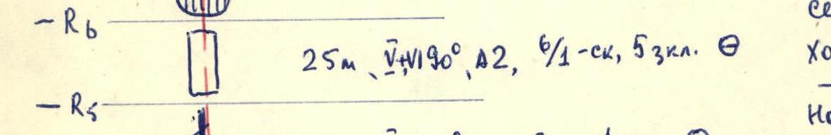
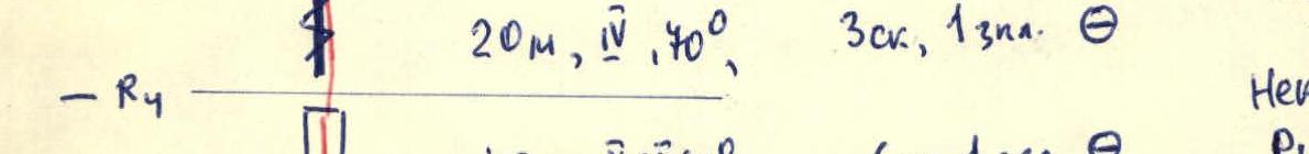
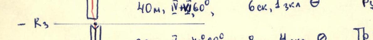
Description of the route sections (according to the scheme)
- R0: 10 m, I, 50°, 1 rock step.
- R1: 20 m, V, 90°, A1, 6 rock steps, 5/3 3 karst ledges.
- R2: 20 m, V, 70–80°, 8 rock steps, 4 karst ledges.
- R3: 40 m, IV, 60°, 6 rock steps, 1 karst ledge.
- R4: 20 m, IV, 40°, 3 rock steps, 1 karst ledge.
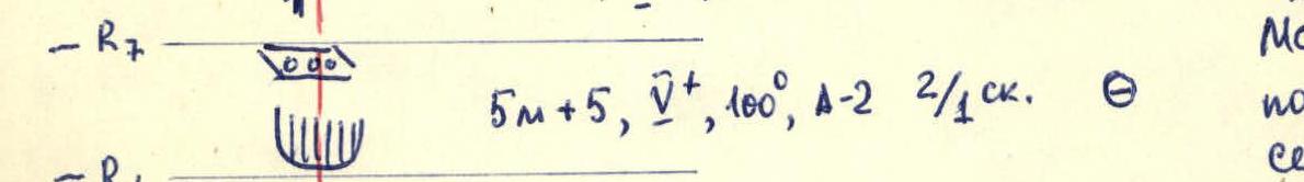
- R5: 5 m + 5 m, V, 100°, A2, 2/1 rock steps.
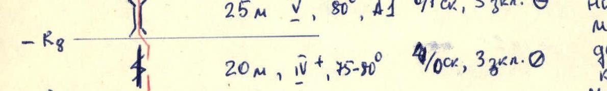
- R6: 25 m, V, 90°, A2, 6/1 rock steps, 5 karst ledges.
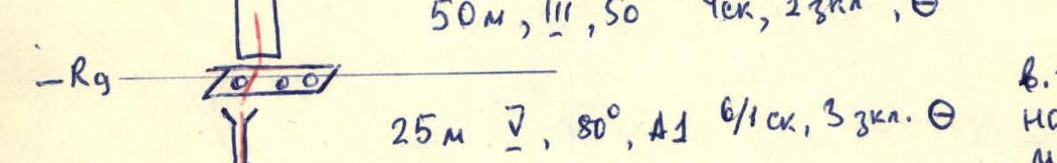
- R7: 20 m, V, 75–80°, 40/10 rock steps, 3 karst ledges.
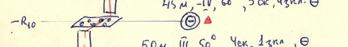
- R8: 25 m, V, 80°, A1, 6/1 rock steps, 3 karst ledges.
- R9: 50 m, II–III, 50°, Check, 1 karst ledge.
- R10: 45 m, III–IV, 60°, 3 rock steps, No karst ledges.
- R11: 40 m, III, 70°, 6 rock steps, 2 karst ledges.
- R12: 10 m, IV, 60°, 9%.
- R13: 400 m, III, 30%.
- R14: 800 m, 20°, I.
Summary information on the route
Summit 4095 m in the western ridge of the Shahdag massif. Route 5A category of difficulty. Via the NW bastion of the Northern wall. Travel time — 14 hours. Overnight stays — 1, comfortable in a tent. Not prone to rockfall. Leader: A. M. KHVASHCHENKO. Coach: Yu. V. GORIN.
www.alpfederation.ru