PASSPORT
I. Class: First Ascent.
- SHAHDAG massif, Eastern Caucasus, from Sudur valley.
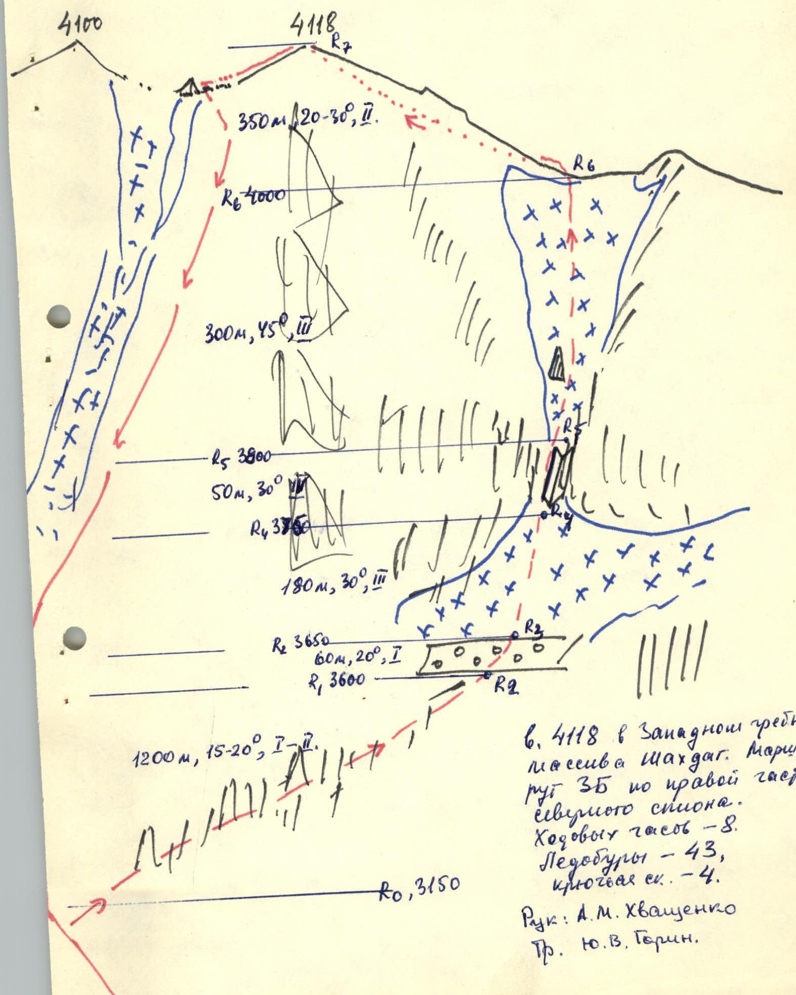
- Peak 4118 m, in the western ridge of Shahdag massif, via the right part of the northern slope, combined.
- Difficulty category — 3B.
- Elevation gain 1050 m, length 2500 m, sections of 3rd diff. cat. — 450 m, 4th diff. cat. — 50 m, average steepness 25°, main part of the route — 45°.
- Pitons — 43/0, ice screws, rock — 4/0. Wedges — 0.
- Travel hours — 8 h.
- No overnight stays.
- Leader: Alexander M. Khvashchenko, Candidate Master of Sports. Participants: Alexander A. Karyakin, Candidate Master of Sports; Andrey N. Kritsky, Candidate Master of Sports; Vladimir E. Meshcheryakov, Candidate Master of Sports.
- Coach: Yu.V. Gorin, Candidate Master of Sports, 1st category.
- Ascent with return to bivouac — September 22, 1990.
- Azerbaijan Republican Alpine Club.
Brief Description
From Sudur village through Zlikh village along the trail to the bridge over Sudurchay river and further through Balaeilag nomad camp via the passage between two "remnants" — exit to "Shayba" bivouac (a large flat stone near the confluence of two streams, see photo). From Sudur village — 6 h.
From bivouac:
- left upwards towards the waterfalls from the first rock belt
- to the right of the waterfalls exit to a wide talus terrace
From overnight stay — 2 h.
Along the terrace to the right upwards via talus and easy rocks — exit to the saddle (R0), from the exit to the terrace — 1 hour. From the saddle traverse to the right upwards 60 m along a steep talus ledge. Then straight up 100 m to the gully and along it 50 m. Above the gully straight up along the ice slope to the snowy ridge. The rock island above the gully is bypassed to the right.
From the lower saddle to the ridge — 5 h.
Along the ridge to the left upwards, bypassing gendarmes to the right along the ledges, ascent to the summit. From the exit to the ridge — 1–1.5 h.
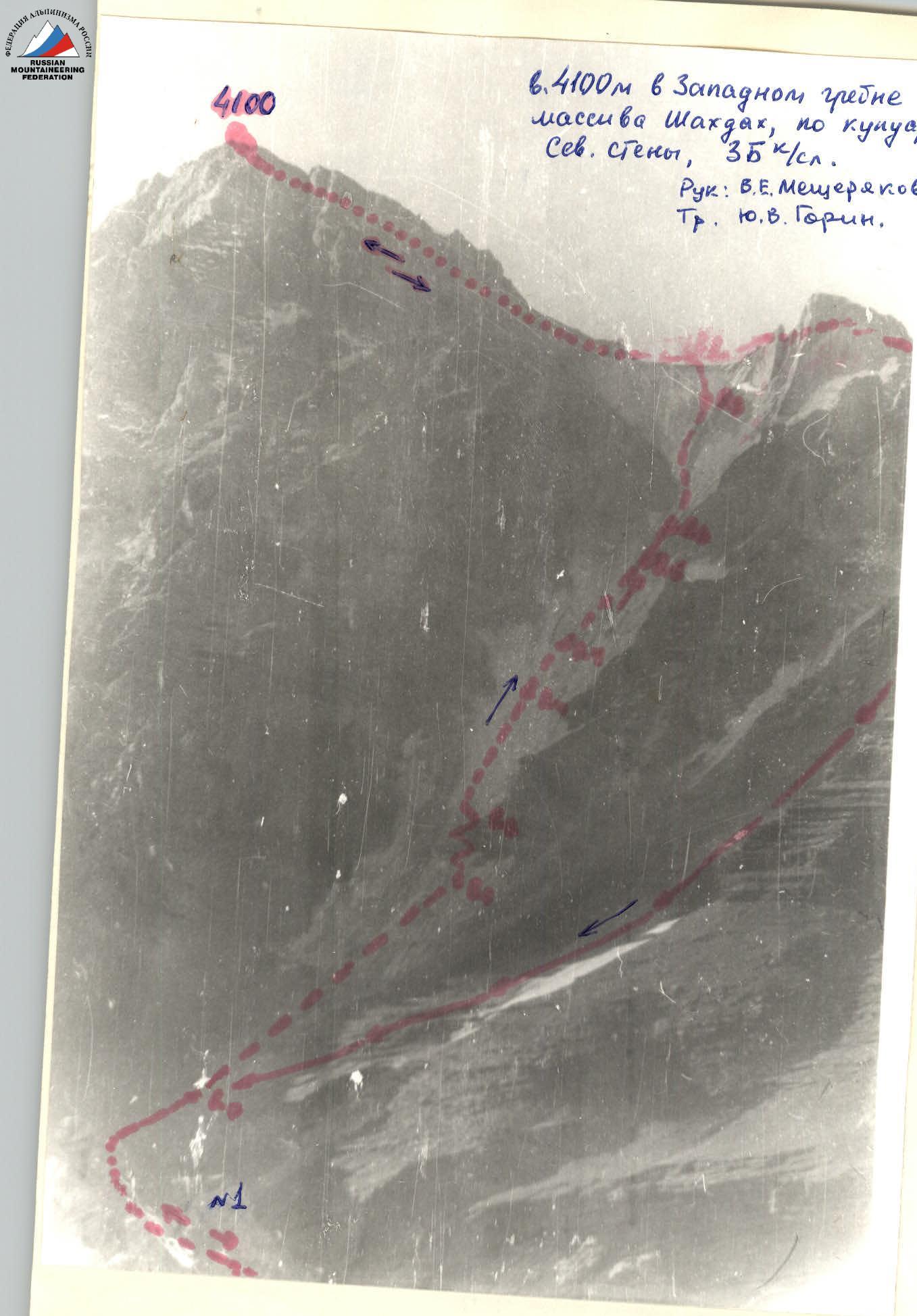
Descent: along the ridge in the direction of peak 4100 m via easy rocks and talus to a sharp gendarme (route cairn!), and from it to the left downwards along the slope in the direction of the lower part of the ice gully of the North face of 4100. Further along the stream descent from the first rock belt and further to "Shayba" bivouac. Descent from the ridge coincides with the descent from peak 4100 m.
Safety notes: Rocks in the gully! Organization of an insurance point in the middle part of the gully is unacceptable (total length about 50 m).
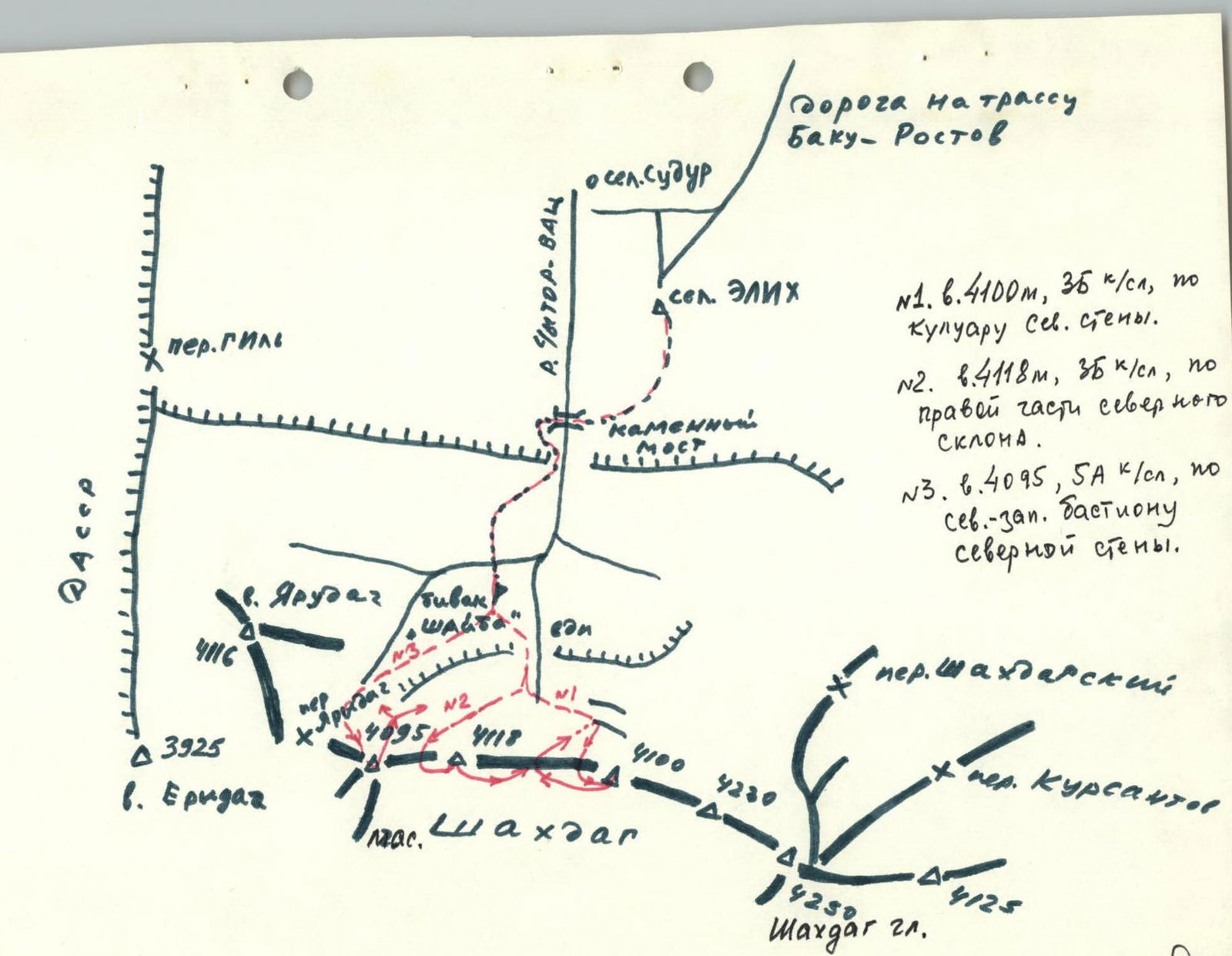
Western ridge of Shahdag massif. North face
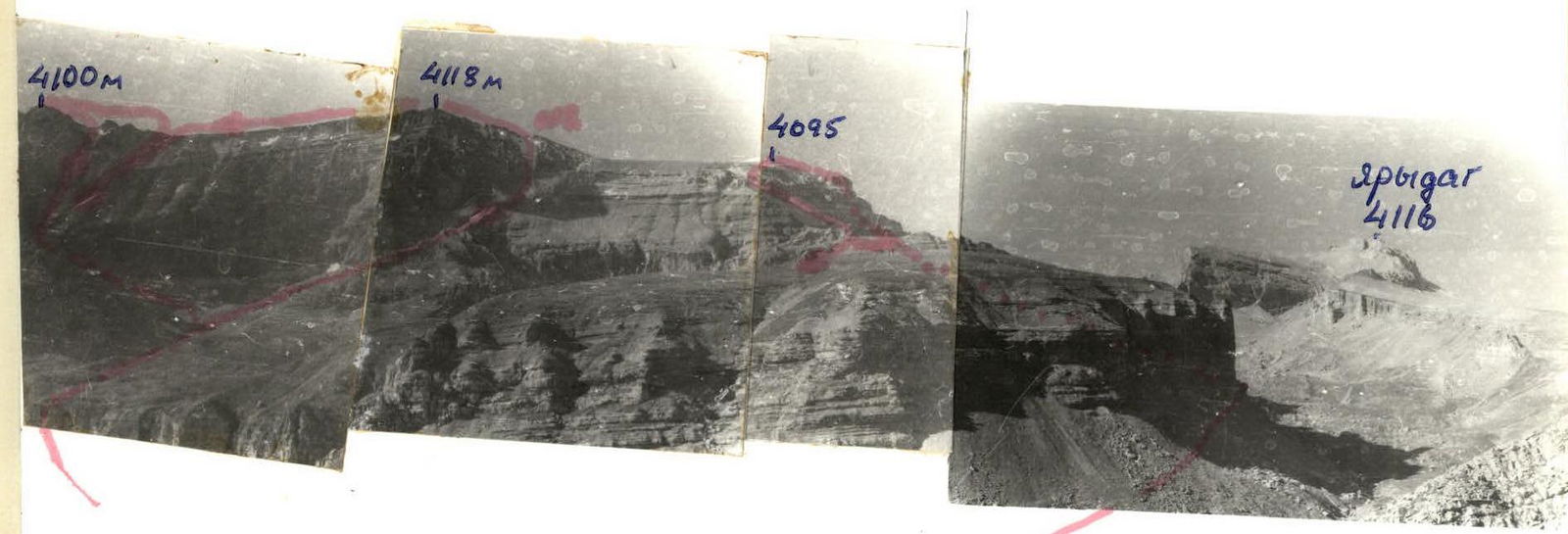
| A. "Shayba" bivouac. | №1. peak 4100 m, 3B diff. cat., via the gully of the North face. |
|---|---|
| №2. peak 4118 m, 3B diff. cat., via the right part of the North slope. | |
| №3. peak 4095 m, 5A diff. cat., via the north-western bastion of the North face. | |
| Coach: Yu.V. Gorin. |