
Climbing Passport
-
Climbing category: combined
-
Climbing region: 2.9 Eastern Caucasus
-
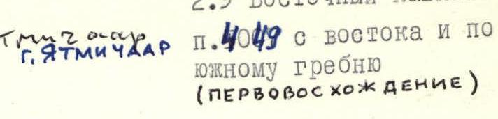
Peak, its height, and ascent route: p. 4049 from the east and along the southern ridge (first ascent)
-
Estimated difficulty category: 1B
-
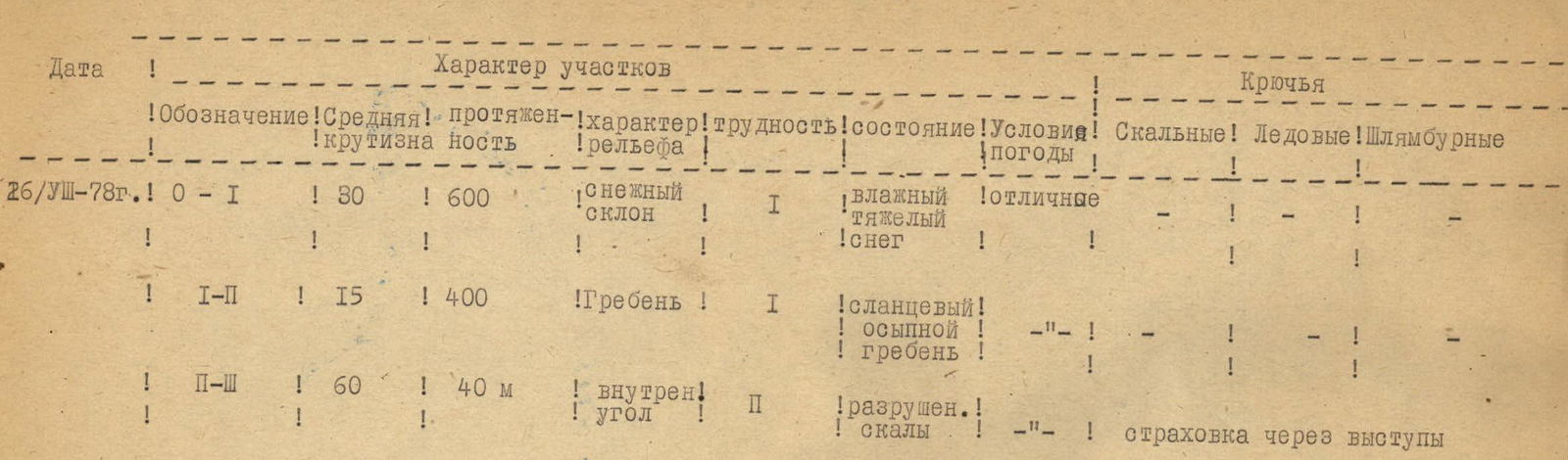
Route characteristics:
- height difference: 600 m
- average steepness: 25°
- length of sections: R1–600 m, R2–400 m, R3–40 m
-
Number of pitons driven:
- for belaying: rock 0, ice 0, bolted 0
- for creating artificial anchors: 0
-
Number of travel hours: 8
-
Number of nights and their characteristics: without overnight stays
-
Full name of the leader and participants, their sports qualification:
-
- Akhmedkhanov K.E — 2nd sports category
-
- Kozorezov E.F — 2nd sports category
-
- Nikomagomedov Z.N — 2nd sports category
-
- Mikirov E.S — 3rd sports category
-
Date of departure on the route and ascent: August 26, 1978
Team coach: M.V. Timoshin
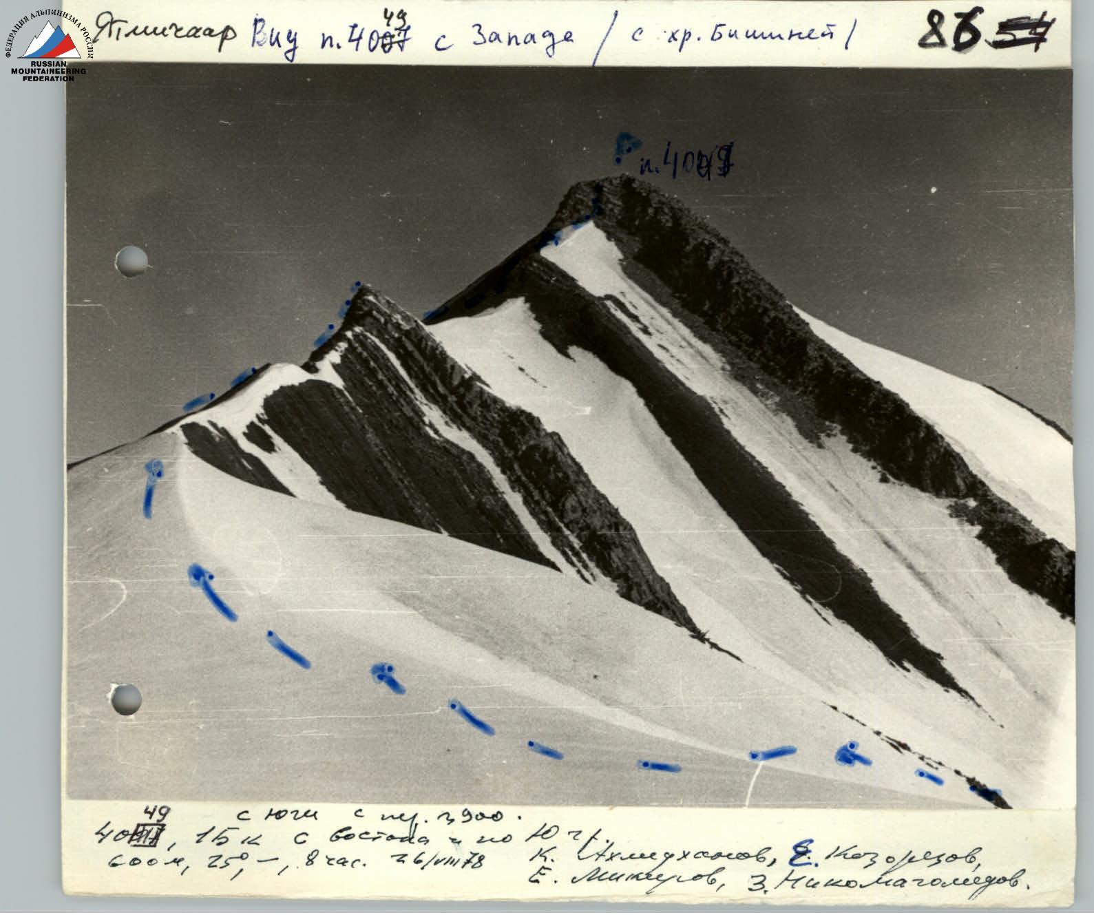
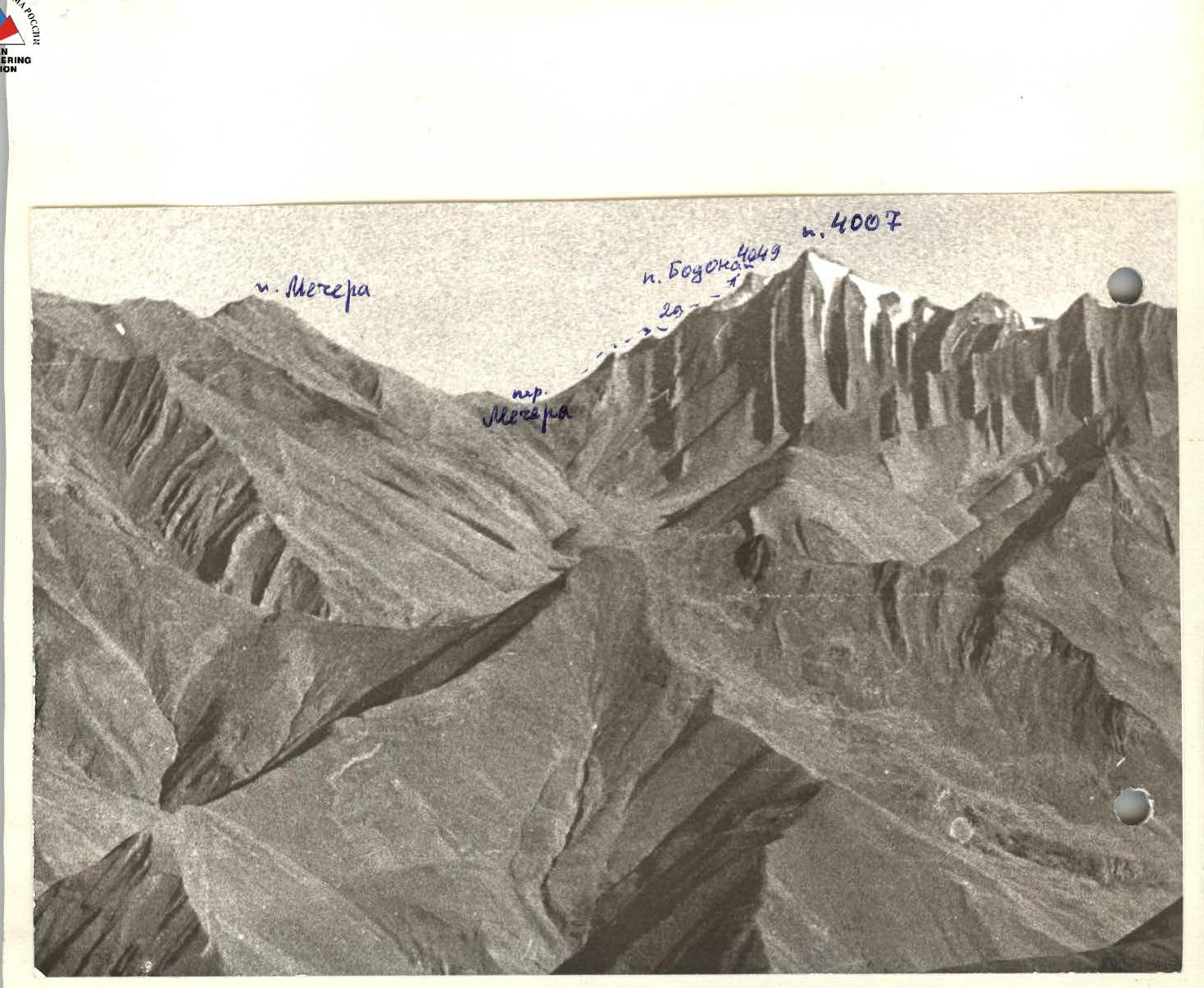
P. 4007. View from the east (from the base camp near the Bodonai River)
P. 4007. View from the west (from the Bishiney ridge)
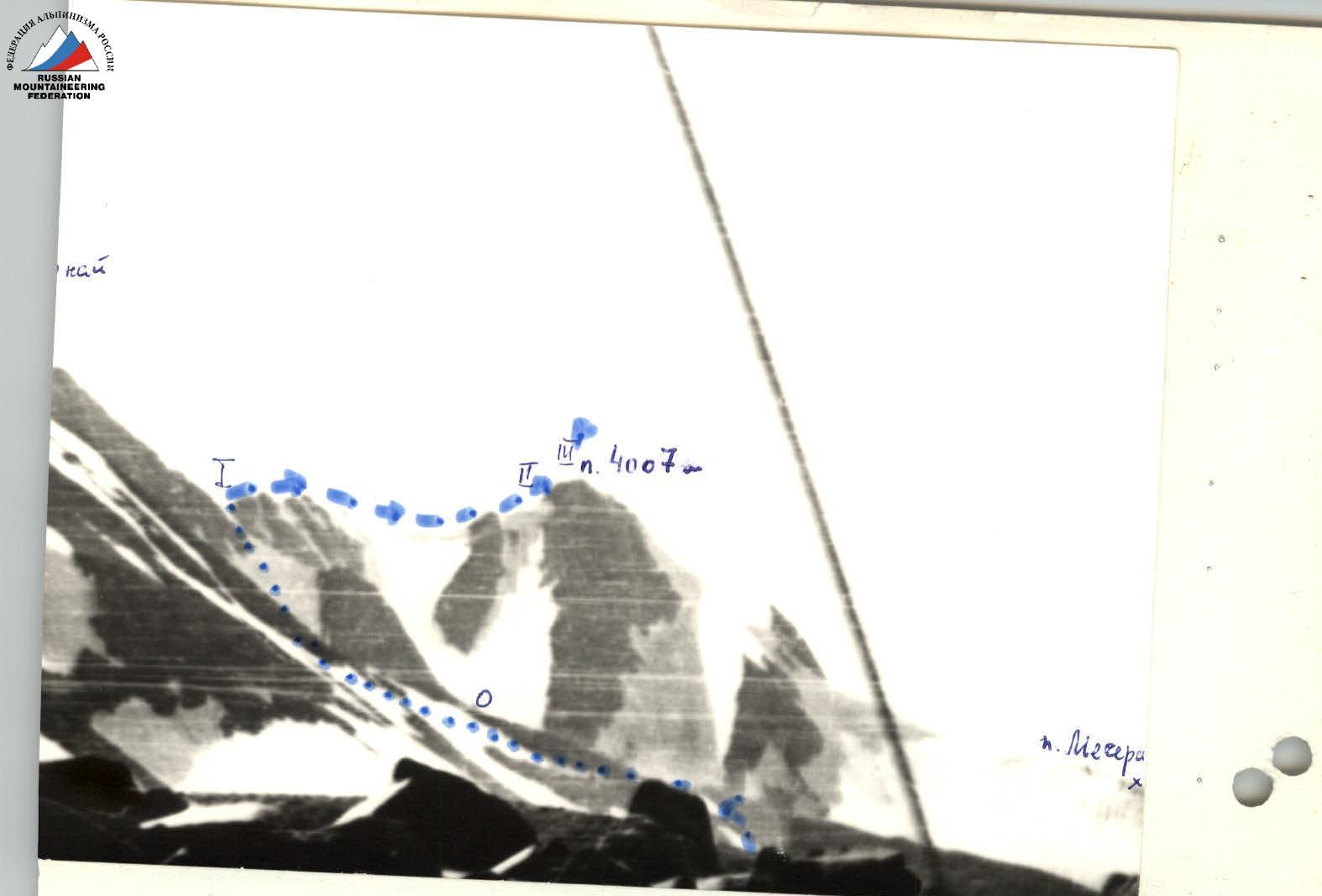
Map of the area
Brief Characteristics of the Peak
The unnamed peak with a height of 4007 m is located in the Shalib ridge between the peaks Bodanai (4049 m) to the north and Mecherа (3500 m) to the south. The mountain is composed mainly of aspidic schists, but there are vertical outcrops of hard sandstone.
The nearest peaks with established routes are:
- Bodanai 2A along the N ridge
- Dyultydag (1B, 2A)
- Metiko (1B, 2A, 2B)
- Bishiney (1B, 1B, 2A, 3A)
- Dartsа (2A, traverse with peak 3770).
Until 1978, ascents to the peak were not recorded.
Description of the Approach to the Route
From the camp, located in a clearing on the left (orographic) bank of the Bodonai River, head west upstream and, before reaching the ascent to the Mecherа pass, cross the river and move along the moraine into the cirque formed by the southern ridge of peak 4007 and the northern ridge of peak Bodanai — this is the starting point of the route. From the camp: 3 hours.
Route Description
From the cirque, ascend the steep snowy slope to the pass between peaks Bodanai and 4007. Upon reaching the pass, movement "in three steps" is possible. (From the cirque 2 hours 30 minutes.) On the pass (3900 m) — a cairn. From it, head south along the ridge (cornices). Along the ridge, it's better to move along the left edge on the way to the peak. On the way — two gendarmes:
- The first is overcome "head-on",
- The second is bypassed on the left along the path.
The gendarmes are composed of sandstones, as is the summit turret, which is ascended via easy rocks along a pronounced internal angle. On the summit — a cairn. From the pass 1 hour. Descent is via the ascent route. The ascent to the pass is also possible from the Khankra river valley (Ris-Or basin).
Route Sections Table
| Date | Designation | Average Steepness | Length | Terrain Characteristics | Difficulty | Condition | Weather Conditions | Rock Pitons | Ice Pitons | Bolted Pitons |
|---|---|---|---|---|---|---|---|---|---|---|
| 26.08.1978 г. | R0–R1 | 30° | 600 m | snowy slope | 1 | wet, heavy snow | excellent | — | — | — |
| R1–R2 | 15° | 400 m | ridge | 1 | schistose, scree ridge | — | — | — | — | |
| R2–R3 | 60° | 40 m | internal angle | 2 | destroyed rocks | — | — | — | belaying via ledges |
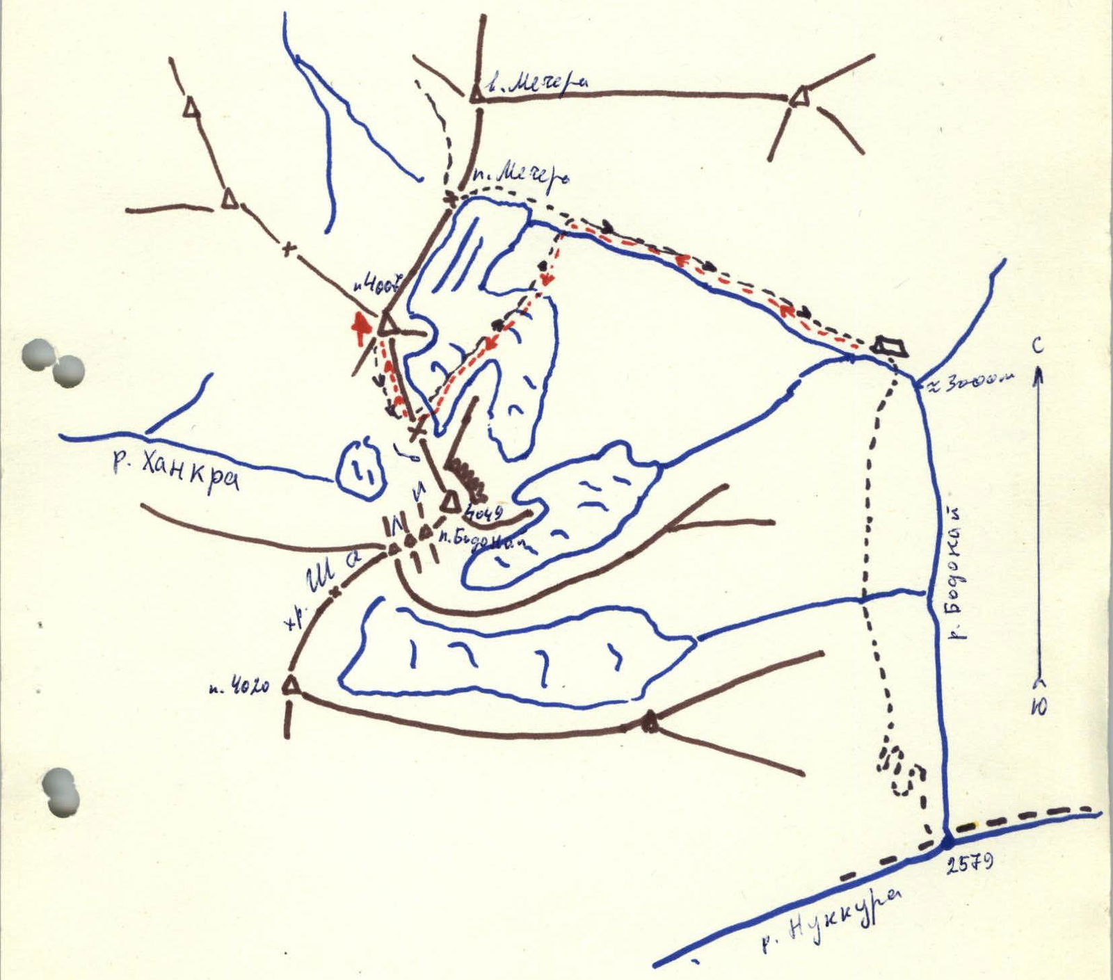
Route Diagram
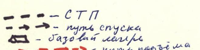
Legend:
-
-
-
- STP ← ← descent path — base camp
-
-
-
-
-
- ascent path
-
-
Climbing Passport
(v. Nesendag via Vakhchag pass 1B category)
- Climbing category: combined
- Climbing region: 2.9 Eastern Caucasus
- Peak, its height, and route: Nesendag (3925 m)
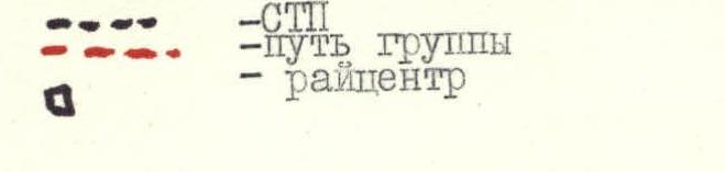
Climbing Area Diagram

Legend: — roads — STP — group path — district center
Comments
Sign in to leave a comment