
ASCENT DOCUMENT
- Winter category.
- Region 2.10, Caucasus, Dagestan Mountains, Nukatly ridge.
- Nukatly South-West, 3776 m, via West Nukatly Pass, combined route.
- Category 1B difficulty, first ascent.
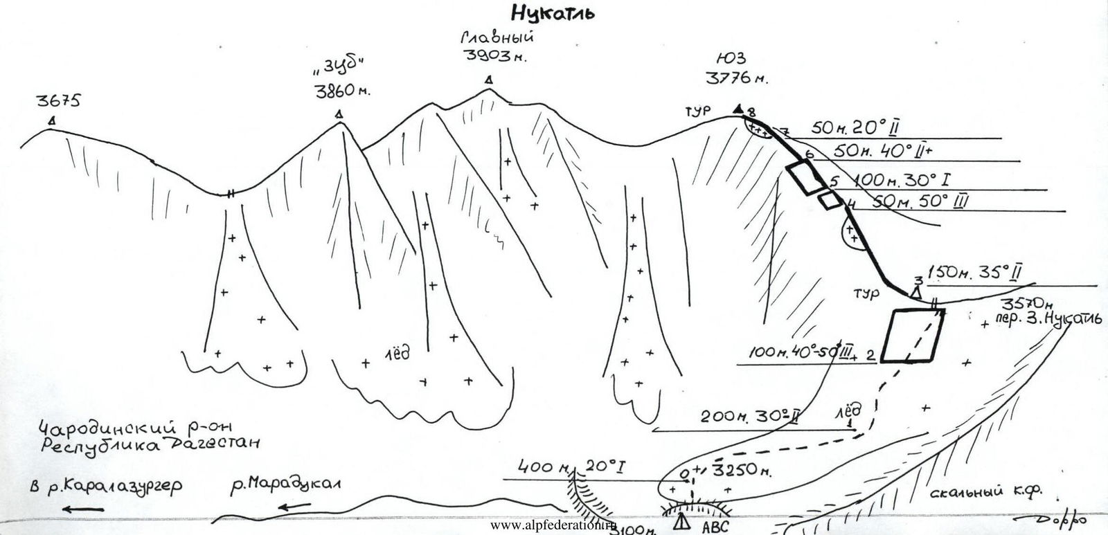
- Route characteristics: height difference — 550 m, average steepness — 30°, length — 1100 m, sections of category 1 difficulty — 500 m, category 2 — 450 m, category 3 — 150 m.
- Pitons were not used, protection through rock formations.
- Climbing hours — 3.
- Overnight stay in the upper reaches of the Maradukal River below West Nukatly Pass (3100 m).
- Dorro Konstantin Eduardovich — Candidate Master of Sports. Maksimov Vladimir Vladimirovich — 2nd sports category.
- Departure, summit, return — January 2, 1995.
- Organization — Eos Mountain Club.
Makhachkala 1995
NUKATLY
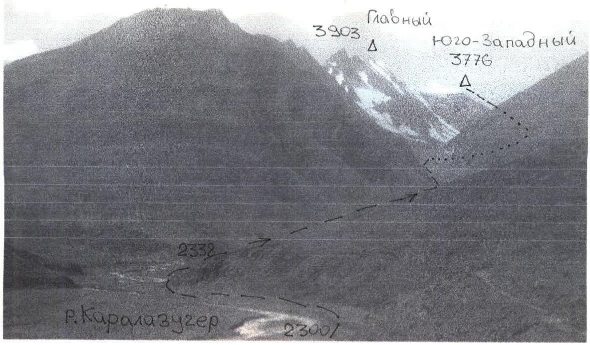 Photo: general view of the Nukatly massif with the Main and South-West peaks. Photo by Akhmetkhanov K.E. from a height of 2300.
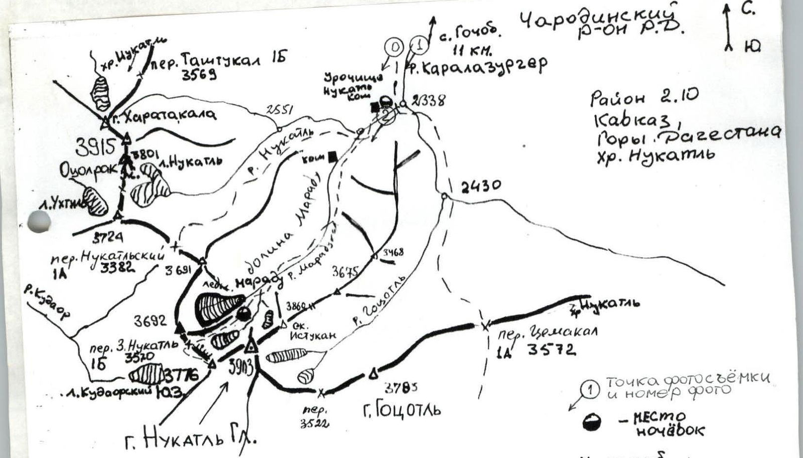
MAP OF THE ASCENT AREA
 Sketch of Nukatly mountain by Akhmedzhanov K.E.
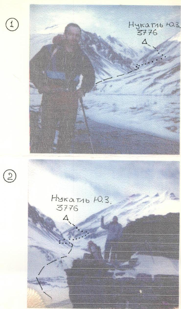 PHOTO 1: Maksimov V.V. in the Karomazurger River valley, height 2300 m, January 3, 1995. PHOTO 2: Dorro K.E. near the shepherd's hut. Overnight location December 31, 1994 – January 2, 1995, height 2370 m, January 3, 1995. Photos — "Polaroid".
DESCRIPTION OF THE APPROACH TO THE ROUTE
From the village of Gochob (2000 m), Charodinsky District, Republic of Dagestan, descend to the Karalazurger River and move upstream, through an orchard and past hamlets and shepherd's huts (some of which are abandoned). There are bridges in some places.
In winter, it is possible to walk:
- directly along the river,
- on the ice.
In summer, part of the path can be taken on the road to the MTF, on the left bank, but after 5 km, it is still necessary to descend to the river.
The ascent is gradual, and after 12 km (4–5 hours), you reach the Nukatly tract (2350 m), where three tributaries merge.
- To the right, on a large rock block, there is a stone hut.
- To the west, the trapezoid of Mt. Otsolrak "Ox Heart" rises.
Continue moving upstream along the middle tributary — the Maradukal River. The valley is trough-shaped with ancient moraine ridges.
- To the left, the powerful "Tooth" of Nukatly and the main peak are visible.
- Straight ahead — the dome of Nukatly SW.
- To the right of it — the West Nukatly Pass.
Taking a slightly left path along the moraine ridges of the Maradu Glacier (it is in a separate cirque, to the right and west, and not visible from the valley), reach a moraine pocket directly below the rock buttress of Mt. 3692. Set up camp here (3100 m), 4–5 hours from the shepherd's hut.
Then:
- to the left of the buttress,
- cross the moraine ridge,
- reach the depression below the wide slope-gully leading to the West Nukatly Pass.
This is the start of the route (3250 m, 0.5 hours).
DESCRIPTION OF THE ROUTE
From the depression (3250 m), ascend the wide slope-gully, the steepness gradually increases, in winter — hard snow, firm snow, crampons. It becomes particularly steep just before reaching the West Nukatly Pass (3570 m). Climber's cairn — turn left and move along the rocky ridge (with "rock needles" in some places), towards the SE. The right slope of the ridge is sheer, with cornices in some places, use rope protection! In the middle of the ridge, there is a damaged rock step. Above the step, the ridge widens and turns into a scree slope leading to a shoulder. The ridge becomes sharp again and turns left. The last 100 m are unpleasant, with cornices to the right. On the summit, a cairn was found (without a note, likely a hunting cairn). 3776 m. 3–4 hours from the cirque. Descent is via the ascent route.
The group planned to ascend the main peak, but weather conditions: wind, frost, lack of visibility, and icing — did not allow them to continue the ascent.
Nukatly
Nukatly SW, 3776 m, category 1B difficulty, via West Nukatly Pass, Nukatly ridge, Caucasus, Dagestan Mountains.
Comments
Sign in to leave a comment