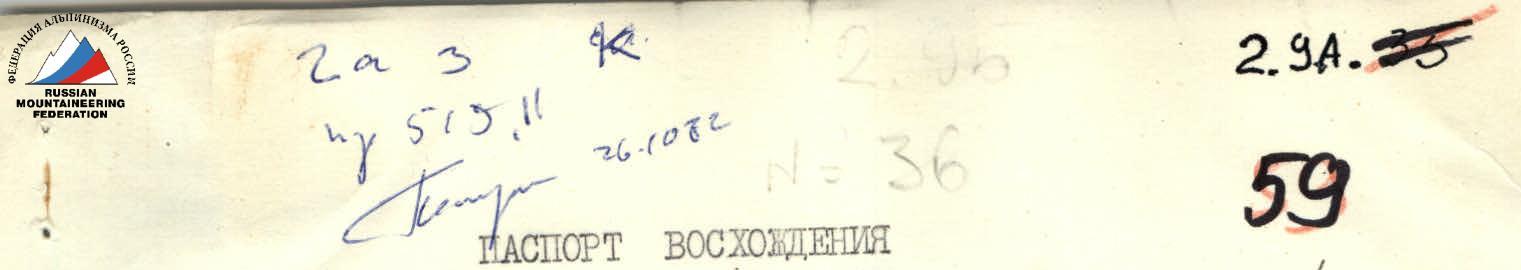
Ascent Passport
- Ascent Class: snow
- Ascent Area: 2.9. Eastern Caucasus
- Peak, its Height, and Route: Nensendag (3925 m), via the eastern slope
- Estimated Difficulty Category: 2B
- Route Characteristics:
- elevation gain — 900 m
- average steepness — 45°
- section lengths:
- R0–R1 — 400 m
- R1–R2 — 350 m
- R2–R3 — 100 m
- R3–R4 — 300 m
- R4–R5 — 250 m
- R5–R6 — 300 m
- Piton Placement:
- for protection:
- rock: 0
- ice: 0
- bolt: 0
- for creating artificial protection points:
- rock: 0
- ice: 0
- bolt: 0
- for protection:
- Total Climbing Time: 12 hours
- Number of Nights and their Characteristics: no overnight stays

- Leader and Participants' Full Names, their Sports Qualification:
- Kozorezov E.F. — 2nd sports category
- Shupinov V. — 2nd sports category
- Semenova M.M. — 2nd sports category
- Smotrov A.I. — 2nd sports category
- Date of Departure and Ascent: May 7, 1981
- Team Coach: Candidate Master of Sports Krasnopolsky Yu.V.
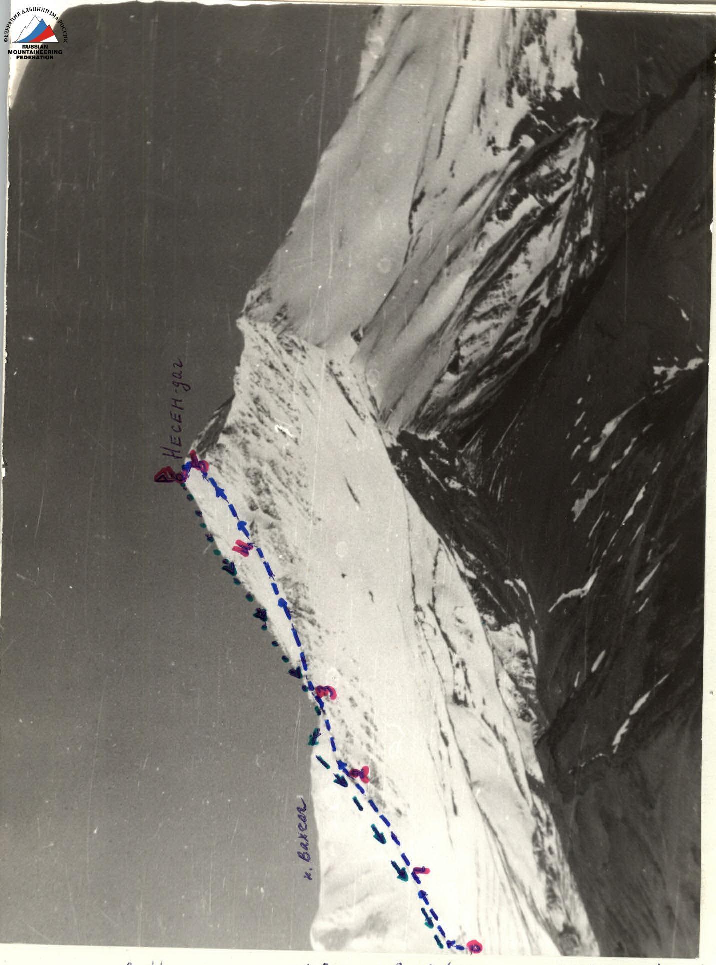
Mt. Nensendag (view from the north from Kurush village)
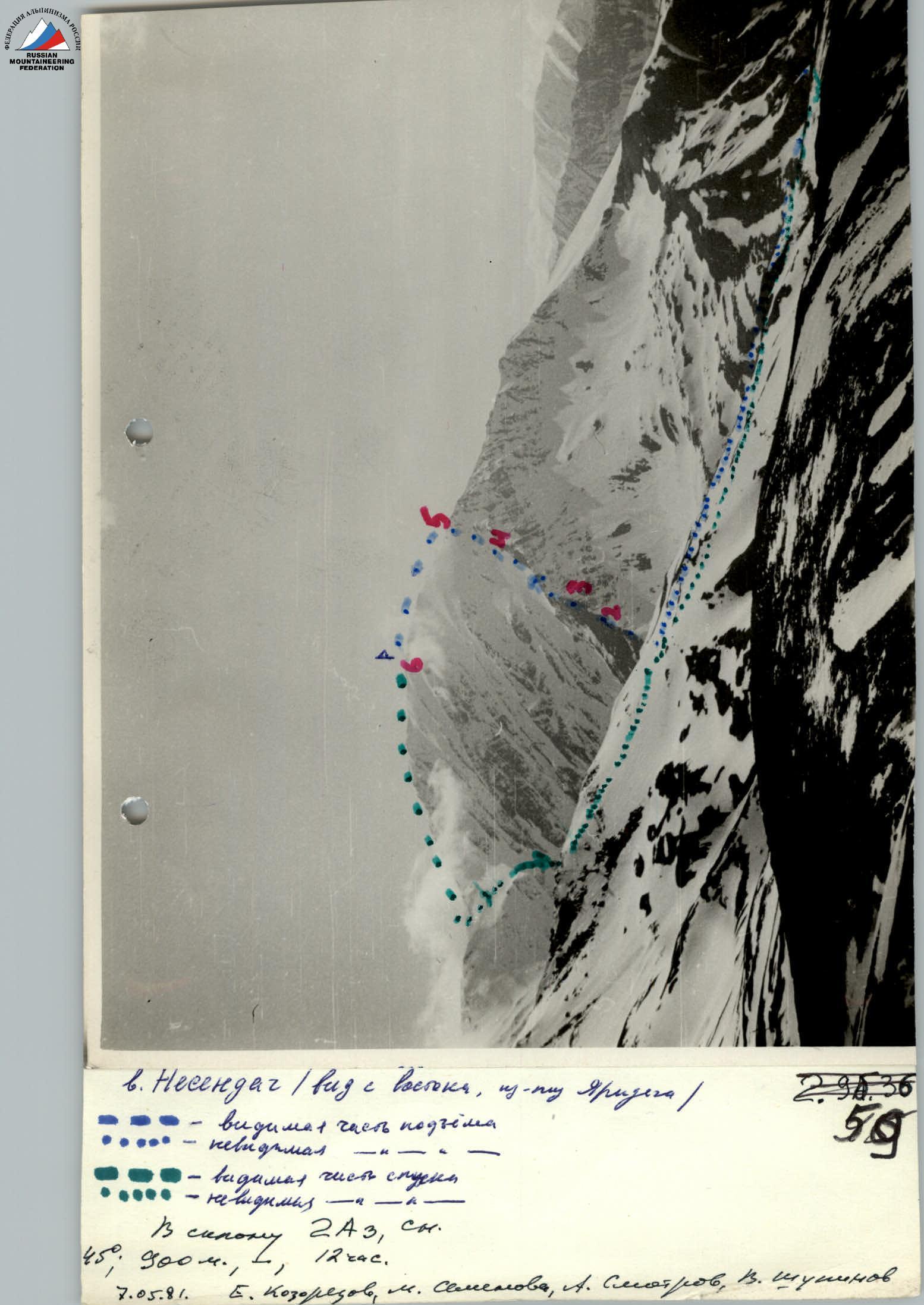
Mt. Nensendag (view from the east from Yarydag) — visible part of the ascent — invisible part — visible part of the descent — invisible part Along the 2A slope, snow and ice. 45°, 300 m, 1, 12 hours. May 7, 1981. E. Kozorezov, M. Semenova, A. Smotrov, V. Shupinov
Area Diagram

Route Diagram according to 2BA
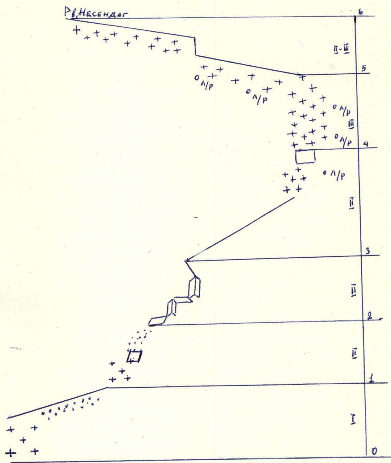
OP — protection via ice axe
Route Sections Table

| Designation | Average Steepness | Length | Terrain Characteristics | Difficulty | Condition | Weather Conditions | Rock | Ice | Bolt |
|---|---|---|---|---|---|---|---|---|---|
| R0–R1 | 30° | 400 m | snow slope and talus ridge | 1 | hard snow, "floating" talus | sunny, no wind | — | — | — |
| R1–R2 | 35° | 350 m | snowfields, talus | 2 | hard snow, fine talus, rock slabs | — | — | — | — |
| R2–R3 | 50° | 100 m | rock band | 2 | heavily destroyed rocks | — | protection via outcrops | ||
| R3–R4 | 40° | 300 m | wide ridge, snow slope, rocks | 2 | loose snow, destroyed rocks | — | protection via ice axe | ||
| R4–R5 | 45° | 250 m | snow slope | 3 | loose snow | — | protection via ice axe | ||
| R5–R6 | 30° | 300 m | narrow ridge | 2–3 | cornices, loose snow | — | protection via outcrops |
Description
Approach to the Route
From the base camp, located 200 m southwest of the bridge over the Usukhchai River (below Kurush village), go upstream along the river for 200–300 m, then ford it and head south up the stream flowing from the cirque formed by the slopes of Bazardyuzyu and Nensendag peaks. A good trail leads into the cirque, initially winding along the stream, then climbing the slope of Nensendag. After 2 hours and 20 minutes from the base camp, it brings you to a wide meadow with signs of a summer pasture. This is the starting point of the route.
Brief Geographical Information
Nensendag Peak (3925 m) is located in the eastern part of the Greater Caucasus Range between Bazardyuzyu Peak to the east and Ragdan (Radyndag) Peak to the southwest. The name of the mountain originates from the term for the noon prayer, as the sun is directly above the peak at noon. Nensendag is a small ridge spur perpendicular to the axial line of the Greater Caucasus Range. The mountain is primarily composed of shale, with horizontal layers of hard sandstone present. Nensendag has been visited by climbers multiple times; however, route descriptions have not been compiled. Snow lies on the peak and its slopes from November to June, and in snowless winters, it appears only at the end of February. The described route is of mountaineering interest when there is snow, so it is proposed as a winter route. The best time for ascents via this route is from March to July.
Route Description
The route follows the not clearly defined right edge of Nensendag's eastern slope. The starting point is on a wide meadow with signs of a shepherd's summer pasture. From the meadow, ascend a steep snowfield onto the ridge. Follow the ridge towards the rock band. A wide talus ridge transitions into a moderately steep talus slope with snowfields after 300 m. It's easier to walk on the snowfields as the snow holds better than the frozen talus. Continuing further across the slabs, you reach a fine shale talus that ends after 350–400 m at a 100-meter heavily destroyed rock band. Here, tie in.
The rock band is overcome using numerous ledges and small couloirs (simultaneous protection via outcrops). The rocks give way to a wide ridge, along which you move simultaneously to a 15-meter rock outcrop (protection via ice axe).
Further, along a steep snow slope, move in "three steps" with alternating protection (possible fixed rope) for 250 m to the pre-summit ridge.
The ridge is sharp, with cornices on both sides. Protection is alternating via ice axe and outcrops (which need to be dug out from under the snow). To the right, there are sheer drops; to the left, an avalanche-prone slope, so movement is possible within 1–2 m from the ridge line. The key section of the ridge is a 7-meter ascent of heavily destroyed shale spires with a snow cornice to the east. Further along the narrow ridge for 100–150 m to the summit.
Descent:
- via the ascent route;
- or to Vakhchag Pass, and then north into the cirque and to the base camp.
Recommended group size — 6–12 people.