
Climbing Passport
- Climbing type: combined
- Climbing region: 2.9.b, Dagestan mountains
- Peak, its height, and ascent route: Izhena, 4025 m, via the NE ridge
- Estimated difficulty category: 1B
- Route characteristics:
- Elevation gain — 900 m
- Length of sections with 1st difficulty category — 1350 m, 2nd — 200 m
- Average steepness — 30°
- 2 glaciers
- Number of pitons used: 2
- Number of travel hours: 8 hours
- Number of nights and their characteristics: overnight stay at the terminal moraine of the Akhvakh glacier
- Full name of the team leader and participants, their sports qualification:
- Dibirgadzhiev Sh.K. 2nd sports category
- Abdurakhmanov A.A. 2nd sports category
- Shanavazov Sh.E. 2nd sports category
- Ilina E.V. 2nd sports category
- Date of ascent: July 13, 1986
- Team coach: Kozorezov E.F.
- Organization: Mountain club of Dagestan State University "Eos"
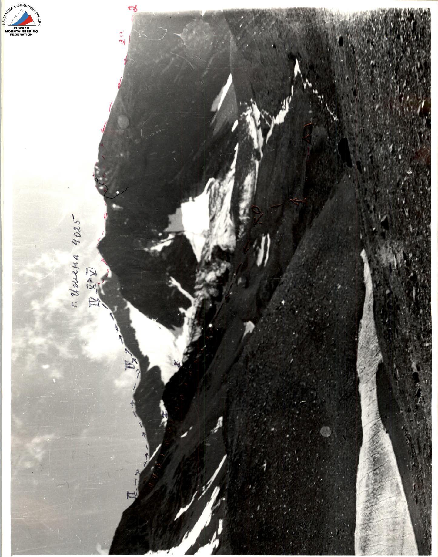
Photo #1. Mt. Izhena 4025 m, view from the NE, July 12, 1986
1———— route via the NE ridge, 1B
2————— route via the N ridge, 2A
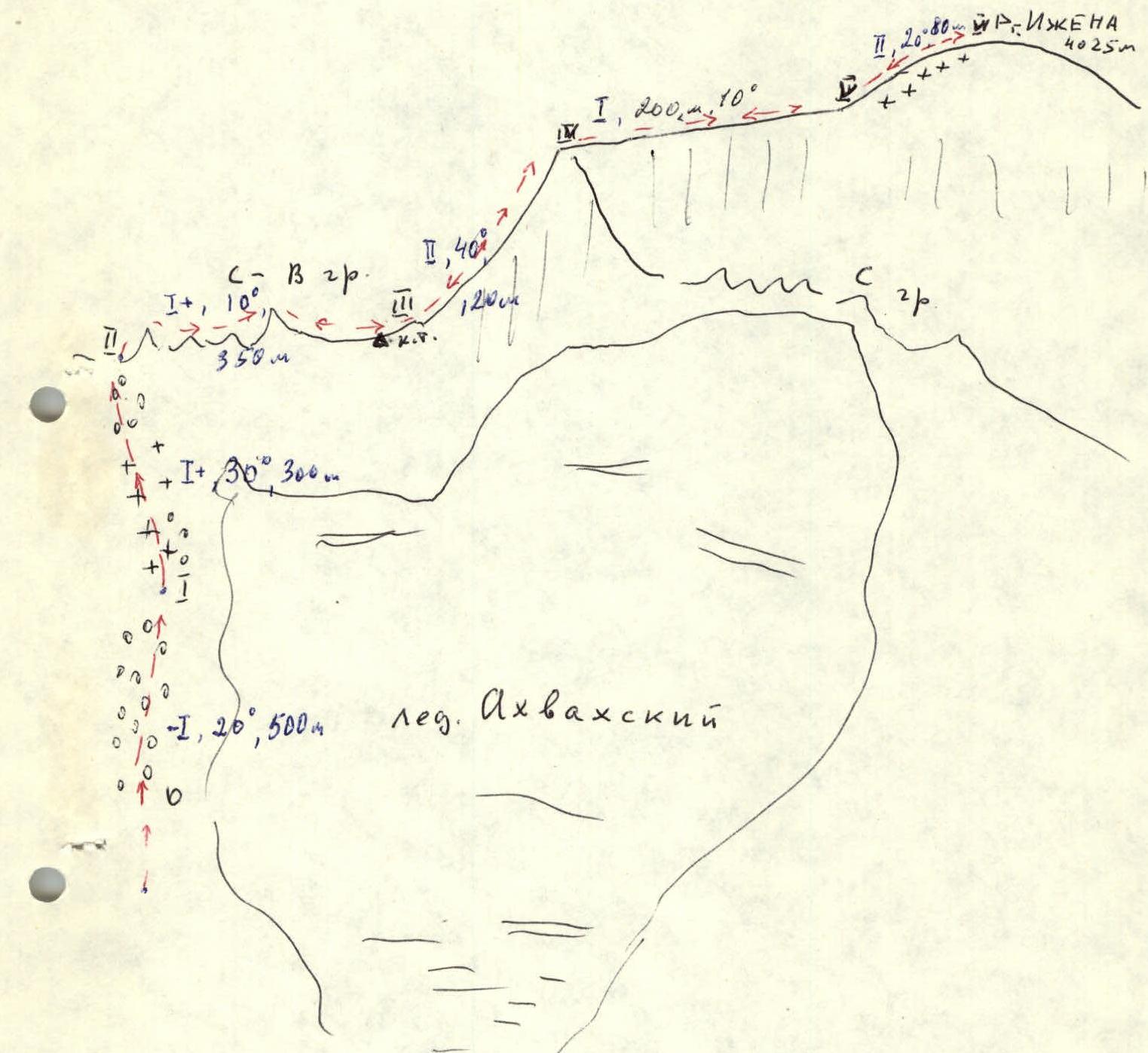
Route diagram
 Photo #3. Sections of the route R0–R1; R1–R2. Tongue of the Akhvakh glacier. Photo taken on July 12, 1986
Brief explanation for the diagram
Izhena-meer is a peak located in the central part of the Bogossky ridge and closes the chain of four-thousanders in this region of Dagestan from the NE. Only one route to the summit has been classified — via the N ridge, 2A. The limitation of the classification period is clearly unjustified, as it is in the summer, when the snow melts, that the ascent via this route presents certain technical difficulties due to the exposed rock "plumes" and the summit ice ridge, which should be overcome with alternating belay and rope installations.
Our group completed a route via the NE ridge in the second decade of July 1986, and we propose classifying this route as 2A difficulty category for summer conditions as well. In terms of terrain and complexity, it is reminiscent of 2A on VIA-tau.
The route via the NE ridge starts on the right (orographic) moraine of the Akhvakh glacier and passes over scree, then along a heavily destroyed shale ridge with several sharp gendarmes — sandstone outcrops.
The rocks on the R3–R4 section are also composed of sandstone, where one should proceed with belay. On the ice ridge of the summit dome, we walked in crampons and along the rope. Descent was made via the ascent route.
Comments
Sign in to leave a comment