Report
On the ascent of the team from Kharkiv region to the summit of Erydag NW 3887 m via the Northwest wall. Presumably VI-A category of difficulty. First ascent.
via the Northwest wall. Presumably VI-A category of difficulty. First ascent.
Poltavets E. I. — team leader, Timko E. N.
Kharkiv 2012
1 Ascent participants
- Team leader — Poltavets Evgeny Ivanovich. Master of Sports. Coaches — Sukhareva L. N., Kopeyka G. V. Address: 61144, Kharkiv, Akademika Pavlova st. 162A, apt. 118. Tel. +38095-125-33-40. Email poltalp@ukr.net
- Timko Evgeny Nikolaevich. 1st sports category. Kharkiv. Coaches — Sukhareva L. N., Kopeyka G. V.
2 Ascent passport
-
Dagestan mountains, section 2.10 of the route classifier for mountain peaks.
-
Erydag NW 3887 m. Via the Northwest wall.
-
Proposed category of difficulty: 6A. First ascent.
-
Rock route.
-
Height difference: 1010 m (by altimeter). Route length: 1950 m. Length of sections with V category of difficulty: 270 m. Length of sections with VI category of difficulty: 460 m.
-
Average steepness of the route — 73 degrees
-
Hooks left on the route:
- Rock hooks: 2
- Bolts: 32
- Skyhook holes: 38
-
Team's total hours: 129.5 h, 14 days.
-
Descent from the summit to the south, then from v. Sel'dy via the SW couloir (2A category of difficulty)
-
Team leader: Poltavets Evgeny Ivanovich, Master of Sports, coaches: Sukhareva L. N., Kopeyka G. V. Participant: Timko Evgeny Nikolaevich, 1st sports category, coaches: Sukhareva L. N., Kopeyka G. V.
-
Start on the route: 8:00, February 10, 2012. Summit: 10:00, February 23, 2012. Return to base camp: 17:00, February 23, 2012
-
Federation of Alpinism and Rock Climbing of Kharkiv region.
-
Report responsible: Poltavets E. I. poltalp@ukr.net

Profile
right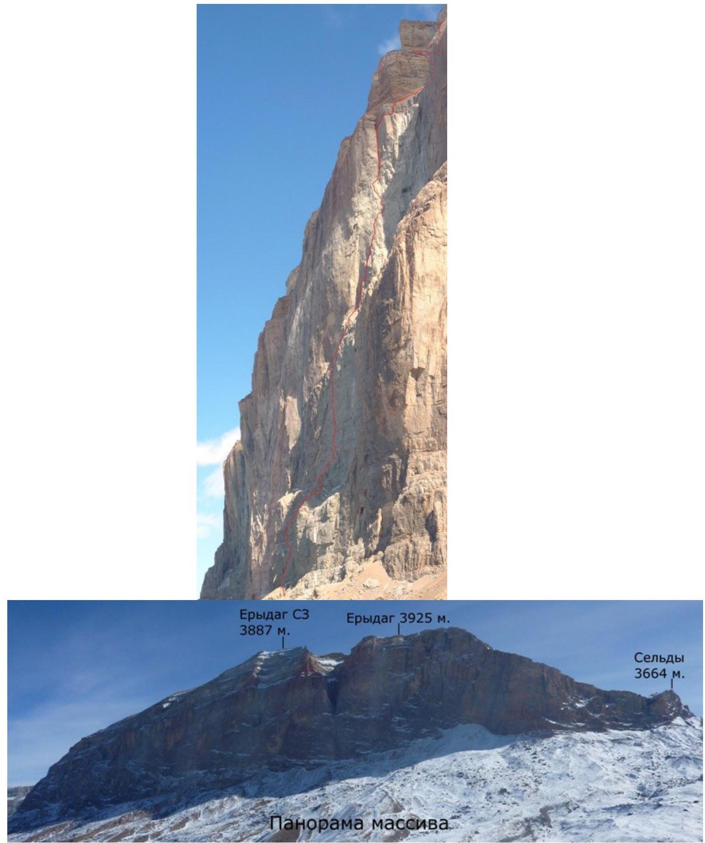
3 Description of the ascent area
The Erydag massif is located in a short northeastern spur of the Main Caucasian Range, on the border between Russia and Azerbaijan, forming almost a single plateau with Yaru-Dag and Shah-Dag. In Dagestan, the walls drop down by 300–1100 m. The wall is composed of metamorphosed limestones.
The weather in the area is substantially more stable than in other regions of the Caucasus, but precipitation in the form of rain or snow is not uncommon. In winter, there is frosty dry weather with periods of strong winds and precipitation (no more than 2–3 days).
Major issues on the wall:
- lack of water;
- snow does not stay on the wall — it is blown away;
- due to dry air, snow does not melt, it evaporates.
To get to the ascent area from Makhachkala, take the federal highway "Caucasus" south to Novy Gopchah village (180 km), then:
- turn right, up the Samur river to Usukhchai village (district center of Dokuzparinsky district) (225 km, 700 m above sea level)
- then left on a dirt road up the Usukhchai river to Kurush village (250 km, 2500 m above sea level)
The road takes 6–8 hours.
From Kurush village, descend along the trail to the confluence of the Chekhychay river with the Sel'dy river (2250 m). Then, cross two bridges and reach a terrace (right orographic bank), walk about 800 m along it towards the Wall, cross a stream and reach a farm. From there, slightly left and lower, a dirt road begins; traverse along the slope (to the NE) for about 2.5 km, then turn right across the grassy slopes towards the "Big Well", traversing the zone of gullies and clay couloirs.
On the terrace, to the right of the waterfall, 200 m from the wall, is the forward base camp (ABC, Efimovskie nights) on the line of the Shchedrin route. Time to reach: 3–4 hours from Kurush village.
From ABC:
- Move left to the start of the K. Dorro route 2002 "Through the nose of the NW wall bastion";
- Then north along the scree shelves and simple rocks to a large stone at the base of the wall;
- Under the overhanging walls of the stone is a safe place for a bivouac (time to reach from Efimovskie nights — 1.5 hours);
- The start of the route is 100–150 m left of the stone.
Erydag NW — 3887 m. Route profile 1:4000.
| 3887 m 23 August 2012 | R42 | ||
|---|---|---|---|
| 3860 m 22.02.12 | R41 | ||
| R40 | |||
| R39 | |||
| R37–R38 | |||
| R36 | |||
| R35 | |||
| 3690 m 21.02.12 | R34 | ||
| R33 | |||
| R31–R32 | |||
| R30 | |||
| R29 | |||
| 3580 m 20.02.12 | R28 | ||
| R27 | |||
| R26 | |||
| 3490 m 19.02.12 | R24–R25 | ||
| R23 | |||
| R22 | |||
| R21 | |||
| 3360 m 17–18.02.12 | R20 | ||
| R19 | |||
| R18 | |||
| R17 | |||
| R16 | |||
| 3210 m 15–16.02.12 | R15 | ||
| R14 | |||
| R13 | |||
| R12 | |||
| 3100 m 14.02.12 | R11 | ||
| R10 | |||
| R9 | |||
| R8 | |||
| R7 | |||
| R6 | |||
| 2950 m 11–13.02.12 | R5 | ||
| R4 | |||
| 2910 m Processing 10.02.12 | R3 | ||
| 73° | R2 | ||
| R1 | |||
| 2860 m R0 | |||
| R9–R10 | 10 | 10 | 1 / 1 |
| :--: | :--: | :--: | :--: |
| R8–R9 | 15 | 2 | 1 / 1 |
| R7–R8 | 10 | 1 | 2 / 6 |
| R6–R7 | 12 | 2 | - |
| R5–R6 | 5 | 6 | - |
| R4–5 | 3 | 2 | - |
| R3–R4 | 12 | 2 | - |
| R2–R3 | 10 | 12 | 0 / 1 |
| R1–R2 | 7 | 14 | - |
| R0–R1 | 3 | 2 | - |
| R19–R20 | 8 | 7 | - |
| --- | --- | --- | --- |
| R18–R19 | 12 | 7 | 1 / 0 |
| R17–R18 | 2 | 9 | 1 / 0 |
| R16–R17 | 12 | 3 | 1 / 0 |
| R15–R16 | 15 | 7 | 1 / 0 |
| R14–R15 | 2 | 2 | - |
| R13–R14 | 10 | 2 | 1 / 0 |
| R12–R13 | 10 | 6 | - |
| R11–R12 | 7 | - | 1 / 0 |
| R10–R11 | 10 | 5 | - |
| R29–R30 | 7 | 5 | - |
| :--: | :--: | :--: | :--: |
| R28–R29 | 14 | 10 | 1 / 0 |
| R27–R28 | 3 | - | - |
| R26–R27 | 2 | - | - |
| R25–R26 | 8 | 10 | - |
| R24–R25 | 1 | 2 | - |
| R23–R24 | 15 | 12 | - |
| R22–R23 | 8 | 8 | 2 / 0 |
| R21–R22 | 10 | 15 | 2 / 0 |
| R20–R21 | 15 | 12 | - |
| R39–R40 | 6 | 2 | - |
| --- | --- | --- | --- |
| R38–R39 | 10 | 8 | - |
| R37–R38 | 3 | - | - |
| R36–R37 | 3 | - | - |
| R35–R36 | 5 | - | - |
| R34–R35 | 2 | - | - |
| R33–R34 | 5 | 4 | - |
| R32–R33 | 12 | 10 | - |
| R31–R32 | 2 | - | - |
| R30–R31 | 2 | - | - |
| :--: | :--: | :--: | :--: |
| R42–R43 | - | - | - |
| R41–R42 | 5 | 4 | - |
| R40–R41 | 10 | - | - |
Technical photo.
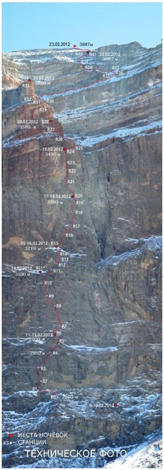 Technical
photo 2. Fragment of the upper part of the
route.
Technical
photo 2. Fragment of the upper part of the
route.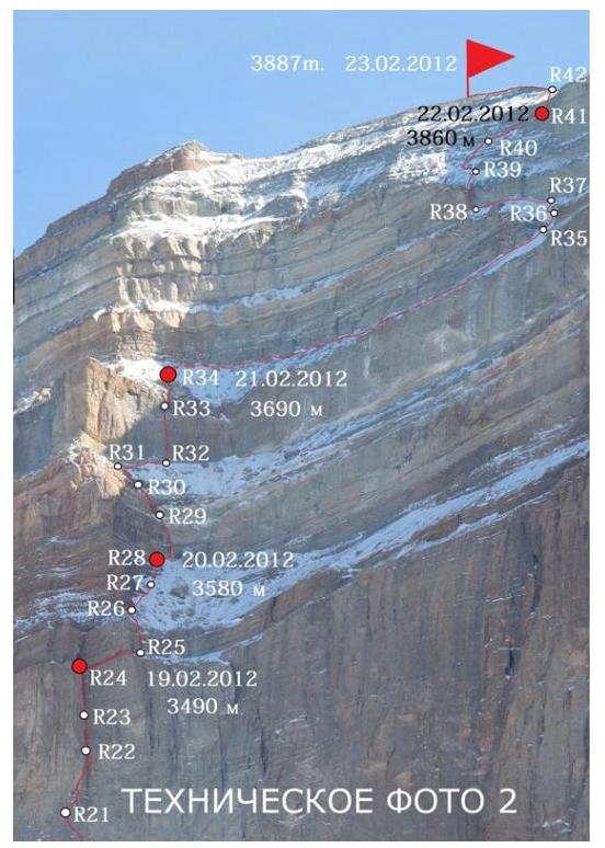
5 Description of the route by sections
R0–R1. Across gentle rocks to a ledge. Along the ledge left to the base of an internal corner. 30 m III.
R1–R2. Up the internal corner, then move right and climb under a canopy. Through the canopy up. Station on a ledge on the right. 30 m VA1
R2–R3. From the station up to a bolt 5 m, then up a crack to a narrow ledge. Several meters left and up a system of cracks to an overhanging internal corner. Up the corner to a ledge. Bolt. 35 m VIA2.
R3–R4. Up a gentle internal corner right and up. Station on a ledge on the left. Bolt. 50 m IV.
R4–R5. Across destroyed gentle rocks and ledges right. There's a bolt. 50 m II.
R5–R6. Move left up to a ledge. 15 m V, 20 m IV.
R6–R7. Overcome a 10-meter wall, walk 15 m right up along a ledge. Then left up across slabs to a ledge.
Complexity of the route:
- 10 m VIA1
- 20 m II
- 20 m V
R7–R8. Right up across a flake to a ledge, move several meters left to a bolt. Up the wall on skyhooks, oriented on bolts 30 m. Station is hanging on 2 bolts.
Complexity of the route:
- 15 m VA1
- 35 m VIA3
R8–R9. Left up on skyhooks to a bolt. From it several meters left, then up to a small ledge at the base of an internal corner. Bolt.
- 30 m VIA3.
R9–R10. Up the corner 10 m. Then along the left wall left up (there's a bolt), avoiding sounding places. Exit left to a ledge. Bolt.
- 40 m VIA3.
R11–R12. Up a wall 10 m. Then right along a ledge to a bolt. 15 m IV, 5 m II.
- 20 m V
- 25 m IV
There's an opportunity to exit left to a ledge for a bivouac.
R11–R12. Up a wall 10 m. Then right along a ledge to a bolt. 15 m IV, 5 m II.
R12–R13. Right up to a small ledge. 10 m VI, 20 m V. R13–R14. Up a corner to a ledge. Bolt. 25 m VA1. R14–R15. Along an scree ledge up to the base of an internal corner. 35 m II. R15–R16. Right to a crack, up the crack right. Bolt. 40 m VIA2. R16–R17. Up a corner to a ledge. Traverse right along the ledge. Up a wall with "shells" to gentle rocks, then 10 m to a bolt.
List:
- 15 m V
- 15 m VIA3
R17–R18. Up a corner to a ledge. From the ledge left up across sounding flakes, exit to an internal corner. Up it 10 m. Through a wall left to another corner. Up it to a ledge. There's a bolt.
10 m IV, 35 m VIA2. R18–R19. Traverse left along a ledge. Up a crack, then right up to a ledge.
List:
- 5 m III
- 10 m VIA2
- 20 m V
R19–R20. Traverse right to an internal corner. Up the corner to a long narrow ledge. Along the ledge left to a bolt. 20 m VIA2, 10 m IV.
R20–R21. From the station up a wall with "shells" to a gully. Up the right side of the gully. Then left up across a steep internal groove. 10 m VIA3, 20 m IV, 20 m V.
R21–R22. Traverse right 10 m, then right up to a huge internal corner. The start of the corner is heavily destroyed, further the corner is monolithic. Up the overhanging corner 15 m to living flakes. Move 5 m right on steel hooks to monolithic relief. Then slightly up and back left to the corner. 2 bolts.
- 10 m IV
- 30 m VIA3
R22–R23. Up the corner through an overhang. Station on 2 bolts.
- 5 m VIA2
- 20 m V
R23–R24. Up the corner to a ledge. Convenient place for a bivouac. 45 m VIA2
R24–R25. Along a ledge right around a corner. 40 m I. R25–R26. Up a corner to the top of the third bastion. Here is a large scree ledge, allowing a traverse right to the routes of the C3 bastion wall. Up the ledge to rocks. 20 m VA1. 30 m I. R26–R27. Right up along rocks. 50 m I. R27–R28. Right up along rocks, then across simple rocks to a wall. 60 m II.
R28–R29. Right 15 m to a narrow crack. Up the crack, veering slightly left. Exit to gentle rocks, then under a destroyed wall. Bolt. 15 m I, 30 m VIA2, 5 m III.
R29–R30. Left up to an overhanging internal corner. Up it left to a ledge and further up across gentle rocks to a scree ledge. 10 m VIA2, 15 m III.
R30–R31. Right 10 m to a lowering of the wall. Then up to scree under the wall of the "Korable Nose" bastion. 40 m II.
R31–R32. Under the bastion wall, traverse right. 70 m I.
R32–R33. Start the ascent from a small internal corner. Up the boundary of red and gray rocks. Initially, the rocks are destroyed, further they are monolithic. Station under a canopy, an anchor left. 40 m VIA2.
R33–R34. Traverse right to a destroyed internal corner. Up the corner to the top of the "Korable Nose" bastion. Convenient place for a bivouac. 20 m IV.
R34–R35. Right up under a belt of rocks. Then along scree ledges walk right about 150–200 m to a logical passage. Climb up 20 m to a large stone. 200–250 m I.
R35–R36. Up scree with rock outcrops to a belt of rocks. 40 m II.
R36–R37. Bypass the belt of rocks on the left and across a clay slope with rock outcrops under the wall. 40 m II.
R37–R38. Along scree ledges along the wall left to a convenient crack. 70 m I.
R38–R39. Up a wall with a crack. Start the ascent right of the crack across a system of thin cracks, then up the crack to gentle destroyed rocks. Up them under a rock wall.
- 20 m VIA2
- 30 m III.
R39–R40. Bypass the wall on the left and up a cascade of ledges and destroyed walls right up to an internal corner. Here there's an opportunity to organize a station.
- 45 m III.
R40–R41. Right up across a cascade to a ledge under the summit belt of rocks. The rocks are covered with clay.
25 m IV, 20 m V.
R41–R42. Right to an internal corner. Up the corner to a clay slope and behind a ridge to the plateau.
10 m V, 40 m I.
Movement schedule on the route
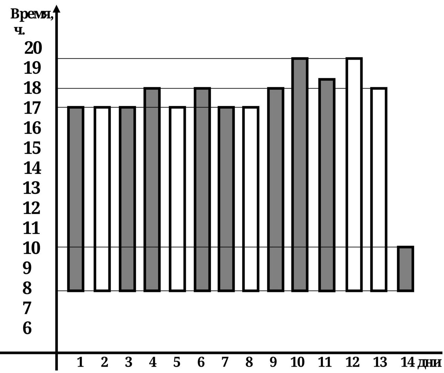
Conventions:
- Movement on the route
- Movement in bad weather (strong wind, snowfall)
6 Tactical and technical actions of the team.
The ascent was based on the study of photographic materials taken by me in February 2010 during the passage of the route "Through the nose of the NW wall bastion".
Our goal was a logical continuation in the center of the Northwest wall, ending with a huge internal corner. When choosing the line of the route, we tried to maximize the use of natural relief and thus minimize the drilling of holes and the use of bolts.
- The lower part of the route follows a counter-force, minimizing the likelihood of rocks falling on the participants from the scree ledges.
- In the upper part, the movement of one group above another is highly undesirable.
The assault camp was set up under the wall, 100 m right of the start of the route. In this place:
- A huge stone has a large overhang, protecting the tent from rockfall.
Initially, we planned just one day for processing the first bastion. This tactic was due to the presence of a convenient ledge after the fourth rope.
Given the unstable weather, we took a supply of food and gas for 16 days.
According to the plan:
- On the first day of the ascent, we overcame the belays, passed 2 ropes, and started processing the "mirror" of the second bastion.
- On the 3rd and 4th days, we processed the "mirror".
- On the 5th day, after passing the belays, we reached the top of the 2nd bastion and bivouacked on a scree ledge.
- On the 6th day, we approached the third bastion and managed to process 40 m.
- On the 7th day, we continued processing the third bastion.
- On the 8th day, we reached a long narrow ledge in the middle of the third bastion and set up a bivouac.
- On the 9th day, we continued processing above the ledge, passed about 100 m, and entered the internal corner.
- On the 10th day, we worked in the internal corner, setting up stations under overhangs. By 19:30, we reached a convenient long ledge.
- On the 11th day, there was bad weather: −23°C, strong wind, snowfall. During the day, we reached a scree ledge above the third bastion and managed to process a rock wall.
- On the 12th day, by 19:30, we reached the top of the "Korable Nose" bastion and bivouacked on a large scree ledge.
- On the 13th day, we searched for a passage in the summit belts of rocks. A large amount of snow and avalanche danger greatly hindered progress. At 18:00, we stopped on a small ledge 10 m from the ridge of the wall. On the plateau, the wind was raging, and we decided not to exit the wall that day.
- On the 14th day of the ascent, at 10:00, we climbed to the summit of Erydag NW — 3887 m. At 12:00, we descended to the lower plateau and down the SW couloir descended from v. Sel'dy (route 2A category of difficulty) to the base camp by 17:00.
During the ascent, participants led in turns. Due to the complexity of the relief, the first climber moved on a double rope.
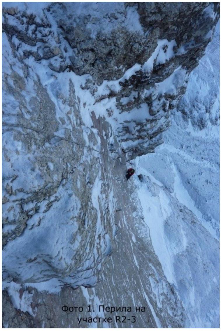
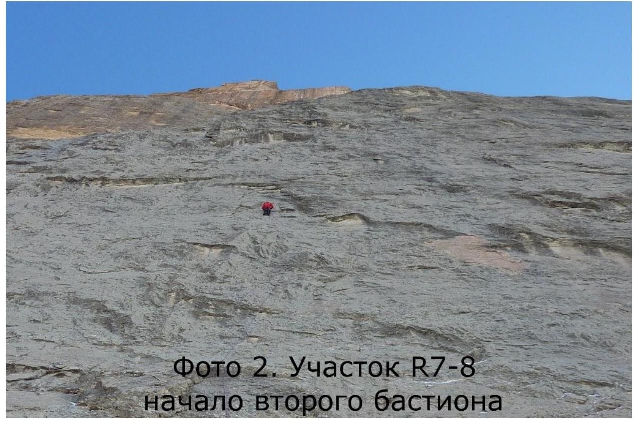
Photo 2. Section R7–R8 — start of the second
bastion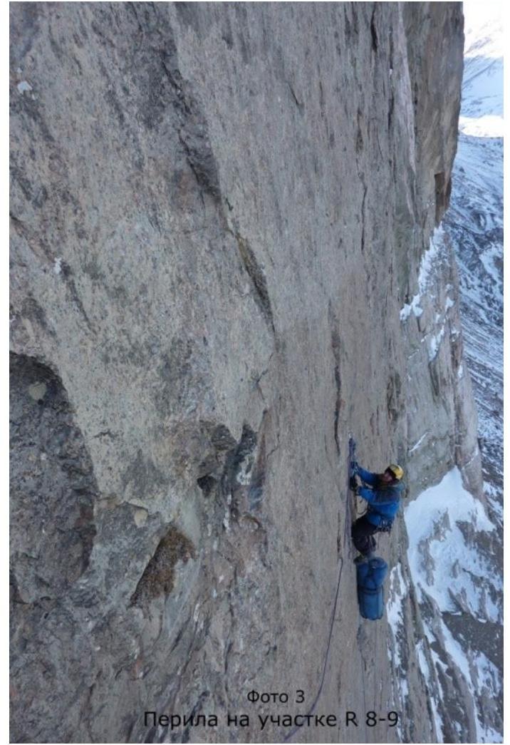
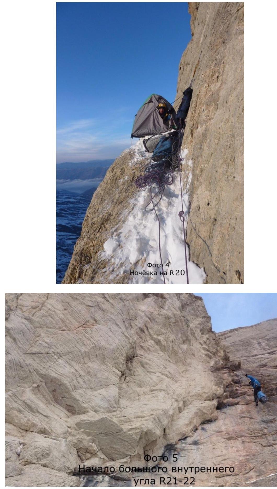
Photo 5. Start of the big internal corner
R21–R22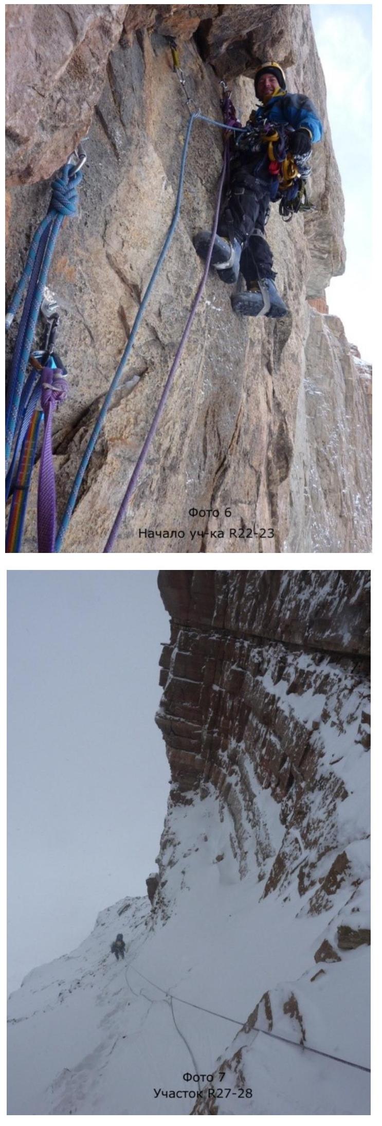
Photo 6. Start of the section
R22–R23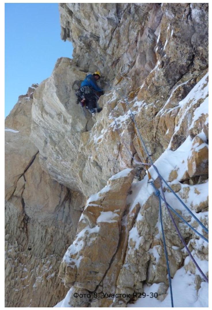
Photo 9. Section
K32–K37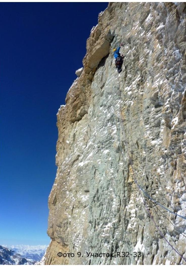
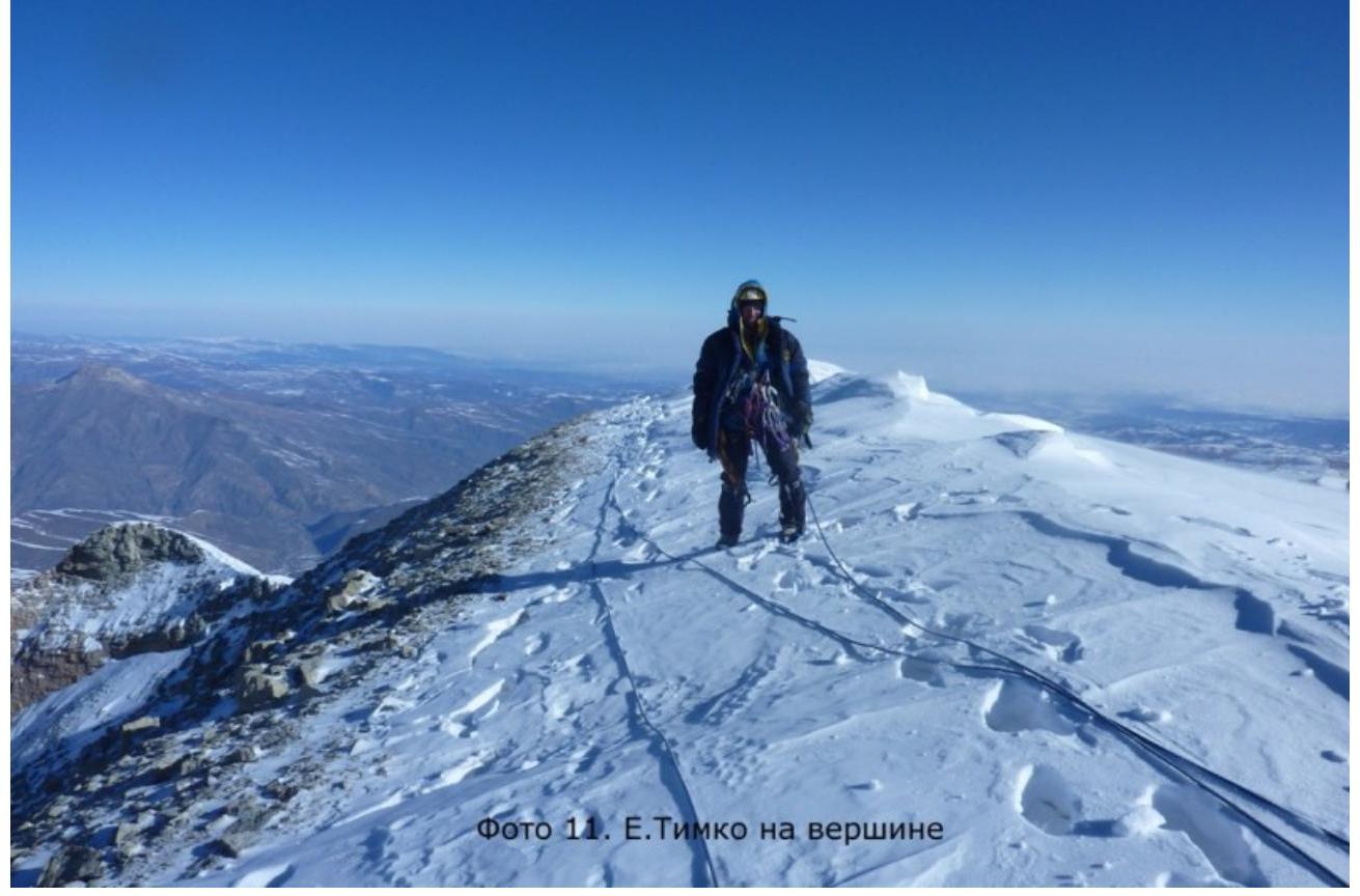
Photo 10. E. Poltavets on the
summit