2010 Russian Mountaineering Championship, High Altitude Category
Report on the ascent of the team from Irkutsk to the NW peak of Erydag, 3887 m, via the center of the NW bastion (S. Voronin, 2001)
Irkutsk, 2010, Ascent Details
-
Location: Eastern Caucasus, Dagestan Mountains, Chekhychay River valley. Classification table section: 2.2.
-
Peak: Erydag NW, 3887 m, route via the center of the NW bastion (S. Voronin, 2001), route #48b.
-
Difficulty category: 6B.
-
Route type: Rock climbing.
-
Wall height: 1050 m.
Route length: 1300 m. Length of sections by difficulty category: V - 405 m, VI - 540 m. Average slope: Bastion - 80°, wall section - 75°, entire route - 60°.
- Pitons left on the route: 5 (3 anchor, 2 chock stones). Pitons used: anchor - 134/15, chock stones - 47/13. Drill screws used: stationary - 11/6, removable - 14/8 (mostly in old holes, including 1 for hanging a hammock on the 2nd night), + about 45 points on skyhooks and fiffies.
- Team's total climbing time: 35 hours 5 minutes (3 full climbing days). Overnights: 1 - hanging in hammocks, 2 - hanging in hammocks, 3 - lying on a comfortable ledge.
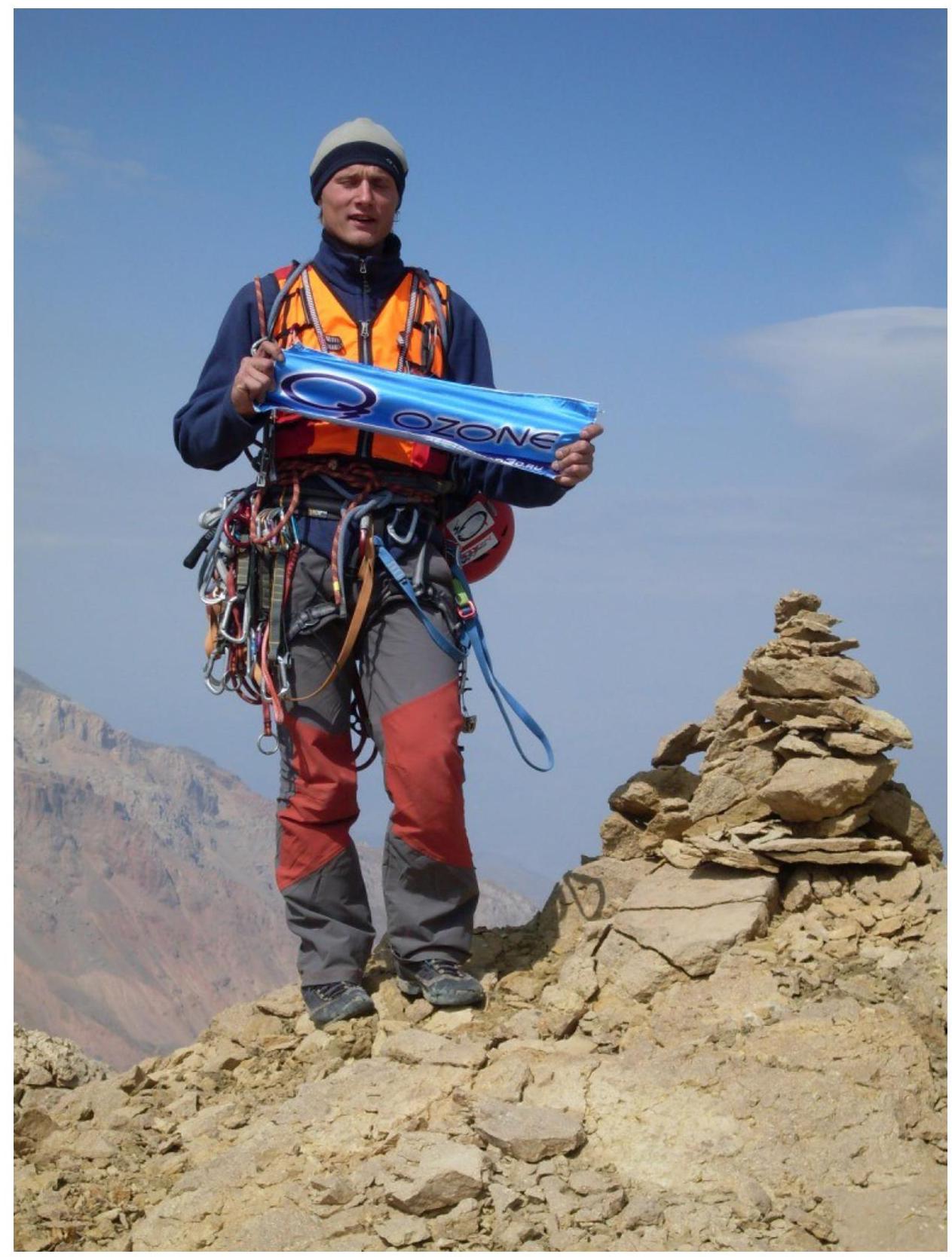
- Team leader: Glazunov Evgeny Vladimirovich (Candidate for Master of Sports). Participant: Ishchenko Alexander Vitalievich (Candidate for Master of Sports).
- Coach: Kosoturov Sergey Vladimirovich (Master of Sports).
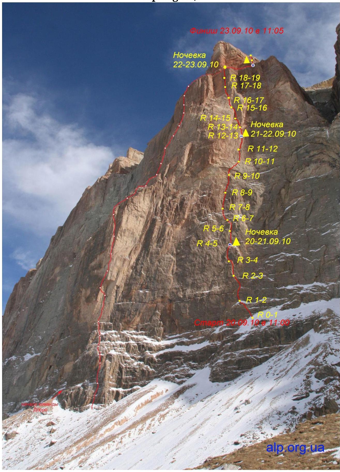
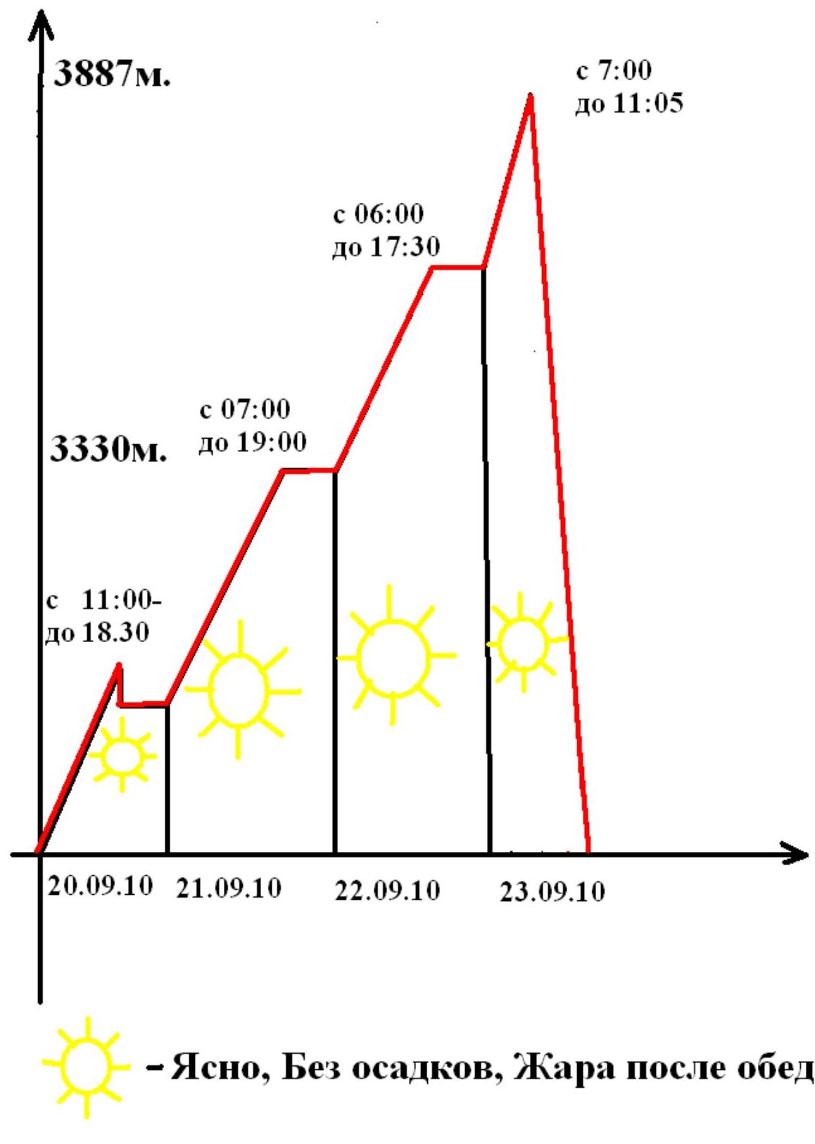
- Departure time: 11:00, September 20, 2010.
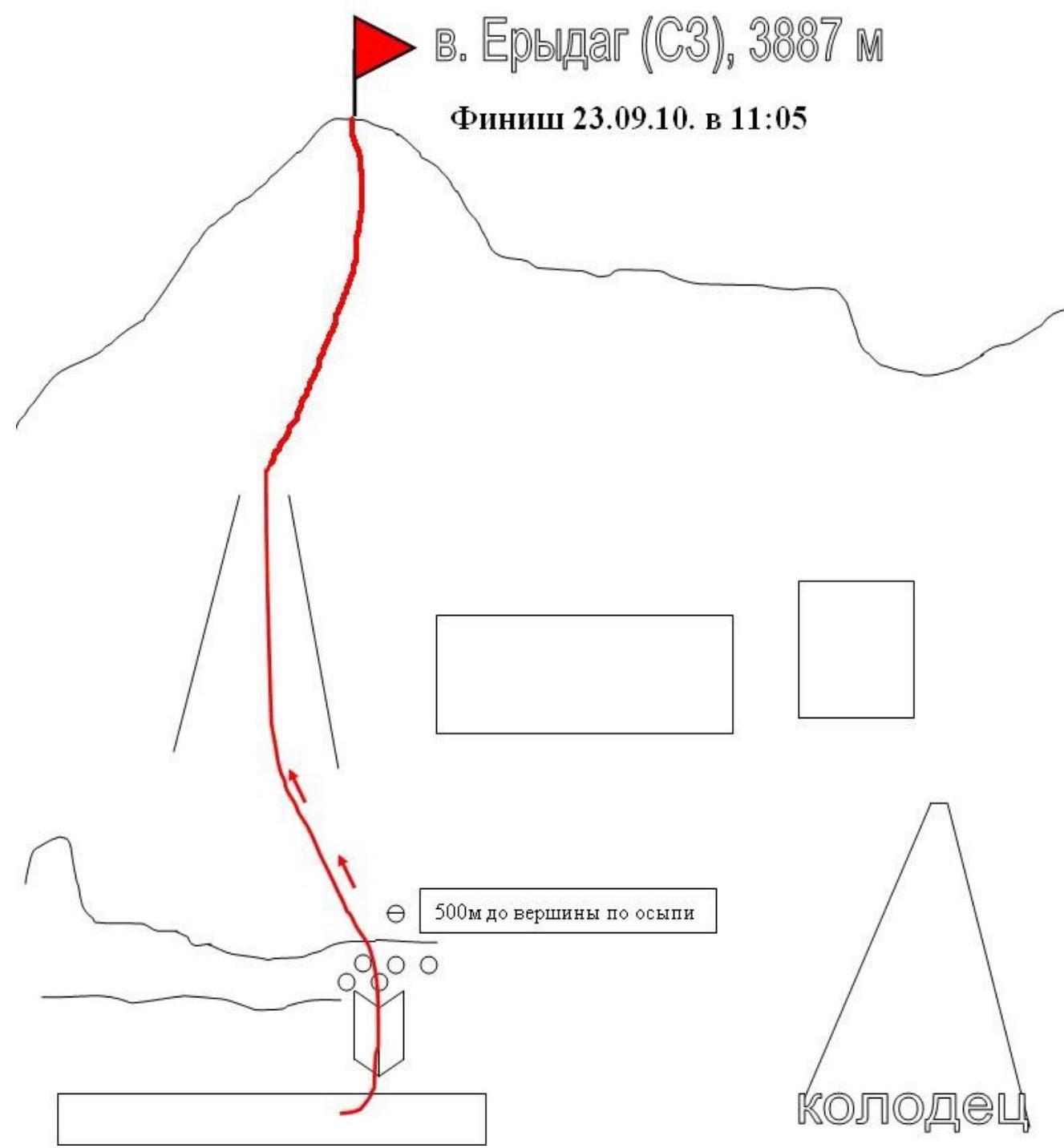
Reached the summit (last one on the plateau): 11:05, September 23, 2010. Returned to Base Camp: 15:30, September 23, 2010.
- Irkutsk Region Alpine Federation.
Tactical Actions of the Team
Voronin's route was initially chosen as a backup; we were planning to climb Shanavazova. However, the abnormally hot weather in the area around September 20 (on September 21, a local resident working near the farm suffered heatstroke) adjusted our plans in favor of a less demanding route requiring less water (which constituted the main weight of our load during the ascent).
During the ascent, several tactical miscalculations were made, which ultimately resulted in a very low speed of movement along the wall. We carried some unused equipment (drill screws, safety gear, bivouac gear), which was a significant burden. We also took only 8.5 liters of water. Water conservation led to a significant decrease in working capacity and, again, a decrease in the speed of movement along the wall.
Based on the results of the ascent, it can be concluded that with our team composition and by eliminating tactical errors, we could have completed the route a day faster. But the result is the result!
During the passage of serious difficulties (apart from water shortage), the team did not encounter any problems, there were no falls or other emergencies. Work ahead was done alternately every other day. The load was transported in a bag under the harness. For overnight stays, we used lightweight hammocks, which allowed us to avoid using a platform and significantly save weight.
Main features of the ascent organization:
- We started working early to climb as much as possible before the sun turned the wall into a "frying pan."
- On average, before lunch (the sun illuminates the wall from 13:00), we managed to climb 7-8 ropes.
- After lunch, until evening, we stably climbed no more than three ropes.
Overall, the route is logical and understandable; there were no serious difficulties in choosing the path. The route encounters old drill screws (construction 8s, sawn off without ears, holes for removable drill screws), which we used for:
- Stations.
- Belays.
In extreme cases, we reinforced the stations with our own removable pitons (belt of destroyed rocks, rope before the chimney).
On the route, equipment was left only for the second climber when moving along horizontal perils.
General View of the Wall (winter photo from alp.org.ua)
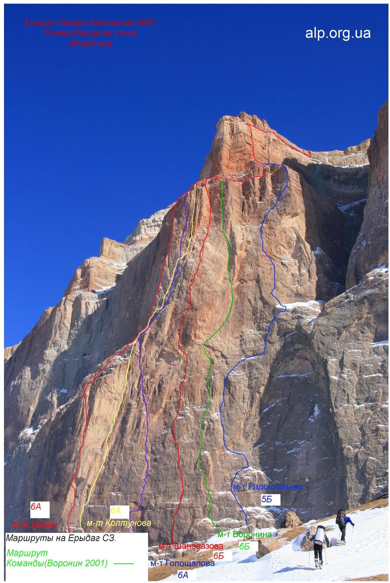
NW Erydag routes. Team's route (Voronin 2001).
Technical photo of the route (winter photo from alp.org.ua)
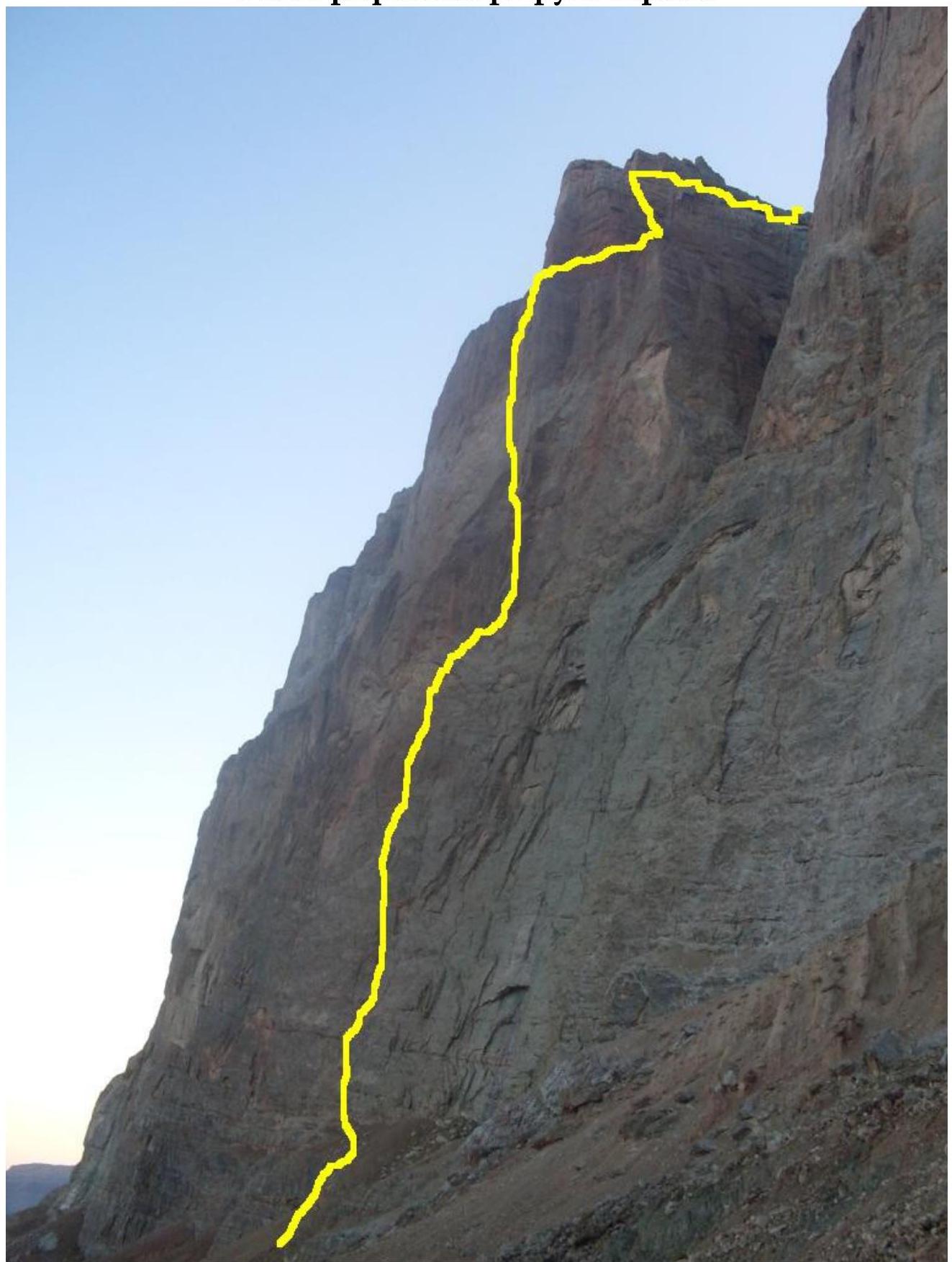
Drawn profile of the route

Photo of the route profile from the right.
Ascent graph
Route Description by Sections
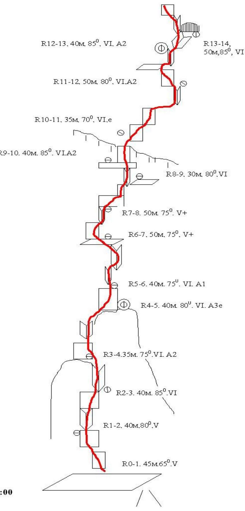
R0–R1 Start from a large ledge, moving from right to left along a small corner. Reach a comfortable ledge.
R1–R2 From the ledge, climb up a crack (photo 1), then traverse right along a small ledge to a corner with a crack. In the middle of the corner, there's a station.
R2–R3 Climb a hanging crack to a ledge above the first "Oгурец" (cucumber); there's a stationary drill screw.
R3–R4 Traverse left to right across slabs to reach a corner, then climb the corner to the roof of the large "Огурец"; there are three stationary drill screws. First overnight stay in hammocks.
4–5 From the ledge, climb a section of monoliths without relief directly (Voronin's line apparently goes left via a system of fractures??; climbing directly seemed more logical, though much harder) using some holes for protection; placed 2 removable pitons on 8. By the end of the day, reached an internal corner with a crack.
5–6 Climb the corner to a small ledge, then pendulum right to a vertical crack, and climb it to a narrow ledge.
6–7 Continue via a system of corners, slabs, and ledges to a wide ledge, then through a small wall to another ledge; there's a station.
7–8 Climb right along a corner towards a cornice to a large ledge; there's a stationary drill screw (photo 3).
8–9 From the ledge, climb right along a corner, then across a slab with a crack (there's a stationary box) to a ledge under the cornice; there's a piton without an ear for a station. According to KТ1 description (no KТ or note!).
9–10 Climb from the ledge to a logical passage in the cornice (photo 4); the rocks are destroyed, protection is poor, but there's a lot of free climbing. Beyond the cornice, there are two drill screws (for a station), but it's only 20–25 m from the station - climbed further to a small ledge suitable for two feet. Removable piton for the station.
10–11 Difficult rope (destroyed rocks, "vertical gravel"!!!); traverse right along a ledge, then climb a system of flakes and blind cracks carefully to a ledge with signs of an overnight stay. Protection is poor; it's hot!
11–12 Climb from the ledge, then right across slabs under a vertical corner with a monolithic crack; the corner leads to a small ledge. Second overnight stay. Didn't process the ledge due to extreme heat; decided to wait until morning.
12–13 Climb the crack, alternating between free climbing and ITO, to reach under a cornice, then descend to a ledge under a logical corner.
13–14 Climb the corner (photo 5), then right under the base of a huge corner with a crack - a full rope.
14–15 Climb the corner with a crack; above the corner, on a ledge, there's a station.
15–16 Direction: right, then up across destroyed rocks to a narrow ledge. There's a piton without an ear for a station.
16–17 From the ledge, climb a crack using ITO towards a cornice; under the cornice, KТ2 in a jar on a piton (note from the Buryatia team). Climb the cornice; beyond the cornice, in a niche, there's a station.
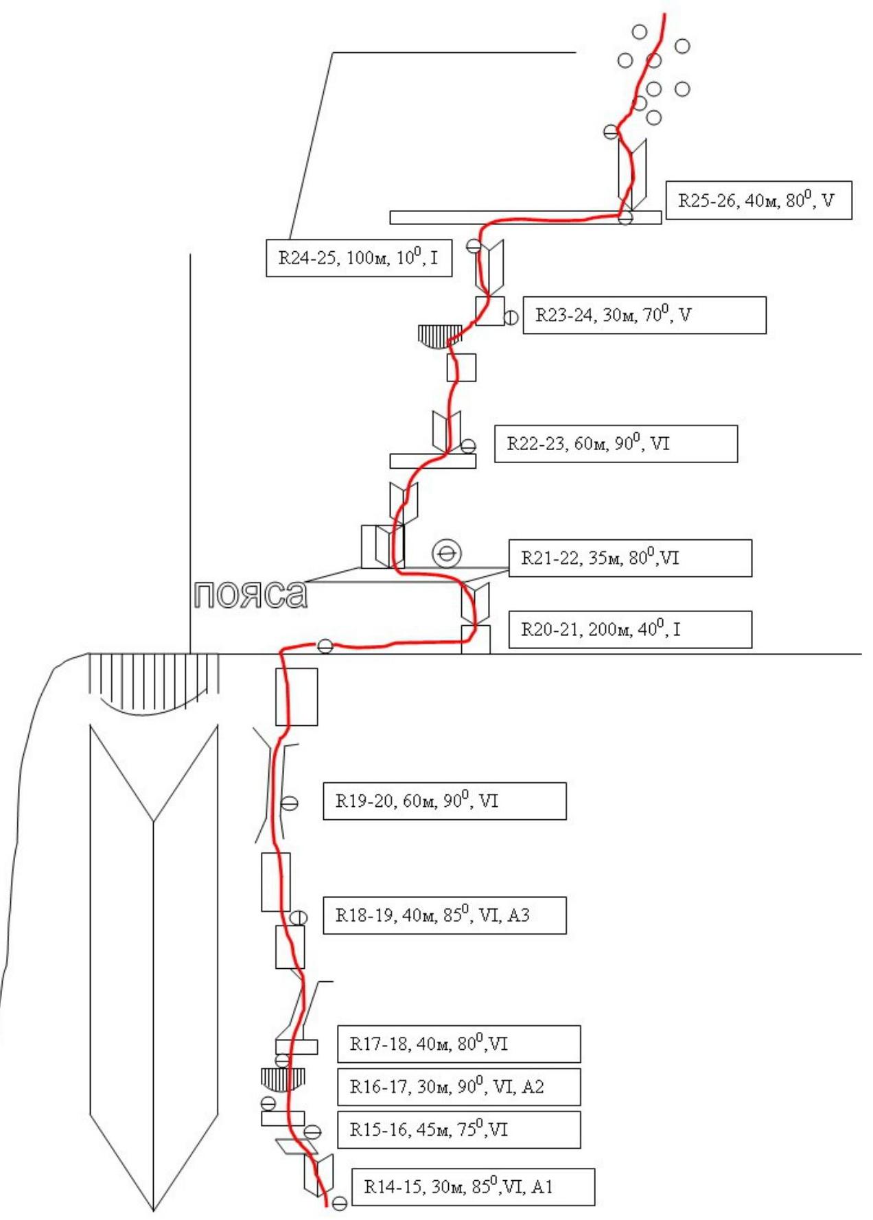
17–18 Climb up a chute and difficult rocks to a small cornice; under it, there's a hanging station.
18–19 Continue slightly right (photo 6); difficult climbing and ITO to a chimney. Difficult rope, likely the crux of the route! In the middle of the wide chimney, there's a station.
19–20 Climb the chimney to a full rope, exiting to a wide ledge. The bastion is passed!
20–21 Walk to the base of the first belt. About 300 meters to the right, traverse under rocks - there's water!!! Decided to stay overnight near the water - still plenty of daylight. Third overnight stay.
21–22 First rope on the belt: climb a vertical crack to a ledge, then slightly right (from the ledge, a difficult start; there's a hole for a skyhook, but can be climbed without) along a corner to a wide ledge. Station here.
22–23 Climb a wall with a crack, then a corner under a cornice. Climb the cornice (photo 7) and, traversing an external corner right, reach a small ledge; station.
23–24 From there, climb across slabs and cracks to exit onto a ledge-terrace. First belt is passed.
22–25 Walk across talus to a corner.
25–26 Climb the 2nd belt via a corner. Rocks are covered with clay; climbing is easy. Exit onto talus - the wall section is completed. Then walk across a couloir and talus to exit onto a plateau, and from there to the summit. No note in the found cairn!
UIAA Scheme
Sheet 3
Sheet 2
 □
Sheet 1
□
Sheet 1
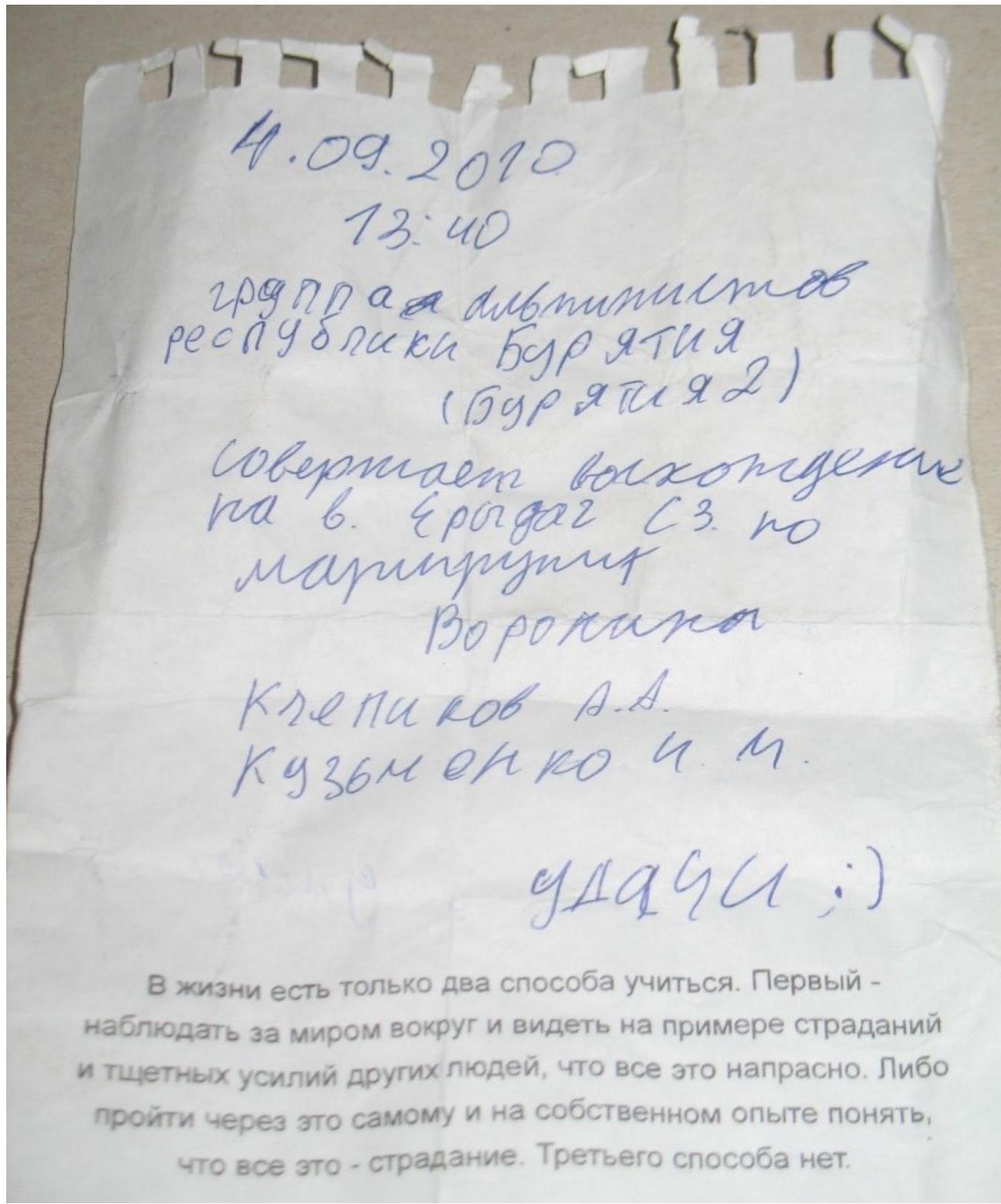
Note from KТ2

Photo 1. R1–R2 section
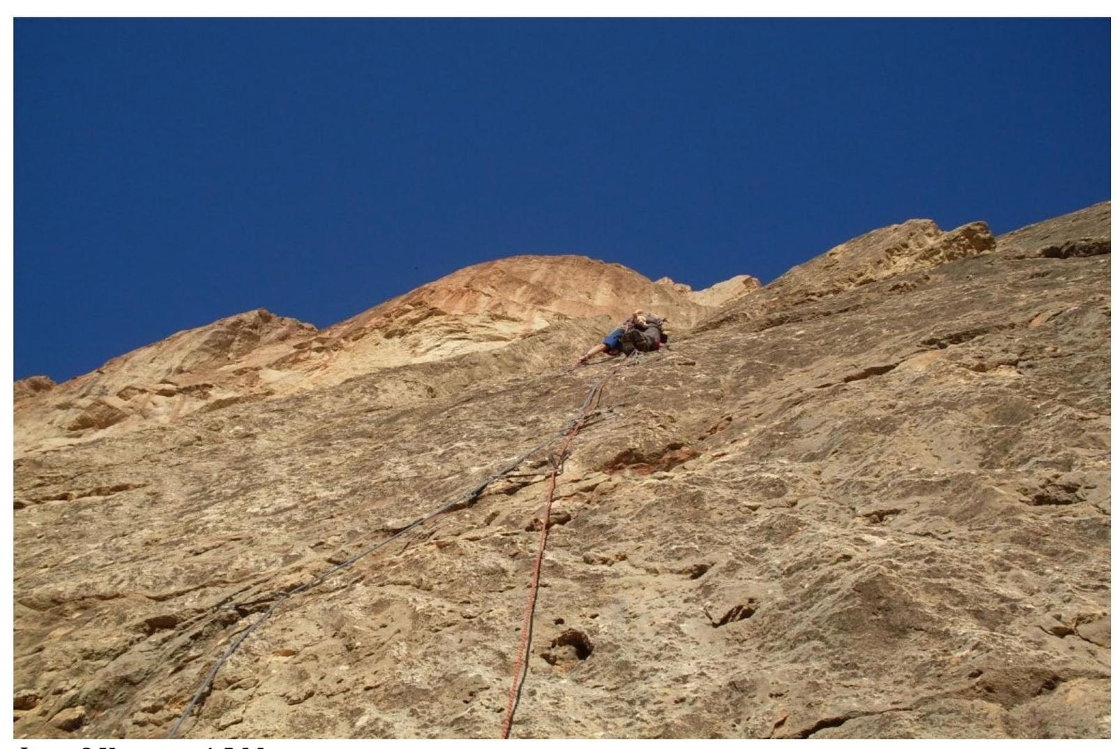
Photo 2. R4–R5 section, monoliths
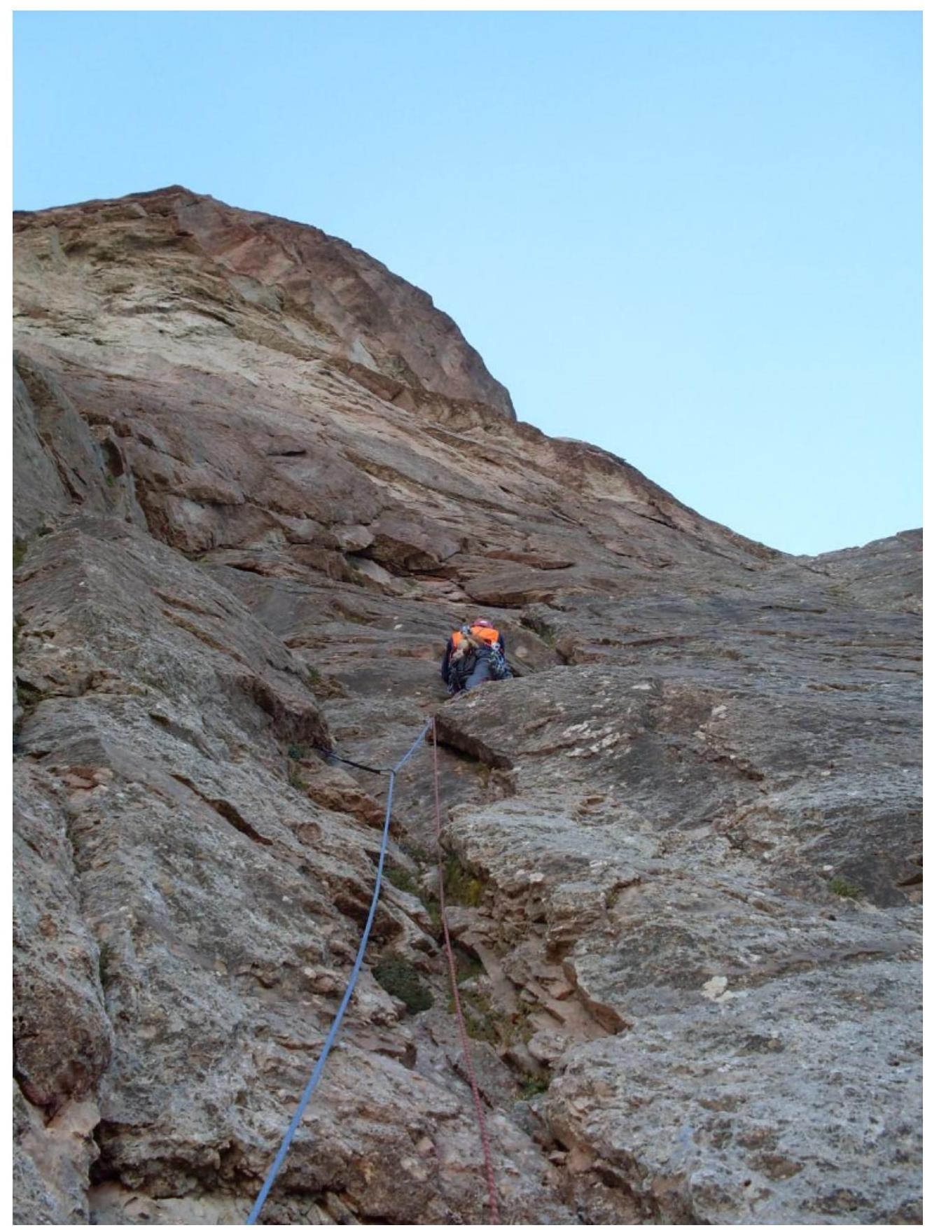
Photo 3. R7–R8 section, approaching the cornice
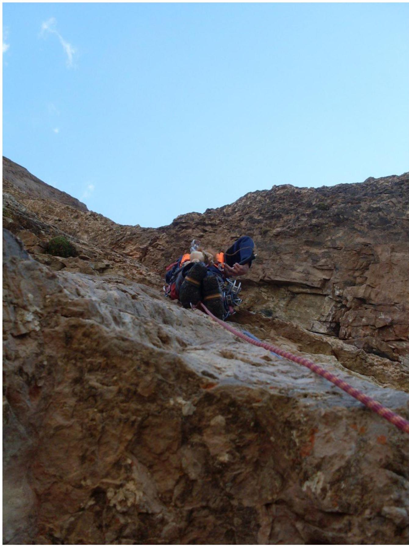
Photo 4. Passage across destroyed rocks and cornice on R9–R10 section

Photo 5. R13–R14 section, free climbing
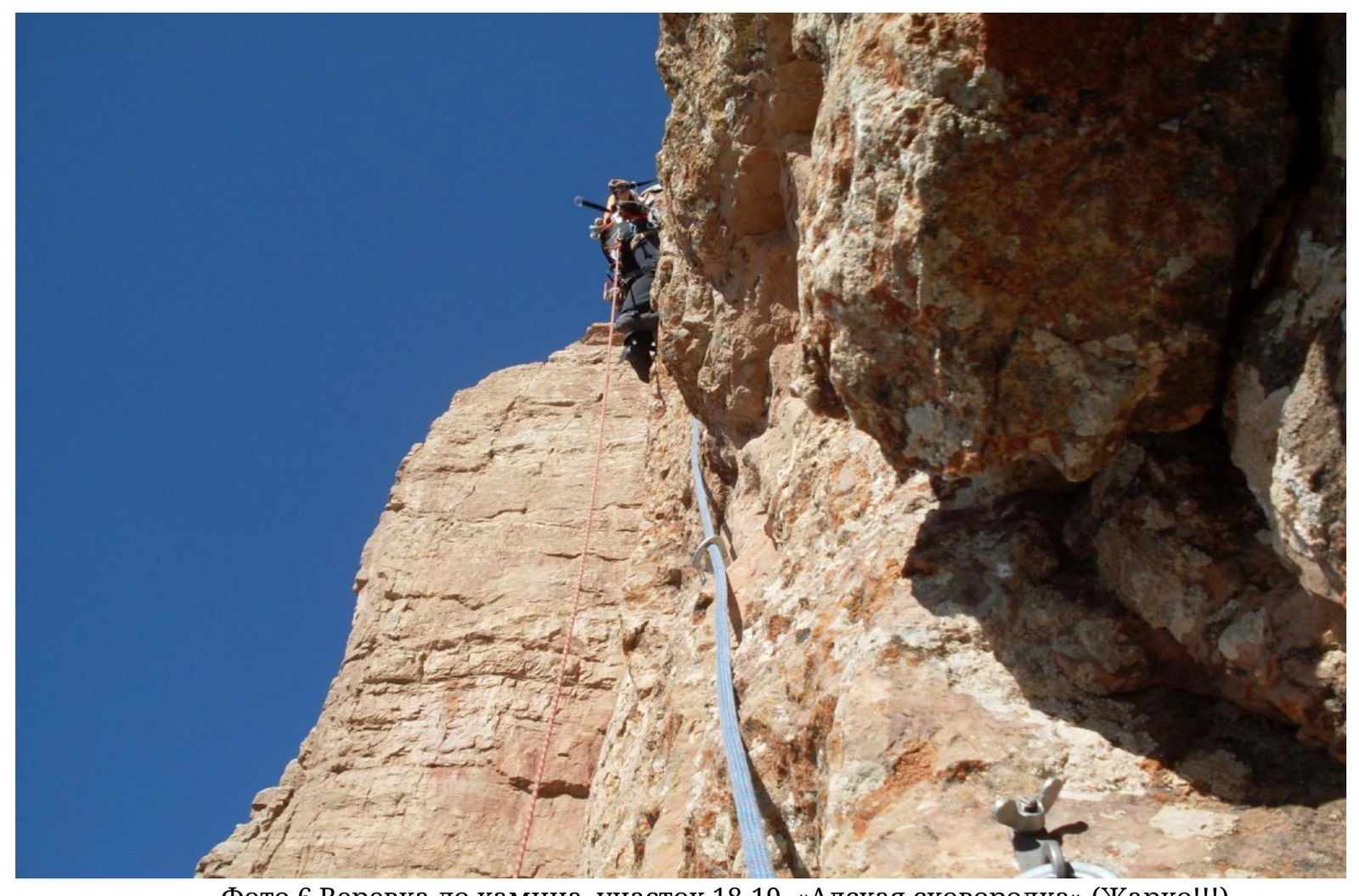
Photo 6. Rope to the chimney, R18–R19 section, "Hellish frying pan" (very hot!!!)
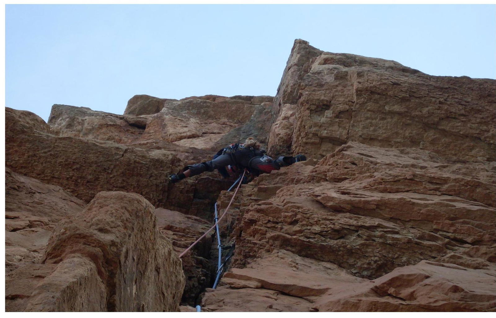
Photo 7. Climbing the cornice with free climbing on R22–R23 section (2nd belt)
E. Glazunov on the summit
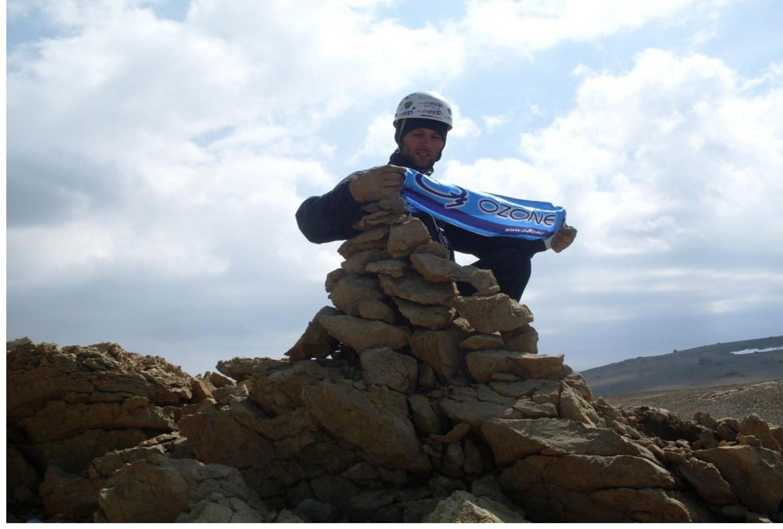
A. Ishchenko on the summit