Ascent Report
of the Odessa Alpine Club team to the summit of Erydag (3925 m)
via the "mirror" of the left part of the Northwest wall (first ascent). EAAC Alpine Championship. Rock climbing category. Caucasus, Dagestan mountains, 2011.
Ascent Passport
- Caucasus, Dagestan mountains, 2.10
- p. Erydag, 3925 m, via the "mirror" of the left part of the NW wall
- Proposed — 6B cat. diff., first ascent
- Route type: rock
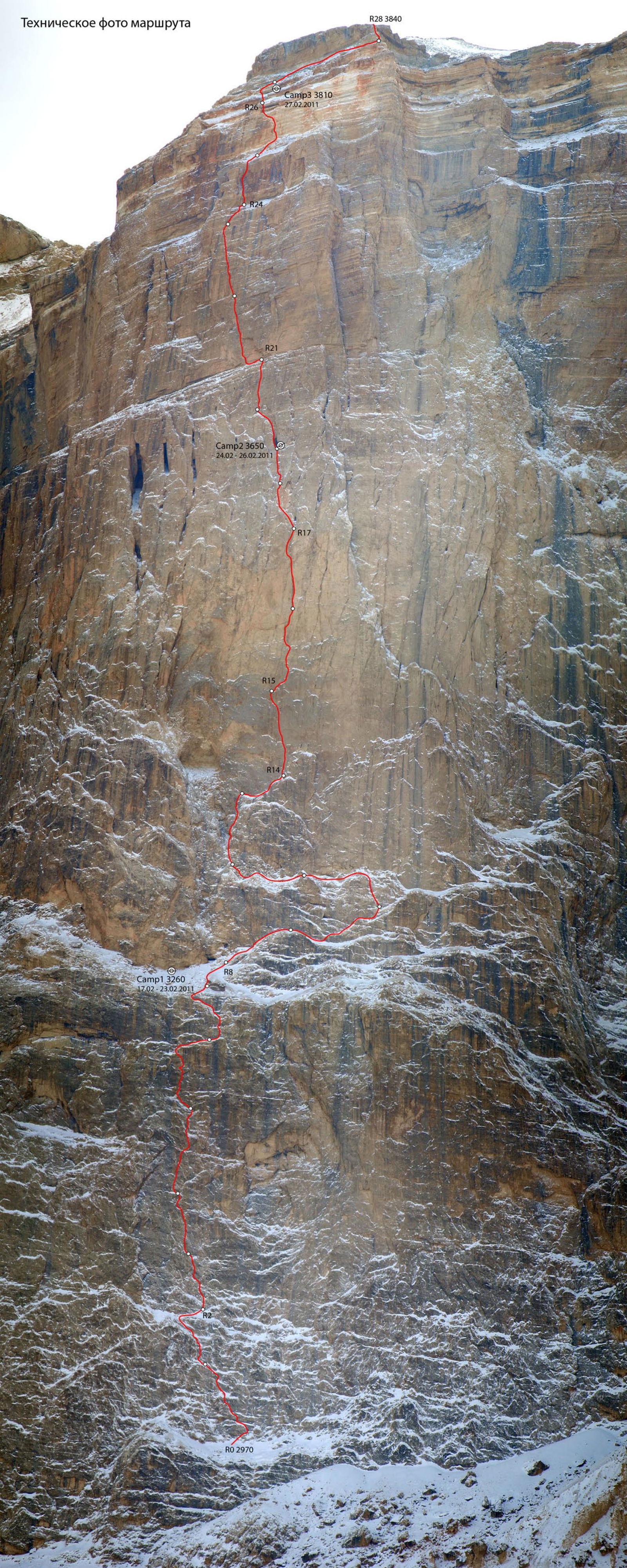
- Route elevation gain: 955 m (by GPS)
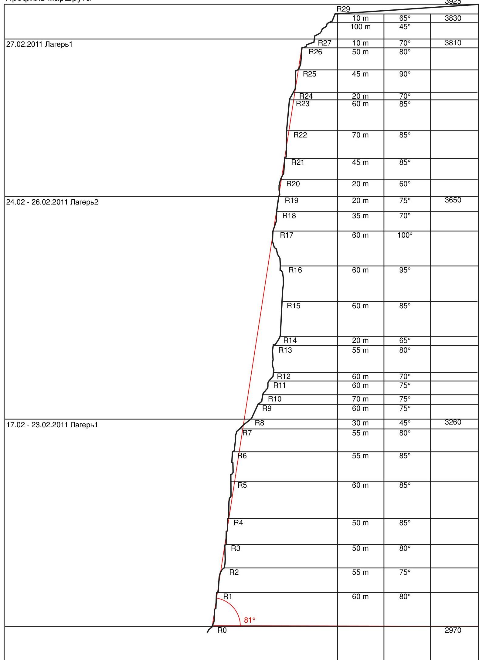
Route length: 1800 m. Length of sections: V cat. diff. – 360 m, VI cat. diff. – 855 m. Average slope: main part of the route – 81° entire route – 45°
- Pitons left on the route: total — 32; including bolted — 32
- Team's climbing hours: 110.5 h, 17 calendar days
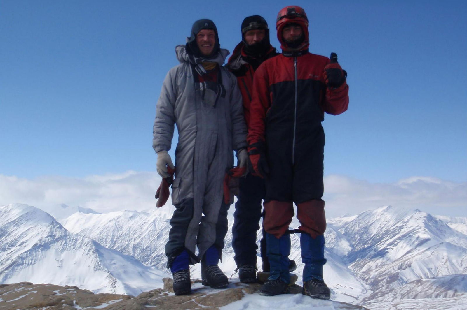
- Leader: Mogyla Vladimir Fedorovich — Master of Sports of International Class. Participants: Klebansky Vladimir Mikhailovich — Master of Sports, Perevalov Maxim Viktorovich — Master of Sports
- Coach: Gorbenko Mstislav Mstislavovich — Honored Master of Sports, Honored Coach
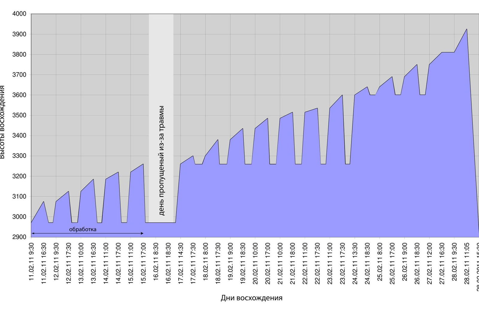
- Departure to the route: 09:30, February 11, 2011
Summit reached: 11:05, February 28, 2011 Return to Base Camp: 17:30, February 28, 2011
- Organization: Odessa Alpine Club
- Responsible for the report: Mogyla V.F.
email: v.mogila@mail.ru, phone: +38 050 976-03-88
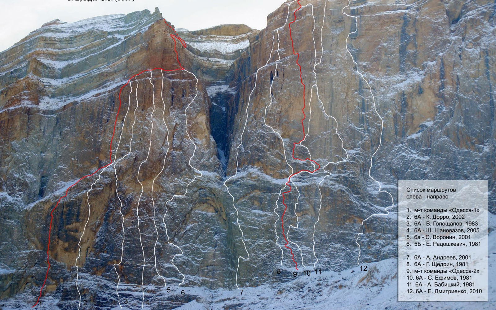
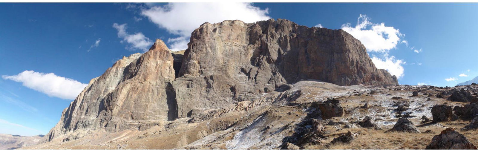
General photo of the Erydag NW wall (3887), Erydag peak (3925)
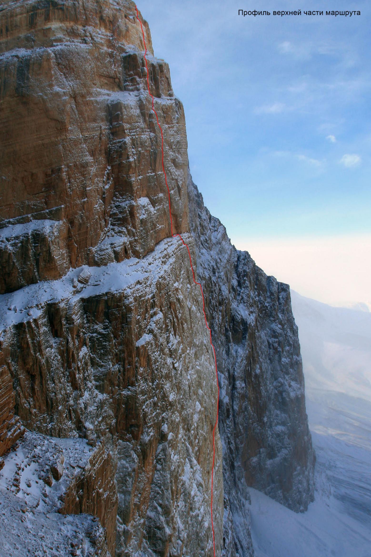
Profile of the upper part of the route
Route profile
Photopanorama of the ascent area
Technical photo of the route
| rock | fixed | bolt | Route scheme in UIAA Symbols. Sheet-1 | № | cat. diff. | length | slope |
|---|---|---|---|---|---|---|---|
| 17/17 | 11/11 | 1 | 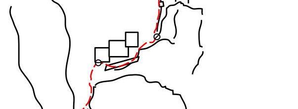 | R15 | VI | 60 m | 85° |
| 2 | 2 | 0 | R14 | IV | 20 m | 65° | |
| 8/4 | 4/2 | 3/1 | R13 | VI–, A2 | 55 m | 80° | |
| 5/2 | 4/1 | 0 | R12 | V–, A1 | 60 m | 70° | |
| 8/1 | 3/1 | 1 | R11 | V, A1 | 60 m | 75° | |
| 6/2 | 3/2 | 1 | R10 | V+, A2 | 70 m | 75° | |
| 5 | 2 | 0 | Camp-1 17.02–23.02.2011 | R9 | V– | 60 m | 75° |
| 2 | 1 | 0 | R8 | I | 30 m | 45° | |
| 10/9 | 3/2 | 0 | R7 | V–, A2 | 55 m | 80° | |
| 13/11 | 5/5 | 4/2 | R6 | VI+, A3 | 55 m | 85° | |
| 12/11 | 6/4 | 3/2 | R5 | VI, A2 | 60 m | 85° | |
| 12/8 | 8/7 | 2 | R4 | VI+, A3 | 50 m | 85° | |
| 11/7 | 10/7 | 1 | R3 | VI, A2 | 50 m | 80° | |
| 7/5 | 2 | 0 | R2 | VI–, A2 | 55 m | 75° | |
| 10/8 | 8/7 | 4/1 | R1 | VI–, A2 | 60 m | 80° | |
| R0 |
| rock | fixed | bolt | Route scheme in UIAA Symbols. Sheet-2 | № | cat. diff. | length | slope |
|---|---|---|---|---|---|---|---|
| 0 | 0 | 0 | R29 | III | 10 m | 65° | |
| 0 | 0 | 0 | R28 | II | 100 m | 45° | |
| 0 | 0 | 0 | R27 | III | 10 m | 70° | |
| 9/8 | 7/6 | 0 | Camp-3 27.02.2011 | R26 | VI, A2 | 50 m | 80° |
| 8/7 | 6/7 | 0 | R25 | VI, A3 | 45 m | 90° | |
| 2 | 2 | 0 | R24 | III | 20 m | 70° | |
| 15/10 | 8/6 | 0 | R23 | VI, A2 | 60 m | 85° | |
| 12/12 | 7/6 | 1 | R22 | VI+, A2 | 70 m | 85° | |
| 11/9 | 5/5 | 2/1 | R21 | VI, A2 | 45 m | 85° | |
| 8/6 | 2/1 | 0 | R20 | VI–, A2 | 20 m | 60° | |
| 8/5 | 4 | 0 | Camp-2 24.02–26.02.2011 | R19 | V, A1 | 20 m | 75° |
| 7/4 | 3 | 1 | R18 | V, A1 | 35 m | 70° | |
| 14/14 | 12/11 | 4/3 | R17 | VI+, A3 | 60 m | 100° | |
| 13/13 | 10/10 | 4/3 | R16 | VI+, A4 | 60 m | 95° | |
| R15 |
Team's movement schedule
- Work on section R1–R2
- Work on section R14–R15
- Work on section R14–R15
- First at station R16
- Work on section R16–R17
- Second bivouac. Camp2 (R19)
- Platform in the grotto at R19. Belayer at R21. First at R22.
- Ropes on section R21–R22. Photo taken from a neighboring mountain.
- Ropes on section R22–R23. Photo taken from a neighboring mountain.
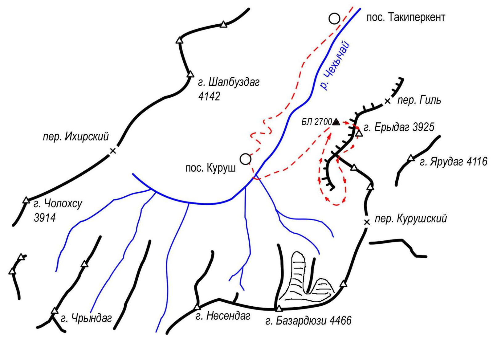
Area diagram