Ascent Passport
- Caucasus, Dagestan Mountains, 2.10.44a.
- Erydag, 3825 m, via the left part of the NW wall.
- Proposed 6B category of difficulty, first winter ascent.
- Route type: rock climbing.
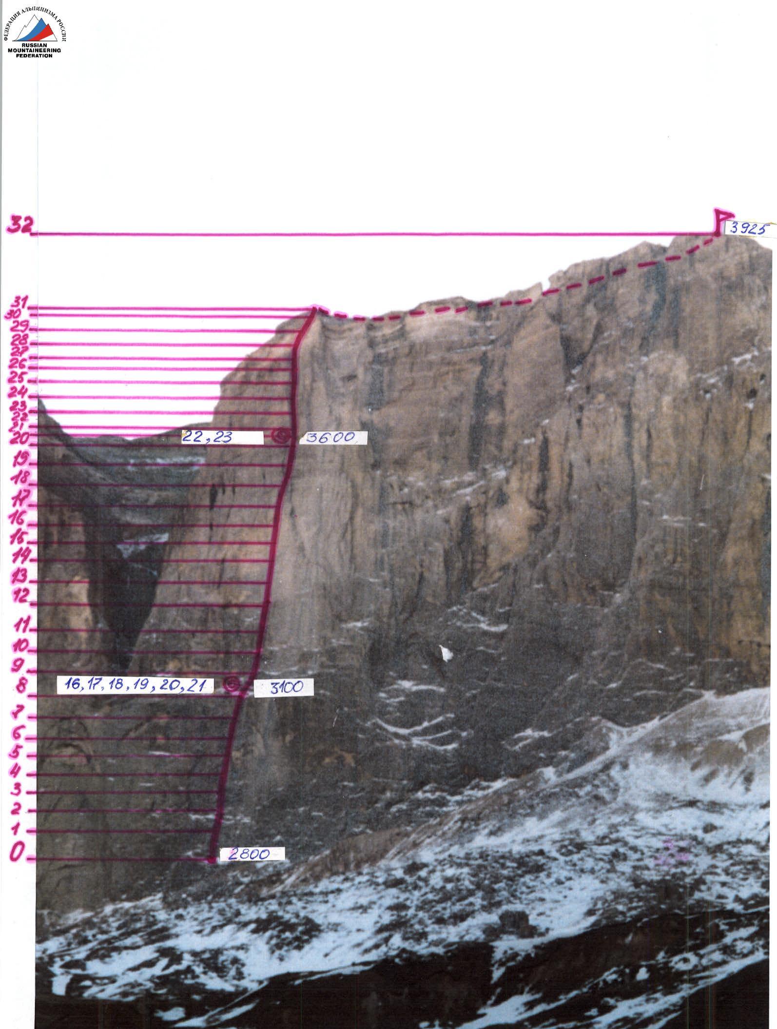
- Route height difference: 1125 m. Route length: 1952 m.
Section lengths:
- 5th category of difficulty — 495 m
- 6A category of difficulty — 275 m
- 6B category of difficulty — 212 m
Average steepness:
- main part of the route (2800 m — 3891 m) — 74°
- entire route (2800 m — 3925 m) — 46°
- Pitons left on the route: total — 0; including bolted pitons — 0.
Pitons used on the route:
- stationary bolted pitons — 19*; including artificial aids (AAs) — 15
- removable bolted pitons — 30; including AAs — 15
- chocks — 418, including AAs — 268
- rock pitons — 118, including AAs — 107
Total artificial points of support (AAs) used: 405.
- Team's working hours (including 6 days of preliminary route processing): 109 hours, 15 days (including 6 days of preliminary route processing).
- Team leader: Korobkov Alexander Alexandrovich, Master of Sports (MS)
Team members:
- Grachev Sergey Anatolyevich, 1st sports category
- Kapitonov Ivan Vasilyevich, 1st sports category
- Kofanov Sergey Anatolyevich, MS
- Ravilov Raif Abdurakhmanovich, Candidate Master of Sports (CMS)
- Shabunin Alexander Anatolyevich, CMS
- Coach: Mikhailov Alexander Alexandrovich, MS, Honored Coach of Russia (ZTR)
- Route start: 15:00, February 10, 2005.
Summit reached: 14:10, February 24, 2005.
Return to Base Camp: 21:00, February 24, 2005.
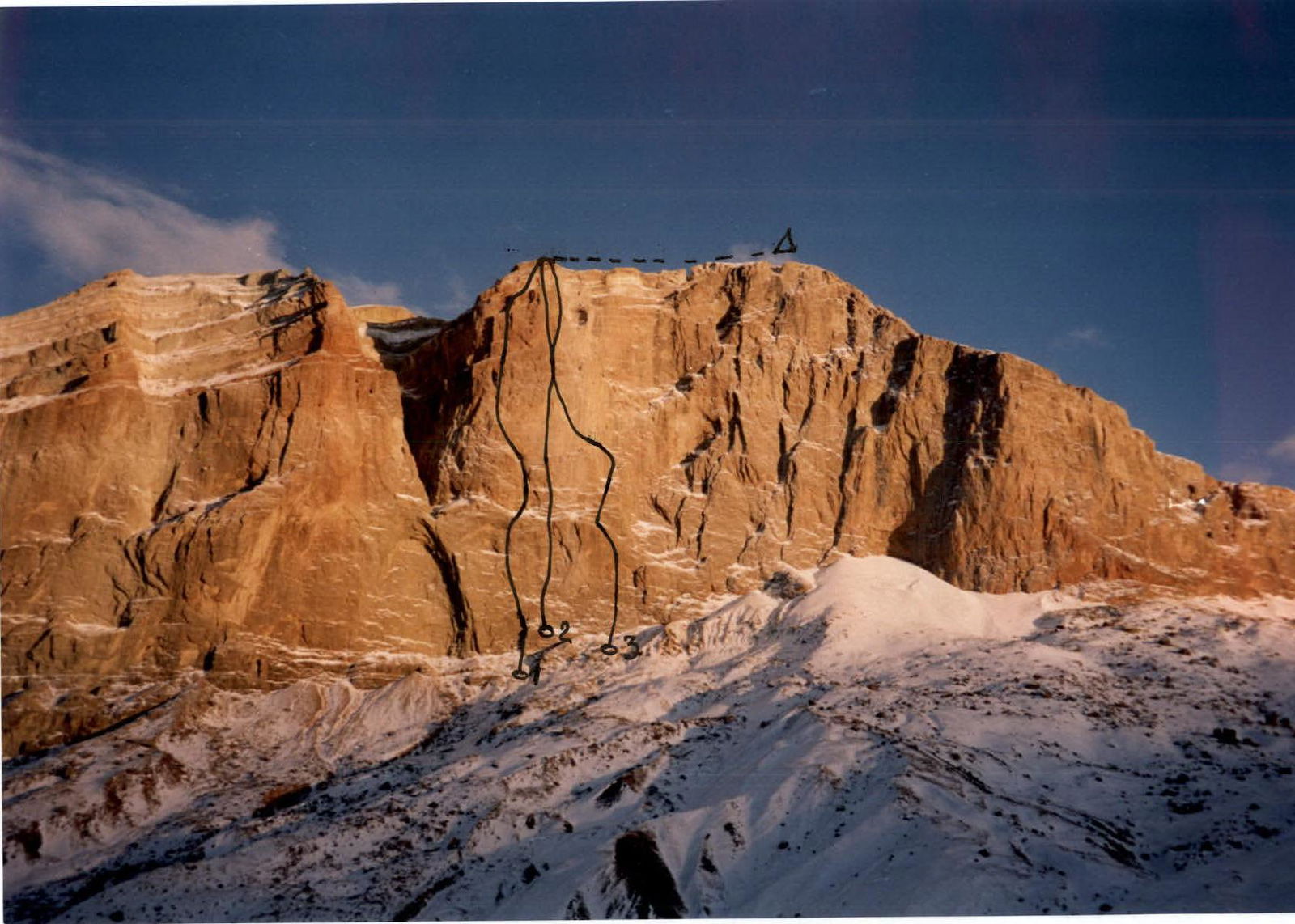
General photo of the summit (February 8, 2005, Kurush village)
1 — Shchedrin's route, 82 2 — Yefimov's route, 82 V 3 — Babitsky's route, 82
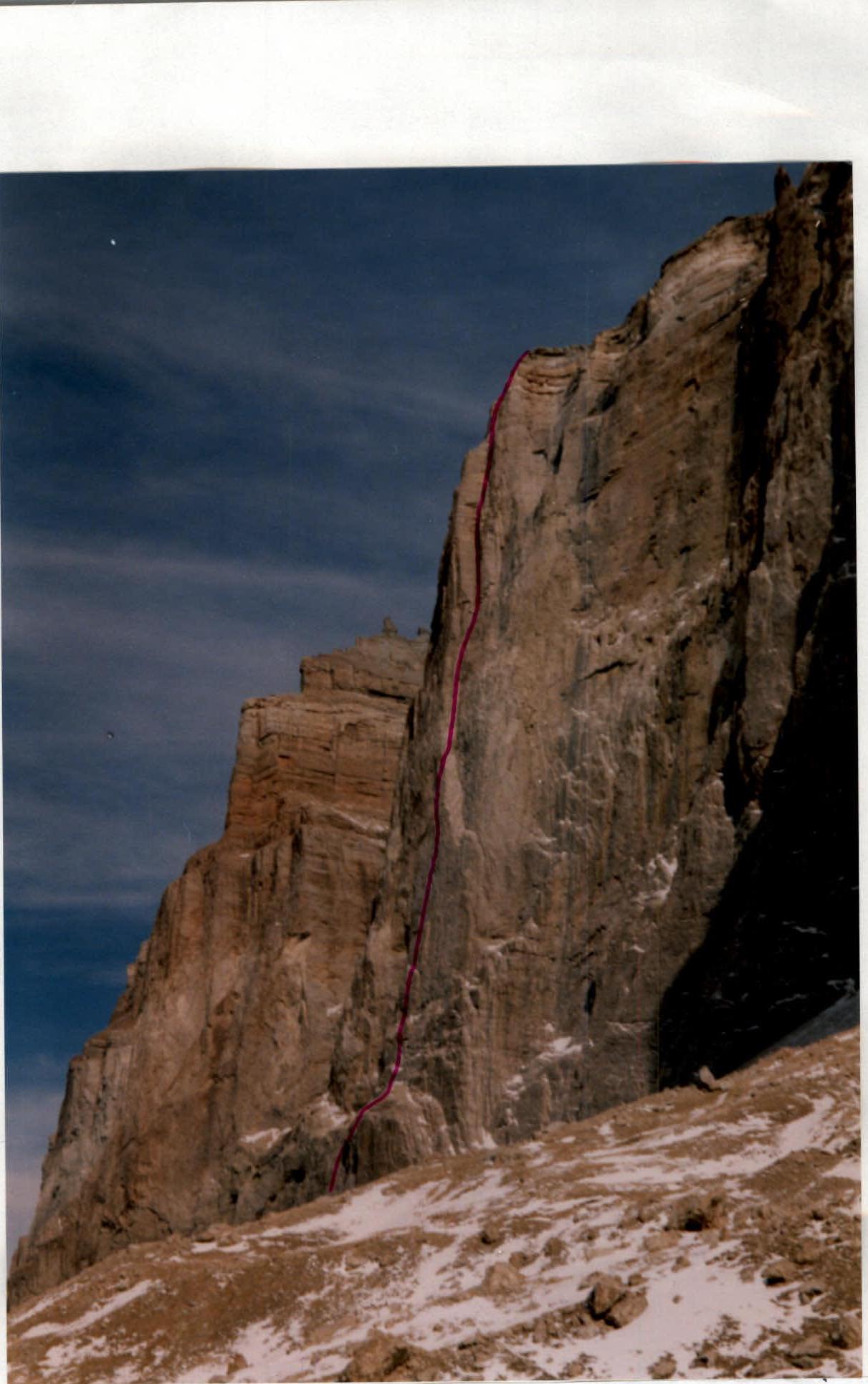
Photograph of the wall profile
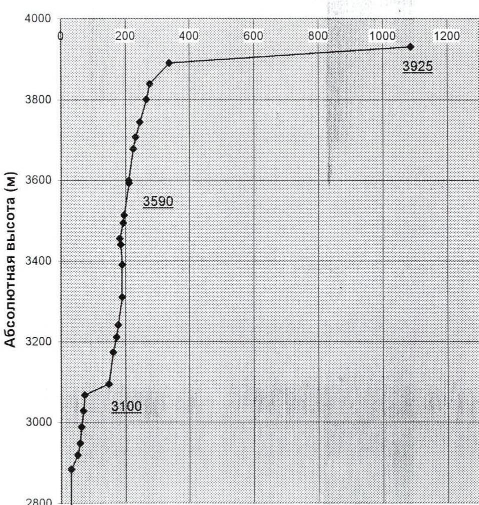
Route profile
Scale 1:10000
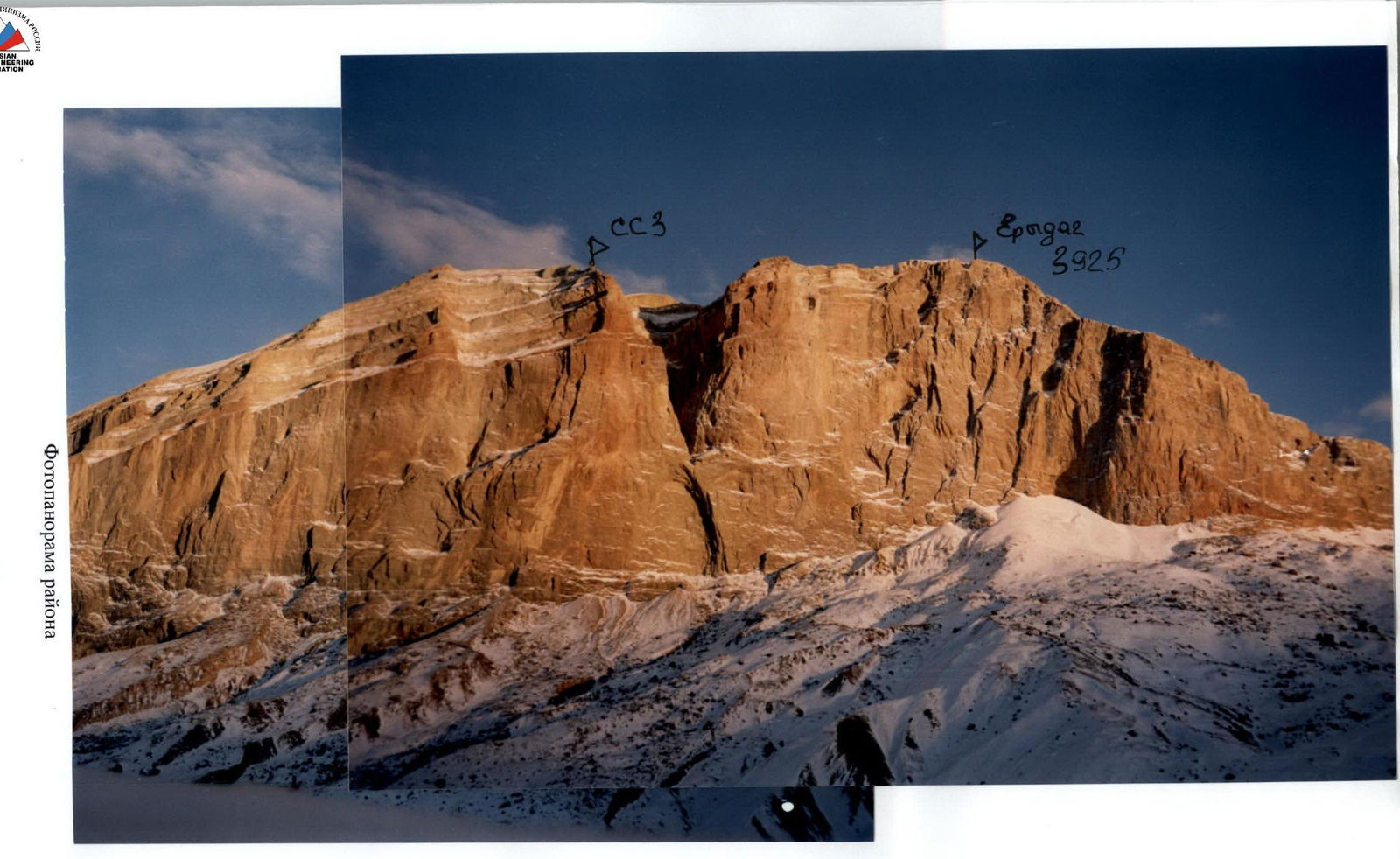
Photopanorama of the area
Brief Overview of the Area
From the Erydag tourist base, cross the Chekhykhay and Sel'dy rivers via two bridges and follow the dirt road along the right bank of the Chekhykhay River, downstream towards the farms, for about 40–50 minutes. Then move towards the NW wall of Erydag in the direction of the Big Well. Establish the ABC (Advanced Base Camp) on the platforms to the right of the scree gully. From the camp (2700 m; 2.5 hours from the tourist base), head upwards to the left through the gully, below the slope with stone "mushrooms," and reach the scree directly under the lower bastion wall. There's a cairn at the top of the scree, marking the start of the route (2800 m, 40 minutes from ABC).

Ascent Schedule
Ascent days, including processing days: February 10–24.
Time spent working on the route (hours) Time spent in bad weather during route work (hours) Route heights (m)
| Section # | Number of protection points | UIAA symbol route MAP 1:2000 | Section difficulty | Length (m) | Steepness (°) | ||
|---|---|---|---|---|---|---|---|
| ZKA AA | SK AA | SHL AA | |||||
| 7 | 1 | - | 2 | 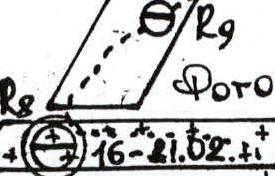 | 15 | 80 | 20 |
| 6 | 30 / 30 | 1 / 1 | 1 / 1 | 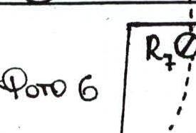 | 6A, A2 | 40 | 85 |
| 5 | 25 / 25 | 1 / 1 | 3 / 1 |  | 6A, A2 | 40 | 80 |
| 4 | 32 / 32 | 8 / 6 | 2 |  | 6A, A2 | 40 | 85 |
| 3 | 19 / 3 | 2 | 1 |  | 15 m — 5A, 15 m — 6A, A2 | 30 | 75 |
| 2 | 9 | 1 | 1 | 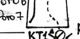 | 5A | 40 | 60 |
| 1 | 32 / 4 | 5 / 3 | 3 |  | 5A | 90 | 70 |
| Section # | Number of protection points | UIAA symbol route MAP 1:2000 | Section difficulty | Length (m) | Steepness (°) | ||
| :-------: | :--------------------------: | :-----: | :-------: | :-------------------------------------------------------------------------------------------------------------------------------------------------------: | :---------------------: | :-------: | :----------: |
| ZKA AA | SK AA | SHL AA | |||||
| 13 | 6 / 6 | 23 / 123 | 3 / 3 |  | 6B, A3 | 40 | 95 |
| 12 | 22 / 122 | 20 / 120 | 4 / 4 | 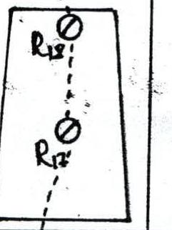 | 6B, A3 | 80 | 90 |
| 11 | 20 / 120 | 27 / 127 | 12 / 11 | 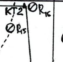 | 6B, A2 | 70 | 80 |
| 10 | 10 / 3 | - | - | 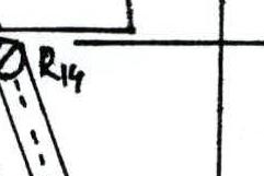 | 5B | 30 | |
| 9 | 8 | - | 1 | 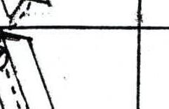 | 4B | 40 | 75 |
| 8 | 27 / 18 | 2 / 2 | 2 | 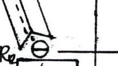 | 5B | 80 | 80 |
| Section # | Number of protection points | UIAA symbol route MAP 1:2000 | Section difficulty | Length (m) | Steepness (°) | ||
| :-------: | :--------------------------: | :-----: | :-------: | :-------------------------------------------------------------------------------------------------------------------------------------------------------: | :---------------------: | :-------: | :----------: |
| ZKA AA | SK AA | SHL AA | |||||
| 21 | 16 / 2 | 1 / 1 | 2 | 90019 | 5Б | 40 | 70 |
| 20 | 18 / 49 | 4 / 4 | 2 / 2 | 5B, A2 | 30 | 75 | |
| 19 | 42 / 37 | 8 / 8 | 2 / 2 | KT3 90018 90019 | 6A, A2 | 80 | 80 |
| 18 | 5 / 5 | - | 1 / 1 | 6B, A2 | 7 | 95 | |
| 17 | 20 / 5 | 4 | 1 | 90015 90016 22-24.02 | 5B, A1 | 80 | 80 |
| 16 | 14 / 4 | 2 / 2 | 2 / 2 | 6A, A2 | 20 | 80 | |
| 15 | 30 / 30 | 4 / 4 | 1 / 1 | 90013 90014 | 6A, A2 | 40 | 75 |
| 14 | 9 / 9 | 5 / 5 | 2 / 2 | 6B, A3 | 15 | 100 | |
| Section # | Number of protection points | UIAA symbol route MAP 1:2000 | Section difficulty | Length (m) | Steepness (°) | ||
| :-------: | :--------------------------: | :-----: | :-------: | :-------------------------------------------------------------------------------------------------------------------------------------------------------: | :---------------------: | :-------: | :----------: |
| ZKA AA | SK AA | SHL AA | |||||
| 25 | - | - | - | 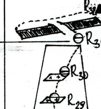 | 15 | 750 | 3 |
| 24 | 5 | - | - |  | 3А | 80 | 40 |
| 23 | 10 | - | 1 |  | 5Б | 40 | 75 |
| 22 | 8 | - | - | 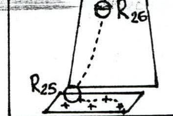 | 10 m — 2A, 50 m — 5А | 60 | 70 |
Technical Photographs of the Route
The note from control point #3 (CP3) is missing.
According to the description, CP3 should have been located on R23 on a stationary bolt. The stationary bolt on R23 was found, but the CP itself was not. The group hypothesizes that:
- Since the CP was located in an internal corner where water flows in the spring,
- It was either washed away by water,
- Or removed by one of the previous climbing groups.
CP3 was restored, and the group left their note.
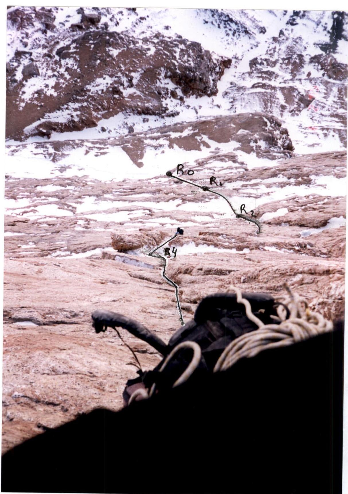
Photo 1. Work on the R0–R5 belays
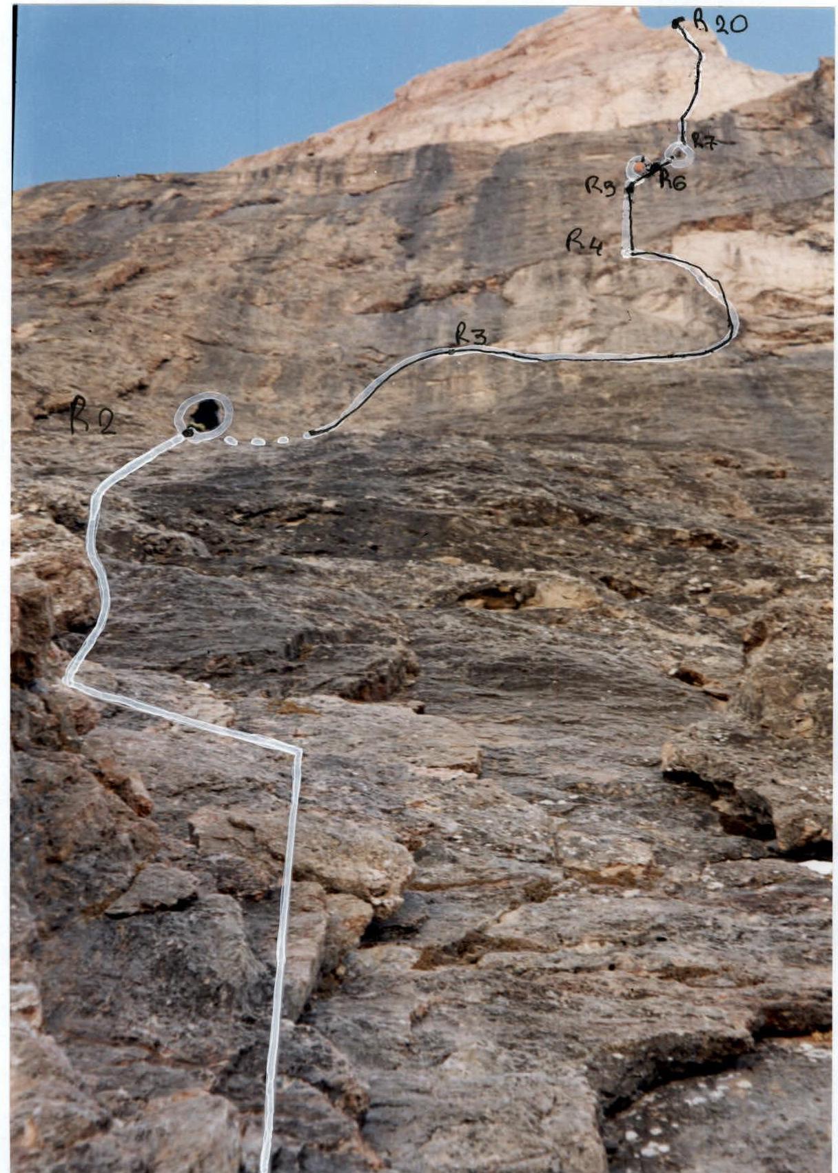
Photo 2. Work on the R1–R7 belays

Photo 3. Crossing the cornice on section 3, R3–R4 ropes
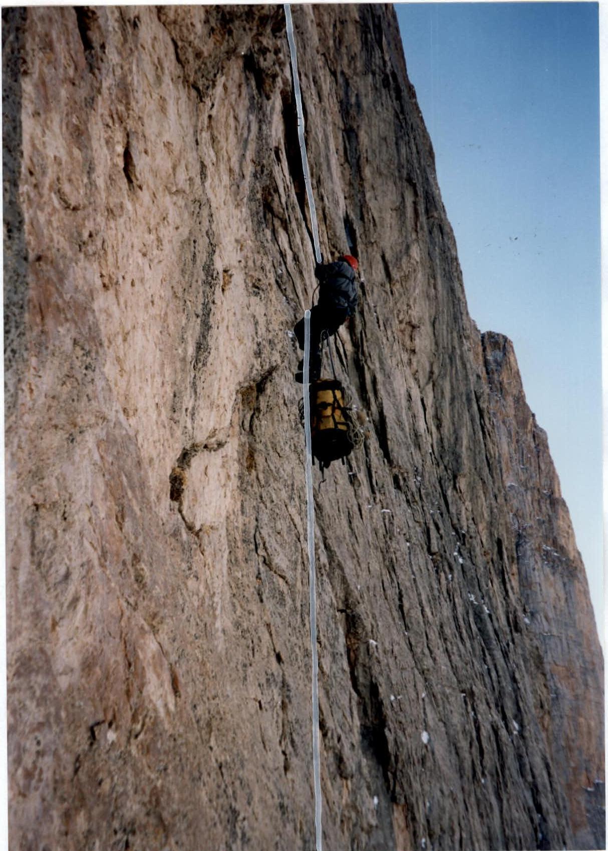
Photo 4. Work on the R4–R5 belays
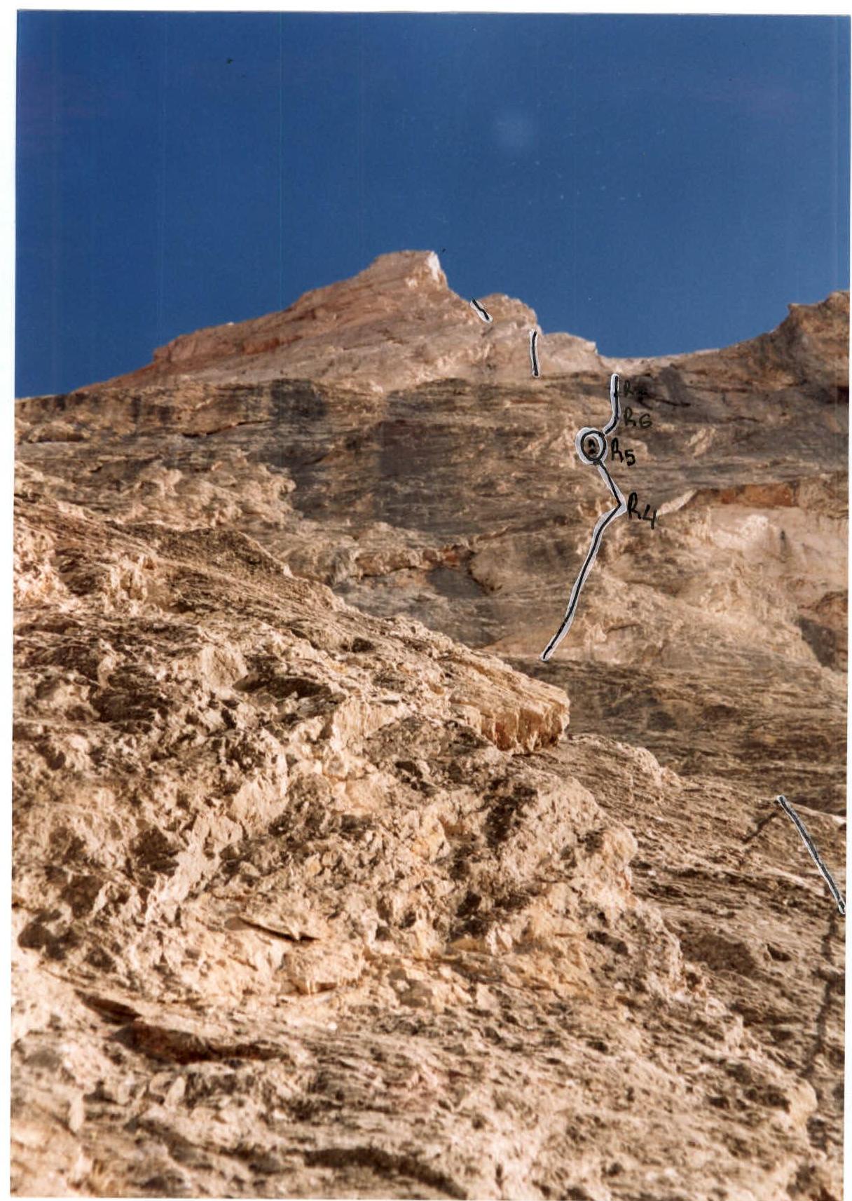
Photo 6. Work on the R3–R7 belays
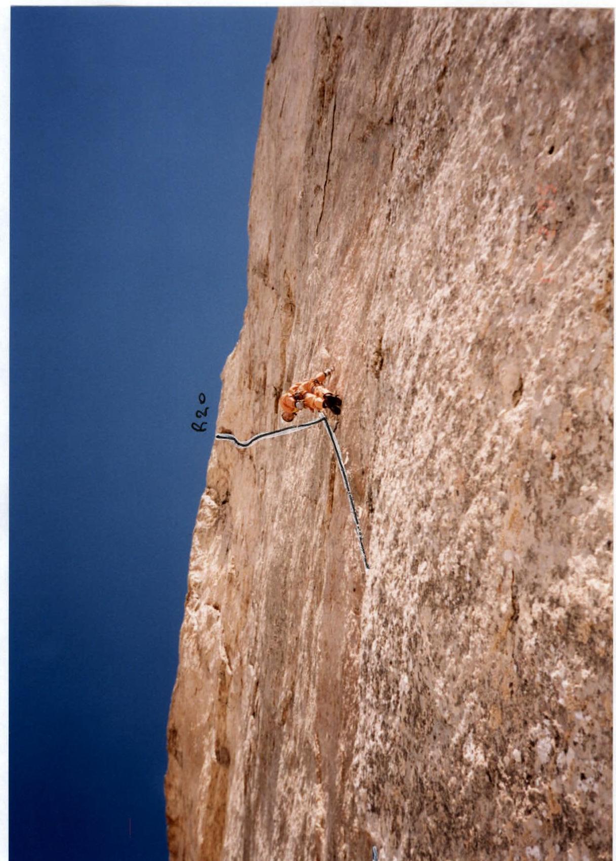
Photo 8. Leader's work on section 11 "mirror", R14–R15 ropes
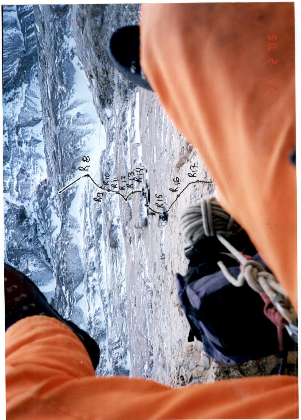
Photo 9. Work on the R14–R17 belays
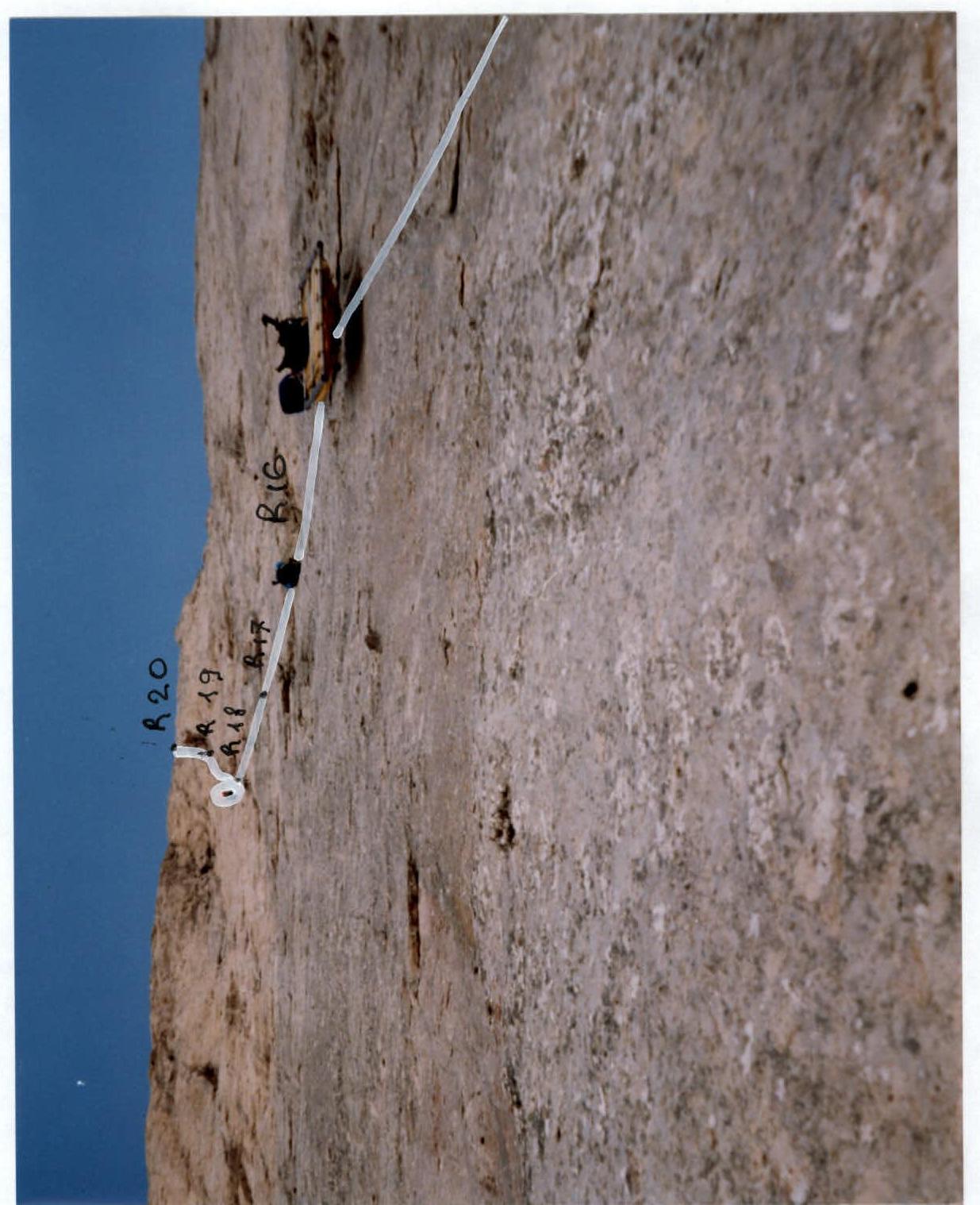
Photo 11. Work on the R15–R20 belays
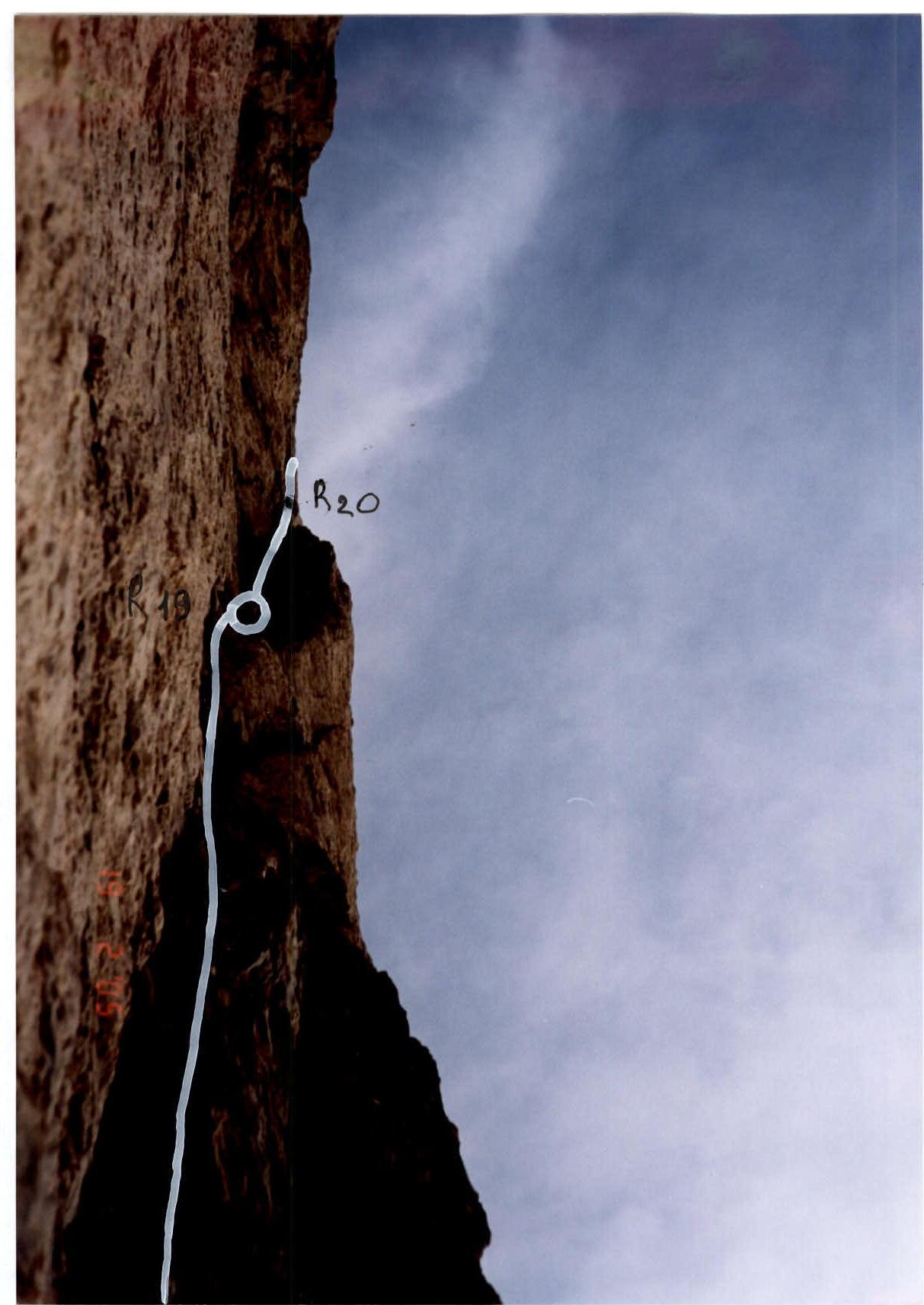
Photo 12. Leader's work on section 14 "minaret", R19–R20 ropes
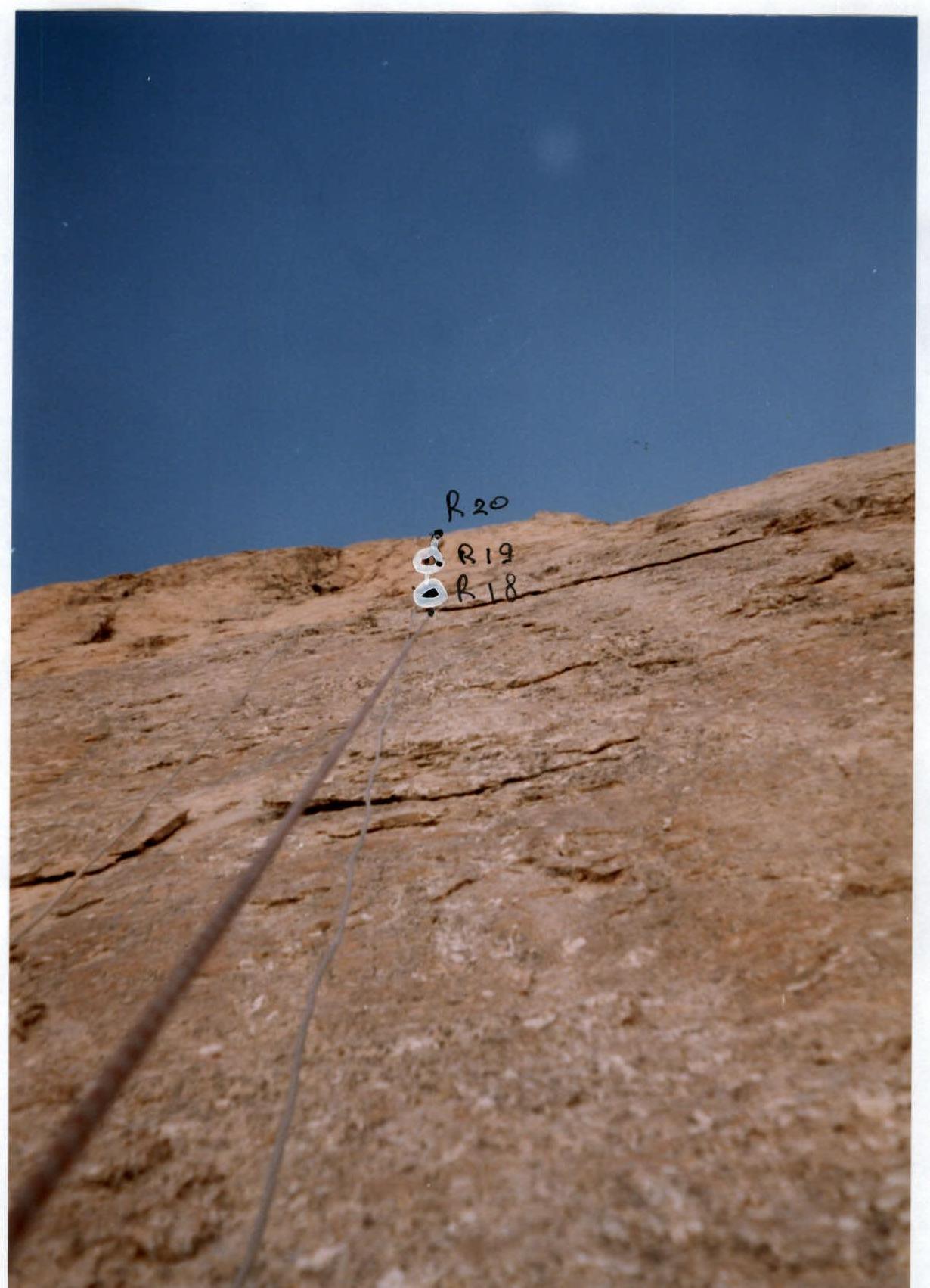
Photo 13. Work on the R18–R20 belays
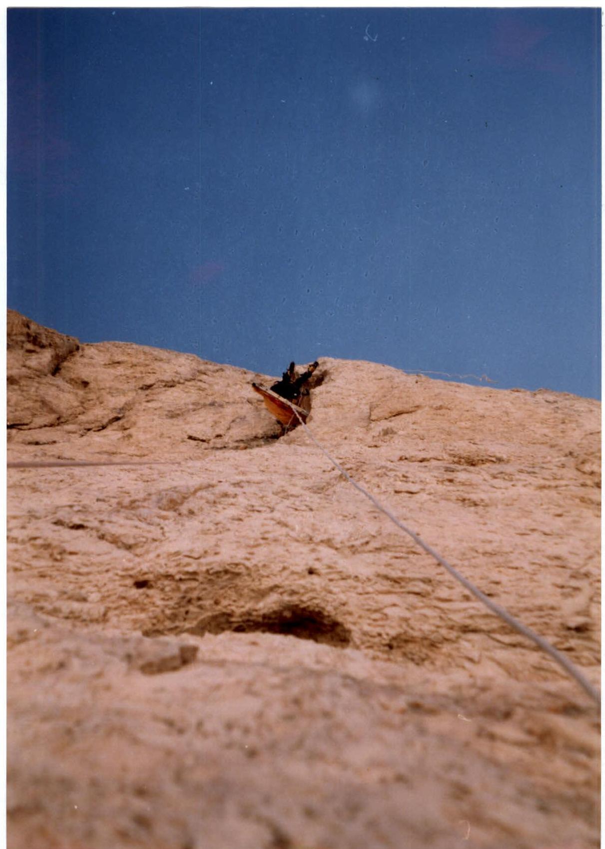
Photo 14. Work on the "minaret" section 14 belays, R19–R20 ropes
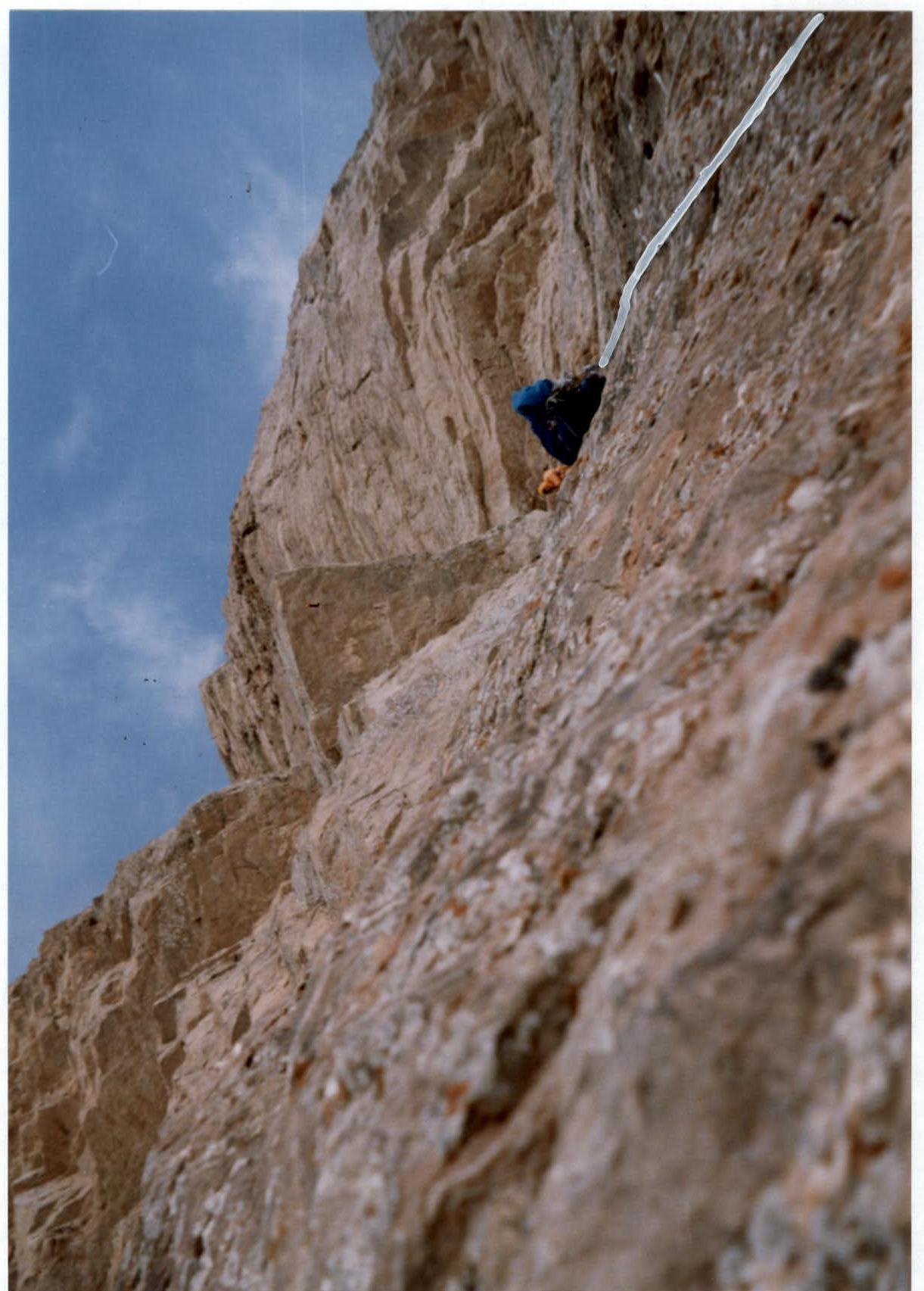
Photo 15. Work of the pair on section 16 "entry to the Book", R20–R21 ropes
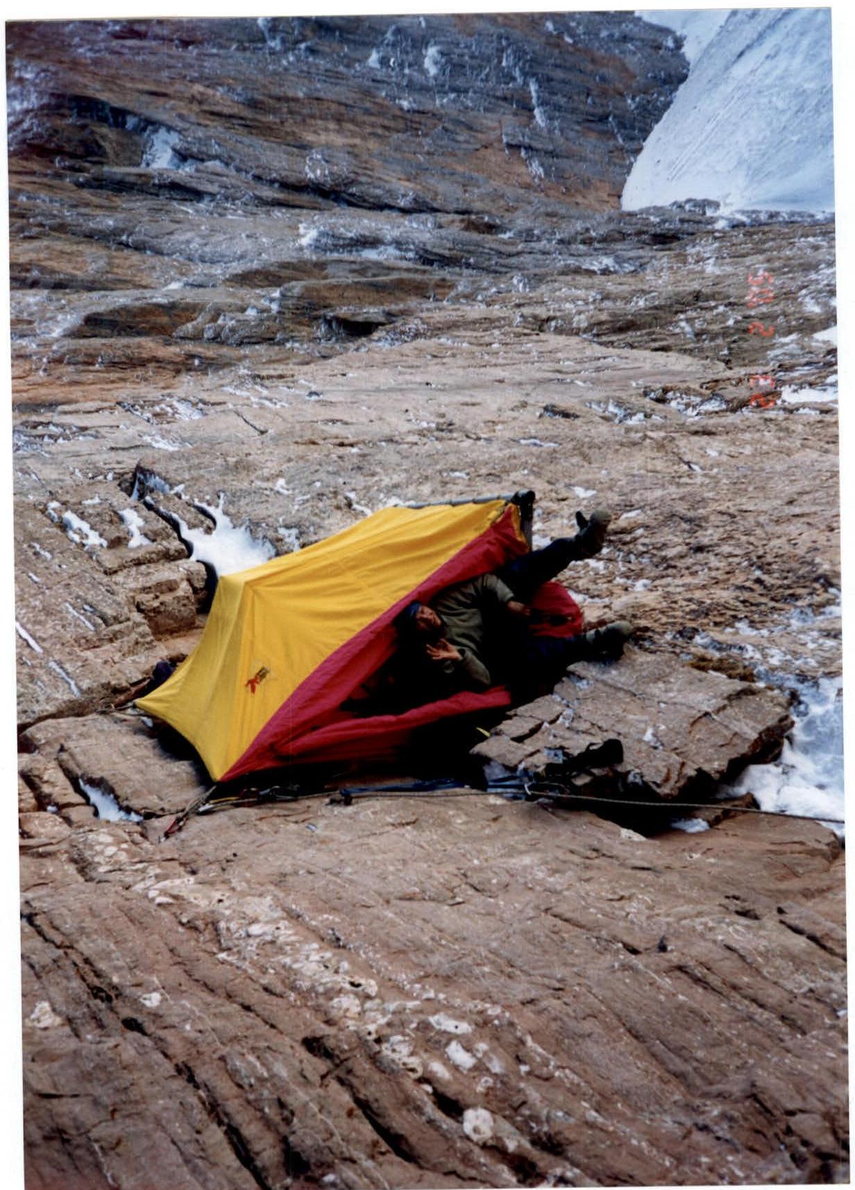
Photo 16. Camp #2
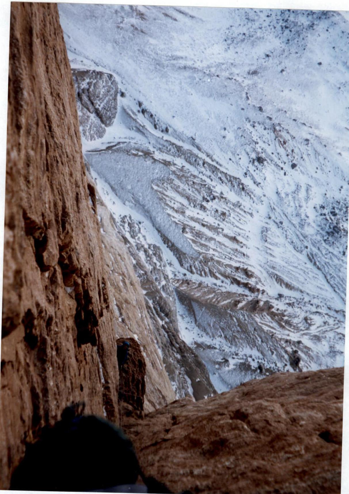
Photo 17. Work in the "Book", section 19, R22–R23 ropes
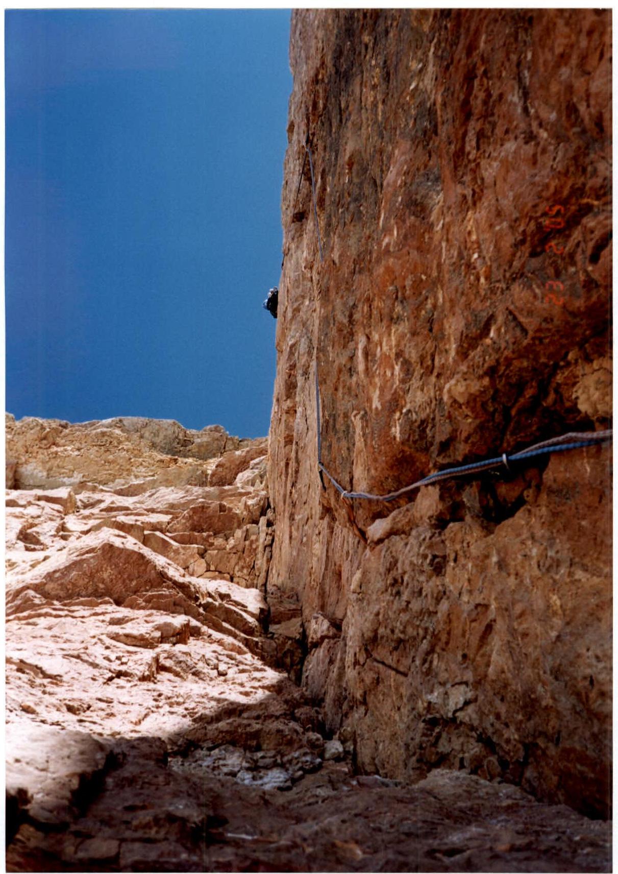
Photo 18. Leader's work on section 20 "bypass of the Book's cornice", R23–R24 ropes
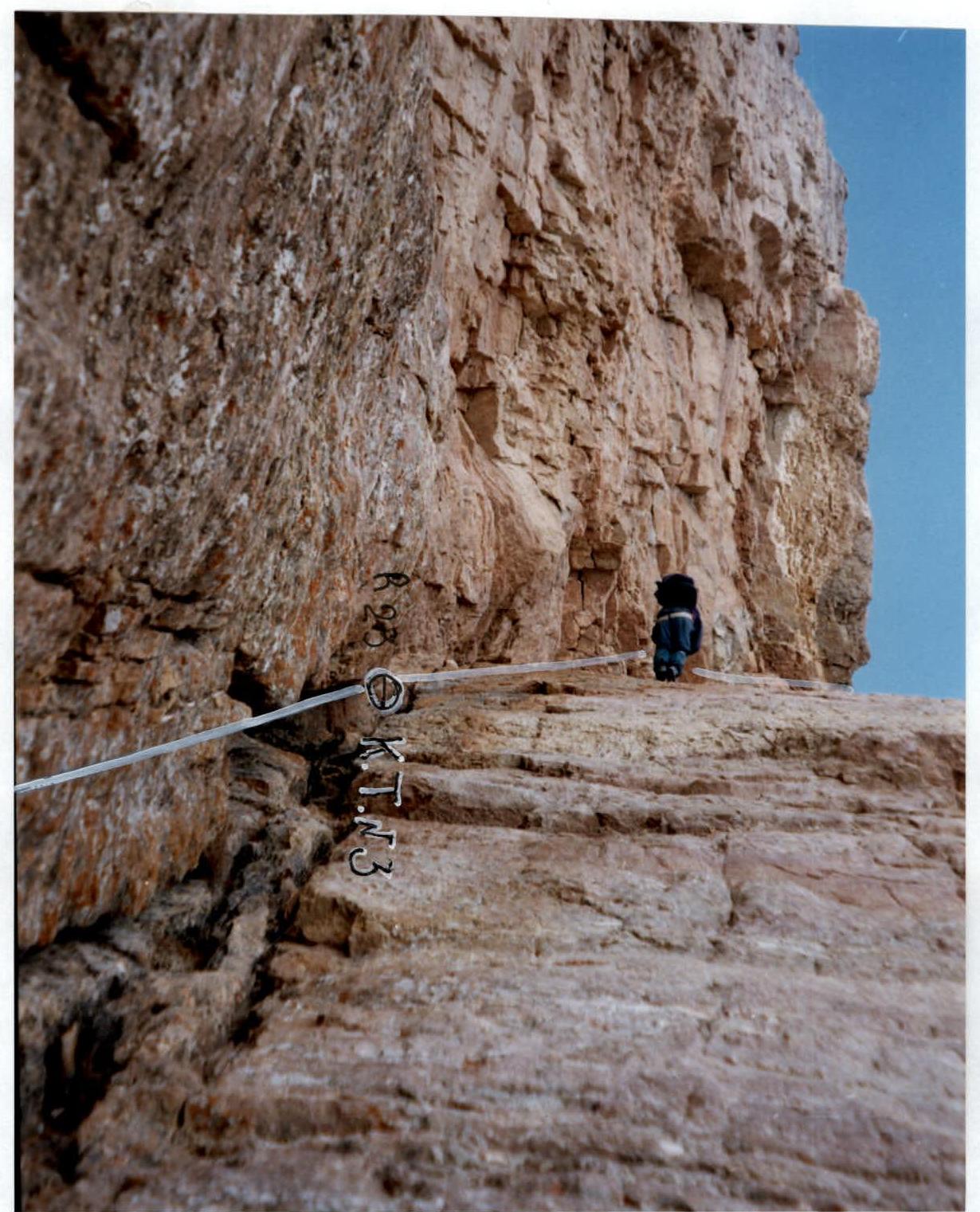
Photo 19. Work on the R23–R24 belays, CP #3
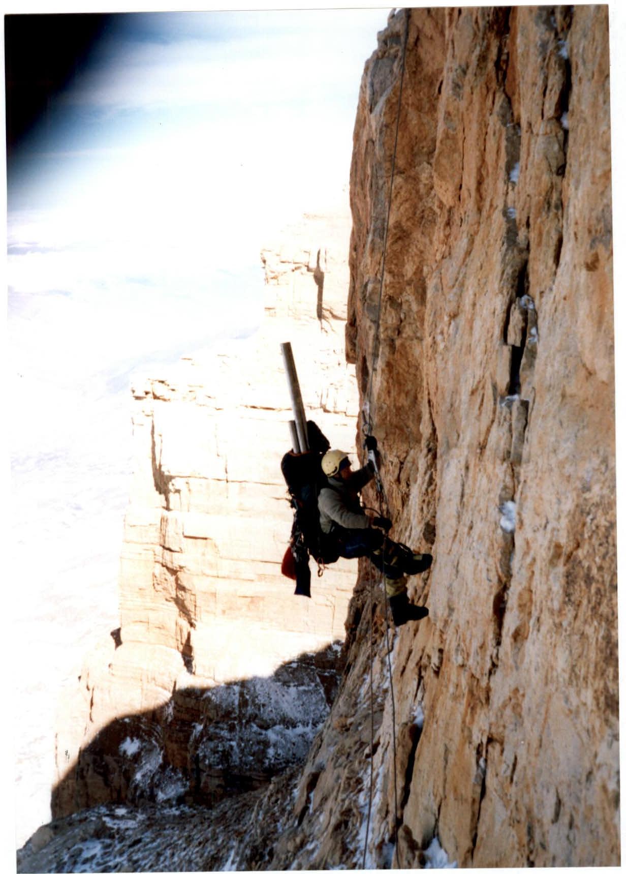
Photo 20. Work on the R27–R28 belays
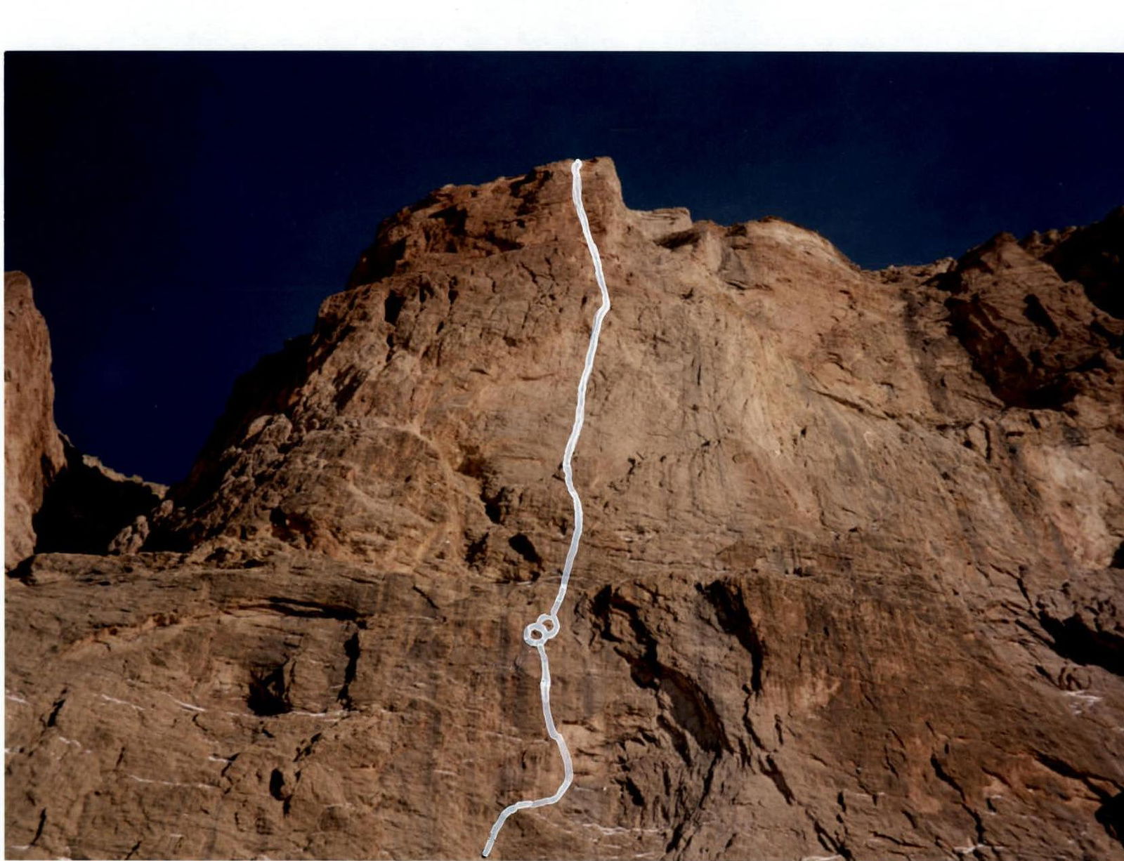
Photo 21. Work of the pair on section 6 "niches", R6–R7 ropes
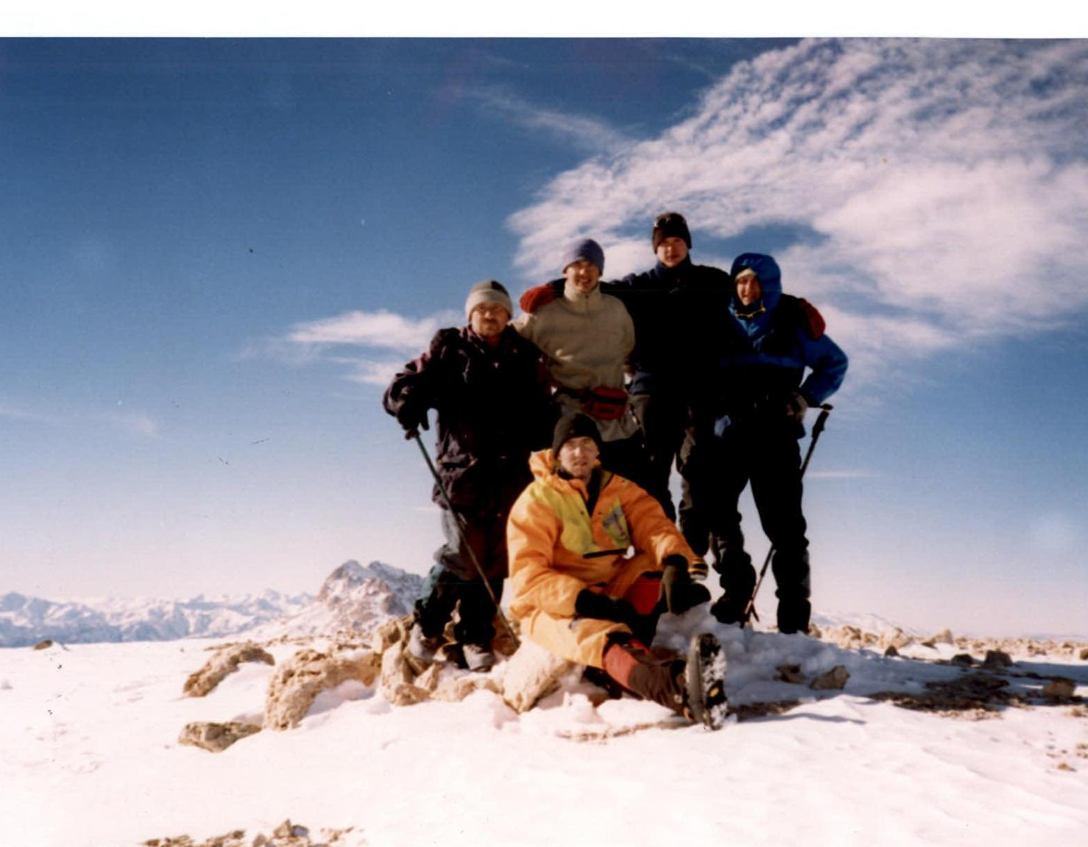
Photo 22. Group on the summit, February 24, 2005. Photo taken by A. Korobkov