Ascent Passport
- Ascent type: rock climbing
- Ascent area: Eastern Caucasus, Kusarчай valley
- Ascent object: Yerydag peak 3925 m via the left part of the northwest wall through the "mirror" ("S. Efimov's route")
- Complexity category: 5B ("classified route")
- Height difference: 985 m distance: 1310 m distance of sections with 5-6 complexity categories: 890 m average steepness of the route: 80°, including 6th category: 85° (3570–3595); 85–95° (3360–3480); 90° (3640–3780); 90–95° (3005–3065, 3120–3145, 3290–3315)
- Pitons hammered: rock pitons 80 26 bolt pitons 8 5 chock stones 121 37
- Team's travel hours: 61 hours and days — 6
- Overnights: 1 and 5 — lying down 2, 3 and 4 — two lying down, two in a half-sitting position
- Team leader: Vladimir V. Poliansky CMS
team members:
- Alexander N. Pavlyuk 1st category
- Alexey P. Kharitonov Master of Sports of the USSR
- Victor I. Shardin CMS
- Coach: Kim K. Zaitsev Master of Sports of the USSR
- Route entry: August 2, 1985 summit: August 7, 1985 return: August 8, 1985
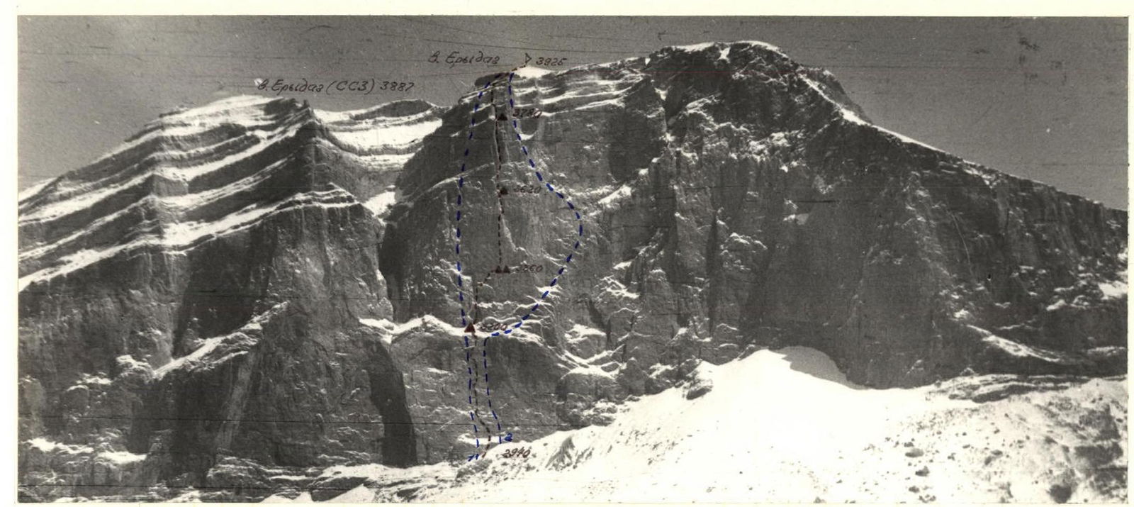
General photo of the summit April 29, 1985, 14:45, "Industar-65ls" lens = 52 mm, approximate distance to the object 3.3 km, shooting point #1, height 2800 m.
Conventions:
- ▲ – overnight stays
- 3200 – elevation marks
- — – route taken by the team
- – – – – G. Shchedrin's route, 1981
- – – – – A. Babitsky's route, 1981
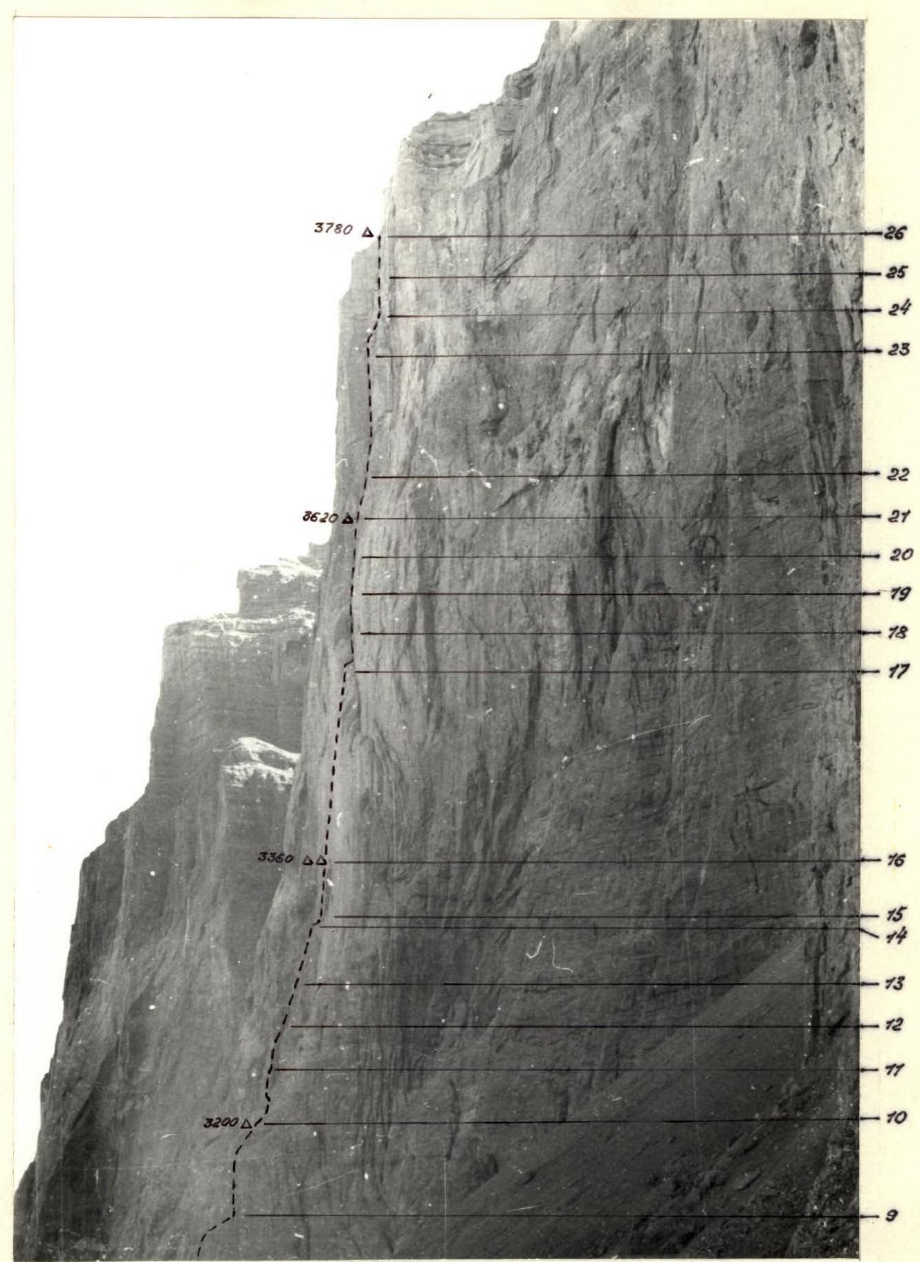
Photo of the wall profile from the right August 1, 1985, 10:00, "TeliOS-44m" lens f = 58 mm, approximate distance to the object 0.7 km, shooting point #2, height 3000 m.
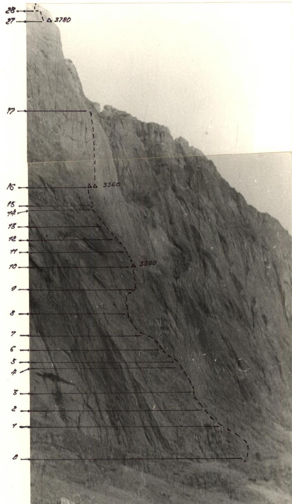
Photo of the wall profile from the left August 2, 1985, 09:15, "TeliOS-44m" lens f = 58 mm, approximate distance to the object 0.6 km, shooting point #3, height 2950 m.