ASCENT DOCUMENT
I. Category — Rock 2. Area from Krestovy Pass to Tfan peak 3. Erydag is centered in the left part of the western wall. 4. Proposed 5B category of difficulty, first ascent. 5. Height difference — 820 m, of which 410 m is wall section, length — 2100 m, of which 600 m is wall section, length of sections R4–R5 category of difficulty — 450 m, of which R5 category of difficulty is about 150 m. Average steepness of main sections — 67 °. 6. Equipment used on the route: rock pitons — 98, bolt pitons — 6, chocks — 33, ice screws — 0. 7. Team's climbing hours — 23, days — 3.5. 8. Overnights: 1st lying on a rock shelf, 2nd semi-reclining on a rock shelf, 3rd lying on a plateau. 9. Team leader: Nekrasov Alexander Olegovich, Candidate Master of Sports Team members: * Gershtein Alexander Semenovich, Candidate Master of Sports * Klimin Alexey Egorovich, 1st sports category * Suponitsky Vladimir Mikhailovich, Candidate Master of Sports * Tulpanov Sergey Sergeevich, Master of Sports 10. Coach: Suponitsky Mikhail Vul'fovich — Master of Sports of the USSR, engineer-methodologist category I. 11. Departure to the route: January 25, 1986. Summit: January 28, 1986. Return: January 28, 1986.
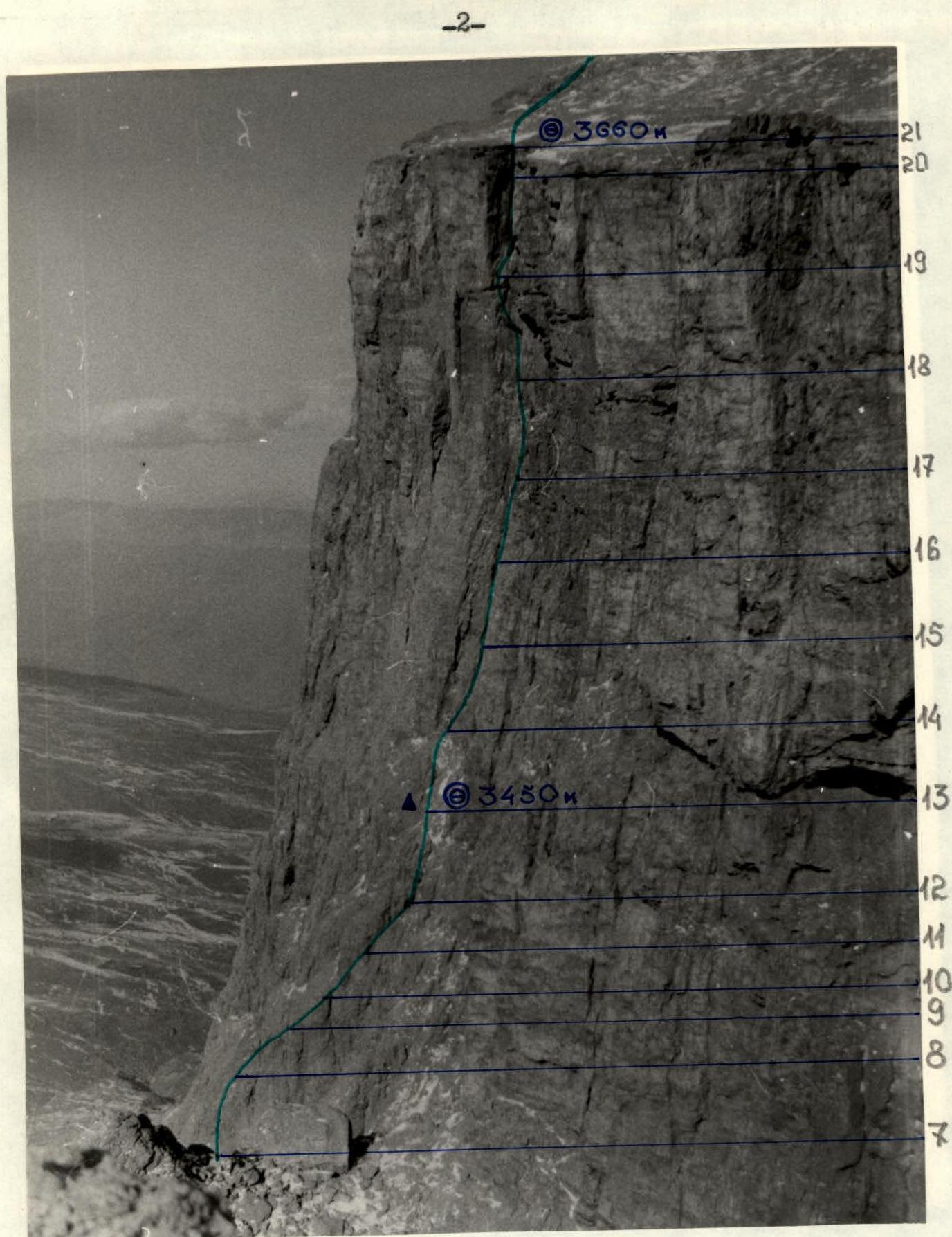
Photo # 2. Wall profile on the right. — team's route, ▲ control cairn, ◎ overnight location. Photo taken on January 22, 1986 at 15:00, Industar-104 lens, F=2.8 cm, distance to the wall 500 m, point # 2, 3150 m.
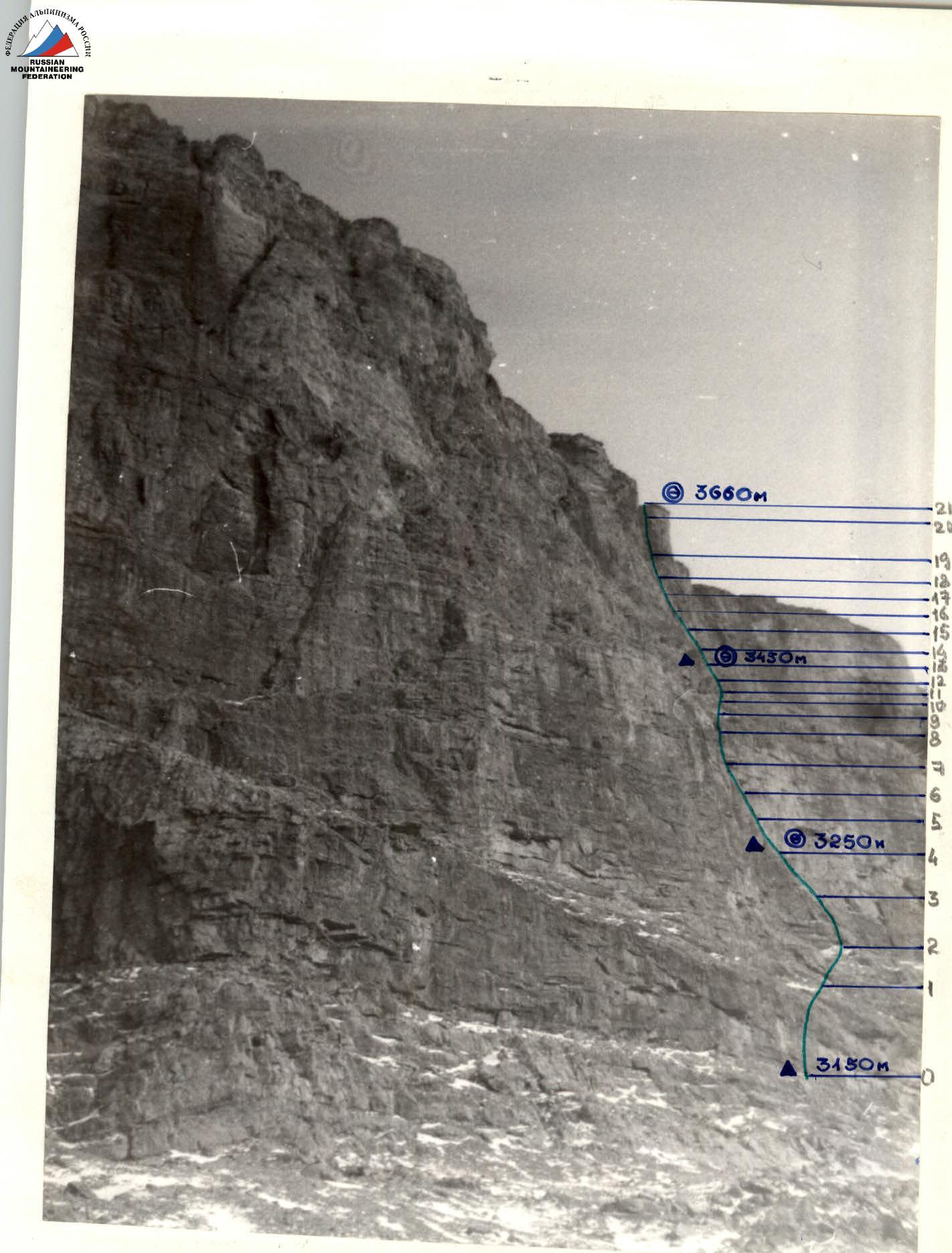
Photo # 3. Wall profile on the left. — team's route, ▲ control cairn, ◎ overnight location. Photo taken on January 23, 1986 at 11:15, Industar-104 lens, F=2.8 cm, distance to the wall 400 m, point # 3, 3150 m.
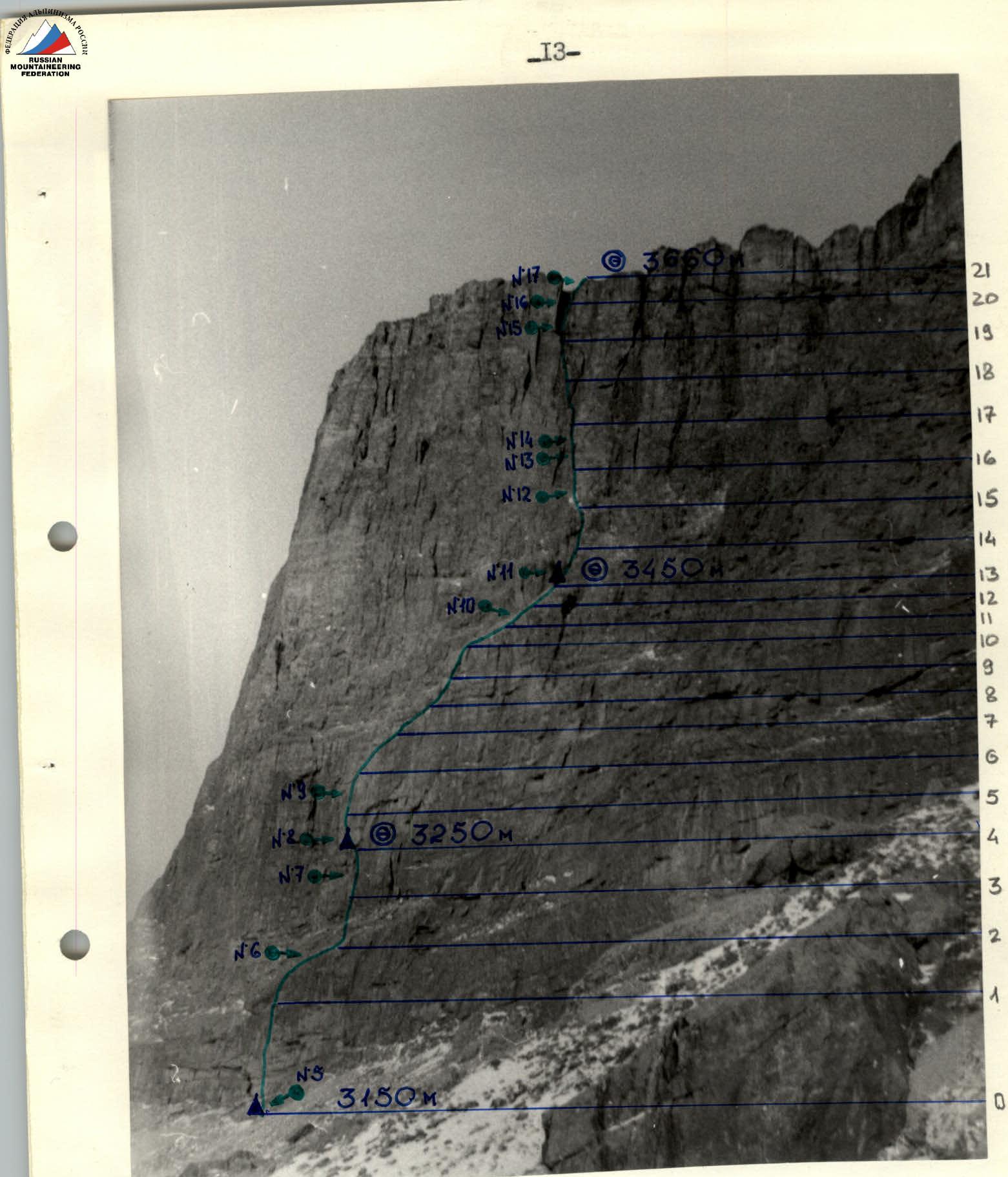
Photo # 4. Technical photograph of the route. — team's route, ▲ control cairn, ◎ overnight location, №... shooting location. Photo taken on January 22, 1986 at 16:00, Industar-104 lens F=2.3, distance to the wall 300 m, point # 4, 3150 m.
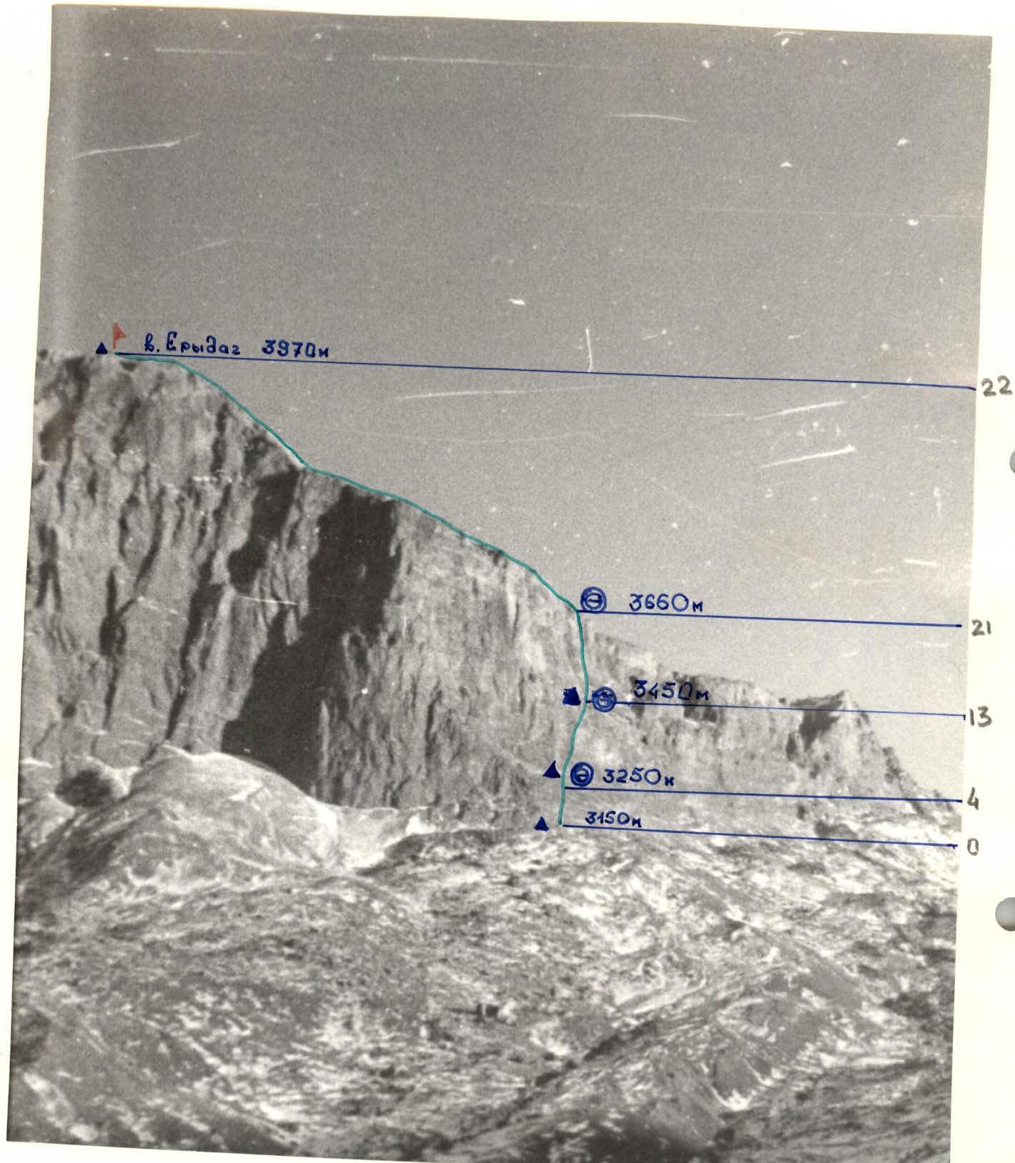
Photo # 4A. Technical photograph of the route.
- Team's route
- ▲ control cairn
- ◎ overnight location
Photo taken on January 29, 1986 at 16:30, Industar-104 lens, F=2.8, distance to the wall 4 km, point # 4A, 2400 m.
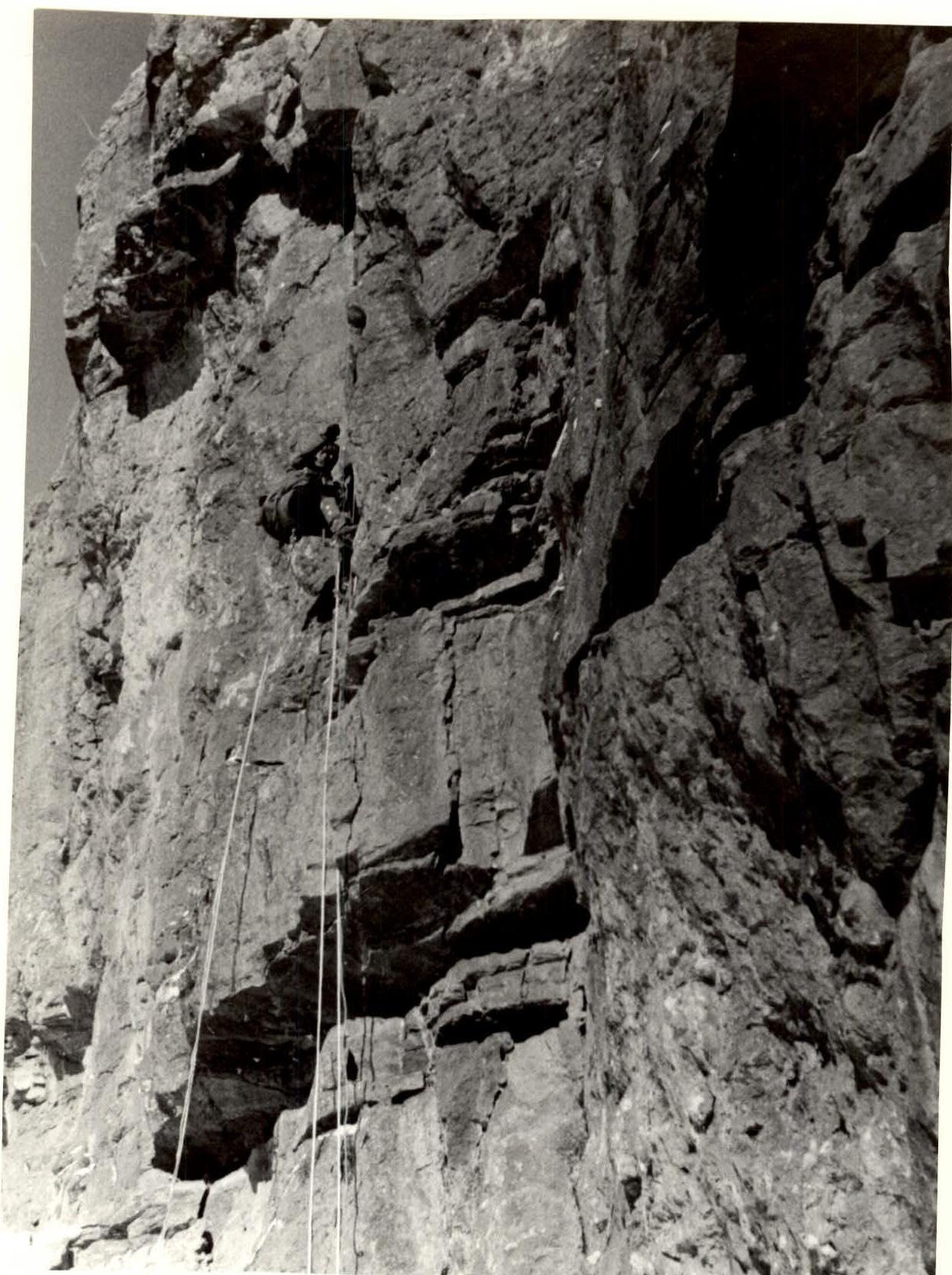
Photo # 5. Second climber on the middle of section R0–R1. Photo taken on January 25, 1986 at 11:20, Industar-104 lens F=2.8, distance 15 m, point # 5, 3150 m.
Team's Tactical Actions
During the ascent, the team performed the following tactical and technical actions.
- The lead climber worked with a double rope throughout the entire route (one Soviet and one made in GDR).
- After the lead climber finished a pitch, the Soviet rope was fixed as a handline, and the German rope served as top rope for the second climber, who followed, bringing two more ropes and pitons.
- Then the lead climber again advanced on the double rope for its entire length.
- While the lead climber organized the next pitch and rested, the second climber received the first climber from the next rope team with top rope and moved up with ropes and pitons.
- While the first rope team worked above, the remaining two members of the second rope team approached the belay station.
- All team members followed the handlines with top rope.
- The last climber followed either on handlines with top rope or, on sections R11–R12 and R12–R13, with top rope on more difficult terrain.
On the wall section of the route, there were two overnights on platforms constructed from stones using natural relief. Overnights:
- First — lying down
- Second — semi-reclining
All overnights were at planned locations.
There were no falls or injuries. The team climbed the route quickly — good physical and technical preparation was evident.
Communication with the base was constant and reliable, with no missed communication sessions. Communication times:
- 8:00, 12:00, 16:00, 20:00 — primary
- 10:00, 14:00, 18:00 — secondary
Route Diagram
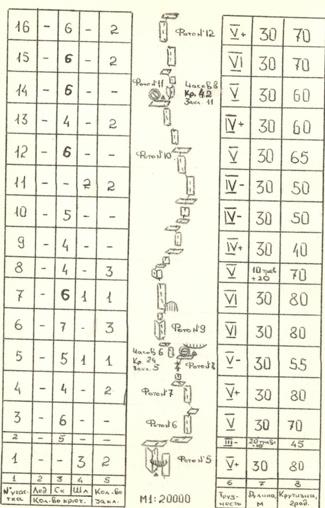
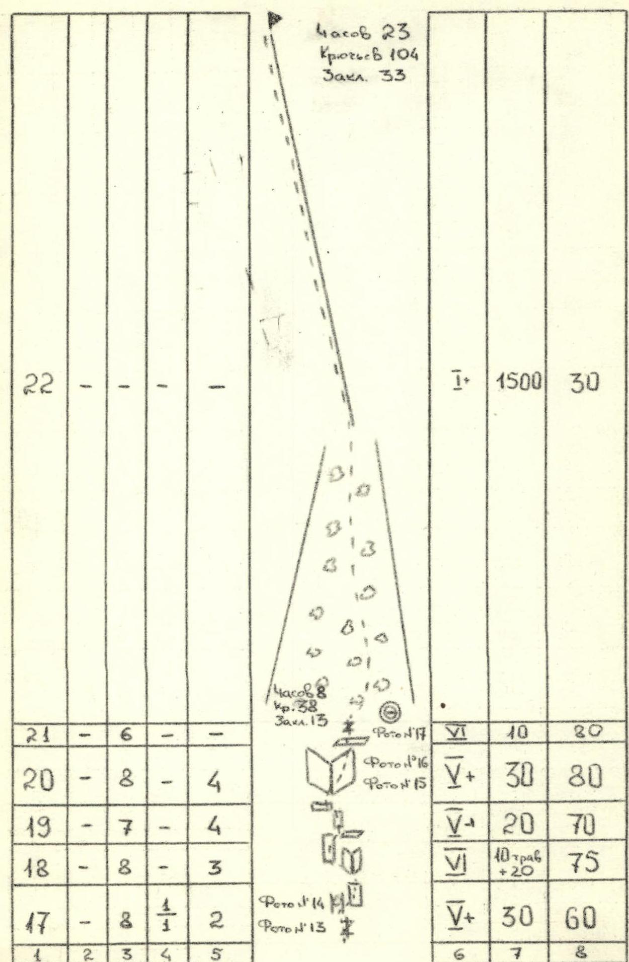
Summary Table of Equipment by Sections
| Section # | Ice screws | Rock pitons | Bolt pitons | TKA count |
|---|---|---|---|---|
| 16 | - | 6 | - | 2 |
| 15 | - | 6 | - | 2 |
| 14 | - | 6 | - | - |
| 13 | - | 4 | - | 2 |
| 12 | - | 6 | - | - |
| 11 | - | 2 | 2 | - |
| 10 | - | 5 | - | - |
| 9 | - | 4 | - | - |
| 8 | - | 4 | - | 3 |
| 7 | - | 6 | 1 | 1 |
| 6 | - | 7 | - | 3 |
| 5 | - | 5 | 1 | 1 |
| 4 | - | 4 | - | 2 |
| 3 | - | 6 | - | - |
| 2 | - | 5 | - | - |
| 1 | - | 3 | - | 2 |
Characteristics of Route Sections
| Designation | Difficulty | Length, m | Steepness, ° | Notes |
|---|---|---|---|---|
| Photo # 12 | V+ | 30 | 70 | |
| VI | 30 | 70 | ||
| VI | 30 | 60 | Hours: 8, Pitons: 42, Chocks: 11 | |
| Photo # 10 | V+ | 30 | 60 | |
| V | 30 | 65 | ||
| V– | 30 | 50 | ||
| IV– | 30 | 50 | ||
| IV+ | 30 | 40 | ||
| V | 10 m traverse +20 m | 70 | ||
| VI | 30 | 80 | ||
| Photo # 9 | VI | 30 | 80 | |
| V– | 30 | 55 | Hours: 6, Pitons: 24, Chocks: 5 | |
| Photo # 7 | V+ | 30 | 80 | |
| Photo # 6 | V | 30 | 70 | |
| III– | 20 m traverse | 45 | ||
| Photo # 5 | V+ | 30 | 80 |
Route diagram scale: 1:20000
Route Description by Sections
From Kurush village down to the bridge, then across the bridge and left-up past the farm to the right part of Polyakov's shelf. The route starts under the right lowering of the shelf, at the beginning there is a control cairn marking the start of the route.
From the control cairn straight up through a not clearly defined inner corner, bypassing the overhang, then along the right wall to an inclined shelf. 30 m from the start of the route. Then 30 m to the right along the shelf to the base of a rock wall. Up the wall 60 m to a cleft and 20 m along the cleft to a narrow inclined shelf under a red wall with an overhang. Overnight location, control cairn.
From the overnight location left-up along the right side of a large inner corner and then up the wall 40 m to a niche. From the niche left along the shelf 10 m and then up the wall 20 m to the base of an inner corner. Up the right side of the corner and then up an inclined slab and wall to the base of a bastion. Along a system of inclined shelves filled with stones and walls right-up 60 m and then up and slightly left 120 m under a light-colored wall to a shelf at the base of an inner corner. Overnight location, control cairn.
From the overnight location up the inner corner and then up the wall 60 m to a cleft turning into a chimney with a plug.
Up the cleft and then up the right wall of the chimney 30 m under a heavily destroyed gray wall.
Left-up along the wall («Be careful, rocks!!!») 50 m to the base of a very large («20–30 m wide») steep inner corner to the right of the bastion.
Up the right side of this corner 30 m to a cleft and then up the cleft 10 m — exit to the plateau.
From the plateau left-up along the scree slope and ridge — exit to the summit.
Climbing on the entire route is very difficult; the lead climber needs to wear galoshes and move without a backpack. Sections R1–R2, R9–R13, R15–R17 are prone to rockfall. In addition to the used overnight locations, overnights are possible on sections R0–R13 and R18–R19.
Descent from the summit to the plateau and then along the plateau to Kurush Pass.

Photo # 13. Processing section R13–R14. Photo taken on January 26, 1986 at 16:30. Industar-104 lens F=2.8, distance 25 m, point # 11, 3450 m.
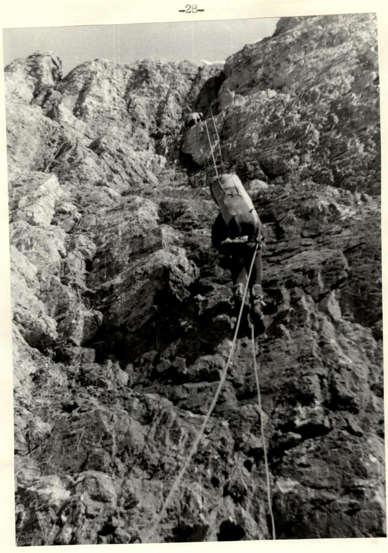
Photo # 19. Middle of section R19–R20. Photo taken on January 27, 1986 at 14:40. Industar-104 lens F=2.8, distance 12 m, point # 15, 3630 m.