I. Climbing category: combined 2. Climbing region: № 2.9 (East Caucasus) 3. Peak, its height, and ascent route: p. Bodonay 4049 m, via the northeast ridge 4. Proposed difficulty category: 2A 5. Route characteristics: — elevation gain 600 m — average steepness 40° — section lengths: R1 — 300 m, R2 — 600 m, R3 — 50 m 6. Pitons driven: rock: — ice: 1 (for belay, for creating belay station) bolt: — 7. Number of nights and their characteristics: no overnight stays 8. Number of travel hours: 6–7 hours 9. Surname, name, patronymic of the team leader and participants, their sports qualification: Kozorezov Evgeny Fedorovich — 2nd sports category Akhmedkhanov Kamil Enverovich — 2nd sports category Mikirov Egor Sergeevich — 3rd sports category Nikomagomedov Ziyautdin Nikomagomedovich — 3rd sports category 10. Team coach: Master of Sports of the USSR Timoshin Mikhail Egorovich II. Date of departure on the route: August 29, 1978
— ascent path
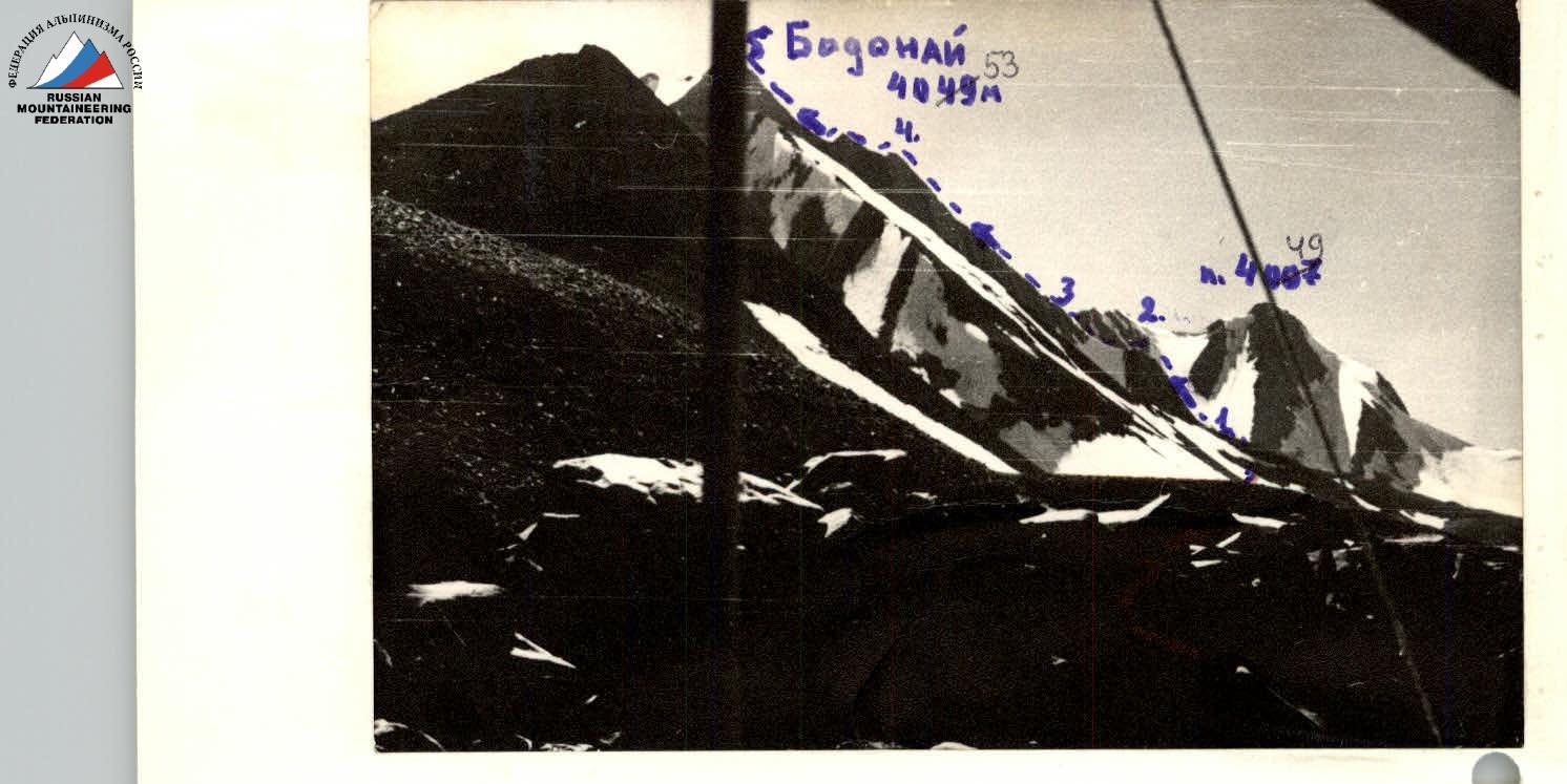
Peak Bodonay (4049 m) is located in the northern part of the Shalib ridge on the border of the Charodinsky and Laksky districts of the Dagestan ASSR. The nearest peaks with classified routes are: to the north — Metiko (1B, 2B), to the west — Vishiney (1B, 2A, 3A), to the south — Dyultydag (1B, 2A). The traverse of the peaks 3700 m — Darca, located west of Bodonay, is classified as 2A. The Bodonay massif consists of five rocky peaks, four of which are grouped within a 100-meter ridge, and the fifth (northern — 4007 m) is about 0.5 km away. The massif is composed mainly of aspidic schists, but there are significant outcrops of strong coarse-grained sandstone, forming, in particular: — the eastern wall — the gendarmes of the northeast ridge
From an alpinist's point of view, apart from the described route, the following are of interest: — routes along the southeast ridge (approx. 2nd category of difficulty) — along the eastern wall (approx. 3rd category of difficulty)
The best route to the Bodonay area is: Makhachkala — Kumukh (plane, bus) — village Burshi (to the bridge). Then along the dirt road running along the Kazikumukhskoe Koisu River to the confluence of the Nukkur River (on the right). From the bridge — 4–5 hours. Then along the Nukkur River to the confluence of the Bodonay River (1.5 hours). Cross the river and ascend a steep trail, then traverse the slope in a northerly direction to the edge of the trough valley, located at a height of 3000–3200 m. There are many good places for a bivouac.
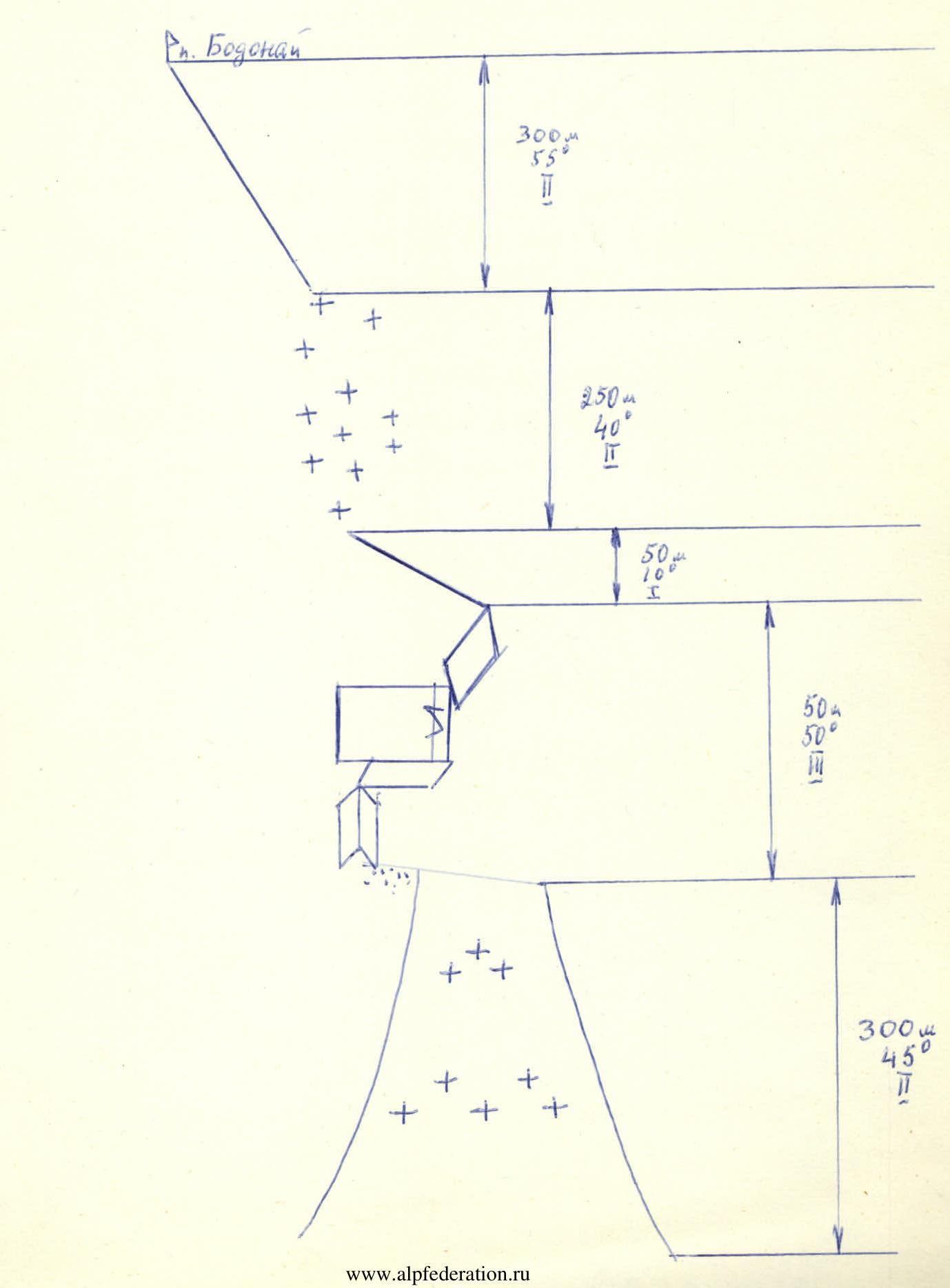
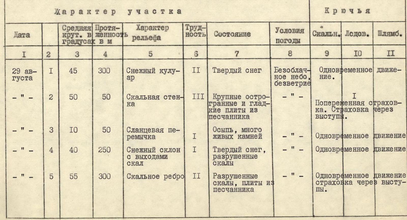
Table
of route sections to p. Bodonay 4049 m via the northeast ridge, 2A category of difficulty, approximate.
Brief description of the approach to the route.
From the bivouac on the left bank of the Bodonay River, go west along the river 200–250 m, then cross to the right bank and, moving in the same direction:
— first along gentle grassy slopes,
— then along snowfields,
— reach the ancient lateral moraine.
Then descend into the cirque, cross it along the snowfield and approach the snow "neck" leading to the first saddle of the north ridge (2.5–3 hours from the bivouac).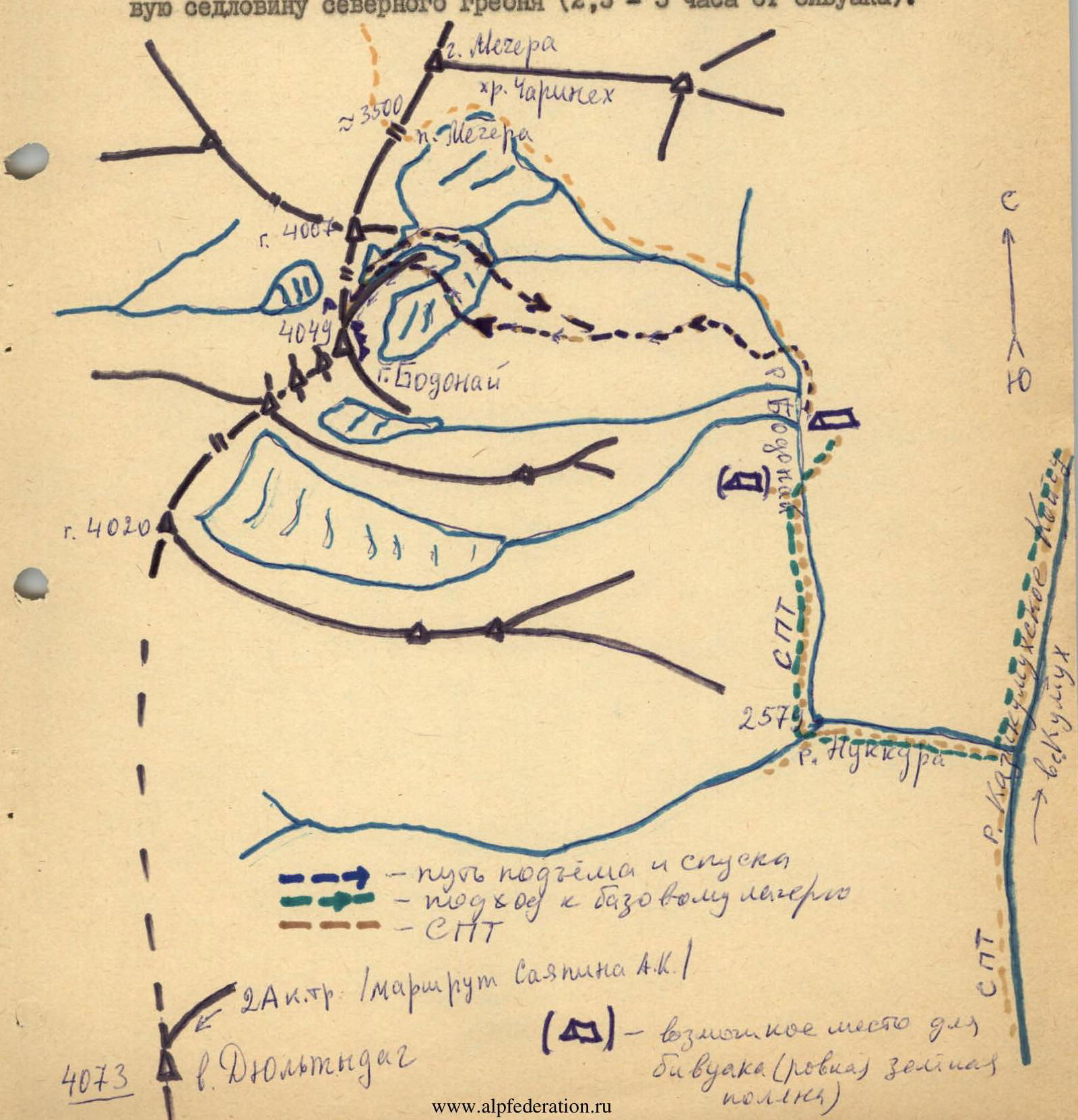
Route description.
Crossing the snowfield in the Bodonay cirque in a westerly direction, ascend the snow "neck" to the saddle between the first and second gendarmes of the north-northeast ridge of Bodonay (40 minutes). Then, moving up the ridge along small scree, approach the rocky wall of the second gendarme. The wall is composed of sandstone slabs with sharp edges; many loose rocks.
Ascent:
— First, ascend the clearly visible internal angle (15 m) and drive an ice axe (wide cracks).
— Traverse 4 m to the right.
— Ascend again (20 m).
— Bypass a heavily destroyed takeoff on the right along a ledge.
— Reach a schist saddle (1 hour 20 minutes).
Then ascend a snowy slope to the shoulder of Bodonay (50 minutes), from which, moving with simultaneous belay along a steep rocky ridge, reach the summit in 40–50 minutes.
Descent is via the ascent route.
Route diagram according to UIAA symbology