Ascent Log
-
Ascent class: combined
-
Ascent area: Dagestan mountains
-
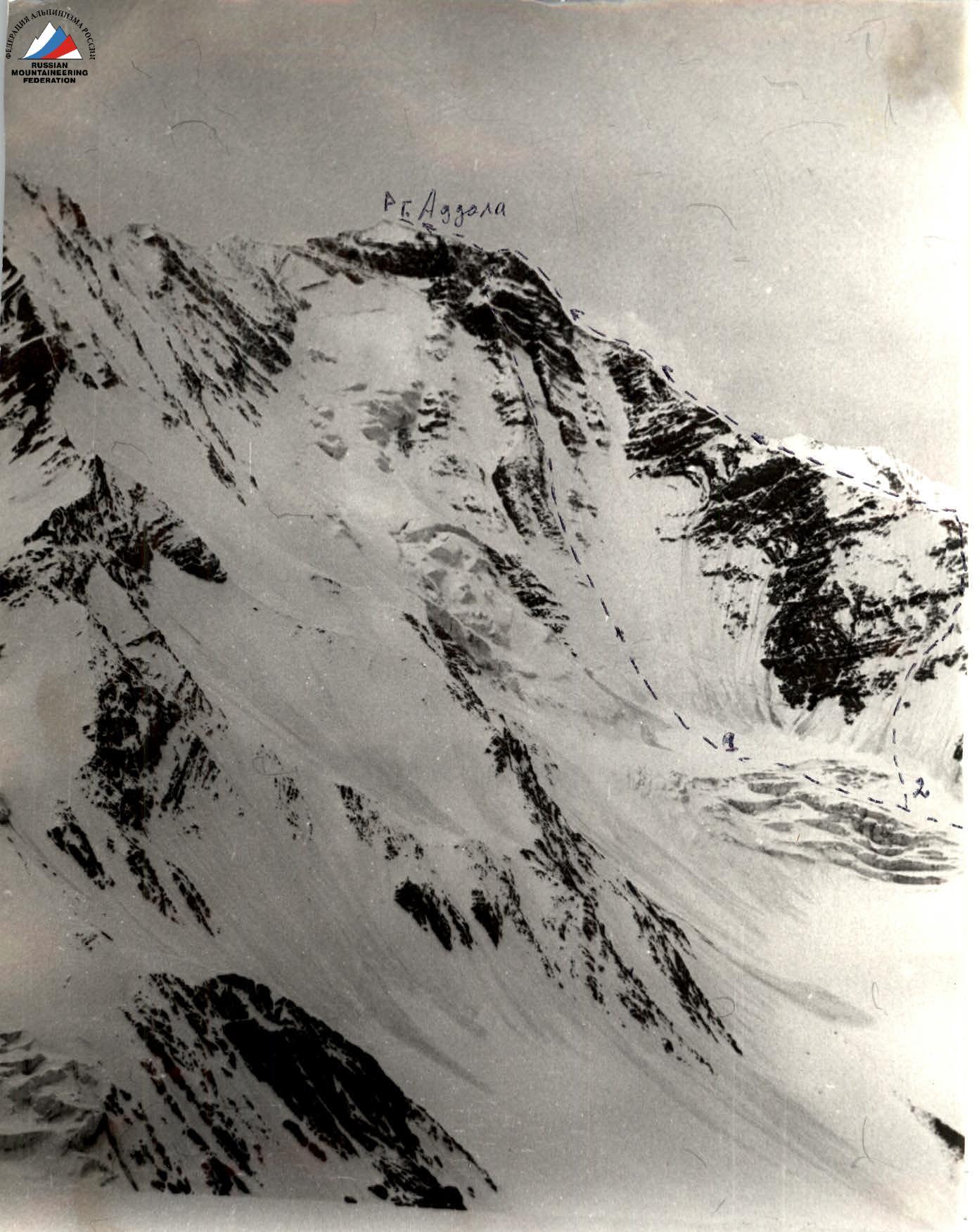
Peak, its height, ascent route: Adдала-Шухгель Mt., 4151 m, via N ridge
-
Estimated difficulty category: 2B
-
Route characteristics:
- height difference — 850 m
- average steepness — 45°
- length of sections:
- I difficulty category — 590 m
- II difficulty category — 200 m
- III difficulty category — 75 m
-
Pitons hammered:
- rock — 5/0
- ice — 2/0
-
Number of climbing hours: 7
-
Number of overnight stays: no overnight stays
-
Names of leader and participants, their sports qualification:
- Shanavazov Sh. — 1st sports category
- Ilyina E. — 2nd sports category
- Aliskandiev A.A. — 3rd sports category
- Dzhavatkhanova P. — 2nd sports category
-
Team coach: Kozorezov E.F.
-
Ascent date: July 9, 1986
-
Organization: "Daggosuniversity Mountain Club 'Eos'"
-
Addala via N ridge. S.V. st. 45
-
Addali via N ridge. 2B or. Group's route
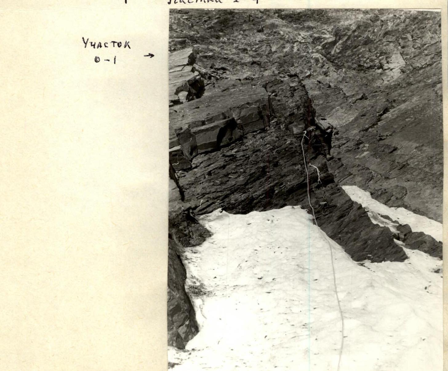
Section R1–R2
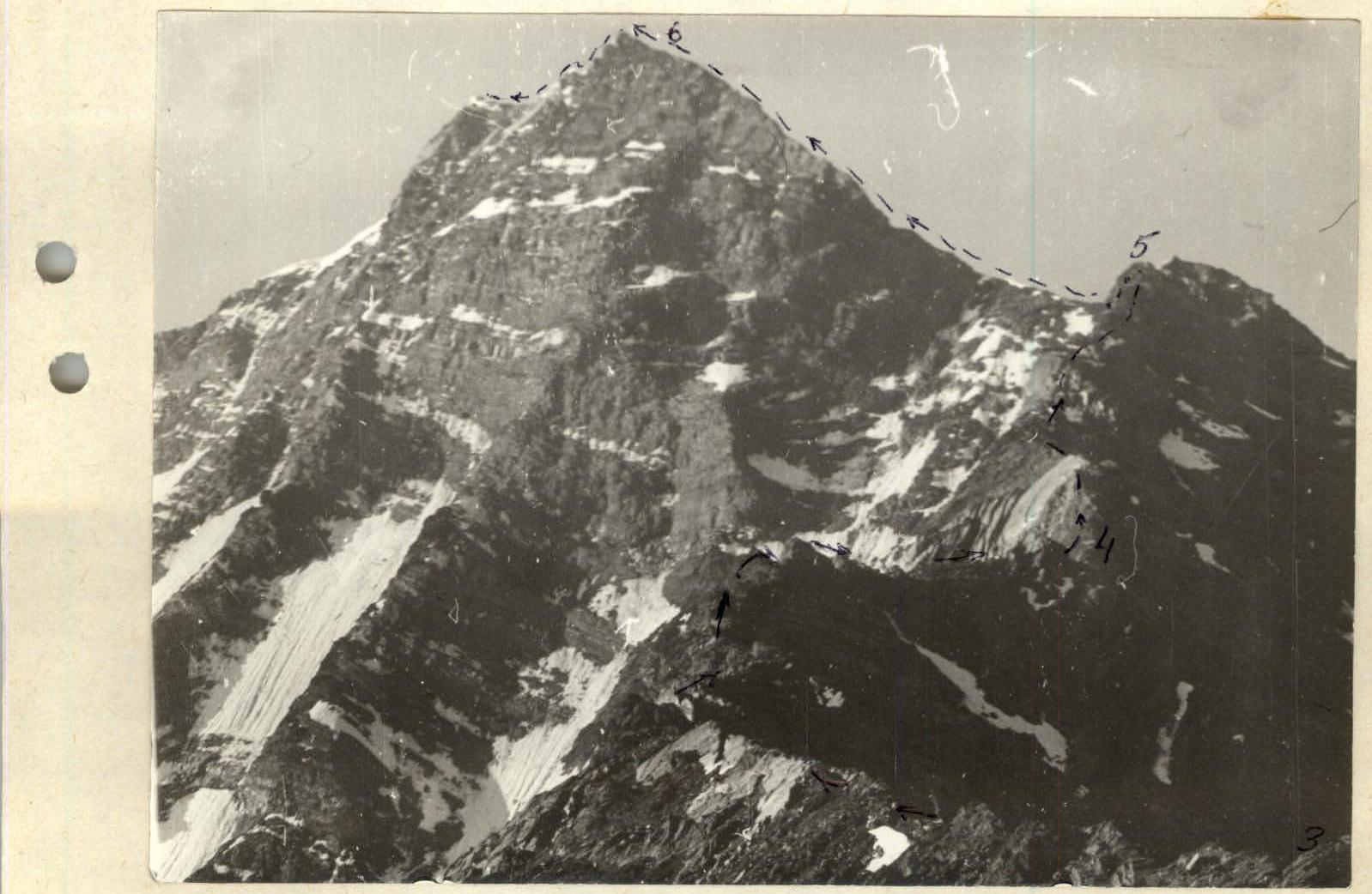
Sections R3–R6
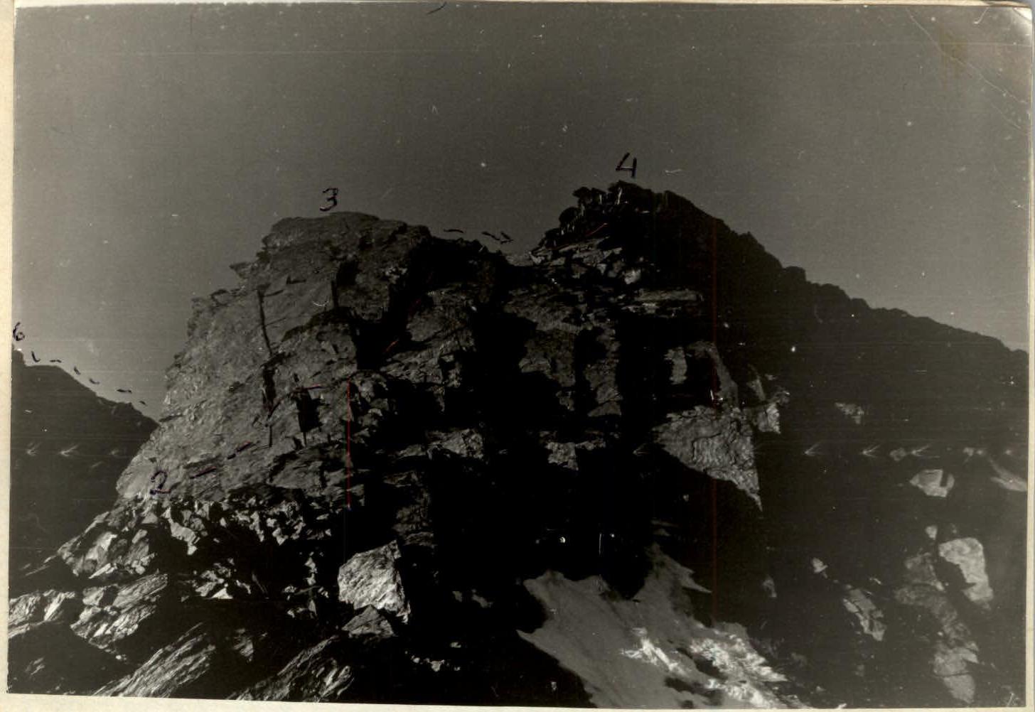
Sections R2–R4, Section R0–R1
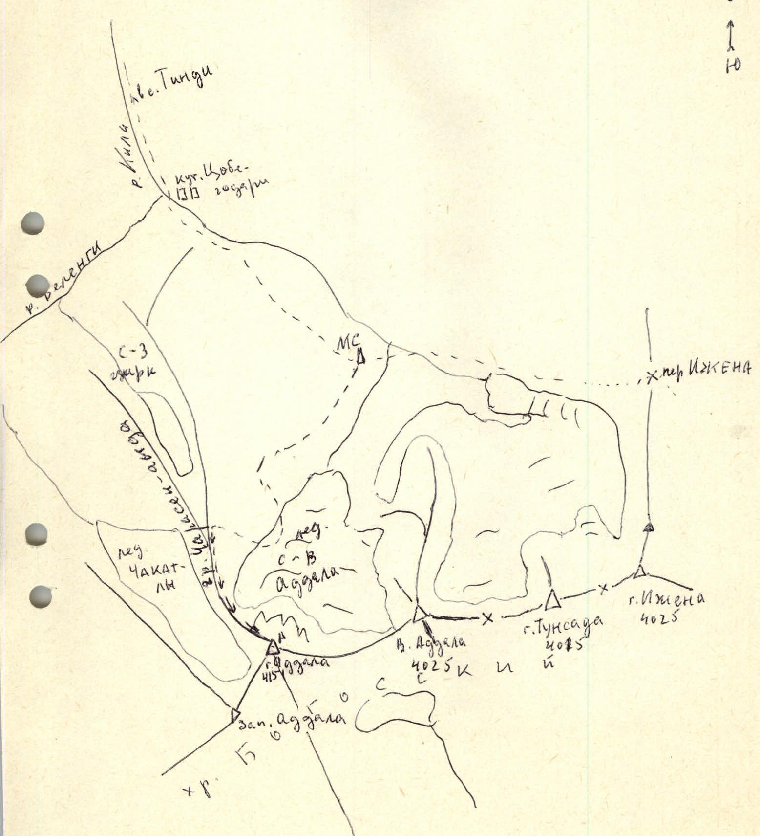
Area map
The first known attempt to ascend Adдала-Шухгель peak via the North ridge was made in May 1974 by a group led by K.E. Akhmedkhanov, but was unsuccessful due to heavy snow cover on the route and approaches. The group turned back from the R3–R4 section.
In June 1974, a group led by A. Aligaziev ascended Adдала via the North ridge, approaching from the Northwest cirque. No route description was made.
Judging by the contents of a note found in the summit cairn, on October 5, 1985, a duo from Baku, T. Tagiev and A. Zharkov, climbed the described route. The group did not register with the KSP and did not provide a route description. The note did not include an assessment of the route's difficulty.
Approach to the route description
- From the "Sulak — high-mountain" weather station, follow the left-bank (orographic) moraine of the NE Addala glacier and descend to the glacier about 40 meters from its end.
- Traverse the glacier, initially towards the N–E wall, and then, after passing the 2nd step of the icefall, turn right and approach the rocks and scree of the N ridge. From the weather station — 1–1.5 hours. Travel across the glacier must be in rope teams.
Explanation of the diagram
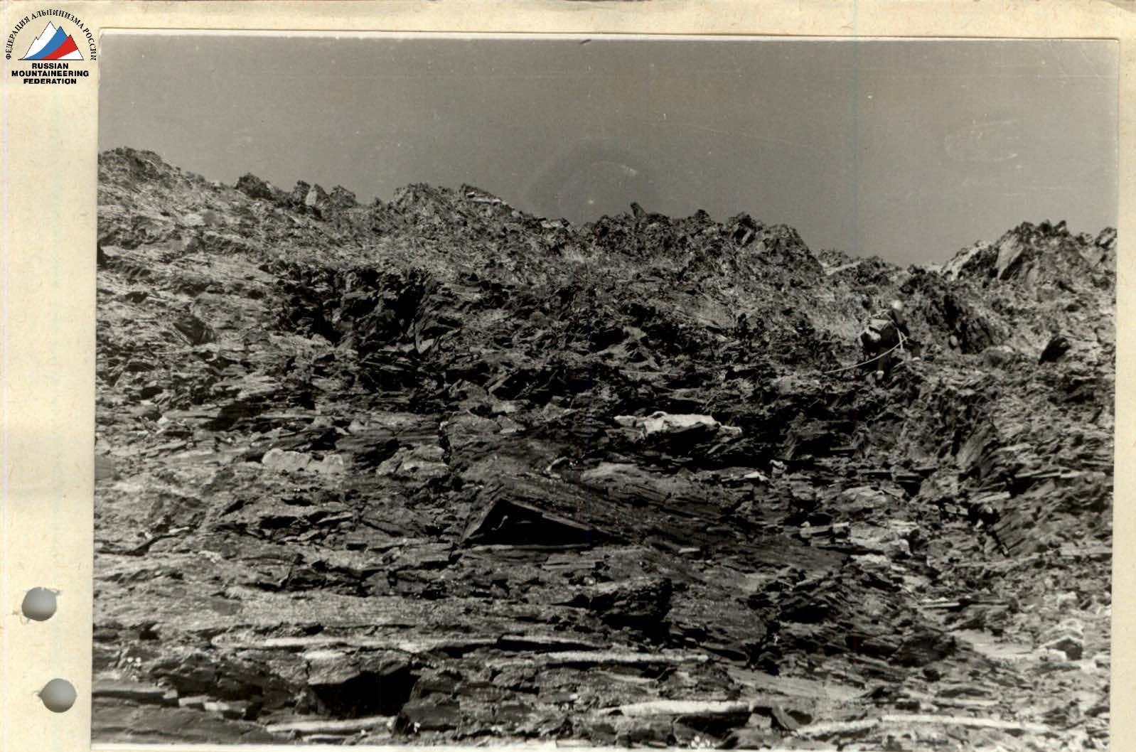
- The ridge is composed of heavily weathered schist; gendarmes are outcrops of sandstone and slabs.
- Protection is required along the entire ridge.
During the ascent, the route was in ideal condition. Snow cover may complicate passage to the extent of 1/2–I difficulty category.
Descent is recommended via the Charasen-Anda slope to the Tsobegodari kutan.
C-3 spheres of the Aggan-Myrient river

Route Diagram
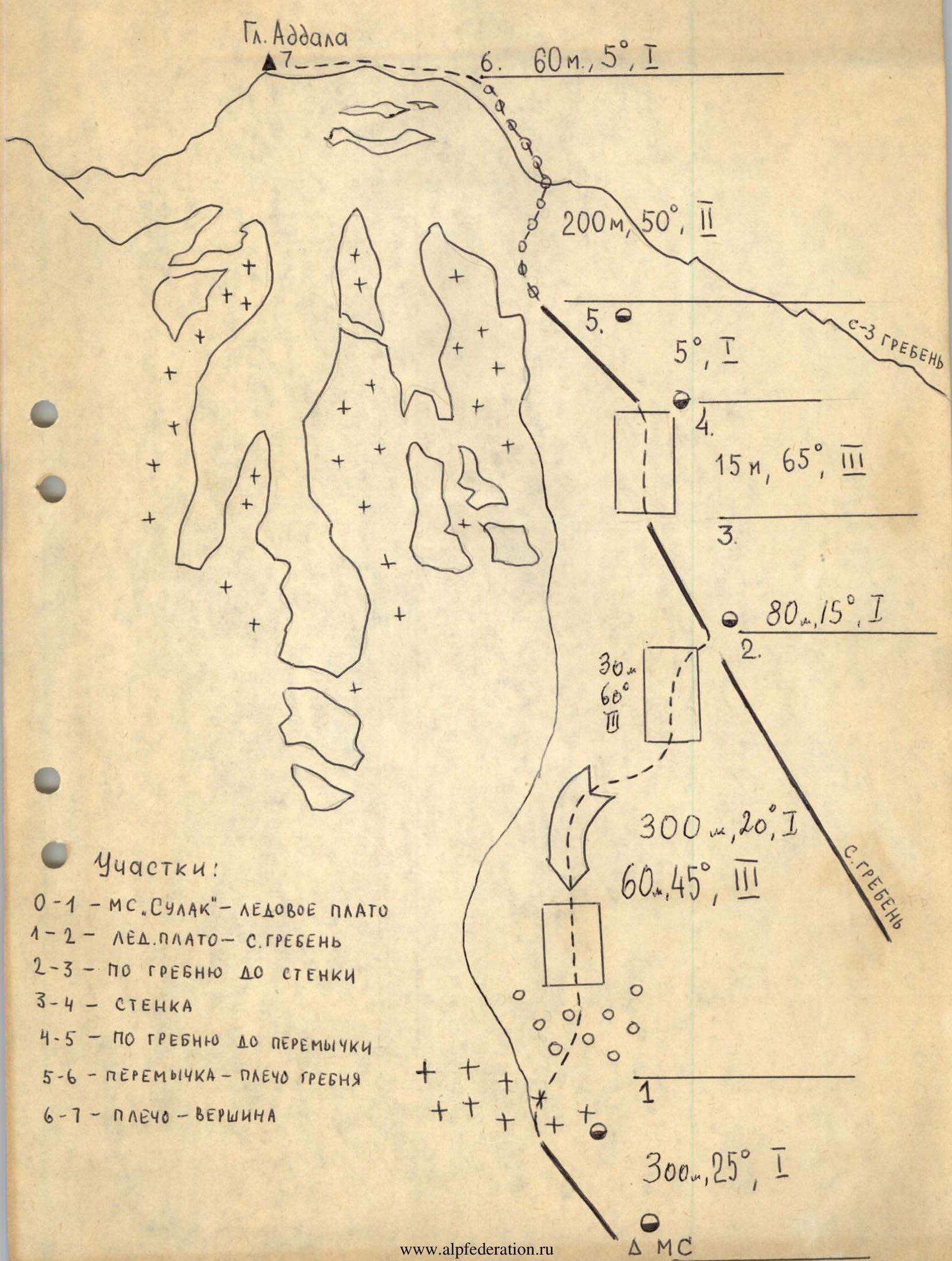
Sections:
-
R0–R1 — "Sulak" WS — Ice plateau
-
R1–R2 — Ice plateau — N ridge
-
R2–R3 — Along the ridge to the wall
-
R3–R4 — Wall
-
R4–R5 — Along the ridge to the saddle
-
R5–R6 — Saddle — Ridge shoulder
-
R6–R7 — Shoulder — Summit
-
Adдала peak
- R6: 60 m, 5°, 1
- R5: 200 m, 50°, 2; 5 m, 5°, 1
- R4: 15 m, 65°, 3
- R3: 80 m, 15°, 1
- R2: 300 m, 20°, 1; 60 m, 45°, 3
- R1: 300 m, 25°, 1