REPORT ON THE FIRST ASCENT TO THE SUMMIT BASHNYA 2930 m VIA THE SW COULoir, CAT. DIFF. 1B by the GSK Upravlenie alpinistskikh lagerei team from April 26 to 26, 2024
I. Climbing Passport
| № | 1. General Information | |
|---|---|---|
| 1.1 | Full name, sports rank of the leader | Chikin Artem Borisovich CMS |
| 1.2 | Full name, sports rank of participants | Gayunov Alexander unranked, Plyuta Dmitry unranked |
| 1.3 | Coach's full name | Yakovenko A.N. |
| 1.4 | Organization | GSK UAL |
| 2. Characteristics of the Climbing Object | ||
| 2.1 | Region | 2.9 from Krestovy Pass to Shaviklde peak |
| 2.2 | Valley | |
| 2.3 | Section number according to the 2013 classification table | |
| 2.4 | Name and height of the summit | Bashnya, 2930 m. |
| 2.5 | Geographical coordinates of the summit (latitude, longitude), GPS coordinates | 42°51′4″ N 44°48′48″ E |
| 3. Route Characteristics | ||
| 3.1 | Route name | Bashnya via SW couloir |
| 3.2 | Proposed category of difficulty | 1B |
| 3.3 | Degree of route exploration | 1st ascent |
| 3.4 | Terrain characteristics of the route | Rock |
| 3.5 | Height difference of the route | 750 m — total |
| 3.6 | Route length (in meters) | 960 m |
| 3.7 | Technical elements of the route | Rock climb cat. 2 — 200 m. Rock climb cat. 3 — 60 m. Rappelling (on descent) – (30–40 m) |
| 3.8 | Descent from the summit | 350 m along a non-categorized ridge and 30 m rappelling to the overnight stay at Jarlam Pass |
| 3.9 | Additional route characteristics | Water is absent on the route, there is a platform on the pre-summit ridge |
| 4. Team Actions Characteristics | ||
| 4.1 | Movement time | 4 h 10 min, 1 day |
| 4.2 | Overnight stays | No |
| 4.3 | Start of the route | 5:10 April 26, 2024 |
| 4.4 | Reaching the summit | 9:20 April 26, 2024 |
| 4.5 | Return to base camp | 14:00 May 26, 2024 |
| 5. Person responsible for the report | ||
| 5.1 | Full name, e-mail | Chikin Artem Borisovich artem.chikin@mail.ru |
II. Ascent Description
1. Characteristics of the Climbing Object
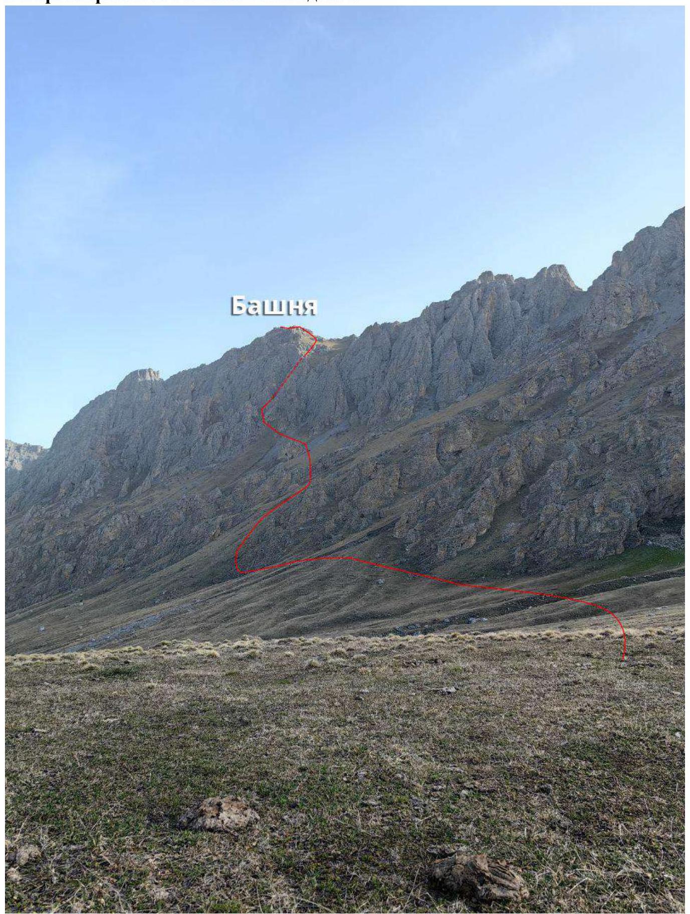 1.1. General photo of the summit.
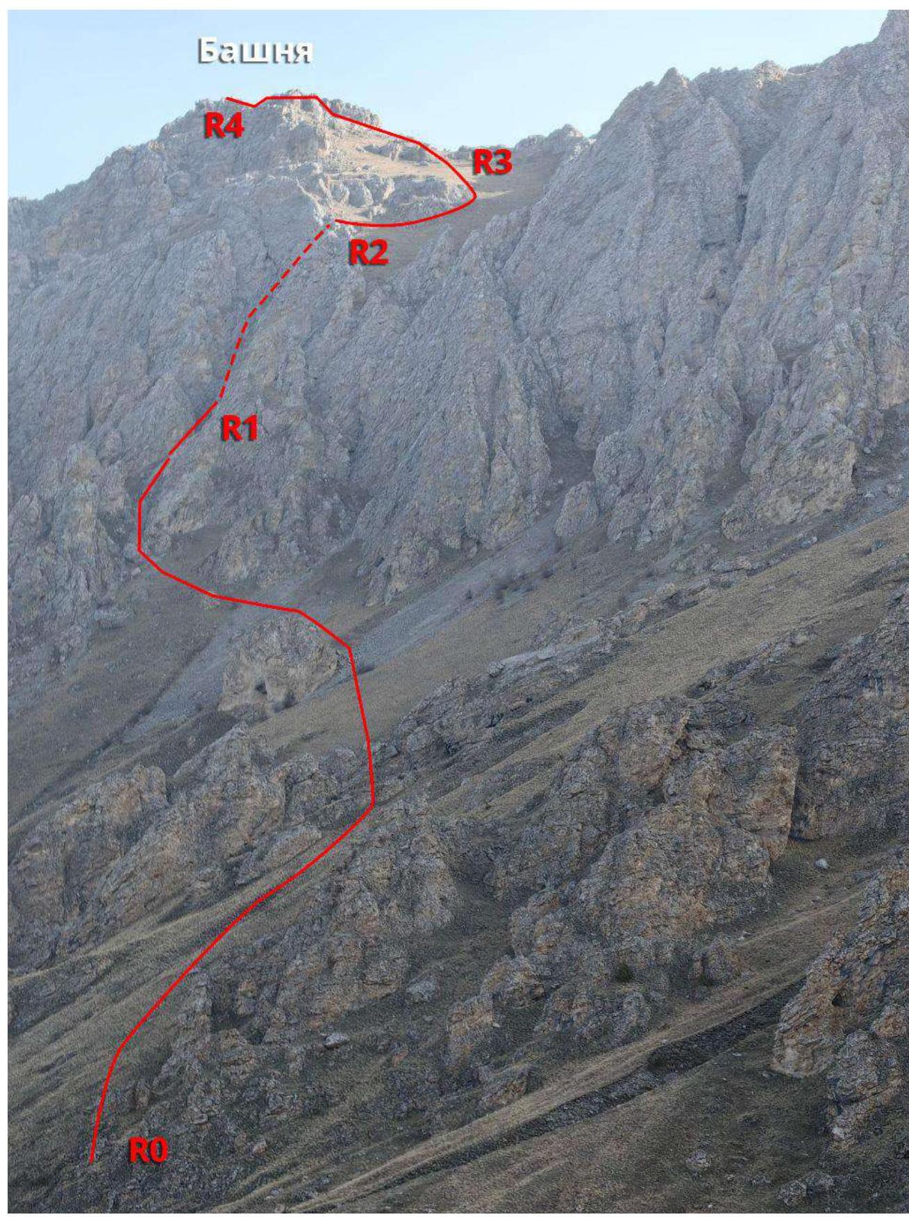
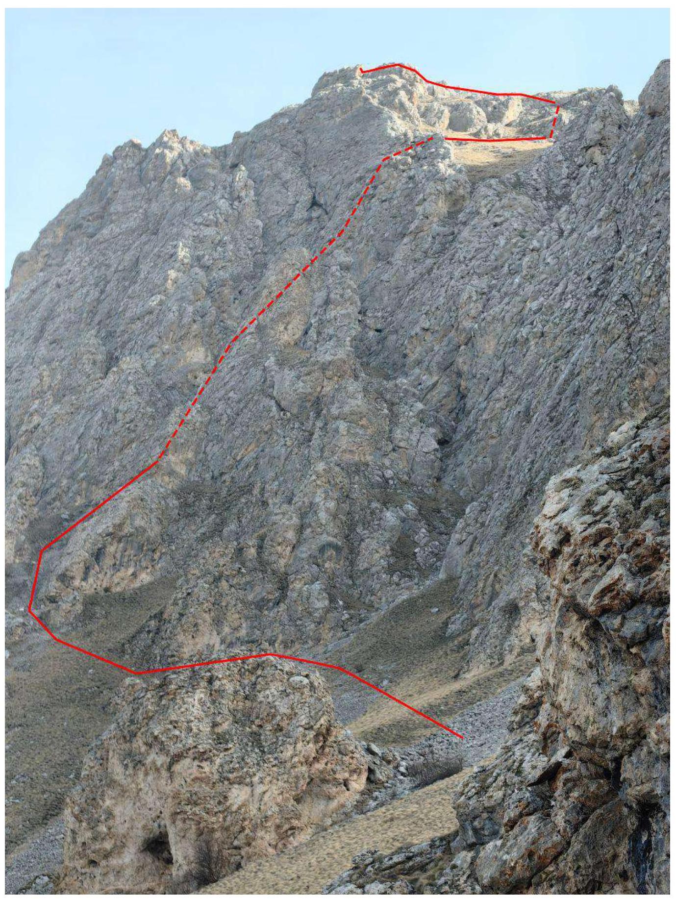 1.2. Photo of the route profile.
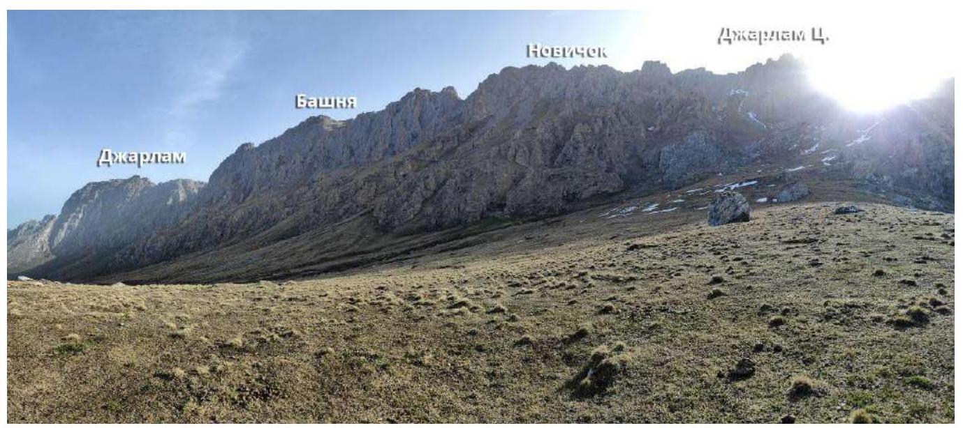 1.3. Photopanorama of the area.
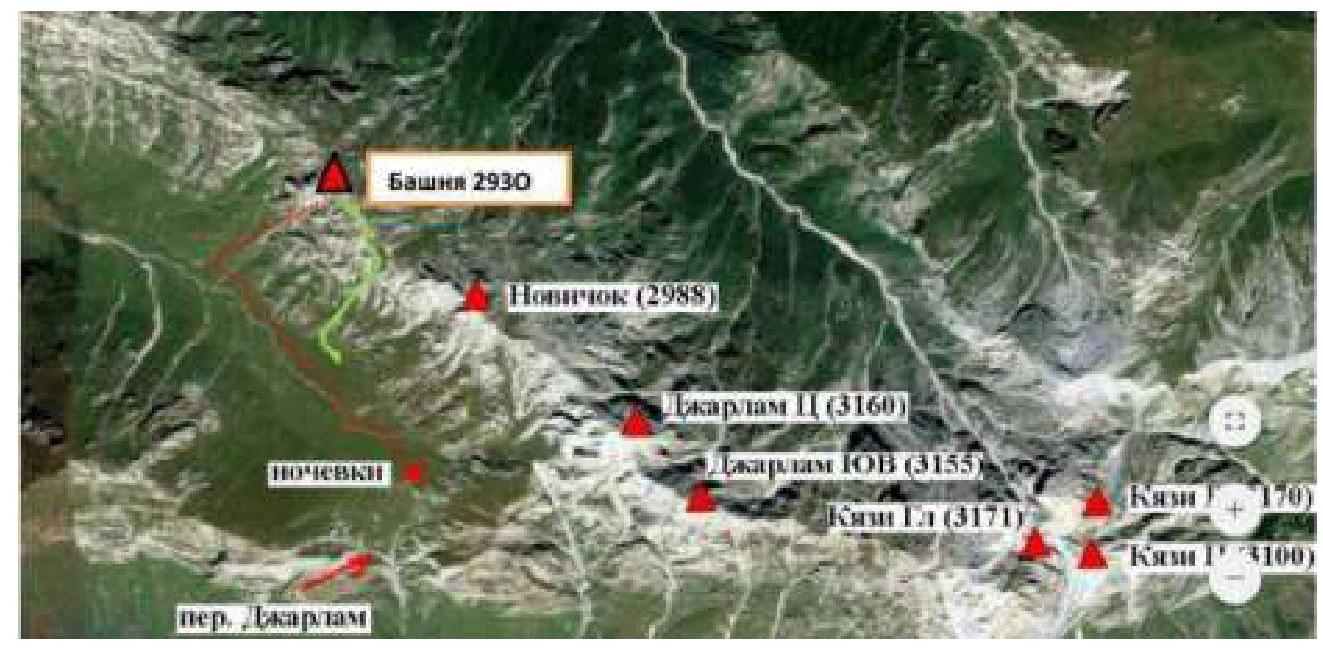 1.4. Map of the area
2. Route Characteristics
2.1. Technical photograph of the route.
2.2. Technical characteristics of the route sections.
| Section № | Terrain characteristics | Category of difficulty | Length, m | Type and number of pitons |
|---|---|---|---|---|
| R0–R1 | Grassy slope, scree | N/C | 600 | 0 |
| R1–R2 | Rocky | 3 | 60 | 1 |
| R2–R3 | Grassy slope | N/C | 100 | 0 |
| R3–R4 | Ridge | 2 | 200 | ledges |
3. Team Actions Characteristics
| Section № | Description | Photo № |
|---|---|---|
| R0–R1 | From Jarlam Pass north with a loss of height towards the Bashnya peak massif. Landmark — red rock gendarme on the slope. Behind the red gendarme along the scree couloir, turning right in the direction of movement and towards rocks with grassy ledges. | 1,2 |
| R1–R2 | Rocks with grass and ledges, up the couloir to the exit into a grassy cirque. Belaying on ledges, caution, loose rocks. | 3 |
| R2–R3 | Along the grass to the ridge | 4,5 |
| R3–R4 | Along the rocky ridge. Simultaneous belaying. | 6,7,8 |
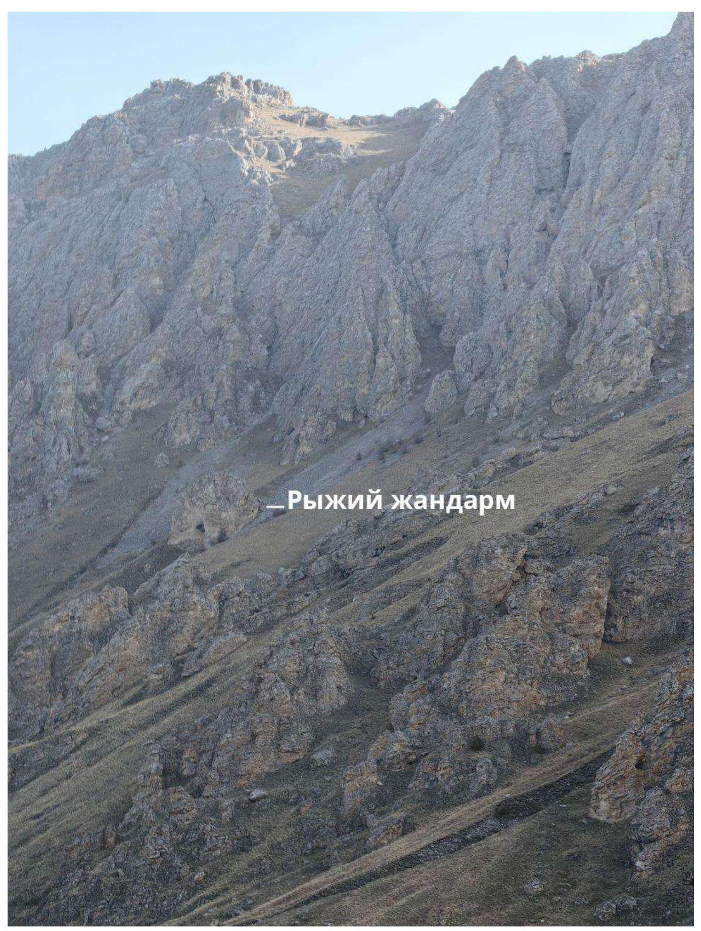
Photo 1. Section R0–R1
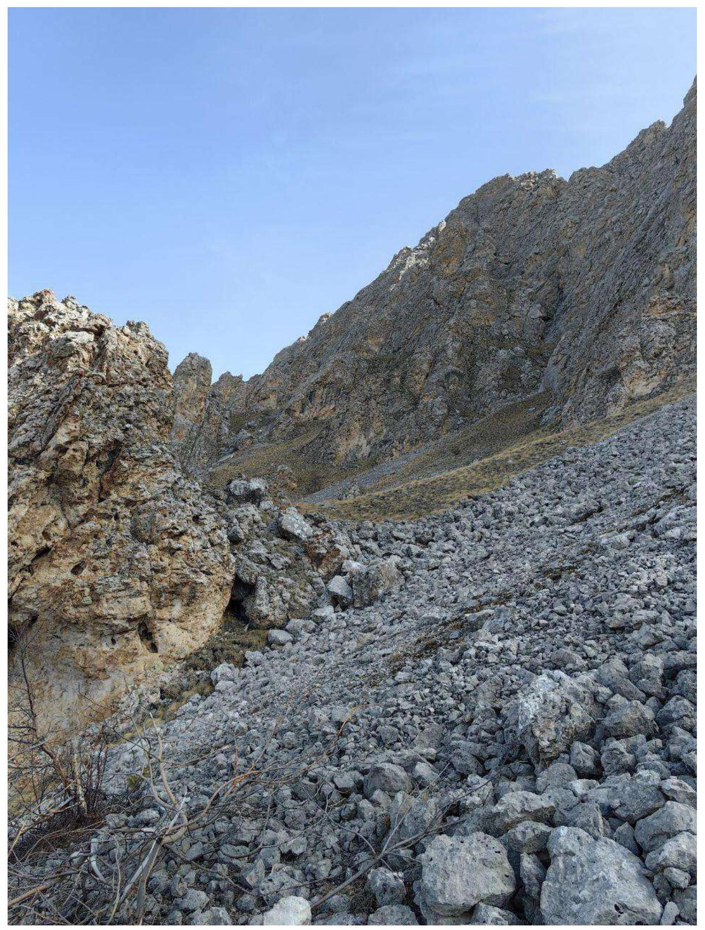
Photo 2. Section R0–R1. The red gendarme is visible on the left
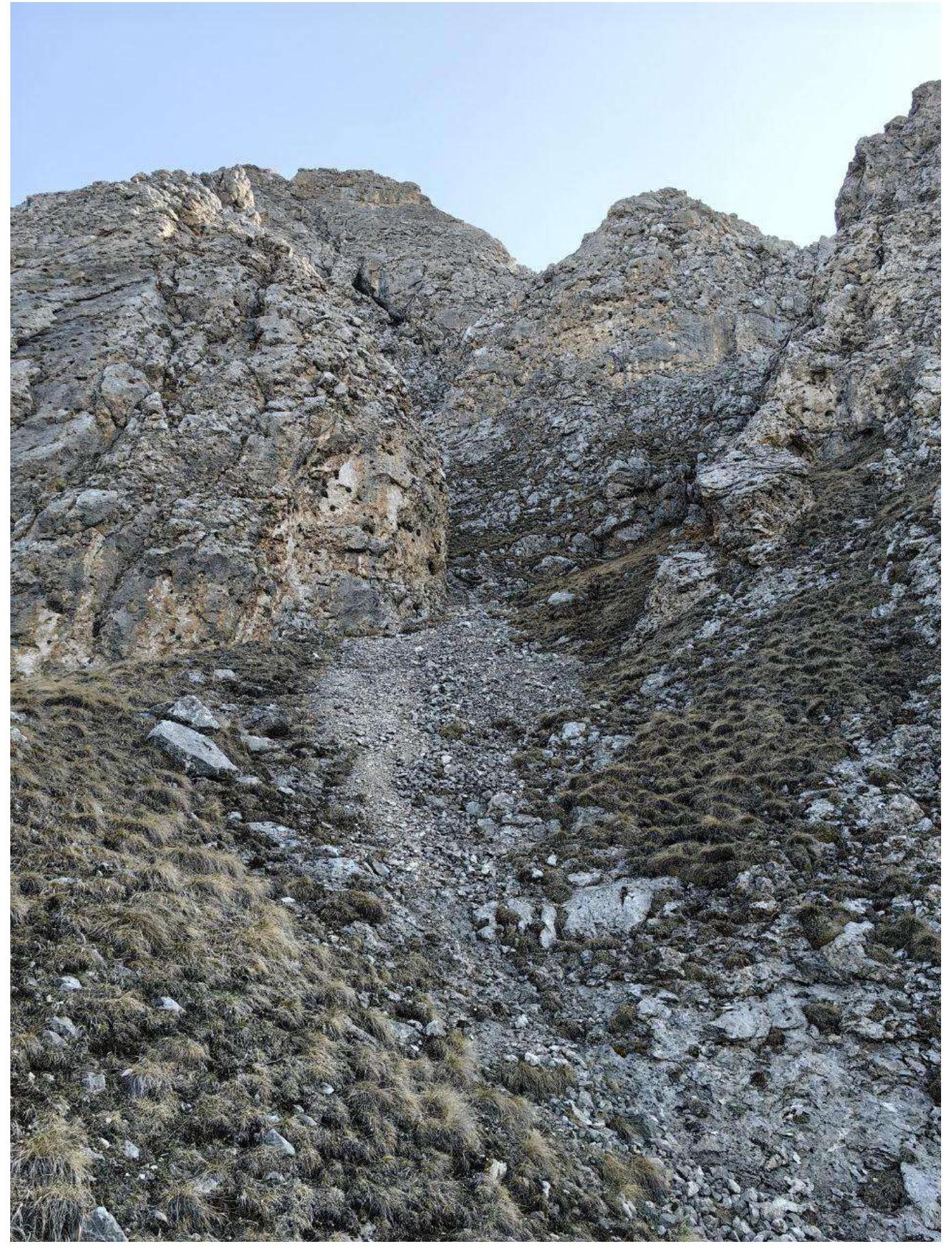
Photo 3. Section R0–R1. Beginning of the scree couloir
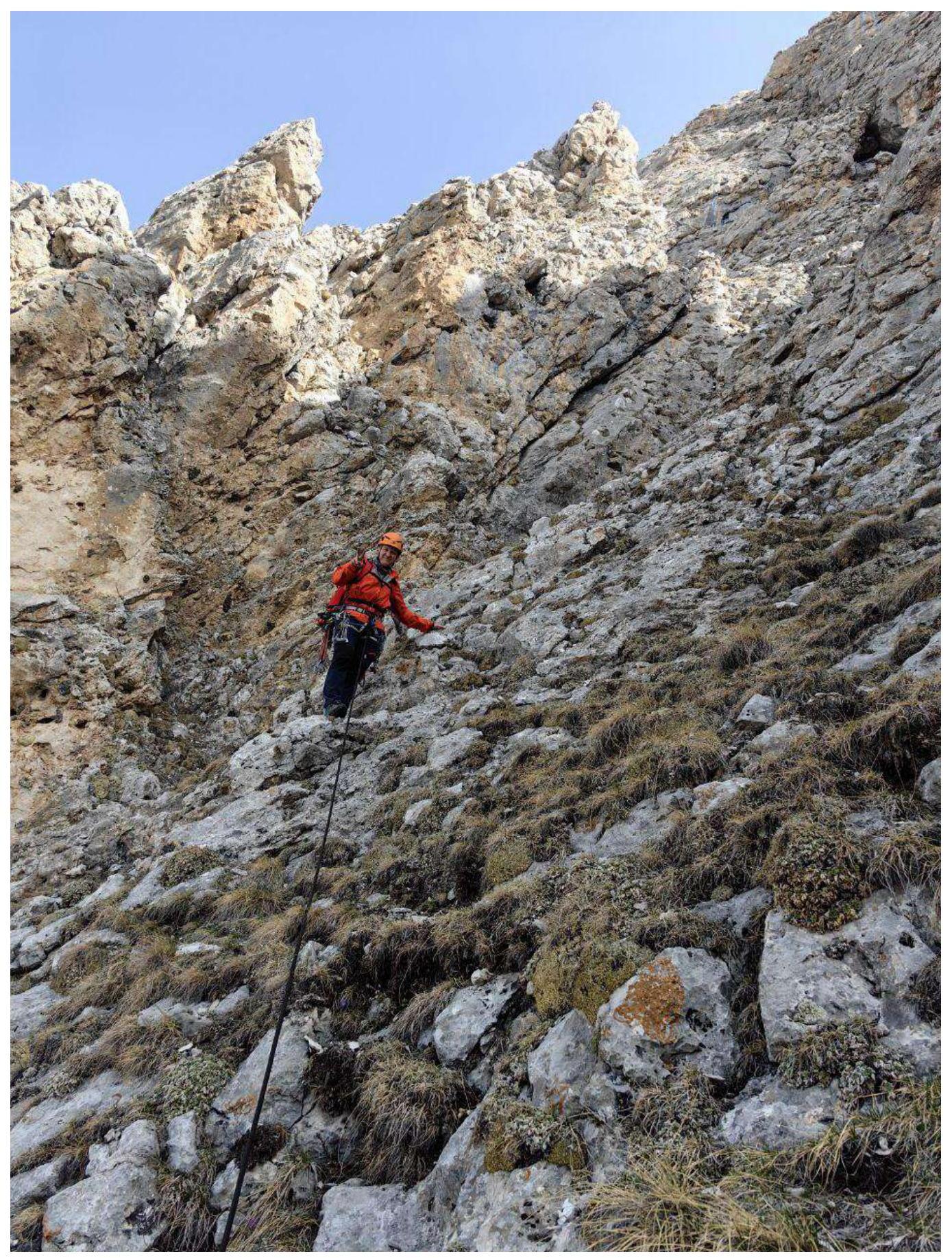
Photo 4. Section R1–R2
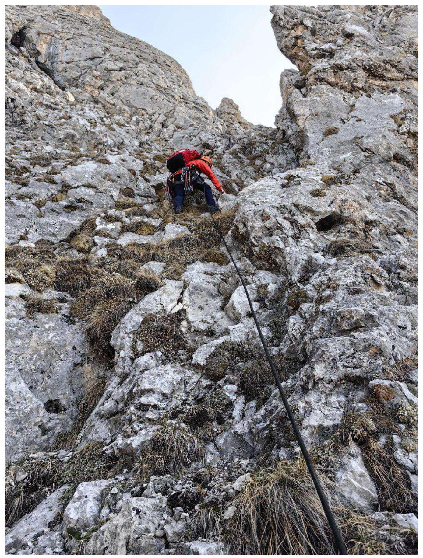
Photo 5. Section R1–R2

Photo 6. Section R1–R2
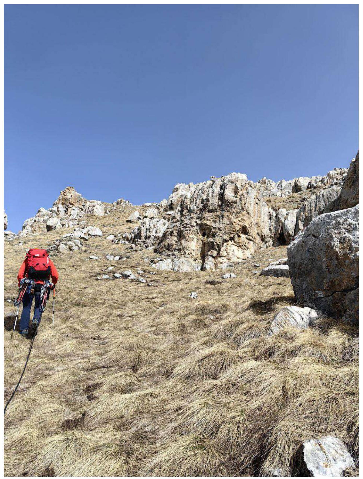
Photo 7. Section R2–R3
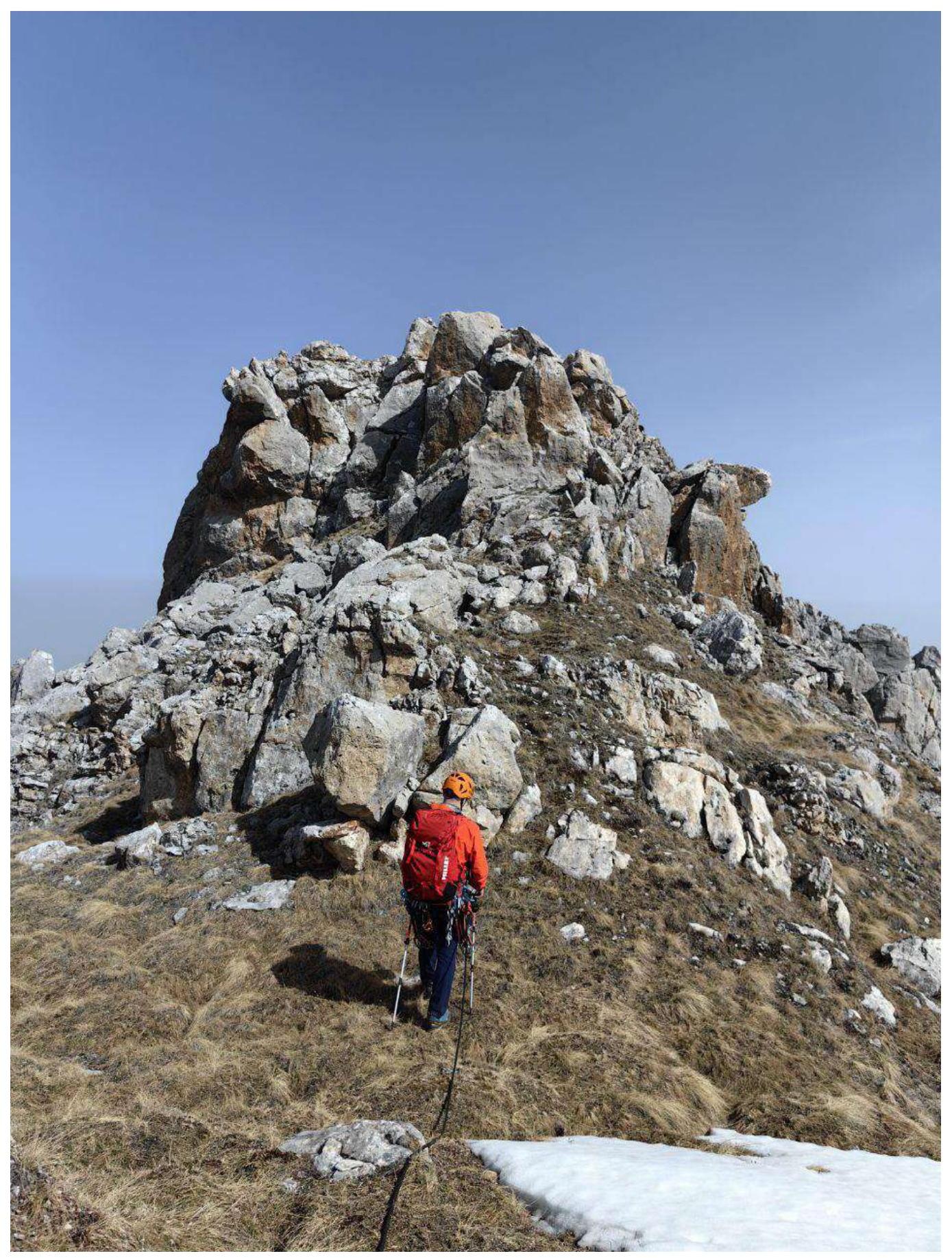
Photo 8. Section R2–R3
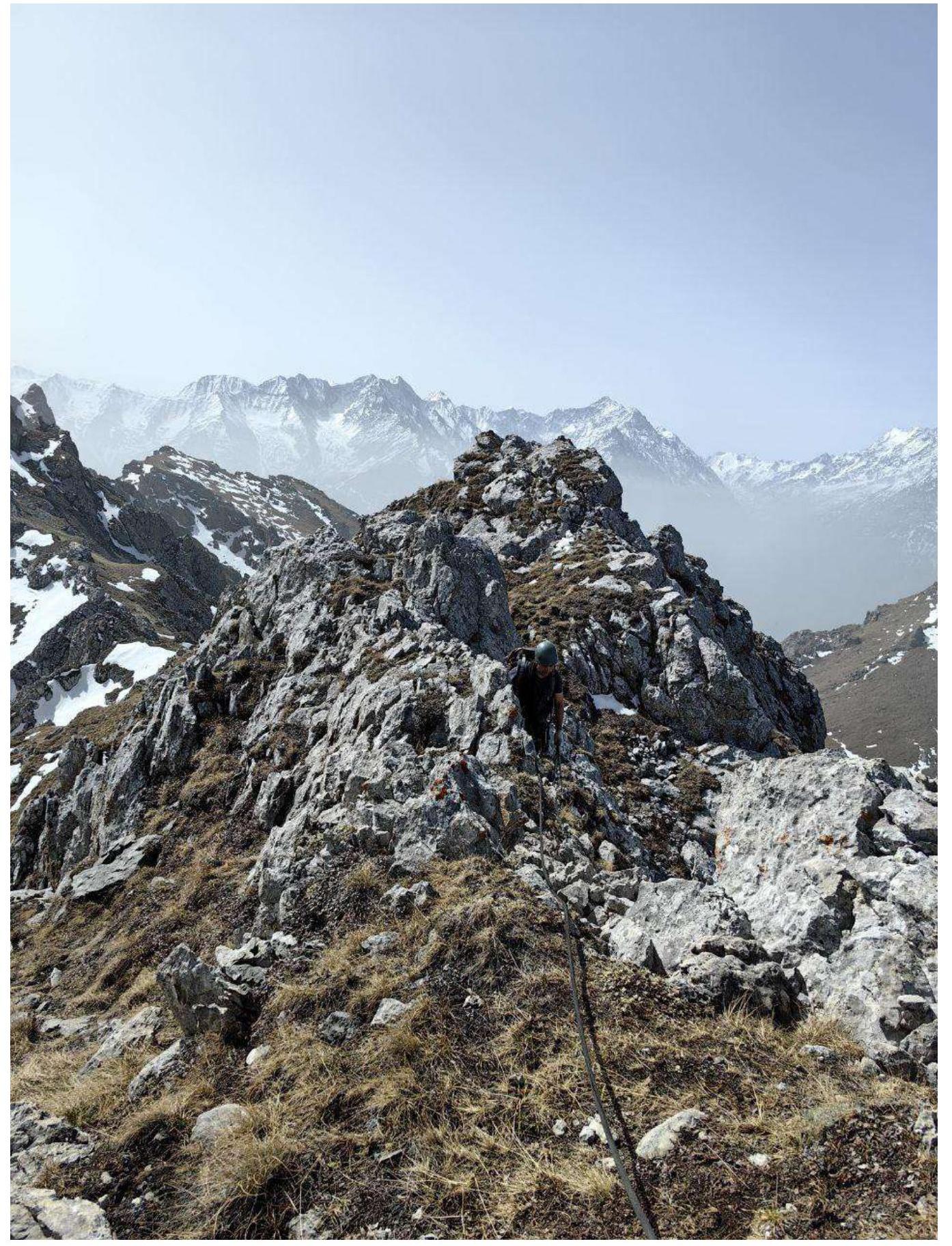
Photo 9. Section R2–R3
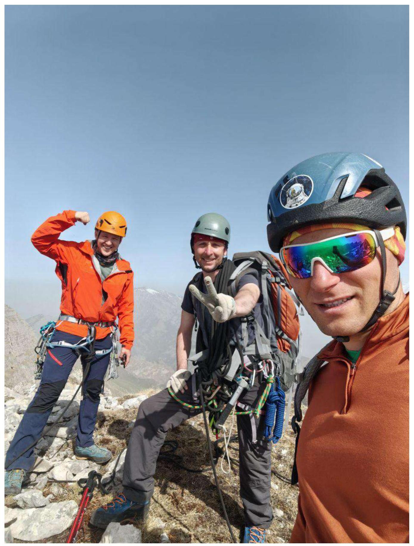
Photo 10. Team on the summit.
3.3. The route is logical, and movement with simultaneous belaying is well-practiced.
There are loose rocks on the ledges and in the couloir, so caution is necessary.
The descent from the route is straightforward: from the summit along the ridge to the south (towards Novichok peak) into a scree couloir with a 30–40 m rappel.
Communication from the route to the "Kyazi" camp may be absent; we communicated through groups on other routes.
We evaluate the route as 1B.