
MINISTRY OF SPORTS OF KRASNOYARSK KRAI KRASNOYARSK KRAI ALPINISM FEDERATION
Report
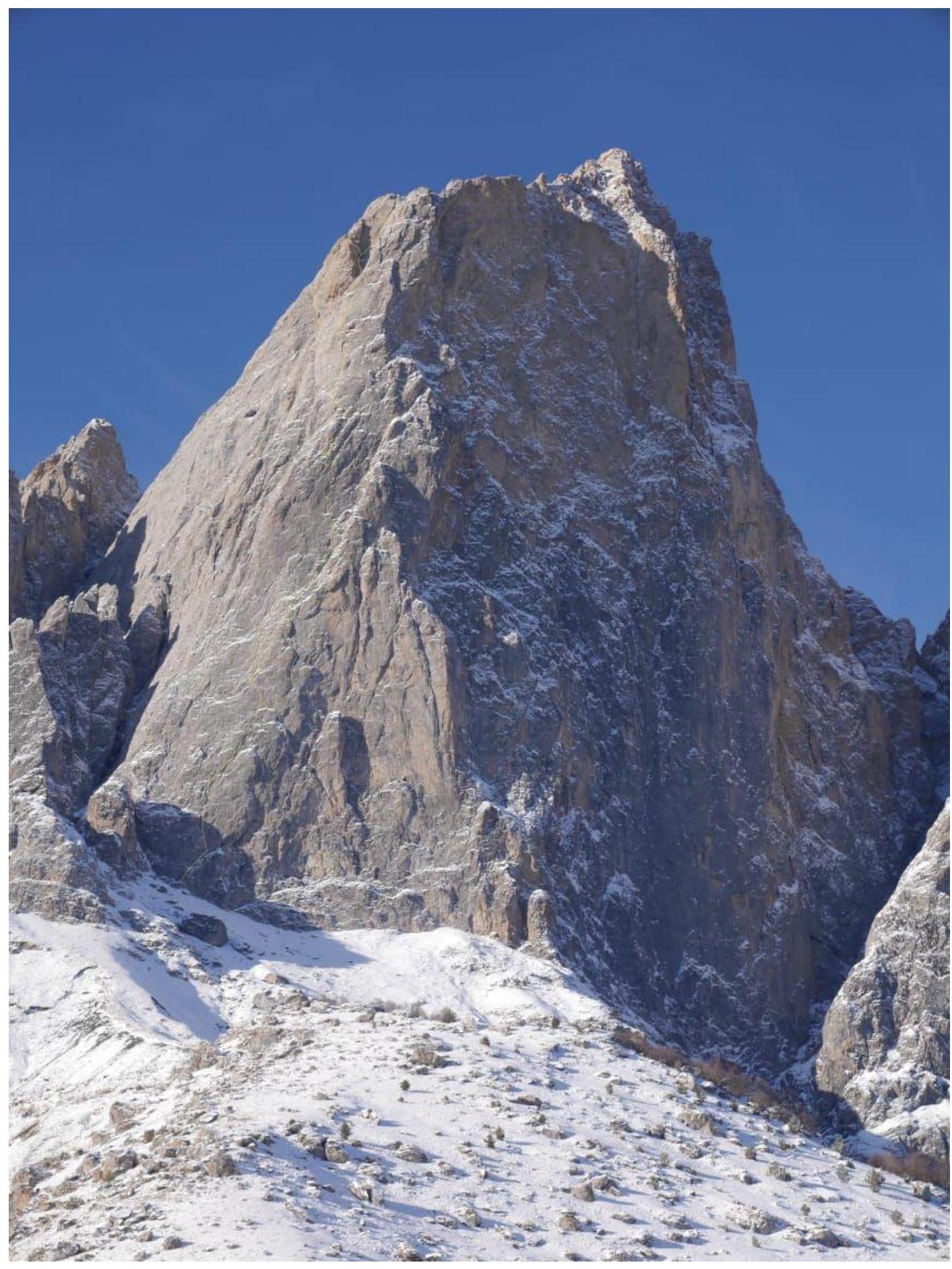
On the ascent to the summit of Tsey-Loam (Kyazi) 3171 m via the route: South wall — first ascent, approximately 5B, by the team from Krasnoyarsk Krai from January 26, 2020, to January 27, 2020.
I. Ascent Passport
| 1. General Information | ||
|---|---|---|
| 1.1 | Full name, sports rank of the leader | Mukhametzyanov Ratmir Nurmukhametovich (MS) |
| 1.2 | Full name, sports rank of participants | Matveenko Egor Vladimirovich (MS), Teplykh Mikhail Vladimirovich (MS) |
| 1.3 | Full name of coach | Balezin Valeriy Viktorovich |
| 1.4 | Organization | FAKK |
| 2. Characteristics of the Ascent Object | ||
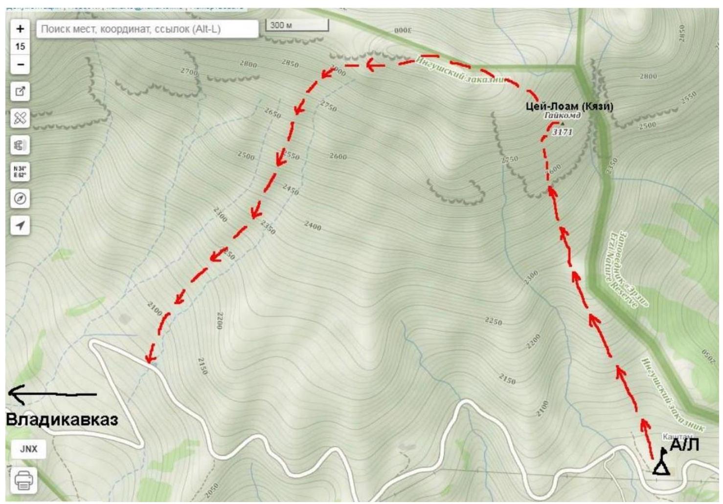
| 2.1 | Region | Caucasus |
| 2.2 | Valley | From Krestovyy Pass to Shaviklde peak |
| 2.3 | Section number according to the 2013 classification table | 2.9. |
| 2.4 | Name and height of the peak | Tsey-Loam (Kyazi) 3171 m |
| 2.5 | Geographical coordinates of the peak (latitude/longitude), GPS coordinates | |
| 3. Characteristics of the Route | ||
| 3.1 | Name of the route | Via South wall |
| 3.2 | Proposed category | 5B |
| 3.3 | Degree of route exploration | — |
| 3.4 | Nature of the route terrain | Rocky |
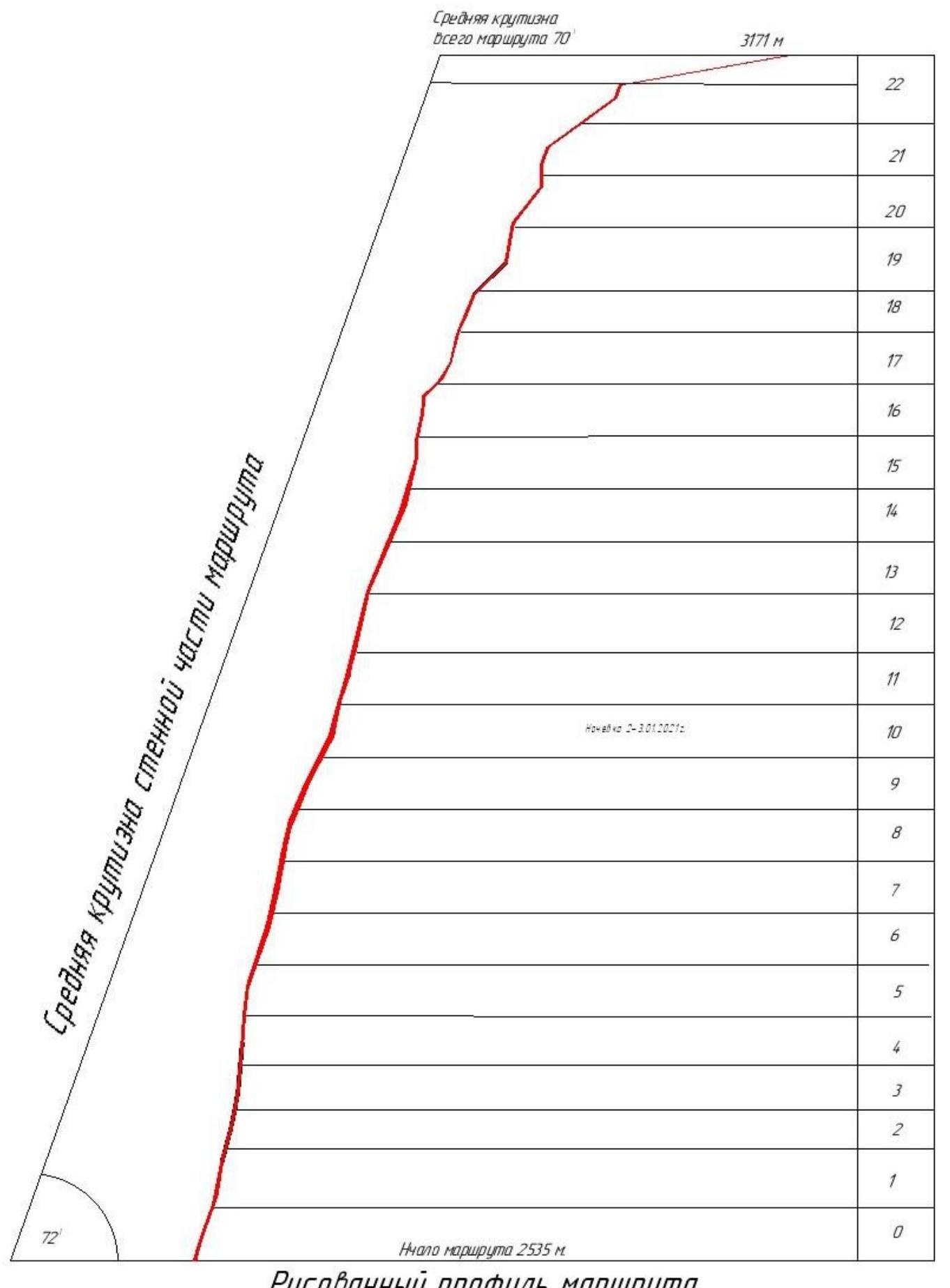
| 3.5 | Height difference of the route (altimeter or GPS data) | 635 |
| 3.6 | Length of the route (in meters) | 845 |
| 3.7 | Technical elements of the route (total length of sections of varying difficulty with terrain type indication (ice-snow, rocky)) | I cat. diff. ice/rock/combination – 175 m. II cat. diff. ice/rock/combination – 30 m. III cat. diff. ice/rock/combination – 90 m. V cat. diff. ice/rock/combination – 180 m. IV cat. diff. ice/rock/combination – 195 m. VI cat. diff. ice/rock/combination – 185 m. Of which ATO: A1 – 135 m A2 – 510 m A3 – 4 m |
| 3.8 | Average steepness of the route, ° (2) | 72 |
| 3.9 | Average steepness of the main part of the route, ° (2) | 72 |
| 3.10 | Descent from the peak | Via Utyasheva route, 2B cat. diff. |
| 3.11 | Additional route characteristics | No water in summer |
| 4. Characteristics of Team Actions | ||
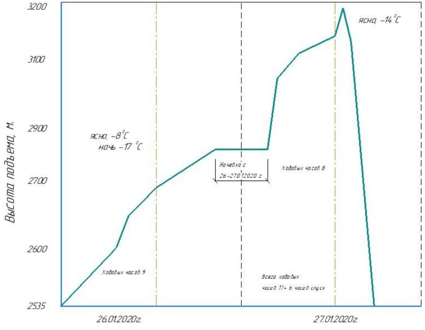
| 4.1 | Time of movement (team's walking hours, in hours and days) | 17 h |
| 4.2 | Overnights | 1 — on a platform |
| 4.3 | Route processing time | No processing |
| 4.4 | Route start | 7:10 on 26.01.2020 |
| 4.5 | Summit push | 13:40 on 27.01.2020 |
| 4.6 | Return to base camp | 19:20 on 27.01.2020 |
| 5. Weather Conditions (4) | ||
| 5.1 | Temperature, °C | 26.01 (–8 °C day / –17 °C night); 27.01 (–14 °C day) |
| 5.2 | Wind speed, m/s | 2.01 – 1–5 m/s; 3.01 – 7–8 m/s; 4.01 – 10–15 m/s |
| 5.3 | Precipitation | 2.01 – no precipitation; 3.01 – no precipitation |
| 5.4 | Visibility, m | 26.01 – good; 27.01 – good |
| 6. Responsible for the Report | ||
| 6.1 | Full name, e-mail | Mukhametzyanov Ratmir Nurmukhametovich ratmir2810@mail.ru |
II. Ascent Description
1. Characteristics of the Ascent Object
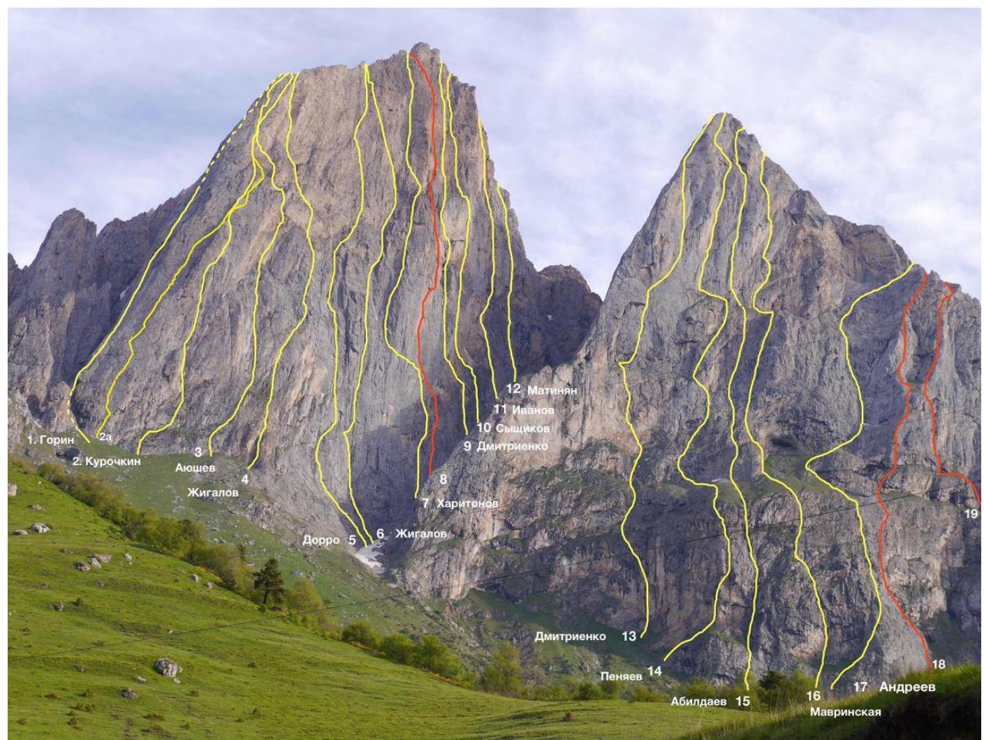
1.1. General photo of the peak
1.2. Hand-drawn profile of the route
1.3. Map of the area at a scale not exceeding 1:80000 (source file:///C:/Users/user/Desktop/6%D0%90%20%D0%95%D1%80%D1%8B%D0%B0%D0%B3%202020/i.webp)
2. Characteristics of the Route
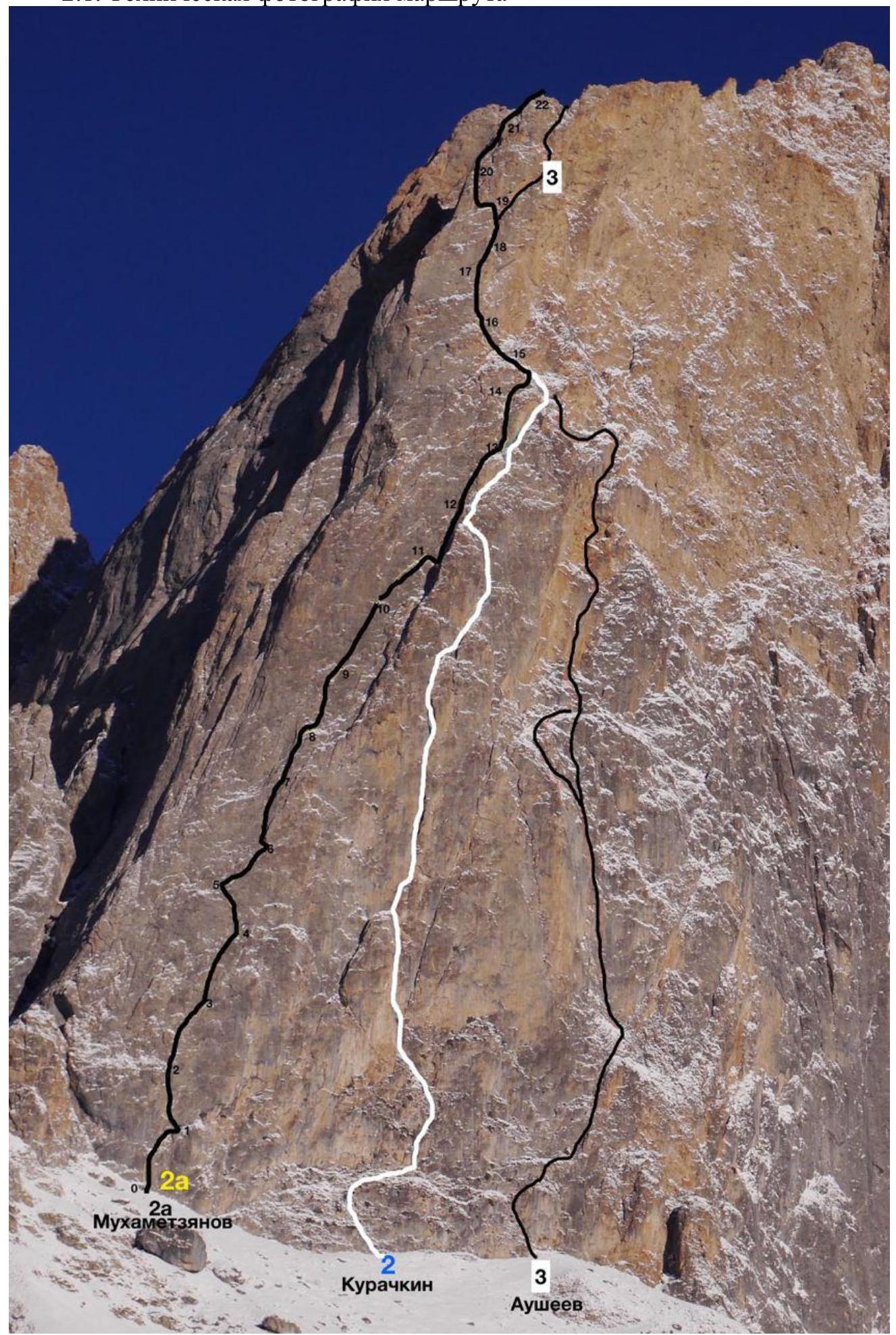
2.1. Technical photograph of the route
2.2. Route diagram in UIAA symbols, scale 1:2000

3. Section-by-Section Description
| Section # | Description | Photo # |
|---|---|---|
| R0–R1 | Start of the route via a cleft leading from left to right; before reaching the top of the cleft, move left to a small overhang 35 m (A2, 30 m), belay station on the right. | |
| R1–R2 | Move left and up through the overhang via a system of cracks towards an oblique, clearly visible crack; belay station on anchors 30 m, A2. | |
| R2–R3 | Up via the same system of cracks; belay station on personal anchors 40 m, A2. | |
| R3–R4 | Continue via the system of cracks to an oblique, noticeable crack; belay station on anchors, ATO A2. | |
| R4–R5 | Traverse left to another system of cracks via broken terrain through an overhang; belay station on anchors, ATO A2, 25 m. | 1 |
| R5–R6 | Up via a clearly visible crack to the right; ATO A2; belay station on personal anchors, 30 m. | |
| R6–R7 | Right and up via a crack, left of a broken corner; 35 m, ATO A2. | |
| R7–R8 | Exit to a ledge (snow-covered); ATO via a system of cracks and dubious placements, A2, section 30 m. | |
| R8–R9 | Right and up via a system of cracks and dubious placements (attempted to traverse left but found no logical terrain; continued upwards) 35 m, ATO A2. | 2 |
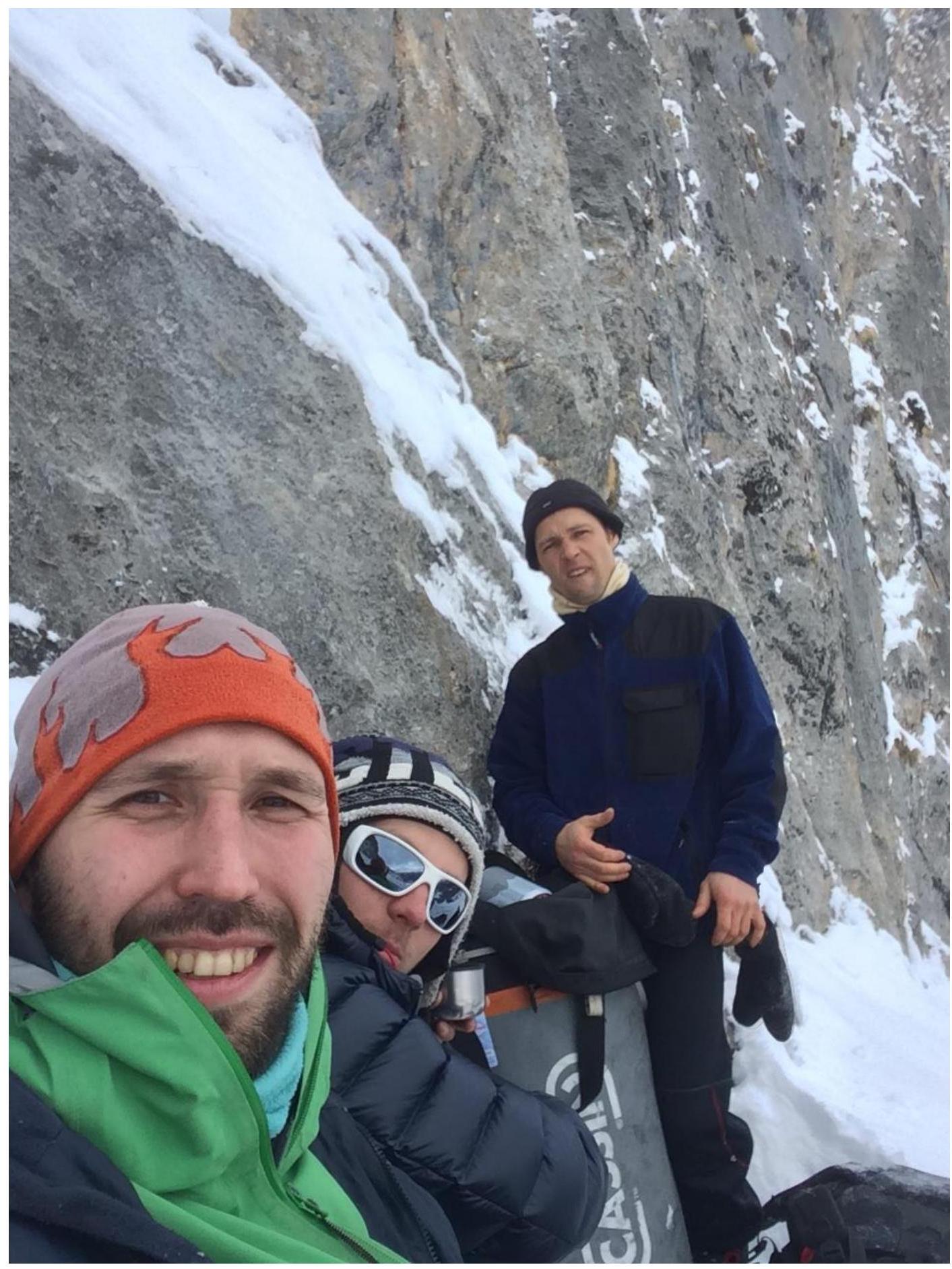
| R9–R10 | 35 m blind ATO A2 via a system of cracks and dubious placements (4 m A3). Overnight in a platform. | 3 |
| R10–R11 | Via broken terrain to a crack under a small overhanging inner corner; higher up, the inner corner becomes sloping; at the end of the rope, traverse 3 m to the right; belay station on large chocks, ATO A2. | |
| R11–R12 | Traverse right into a chimney; then up via an inner corner; protection: anchors, cams; 30 m, easy climbing. | |
| R12–R13 | Right and up via a wide chimney; few protection points; climbing is easy 35 m. | |
| R13–R14 | Exit from the chimney; ATO A2; then up from a bastion via a ridge departing from the wall to a snow-covered ledge 30 m; exit to the ledge involves climbing. | 4 |
| R14–R15 | Then climb right and up; then exit to the next ledge – 25 m. | 5 |
| R15–R16 | Traverse along the ledge to the left; then a small inner corner; protection: anchors, cams. Move via snow-covered ledges complicating climbing. Belay station in an inner corner – 25 m. | |
| R16–R17 | Via an inner corner – 4 m to a driven piton; then left and up to an old, driven bollard. Then via an inner corner under an overhang. | |
| R17–R18 | Through the overhang to a narrow crack; ATO A2; exit to a small ledge with an inner corner to the belay station. | |
| R18–R19 | Move around the corner into an inner corner where it breaks apart; from there, left to a ledge; belay station on personal anchors. | |
| R19–R20 | Then left along the ledge; traverse to an inner corner with cracks; exit to a small chimney; belay station in the chimney. | |
| R20–R21 | From the chimney, right and up via gentle sections; climbing. | |
| R21–R22 | Easy climbing to a bastion; bypass the bastion on the left. Then 175 m via a 45° loose slope to the summit of Tsey-Loam Kyazi 3171 m; descent via a 2B category route. | 6 |
4. Characteristics of Team Actions
Ascent schedule to the summit of Tsey-Loam Kyazi 3171 m via the South wall
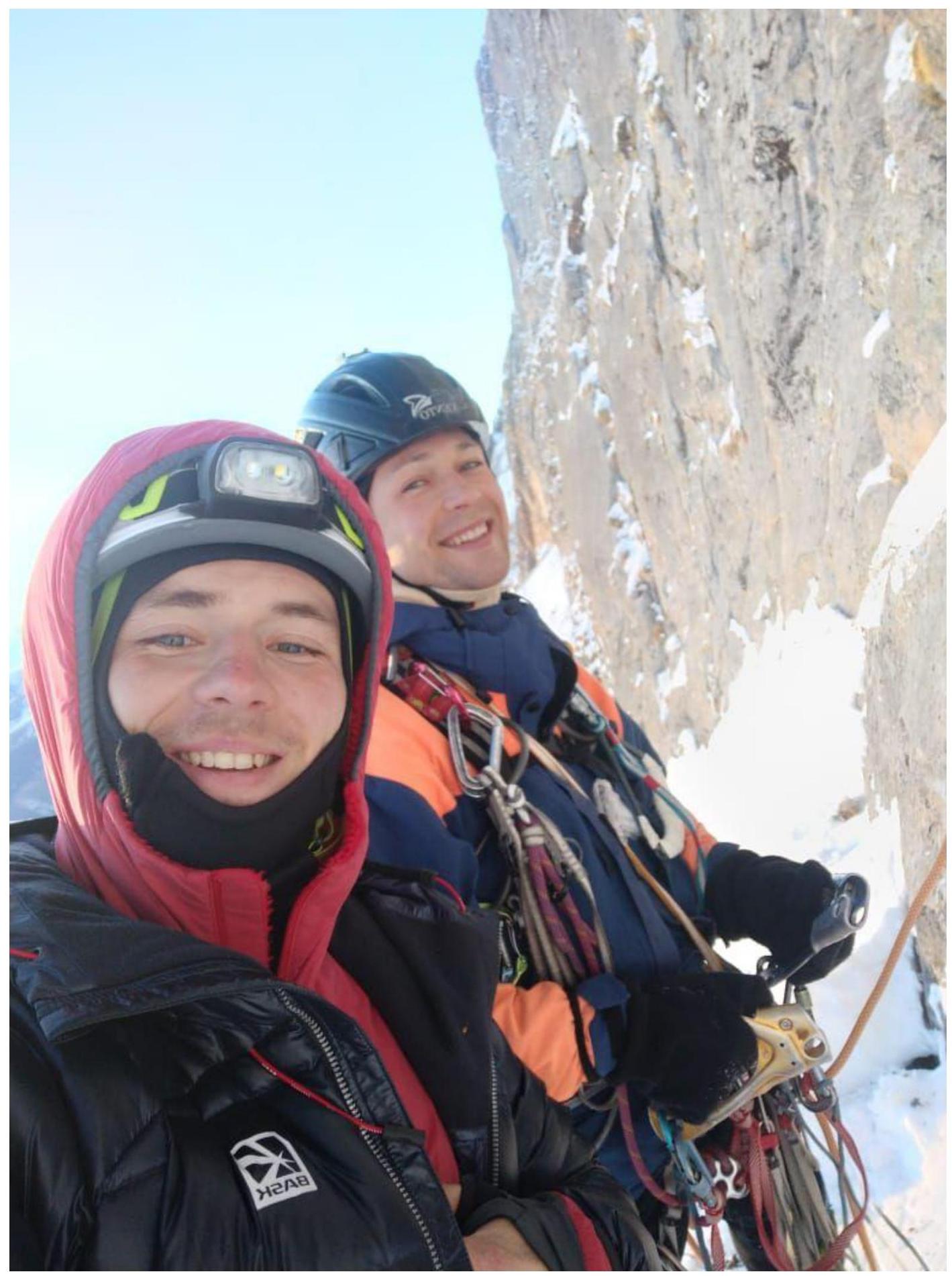
 The ascent was made in 2020 as an acclimatization sortie before the Russian Championship. Later, a team from Stavropol Krai — Rostov Oblast made a second ascent of this route in 42 walking hours, guided by our draft description and radio consultations. We completed the route without prior reconnaissance, with one overnight on a platform and using a simultaneous movement scheme. The chosen route line passes left of the Kurochkin route (2), and the final sections of the wall part coincide due to the logical nature of the terrain with the Kurochkin route. After the overnight, Ratmir's insulated jumper was discarded from the route. He also shamelessly lost the draft route description compiled by the team since 2020, but forward-thinking ascent participants had photographed the draft.
P. S. – We do not recommend Ratmir as an ascent leader.
The ascent was made in 2020 as an acclimatization sortie before the Russian Championship. Later, a team from Stavropol Krai — Rostov Oblast made a second ascent of this route in 42 walking hours, guided by our draft description and radio consultations. We completed the route without prior reconnaissance, with one overnight on a platform and using a simultaneous movement scheme. The chosen route line passes left of the Kurochkin route (2), and the final sections of the wall part coincide due to the logical nature of the terrain with the Kurochkin route. After the overnight, Ratmir's insulated jumper was discarded from the route. He also shamelessly lost the draft route description compiled by the team since 2020, but forward-thinking ascent participants had photographed the draft.
P. S. – We do not recommend Ratmir as an ascent leader.
- The route features sections with broken terrain. Communication with the base camp via VHF radio station is stable. Visual observation from the base camp is possible. Descent is via a 2B category route.
6. Weather Conditions
4.1. Confirmation of data mentioned in the Ascent Passport with weather forecast screenshots from websites:
On this photo, the route is drawn with a faint yellow line, but the entire terrain is clearly visible.
Under the route
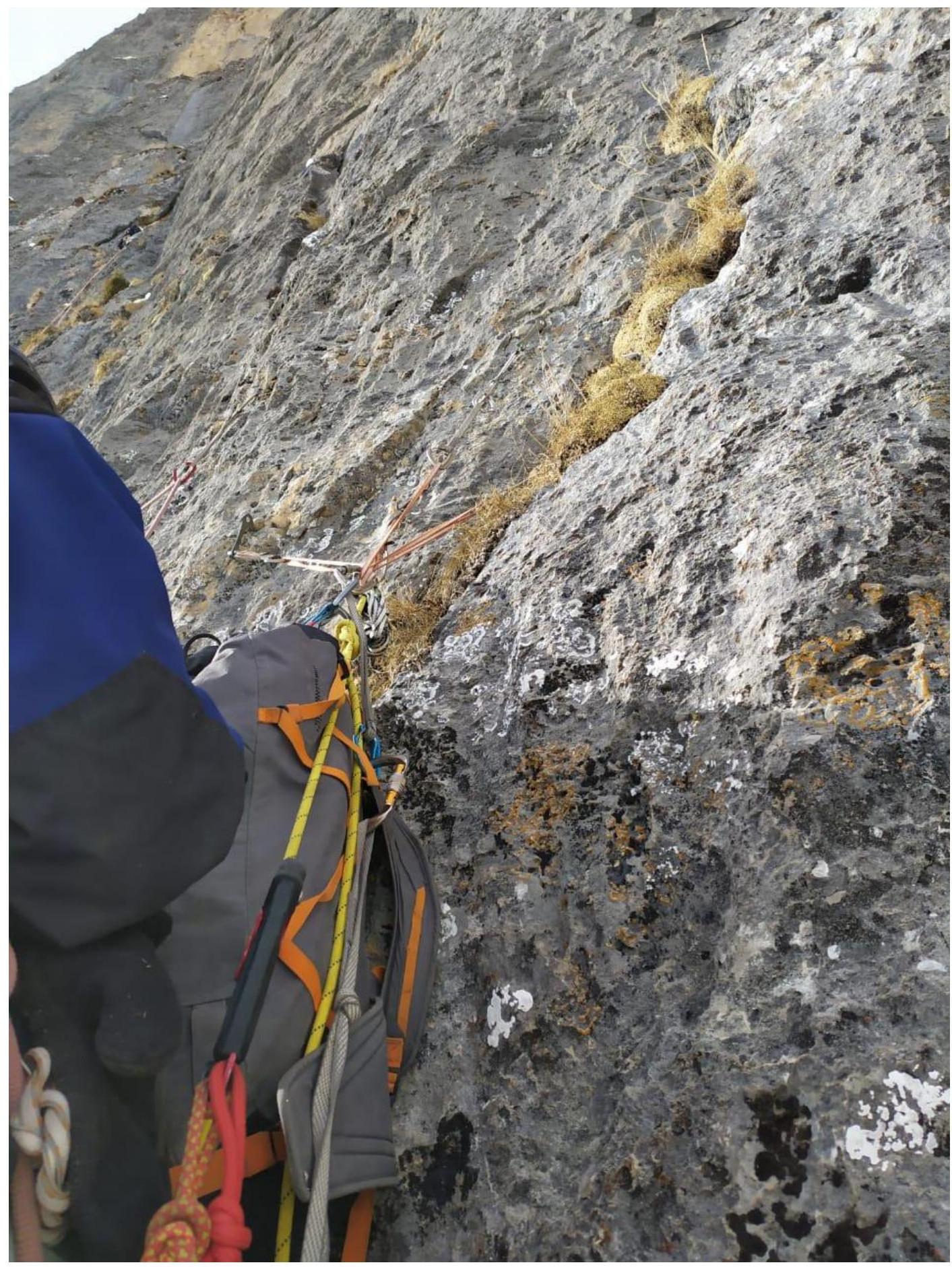
Photo 1 — R4–R5
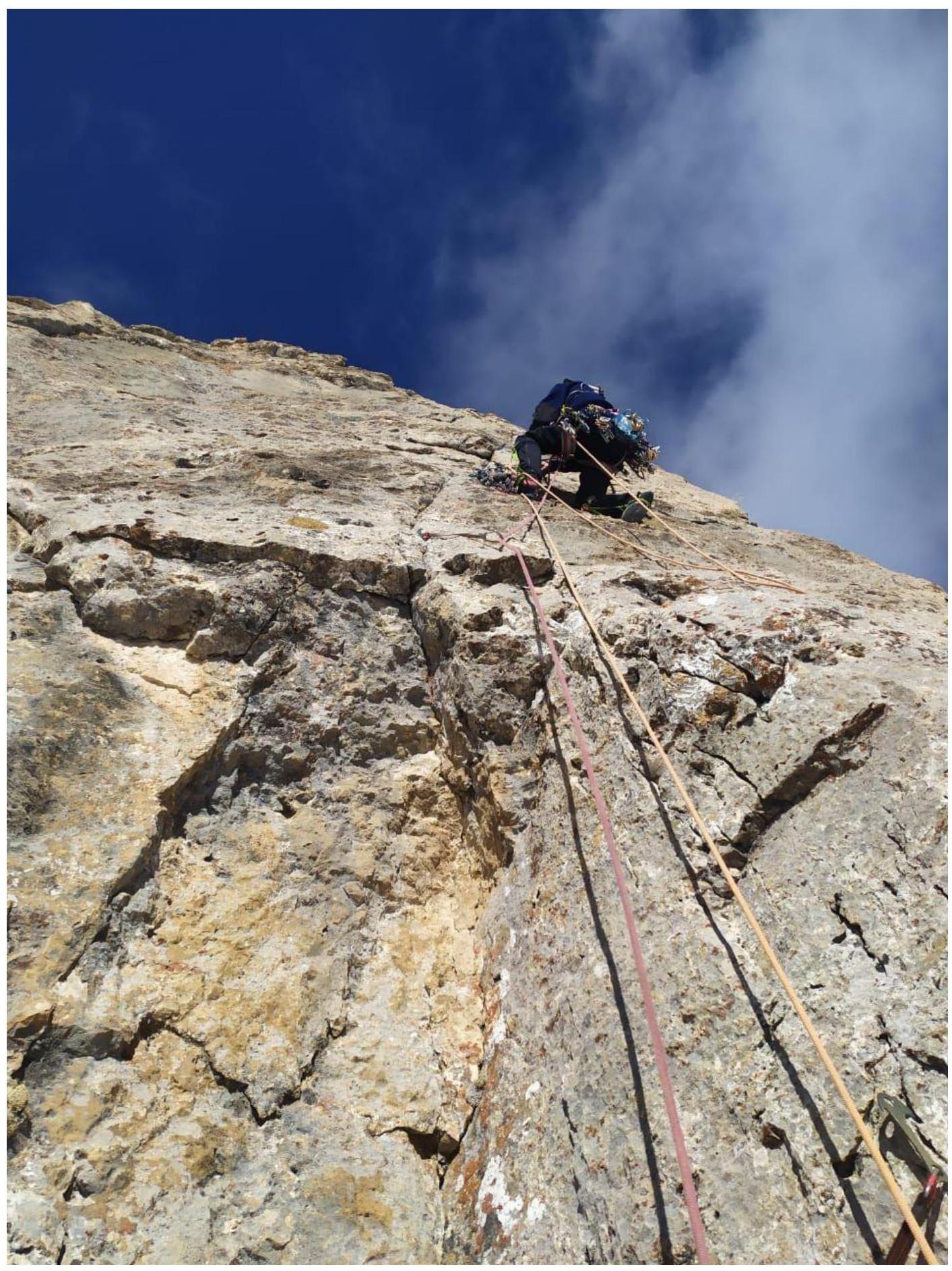
Photo 2 — R8–R9
After overnight, Photo 3 — R10–R11
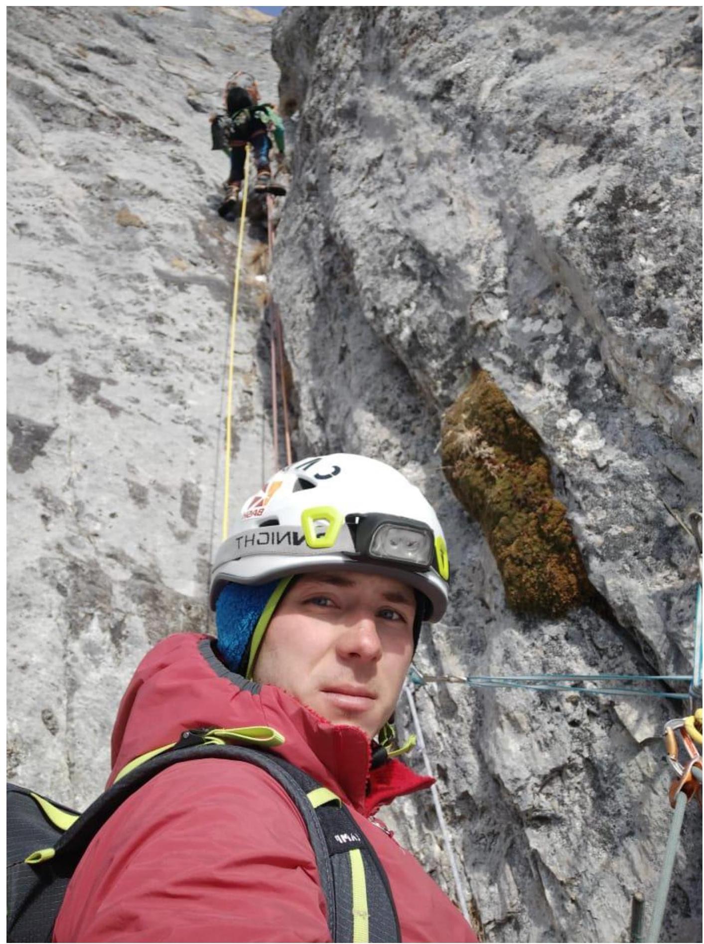
Photo 4 — R12–R13
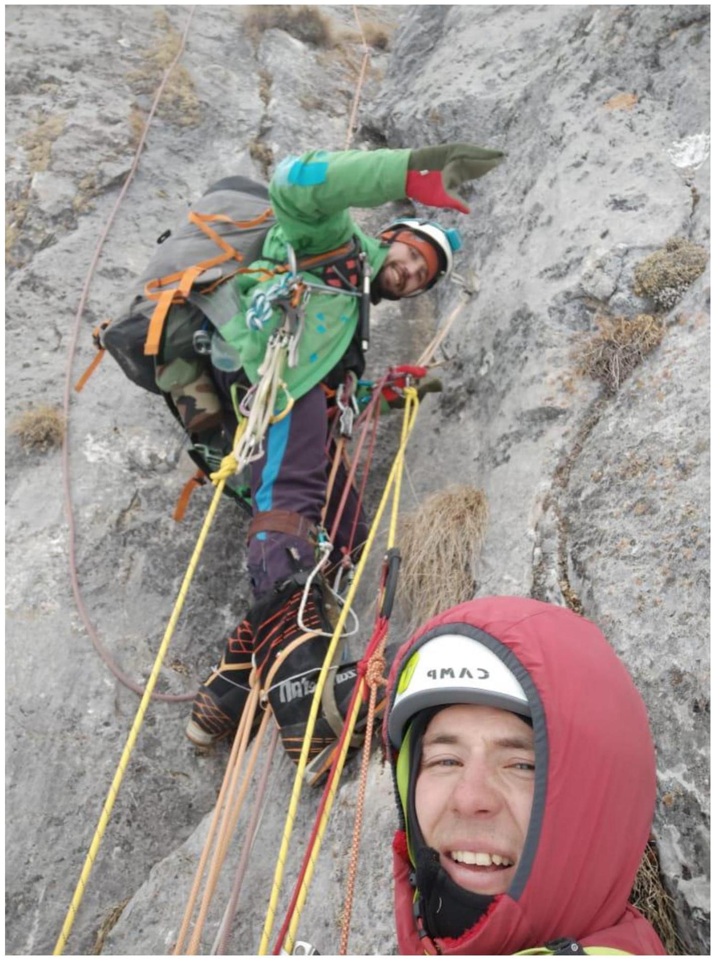
Photo 5 — R13–R14
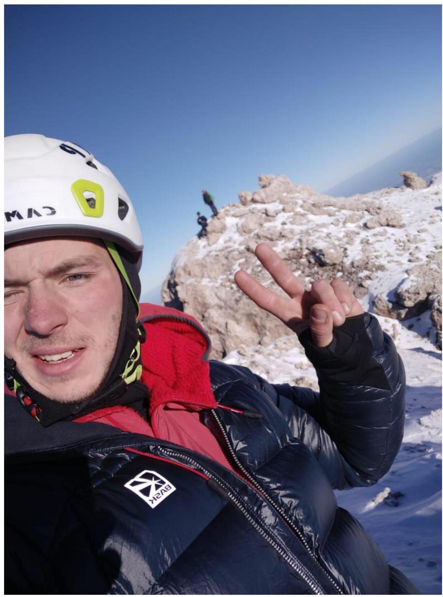
Photo 6 — Summit
14.12.2022