REPORT ON THE FIRST ASCENT TO THE SUMMIT BASHNYA 2930 m VIA THE SOUTHEAST RIDGE, CATEGORY 2A BY THE GSK UAL TEAM DATED MAY 11, 2024
I. Ascent Passport
| № | 1. General Information | |
|---|---|---|
| 1.1 | Full name, sports rank of the team leader | Chikin Artem Borisovich CMS |
| 1.2 | Full name, sports rank of the participants | Bautin Alexey 3rd sports rank, Ismagilov Anton 3rd sports rank, Larina Valeria 3rd sports rank |
| 1.3 | Full name of the coach | Yakovenko A.N. |
| 1.4 | Organization | GSK UAL |
| 2. Characteristics of the Ascent Object | ||
| 2.1 | Area | 2.9 from Krestovy Pass to Shaviklde summit |
| 2.2 | Valley | Armkhi |
| 2.3 | Section number according to the 2013 classification table | |
| 2.4 | Name and height of the summit | Bashnya, 2930 m |
| 2.5 | Geographic coordinates of the summit (latitude/longitude), GPS coordinates | 42°51′4″ N. Lat. 44°48′48″ E. Long. |
| 3. Characteristics of the Route | ||
| 3.1 | Name of the route | Bashnya via the SE ridge |
| 3.2 | Proposed category of difficulty | 2A |
| 3.3 | Degree of route exploration | First ascent |
| 3.4 | Nature of the route relief | Rock climbing |
| 3.5 | Height difference of the route | 750 meters — total |
| 3.6 | Length of the route (in meters) | 585 m |
| 3.7 | Technical elements of the route | I—II category rock — 400 m. III category rock — 150 m. IV category rock — 35 m. Dülfer descent (on descent) — (30–40 m) |
| 3.8 | Descent from the summit | 400 meters via non-categorized ridge and 30 m dülfer to overnight stays at Jarlam Pass |
| 3.9 | Additional characteristics of the route | No water on the route, a site available on the pre-summit ridge |
| 4. Characteristics of the Team's Actions | ||
| 4.1 | Time of movement | 6 hours 0 minutes, 1 day |
| 4.2 | Overnight stays | None |
| 4.3 | Departure on the route | 4:30 AM May 11, 2024 |
| 4.4 | Arrival at the summit | 10:30 AM May 11, 2024 |
| 4.5 | Return to the base camp | 2:00 PM May 11, 2024 |
| 5. Person Responsible for the Report | ||
| 5.1 | Full name, e-mail | Chikin Artem Borisovich artem.chikin@mail.ru |
II. DESCRIPTION OF THE ASCENT
1. Characteristics of the Ascent Object
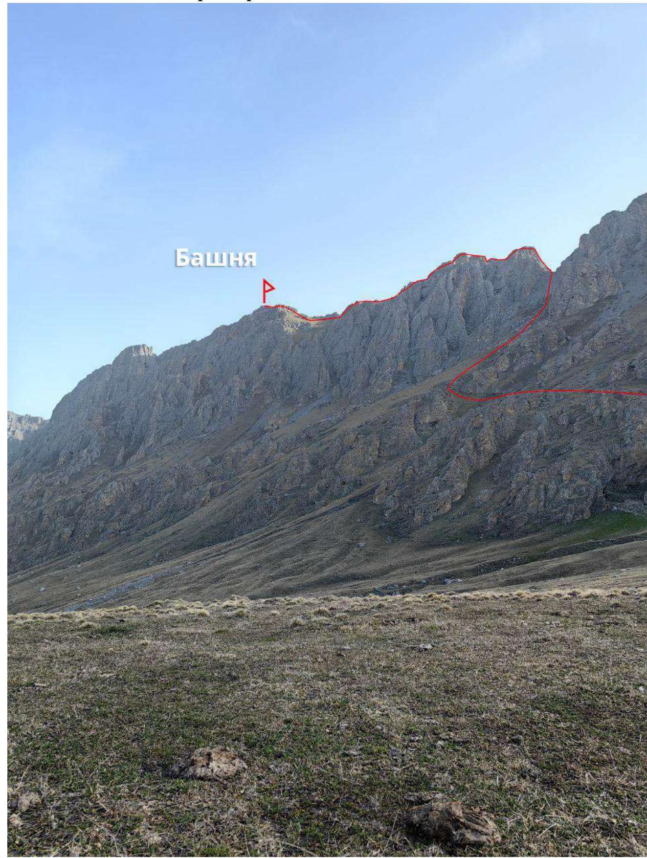
1.1. General photo of the summit.
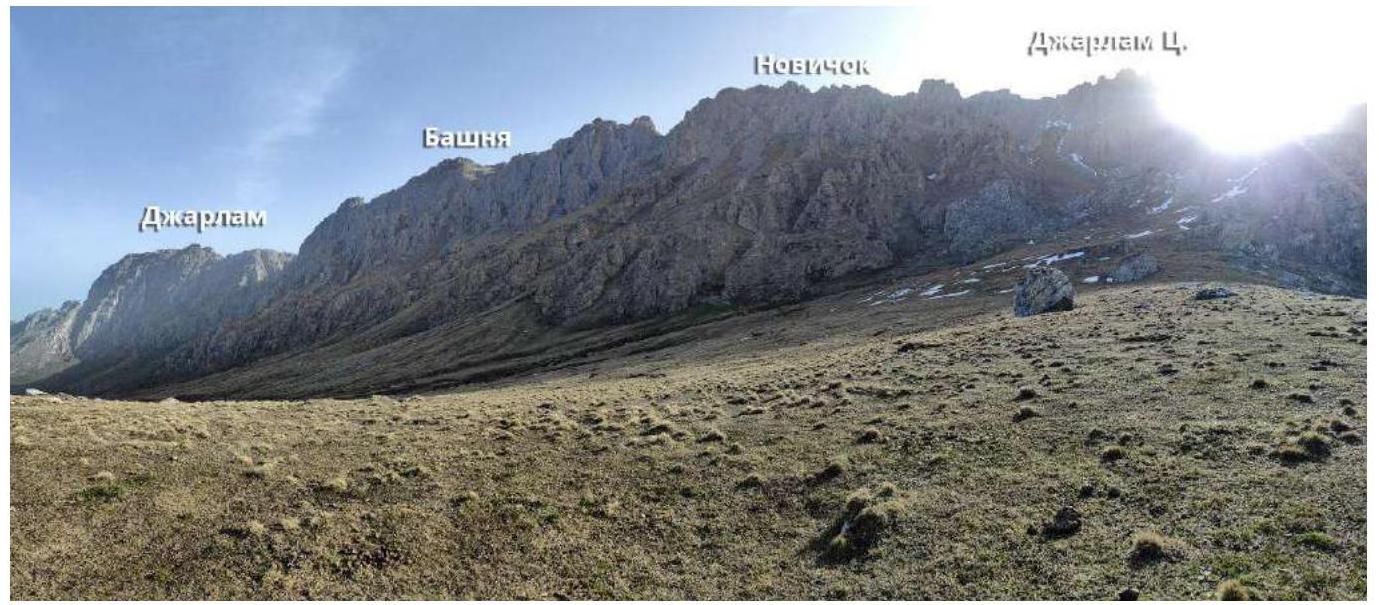
1.3. Photopanorama of the area.
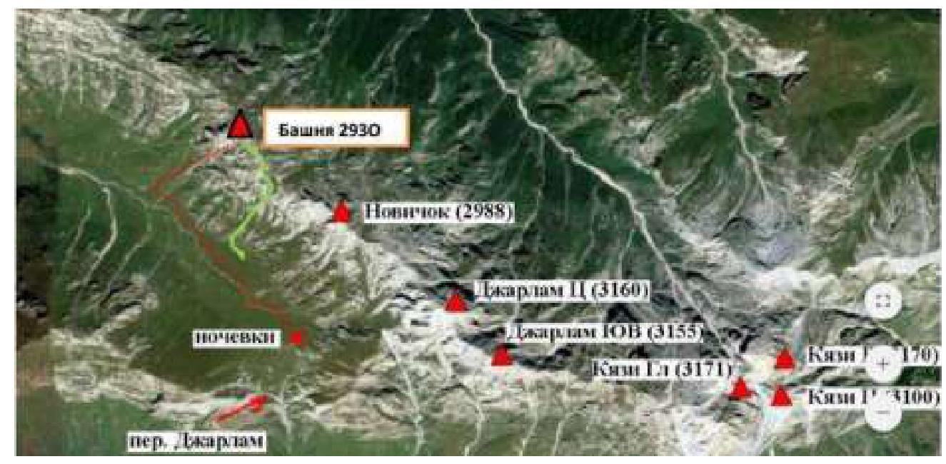
1.4. Map of the area
2. Characteristics of the Route
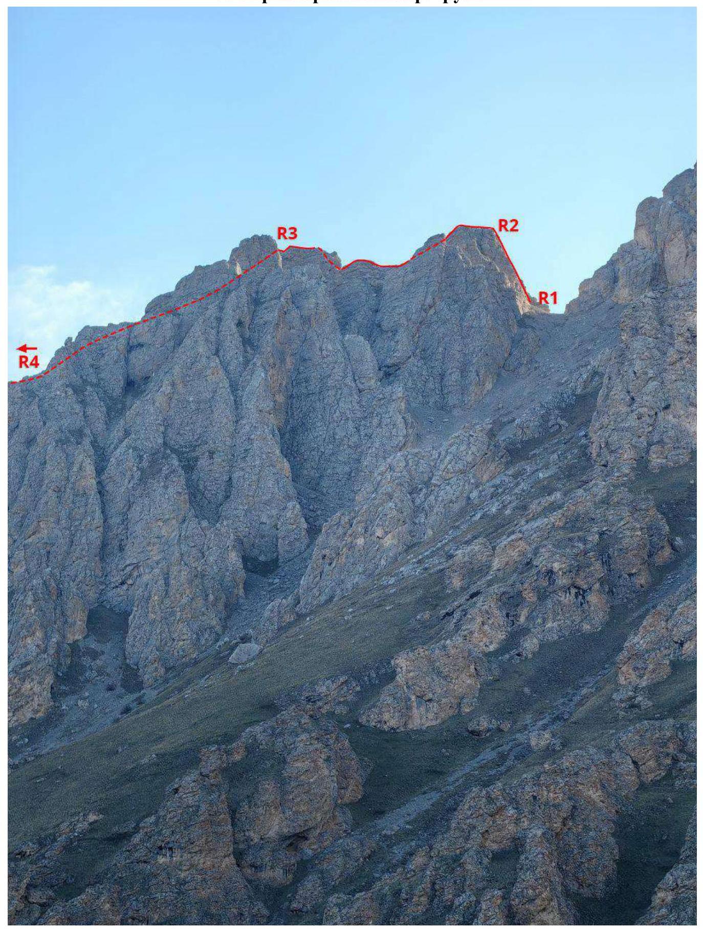 2.1. Technical photograph of the route.
2.2. Technical characteristics of the route sections.
2.1. Technical photograph of the route.
2.2. Technical characteristics of the route sections.
| Section № | Nature of relief | Category of difficulty | Length, m | Type and number of anchors |
|---|---|---|---|---|
| R0–R1 | Grassy slope, scree | Non-categorized | 900 | 0 |
| R1–R2 | Rock climbing | 4 | 35 | 3 anchors, 1 friend |
| R2–R3 | Ridge | 3 | 150 | 1 anchor, 2 friends, ledges |
| R3–R4 | Ridge | 1–2 | 400 | ledges |
3. Characteristics of the Team's Actions
| Section № | Description | Photo № |
|---|---|---|
| R0–R1 | From Jarlam Pass via standard overnight stays, passing the grotto, across the slope with a gain in height towards the saddle between the Bashnya ridge and Novichok peak. | 1 |
| R1–R2 | From the saddle slightly upwards. The ridge starts with a wall of reddish color, the key to the route. Climbing through internal corners and via a small chimney at the end, exit onto a scree-covered ledge (live rocks). Station on a ledge. Control point! | 2 |
| R2–R3 | Along the ridge downwards, then along the flat section and bypassing a large boulder on the right, descend to the next jandarm, climb onto it, along the ridge and descend into a couloir, exit onto grassy areas of the ridge. Belaying via ledges and some protection points — anchors, friends. Simultaneous and alternating movement possible. | 3, 4, 5 |
| R3–R4 | Along the grassy slope, between large boulders and along the rocky ridge to the summit. Simultaneous belaying. | 7 |
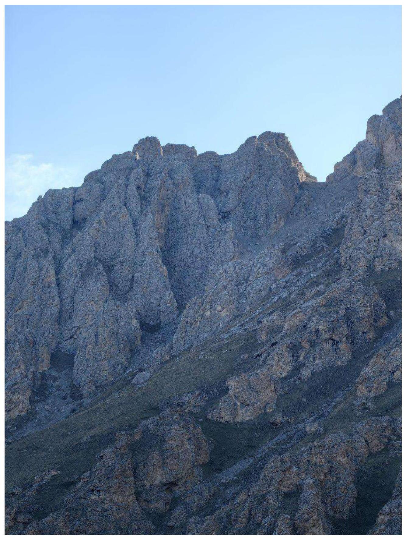 Photo 1. Section R0–R1
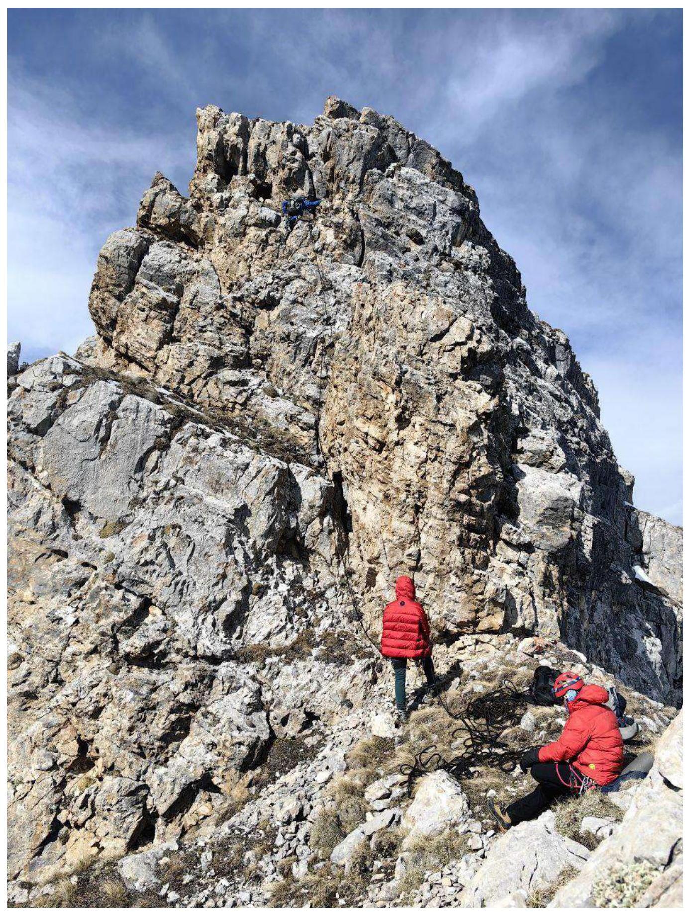 Photo 2. Section R1–R2
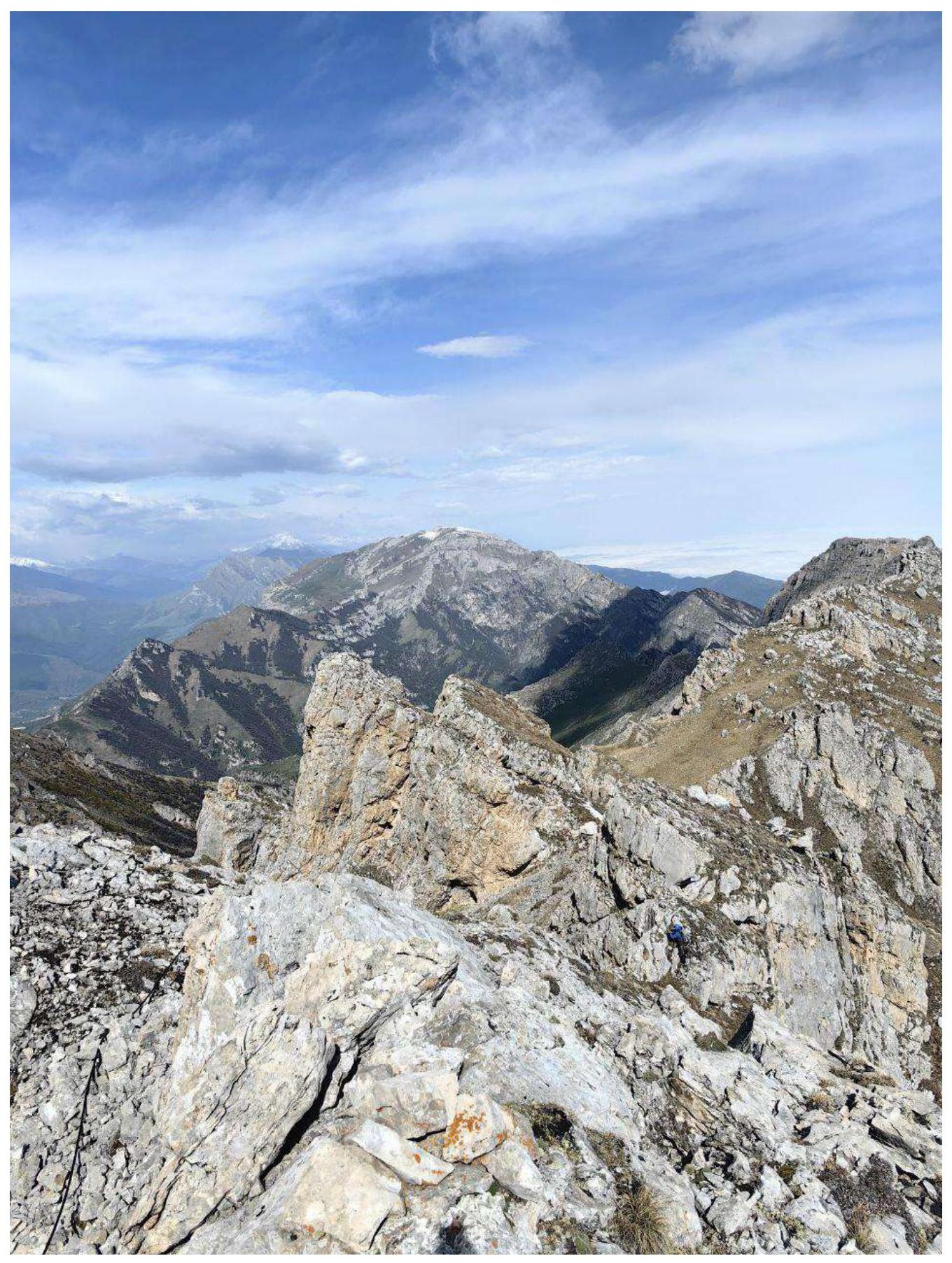 Photo 3. Section R2–R3. At the control point.
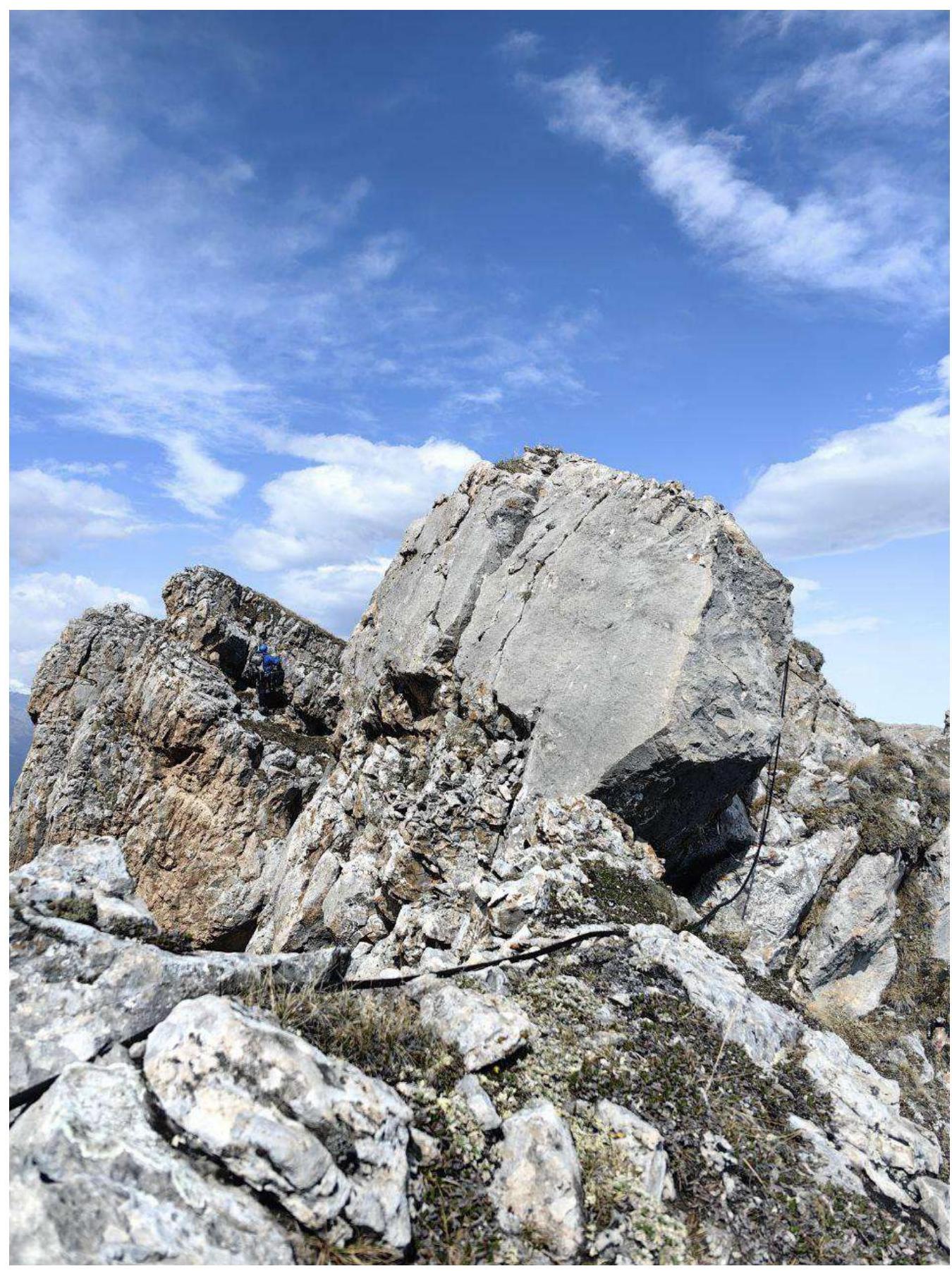 Photo 4. Section R2–R3. Bypassing a boulder and exit to the last jandarm.
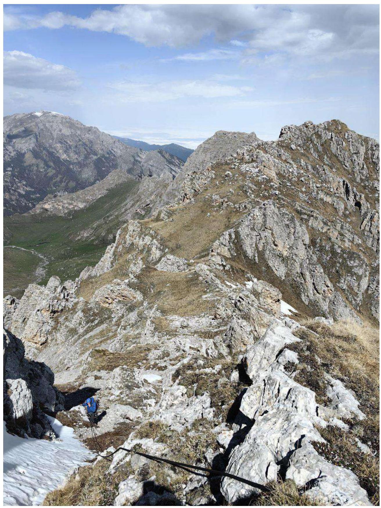 Photo 5. Section R2–R3. Descent onto grassy areas of the ridge.
 Photo 6. Section R3–R4
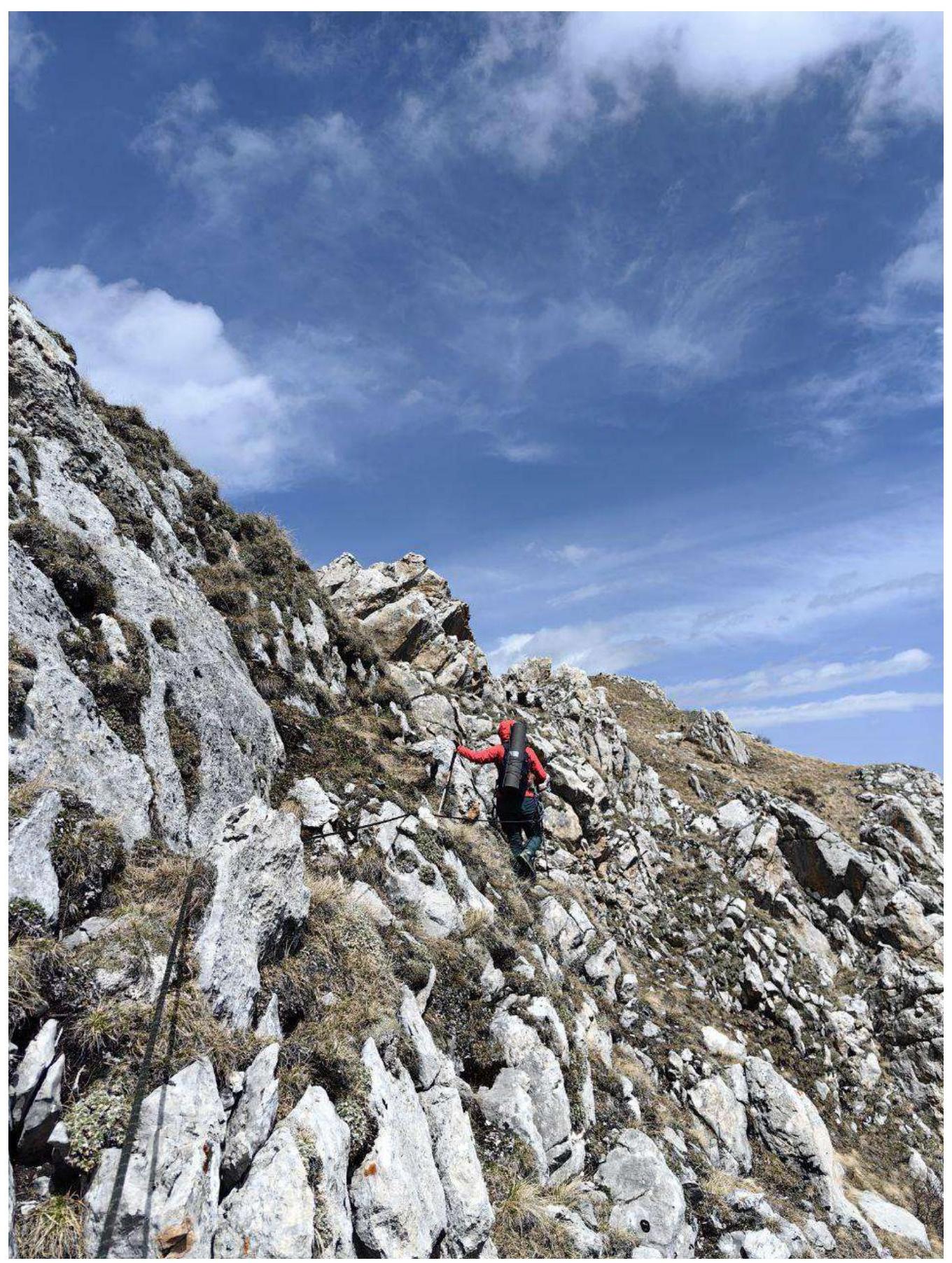 Photo 7. Section R3–R4
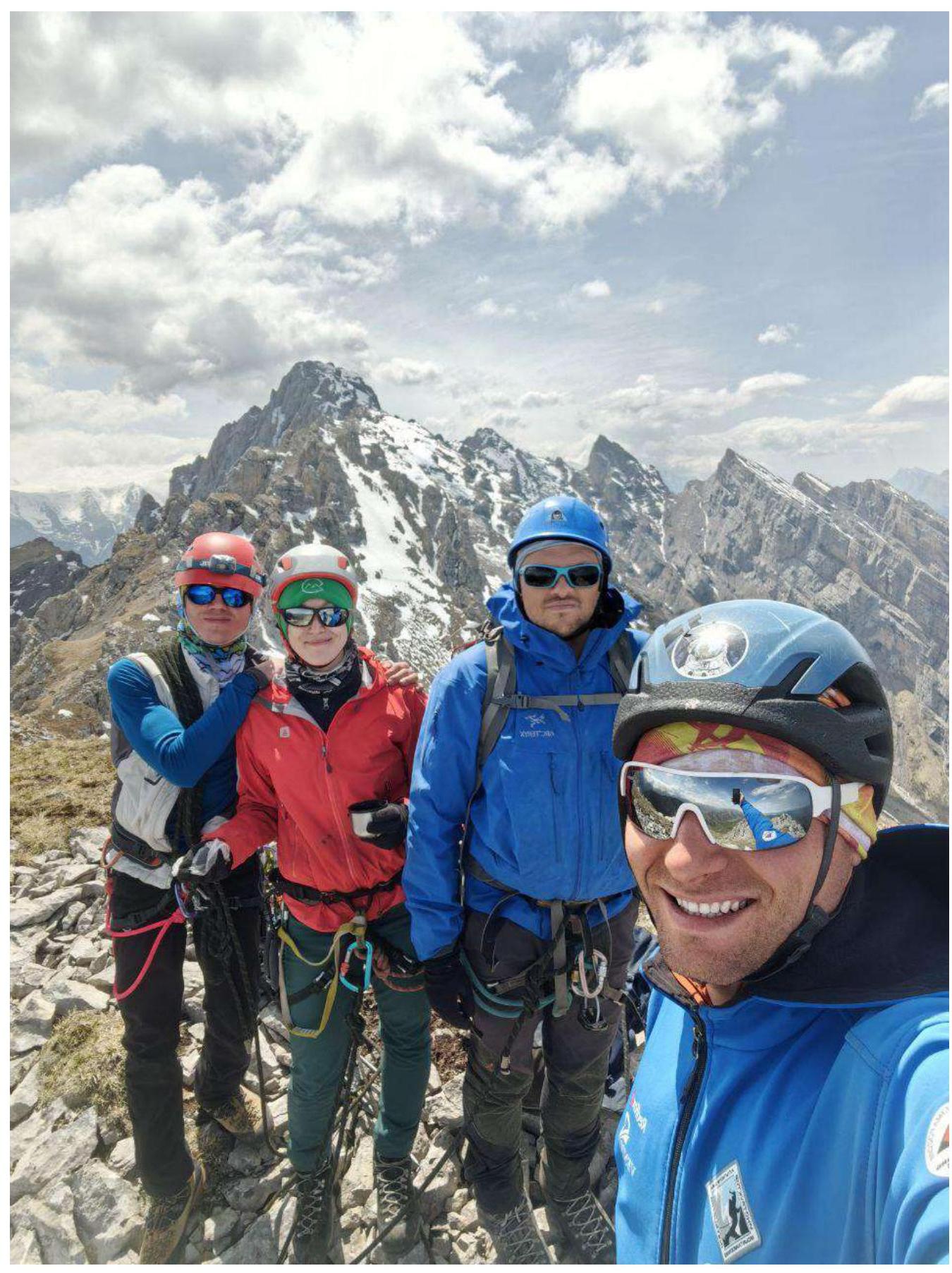 Photo 8. Team on the summit.
The route is logical, and movement with alternating and simultaneous belaying is well-practiced. On the ledge at the end of the first rope, there are live rocks, so caution is necessary.
The descent from the route is straightforward: from the summit along the ridge to the south (towards Novichok peak) into a scree-filled couloir with a 30–40 m dülfer.
Communication from the route to the "Kyazi" camp is available via radio.
Compared to other routes in the area, we assess this route as a good category 2A.