
Climbing Report on Tsey-Loam (Kyazi) Peak via the Center of the South Face, Category 5B, by the Team from Alania, Vladikavkaz, from 8:00 AM on November 8, 2021, to 5:00 PM on November 9, 2021
| 1. General Information | ||
|---|---|---|
| 1.1 | Full Name, Sports Rank of the Team Leader | Chikin Artem Borisovich, 2nd sports rank |
| 1.2 | Full Names, Sports Ranks of the Participants | Leontyeva Evgeniya Andreevna, 2nd sports rank, Golobokov Maxim Gennadyevich, 1st sports rank, Koklin Dmitry Alexandrovich, 2nd sports rank |
| 1.3 | Full Name of the Coach | Ryzhanov Oleg Nikolaevich |
| 1.4 | Organization | ASC "Kaskad" |
| 2. Characteristics of the Climb | ||
| 2.1 | Region | Caucasus |
| 2.2 | Area | From the Krestovy Pass to the Shaviklde Peak |
| 2.3 | Section Number according to the 2013 Classification Table | 2.9. |
| 2.4 | Name and Height of the Peak | Tsey-Loam (Kyazi), 3171 m |
| 3. Route Characteristics | ||
| 3.1 | Route Name | via the center of the S wall (A. Kurochkin, 1983) |
| 3.2 | Proposed Category of Difficulty | 5B |
| 3.3 | Degree of Route Exploration | – |
| 3.4 | Relief Characteristics of the Route | rocky |
| 3.5 | Height Difference of the Route | 640 m |
| 3.6 | Length of the Wall Climbing Part of the Route | 720 m |
| 3.7 | Technical Elements of the Route | IV cat. diff. – 140 m, V cat. diff. – 395 m, VI cat. diff. – 85 m |
| 3.8 | Average Steepness of the Route, ° | – |
| 3.9 | Average Steepness of the Wall Climbing Part, ° | 70° |
| 3.10 | Descent from the Summit | 2A |
| 3.11 | Additional Route Characteristics | No water available, carried with them |
| 4. Characteristics of the Team's Actions | ||
| 4.1 | Time of Movement (in climbing hours, indicated in hours and days) | 14 h 20 min, 2 days |
| 4.2 | Overnight Stays | One overnight stay. On karamats and sleeping bags on a small shelf |
| 4.3 | Time Spent on Route Preparation | Without preparation |
| 4.4 | Start of the Route | 8:30 AM on November 8, 2021 |
| 4.5 | Summit Ascent | 12:20 PM on November 9, 2021 |
| 4.6 | Return to the Base Camp | 3:30 PM on November 9, 2021 |
| 5. Weather Conditions | ||
| 5.1 | Temperature, °C | From 0° to +15°C |
| 5.2 | Wind Speed, m/s | Moderate, 1–4 m/s |
| 5.3 | Precipitation | None |
| 5.4 | Visibility, m | Good, 10,000 m |
| 6. Responsible for the Report | ||
| 6.1 | Full Name, e-mail | Chikin A.B. artem.chikin@mail.ru |
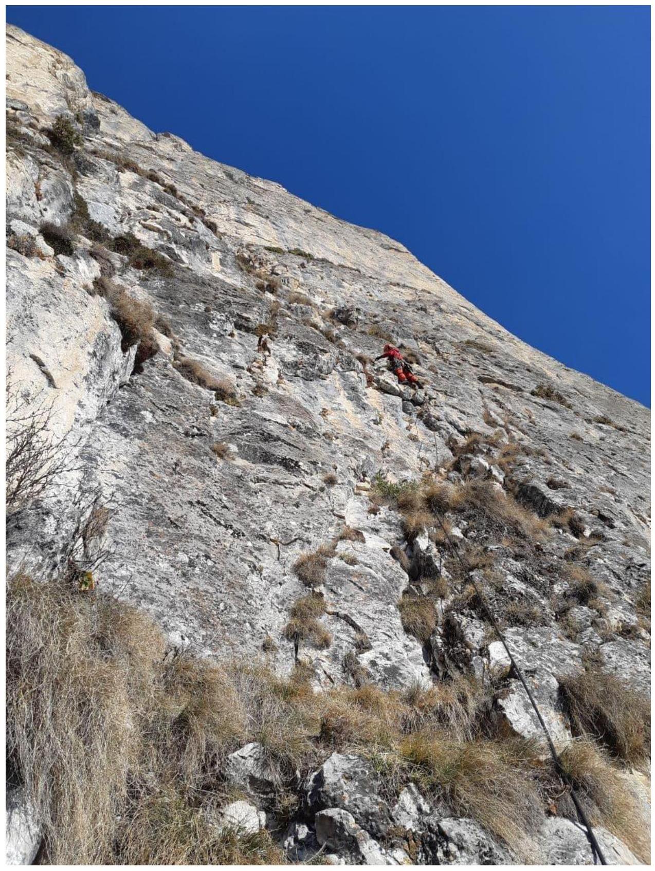
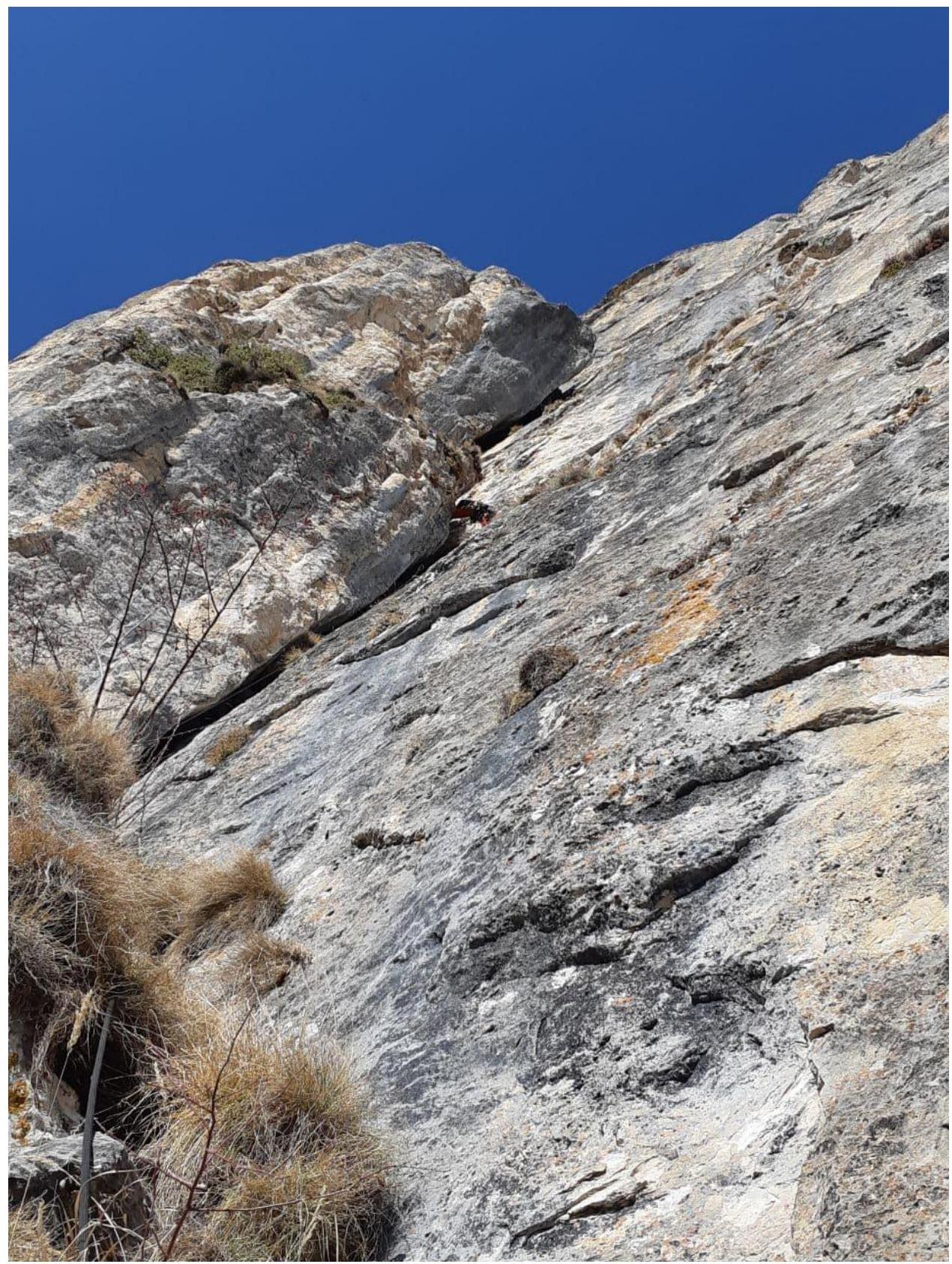
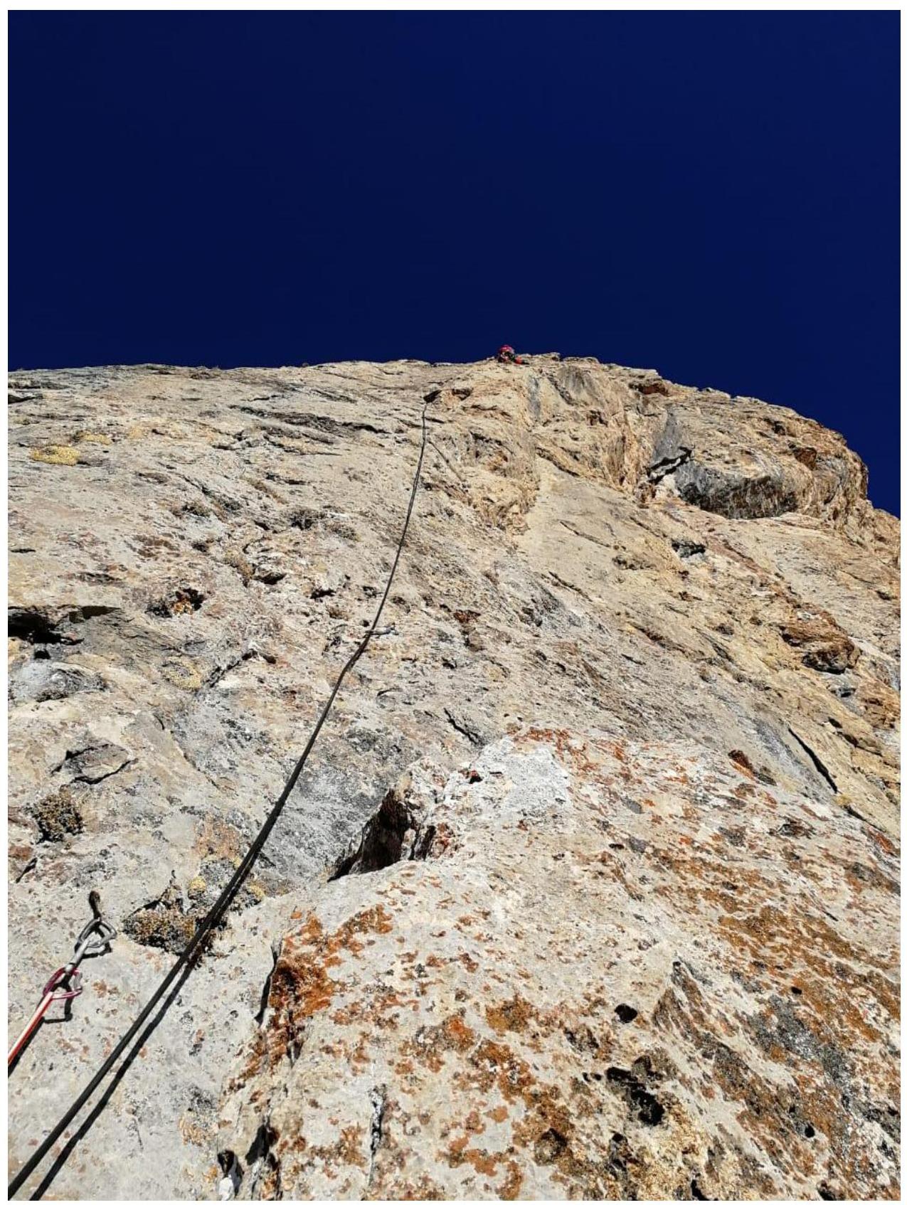
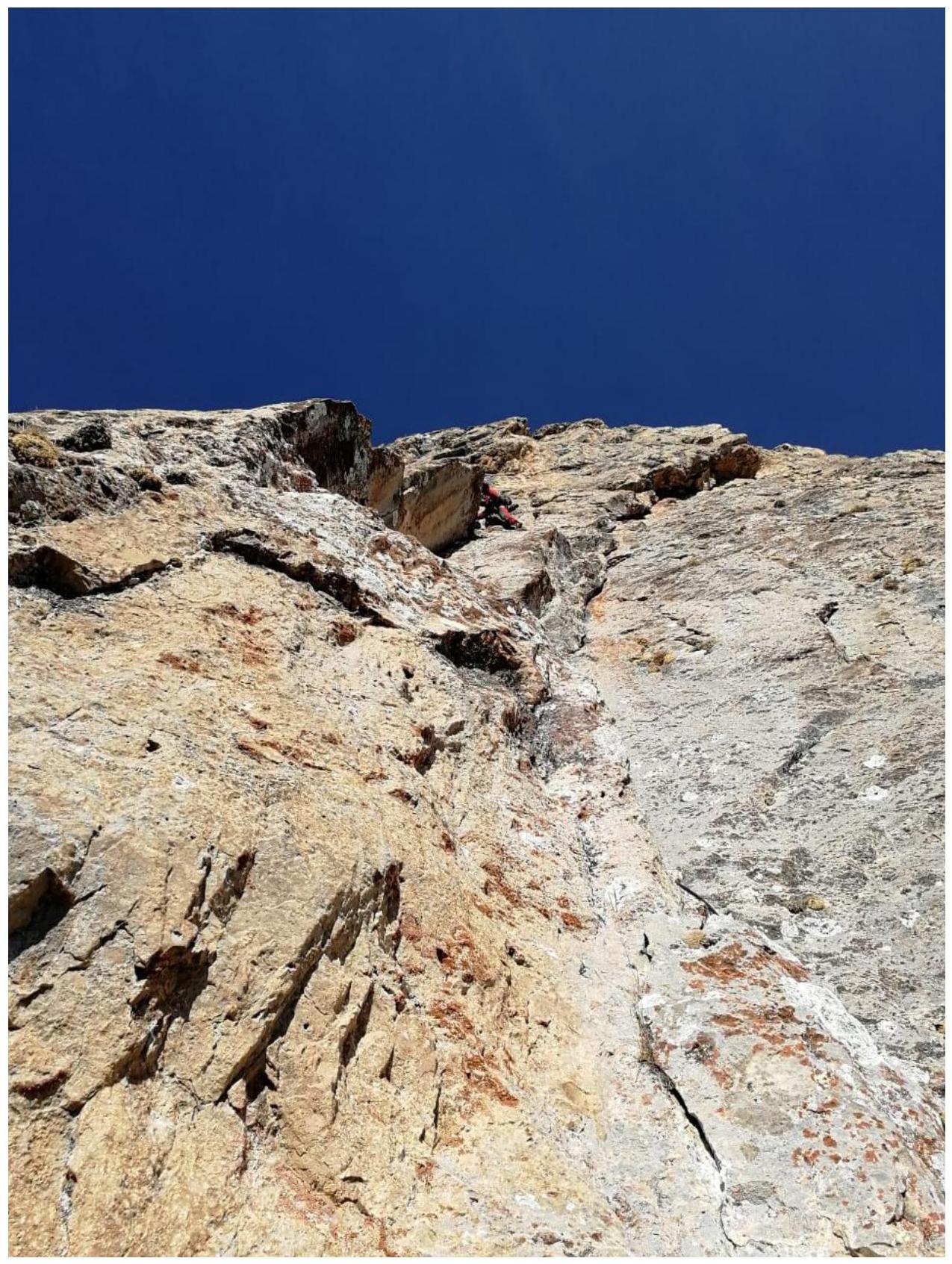
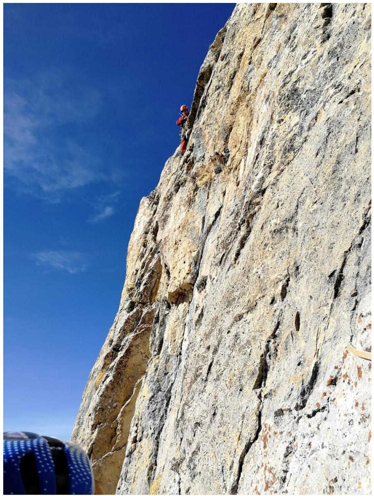
Technical photograph of the route
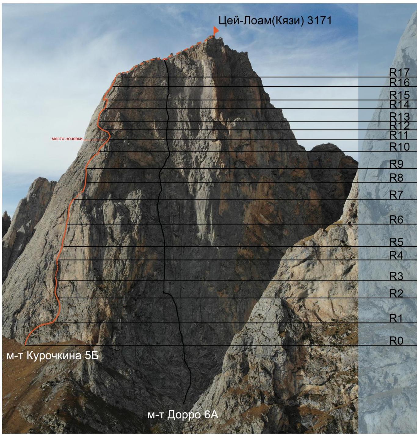
Photograph by Nadezhda Oleneva
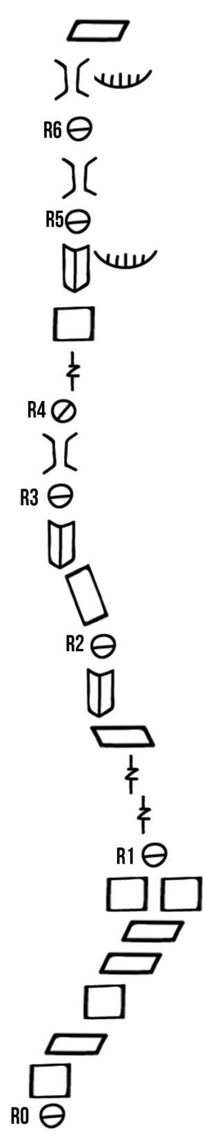
UIAA Scheme
R14
Θ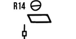 □
R13
Θ
□
R13
Θ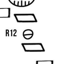 □
R12
Θ
□
R12
Θ □
R11
Θ
□
R11
Θ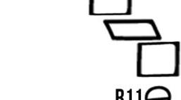 □
R10
Θ
□
R10
Θ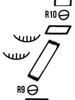 R15
Θ
R15
Θ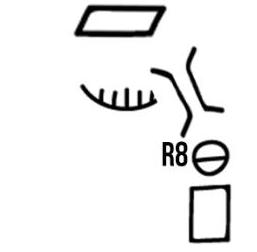 □
R17
Θ
□
R17
Θ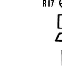 □
R16
Θ
□
R16
Θ □
R15
Θ
□
R15
Θ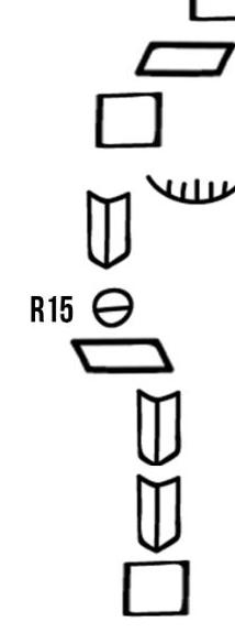
Route Description
R0–R1
50 m + 15 m 60° III+ / I–. Approach to the wall. Walls with grassy ledges. Belays with anchors and juniper. Traverse 15 m 0° I–.
R1–R2
50 m. IV–47 m, V–3 m 80°. Destroyed wall, station on a ledge, 15 m short of a crack.
R2–R3
35 m. 15 m. 45° III. Approach to an off-width crack. 15 m. 70° V, 5–VI, f6b. Crack, belays with anchors, on station with a hook.
R3–R4
35 m. 80° V, f5c+. Climb a chimney to a ledge between the wall and a spall. Possible overnight stay, station on a block.
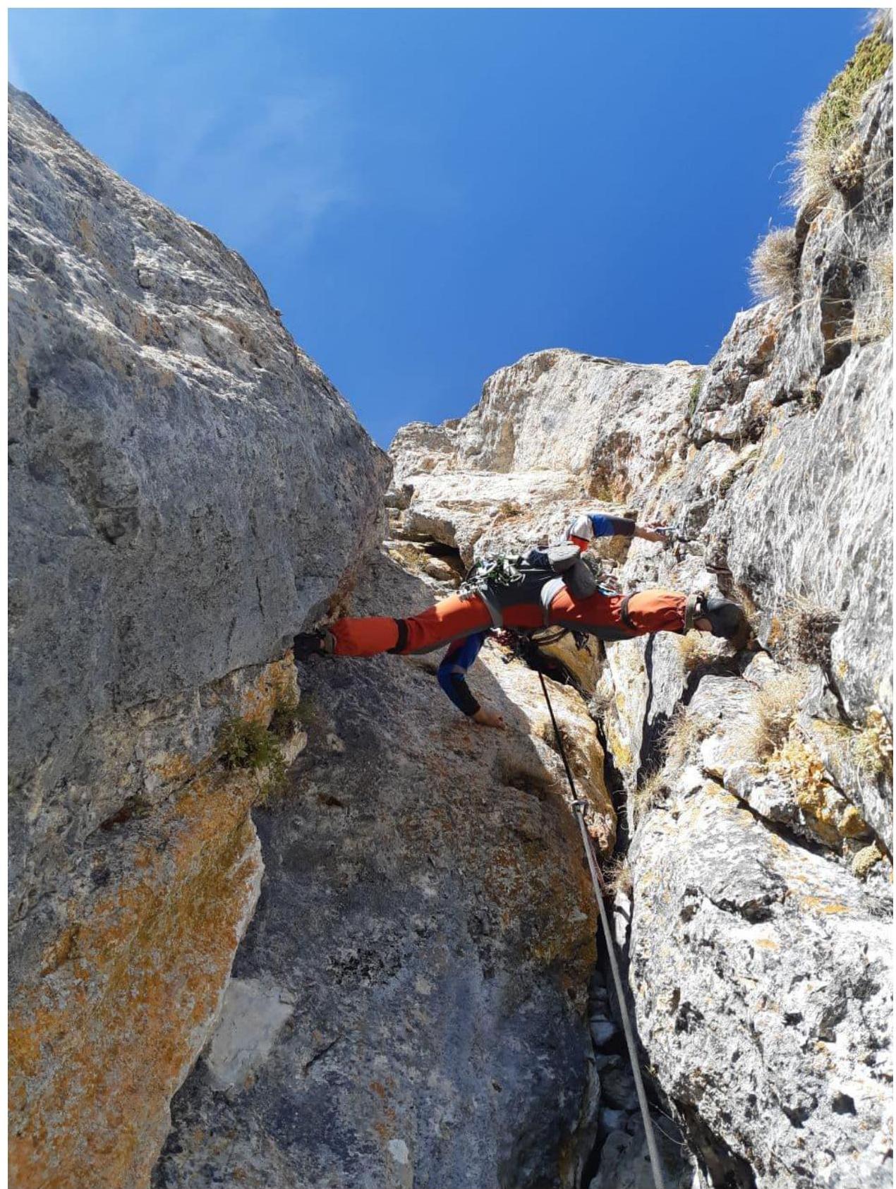
R4–R5
30 m. 80° V, f5b. Crack-slab, transitioning into an internal corner. 10 m. 85° VI, f6a. Climb the corner through an overhang to a station.
R5–R6
50 m. 75° V+. Climb a wide chimney. 3 m VI, f6a+. Narrow section of the chimney.
R6–R7
50 m. 75° IV–V+. Climb a wide chimney to the top of the spall. Convenient ledge for an overnight stay.
R7–R8
f5c. 45 m. 65° V. Climb a chimney to a large ledge, then up a wall and right of an overhanging rock into a chimney.
R8–R9
45 m. 80° IV–VI A1. In the chimney, a hook. Then, AID on bolts and fifi hooks, one move on a skyhook after the first bolt. After the chimney, exit to a ledge, top of the spall.
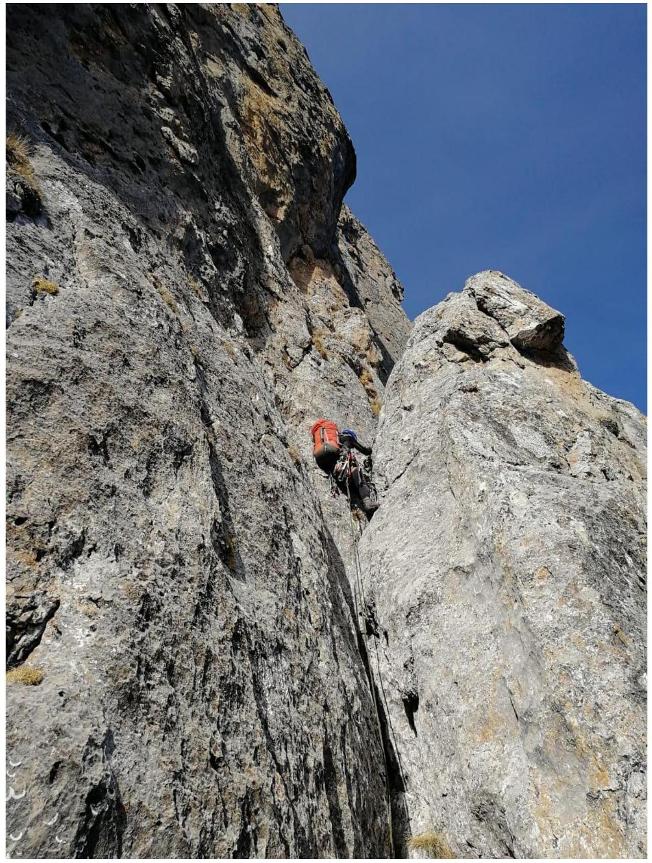
R9–R10
55 m. 65° V–. Right up the wall, bypassing an overhang on the right. Station on a large ledge.
R10–R11
30 m. 70° V, f5b. Climb a lying wall and a crack left of it, then up to a large grassy ledge. Station on a protruding pyramid.
R11–R12
35 m. 60° III+. Climb from the pyramid to a grassy ledge. Then, traverse left on ledges with walls. Possible overnight stay in a normal grotto just above the climbing line.
R12–R13
20 m. 70° IV. Traverse left on a ledge, to the left internal corner, climb onto a spall.
R13–R14
50 m. 75° V–VI A1. From the spall, AID about 10 m up and left (there is a lug) to an internal corner. Climb the corner f5c up, the corner ends in an overhang, right of it. Then, traverse right on AID and at the end, climb to a ledge.
R14–R15
30 m. 75° V–VI f6a+. From the station, up to the base of the leftmost, rusty internal corner. Then, climb the corner to a narrow ledge, station in the middle of the narrow ledge.
R15–R16
20 m. 70° V+, f5c. Traverse left on a ledge to an internal corner, then climb the corner to an overhang. Then, left to simple rocks. 30 m. 60° IV. Continue up to a convenient ledge.
R16–R17
50 m. 60° IV–V. Climb simple rocks to a short overhanging corner 5 m – f5c, after the corner, exit to a ridge left and find a way to pedestrian ledges on the left side of the ridge.
R18 – Summit
Climb simple rocks to scree slopes and, keeping left of the ridge, reach the summit.
Team Actions
On November 8, 2021, at 5:20 AM, the team departed from Vladikavkaz. They started working on the route at 8:30 AM. Only the leader climbed with a rope due to the heavy backpacks carried by the other team members (carrying bivouac equipment and 7 liters of water). The second participant ascended using jumar ascenders on a dynamic rope, removing protection and setting up static ropes for the other team members. At 5:00 PM, with darkness approaching, they stopped for an overnight stay at point R11. They used tourist mats, sleeping bags, and a tent tarp.
On November 9, 2021, they resumed climbing at 7:30 AM. At 12:20 PM, they reached the summit. At 3:30 PM, they descended to the KyaZi base camp via a 2A category route.
Results, Conclusions, Comments:
The mountain was chosen primarily due to the region's climatic conditions, allowing for comfortable climbing in November ("plus temperatures even at night"). The geographical location of Tsey-Loam was also a significant factor: just 1.5 hours' drive from Vladikavkaz.
When selecting a route, they leaned towards lines corresponding to approximately category 5B difficulty but with minimal AID sections. Kurochkin's route seemed logical and climbable. As it turned out, it was interesting, with a variety of chimneys and cracks, lying walls, and the use of different types of protection and AID. The first two sections were destroyed, but the rest was fairly monolithic, though somewhat dirty and covered with lichen. Orientation was not difficult; most of the climb followed chimneys and cracks, and on AID sections, they could sometimes orient themselves by the remaining hardware. Occasionally, they found ready-made stations on bolts or hooks.
They mainly used:
- anchors (about 10),
- cams (10),
- rarely — nuts.
For AID, they used:
- anchors,
- fifi hooks,
- once — a nut.
The AID was simple and reliable. The leader managed to climb all ropes free, except for sections:
- R8–R9 (first 15 m on the wall — 1 move on a skyhook, then on bolts, fifi hook, and anchors),
- R13–R14 (first 10 m AID on hooks and a bolt, then climbing an internal corner and about 15 m AID on a diagonal crack using anchors and nuts).
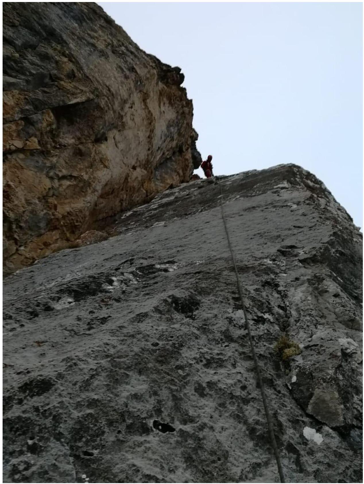
Beginning of section R0–R1
Middle of section R1–R2
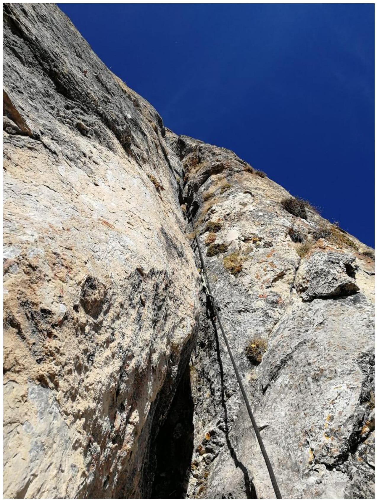
Section R2–R3
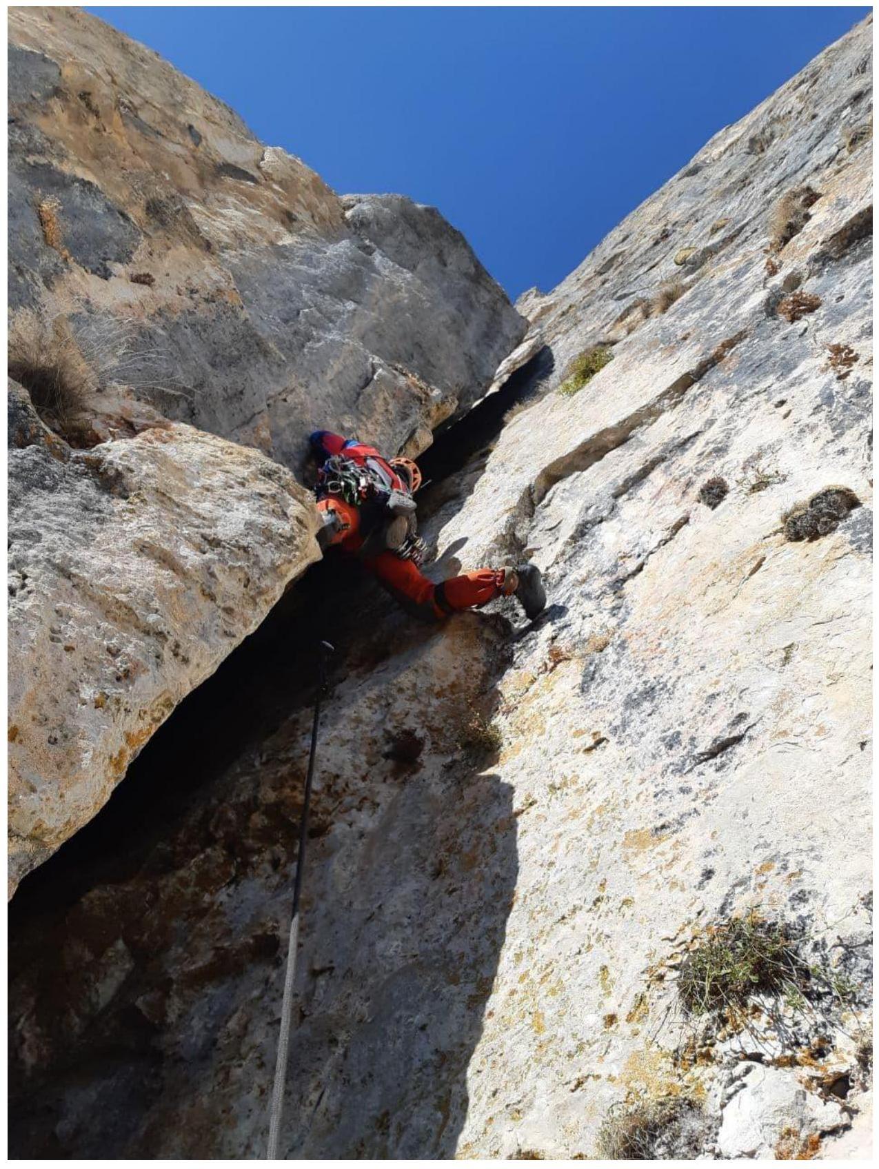
Section R3–R4

Section R4–R5
Section R5–R6
Section R6–R7
Section R7–R8

Section R8–R9
Section R9–R10
Section R10–R11
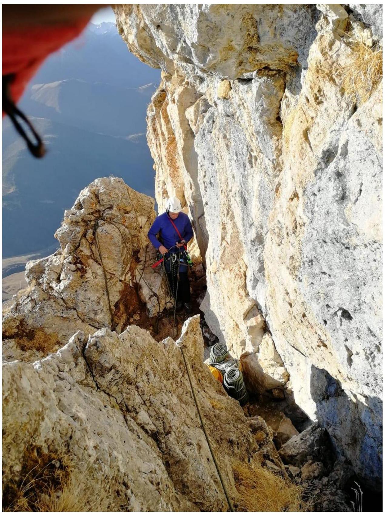
Section R11 – overnight stay location
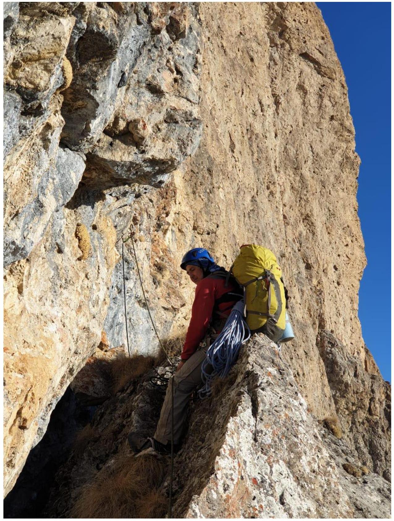
Beginning of section R11–R12
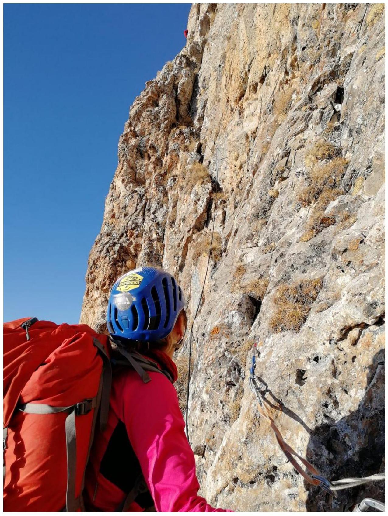
Section R12–R13
Section R13–R14
Section R14–R15
Section R15–R16

Section R16–R17
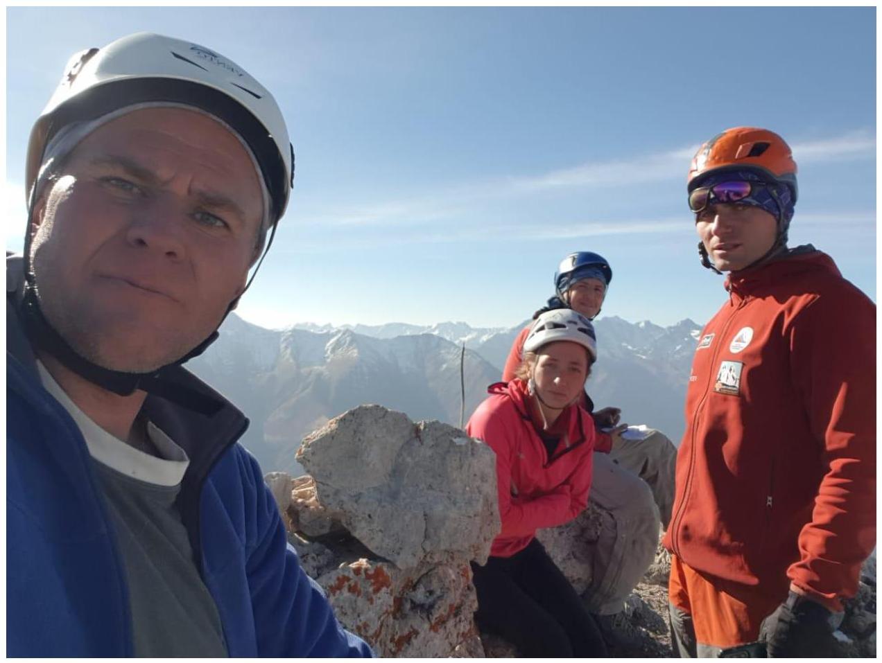
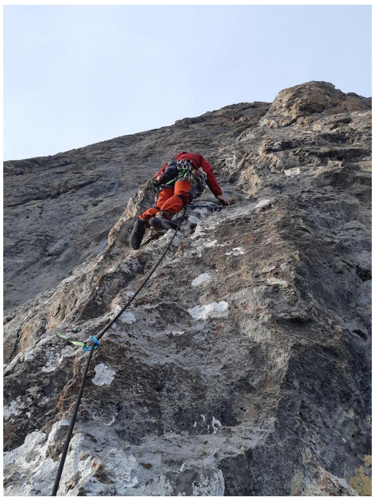
The team on the summit