Russian Mountaineering Championship 2021 Class of High-Altitude Technical Ascents.
Report
on the ascent to the summit of Tsey-Loam (Kyazi) 3171 via the route through the center of the S wall (Kurochkin's route), 5B category of difficulty by the team from Samara Region for the period from October 28 to 29, 2021.
2021 year
1. Ascent Passport
| 1. General Information | ||
|---|---|---|
| 1.1 | Team Leader. | Erokhov I.Yu. – CMS |
| 1.2 | Participants | Varlamov N.O. – CMS |
| 1.3 | Coach's Full Name | Knyazeva M.A. |
| 1.4 | Organization | FASO |
| 2. Characteristics of the Ascent Object | ||
| 2.1 | Region | Caucasus |
| 2.2 | Area | From the Krestovy Pass to the Shaviklde peak |
| 2.3 | Section Number according to the 2013 Classification Table | 2.9. |
| 2.4 | Name and Height of the Summit | Tsey-Loam (Kyazi) 3171 |
| 3. Route Characteristics | ||
| 3.1 | Route Name | through the center of the S wall |
| 3.2 | Proposed Category of Difficulty | 5B |
| 3.3 | Route Exploration Level | – |
| 3.4 | Route Terrain Type | rocky |
| 3.5 | Route Elevation Gain | 640 m |
| 3.6 | Length of the Wall Part of the Route | 720 m |
| 3.7 | Technical Elements of the Route | IV cat. diff. – 140 m, V cat. diff. – 395 m, VI cat. diff. – 85 m |
| 3.8 | Average Steepness of the Route, ° | – |
| 3.9 | Average Steepness of the Wall Part of the Route, ° | 70° |
| 3.10 | Descent from the Summit | – |
| 3.11 | Additional Route Characteristics | no water, carried with them |
| 4. Characteristics of the Team's Actions | ||
| 4.1 | Time of Movement (in hours, specified in hours and days) | 22 h 40 min, 2 days |
| 4.2 | Overnight Stays | One overnight stay. Small ledge for a tent. |
| 4.3 | Route Processing Time | without processing |
| 4.4 | Start of the Route | 6:40, October 28, 2021 |
| 4.5 | Summit Ascent | 20:00, October 29, 2021 |
| 4.6 | Return to the Base Camp | 2:00, October 30, 2021 |
| 5. Weather Conditions Characteristics | ||
| 5.1 | Temperature, °C | From −4 °C to +10 °C |
| 5.2 | Wind Speed, m/s | Moderate, 3–5 m/s |
| 5.3 | Precipitation | None |
| 5.4 | Visibility, m | Good 10,000 m. |
| 6. Person Responsible for the Report | ||
| 6.1 | Full Name, e-mail | Varlamov N.O., VarlamovNikita@yandex.ru |
General photo of the route.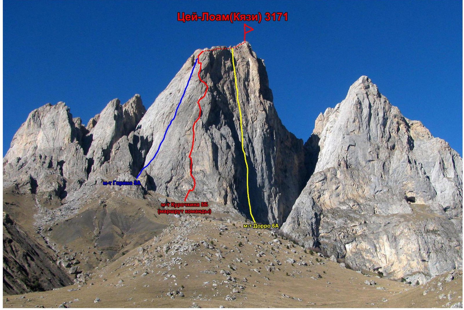 Route profile.
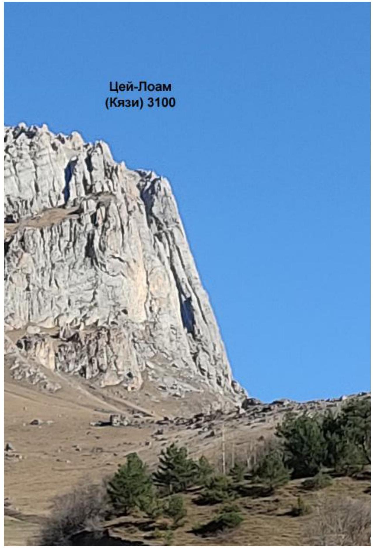 Route profile.
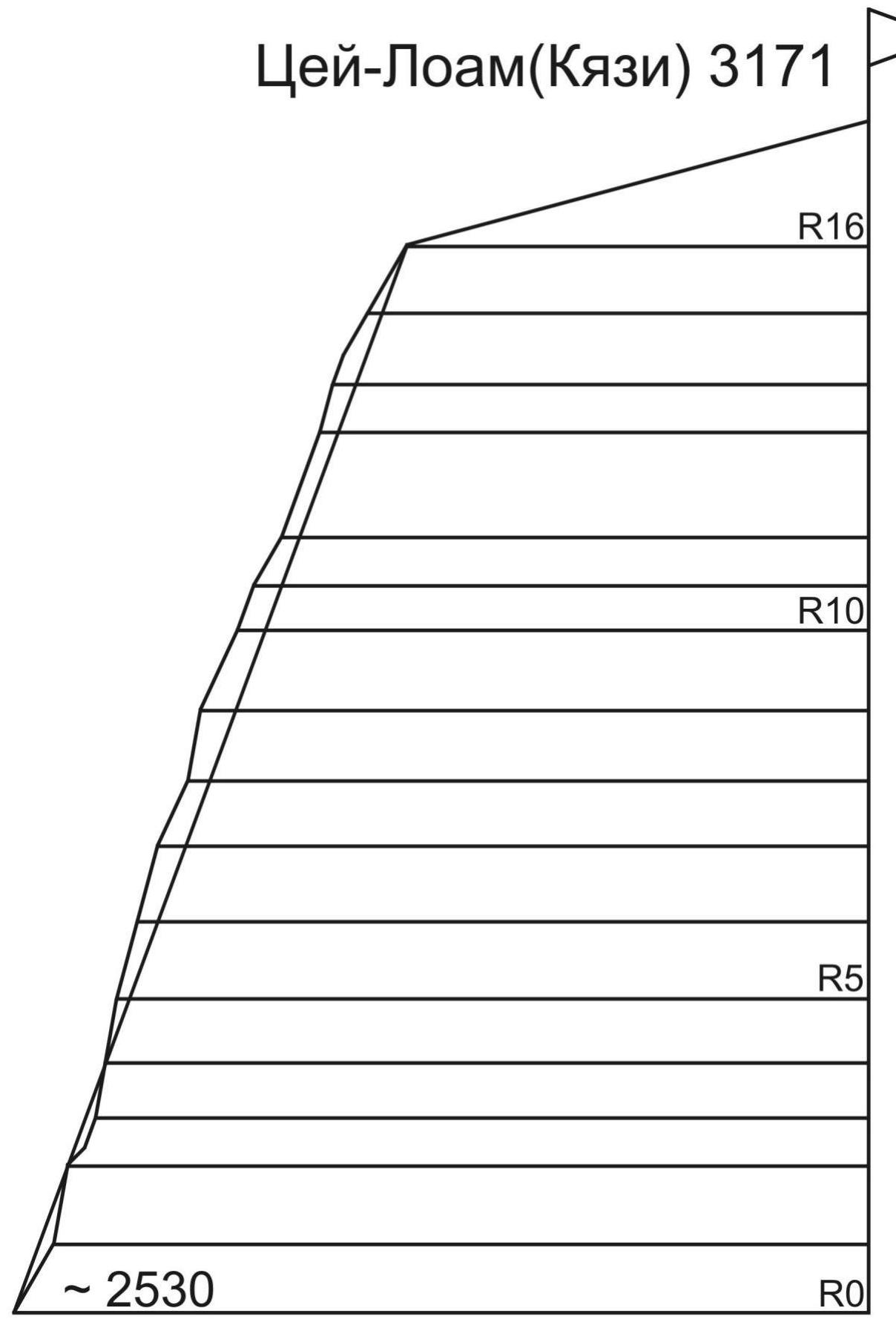
Average steepness of the wall part of the route ~70°
Photo of the area panorama.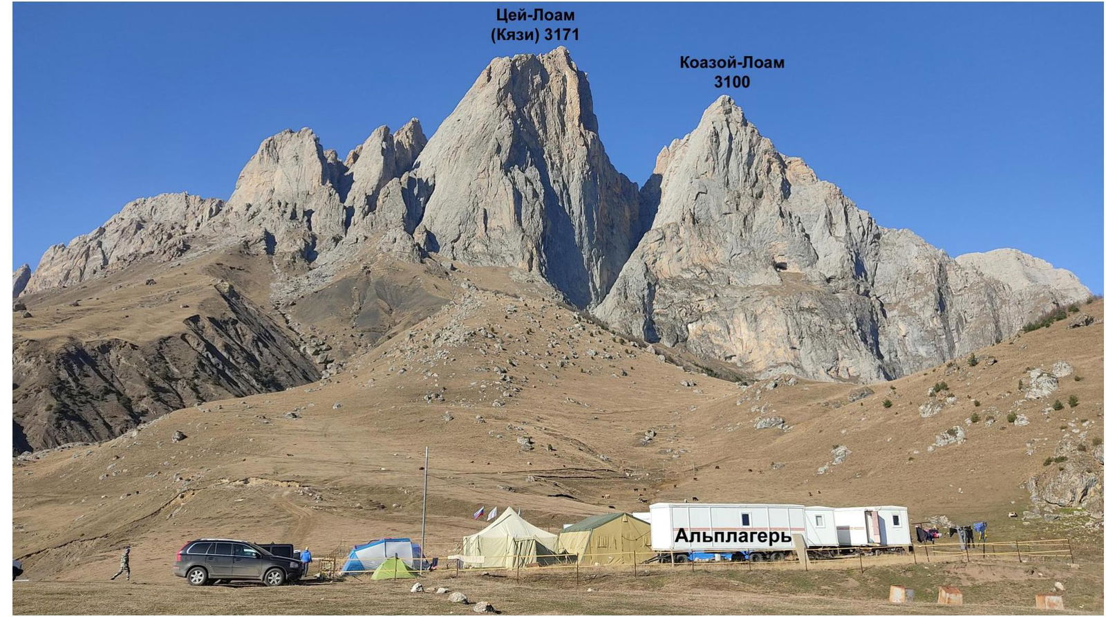
Map of the area.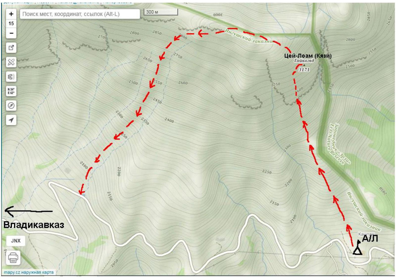
Technical photo of the route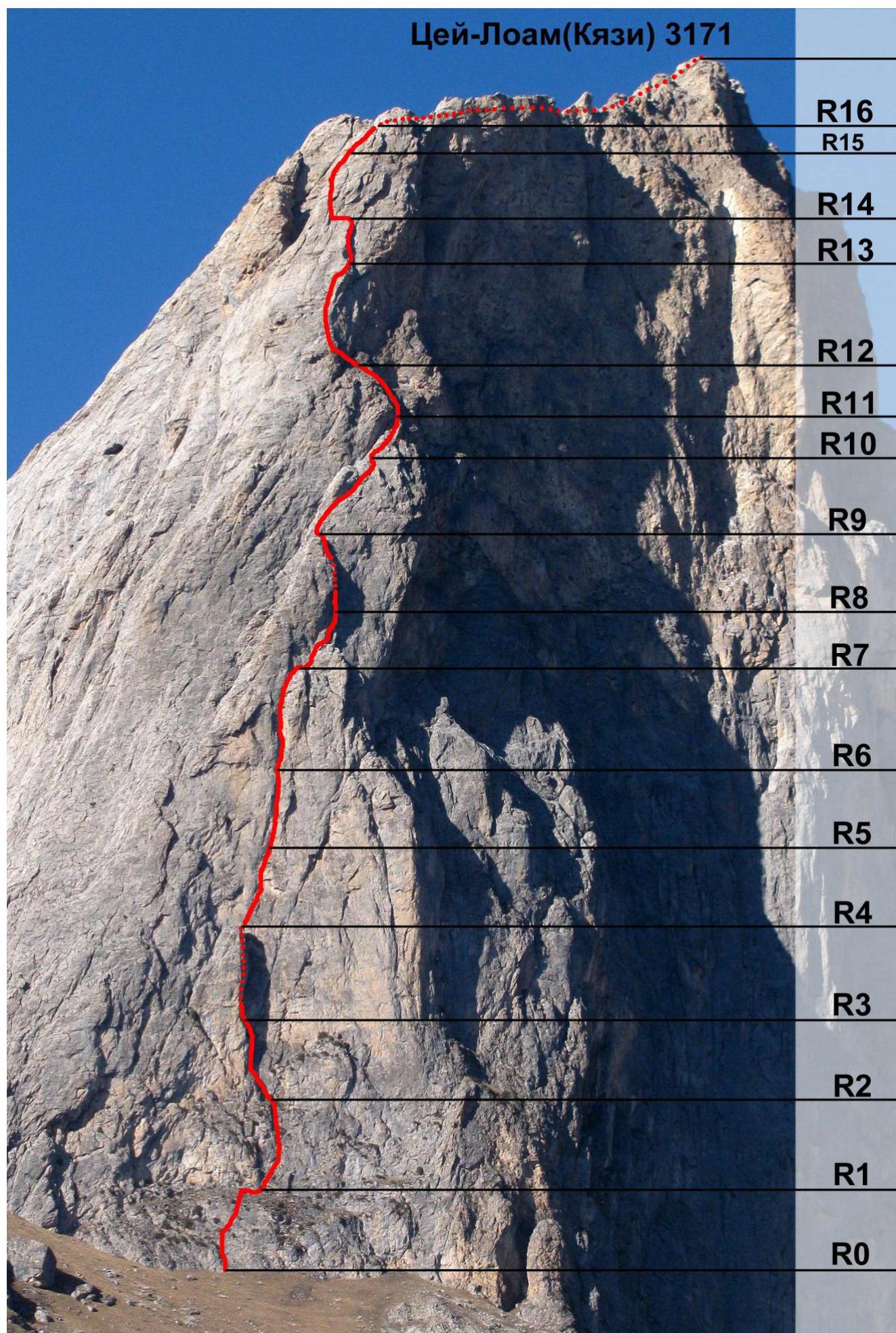
Legend for UIAA symbols:
Rock climbing:  Snow climbing:
  Mixed climbing:
  Ice climbing:
  Artificial Protection Points (AIDs):
Pitch No.  | Anchors | Nuts | Bolts | UIAA Symbol Scheme | Length | Steepness | Cat. diff. |
|---|---|---|---|---|---|---|---|
| R16 | 4 | 2 | 50 | 60° | IV–V | ||
| R15 | 5 | 4 | 30 | 60° | IV | ||
| 20 | 70° | V+ | |||||
| R14 | 5 | 4 | 30 | 75° | V–VI A1 | ||
| R13 | 10 | 3 | 2 | 70 | 70° | V–VI A1 | |
| R12 | 4 | 2 | 35 | 60° | III+ | ||
| R11 | 4 | 2 | 30 | 70° | V+ | ||
| R10 | 7 | 5 | 55 | 65° | V− | ||
| R9 | 7 | 3 | 3 | 45 | 80° | IV–VI A1 | |
| R8 | 7 | 5 | 45 | 65° | V− | ||
| R7 | 9 | 3 | 50 | 75° | IV–V+ | ||
| R6 | 7 | 4 | 50 | 75° | V+ | ||
| 10 | 85° | VI A1 | |||||
| R5 | 3 | 3 | 30 | 80° | V | ||
| 35 | 80° | V | |||||
| R4 | 3 | 2 | 20 | 70° | V A1 | ||
| R3 | 6 | 1 | 1 | 15 | 45° | III | |
| R2 | 5 | 1 | 50 | 80° | V | ||
| R1 | 5 | 50 | 60° | III+ | |||
| R0 |
Verbal Description of the Route
R0–R1' 50 m, 60°, III+. Base – approach to the wall. Walls with grassy ledges. Anchors for belay.
R1'–R1 15 m, 0°, I. Traverse.
R1–R2 50 m, 80°, V. Wall with cracks and corners, belay station on a ledge, 15 m short of the off-width.
R2–R3
15 m, 45°, III. Approach to the off-width. 20 m, 70°, VI A1. Off-width, poor protection. Can be climbed clean, with a belay station.
R3–R4 35 m, 80°, V
Climb a chimney to a ledge between the wall and the slab. Possible overnight stay, belay station on a block.
R4–R5
30 m, 80°, V. Crack-split, turning into an internal corner. 10 m, 85°, VI A1. Climb the corner through an overhang to a belay station.
R5–R6 50 m, 75°, V+. Climb a wide chimney.
R6–R7
50 m, 75°, IV–V+. Climb a wide chimney to the top of the slab. Convenient ledge for an overnight stay.
R7–R8
45 m, 65°, V. Climb a chimney to a large ledge, then along the wall to the base of the chimney.
R8–R9
45 m, 80°, IV–VI A1. Enter the chimney from the right. Belay station in the chimney, possible overnight stay. Then AIDs on bolts and fifi hooks, one move on a skyhook. After the chimney, exit to a ledge, on top of the slab.
R9–R10
55 m, 65°, V−. Right along the wall, bypassing the overhang on the right. Belay station on a large ledge.
R10–R11 30 m, 70°, V+. Right along the wall with cracks, then up to a large grassy ledge. Belay station on a pyramid-shaped outcrop.
R11–R12 35 m, 60°, III+. Climb from the pyramid-shaped outcrop to a grassy ledge (bouldering 3 m, 6a, can place a stopper). Then along the ledges with walls to the wall. Possible overnight stay on a steep grassy slope.
R12–R13
70 m, 70°, IV–VI A1. Left along the ledge, to the left internal corner. Climb to the slab on the left. From the slab, AIDs up to the left to the internal corner. Climb the corner, which ends in an overhang. Then right along the crack to a ledge. This section is better divided into two; otherwise, the second climber will have to approach.
R13–R14
30 m, 75°, V–VI A1. From the belay station, up 3 internal corners. Then climb the internal corner to a narrow ledge, belay station in the middle of the narrow ledge.
R14–R15
20 m, 70°, V+. Along the ledge to the left to an internal corner, then climb the corner to an overhang. Then left to simple rocks. 30 m, 60°, IV. Then up to a convenient ledge.
R15–R16
50 m, 60°, IV–V. Along simple rocks to a short overhanging corner. After the corner, exit to the ridge on the left and look for a way to the left side of the ridge to pedestrian ledges. This section looks like a wall on the photo due to the overlapping wall in the background; in fact, it passes along a wide, steep edge-ridge.
R16–Summit
Climb simple rocks to talus slopes and reach the summit. "Good luck with the mountain!"
Descent from the summit via one of the simple routes. We descended via 1B, but they say 2A is easier.
Team's Actions
On October 27, went under the wall, brought equipment and water. On October 28, left the alp camp at 4:40, started working on the route at 6:40. Set up an overnight stay at R7 at 17:00. On October 29, gathered the bivouac and continued working on the route at 7:40. Reached the summit at 20:00. Then began descending via route 1B, returned to the camp on October 29 at 2:00.
Results, Conclusions, Comments:
The route is interesting, felt quite challenging for a 5B category. Orientation is relatively simple in the lower part. From R2 to R9, it's almost impossible to deviate from the route. In the upper part, orientation will be required, with possible variations. The rock is limestone, quite strong, not much rubble, but quite dirty with a lot of grass and earth. Anchors are mostly used for protection, we took 16 pieces. Nuts and cams are also used, we took two sets of cams up to size 3; the second set of size 3 is not necessary, one is enough. On the R8–R9 section, there's one move on a skyhook with a poor hole; be careful, we didn't use skyhooks again. Occasionally used fifi hooks for AIDs, standard ones without a bend. There's plenty of space for a sitting overnight stay on the route; R4, R7, R8–R9, and R16 have possible lying overnight stays; we stayed overnight at R7. The route is very enjoyable, logical, strong, with interesting climbing, and protection is easy to organize.
First climber on pitch R0–R1'.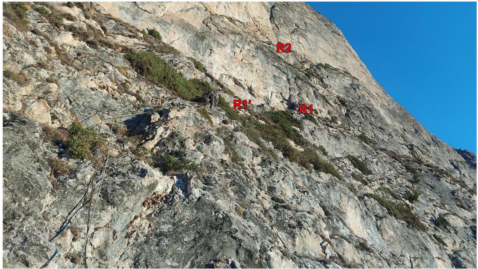
Belay station R1, second rope visible.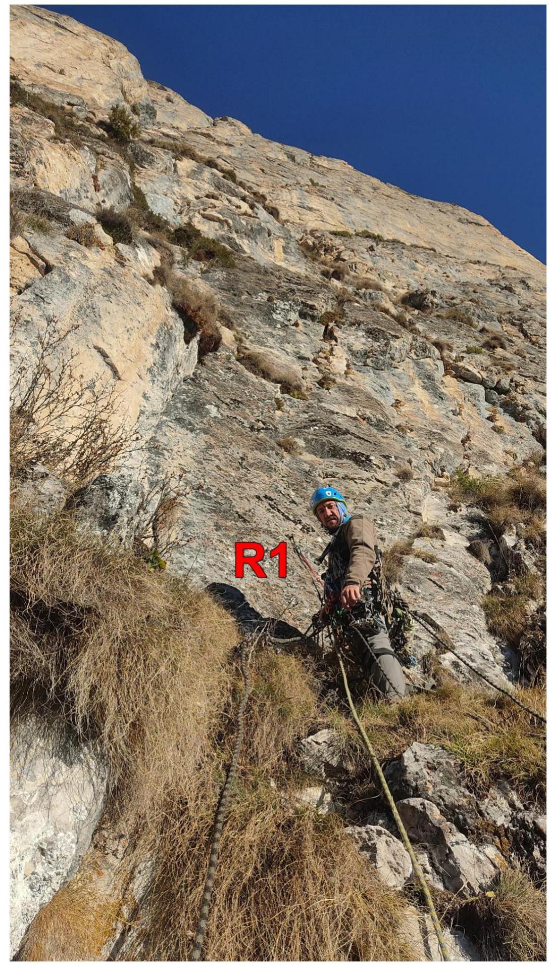
Pitch R2–R3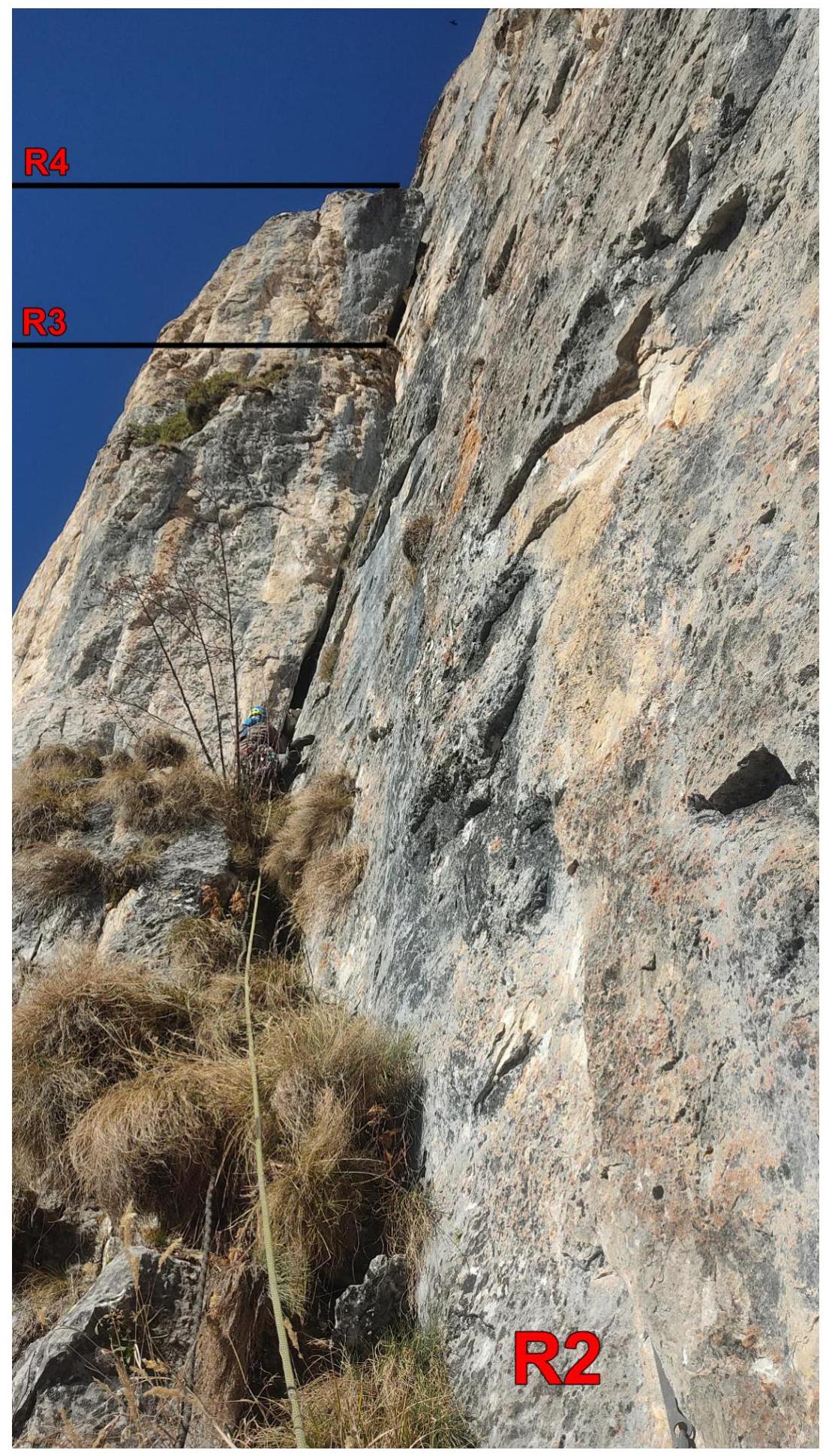
Note from the cache at belay station R3
Chimney on pitch R3–R4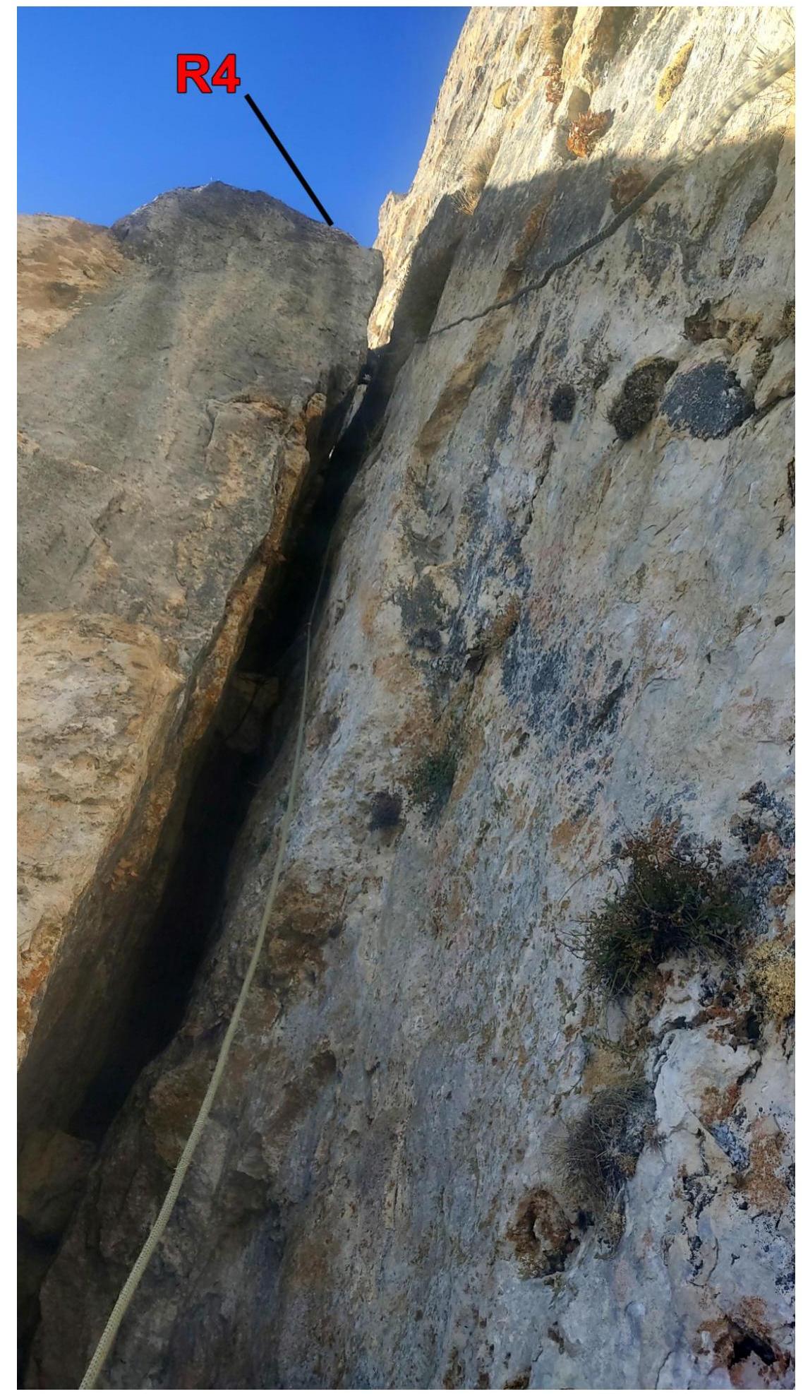
Chimney on pitch R3–R4, top view.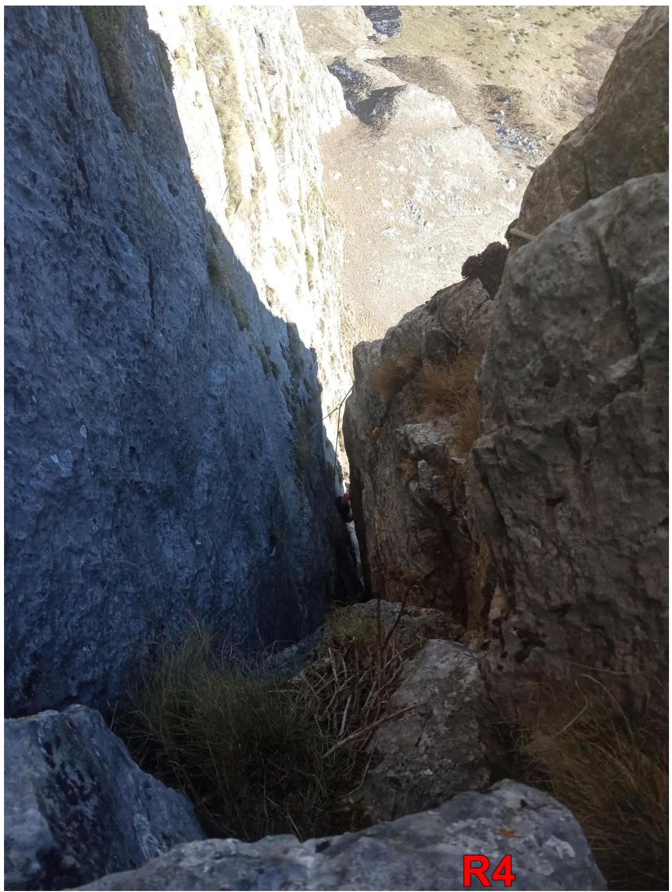
First climber on pitch R4–R5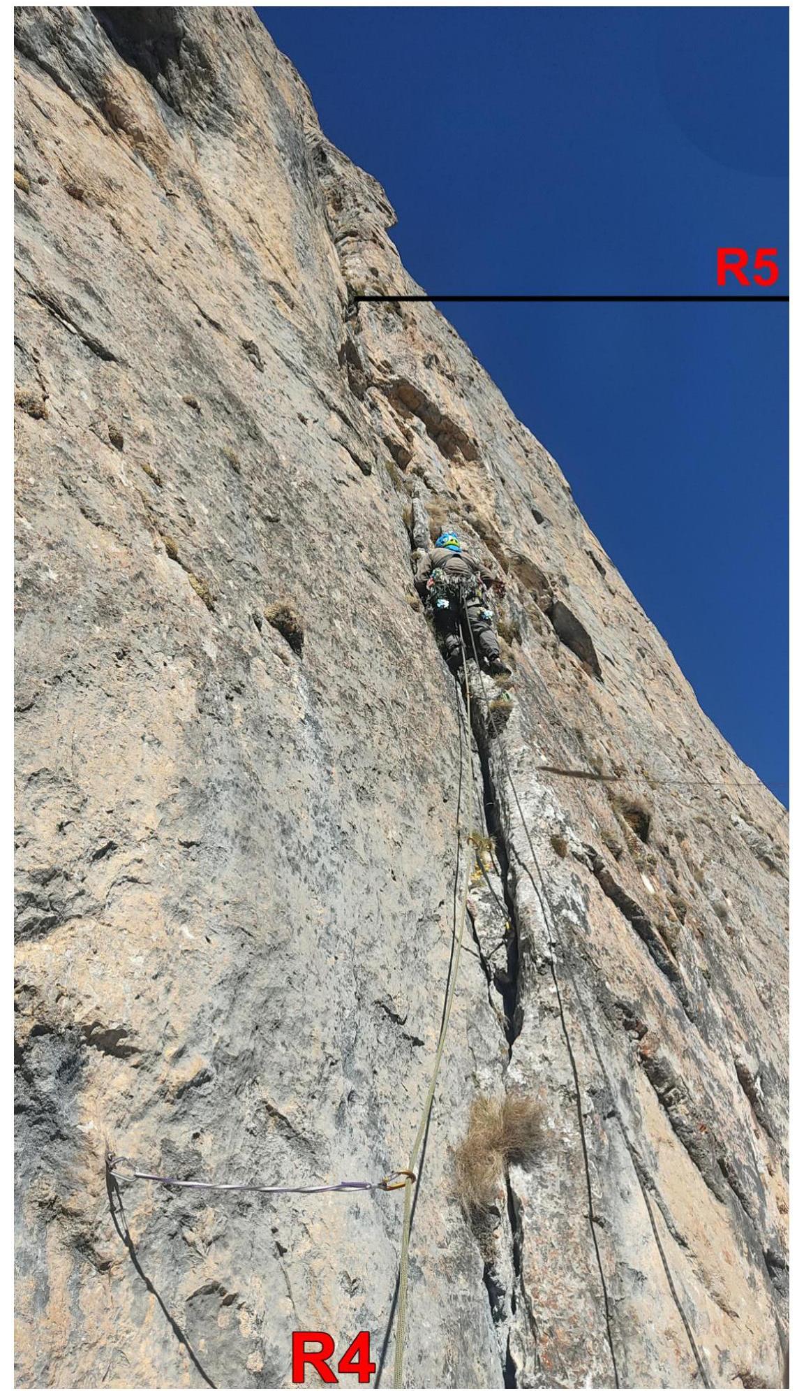
Pitch R5–R6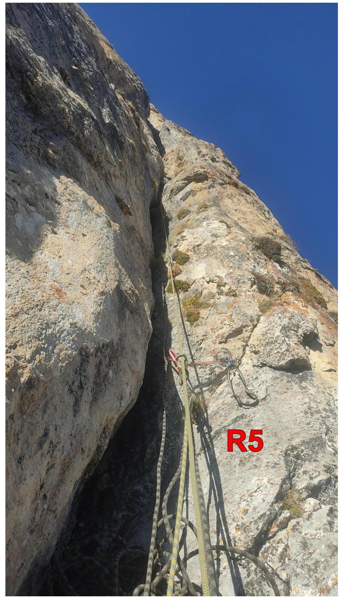
First climber on pitch R6–R7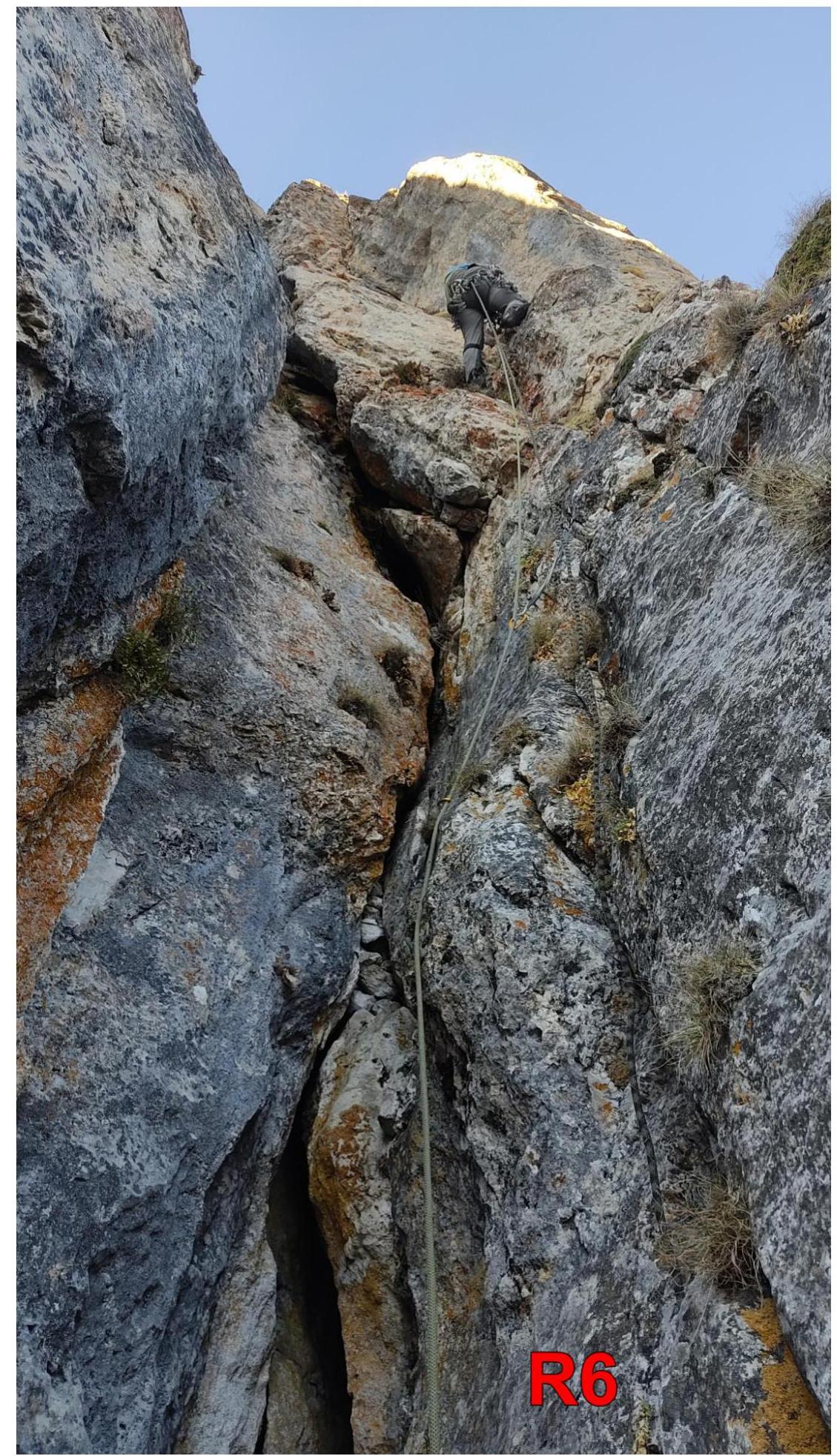
Overnight stay at R7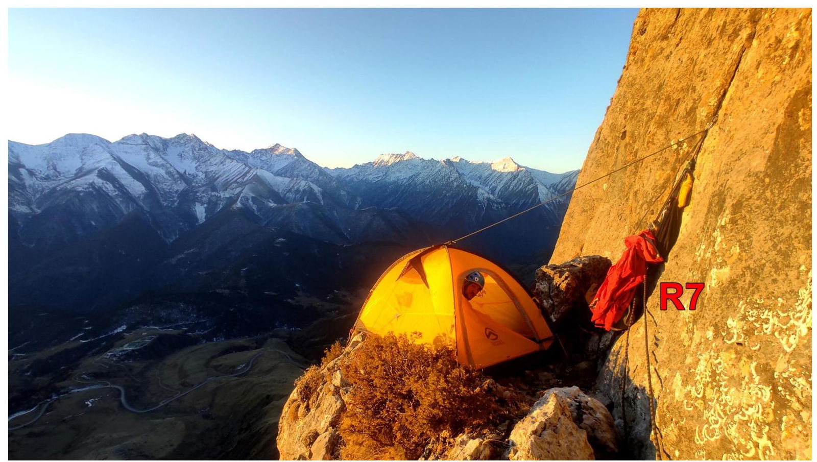
First climber on pitch R7–R8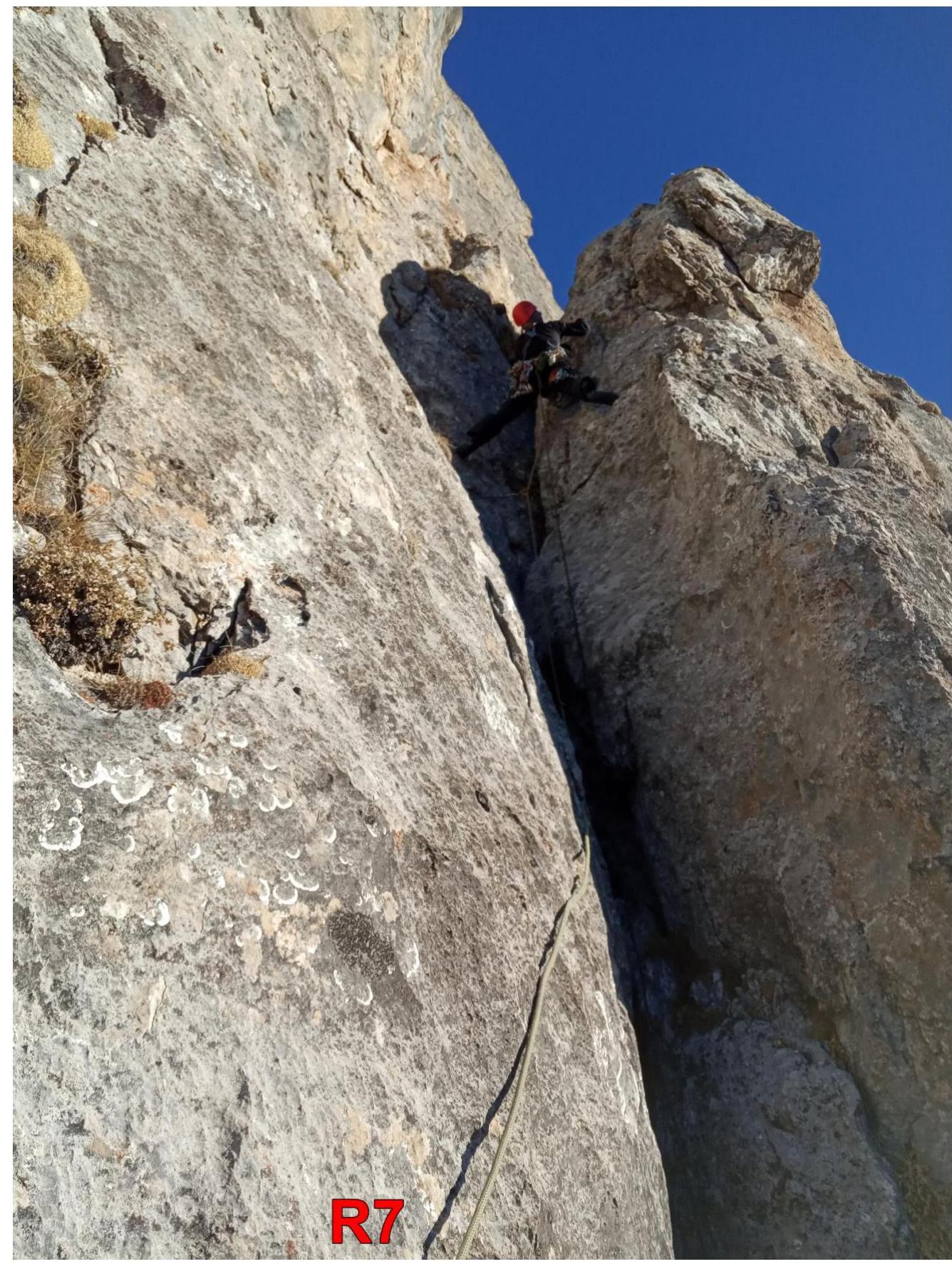
First climber on pitch R8–R9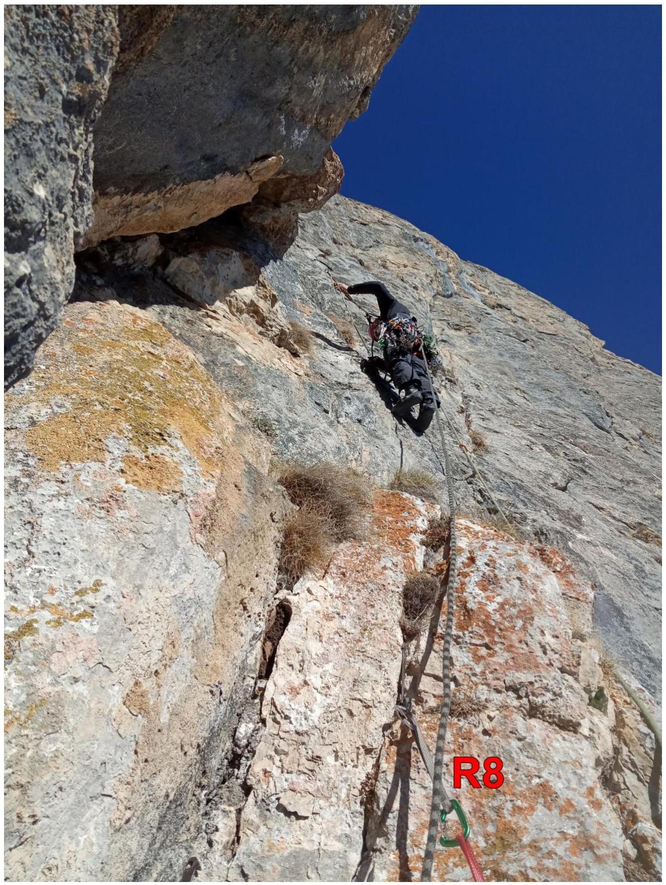
On the summit of Tsey-Loam (Kyazi) 3171.