Report
On ascending to the summit of Tsey-Loam (Kyazi) via the South Counterfort of the Western Ridge, category 2A, by the team of the Climbing Camps Management from January 16, 2022, to January 16, 2022.
I. Climbing Passport
| № | 1. General Information | |
|---|---|---|
| 1.1 | Full name, sports rank of the team leader | Gurenko Taras Yuryevich, 3rd sports rank |
| 1.2 | Full name, sports rank of the participants | Kergin Ivan Vasilyevich, 2nd sports rank |
| 1.3 | Full name of the coach | Yakovenko Alexander Nikolayevich, Master of Sports |
| 1.4 | Organization | Climbing Camps Management |
| 2. Characteristics of the Climbing Object | ||
| 2.1 | Region | 2.9. From the Perevalny Pass to the Shaviklde peak |
| 2.2 | Valley | Armkhi |
| 2.3 | Section number according to the 2013 Classification Table | 53 |
| 2.4 | Name and height of the peak | Tsey-Loam (Kyazi), 3171 m |
| 2.5 | Geographical coordinates of the peak (latitude/longitude), GPS coordinates | - |
| 3. Characteristics of the Route | ||
| 3.1 | Route name | South Counterfort of the Western Ridge |
| 3.2 | Proposed category | 3A |
| 3.3 | Degree of route exploration | 2nd passage |
| 3.4 | Character of the route terrain | Rocky |
| 3.5 | Route elevation gain (altimeter or GPS data) | 543 m |
| 3.6 | Route length (in meters) | 1615 m |
| 3.7 | Technical elements of the route (total length of sections of varying category with terrain description) | Category 1 rocky terrain – 1410 m. Category 2 rocky terrain – 95 m. Category 3 rocky terrain – 0 m. Category 4 rocky terrain – 35 m. Category 5 rocky terrain – 75 m. Movement on closed glacier – 0 m Abseiling – 85 m |
| 3.8 | Descent from the summit | Through the Western Ridge along the right couloir |
| 3.9 | Additional route characteristics | No water available; entire route is rockfall-prone! |
| 4. Characteristics of the Team's Actions | ||
| :------ | :--------------------------------------------------------------------------- | :----------------------------------------------------------------------- |
| 4.1 | Time on the move (team's walking hours, in hours and days) | 11 |
| 4.2 | Overnight stays | No |
| 4.3 | Start of the route | 7:00, January 16, 2022 |
| 4.4 | Reaching the summit | 15:30, January 16, 2022 |
| 4.5 | Return to base camp | 18:20, January 16, 2022 |
| 5. Responsible for the Report | ||
| 5.1 | Full name, e-mail | Ivan.kergin@mail.ru |
- Characteristics of the Climbing Object
1.1. General photo of the peak
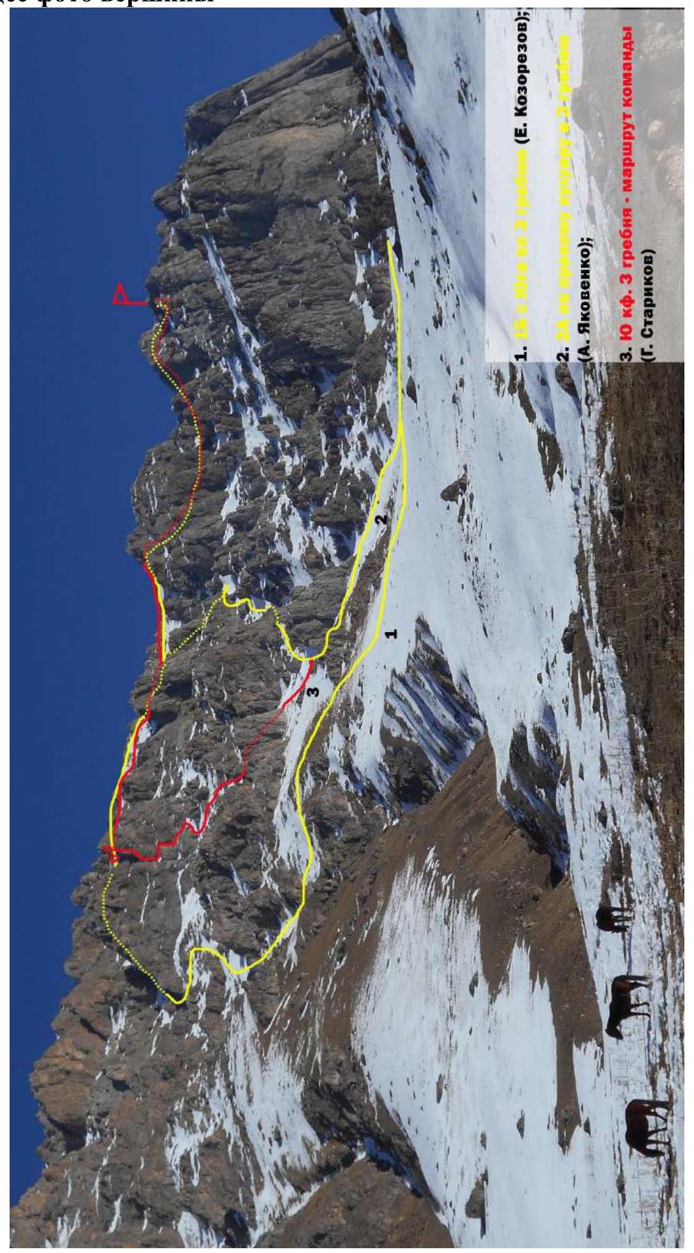
Fig. 1. Photo from the road on January 10, 2022.
1.2. Photo of the route profile (Main technical part of the route)

Fig. 2. Photo from the first control tur. Photo from January 16, 2022.
2. Characteristics of the Route
2.1. Technical photograph of the route
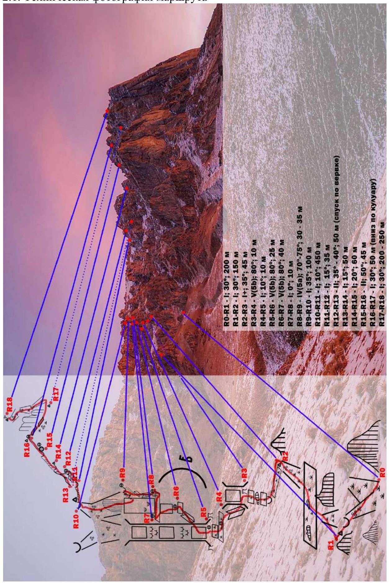
Fig. 3. On the approach. Photo from January 16, 2022.
2.2. Section numbers
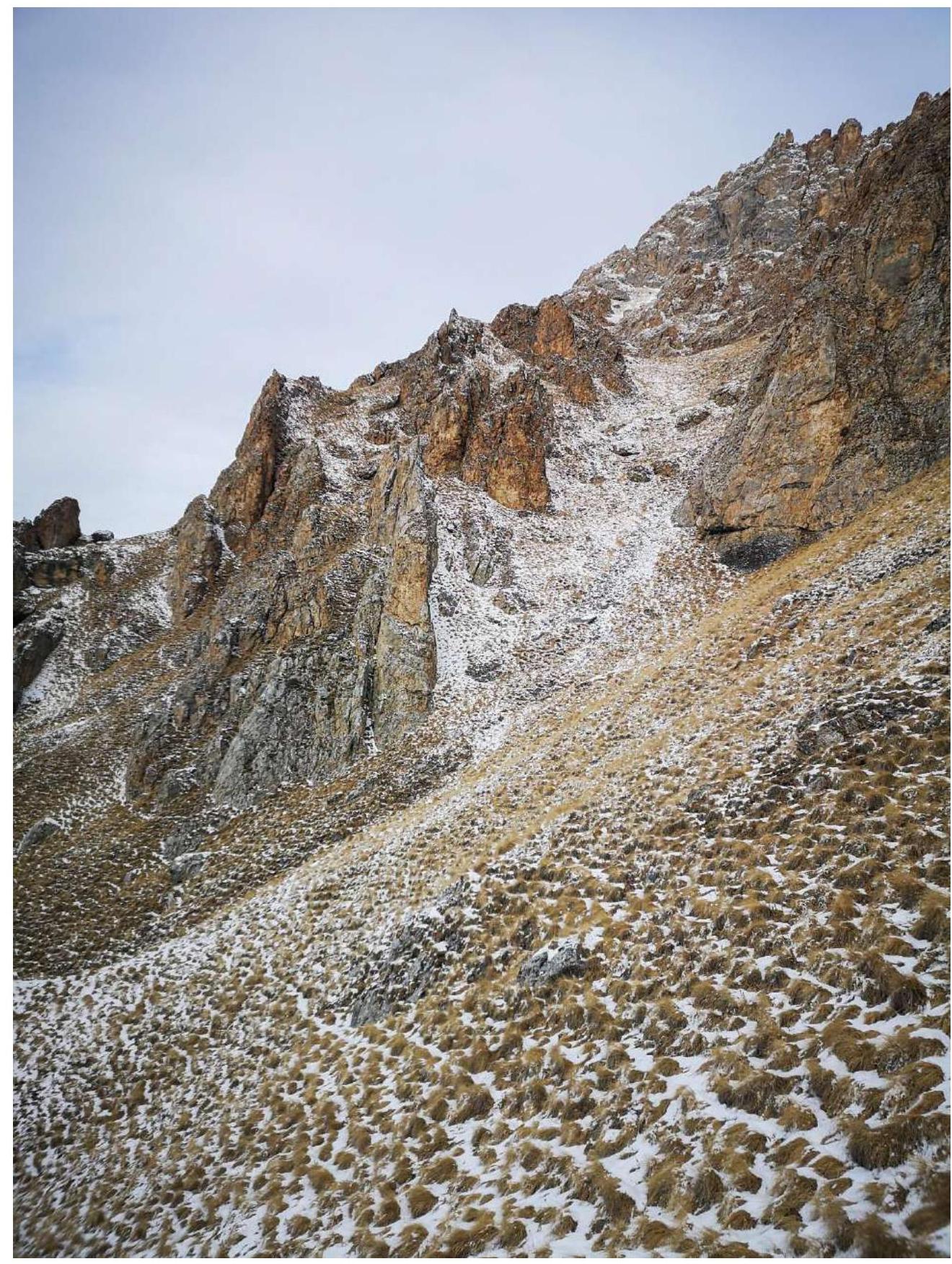
Fig. 4. Section R0–R1 Photo from January 16, 2022.
Fig. 5. Section R1–R2. Photo from January 16, 2022.
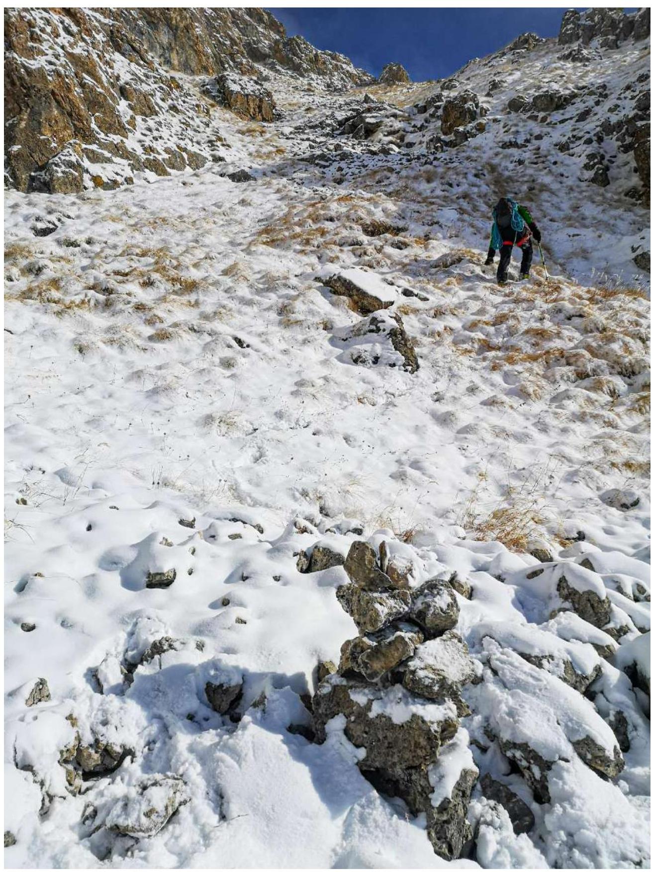
Fig. 6. Section R1–R2. Upper section from the tur. Photo from January 16, 2022.
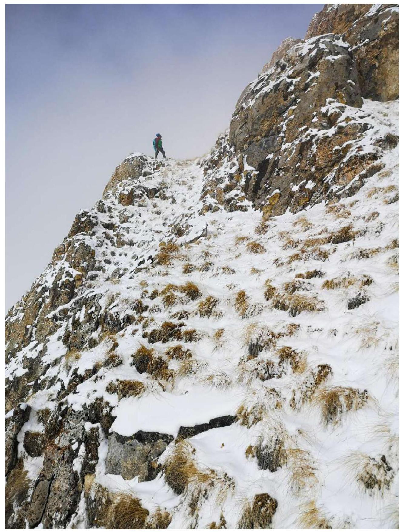
Fig. 7a. Section R2–R3 (First part). Photo from January 16, 2022.
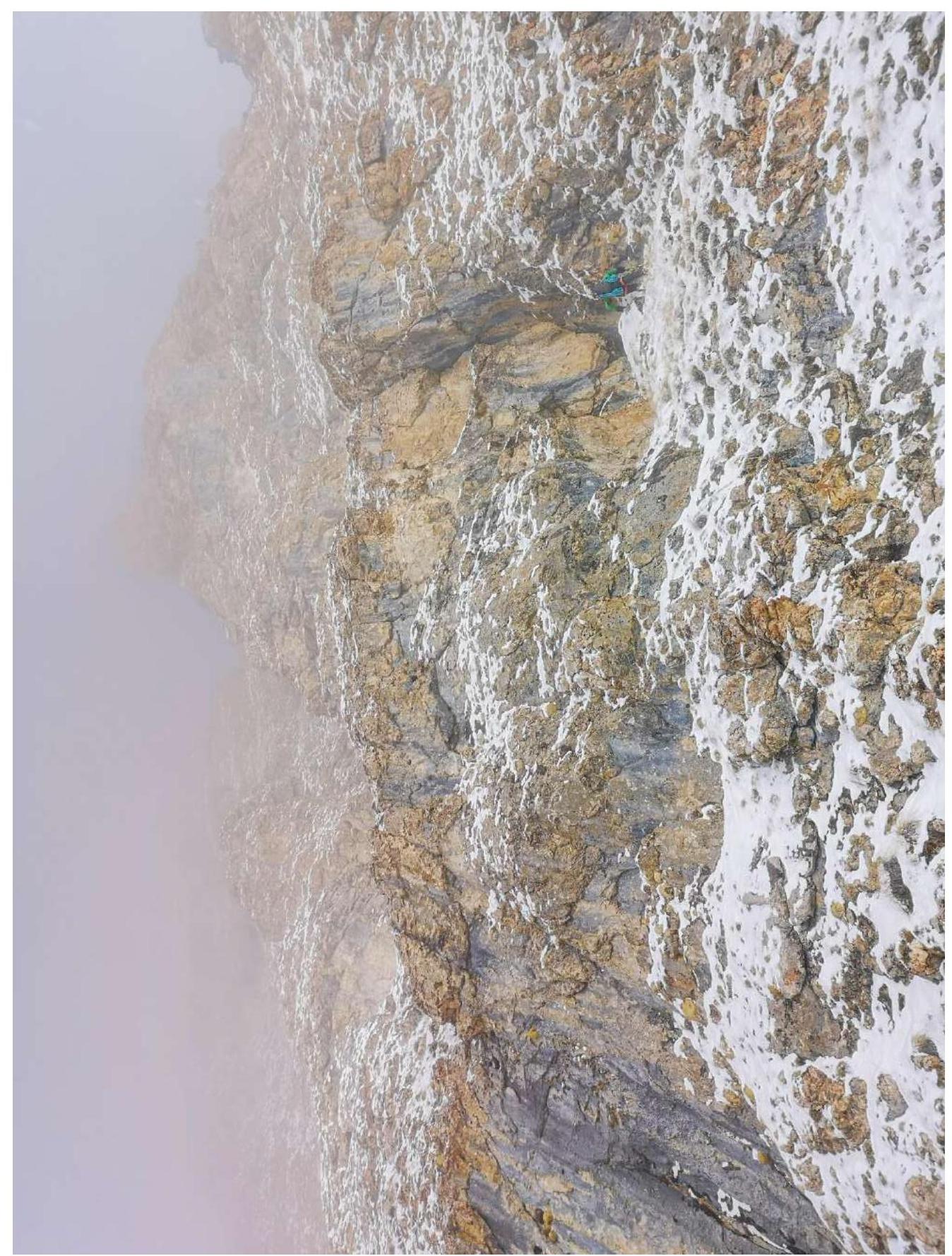
Fig. 7b. Section R2–R3 (Upper part). Approach to section R3–R4. Photo from January 16, 2022.
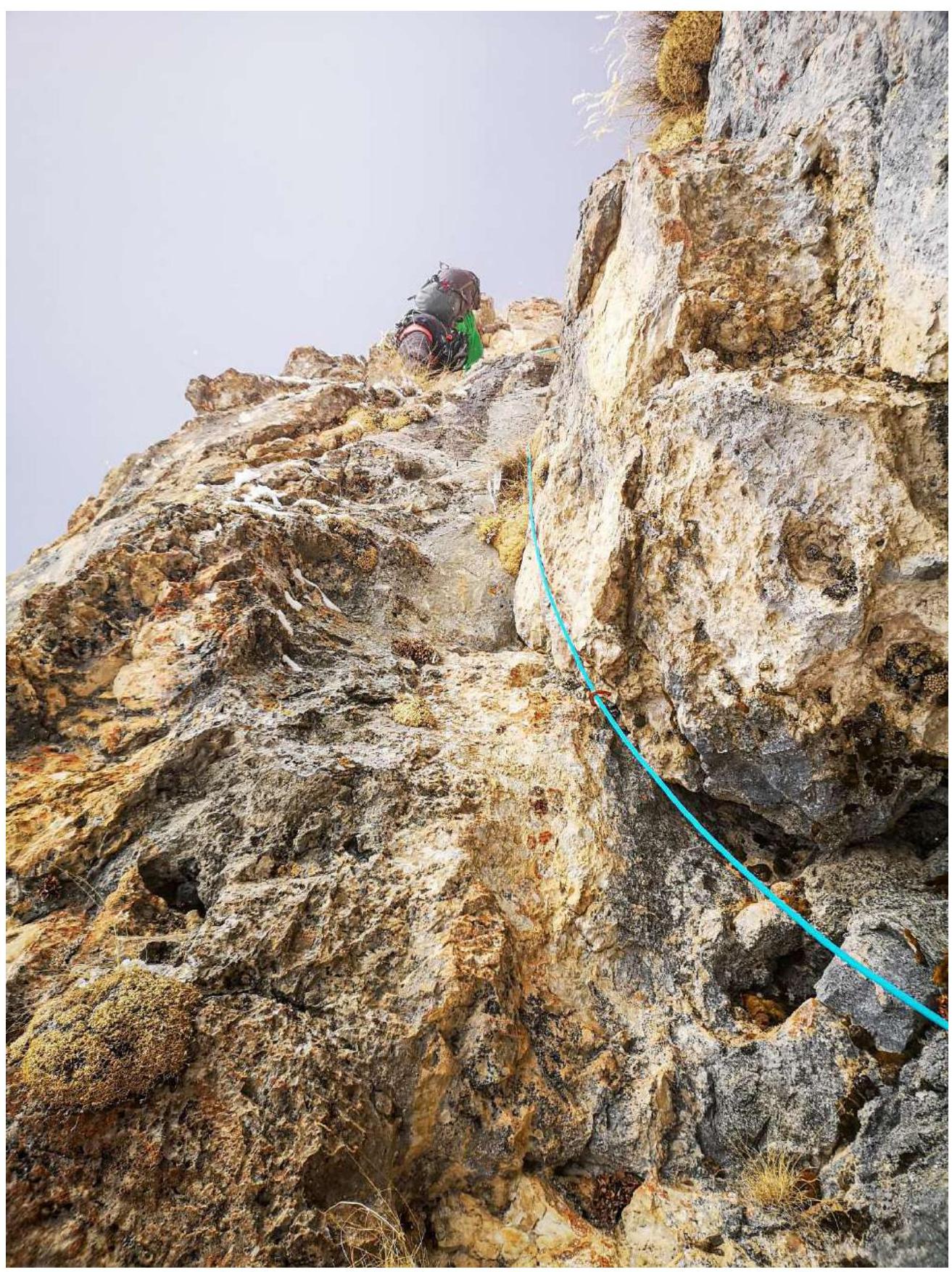
Fig. 8. Overcoming section R3–R4. Photo from January 16, 2022.
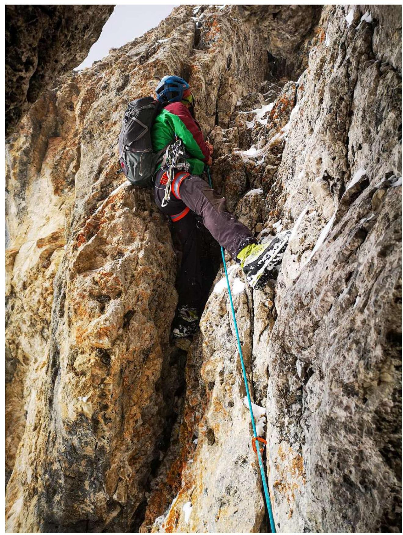
Fig. 9. Section R5–R6 (Start). Key part of the route. Photo from January 16, 2022.
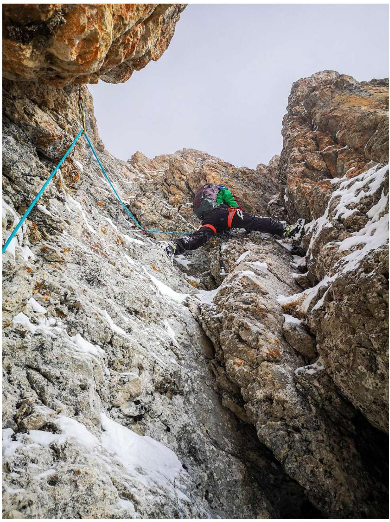
Fig. 10. Section R5–R6 (Exit to the inner corner after the wall). Key part of the route. Photo from January 16, 2022.
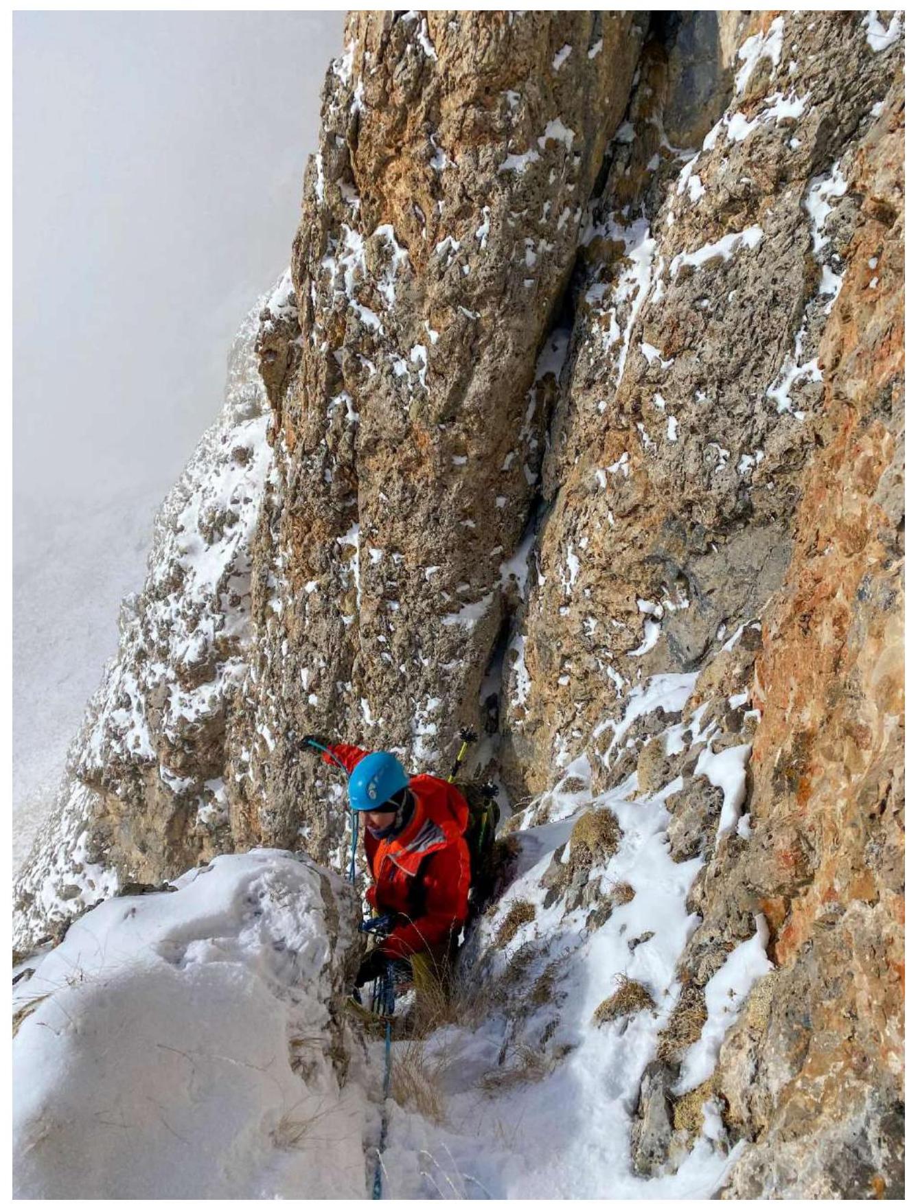
Fig. 11. Section R5–R6 (Exit from the inner corner to the ledge). Key part of the route. Photo from January 16, 2022.
Fig. 12. Section R6–R7 (View from above the station). Key part of the route. Photo from January 16, 2022.
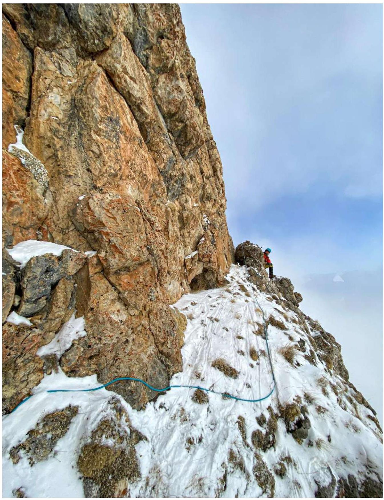
Fig. 13a. Section R7–R8. View from the first station. Photo from January 16, 2022.
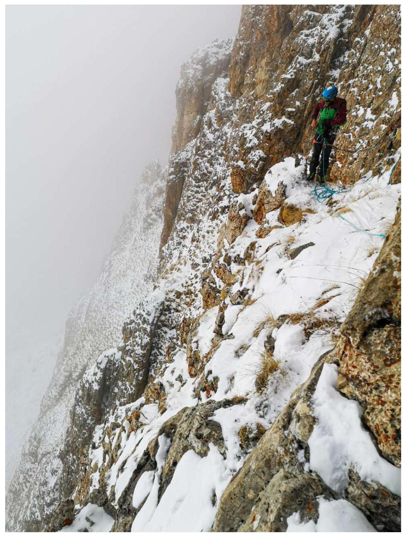
Fig. 13b. Section R7–R8. View from the second station. Photo from January 16, 2022.
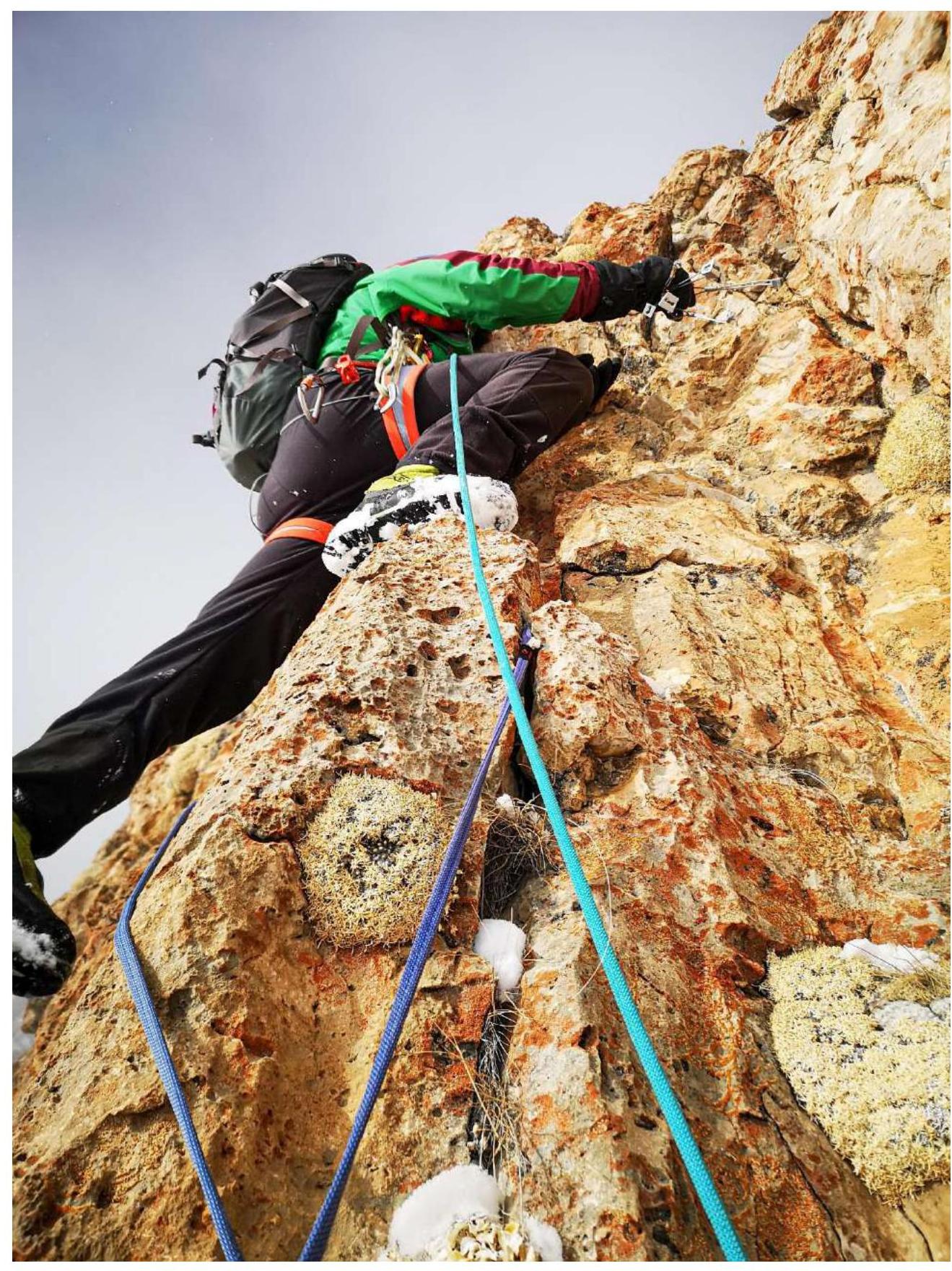
Fig. 14. Section R8–R9 (Start of the inner corner). Photo from January 16, 2022.
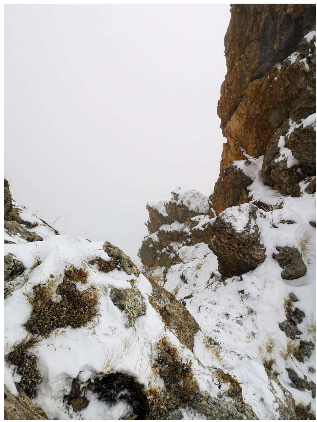
Fig. 15. Section R8–R9. End of the section. Photo from the saddle and upper station. Photo from January 16, 2022.
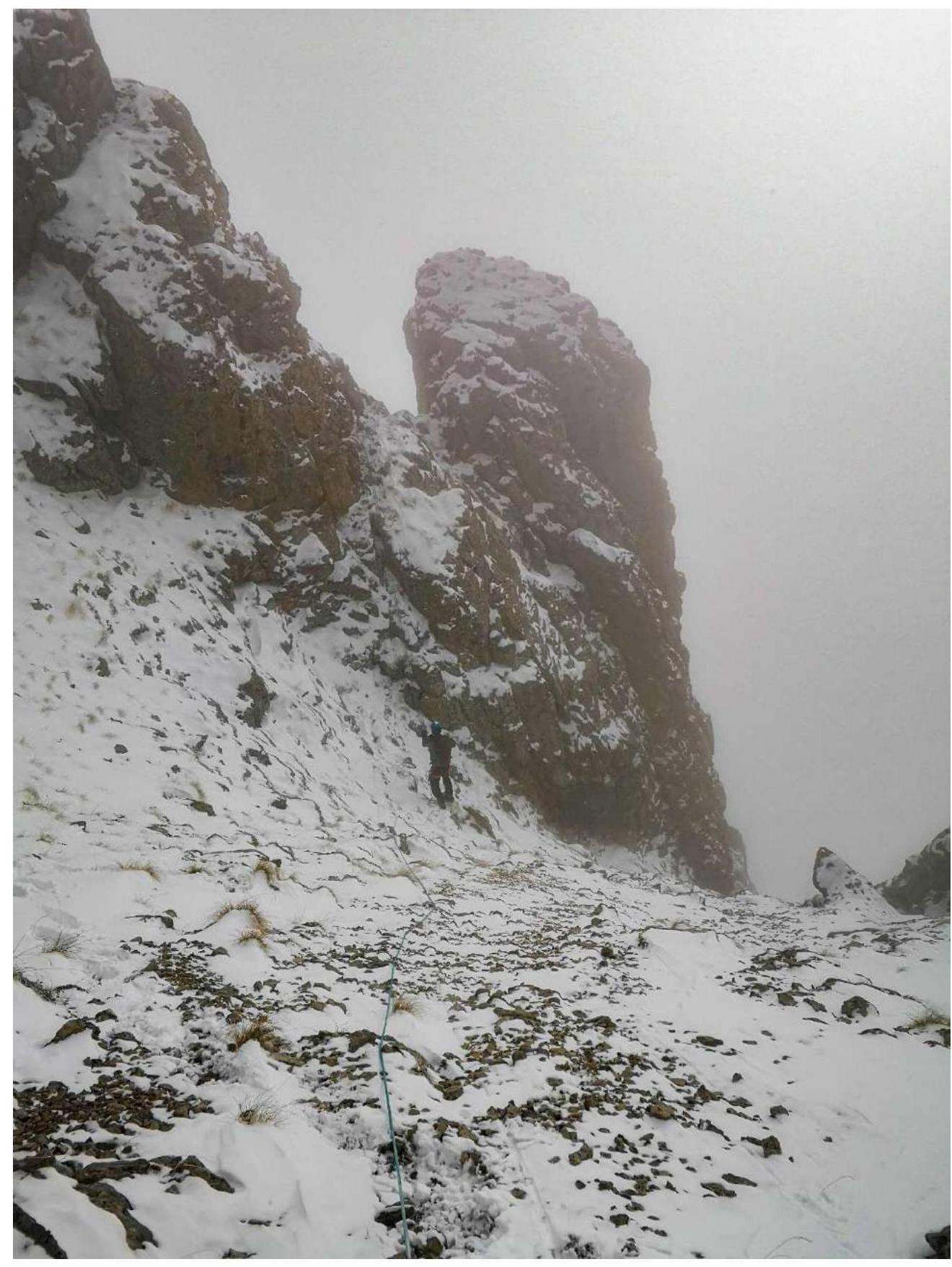
Fig. 16. Section R9–R10 (Abseiling from the saddle to the couloir). Photo from January 16, 2022.
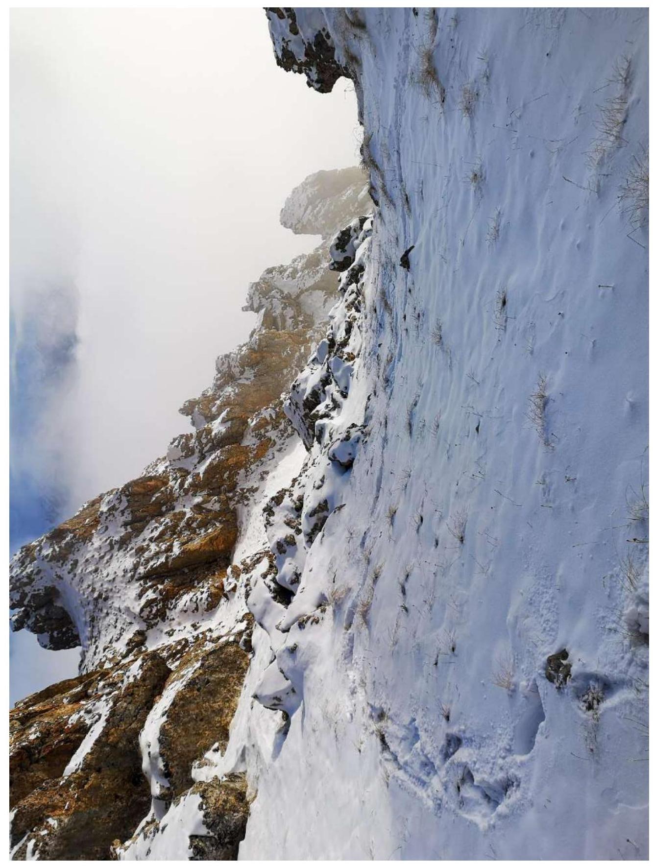
Fig. 17. Section R9–R10 (Exit to the saddle). Photo from January 16, 2022.
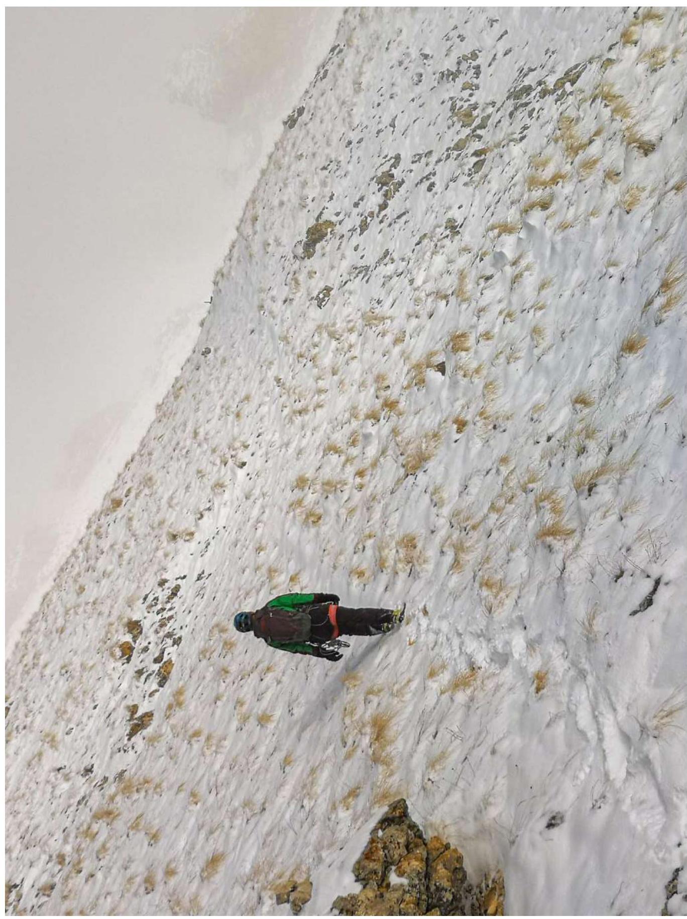
Fig. 18a. Section R10–R11 (Traverse towards the grotto near the ridge). Photo from January 16, 2022.
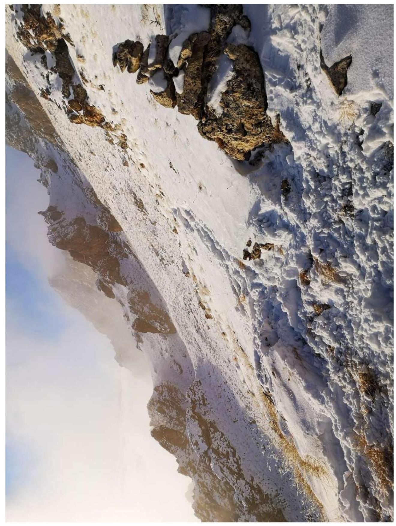
Fig. 18b. Section R10–R11 (Traverse towards the grotto near the ridge). View of the passed section. Photo from January 16, 2022.
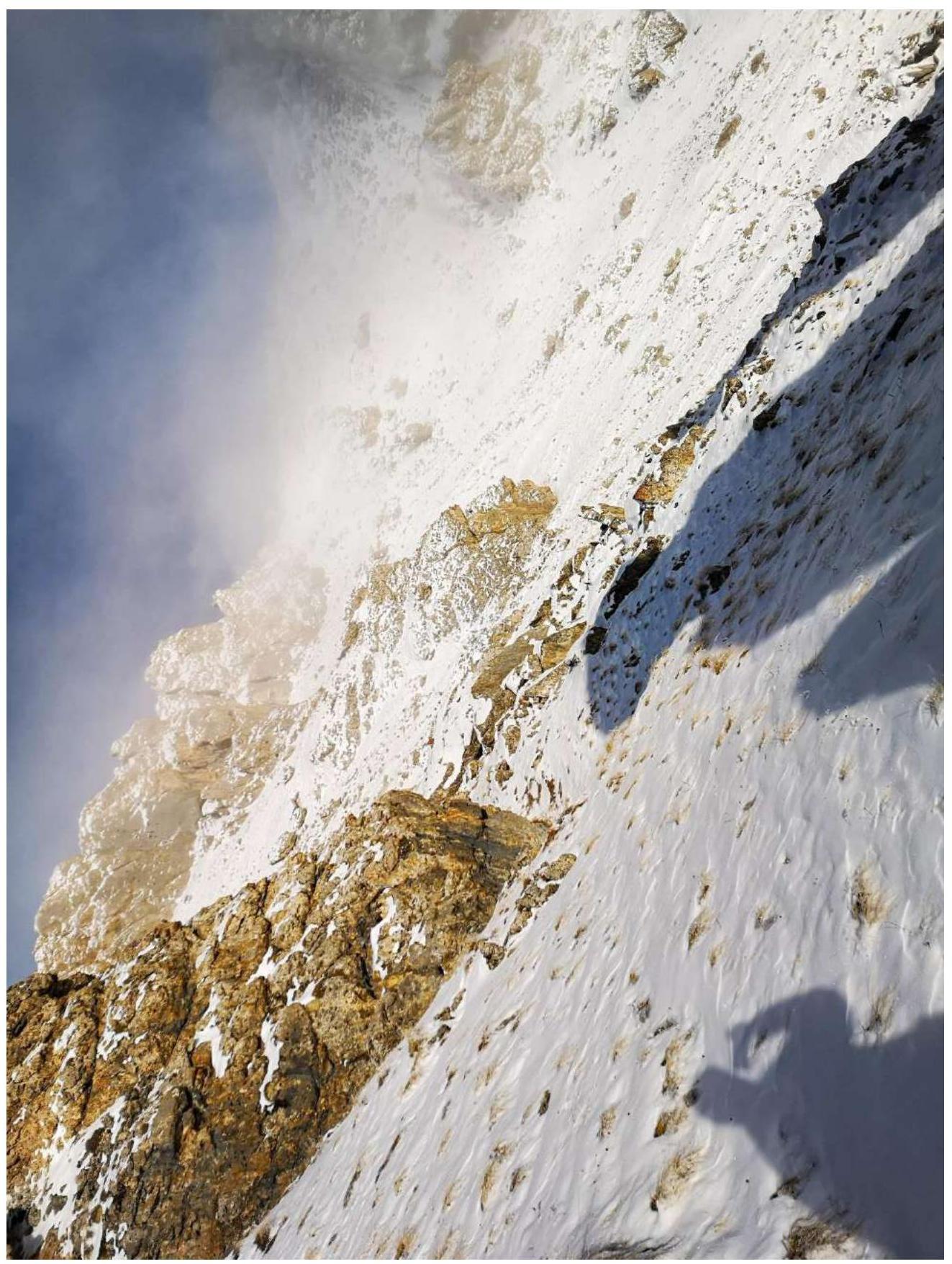
Fig. 18c. Section R10–R11
Traverse towards the grotto and exit to the "Right couloir of the Western Ridge" route. Photo from January 16, 2022.
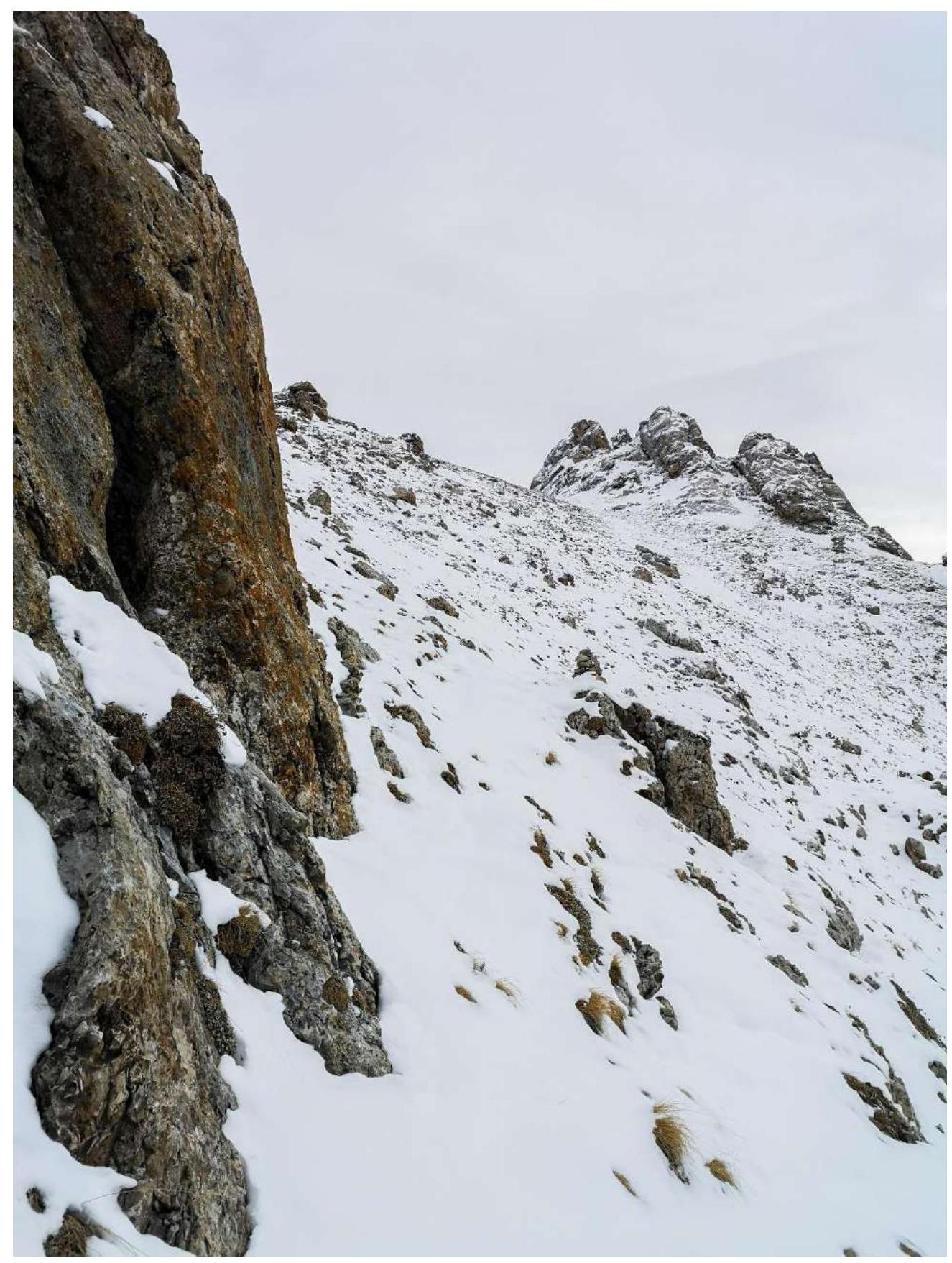
Fig. 18d. Section R10–R11. View of the saddle from under the grotto. Photo from January 18, 2022.

Fig. 19. Section R11–R12. Start of the destroyed rocks. Photo from January 18, 2022.
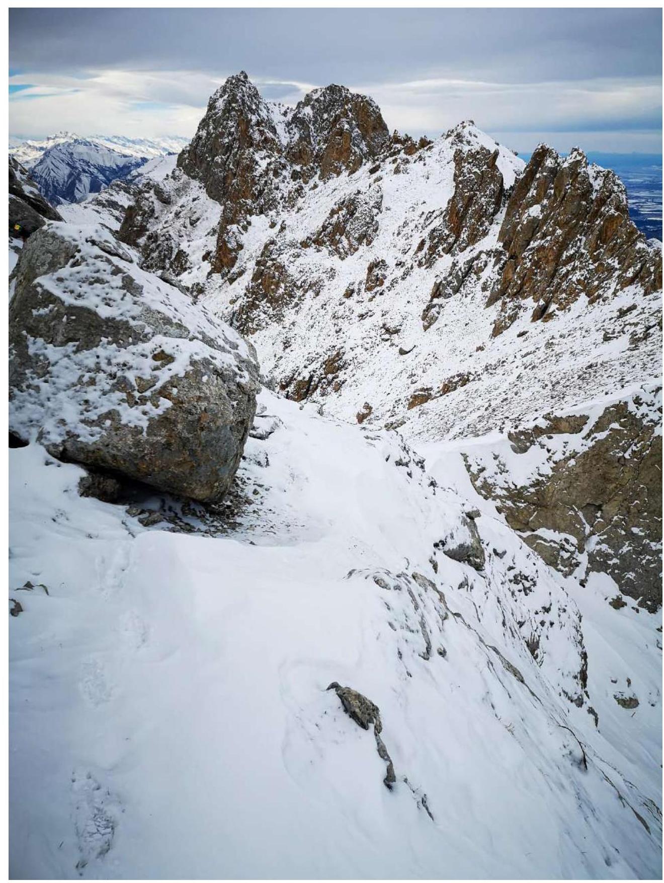
Fig. 20. Section R11–R12. View from the ledge to part of section R10–R11. Photo from January 18, 2022.

Fig. 21. Section R12–R13. View from the ledge to the rock outcrop for the descent station and to the entire section R13–R14. Photo from January 18, 2022.

Fig. 22. Section R12–R13. View from the saddle R14 from the tur. Photo from January 18, 2022.

Fig. 23. Section R14–R15. Photo from January 18, 2022.
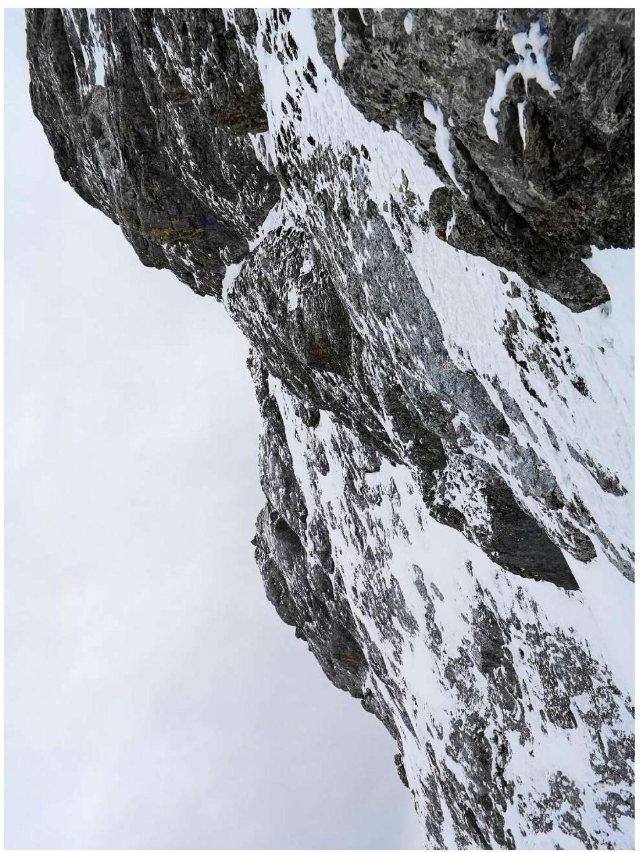
Fig. 24. Section R15–R16. Start of the sloping ledge. Photo from January 18, 2022.

Fig. 25. Section R15–R16. End of the sloping ledge. Photo from January 18, 2022.
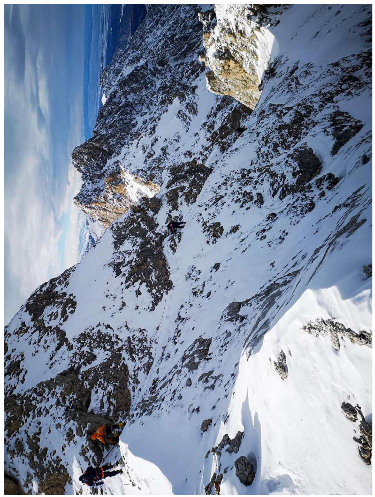
Fig. 26. Section R15–R16. General view of the sloping ledge. Photo from January 18, 2022.
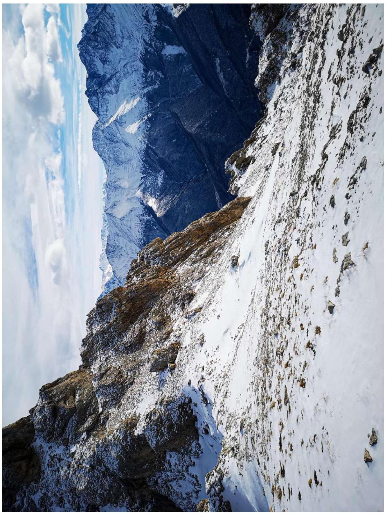
Fig. 27. Section R16–R17. Photo from January 18, 2022.
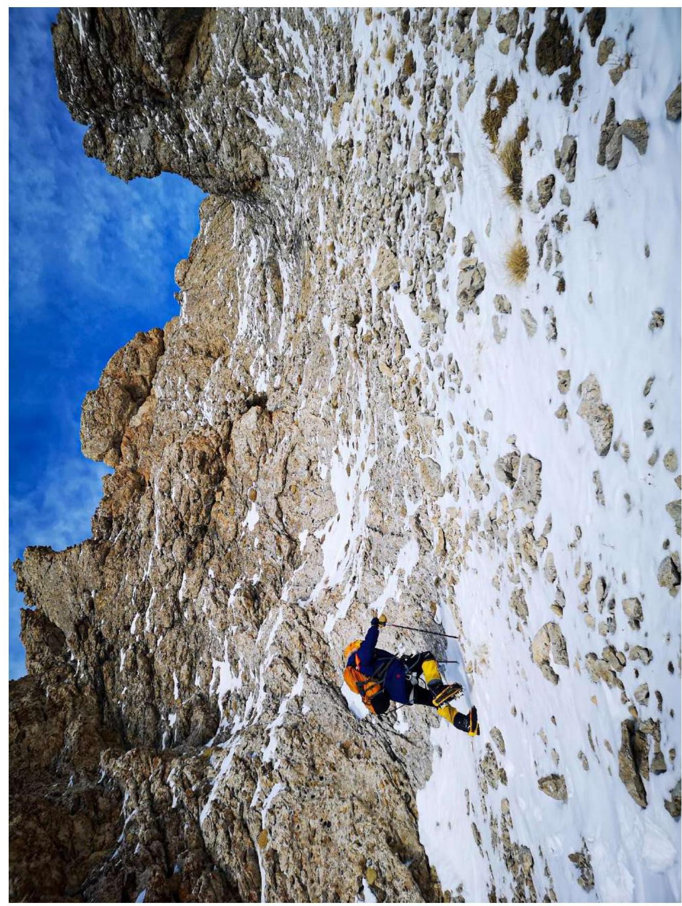
Fig. 28. Section R17–R18. Start of the couloir. Photo from January 18, 2022.
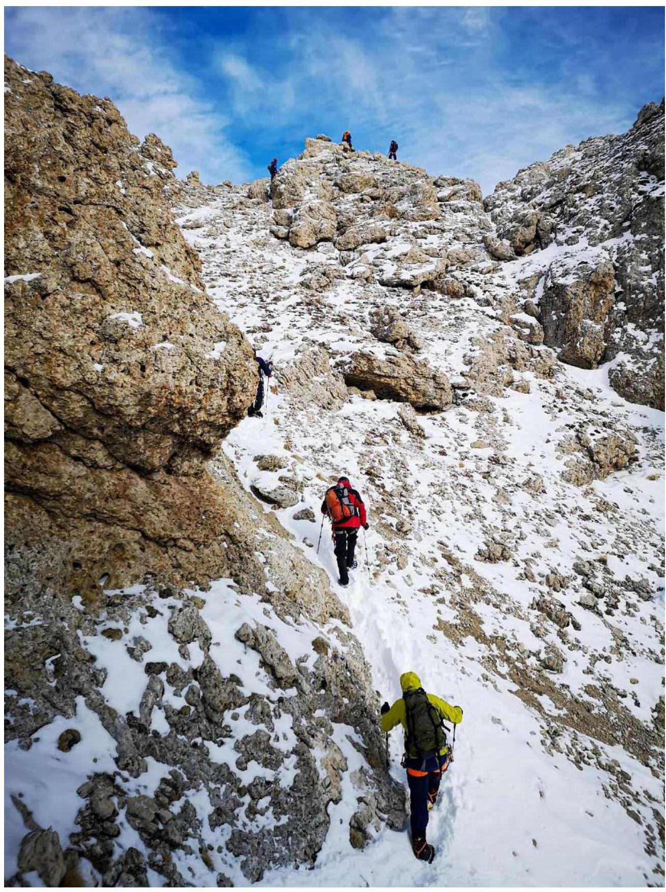
Fig. 29. Section R17–R18. Pre-summit ascent (End of the couloirs). Photo from January 18, 2022.
2.3. Technical characteristics of the route sections
| Section | Character of the terrain | Type and number of pitons |
|---|---|---|
| R0–R1 | Grass, scree | 0 |
| R1–R2 | Grass, scree | 0 |
| R2–R3 | Grass, scree | 0 |
| R3–R4 | Inner corner | 2 — friend (small); 2 — stopper (medium) |
| R4–R5 | Grass | 0 |
| R5–R6 | Rocky wall in a chimney, inner corner, ledge with grass | 2 — friend (small); 3 — anchors; 6 — stoppers. Station on an anchor and stoppers |
| R6–R7 | Rocky wall, large grassy ledge | 1 — friend; 8 — stoppers; 2 — anchors. Station on a loop |
| R7–R8 | Long grassy ledge, large rock | 0. Station on a loop |
| R8–R9 | Inner corner, outer corner, inclined grassy ledge with a saddle | 2 — anchors; 4 — stoppers. Station on a loop |
| R9–R10 | Abseiling into a large, long grassy couloir with scree | 0 |
| R10–R11 | Grass, small and medium scree, ridge | 0 |
| R11–R12 | Saddle, scree, some "ram's foreheads" (smooth rocks), grassy ledge, ridge | 0 |
| R12–R13 | Not very difficult destroyed inclined slabs (rocks) | Loop for descent |
| R13–R14 | Ridge, scree | 0 |
| R14–R15 | Various scree | 0 |
| R15–R16 | Saddle, inclined rocky ledge, small scree | 1 — stopper; 1 — anchor; 1 — hourglass; 1 — station on a loop; 1 — bolted piton |
| R16–R17 | Grass, scree | 0 |
| R17–R18 | Grass, scree | 0 |
3. Characteristics of the Team's Actions
3.1. Brief description of the route passage
| Section | Description | Photo number |
|---|---|---|
| R0–R1 | From a large triangular rock bastion, start moving left and up along a grassy couloir, overcoming grass and small scree. Reach an intermediate tur on a saddle. Simultaneous movement. | Fig. 4. |
| R1–R2 | From the tur, start moving along a small couloir and exit onto a large grassy ledge (field), then head right towards the next couloir. Along the way, you'll encounter an intermediate tur. Simultaneous movement. | Fig. 5.; Fig. 6. |
| R2–R3 | From the tur, move slightly higher and turn left to exit onto an extended grassy ledge with a saddle. From the saddle, turn right and move towards a chimney and a small grotto. Simultaneous movement. | Fig. 7a, b |
| R3–R4 | To the left of the chimney, an inner corner begins. Continue moving along it and exit onto a convenient grassy ledge. Convenient station. Alternating movement. | Fig. 8. |
| R4–R5 | Move simultaneously towards the start of a large, extended chimney. | - |
| R5–R6 | On the left and right of the chimney's start, there are two large grottos where you can safely hide. Start moving along the rocky wall and move right into the inner corner, which leads to a convenient panoramic grassy ledge. Convenient station. Alternating movement. Key part of the route. | Fig. 9, 10, 11 |
| R6–R7 | From the station, continue moving along the rocky wall, leaning slightly left. Then exit onto a large ledge. Alternating movement. Convenient station. Key part of the route. | Fig. 12. |
| R7–R8 | From the station, move right along the ledge to a large rock, go around it, and exit under the start of an inner corner with a small gap. Convenient station. Simultaneous movement. Belaying through the terrain. | Fig. 13a, b |
| R8–R9 | From the station, move straight up into the inner corner. Then, veering right, continue moving along a non-trivial outer corner, and exit onto an inclined grassy ledge with a saddle. Alternating movement. Convenient station. | Fig. 14, 15 |
| R9–R10 | From the saddle, descend into a couloir (abseiling – 8–10 m). | Fig. 16, 17 |
| R10–R11 | Move up the couloir, then head right and approach a large grassy saddle (tur), followed by a long traverse right along the ridge to a grotto, and then from the grotto to another saddle (pass). | Fig. 18 a,b,c,d; Fig. 20. |
| R11–R12 | From the saddle, move straight up along not very difficult inclined destroyed rocks (somewhat resembling "ram's foreheads") to a convenient ledge. Simultaneous movement. | Fig. 19, 20 |
| R12–R13 | Then descend to a rock outcrop where it's convenient to set up a descent loop, and then descend 50 meters along a rope to not very difficult inclined destroyed slabs (somewhat resembling "ram's foreheads"). Alternating movement. | Fig. 21,22 |
| R13–R14 | Move along the ridge to a saddle where an intermediate tur stands. Simultaneous movement. | Fig. 21. |
| R14–R15 | From the tur, move along the ridge on scree upwards to another saddle with a large rock. | Fig. 23. |
| R15–R16 | Go around the large rock and start moving along a sloping ledge. Convenient stations. Alternating movement. | Fig. 24, 25, 26 |
| R16–R17 | Go around the large rock and start moving along a sloping ledge. Convenient stations. Alternating movement. | Fig. 27 |
| R17–R18 | From the tur, go around the rock and continue simultaneous movement along couloirs to the summit. | Fig. 28, 29 |
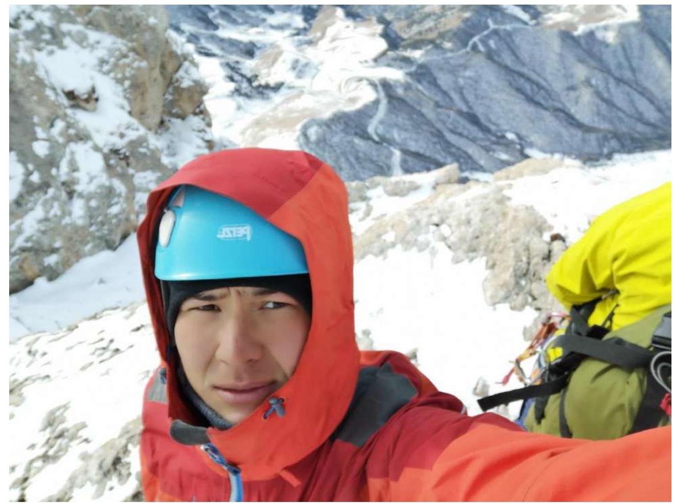
3.2. Photo of the team at the summit by the control tur
Due to objective reasons, a general photo of the team at the summit is missing because there was no opportunity to continue taking pictures due to a dead camera battery. Therefore, we are attaching a photo of the team from January 18, 2022.
3.3. Safety assessment of the route
Overall, the route is relatively safe, except for the start of the large, long chimney R5–R6. This section should be traversed as quickly as possible. We assume that this part of the route is the most rockfall-prone and is likely the area where accumulated snow mass comes from.
Section R12–R13 is extremely uncomfortable. It should be traversed with a rope.
The not very difficult smooth rocks covered with snow are one of the most unpleasant components of the route. It is worth paying attention to this.
However, the return path largely follows the key route ± category 2A. But for experienced athletes, it won't pose a significant challenge. For training groups, it's an excellent section for reinforcing skills and knowledge.
Section R15–R16 should only be traversed in crampons during snowy weather. There's a serious drop on the left side of the route.
Options for communication on the route:
- Up to section R10–R11, there is stable cellular coverage.
- Further along the route, due to the location, it is interrupted. Radio communication is similar. At the summit, both work stably.
- Recommendations for future climbers: In snowy weather, we strongly recommend bringing crampons and an ice axe. Also, as a last resort, there is a grotto on section R10–R11 where you can wait out bad weather or set up a tent, in general, organize an overnight stay. There is no water on the route.
From section R10–R11, G. Starikov's route and route 2A by Yakovenko converge. We recommend studying route 2A, as it will serve as the descent route.
Detailed information about the descent from the summit with landmark indications: The descent from the summit begins after the grotto, from which you need to descend into a couloir with many turs (helping with orientation during descent).
On the descent, you'll need to:
- Perform a 25 m abseil in a large chimney.
- Then stay on the right side and follow the turs with characteristic red ribbons.
- Eventually, exit onto section R0–R1.
P.S. — Previously, this descent was used in Russian Alpine Championships.
Conclusion on the preliminary assessment of the route: Before our passage, there was no information or description of the route. All that existed was a drawn line on a photograph, which did not reflect the actual and reliable complexity.
This route does not correspond to the stated category due to its individual sections (such as R3–R4–R5–R6–R7–R8–R9) significantly exceeding the complexity of category 2A routes.
Because on category 2A routes:
- There are no such vertical sections;
- There is no such length;
- There are no such obstacles.
Compared to classified routes of the same category in this area and the climbing experience of the team members, the real objective complexity of the route is category 3A.