
Regional Sports Public Organization Federation of Alpinism of the Udmurt Republic
Championship of the Volga and Ural Federal Districts in Alpinism 2024
Technical altitude class
Report on the ascent to peak Koazoy-Loam 3100 m via the center of the SW wall (I. Penyaev's route), 6A category of complexity, for the period from 22.04.2024 to 25.04.2024
Table of Contents
-
Ascent Passport
-
Panorama of the Area
-
Technical Photograph of the Route
-
Photo of the Summit with Existing Routes
-
Route Profile
-
Route Diagram in UIAA Symbols (Version of Penyaev's route)
-
Overview of the Ascent Area
-
Tactical Actions of the Team
-
Photographs of the Route
-
Archive Meteorological Data
-
Conclusion
-
Ascent Passport
| General Information | ||
|---|---|---|
| 1.1 | Name, Sports Rank of the Leader | Ilynikh Dmitry Sergeevich, CMS, instr. №1847, token №458 |
| 1.2 | Name, Sports Rank of the Participant | Shutov Artem Ivanovich, CMS, instr. №1866, token №460 |
| 1.3 | Name of the Coach | Shutov Artem Ivanovich, CMS, instr. №1866, token №460 |
| 1.4 | Team Name | «Energiya» Izhevsk |
| 2. Characteristics of the Ascent Object | ||
| 2.1 | Region | Region 2.9, from Kreстовый pass to v. Shavikldе |
| 2.2 | Gorge | - |
| 2.3 | Name and Height of the Summit | peak Koazoy-Loam 3100 m |
| 3. Characteristics of the Route | ||
| 3.1 | Name of the Route | Route of I.N. Penyaev via the center of the SW wall |
| 3.2 | Category of Complexity | 6A |
| 3.3 | Degree of Route Exploration | - |
| 3.4 | Nature of the Route Terrain | Rock |
| 3.5 | Altitude Difference of the Route (data from altimeter or GPS) | 735 m |
| 3.6 | Length of the Route (in meters) | length of the wall part of the route: 830 m |
| 3.7 | Technical elements of the route (total length of sections of varying complexity with indication of terrain type (ice-snow, rock)) | sections of V cat. diff.: 260 m; sections of VI cat. diff.: 260 m; of which A1 A2: 64 m; A3: 20 m. |
| 3.8 | Average Steepness of the Wall Part of the Route | 73° |
| 3.9 | Descent from the Summit | Via SW edge of Koazoy-Lolam, 4B, route by I. A. Loginov |
| 3.10 | Additional Characteristics of the Route | After the first 5 ropes, there is a possibility to arrange a good overnight stay in a grotto. Further overnight stays are arranged in niches/shelves without setting up a tent. In April, there are remaining snow "patches" on the route's shelves. |
| 3. Characteristics of the Team's Actions | ||
| 3.1 | Time of Movement (team's working hours) | 31 h 30 min |
| 3.2 | Overnight Stays | 2 on the wall, 1 on the summit |
| 3.3 | Time of Route Preparation | Without preparation |
| 4. Characteristics of Weather Conditions | ||
| 4.1 | Precipitation | None |
| 4.2 | Cloud Cover | Variable |
| 4.3 | Temperature | +10–11°C in the morning, +14–16°C during the day, +5–6°C at night |
| 5. Responsible for the Report | ||
| 5.1 | Name, e-mail | Shutov Artem Ivanovich (Urmf.18@ya.ru), 89120266440 |
| 6. Release of the Group to the Route | ||
| 6.1 | a/l «Kyazi» | Alekseev V.V. |
2. Panorama of the Area

Peaks Tsey-Loam (Kyazi) on the left and Koazoy-Loam on the right
3. Technical Photograph of the Route
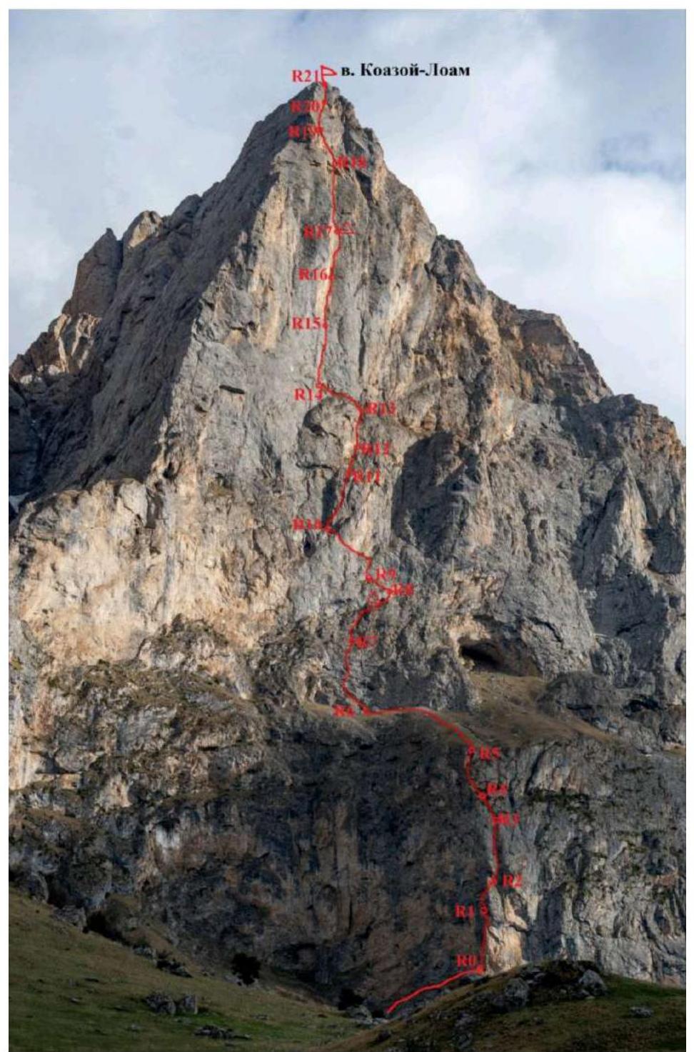
Section numbers on the technical photograph correspond to the section numbers on the route diagram in UIAA symbols
4. Photo of the Summit with Existing Routes

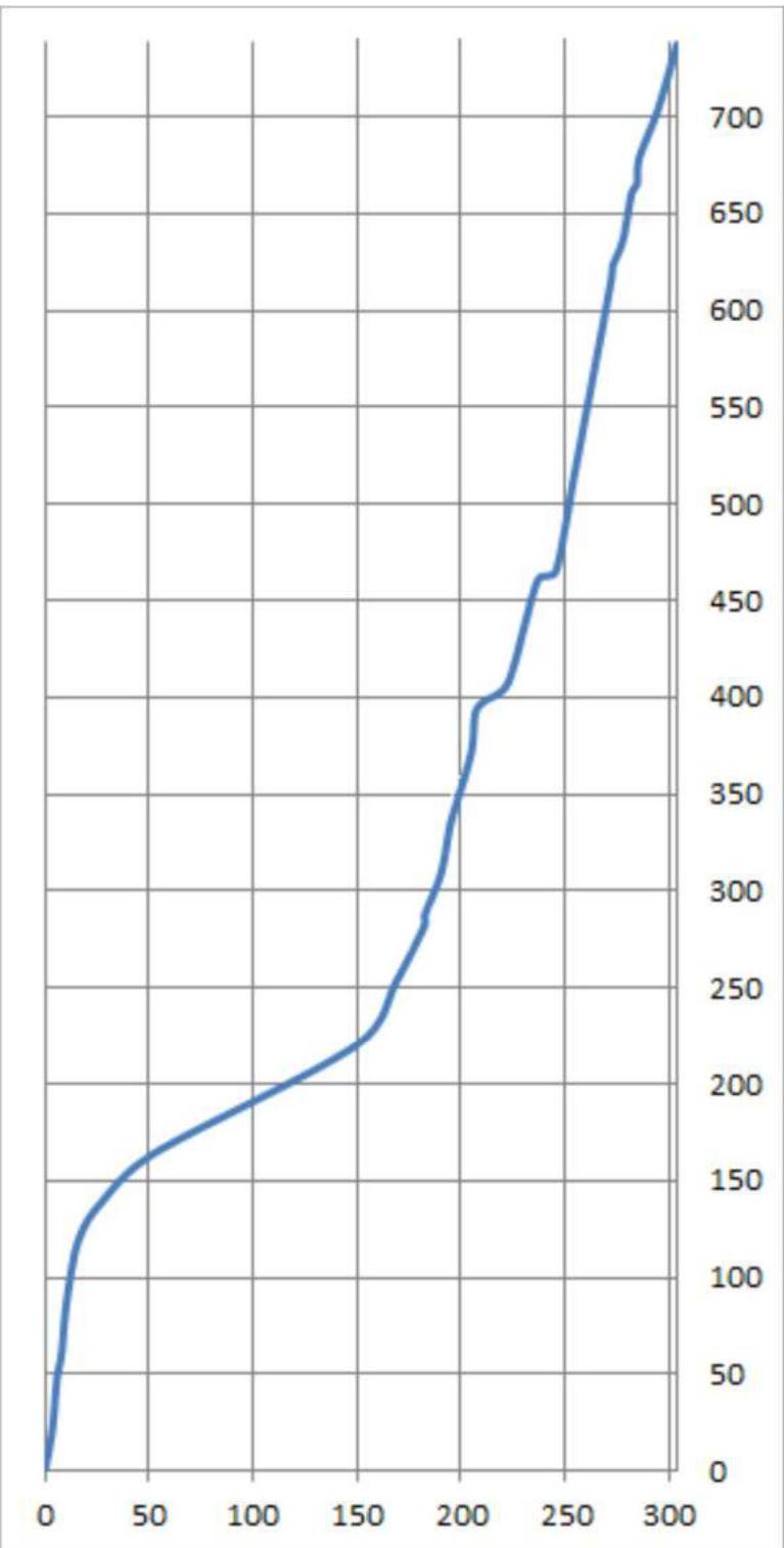
5. Route Profile
6. Route Diagram in UIAA Symbols
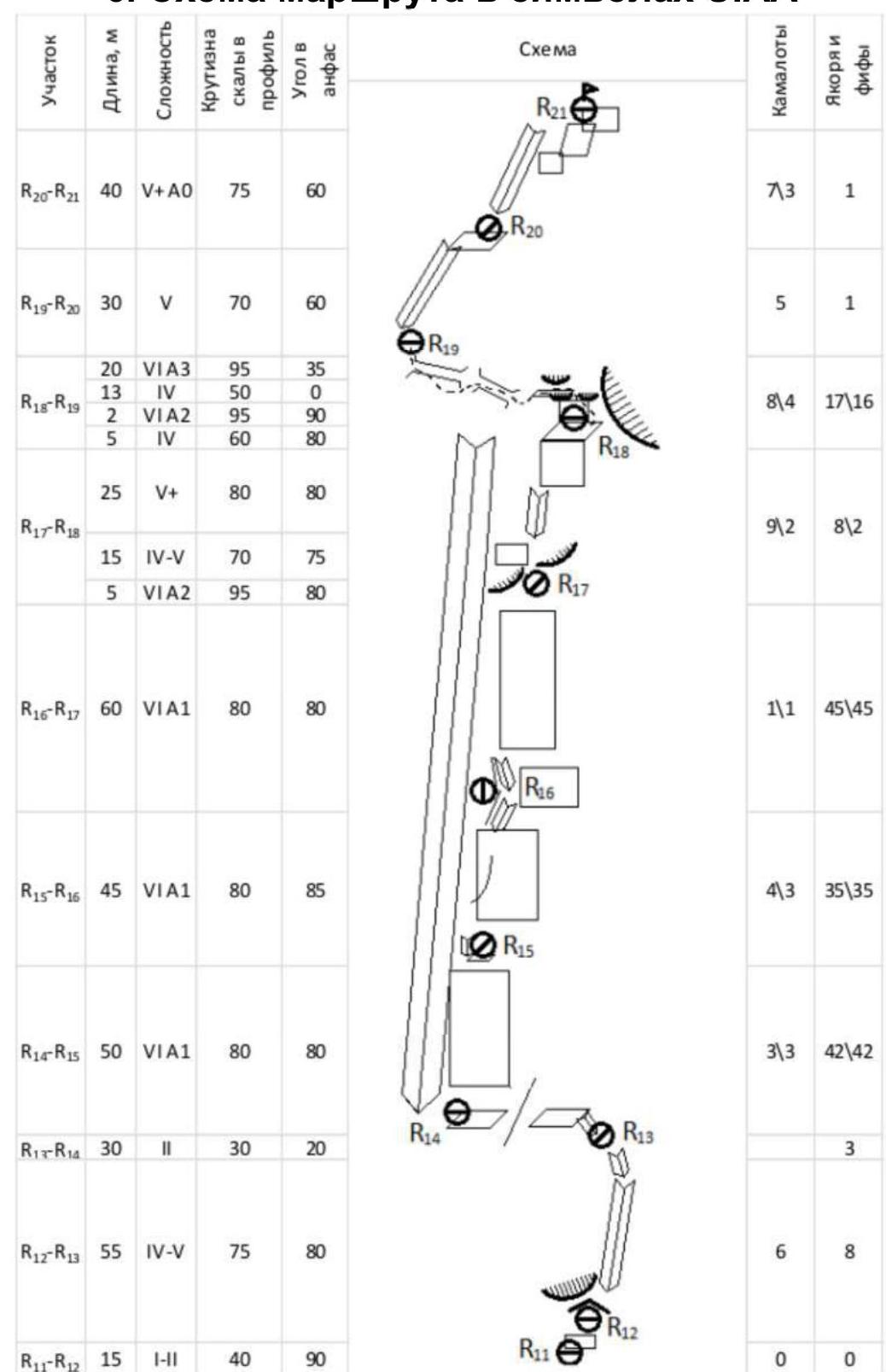
Fig. 1. Upper part of the route
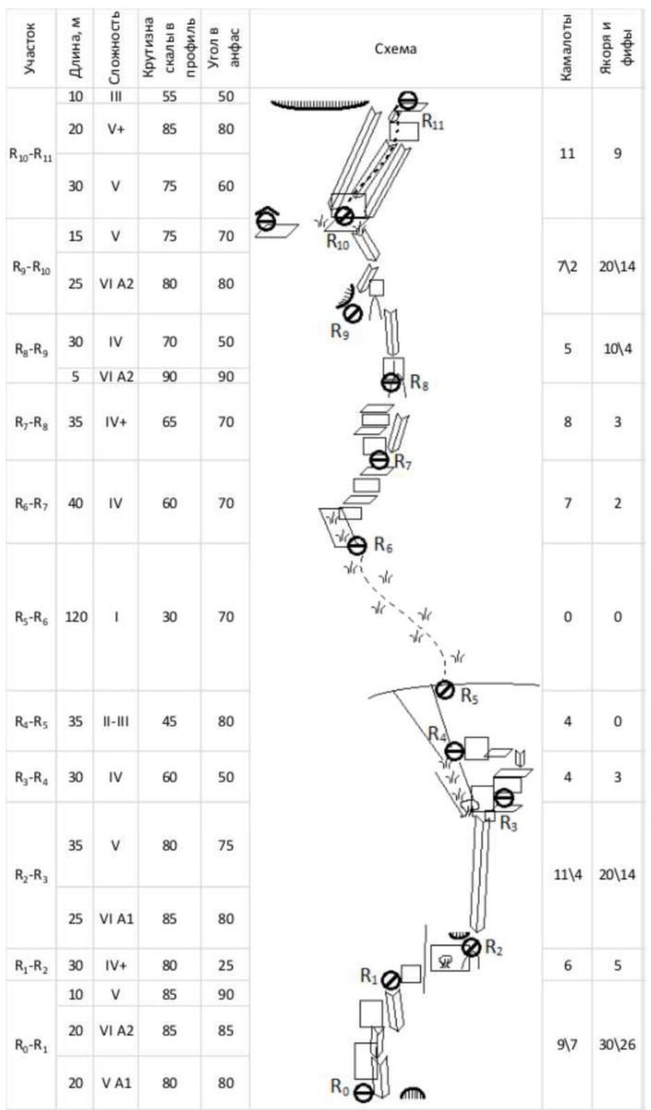
Fig. 2. Lower part of the route
7. Overview of the Ascent Area
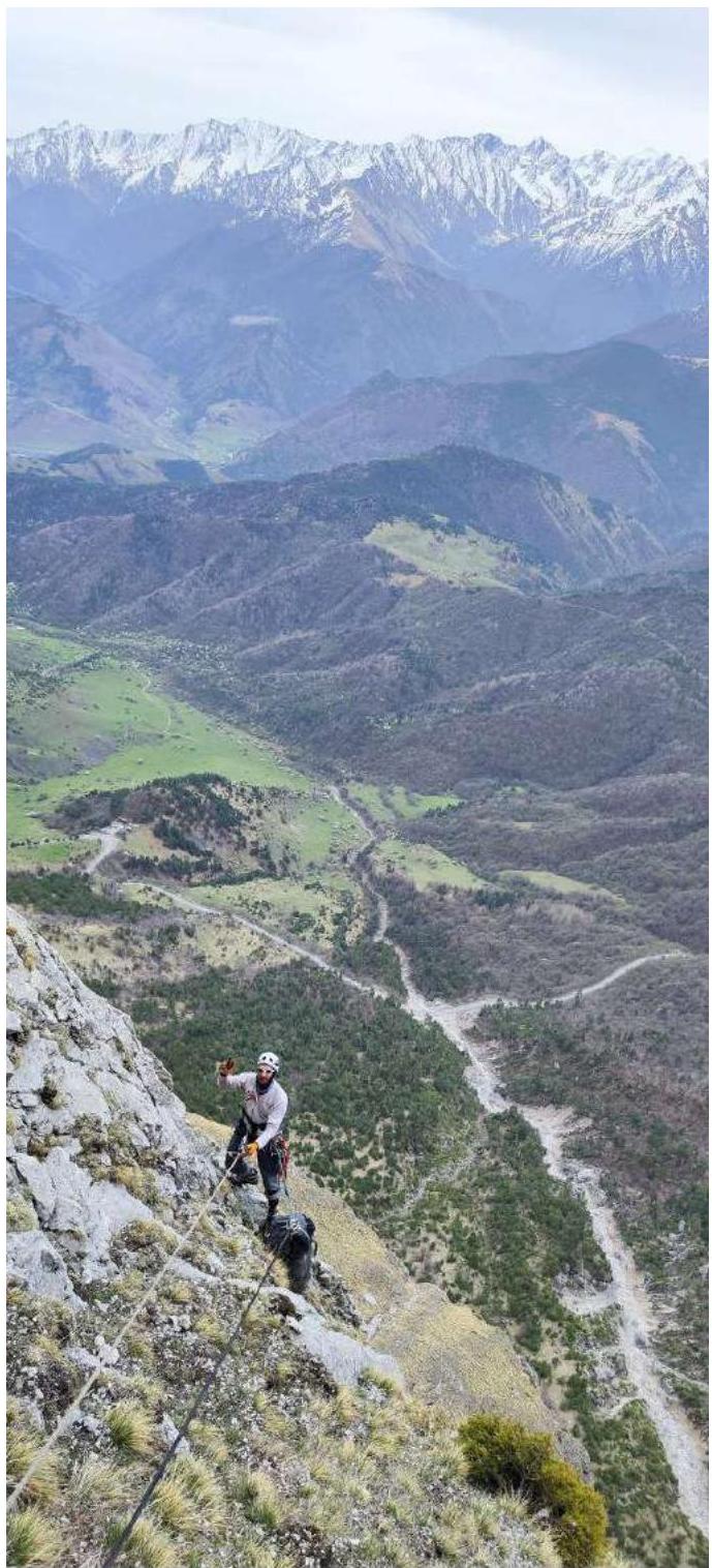
The summit Koazoy-Loam is located in the Rocky Range of the Greater Caucasus, in the section of the range between the rivers Terek and Assa. The ascent route and approaches to it are located on the territory of the Dzheyrakhsky district of the Republic of Ingushetia. Our base camp was set up on the territory of the a/l «Kyazi». Border passes are not required, but it is mandatory to have identification documents (passport) with you. In the base camp, there is a connection of operators such as «Beeline», «Megafon», and Wi-Fi is available. The weather in April is generally stable and warm, leading to abundant snowmelt on the shelves of all routes. With the onset of May, the weather usually deteriorates, and snow often falls. The rock type of the peaks Koazoy-Loam is sedimentary, limestone. The wall of the route alternates between solid and loose rock sections. In the lower part, there are more solid sections of gray color, while in the upper part, there are loose sections with a yellowish-white hue.
The route was first ascended by a team from St. Petersburg in February 2017, during the Russian Alpinism Championship in the technical class.
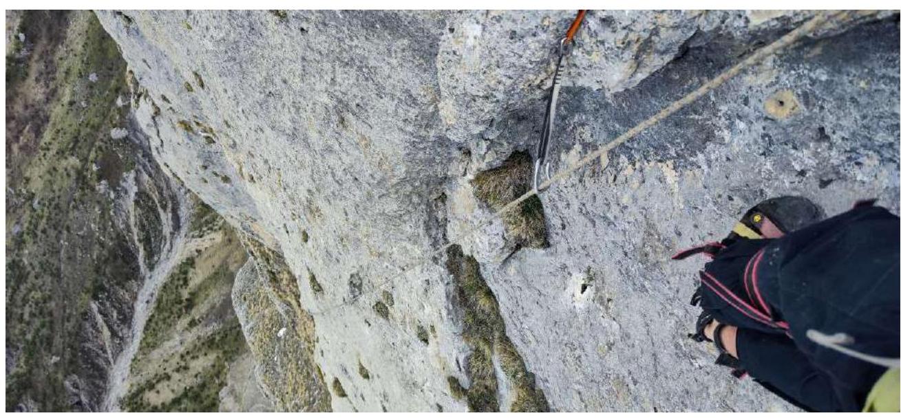
Throughout the route, there are sections of unstable limestone massif. This is loose, yellowish-white rock (sections R15–R16, R17–R18), in which there are destroyed blocks. On such sections, protection is only through rock anchors. In the lower part, the rock is more solid and allows the use of the entire range of mountaineering equipment.
The approach to the route is initially along an asphalt road down to a characteristic couloir (a dried-up stream). The approach to the route goes along a grassy shelf at the base of the wall. In wet weather, it can be dangerous. Below is a deep precipice. The route begins to the left of a small cave R0.
8. Tactical Actions of the Team
April 22, 2024 – Day 1
Departure to the route at 5:00 from the base camp. To the wall. Took 4 l of water with us, as snow sections were visible on the shelves from the camp.
At 7:00, the leader (Shutov A.I.) started work on the first rope R0–R1. The first rope begins along a destroyed inner corner, then moves right through a bend. The first 10 m are simple rocks, followed by ITO along destroyed walls.
R1–R2. After R1, move right along the wall beyond the bend. Moved carefully, with «live» rocks in some places. Move to the base of a large inner corner. Then a small traverse to the right, then up and left. Protection on anchors.
R2–R3. Up the wall. Climbing becomes a bit easier. Protection through anchors and medium Friends. Station on our own points.
R3–R4. Main direction is up. Protection through anchors and medium Friends. Sections of «live» rocks start to appear. Station on our own points. The relief becomes more fragmented.
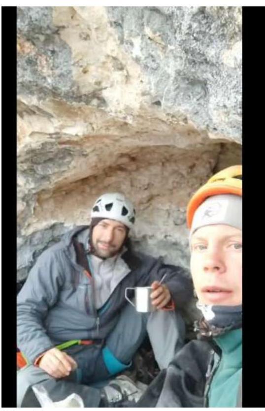
R4–R5. Up along simple rocks, which lead to a talus, and then to a grassy slope that crosses the entire SW wall. At 15:30, we reached the inclined grassy shelf. This is section R5–R6. We processed another section R6–R7. Decided to set up a bivouac in a grotto on the right part of the shelf.
Working hours of the first day: from 7:30 to 17:30 (9 h).
Day 2
On the route, (Ilynikh D.S.) is working. Start at 7:30. R7–R8. To continue the route, it is necessary to move along the slope up and left to a narrow grassy ascent leading to the wall. Landmarks for movement are white streaks on the gray wall; need to move towards the right one.
R8–R9:
- From the station, move through a ledge along a complex wall with cracks up into an inner corner.
- Then up.
- Then left in a traverse through a large spall.
- The station is located with an offset from the line to the left in a safe place.
- Station on anchors.
R9–R10. Approach back to the spall. Then up and left along complex rocks to a grassy shelf, under characteristic relief in the form of the number seven (7). Station on anchors.
R10–R11. The next section begins at the base of the seven. Move up and right, going along shelves and walls into the neighboring inner corner. Up along it, onto the wall. The relief is relatively monolithic. Medium and large Friends are used, along with anchors.
The station is comfortable, on a shelf.
R11–R12. The R11 station is comfortable, on a shelf. Further, it is necessary to approach the next wall along a steep slope with grass. The movement is not complex but requires attention. In wet weather, more protection points are required, as the second participant may fall with a cowtail. At 15:00, we reached R12. There is a shelf where we can comfortably settle.
R13–R14. Simultaneous movement along the shelf to the left and traverse through a bend. Approximately 60 m to the start of the next station. After the bend, there is a constructed platform under a small overhang. We set up a bivouac here with preliminary installation of peripheral protection. Comfortable for two participants. It is also possible to place three participants «valet-style». All items on the bivouac require additional protection!!!
R14–R15. Up along the inner corner. We processed this section R14–R15. At 17:30, we descended to the bivouac. Team's working hours on the 2nd day: from 7:30 to 18:00 (10 h 30 min).
Day 3
The leader is (Ilynikh D.S.). Start at 7:00. R15–R17. Practically direct sections of movement on ITO. Movement along walls with cavities, to the right of a ripe inner corner. The relief is unreliable; loose rock; often installed rock pins in cavities. Movement on ITO. Protection on anchors, rarely – large Friends.
At the station R17 at 15:40.
R17–R18. The leader is (Shutov A.I.). Move slightly left and up along complex relief and then along the inner corner and wall to a good shelf R18. To the left is a very large overhang. At R18, the route connects with Ibragimov's route 5B.
R18–R19. The key to the route. Move slightly up, through reddish, loose relief. Then left into a large, slightly overhanging inclined chimney. The first part of the chimney is passable. The second part is more difficult. It is hard to find reliable relief. Movement on ITO on pins. At the end of the chimney, vertically up about 4–5 m.
R19–R20. Further up and right along a wide groove. Protection points on large and medium Friends. Station on a shelf on our own points.
R20–R21. Further, move up along the groove. Climbing becomes easier. Protection points on large and medium Friends. Then exit to the summit.
At 18:30. Both participants reached the summit. There is a comfortable area for an overnight stay on the summit, with plenty of snow. Working hours: from 7:00 to 19:00 (12 h).
Day 4
Rise at 8:00. Descent along 4B route by Loginov took about 5 h and another 1 h to the camp.
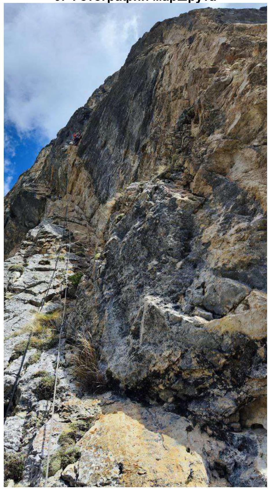
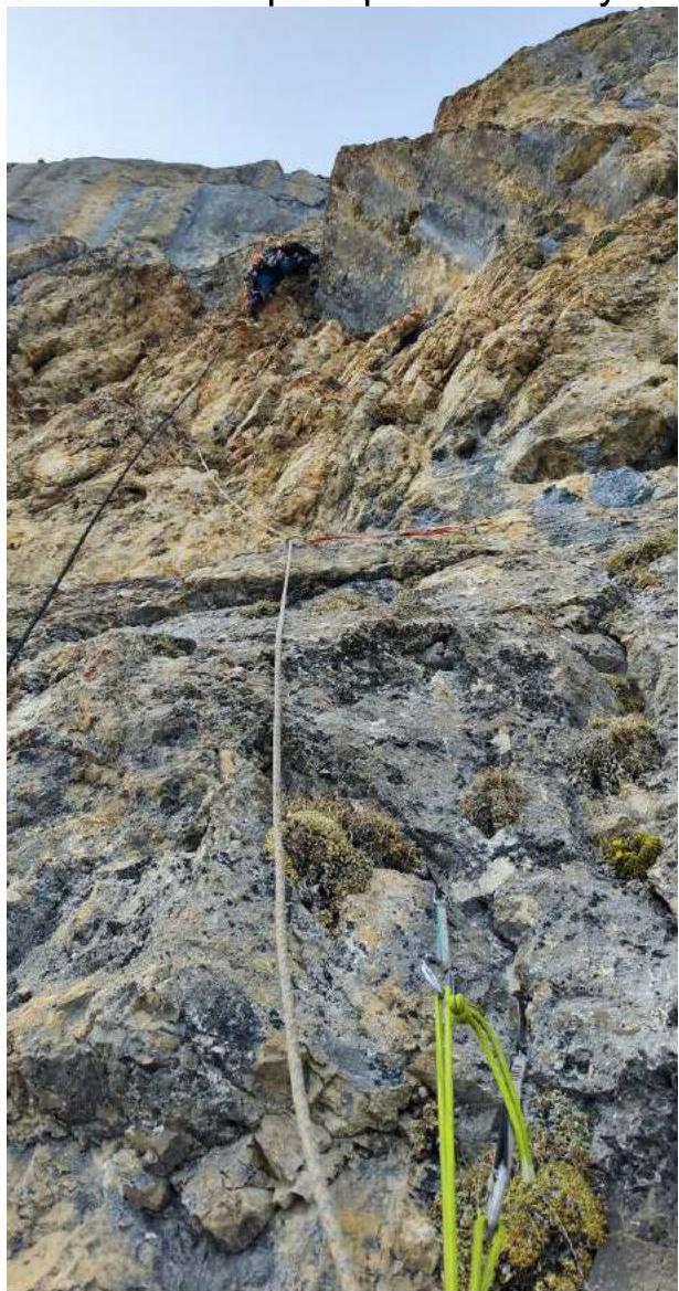
9. Photographs of the Route
Start of movement on section R0–R1
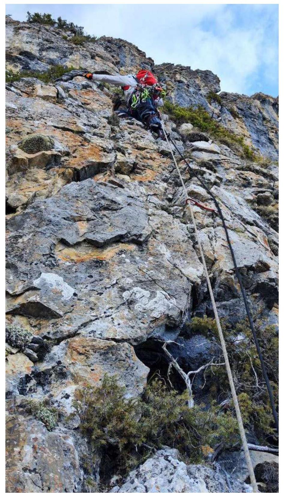
Section R3–R4. Further movement goes along rocks of medium difficulty. The upper part of section R5 along simple rocks leads to a grassy shelf.
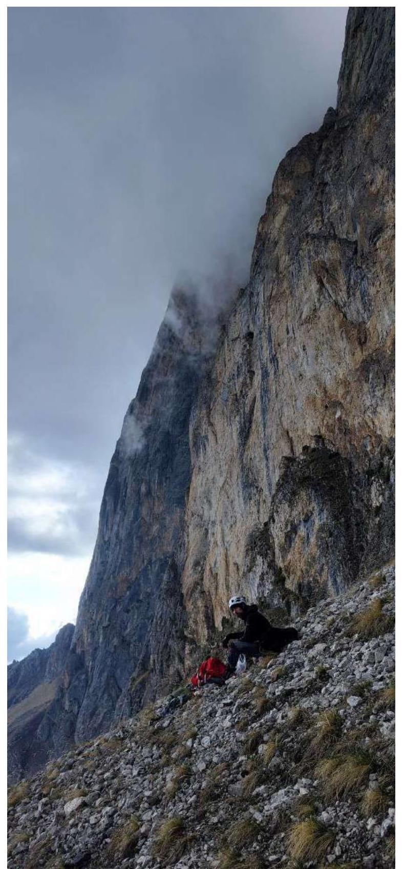
End of section R5. There is a large grotto on the right part of the shelf; water on the shelf was in the form of a small amount of snow.
Approach to the second overnight stay. Section R14
On the bivouac, platform on R14
Section R15. First is Ilynikh Dmitry.
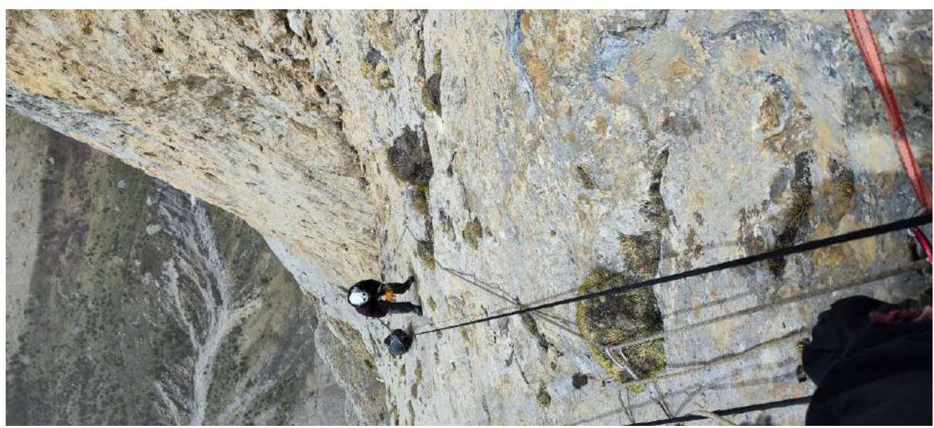
Section R16–R17. Second is Shutov Artem.
Passing through a cornice on section R16–R17. Ilynikh Dmitry passes a belt of destroyed rocks.
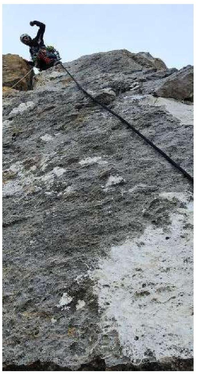
Section R20–R21
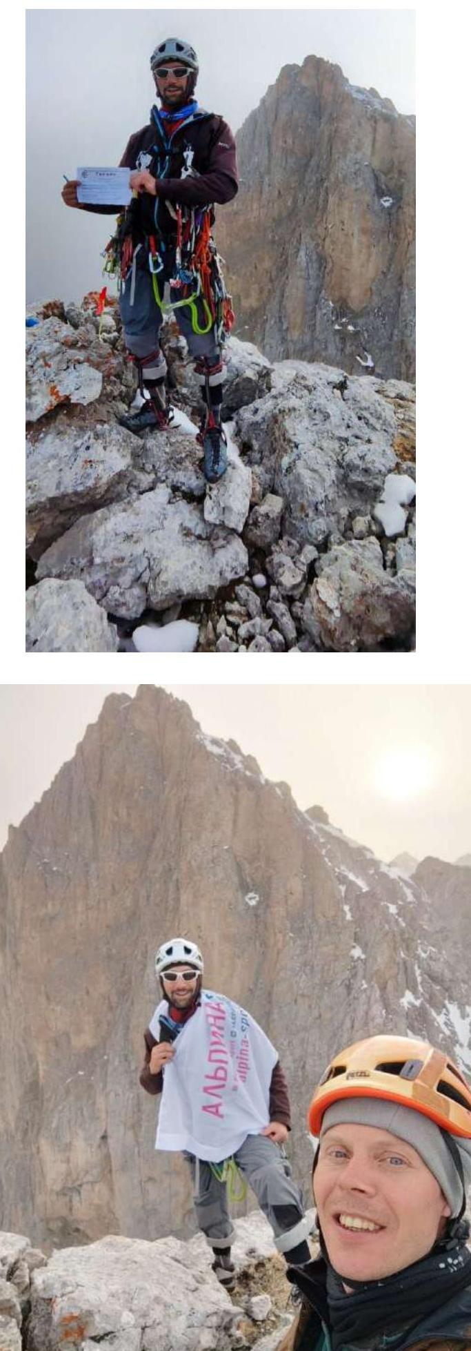
On the summit.
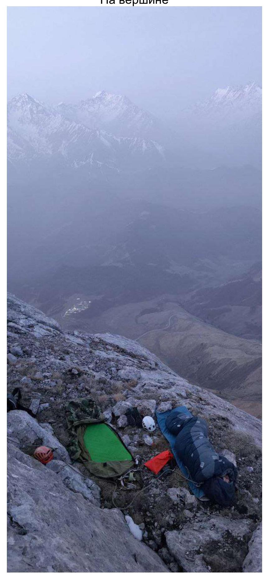
Overnight stay on the summit.
10. Archive Meteorological Data
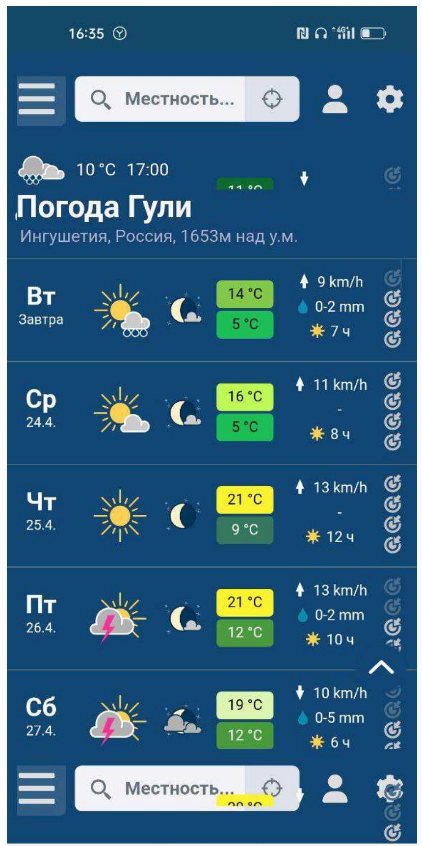
Weather Guli — meteoblue
11. Conclusion
Overall, we liked the route. Perhaps its character was expected for us, as we had experience climbing the K. Dorro route. Comparing it to 6A Dorro, we can say that it is more complex. The amount of ITO is greater.
It is worth noting that teams can change the line of ascent under adverse circumstances and exit onto the line of Ibragimov's route in the upper part (starting from section R18, traversing about 15 m to the right).
The route was climbed at the end of April with a minimal amount of snow on the shelves. In the summer months, water transportation will be required.
There are quite large sections of destroyed relief. This, combined with the verticality of the route, gives a high risk of falling or dropping rocks on a partner during careless climbing.
Particularly unpleasant sections on the route in this regard are: R0–R2, R6–R9, and R18–R19.
Along the entire route line, rock pins and anchors are most in demand (we took about 22 pcs with us). Medium Friends are used less frequently, and large ones are used rarely.
A note from the alpcclub «GORNYAK» team was found on the summit, having ascended via route 4B category of complexity.