
Ascent Passport
- Ascent category — Combined
- Ascent region — East Caucasus, Shavana ridge
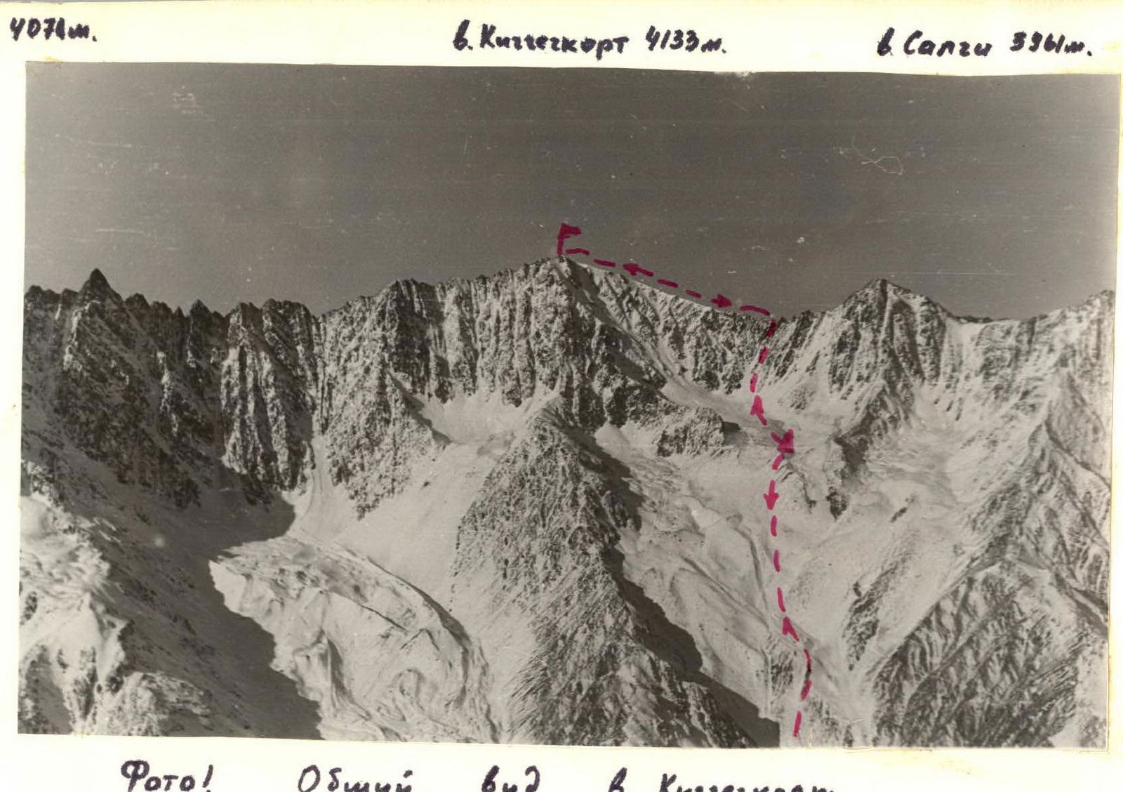
- Peak, its height, route — Kichchechkort, 4133 m, via N ridge.
- Route characteristics: a) height difference — 900 m. b) route length — 1900 m. c) average steepness of the route — 40 °
- Pitons hammered for belay (I.T.O.): rock — 1 ice — 2 bolted —
- Number of climbing hours on the route: to the summit — 7 h.
- Number of nights and their characteristics: NONE.
- Proposed category of difficulty — 2A.
- Full name of the leader, participants, their qualification:
- Ivashkin V.V. — CMS
- Nedyuzhev E.I. — 1st sports category
- Logovskoy V.I. — CMS
- Borodatsky I.G. — MS
- Team coach: Vasilenko A.A.
- Dates of departure to the route and return to the base camp: a) departure to the route — October 1, 1984. b) reaching the summit — October 1, 1984. c) return to the base camp — October 1, 1984.
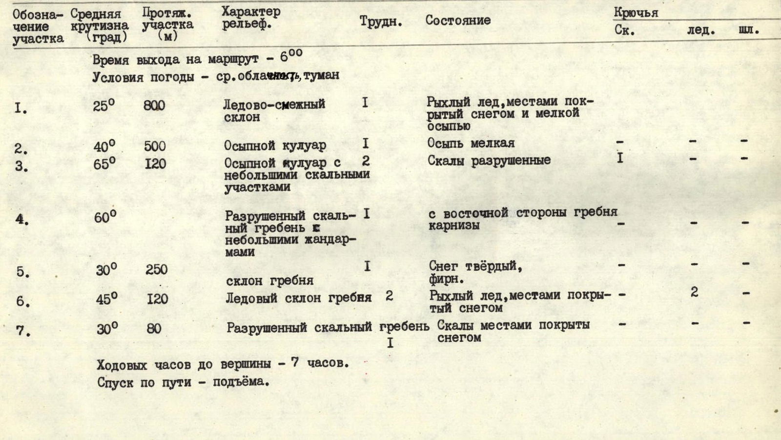
Route Sections Table
Departure time — 6:00 Weather conditions — average cloudiness, fog
| Section | Average steepness (°) | Length (m) | Terrain characteristics | Diff. | Condition | Rock | Ice | Bolt |
|---|---|---|---|---|---|---|---|---|
| R1 | 25 | 800 | Ice-mixed slope | 1 | Soft ice, partially covered with snow and scree | |||
| R2 | 40 | 500 | Scree gully | 1 | Fine scree | - | - | - |
| R3 | 65 | 120 | Scree gully with small rock sections | 2 | Destroyed rocks | 1 | - | - |
| R4 | 60 | Destroyed rock ridge with small gendarmes | 1 | Cornices on the eastern side of the ridge | - | - | - | |
| R5 | 30 | 250 | Ridge slope | 1 | Hard snow, firn | - | - | - |
| R6 | 45 | 120 | Ice slope of the ridge | 2 | Soft ice, partially covered with snow | - | 2 | - |
| R7 | 30 | 80 | Destroyed rock ridge | 1 | Rocks partially covered with snow | - | - | - |
Climbing hours to the summit — 7 h. Descent via the same route.
Description of the Ascent Region
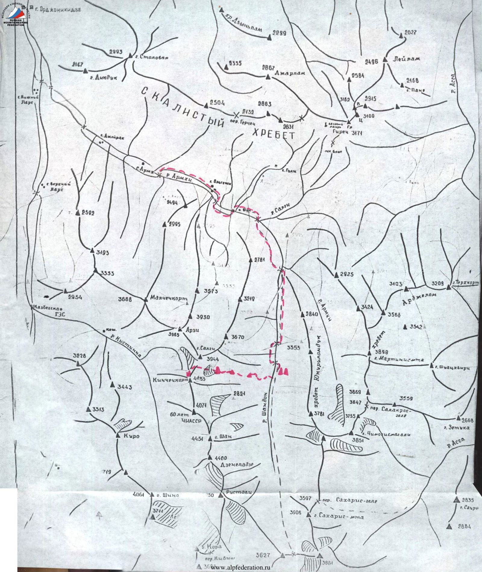
The ascent object is located in the Eastern Caucasus, in the southern part of the Chechen-Ingush ASSR, in the Shavana ridge.
The ascent object is located in the center of the Shavana ridge, which divides the gorges of the Kistinka and Shan-don rivers. This ridge includes the peaks of Shan (4451 m), Dzeneladze (4400 m), Rustavi (4350 m), Kichchechkort (4133 m), and others. Routes to the peaks of this ridge have been laid (from the Kistinka gorge) from 1B to 4B category of difficulty. No ascents have been made from the Shan-don river gorge.
At the 21st km of the Military Georgian Road, the Terek River is joined by its left tributary — the Armkhi River. The road leads to the village of Armkhi (12 km) — regular buses run from the city of Ordzhonikidze.
From the village of Armkhi, follow the Armkhi River upstream to its confluence with the Shan-don River (about 2 hours walk).
Then continue up the Shan-don River (direction — south). The gorge is covered with forest, with a good trail.
At the edge of the forest, near the lakes (2071 m) — base camp, 6–7 hours from the village of Armkhi.
From the base camp to the eastern cirque of the Kichchechkort peak:
- Path along the wide gully-slope on the left bank of the Shan-don River.
- Ascend to the East Kig glacier.
- The glacier is covered with moraine.
- Overnight stay under the East rib of the Kichchechkort peak near a large "reddish" boulder (3200 m).
- Water in a glacier crevice. From the base camp to the overnight stay — 5–6 hours.
3627
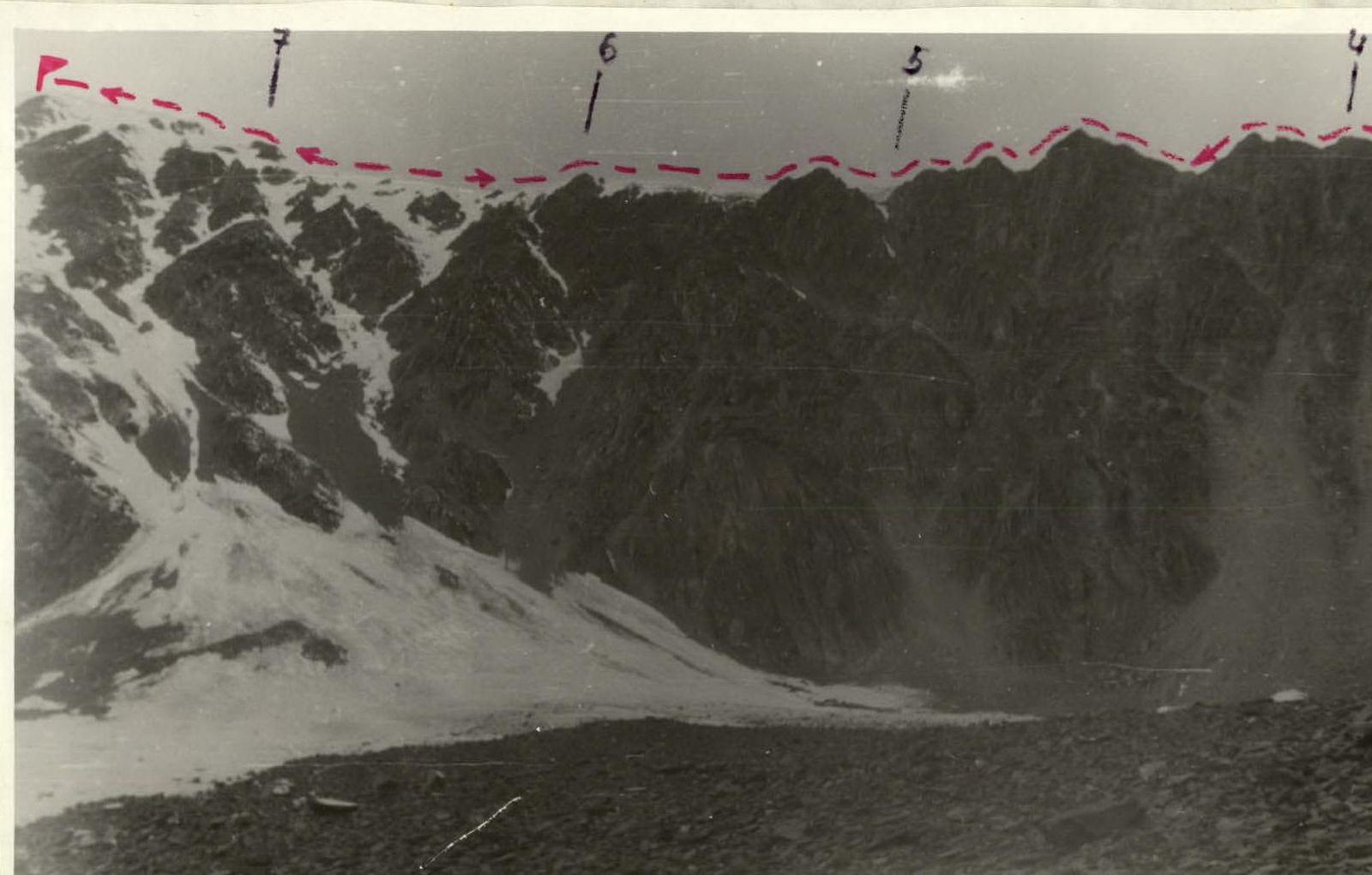
6. Kichchechkort Peak (4133 m)
Comments
Sign in to leave a comment