Report
ON ASCENDING JARLAM CENTRAL PEAK VIA THE WESTERN ROUTE, CATEGORY 1B DIFFICULTY BY THE TEAM OF MOUNTAINEERING CAMPS MANAGEMENT FOR THE PERIOD FROM DECEMBER 29, 2021 TO DECEMBER 29, 2021
I. Ascent Passport
| № | 1. General Information | |
|---|---|---|
| 1.1 | Name, sports rank of the leader | Kergin Ivan Vasilievich, 2nd sports rank |
| 1.2 | Names, sports ranks of participants | Panova Alena Mikhailovna, CMS, Mendin Vladimir Yurievich, 2nd sports rank |
| 1.3 | Coach's name | Yakovenko Alexander Nikolaevich, MS |
| 1.4 | Organization | Mountaineering Camps Management |
| 2. Characteristics of the ascent object | ||
| 2.1 | Region | 2.9. From the Krestoviy pass to the Shaviklde peak |
| 2.2 | Valley | Armhi |
| 2.3 | Section number according to the 2013 classification table | 11 |
| 2.4 | Name and height of the peak | Jarlam (Central), 3160 m |
| 2.5 | Geographic coordinates of the peak (latitude/longitude), GPS coordinates | – |
| 3. Route characteristics | ||
| 3.1 | Route name | From the West |
| 3.2 | Proposed difficulty category | 1B |
| 3.3 | Route освоенности degree | – |
| 3.4 | Terrain type along the route | Rocky |
| 3.5 | Elevation gain (altimeter or GPS data) | 402 m |
| 3.6 | Route length (in meters) | 995 m |
| 3.7 | Technical elements of the route (total length of sections with varying difficulty, terrain type) | Category I rocks – 985 m, Category II rocks – 10 m, rappel descent – 7-8 m (one rope) |
| 3.8 | Descent from the peak | Via the ascent route |
| 3.9 | Additional route characteristics | No water |
| 4. Team actions characteristics | ||
| 4.1 | Time on the move (team-hours, in hours and days) | 1 day, 8 hours |
| 4.2 | Overnights | No |
| 4.3 | Departure time for the route | 7:00, December 29, 2021 |
| 4.4 | Time of reaching the peak | 10:30, December 29, 2021 |
| 4.5 | Return to base camp | 14:00, December 29, 2021 |
| 5. Responsible for the report | ||
| 5.1 | Name, e-mail | Kergin Ivan Vasilievich, ivan.kergin@mail.ru |
II. Ascent Description
1. Characteristics of the Ascent Object
1.1. General photo of the peak
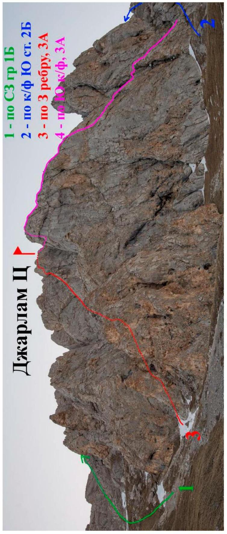
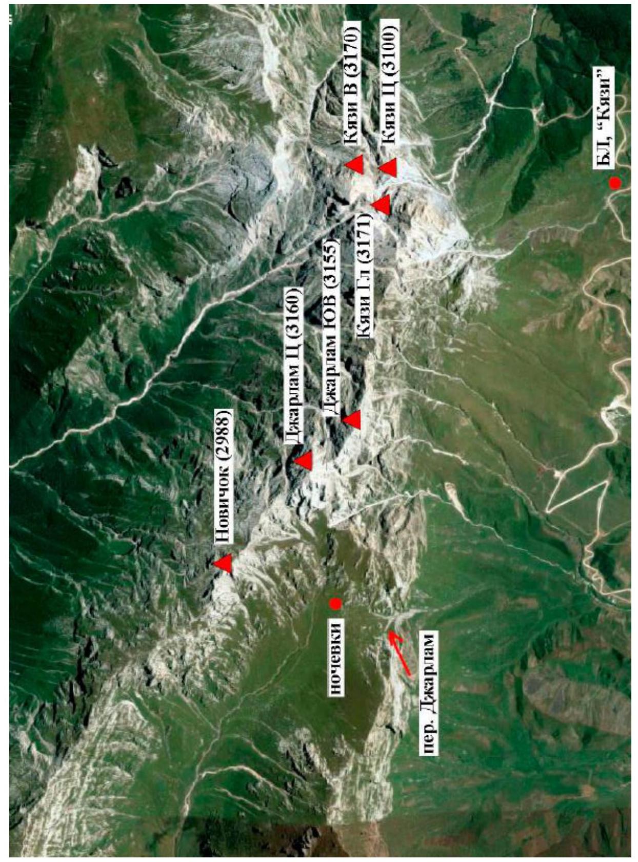
1.2. Map of the area
1.3. Photopanorama of the area

Photo from V. Shipilov's report
2. Route Characteristics
2.1. Technical photograph of the route
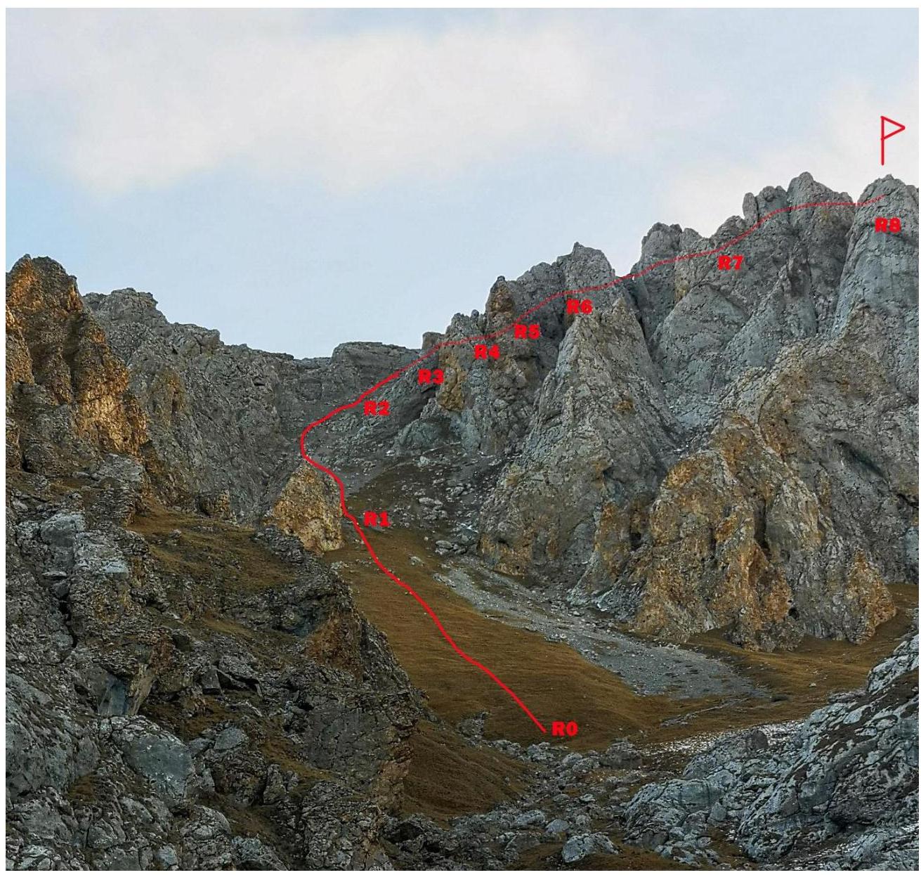
2.2. Section numbers
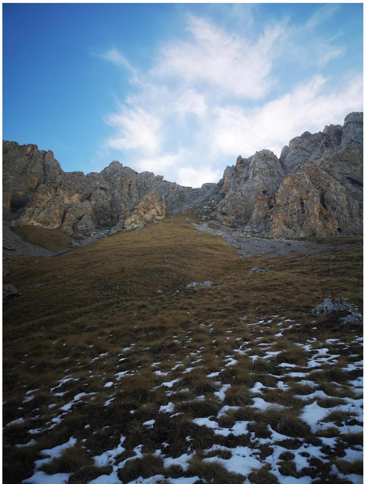
Fig. 1. Section R0–R1
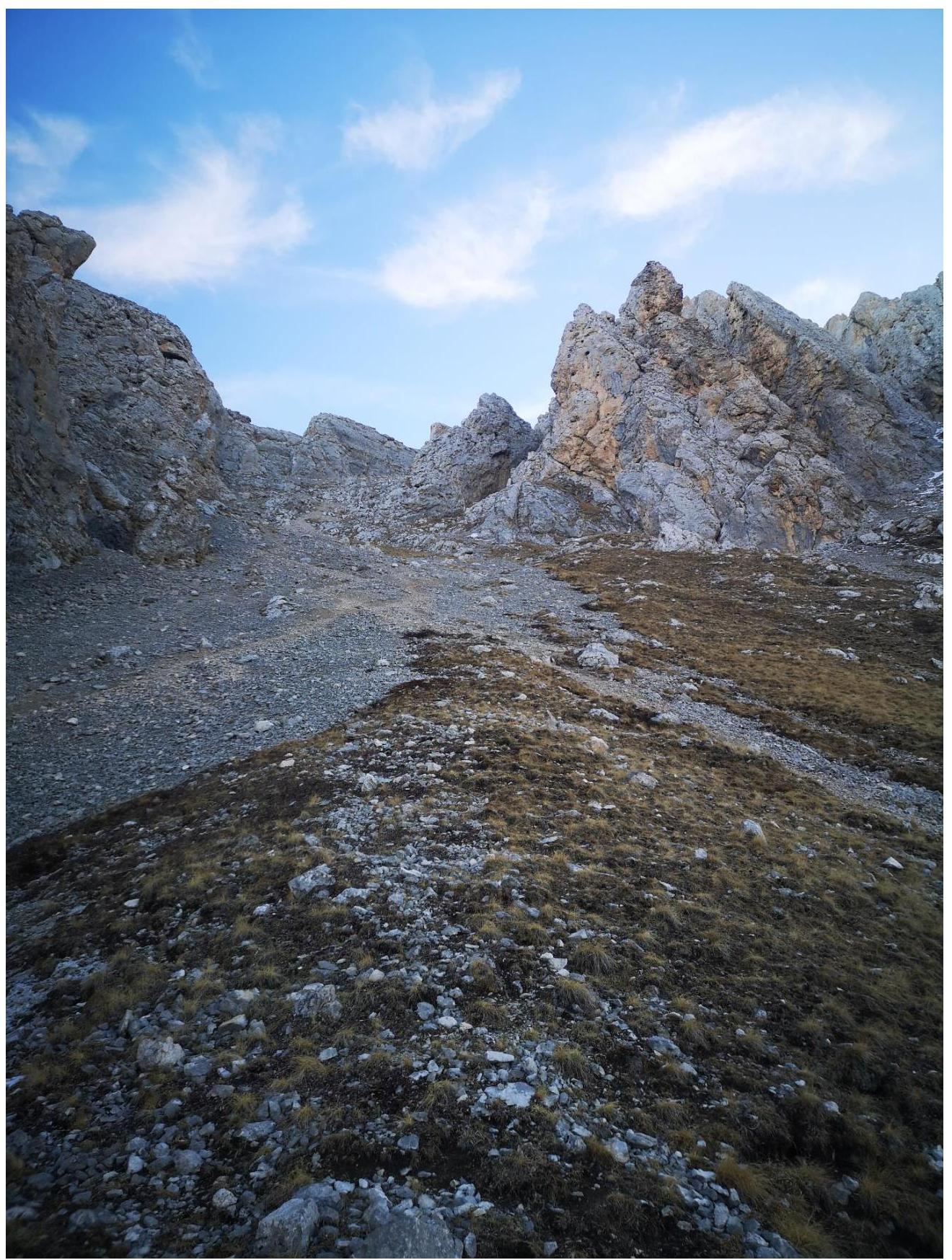
Fig. 2. Section R1–R2
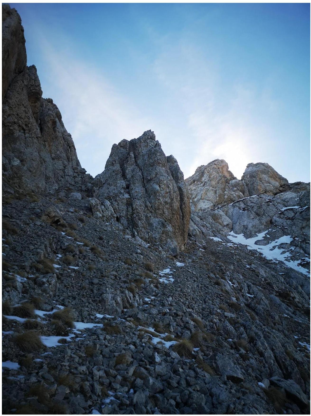
Fig. 3a. Section R2–R3 (First part 15°)
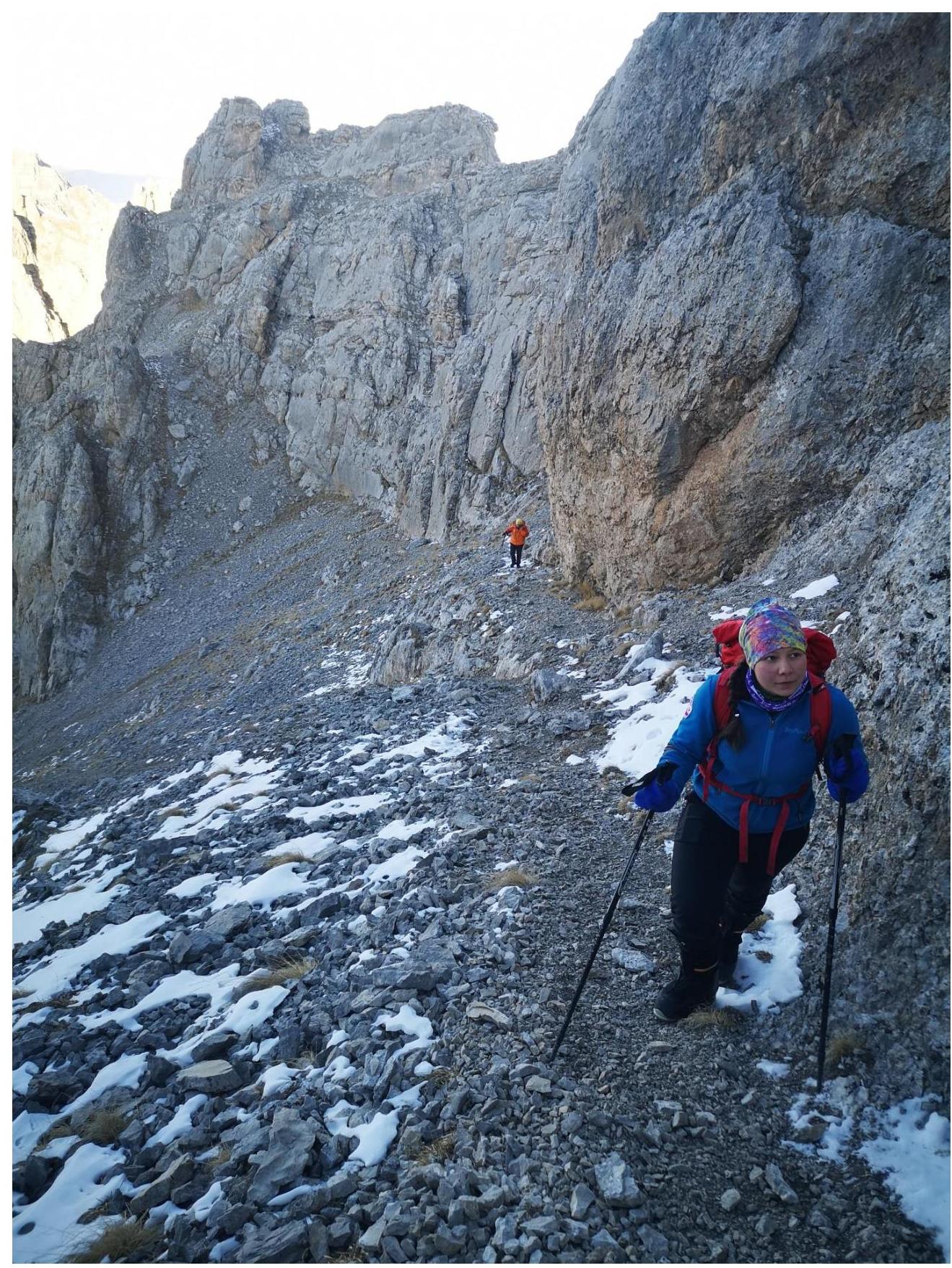
Fig. 3b. Section R2–R3 (First part 15°)
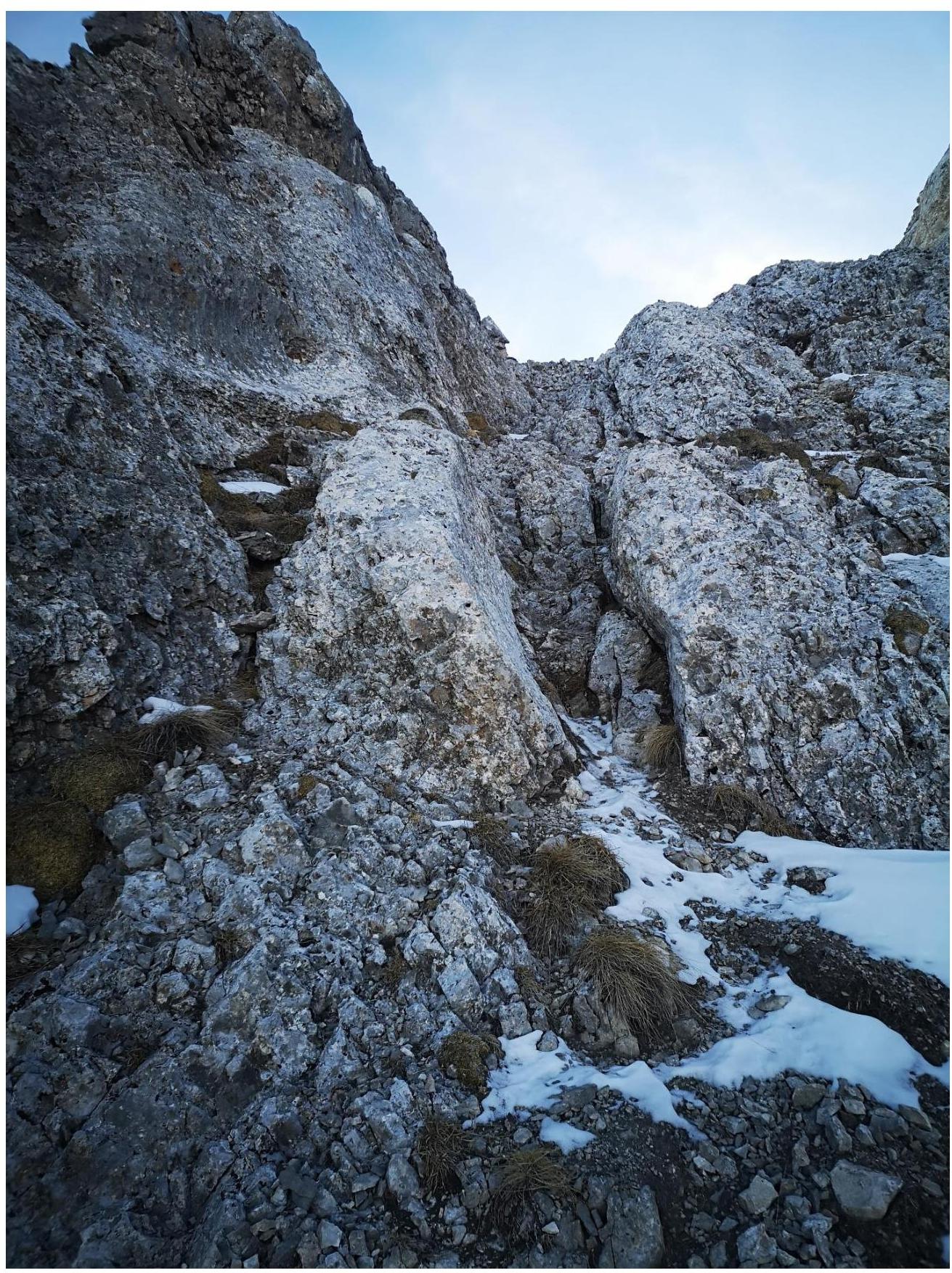
Fig. 3c. Section R2–R3 (Second part 35°)
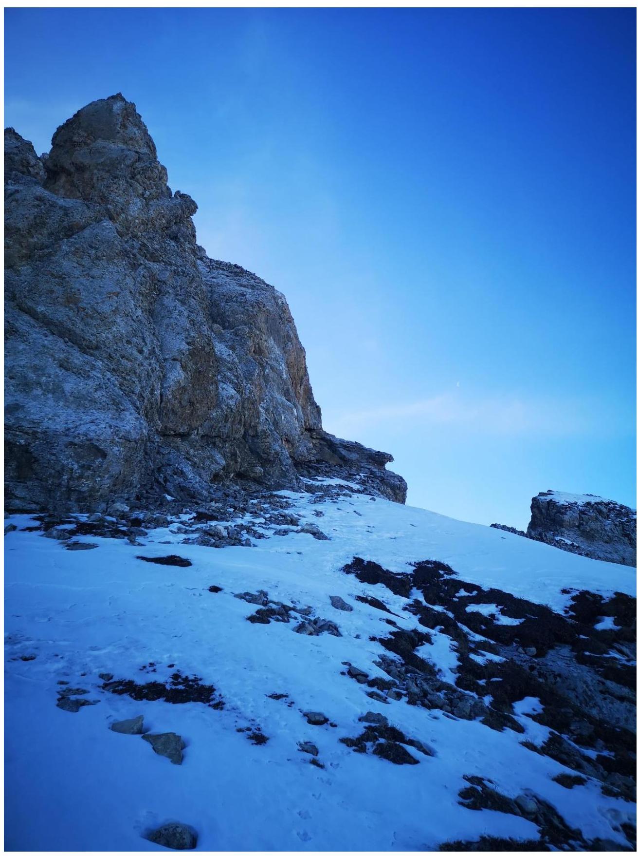
Fig. 4. Section R3–R4 (Traverse right to the crux)
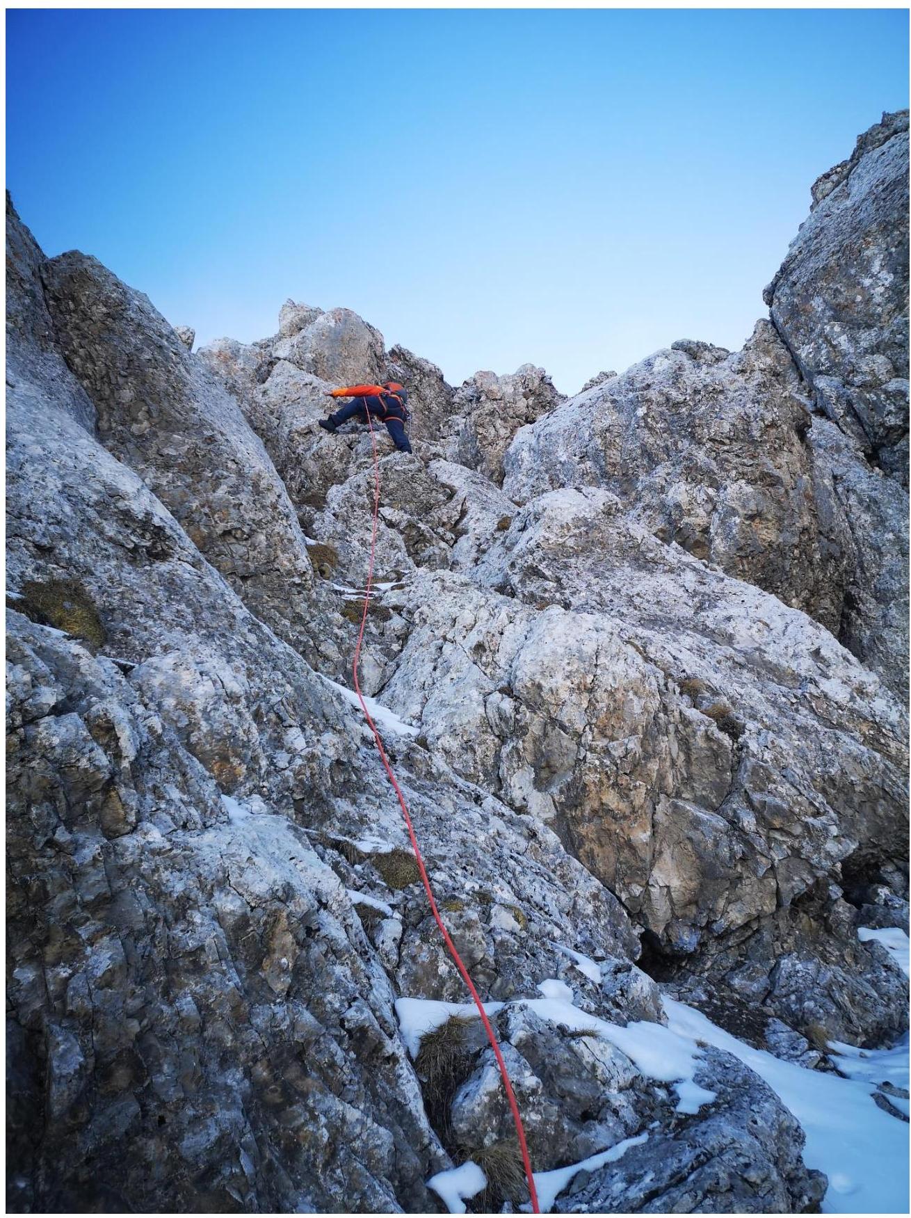
Fig. 5. Section R4–R5 (Route crux)
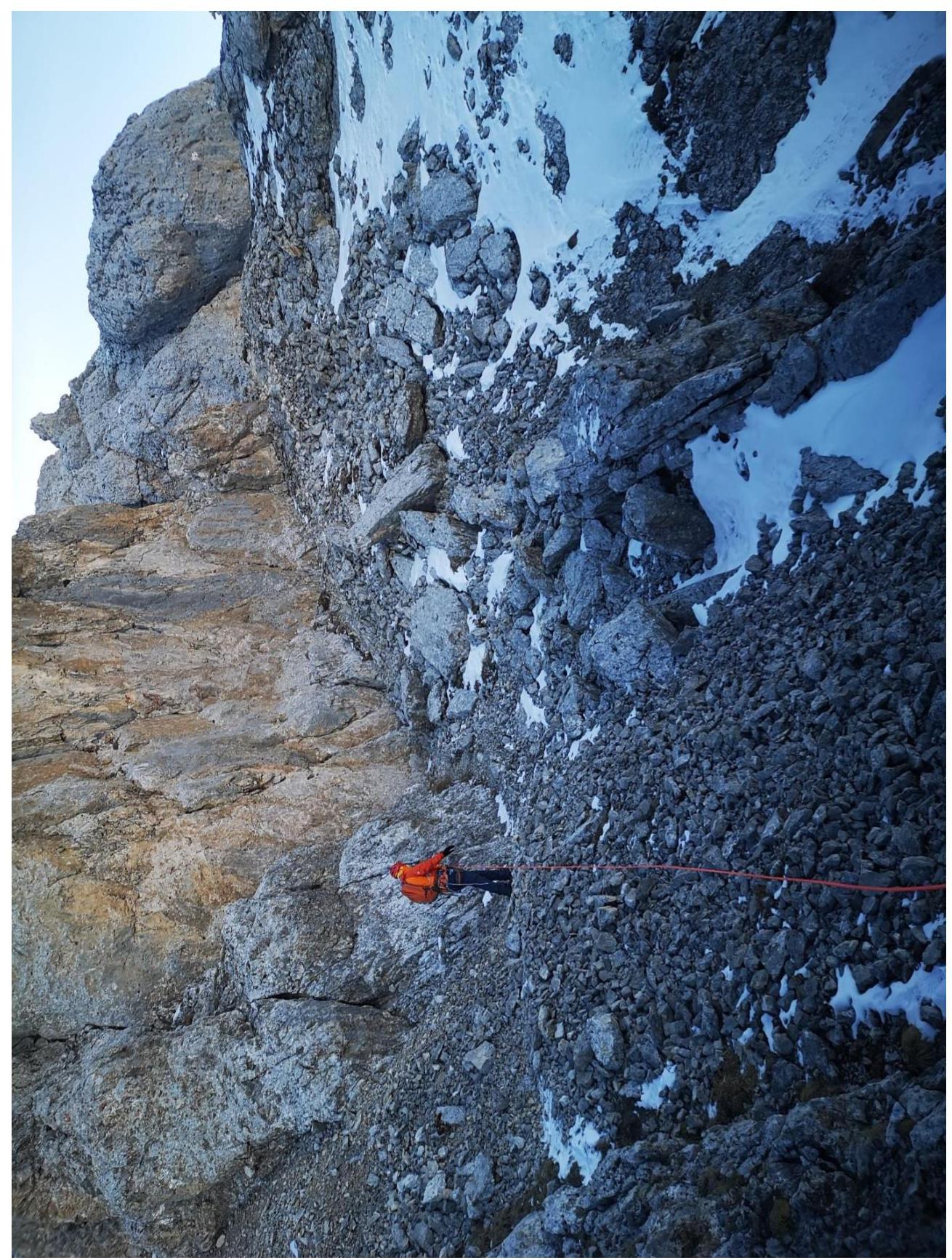
Fig. 6. Section R5–R6
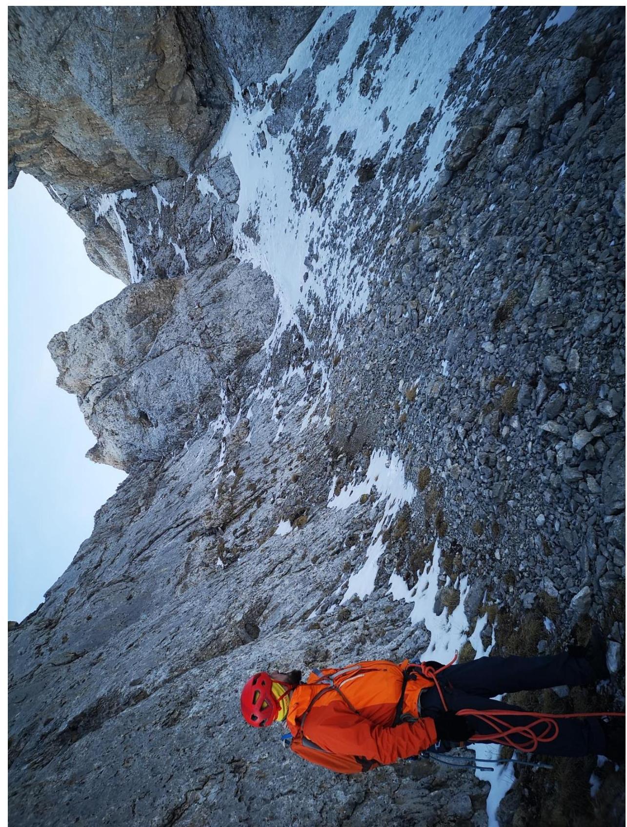
Fig. 7a. Section R6–R7 (Approach to the rock gates)
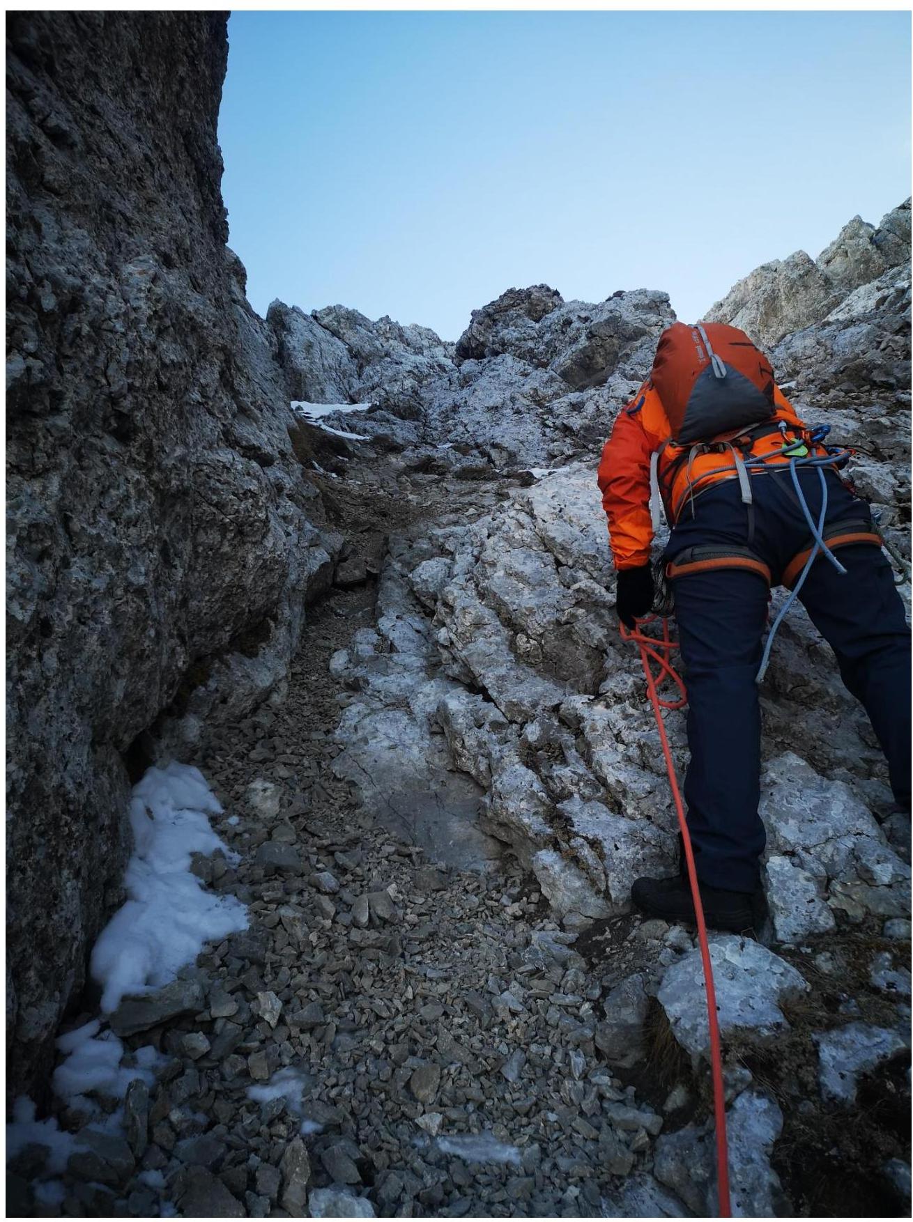
Fig. 7b. Section R6–R7 (Overcoming the rock gates)

Fig. 8. Section R7–R8 (Towards the peak)
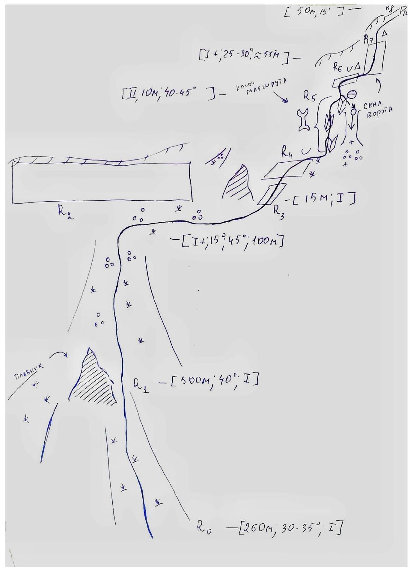
2.3. Technical characteristics of route sections
| Section № | Terrain type | Difficulty category | Length, m | Steepness | Type and number of pitons |
|---|---|---|---|---|---|
| R0–R1 | Grass | I | 260 m | 30°–35° | Simultaneous movement |
| R1–R2 | Small, medium scree, grass | I | 500 m | 40° | Simultaneous movement |
| R2–R3 | Scree path, inclined slab | I+ | 100 m | 15°–35° | Simultaneous movement |
| R3–R4 | Inclined grassy ledge | I+ | 15 m | 35° | Simultaneous movement |
| R4–R5 | Series of internal corners | II | 10 m | 40°–45° | Alternating movement, belay via terrain |
| R5–R6 | Scree, grass, traverse, cairn | I | 30 m | 10° | Simultaneous movement |
| R6–R7 | Scree, rock gates (resembling a chimney), cairn | I+ | 25–30 | 55° | Simultaneous movement |
| R7–R8 | Cairn, ridge, scree, peak | I | 50 m | 15° | Simultaneous movement |
2.4. UIAA Technical characteristics of route sections
3. Team Actions Characteristics
3.1. Brief description of the route passage
| Section № | Description | Photo № |
|---|---|---|
| R0–R1 | Turn right from the Jarlam pass and pass the assault camp, then approach the long ridge. From a small tree – the start of the route, go straight to the rocky "fin". Simultaneous movement. | Fig. 1. |
| R1–R2 | From the "Fin" exit onto small and partially medium scree, then go straight to the rocky wall (ridge). Simultaneous movement. | Fig. 2. |
| R2–R3 | Then traverse along a clearly marked path – 15°. During the movement, a "gendarm" will be on the left. The path leads to a destroyed inclined slab – 45°. Simultaneous movement. | Fig. 3a. Fig. 3b. Fig. 3c. |
| R3–R4 | Further exit onto a large inclined grassy ledge, then continue moving from the wall to the right and reach the route crux. Simultaneous movement. | Fig. 4. |
| R4–R5 | Overcome a series of internal corners. Alternating movement. Belay via terrain. | Fig. 5. |
| R5–R6 | Along the path, traverse to a traverse with a cairn. Simultaneous movement. | Fig. 6. |
| R6–R7 | From the cairn, continue moving along the ridge (along the path) and approach the rock gates. Overcome them with simultaneous movement and exit to a cairn. | Fig. 7a. Fig. 7b. |
| R7–R8 | From the cairn on the western ridge, move towards the peak along small scree. Peak. Simultaneous movement. | Fig. 8. |
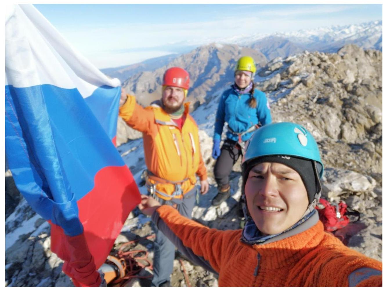
3.2. Team photo at the peak near the control cairn
3.3. Route safety assessment:
- Overall, the entire route is considered safe.
- Well-trodden.
- Easy and memorable landmarks.
Options for communication on the route:
- Cellular connection is available along almost the entire route: Megafon and Beeline.
- Exceptions may be natural obstacles that sometimes cause signal loss.
- Radio communication works but not everywhere.
- Excellent at the peak.
Recommendations for subsequent climbers: recommend bringing crampons, as there may be hard crust on shaded sections of the route.
Detailed information about the descent from the peak, indicating landmarks: Descend from the peak via the ascent route. Reach R4–R5 and rappel down 7–8 m. (Carefully – a small cornice). There are stationary loops. On the descent, on sections R0–R2, recommend using trekking poles for better control.
Conclusion on the preliminary assessment of the route: Based on the experience of climbers and general opinion, it can be stated that this route corresponds to the declared difficulty category, as the set of obstacles objectively reflects its complexity.