
Ascent Passport
- Rock class.
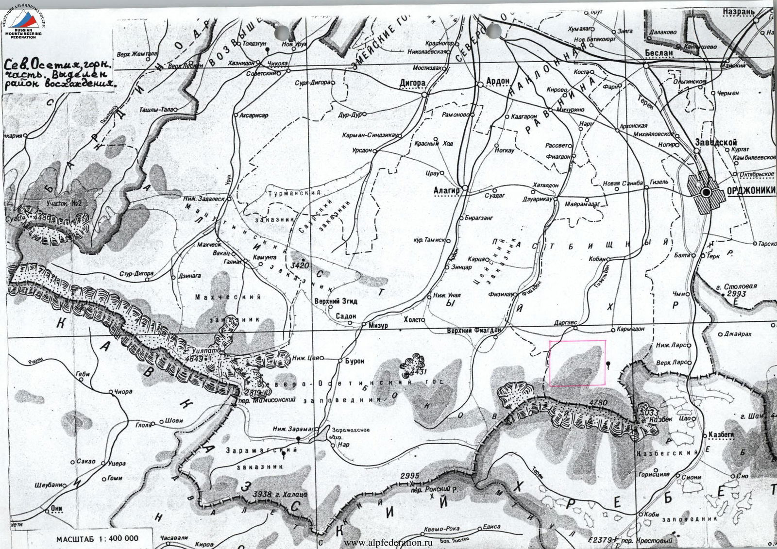
- Caucasus, Lateral Ridge, Tsatadon River gorge.
- Peak 3664 m (Tsat); from Southeast via South Ridge.
- Proposed — Category 1B difficulty, first ascent.
- Elevation gain: 400 m, approximately 2 km long. Average slope along the route is about 30°.
- Pitons driven:
rock chocks ice screws bolted pitons 2 4 0 0 0 0 0 0 Left on the route: rock — 0, chocks — 0. - Team's travel hours: 6 hours and 1 day.
- Overnight stay: on the surface moraine of Tsat Glacier — comfortable.
- Leader: Egorin Sergey Vladimirovich — Candidate for Master of Sports.
Participants:
- Gazdarova Olga Valerievna — III sports category
- Makarenko Andrey Viktorovich — III sports category
- Makarenko Irina Viktorovna — III sports category
- Coach: Egorin Sergey Vladimirovich — Candidate for Master of Sports. City Vladikavkaz.
- Departure to the route: August 26, 1998. Summit: August 26, 1998. Return to base camp: August 26, 1998.
- Organization: North Ossetian Republican Search and Rescue Service of the Ministry of Emergency Situations of Russia. Address: 362035, Vladikavkaz, pr. Kosta 273, North Ossetian Republican Search and Rescue Service.
Brief Overview of the Ascent Area
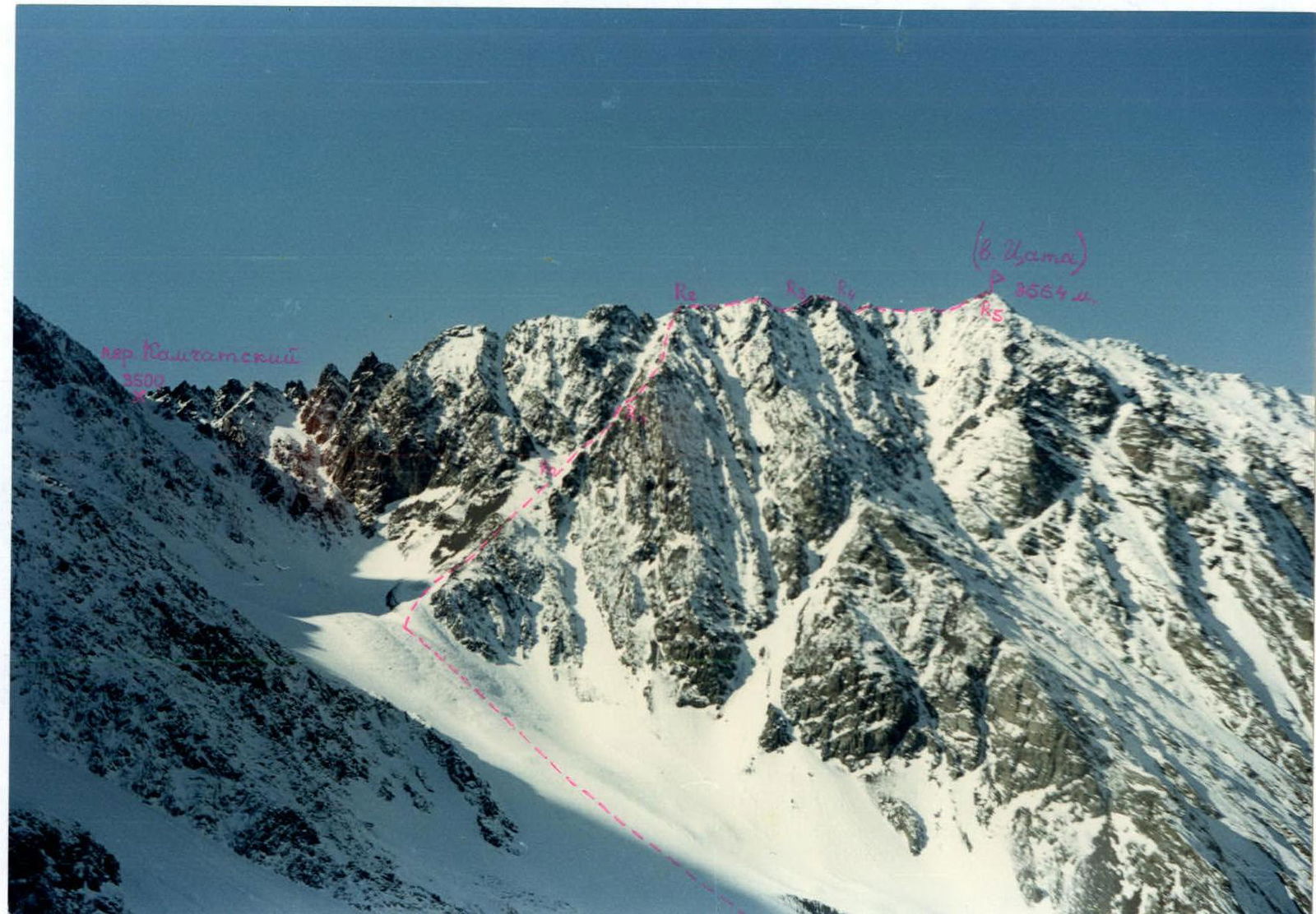
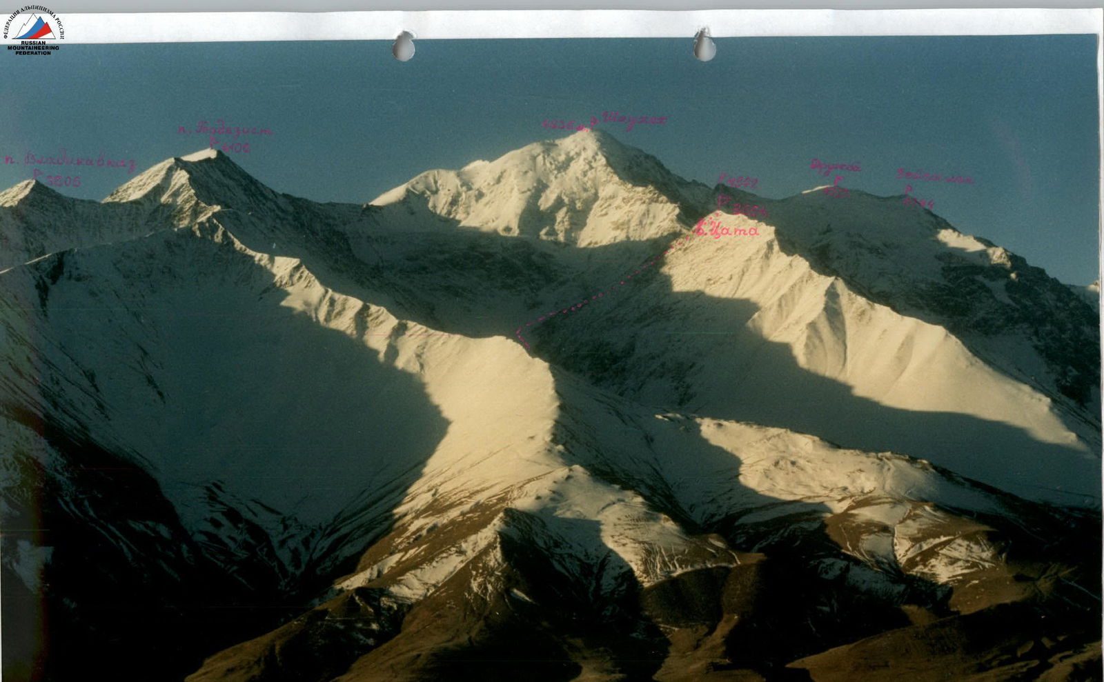
Peak 3664 m (Tsat) is located within the Republic of North Ossetia – Alania, between the Gizeldon and Terek rivers. The highest points in this area are: Kazbek (5033 m), Jimaray (4780 m), and Shaukhokh (4636 m). Tsat Peak is situated in the North Ridge of Shaukhokh, beyond the Kamchatsky Pass.
During our first winter ascent of the North face of Shaukhokh this year, we noticed possible ascent routes to Peak 3664 m from the Tsatadon River gorge.
We found no information about ascents to this peak. Until our first ascent on Shaukhokh, there was only one mountaineering route in the Zarriyu gorge (Tsatadon River gorge). This was the route to Shaukhokh via the North Ridge by A. Japaridze, completed in 1938. In other words, for nearly 50 years, this gorge was visited only by tourist groups.
The rocks composing the area are primarily of sedimentary origin, including clay shales that are heavily weathered in places. Therefore, the slopes of most peaks are characterized by alternating weathered counterforts and ridges, between which lie snow or talus couloirs (depending on the season).
Approach to the Route Description
From Vladikavkaz, take a scheduled bus to Jimara village, approximately 1.5 hours. From the village, head up the Gizeldon River gorge for about 2 km. Then turn east and begin ascending to the ridge separating the Tsatadon and Gizeldon rivers. After reaching the saddle of the ridge in about 45 minutes, continue along an old dirt road through the Tsatadon River gorge. Follow the river for about 3–4 hours until reaching a moraine ridge located to the left of the river. Ascend the ridge until reaching the flat, snow-covered part of Tsat Glacier, just before the plateau under the North face of Shaukhokh. Overnight at this location, at an elevation of 2800 m. Water is available in a glacier depression in the form of streams flowing over the ice.
From the overnight location, looking west, one can see:
- the North Ridge of Shaukhokh,
- Kamchatsky Pass,
- and beyond it, Tsat Peak (3664 m).
The latter has a clearly visible:
- South Ridge,
- Eastern slopes.
The journey from Jimara village to the overnight location takes around 7 hours.
 General view of Peak 3664 m (Tsat) from the East. February. The first ascent route is marked.
Route Description
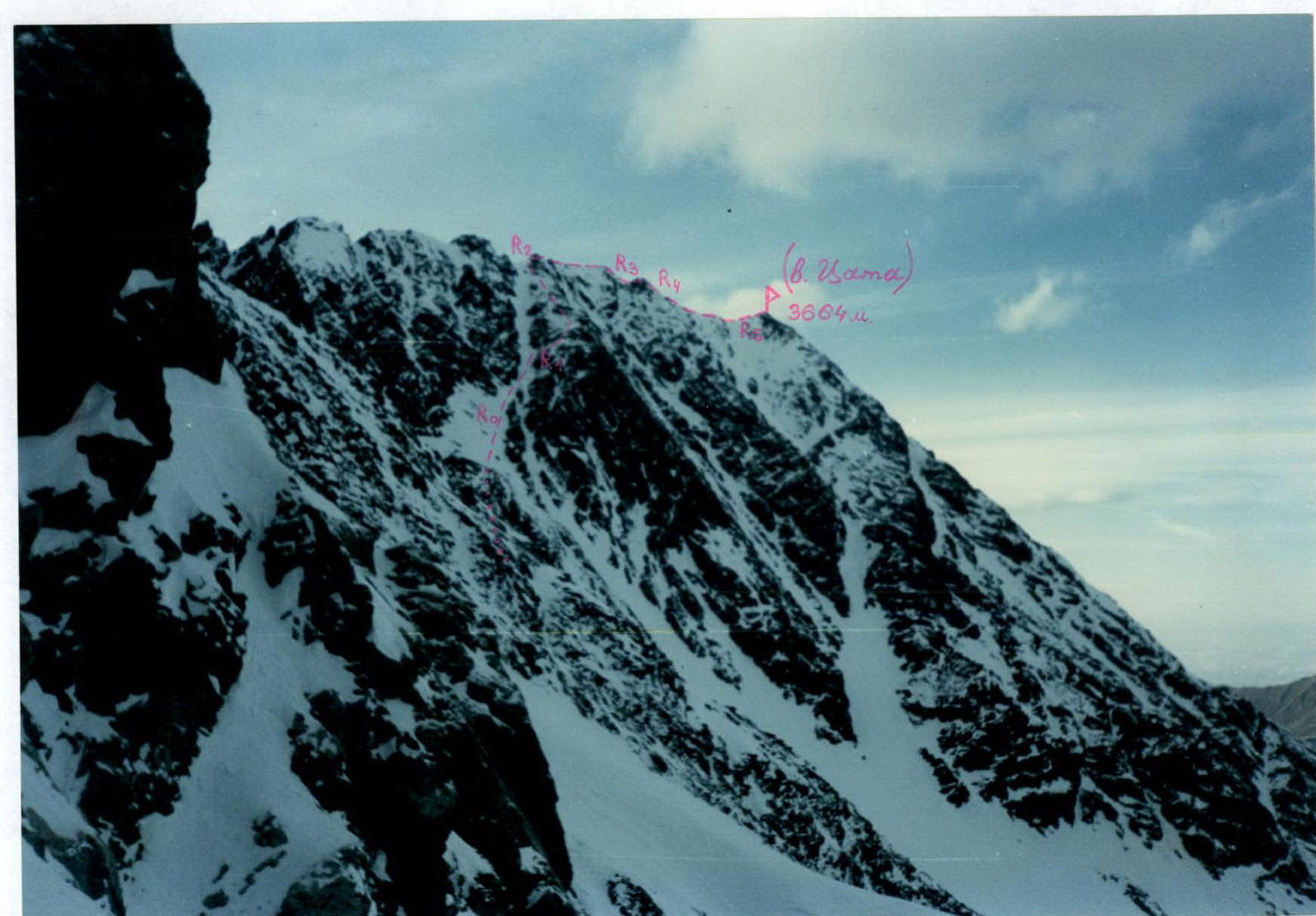
From the overnight location, cross the snow-covered Tsat Glacier towards the visible Kamchatsky Pass to the west. Begin ascending the snow and talus slopes towards the pass saddle. Upon reaching an intermediate cirque on this slope (a remnant glacier), turn right. Straight ahead is the actual pass ascent. By turning right, move towards the base of a couloir that leads to the South Ridge of Tsat Peak. The couloir is narrow and filled with snow and talus.
R0–R1: From the overnight location to the start of the couloir takes 2–3 hours. Enter the couloir and ascend along its rocky paths. "Live" rocks! Depending on the month, the ascent is possible either on snow or through loose scree. The slope is about 30°, difficulty category 1–2.
R1–R2: As ledges appear to the right of the couloir, leading to a counterfort, exit onto the rocks via one of them. Continuing up the couloir becomes more challenging because the scree lies on a rocky substrate. If there is snow in it (spring to early summer), reaching the South Ridge is possible directly via the couloir. However, with poor snow conditions, there is a risk of avalanches. Ascend the counterfort's rocks, bypassing difficult sections via numerous ledges, to reach the South Ridge of Tsat Peak. This section is category 2–3 difficulty.
R2–R3: Upon reaching the South Ridge, turn right. Along the ridge's rocks, bypassing difficult sections on the left, approach the pre-summit ascent. This section is category 1–2 difficulty.
R3–R4: Initially, ascend the wall of the pre-summit directly along the ridge line, then move left. The rocks are category 3–3+ difficulty. Approximately 30 m, 40–50°.
R4–R5: Continue along the ridge to the north. The ridge is rocky and scree-covered. After 15–20 minutes, reach the summit of Tsat (3664 m). This section is category 1–2 difficulty.
From the overnight location to the summit takes about 6 hours.
From the summit, one can see:
- Geodezist,
- the North face of Shaukhokh,
- Zeygalan,
- to the west, the ridge of Donchenty-Baira-syrt.
The descent follows the ascent route and takes 3–3.5 hours.
Conclusions and Recommendations
No signs of human presence were found on the summit. We were unable to find any information about previous ascents to this peak. Therefore, we consider our route to Peak 3664 m to be the first ascent.
We propose naming the peak Tsat, after the river located under its eastern slopes. Additionally, the ascent route begins from Tsat Glacier.
During the ascent and descent, caution is necessary due to large rocks in the scree.
The route is logical as it represents the easiest path to Tsat Peak. It is recommended for training ascents.
 Exit onto the South Ridge of Tsat Peak (3664 m). Initially via the couloir, then along the counterfort. August.
Comments
Sign in to leave a comment