
Alpinist Sports Club "KASKAD"
Report
On the ascent to Tepli Glavnaya peak 4431 m from the Southwest by the couloir of the Western ridge, presumably 3B cat. diff.
Variant of the route by A. ZyuziN. Tepli Glavnaya by the North-West ridge, 3B cat. diff., 1938, number in the classifier 2.8.85.
Kirkitadze D.A. Dyakonov B.V.
Central Caucasus, October 2013
Climbing participants
- Leader: Kirkitadze David Amiranovich, II sports category, Kambiileevskoe village. Address: Republic of North Ossetia-Alania, Kambiileevskoe village, Yuri Kuchiev St., 62. Phone: +7 961 822-28-22.
- Participant: Dyakonov Boris Valerievich, II sports category, Beslan.
Ascent details
- Central Caucasus, Lyadon river gorge, section 2.8 in the classifier;
- Tepli Glavnaya, 4431 m, from the Southwest by the couloir of the Western ridge;
- Presumably 3B cat. diff., variant of route 2.8.85;
- Ice-snow route;
- Height difference: 1090 m (GPS); Route length: 1600 m; Section length: III–200 m, IV–300 m; Average slope: 45°;
- Insurance points left on the route: 0; Used: 13 ice screws;
- Climbing time: 15 hours;
- Descent from the summit: via the ascent route;
- Leader: Kirkitadze D.A., participant Dyakonov B.V.;
- Start of the route: 6:00, October 23, 2013; Summit: 16:00, October 23, 2013; Return to base camp: 21:00, October 23, 2013;
- Year-round alpinist event by ASK "Kaskad", team coach Ryzhanov Oleg Nikolaevich;
- Responsible for the report Dyakonov B.V., dboris79@gmail.com, +79280701597.
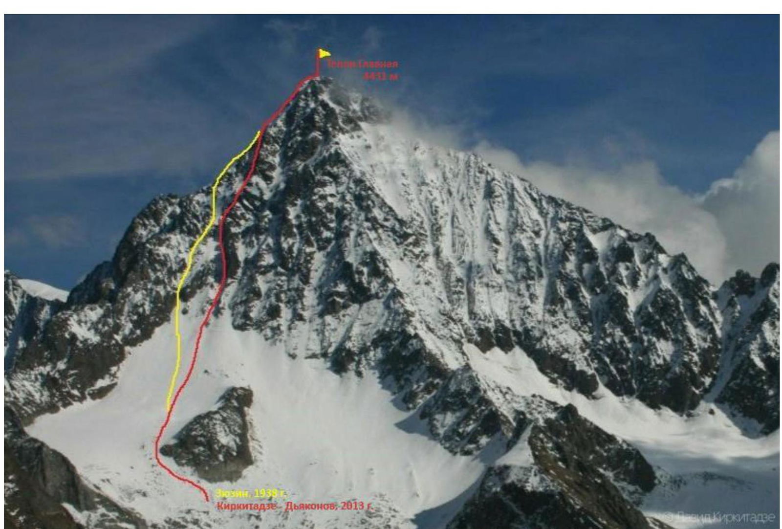
General photo of Tepli Glavnaya peak, 4431 m. Yellow line — A. ZyuziN's route, 1938, red — D. Kirkitadze's, 2013. View from the Southwest from the slopes of Pik Kosta. D. Kirkitadze, 2012.
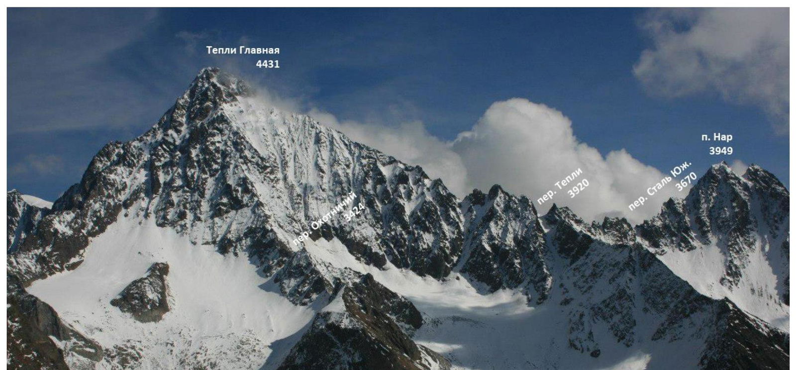
Photopanorama of the area. Nearest peak and passes are marked.
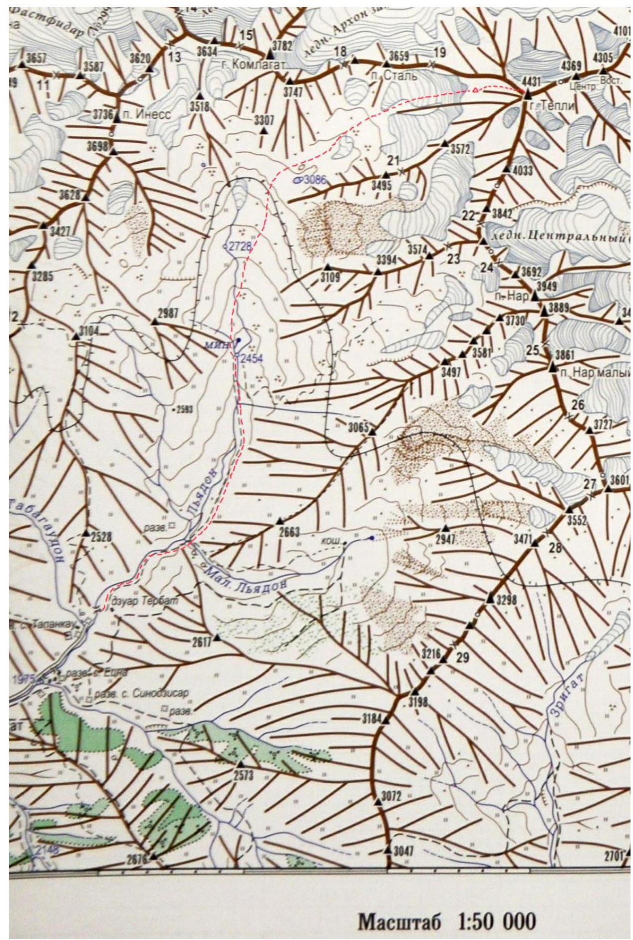
Area map. The path from Tapankau village and the route are marked with a red line.
Description of the climbing area
Tepli Glavnaya peak (4431 m) is located in the Lateral ridge of the Central Caucasus and is the highest point of a major mountain node stretching 12 km from west to east from Tsmiakom-khokh peak (4117 m) to Arkhon peak (4158 m). To the east is the next node of the Lateral ridge with peaks Shau-khokh (4636 m), Jimarai-khokh (4780 m), and Kazbek (5033 m).
Numerous ridges and edges descend from the peak in all directions. The southern ridge descends to the South Tepli, South, and North Nar passes. On the eastern summit ridge, the rocky Tepli Tsentralnaya peak (4390 m) and the snow-ice Tepli Vostochnaya peak (4350 m) stand out. From it, the North-East ridge descends to the Khetagurov pass. The northern ridge of Tepli Glavnaya peak drops down with walls and descends to the North Tepli pass (3200 m). The South-West edge of Tepli descends to the eponymous glacier South-West Tepli. The Western ridge of Tepli descends to the West Tepli pass.
The South-West slope of Tepli is a wall of medium steepness with edges and couloirs, bounded by the Western ridge and the massive South-West edge. Under the slopes is a small glacier with a prominent rocky "island". The approach path to the overnight stay location under the South-West slope runs through the Lyadon river gorge, with the starting point at the abandoned village of Tapankau, and takes about 6 hours. Movement along the trail to the clearing with a mineral spring, then to the right along the moraines to the South-West Tepli glacier. Bivouac in a safe proximity to the rocky island.
Route description
| Section | Length, m | Steepness, ° | Terrain character | Category of difficulty | Number of pitons |
|---|---|---|---|---|---|
| R0–R1 | 750 | 35 | snow | 1 | - |
| R1–R2 | 250 | 45 | snow | 2 | - |
| R2–R3 | 300 | 55 | ice | 4 | 7 |
| R3–R4 | 200 | 45 | snow/ice | 3 | 1 |
R0–R1: Up the snow slope to the right part of the entrance to the couloir, bypassing a large rocky island on the left. Tie in before the bergschrund. Snow, 750 m, 35–40°, 1.
R1–R2: Cross the bergschrund and, staying to the right part of the couloir, move up the snow to the ice. Station on the ice. 250 m, 45°, 2.
R2–R3: Bypassing small rocky outcrops, move up to the left of the center of the couloir to the ridge, using ice screws for insurance. Ice, 300 m, 45–55°, 4.
R3–R4: To the right along the broad ridge, bypassing rocks on the left. Reach a small dip in the ridge before the summit. Insurance point on the ice. Exit to the summit along the left side of the ridge. On the right side of the ridge — cornices. Snow, 200 m, 45°, 3.
R4–R0: Descent via the ascent route.
Technical photo of the route with the sections passed, view from the Southwest.
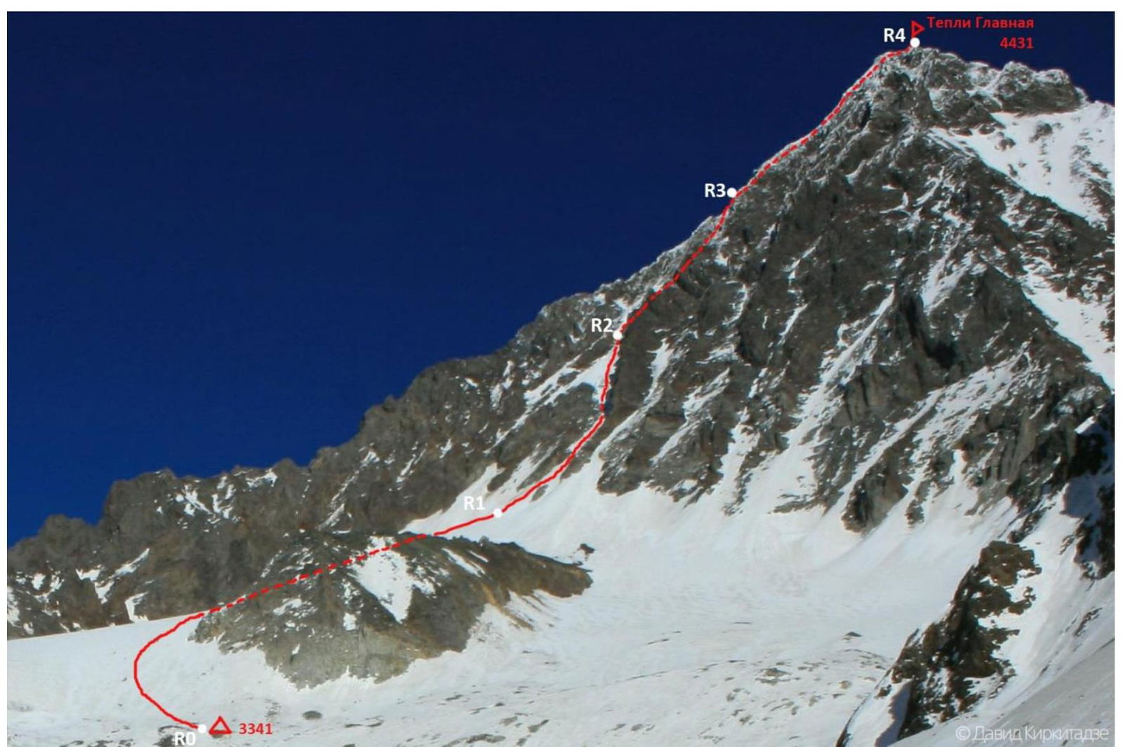
Route profile on the right.
General description
The first ascent to Tepli Vostochnaya via the Eastern ridge was made in 1896 by Italian mountaineers and photographers Vittorio Sella and Emilio Gallo (2B). Along the same ridge to the Central peak, a group led by A. Getter ascended in 1935 (3A). In 1938, several groups, including A. ZyuziN and A. Japaridze, completed routes to Tepli Glavnaya (3B and 4A). In 1947, a group led by G. Cherevichenko traversed the peaks Tepli Glavnaya — Arkhon Glavnaya from the South-West couloir (4A). In total, seven routes are known to have been completed.
The idea for our ascent belongs to David Kirkitadze, who made an ascent in this area in 2012. Initially, we planned to ascend via the Western ridge along the route by A. Japaridze, 4A cat. diff., but on-site, we revised the plan and chose to follow the couloir, completing a variant of A. ZyuziN's route, 3B cat. diff. (Naumov A.F. "Caucasus from Sbay pass to Mamison pass", published by I.V. Balabanov, 2001. P. 212. No.80. Tepli Glavnaya from the Southwest by the couloir of the Western ridge, combined route by A. ZyuziN, 3B). A. ZyuziN's combined route seemed more hazardous due to its proximity to rocky sections and limited space for safe movement in case of rockfall. In our variant, considering the season, the route is mostly snow-ice.
Objective hazards on the route:
- rockfall in warm seasons
- avalanches during the rest of the year
- cornices possible on the pre-summit ridge section
We ascended with simultaneous insurance, using ice screws on steep ice sections. The ice on the route is mostly thin; we recommend short ice screws. Insurance on snow was done through ice axes. The relatively safest and best time for our route is autumn and winter, considering favorable snow conditions.
 Fig. 117. Tepli from the Southwest. Comparison of routes, photo from Naumov A.F.'s book, black line — A. ZyuziN, green — D. Kirkitadze.
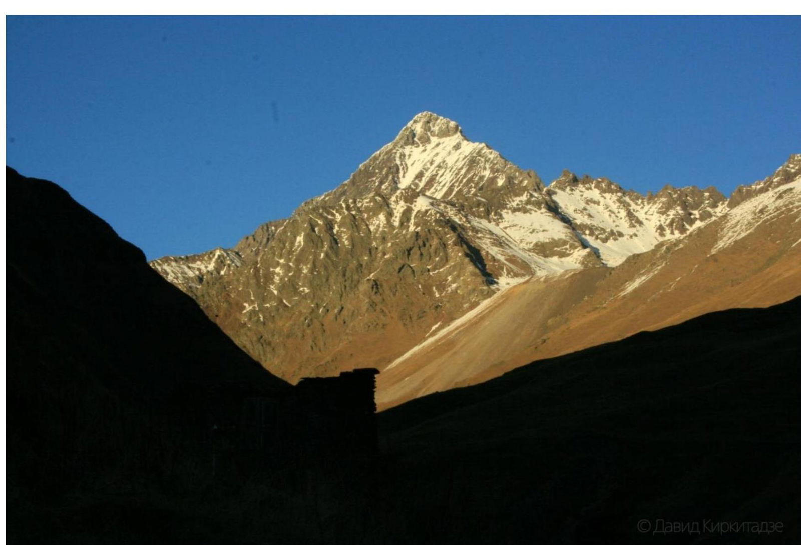
Initial point of approach to the route, Tapankau village.
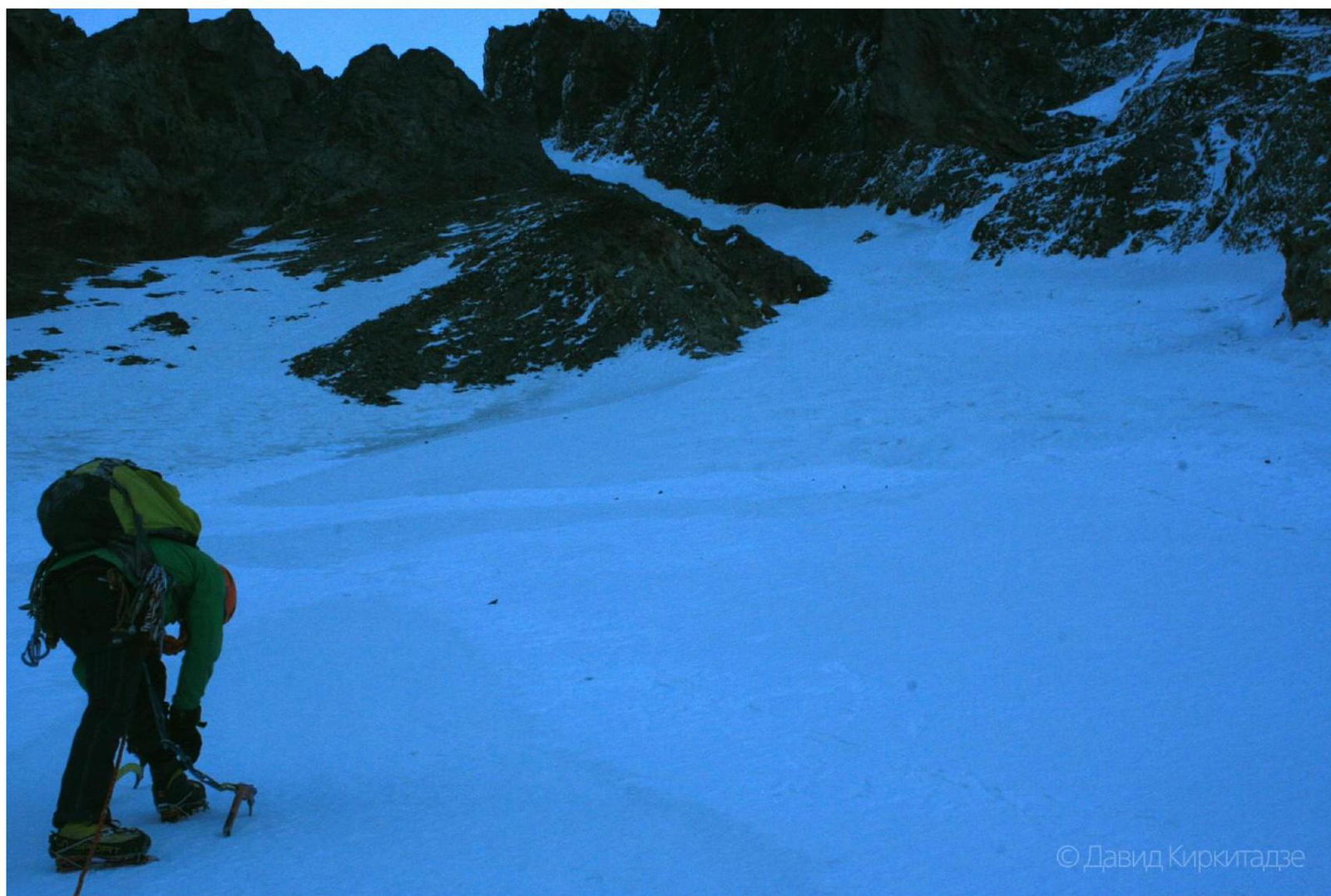
Start of section R1–R2, to the right part of the entrance to the couloir.

On section R1–R2.
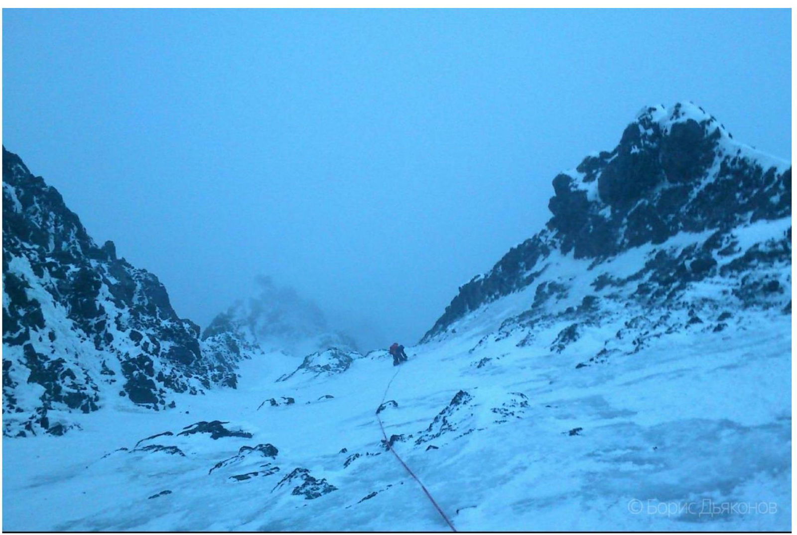
Section R2–R3.
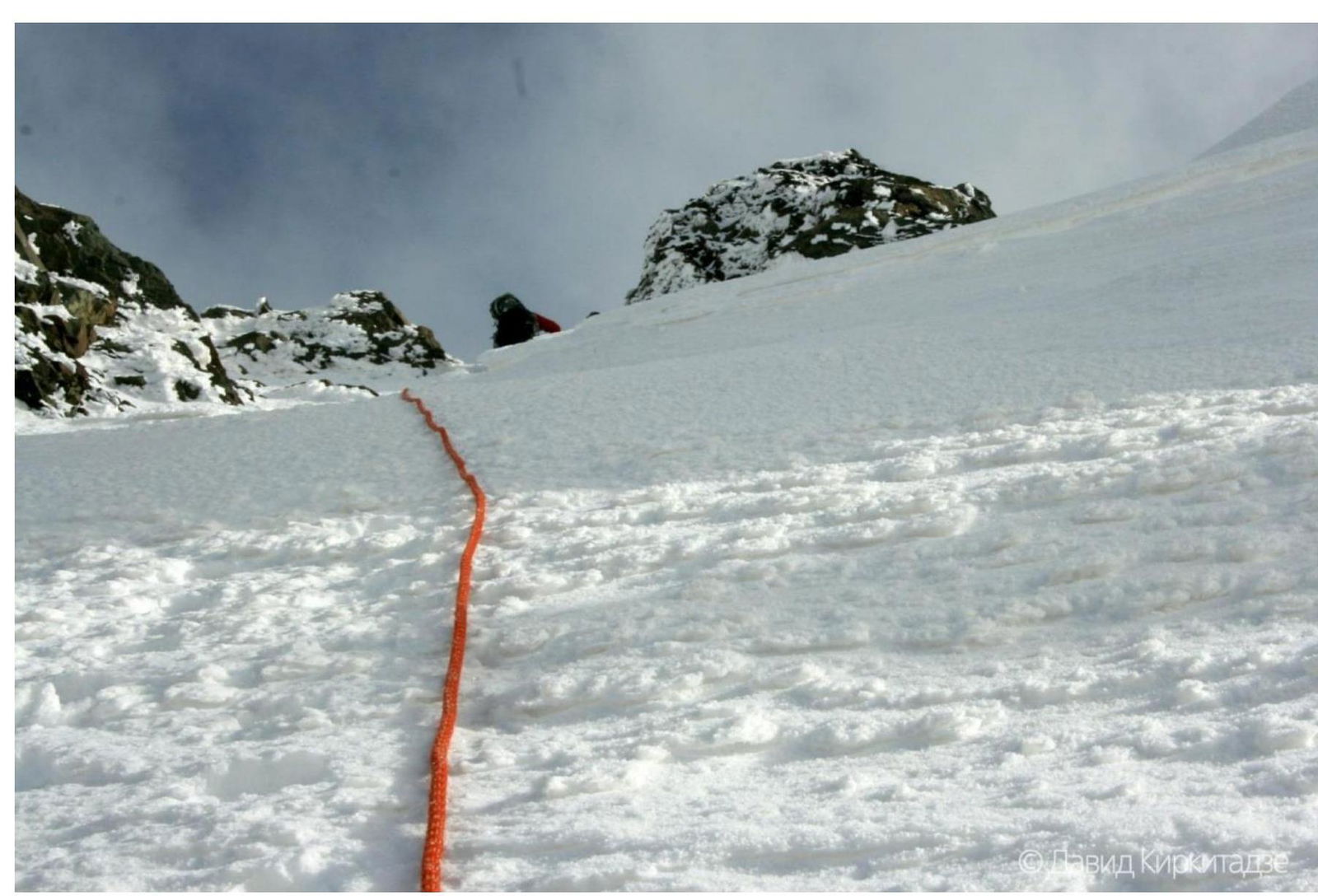
In the upper part of section R3–R4.
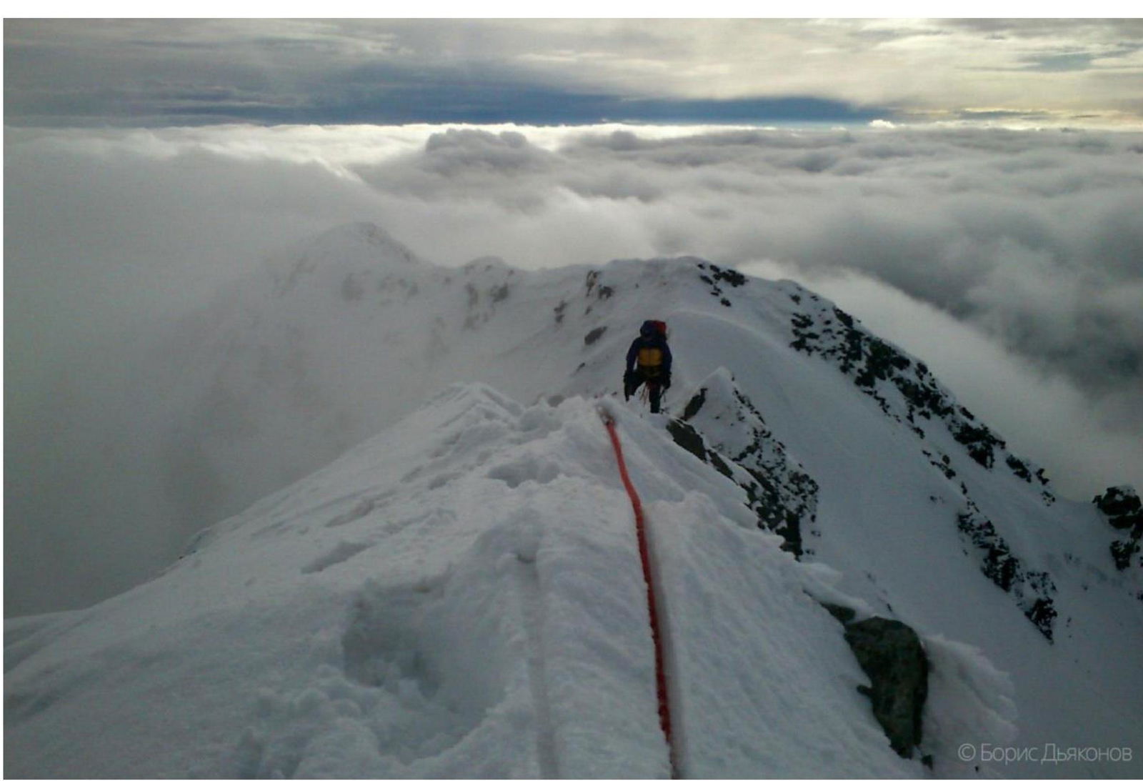
Pre-summit ridge on section R3–R4.
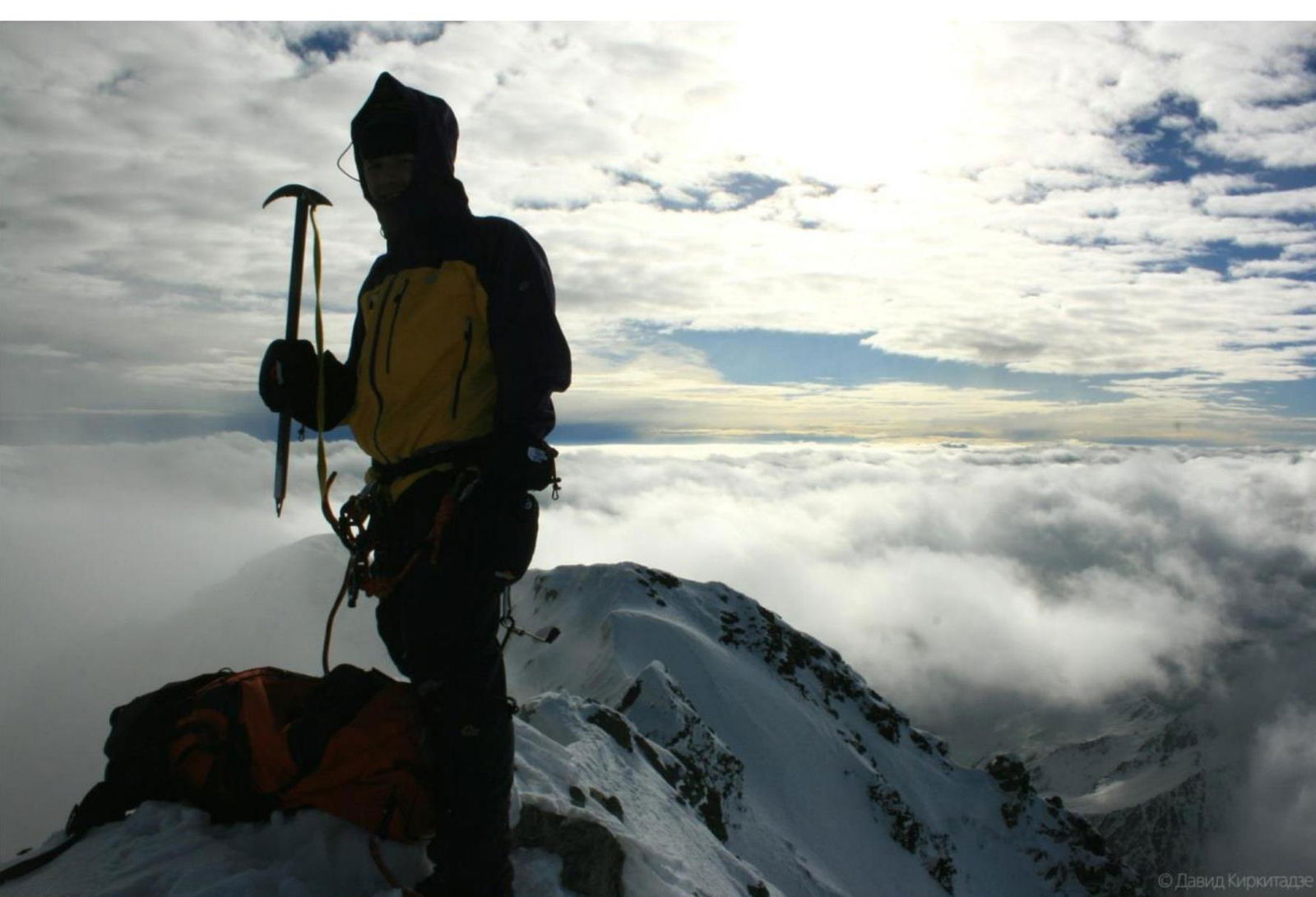
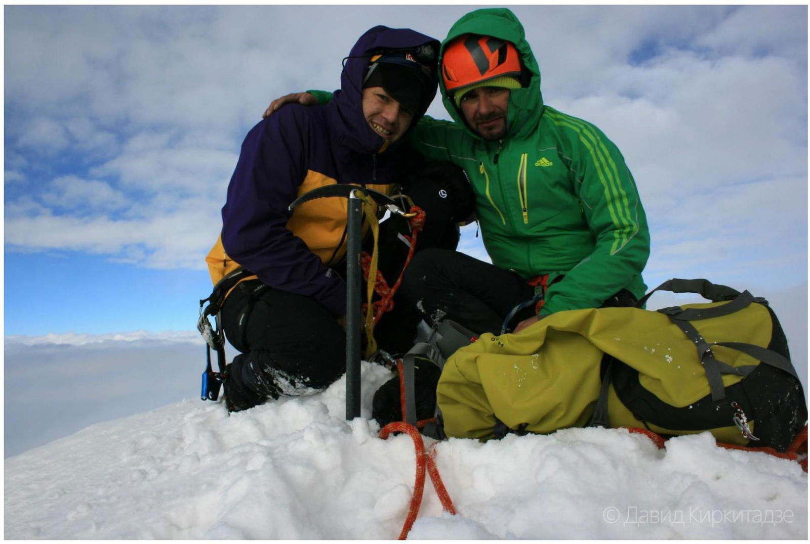
On Tepli Glavnaya summit, 4431 m.
© David Kirkitadze
Comments
Sign in to leave a comment