
Ascent Passport
- Caucasus; Rocky Ridge; Classification section number - 2.8.
- Tbau (C-3) - 2980 m; via the southern wall of the North-West ridge.
- Category 2A difficulty; first ascent.
- Route type - rock climbing.
- Route elevation gain – 650 m.
Approximate route length is 2300 m. Wall section elevation gain – 250 m. Steepness of key route sections up to 90°. Average steepness of the entire route – 30°.
-
Pitons left on the route - none.
-
Team's walking hours – 7, days – 1.
-
Team leader: Egorin Sergey Vladimirovich – Master of Sports
Team member: Gagiev Vilyam Taymurazovich – 3rd sports category
-
Coach: Egorin S.V. – Master of Sports
-
Departure to the route: April 15, 2001
Summit reached: April 15, 2001 Return to base camp: April 15, 2001
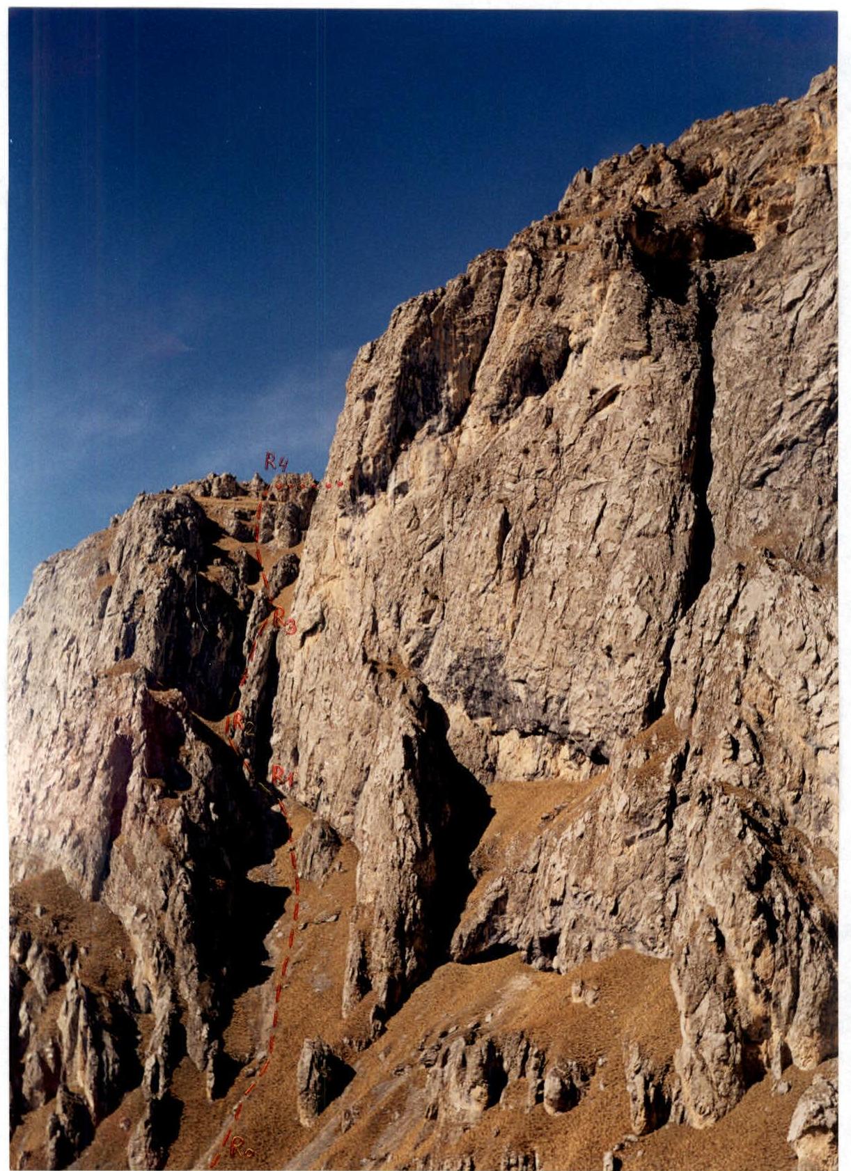
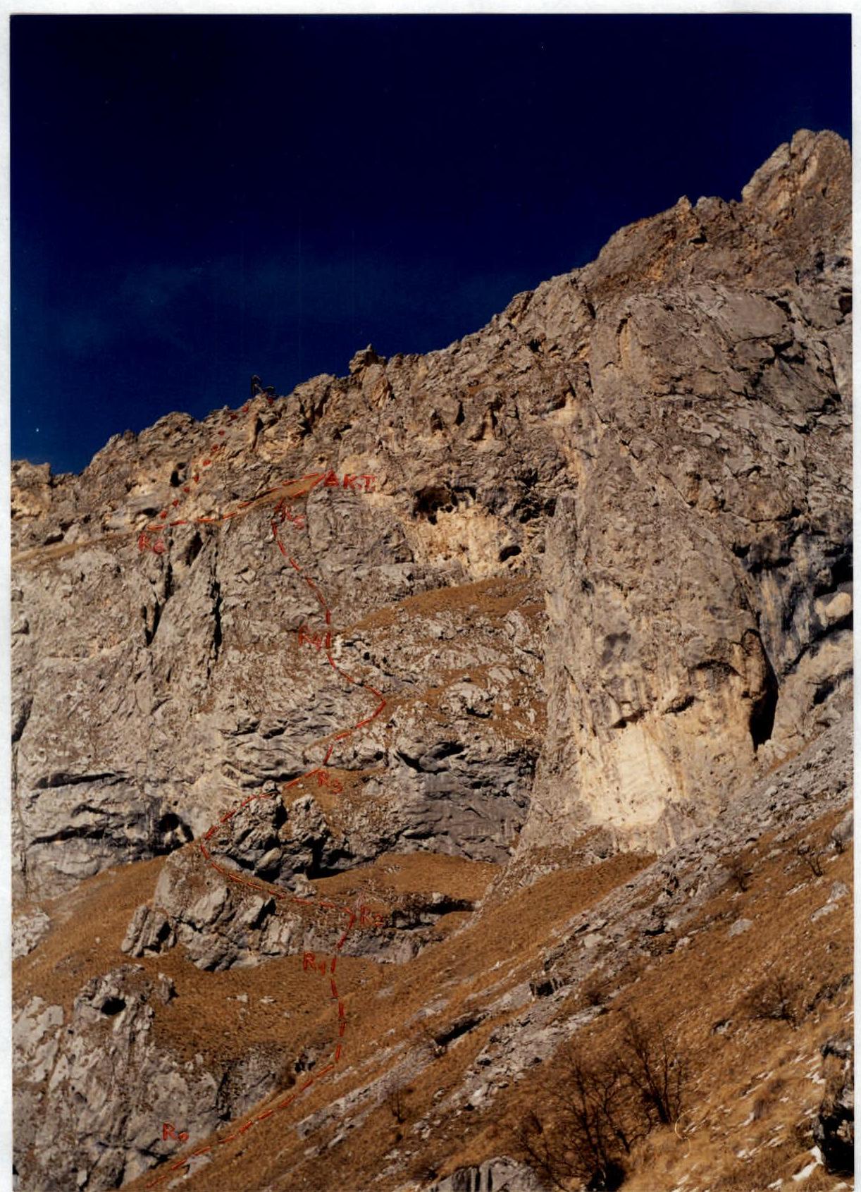
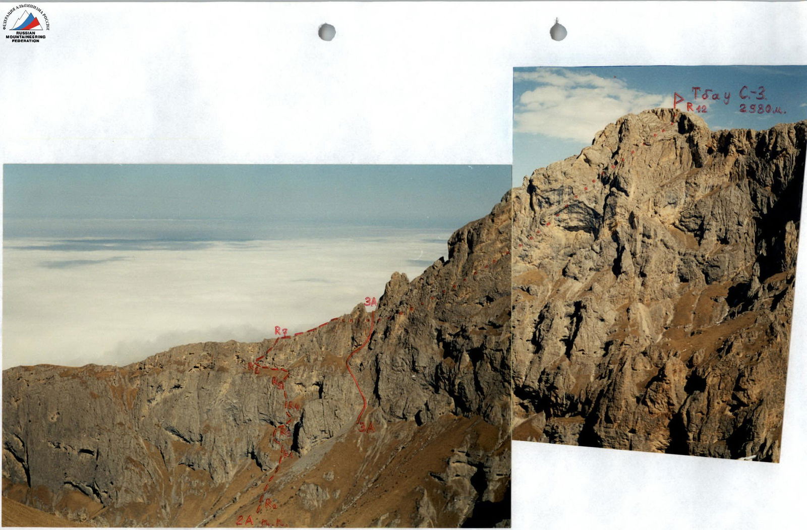
| View from the South at the key section of the route – Southern |
|---|
| walls of the North-West ridge. The first ascent route marked. |
| View from the South at the key section of the route – Southern |
|---|
| walls of the North-West ridge. The first ascent route marked. |
Brief Overview of the Ascent Area
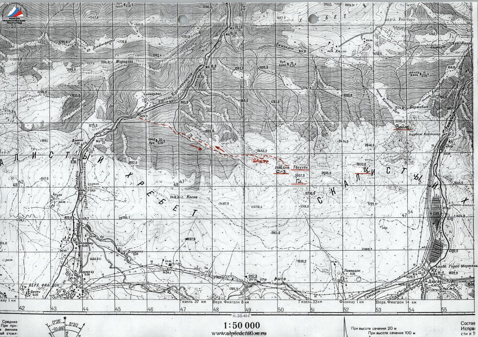
The ascent area is located in the Republic of North Ossetia – Alania between the Fiagdon River to the west and Gizeldon River to the east. The Tbau massif is part of the Rocky Ridge and stretches more than three kilometers from west to east.
The rocks forming the Tbau peak are sedimentary in origin - these are:
- limestones,
- dolomites,
- and in places calcites and marble.
Like most peaks of the Rocky Ridge, Tbau is a typical escarpment, i.e., it has relatively gentle northern slopes and steep southern slopes with rock walls.
Previously, this peak was only accessible from the South and South-East from the villages of Kakadur and Fazikau via a non-categorized route. Sporting exploration of the massif began only 7 years ago. In particular, the South-West wall of North-West Tbau was explored.
In the future, categorized routes are possible on:
- Tbau Main.
- Tbau Eastern.
For the Ossetians of the Dargavs gorge, the Tbau peak is considered sacred; according to legend, it is the abode of Tbau-uac-Ila (St. Elijah of Tbau mountain). To this day, every year in June, the village of Dargavs celebrates a festival in his honor.
Middle Prilovom
Approach to the Route Description
From Vladikavkaz, take a scheduled bus to Kharisdzhin through the Kurtatin gorge, getting off at the "Metallurg" pioneer camp - approximately 1.5 hours.
Cross the Fiagdon River by bridge and ascend via a dirt road from the water pumping station. Passing through a forest and two clearings, you'll reach the start of a gorge (on its right slope as you ascend), which leads under the South-West walls of Tbau. Ascend via an old abandoned road through a beech forest. Continue on a trail that transitions to the left slope. From the water pumping station, it's about 1.5 hours.
After a steep ascent, exit the forest and continue up the gorge on grassy slopes. It's easier to walk above the forest under the rock walls on the left. When the gorge narrows, descend to its bottom. Approach a narrow rock canyon and traverse the wall across the canyon to the right via moss-covered rocks (category 2-3 complexity). Continue along the canyon floor, passing small walls, to the only spot in the gorge where water may be found during the off-season. Above and below this point, water disappears.
Proceed further along the canyon until it widens slightly on the right slope. Continue straight up the gorge until it forks. Turn left here and ascend via scree and a couloir towards the visible South-West wall of Tbau (C-3). When the couloir opens into a wide grassy slope with rock outcrops, turn left and ascend along the southern walls of the North-West ridge of Tbau peak (C-3). Pass a couloir leading to the North-West ridge (remaining on the left), and continue straight up under the southern walls.
Overnight stay is possible in grottos - tents not required. Elevation is about 2300 m. Elevation gain from the water pumping station is 1200 m, taking 5-6 walking hours. There's no water near the grottos; snow may be present from November to April.
Route Description
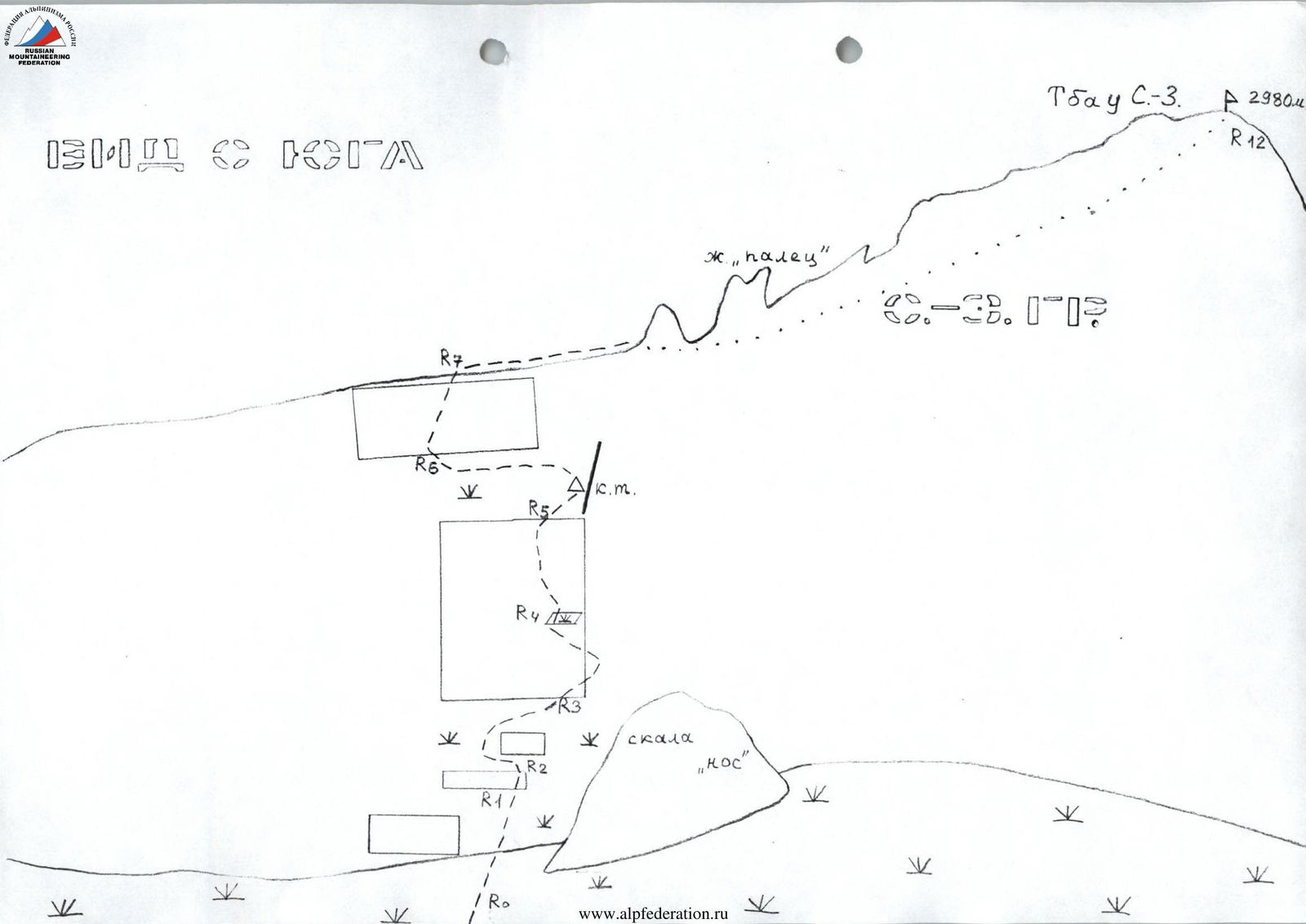
From the overnight stay, ascend along the Southern walls of the North-West ridge towards the visible "Nose" rock.
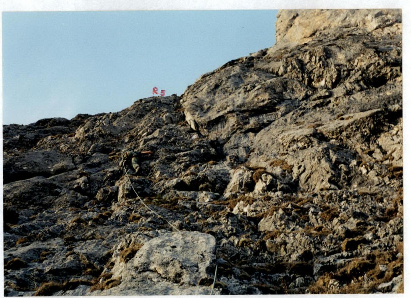
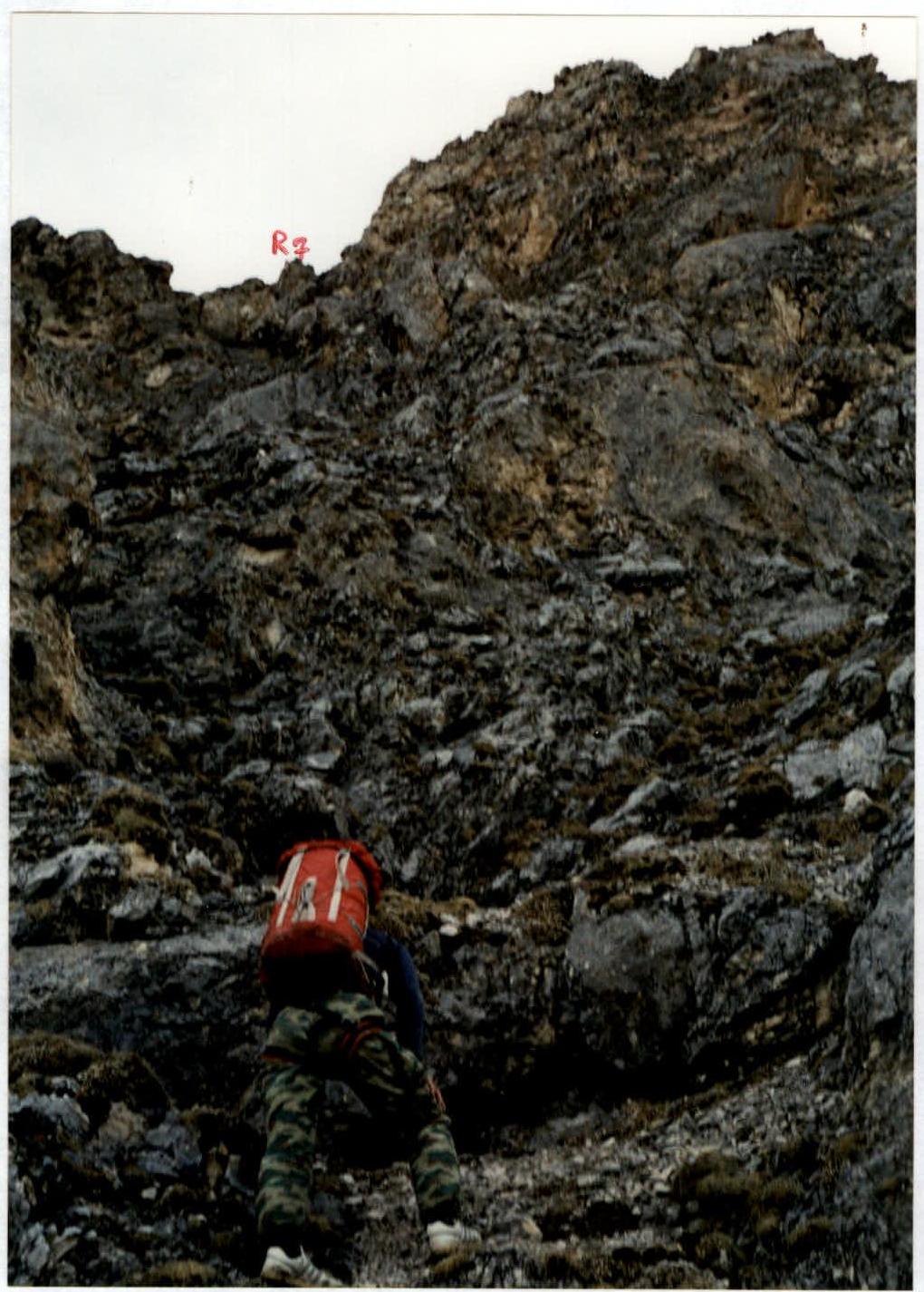
R0–R1: Head towards the "Nose" rock, turning left about 100 m before reaching its base. Cross a dry stream bed (scree) and approach the first rock band. Section is about 300 m. R1–R2: Ascend a grass-covered wall, 15 m, category 2-3. R2–R3: After the wall, traverse left on a grassy ledge. Then, move right and up towards the second rock band at its narrowest part. Section is about 150 m. R3–R4: Ascend directly up through the second rock band via third, and in places, fourth category difficulty slabs - 10 m. Then, traverse about 50 m right and up on a grassy ledge. Turn left and ascend through the third rock band via a grass-covered wall (30 m, 2-3) to reach below the key section - the fourth rock band. R4–R5: The key wall appears as a rectangle from R0. The first 15 m are category 2-3 walls with small ledges. The wall steepens, reaching 90° in places, with difficulty increasing to category 4-5. The second part of the key wall is about 30 m long. The route goes left of the grey smooth rocks. Near the top, 5 m from the bend, there's an "hourglass" feature for belaying. R5–R6: After the wall's bend, reach a grassy terrace bounded on the right by rocks. Follow these rocks up for about 30 m to a rock niche with a control cairn. Continue up under the fifth rock band, traversing left to a wide internal angle formed by broken and grass-covered rocks. The entire section is about 150 m. R6–R7: Ascend via the internal angle and its right side on category 1-2 rocks to reach the North-West ridge. Section is about 60 m. R7–R8: Follow the North-West ridge on its left side to approach the "Finger" gendarme at the base of the right part of the North slope of Tbau peak (C-3). About 200 m.
The further route to the summit (R8–R12) fully corresponds to the category 1B difficulty route, specifically sections R5–R9. The description of the category 1B route from the South via the North-West ridge is submitted along with this report, along with photos of the further sections to the summit.
From the overnight stay to the summit takes 6-7 hours. Descent via the category 1B route (see above) takes 1.5-2 hours.
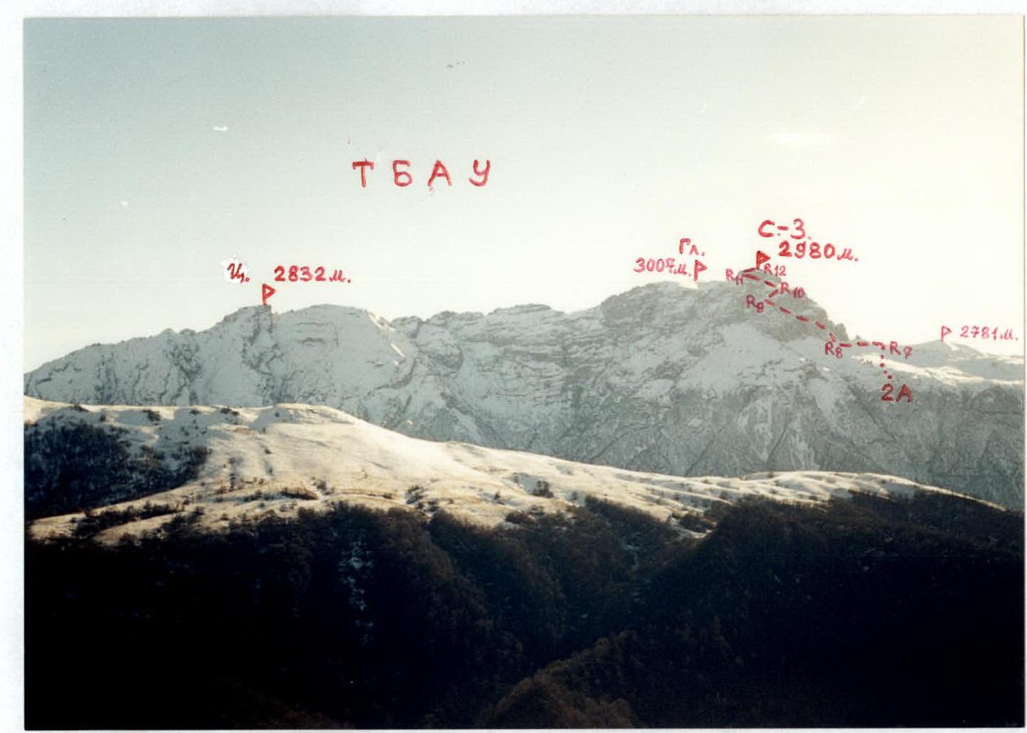
General view of Tbau C-3 peak from the South. April. Photo taken from the 2781 m mark. The first ascent route is marked.
View from the South
Tbau massif from the North. January. Photo taken from the Pastbishchny Ridge (Khashkharanagh Ridge 1500 m). The first ascent route is marked.
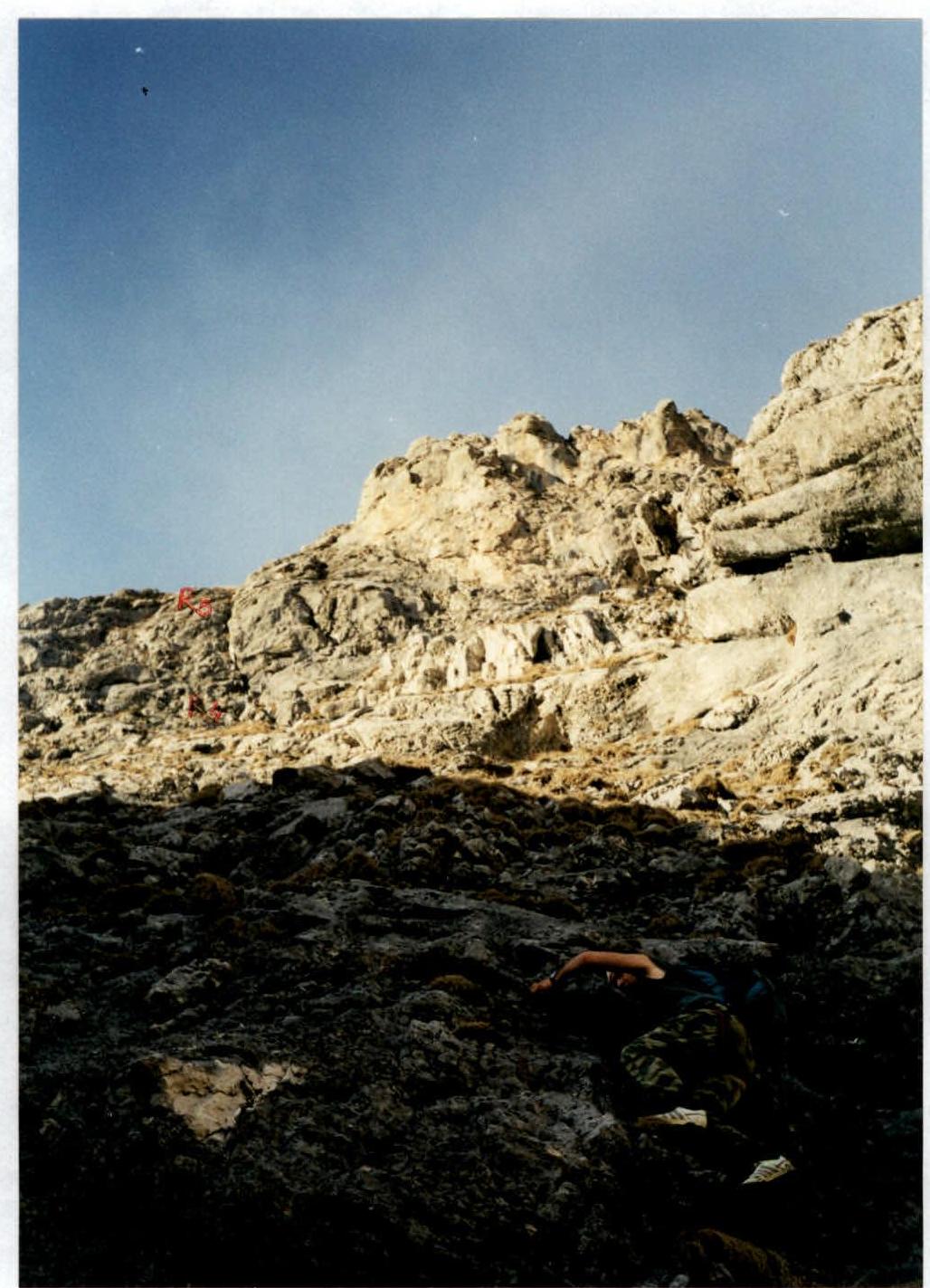
Passage of section R1–R2

Passage of the lower part of section R3–R4
Passage of the second part of the key wall. Section R4–R5
At the start of section R6–R7
Comments
Sign in to leave a comment