
Ascent Passport
- Ascent category: COMBINED (rocky in summer)
- Ascent region: CAUCASUS: 2.8: Tsaziut-Don river valley
- Peak, route: Geodesist peak (4138 m): via the Western ridge
- Estimated category of difficulty — 2B category of difficulty, first ascent
- Route characteristics: height difference — 1,600 m; route length — 3,000 m; length of 2B category of difficulty sections — 120–150 m; average steepness of the key part of the route — 70–80°
- Pitons hammered: rock — 4 pcs. (on descent); ice — none; placed elements — none.
- Number of walking hours (days): — 14 (1)
- Number of overnight stays: first — in the cirque, second — in the cirque (bivouac in one place).
- Leader: Khamitsaev Kazbek Borisovich
Participants:
- Gorbunov A.
- Korenkov V.
- Abisalov A.
- Bychkov B.
- Ivakin A.
- Coach: Proskuryakov Ruslan Pavlovich
- Departure to the route — December 26, 1993 Return to the bivouac — December 26, 1993
- Organization: KM FA RSO-A.
Route Description
From the bivouac, move straight into the depths of the cirque and after 200–250 m turn right and ascend a steep rocky-grassy slope (snowy in winter) to the ridge. From the bivouac — 1–1.5 hours. From the ridge, turn left and follow a simple rocky, partially snow-covered ridge, orienting towards the Western shoulder, to the base of the rocky ascent. Ascend steep, broken rocks (variable belay 120–150 m upwards) to the Western shoulder. Then turn right and follow a long snow-covered ridge, keeping to the left part (rocky drops on the right!), to a small ice ascent and then reach the summit. On the rocks — a cairn. Time to complete the route uphill — 11–12 hours. Descent via the ascent route takes 2.5–3 hours (careful belay when descending from the shoulder!). The route with approaches and return takes 2–3 days.
Approach Description
From Vladikavkaz to Dargavs village — by regular bus Vladikavkaz — Jimara. From the "green" pass (1700 m) move left from the road along gentle grassy slopes to the col (water near the col). Then turn right and ascend gentle grassy slopes to the ridge. On the ridge, turn left and, orienting towards a wide cirque bounded by rocky ridges, reach the grassy slopes of the left ridge. Then follow a livestock trail to a steep rocky-grassy ascent and, overcoming it, enter the cirque. Here is the initial bivouac.
Attention! — lack of water in summer!
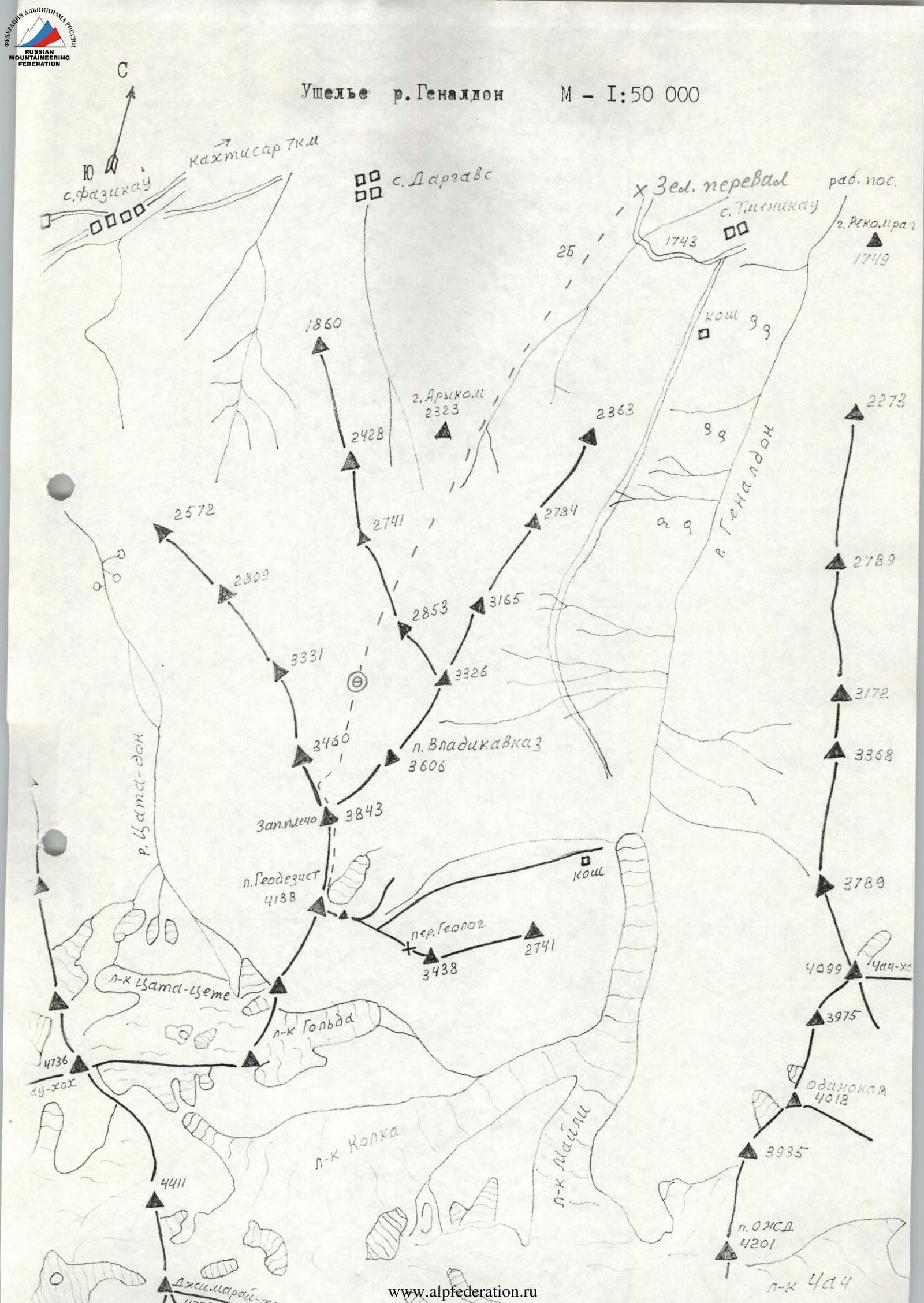
Genallon River Valley
Scale 1:50 000
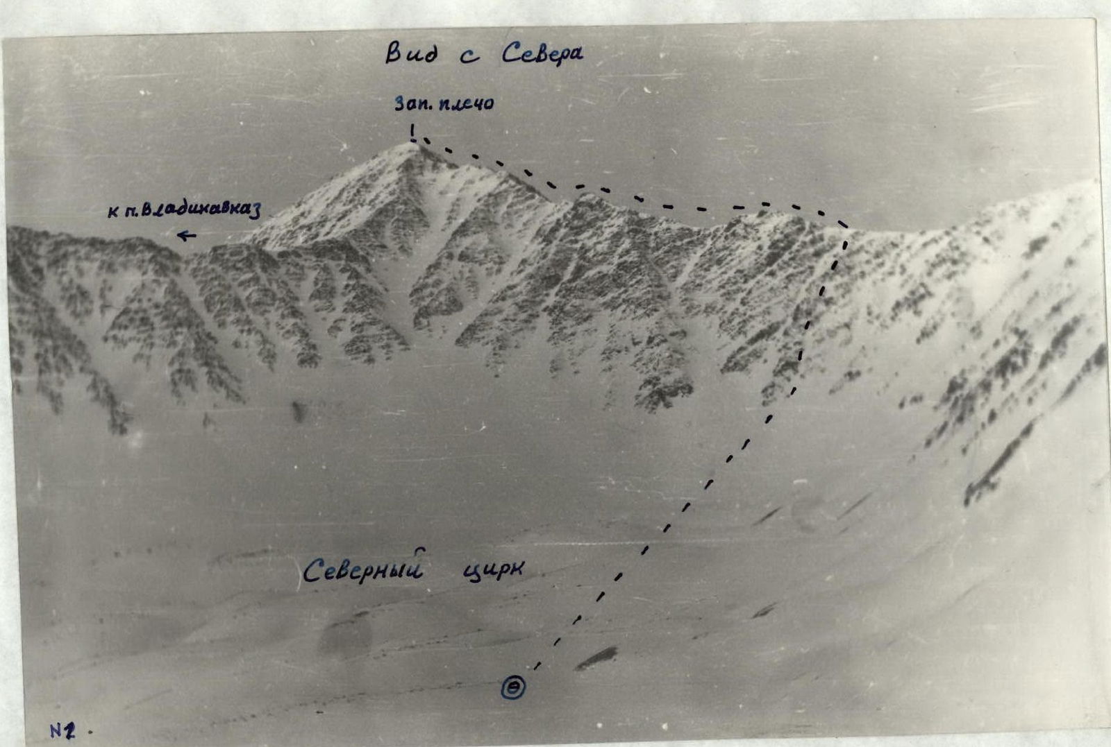
View from the North-West
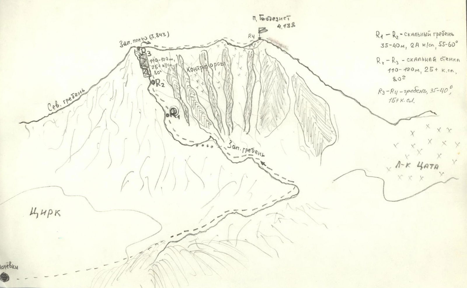
- R1–R2 — rocky ridge 35–40 m, 2A category of difficulty, 55–60°
- R2–R3 — rocky wall 110–120 m, 2B+ category of difficulty, 80°
- R3–R4 — ridge, 3B–40°, 15+ category of difficulty.
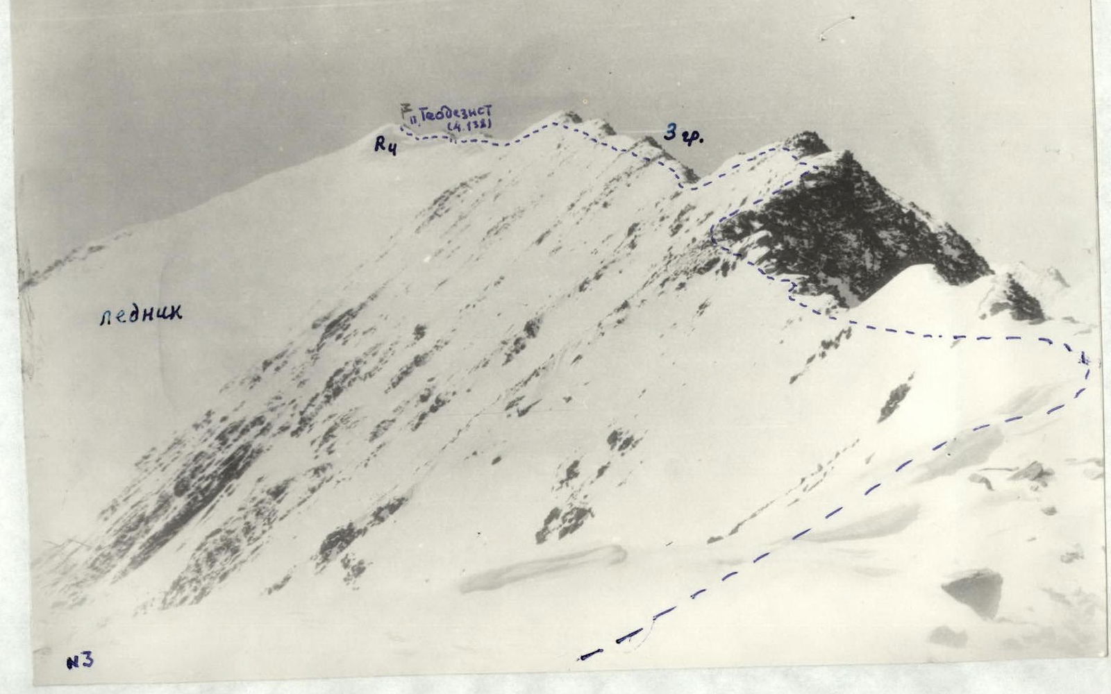
View from the North-East
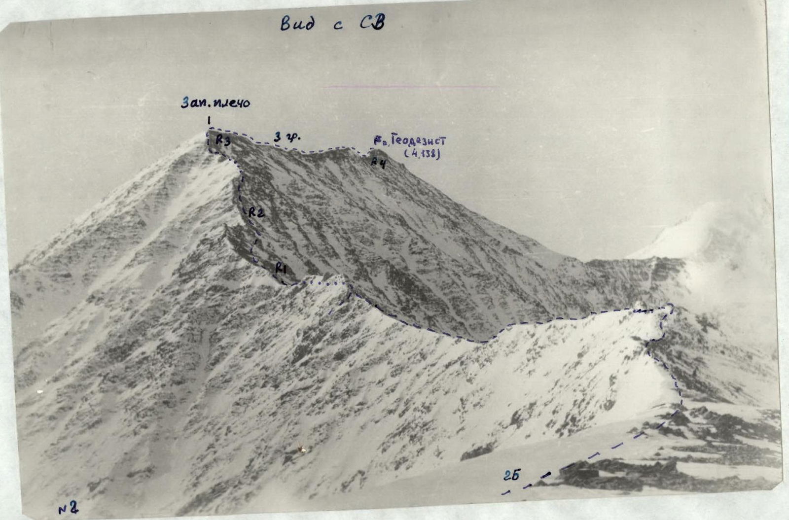
- Western shoulder
- Geodesist peak (4138 m)
View from the North-West
- glacier
- Geodesist peak (4138 m)