Report on the first ascent of Pik Atarbeka Tedeeva, 3239 m via the Northwest Counterfort
Approximately — 1B category of difficulty. Completed by a group of climbers from the Mountain Sports Federation of the Republic of South Ossetia on August 20, 2015, led by Tedeev Tamerlan Taimurazovich.
Address: Republic of South Ossetia, Tskhinval, A. Dzhioev Avenue, 114, Tedeev_t@mail.ru +79284848861
Ascent Passport
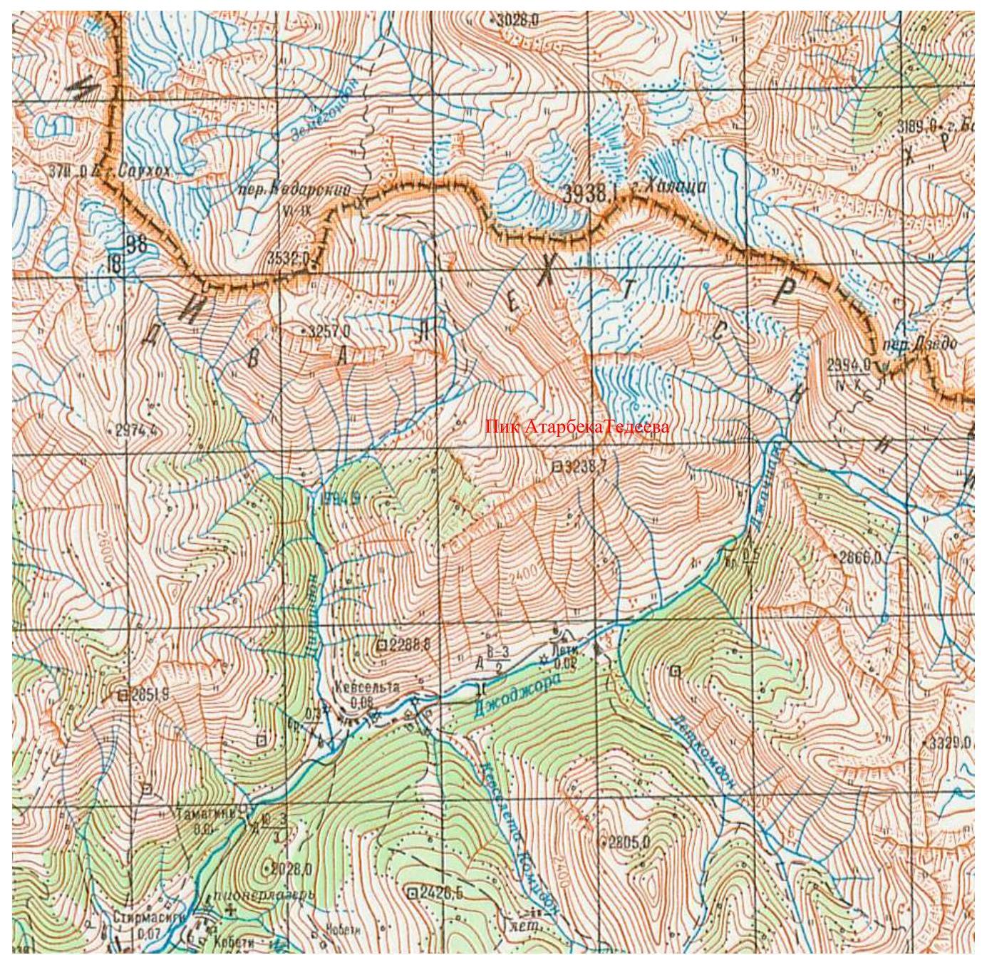
- Caucasus, section number in the classifier 2.8:, south of the Main Caucasian Range, between the Tsidon river gorge to the west and the Djodzhora river gorge to the east.
- Pik Atarbeka Tedeeva (3239 m), via the Northwest Counterfort.
- Assumed 1B category of difficulty, first ascent.
- Route character — rocky.
- Route height difference is about 300 m. Route length — about 380 m. Section lengths: 2 category of difficulty — 30 m, 2+ category of difficulty — 20 m. Average steepness of the main part of the route — 40°.
- Used 1 nut, 2 "friends".
- Number of climbing hours / days: 7 h / 1 day.
- Number of nights: 1 — at a bivouac.
- Leader: Tedeev T. — 2nd sports category. Participant: Tedeev A. — 3rd sports category.
- Coach: Tedeev Tamerlan Taimurazovich.
- Approach to the route: August 20, 2015, 8:00 Moscow time. Reach the summit: August 20, 2015, 12:00 Moscow time. Return to bivouac: August 20, 2015, 15:00 Moscow time.
- Organized by: Mountain Sports Federation of the Republic of South Ossetia. Leader — Tedeev Tamerlan Taimurazovich.

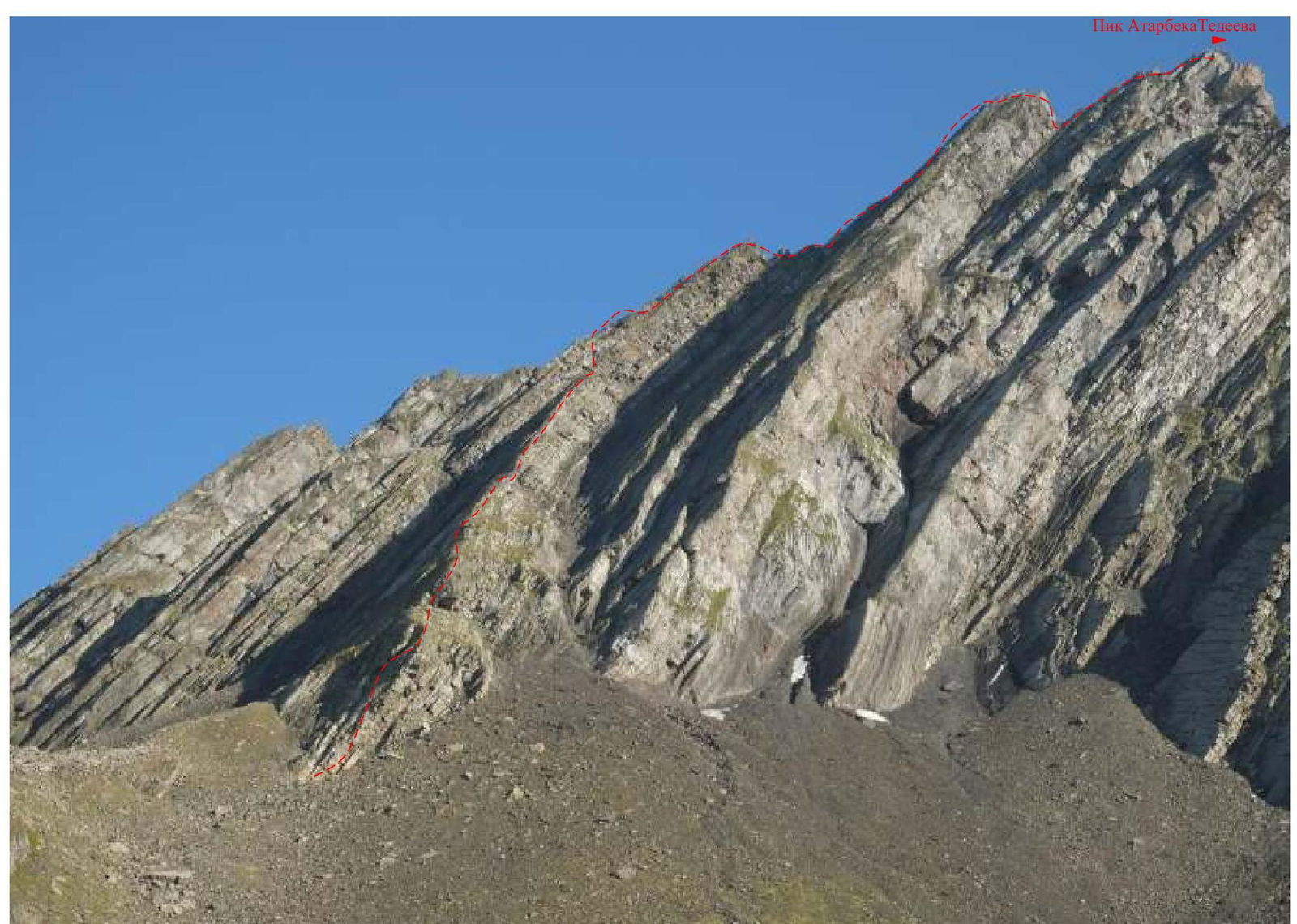
The first ascent route is marked in red. The approach path to the route is marked in blue.
Route Characteristics by Sections
| Section # | Steepness, deg | Length, m | Terrain Character | Category of difficulty | Belay |
|---|---|---|---|---|---|
| R0–R1 | 30°–45° | 100–120 m | Simple rocks with small walls. | 1 | Movement with alternating belay, using nuts for belay. |
| R1–R2 | 60°–70° | 20 m | Alternating steep walls and small ledges. | 2+ | |
| R2–R3 | 30°–45° | 90 m | Rocky ridge, simple rocks | 1 | |
| R3–R4 | 30°–45° | 80 m | Gentle rocky ridge, simple rocks | 1–2 | |
| R4–R5 | 50° | 70 m | Not very steep rocky ridge, simple rocks | 1–2 |
Description of Approaches to the Route
From Tskhinval to the village of Kevselt in the Kudar gorge, it takes about 3 hours by car. From the Kudar pass of the Main Caucasian Range, the Dzuarikau-Tskhinval gas pipeline descends towards Tskhinval. You can drive to the bridge over the Djodzhora river and, leaving the car there (there is a barrier on the bridge — a restricted zone for cars), ascend via the technical road of the gas pipeline to the beginning of the Western ridge of the nameless mountain, named Pik Atarbeka Tedeeva on July 31, 2014.
There is a place for a tent on the technical road and there is water. When approaching the start of the route, you need to go along the grassy ledge, to the left of the Western ridge. The mountain and part of the route are visible from the bivouac.
There is plenty of water on the approaches, but no water on the route!!!
It takes 2 hours from the village to the bivouac.
Campfires are prohibited. Before the ascent, it is necessary to notify Gazprom employees and employees of the Border Guard Administration of the Republic of South Ossetia!
Description of the Ascent Route
Section R0–R1: We start moving along the ridge. We need to move along the simple rocks of the ridge. The rocks are simple, with small walls. When ascending along the ridge, we need to stick to its central part. The ridge is a section of increasing steepness. 30°–45°, 100–120 m, 1 category of difficulty, up to a steep wall. There is a place for a stance.
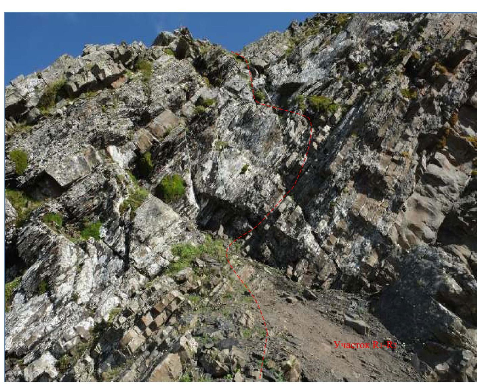
Section R1–R2: The section is an alternation of steep walls and small ledges. There is a large stone above the wall, on which it is convenient to make a stance. The wall is passed in a zigzag: first to the right, then to the left and up. There are "loose rocks". The rocks are destroyed. It is necessary to use nuts for belay. 60°–70°, 20 m, 2+ category of difficulty.
Section R2–R3: We continue moving to the summit ridge. We exit onto the ridge and move slightly to the right and continue moving towards the summit and reach a small gendarme. The rocks are simple, with small walls. 30°–45°, 90 m, 1 category of difficulty.
Section R3–R4: A small descent from the gendarme. Along simple rocks, we reach the summit tower. When ascending along the ridge, we need to stick to its central part. The rocks are cut and partially destroyed. Towers. 30°–45°, 80 m, 1–2 category of difficulty.
Section R4–R5: Along a not very steep ridge, we ascend to the summit. The rocks are simple, with small walls. 50°, 70 m, 1–2 category of difficulty.
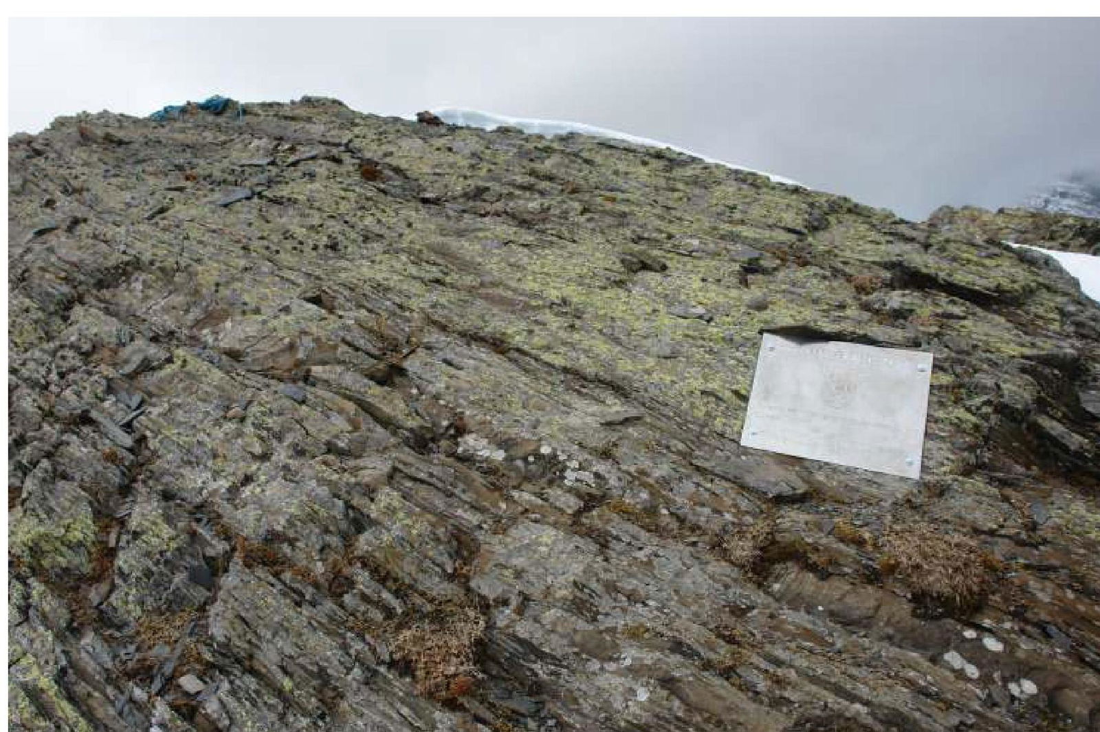
Descent is via the ascent route. 1 rappel ring was left on the descent.
Conclusions and Recommendations
The height difference from the village of Kevselt to the bivouac is 540 m. From the bivouac to the start of the route, the height difference is 600 m. From the bivouac to the summit, the height difference is 939 m. From the car to the summit, the height difference is 1578 m.
Village Kevselt — 1740 m. Bivouac — 2300 m. Start of the route — 2900 m. Summit — 3239 m.
The route via the Northwest Counterfort is logical, potentially safe, and is recommended for strong training groups due to its remoteness and length.
The ridge is mostly destroyed — in some places, belaying on protrusions is problematic due to the possibility of breaking them off. There are cracks on the route suitable for using nuts such as "friends", nuts, and anchor pitons — it is desirable to have one set of each. Stance slings can also be used. The sections are mostly over 40 m, so 50 m ropes are necessary. On the ridge, use belay on protrusions. Rappel rings will be needed.
In terms of difficulty and length of key sections, the route complexity corresponds to a classic route of 1B–2A category of difficulty.
Comparing the route taken with already completed and classified routes, we recommend classifying the route via the Northwest Counterfort of Pik Atarbeka Tedeeva as a 1B category of difficulty route.
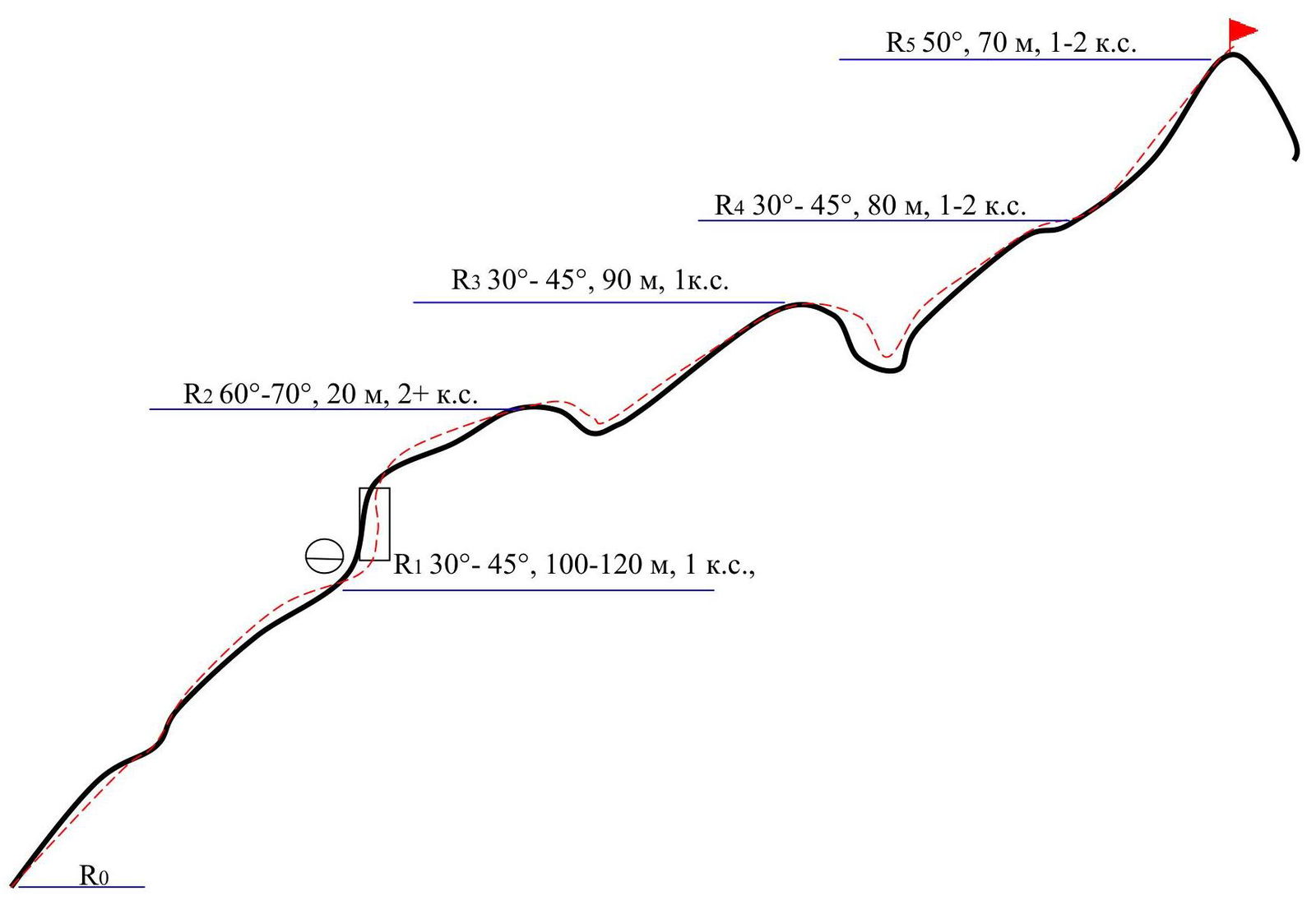
R0 R5 50°, 70 m, 1–2 category of difficulty. R4 30°–45°, 80 m, 1–2 category of difficulty. R3 30°–45°, 90 m, 1 category of difficulty. R2 60°–70°, 20 m, 2+ category of difficulty. R1 30°–45°, 100–120 m, 1 category of difficulty.