Ascent Record
-
Technical category.
-
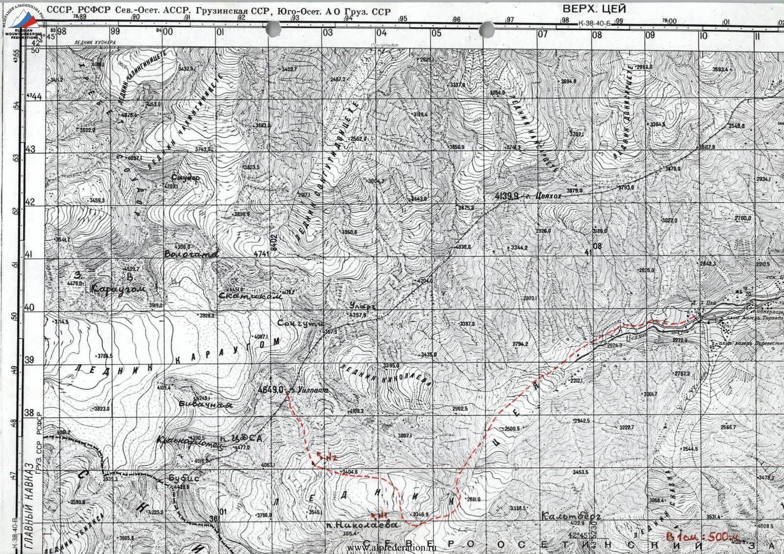
Caucasus, Tsey Range.
-
Uilpata (4649 m), via the 1st buttress of the South Ridge.
-
Proposed category: 5A–5B, first ascent.
-
Elevation gain: 1050 m; route length: 1640 m. Length of 5–6 category sections: 35 m. Average slope: 50° for the main part of the route, 45° for the entire route (from the bergschrund).
-
Pitons used:
- rock pitons — 17
- chocks — 29
- ice screws — 3
- bolted pitons — 0
Left on the route:
- rock pitons — 2
- chocks — 0
- ice screws — 0
- bolted pitons — 0.
-
Climbing time to the summit: 16 hours over 2 days.
-
Overnight stop on the South Ridge, comfortable, lying down.
-
Team leader: Sergey Vladimirovich Egorin, Master of Sports.
Team member: Maxim Nikolayevich Akulov — 2nd sports category.
-
Coach: Sergey Vladimirovich Egorin, Master of Sports.
All team members are from Vladikavkaz.
-
Start of the route: October 1, 1999. Summit: October 2, 1999. Return to base camp: October 3, 1999.
-
Organizing body: North Ossetia Republican Rescue Squad of the EMERCOM of Russia.
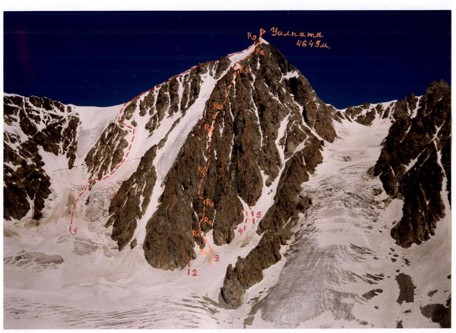
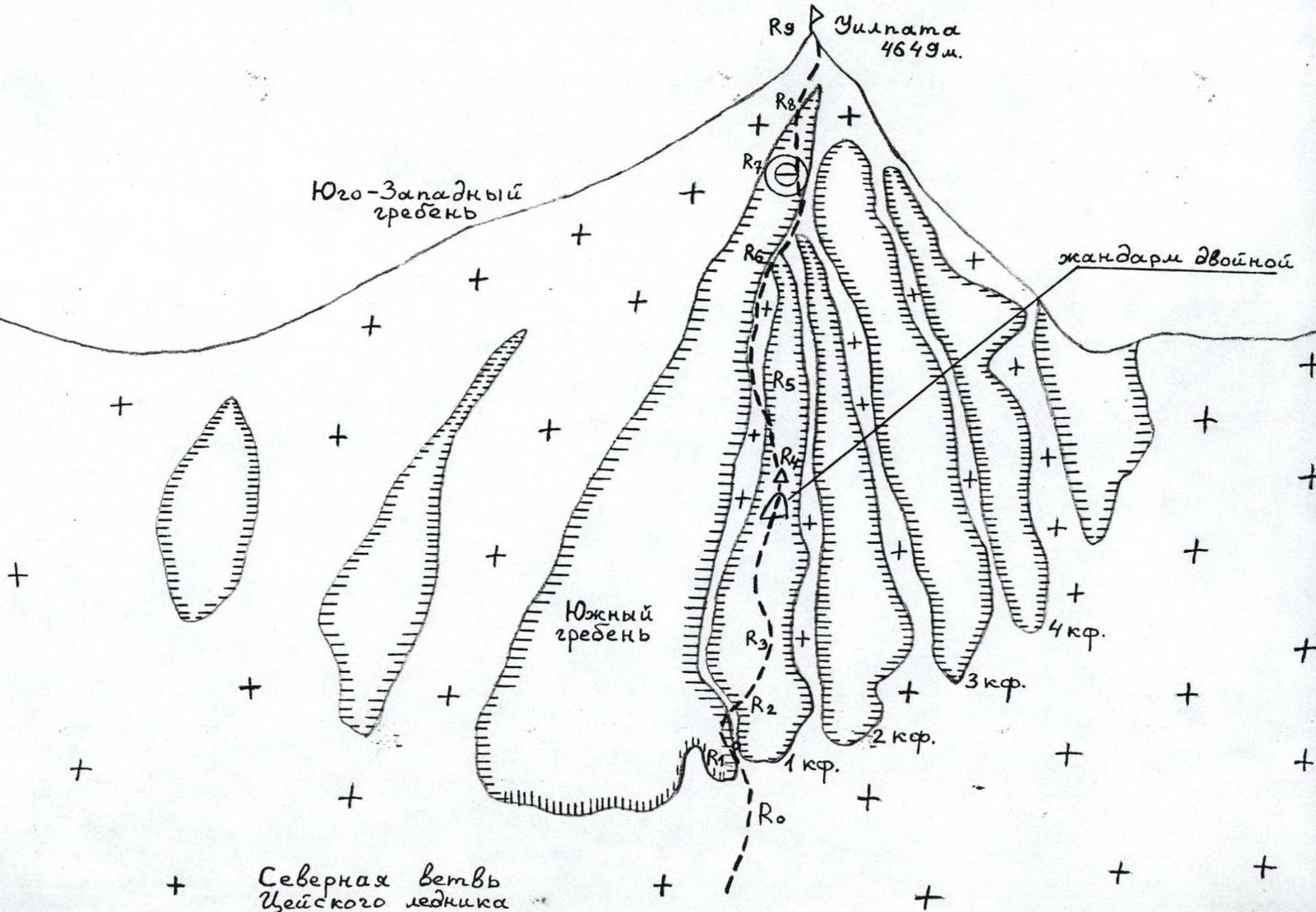
Photo 1. General view of Mt. Uilpata (4649 m). Photo taken from the summit of Hitsan, July. View from the South. The number 3 indicates the first ascent route via the 1st buttress of the South Ridge. The number 1 marks the route category 2B via the South Ridge. The number 2 marks the route category 5B via the South Ridge. The number 4 marks the route category 5B via the 2nd buttress of the South Ridge. The number 5 indicates the route category 5A via the 3rd buttress of the South Ridge.
USSR. RSFSR. North Ossetian ASSR. Georgian SSR, South Ossetian AO of Georgian SSR
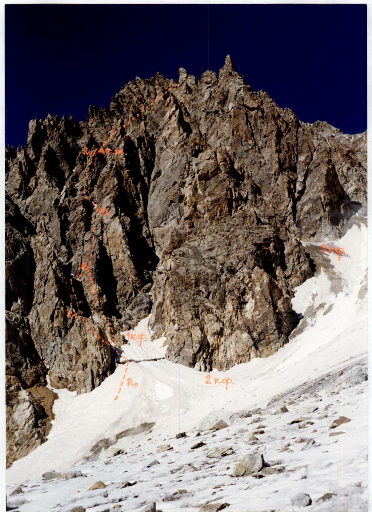
Photo 2. Lower part of the 1st buttress of the South Ridge of Mt. Uilpata. The first ascent route is marked.
Route Description by Sections
The base of the 1st buttress is characterized by two distinct, parallel ridges. The ascent path primarily follows the left ridge.
R0–R1: Approach the bergschrund via a snow slope and cross it via a snow bridge. Continue towards the couloir separating the South Ridge and the 1st buttress. Cross the couloir and exit left onto the ledges on the right side of the South Ridge. Ascend along these ledges towards a large boulder wedged in the couloir. Stop short of the boulder. The entire section is about 150 m. The snow section is category 2–3; the rock section is category 3–3+.
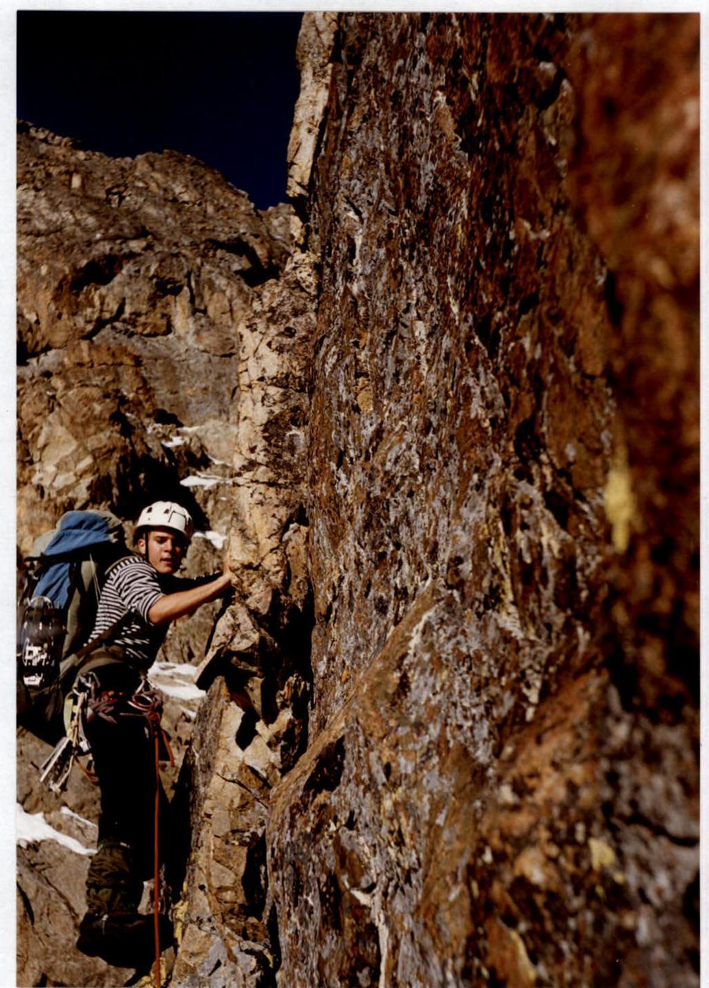
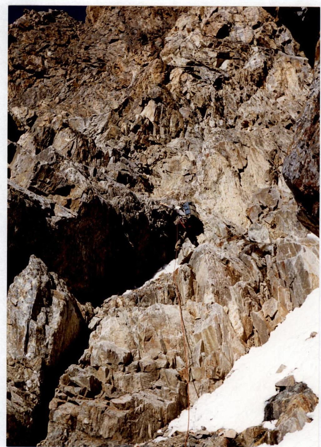
R1–R2: Ascend directly up the wall to the left of the boulder. The climbing is very strenuous, without backpacks, and there are few cracks. The wall is 15 m, 85–90°, category 5–5+. Upon reaching the top of the boulder, organize rope pulling. Proceed slightly along the couloir and exit right onto a ledge leading to the 1st buttress. Another 50 m or so, category 2–3. Unfortunately, photographs of this section were not obtained. It is also possible to reach point R2 via the left ridge at the base of the 1st buttress. This path is more difficult than the one we took but less prone to rockfall.
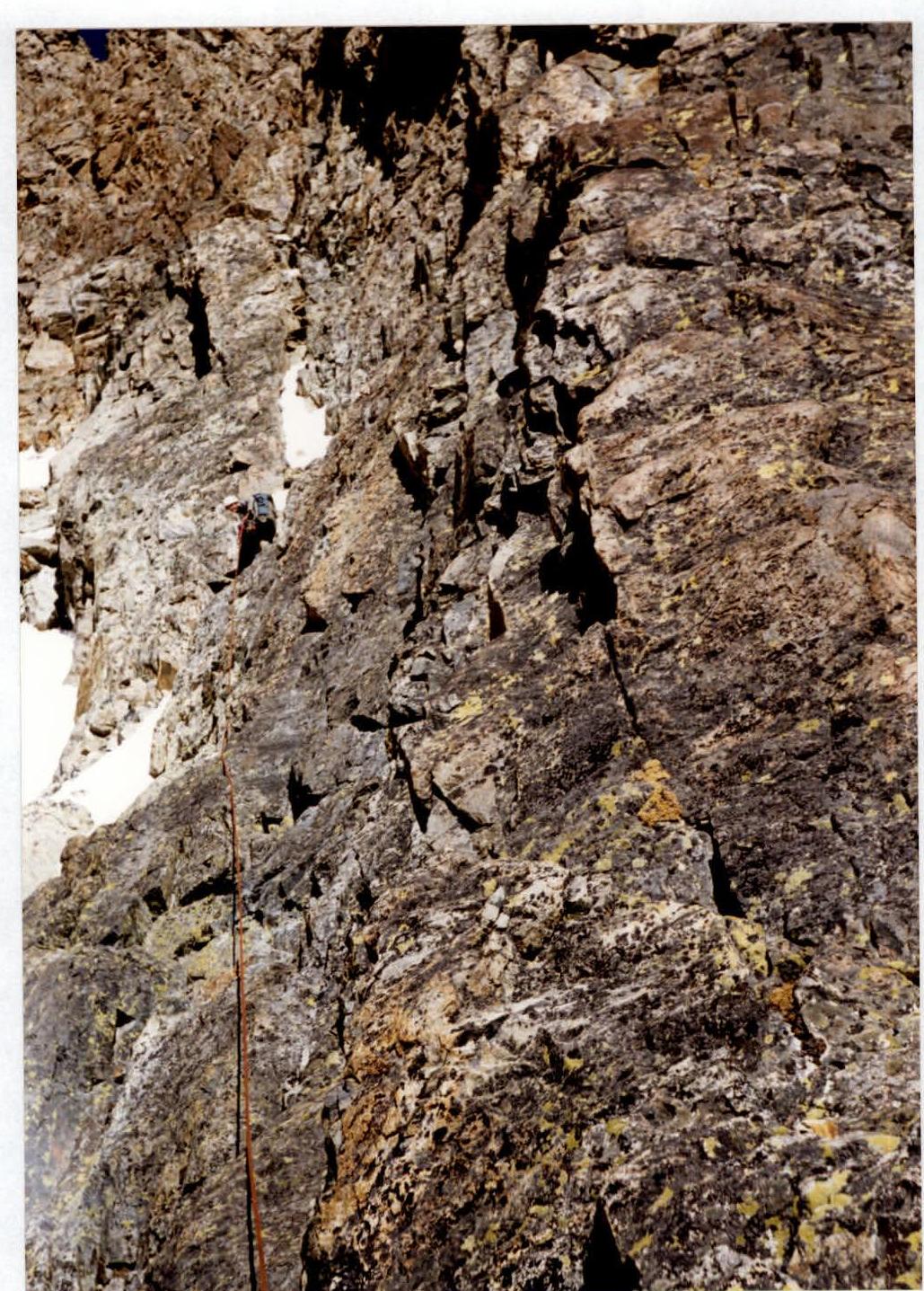
R2–R3: Continue directly up the 1st buttress. The initial wall is category 5, 10 m, 85°. It's better to climb without a backpack. Then proceed along the ridge to the right of a stream on the rocks, heading towards a square pinnacle. Enter a rocky couloir-gutter to the right of the pinnacle. The entire section is about 120 m, category 4, местами category 4+.
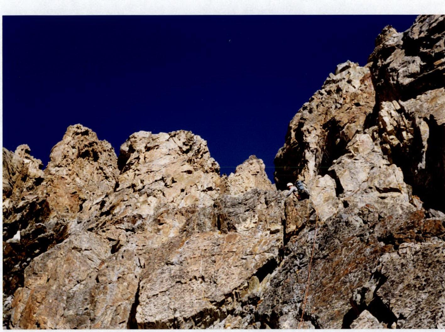
R3–R4: Cross the couloir upwards to the left and re-emerge onto the ridge of the buttress beyond the square pinnacle. Continue up the rocks, initially large blocks and then more fragmented. Approach a double pinnacle along the edge of the buttress (the lower part is composed of reddish rocks, the upper part is black) and, bypassing its summit on the right, reach a col behind it. A control cairn is located slightly above the col. The entire section is about 120 m, category 4–4+, with some category 5 sections (about 10 m total). It takes 6–7 hours to reach this point from the start of the route. There are many ledges along the buttress up to the control cairn, suitable for sitting overnight.
R4–R5: From the col, proceed along the left side of the 1st buttress on ledges, gradually entering the couloir. Continue to ascend along the sides of the couloir via ledges and small walls of category 4 until reaching an ice wall in the couloir. The section is 200 m, category 3–4.
R5–R6: The ice wall can be climbed directly or bypassed on the left via rock — 20 m, category 4+. Continue up the couloir to the junction of the 1st buttress and the South Ridge. Another 60 m, category 3–4. An overnight stop is possible here.
R6–R7: Continue ascending while staying to the right side of the South Ridge, and reach a shoulder — the end of the 2nd buttress. Then enter a wide, snow-covered couloir with rock outcrops and bypass waterlogged and iced rocks on the left. Pass through walls of category 3–4 and a possible overnight location (under an overhanging rock), turn right, and re-enter a snow and scree couloir lower and to the left of where the 3rd buttress ends. Continue up the couloir, reach the right side of the South Ridge, and approach wide scree platforms. An overnight stop is possible here. The entire section is about 300 m, category 2 to 4. It takes 12–14 hours to reach this point from the start of the route.
R7–R8: The route continues along the South Ridge. Traverse simple rocks, category 3 at times, bypassing pinnacles on the left, and approach an ice slope. The entire section is about 400 m.
R8–R9: Ascend a snow and ice slope to the summit rampart and climb to the summit of Uilpata via the right side of the tower. The section is 200 m, category 2–3.
Descent is via the Southwest Ridge, category 2B route.
Passage of the lower part of section R2–R3.
Passage of the middle part of section R2–R3.
Passage of the lower part of section R3–R4.
Passage of the lower part of section R4–R5.