To the memory of our friends, lost in the mountains...
Report on the First Ascent to the Summit 3593 m, Peak Spasately
Climbing Passport.
- Caucasus. Tsey Range. Section number in the Classification 2.7.
- p. 3593 m (Peak Spasately) — via the Southwest Ridge.
- Proposed 1B category of difficulty, first ascent.
- Route type — rock.
- Height difference of the route — 400 m.
Total route length — about 600 m. Length of sections with 3rd category of difficulty — 20 m. Steepness of key sections — 70°. Average steepness of the route — 30°.
- Pitons left on the route — none.
- Climbing hours – 5; days – 1.
- Leader: Egorin S. V.
Participants:
- Shemyakin A.
- Zinoviev M.
- Abisalov A.
- Rodin A.
- Grigorov A.
- Kukharin A.
- Kolyada A.
- Coach: Egorin S. V.
- Approach to the route; summit; descent: September 20, 2009.
- Organization: High-Mountain Rescue Team of EMERCOM of Russia.
- Leader's contact information for report inquiries:
email: e.s.128@mail.ru; phone: 8 928 490-31-28; 8 963 377-01-28.
Adaihoh
Spasately

Photopanorama of the area from the North. July.
Brief Overview of the Climbing Area.
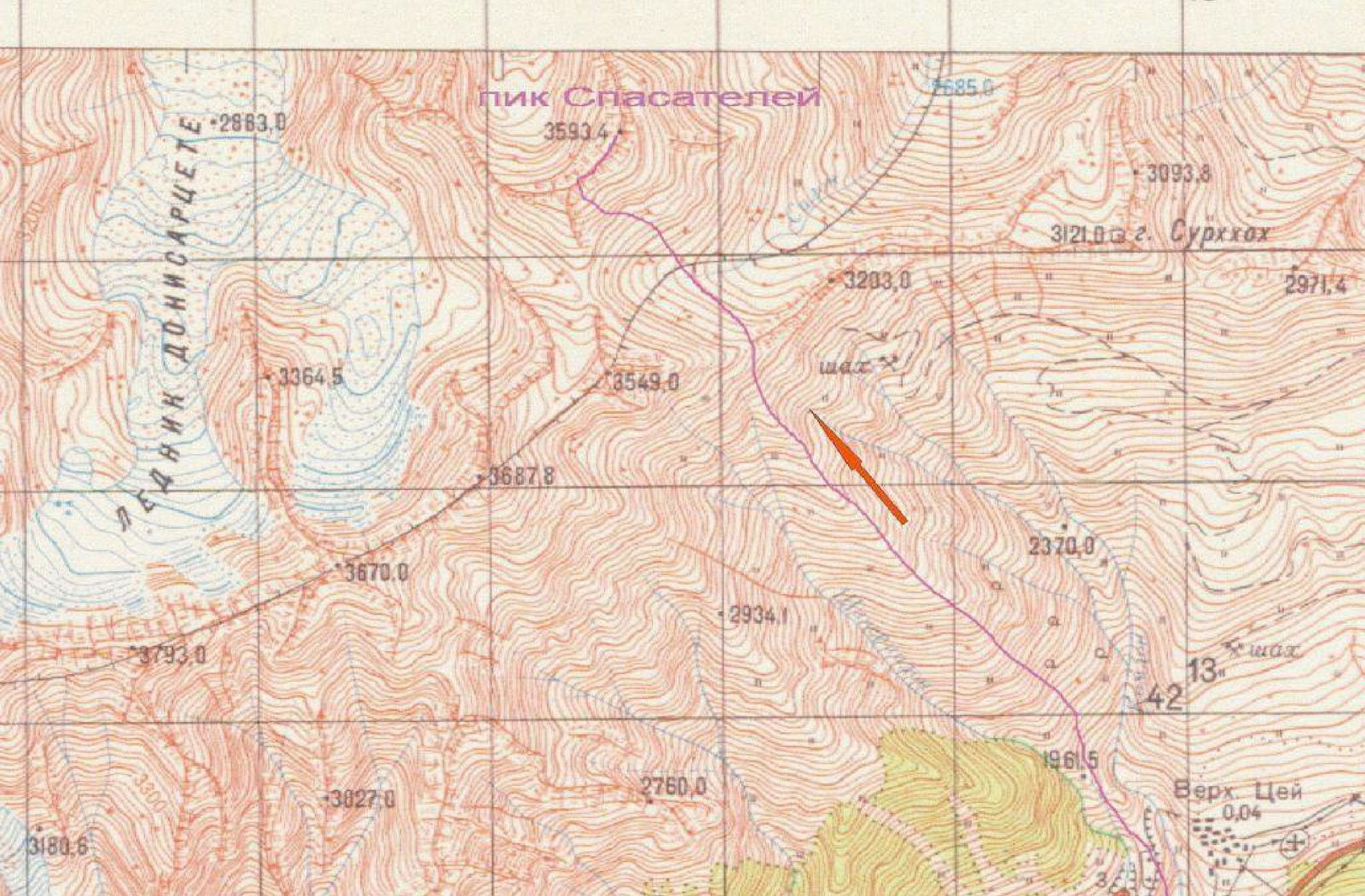
The summit 3593 m — Peak Spasately, is located in the Tsey Range, situated in the Central Caucasus, within the Republic of North Ossetia – Alania.
The Tsey Range branches off to the north from the Tsey-Karaugom pass—a saddle on the northern slope of the Bubis summit in the Main Caucasian Range. The southwestern part of the Tsey Range forms the boundary between:
- The Karaugom plateau, lying to the west from Bubis to Songuti,
- The northern branch of the Tsey Glacier, lying under the eastern slopes of the range from Bubis to Uilpata and the ridge of SKVO.
Above the Tsey-Karaugom pass, the range features the summits of Dubl' Pik, Krasnoflotets, Krasnoarmeets, TsDSA, Uilpata, and Songuti.
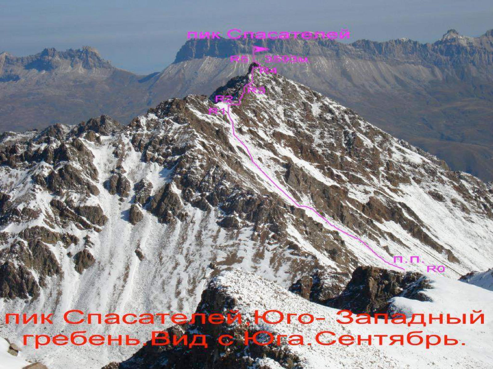
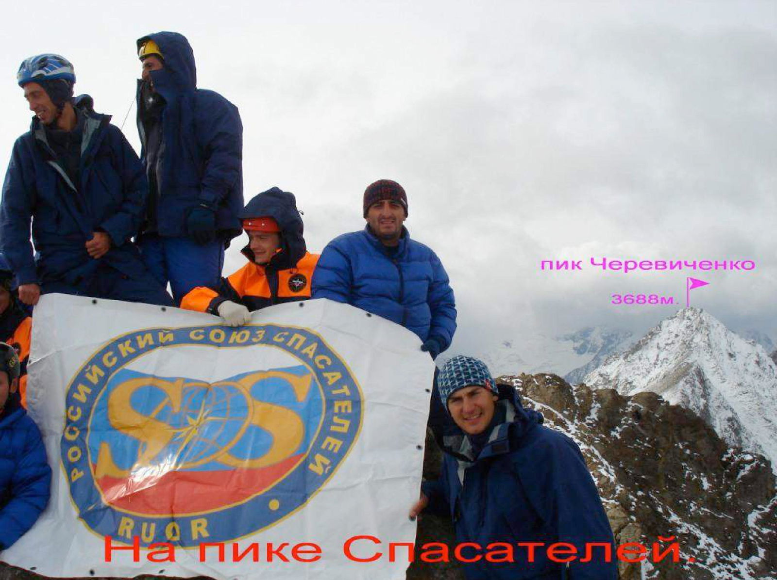
To the northeast, beyond a series of large gendarmes of Songuti, the Tsey Range turns east. It is home to the summits of Ularg, Oniiani, Zolotareva, Antonovicha, Poyasova, Turkhoh, Tsey, Malaya Songuti, Burevestnik-Tseyskiy, Cherevichenko (Spartak-Tseyskiy), and Sadon. Beyond the Sadon summit, the Tsey Range turns north and, through the summit 3593 m (Peak Spasately), transitions into a destroyed, scree-covered, grassy ridge that descends to the Kion pass.
Previously, there were no ascents to the summit 3593 m. We found no signs of human presence at the highest point. As the first ascenders, we propose naming the 3593 m mark as Peak Spasately.
- 355,5 +2883,0 10 +3093,8 121.0.3.2. Surkhoh
- 3549,0 +3203,0 10 +3087,0 121.0.3.2. Surkhoh
- 3870,0 +3870,0 10 +3870,0 121.0.3.2. Surkhoh
- 2934,1 +3870,0 10 +3870,0 121.0.3.2. Surkhoh
- 2760,0 +3870,0 10 +3870,0 121.0.3.2. Surkhoh
- 1861,5 +3027,0 10 +3027,0 121.0.3.2. Surkhoh
- Upper Tsey 0,04 3180,6
Description of the Approach to the Route.
From the alpine camps of the Tsey area, exit onto the road and follow it down the Tsey valley. Before the last turn towards the settlement of Verkhny Tsey, turn left off the road. Then, proceed to a grassy, watershed ridge that separates the Shacherpakoidon valley on the left and the Komidon valley on the right. The path goes upwards, to the north, along an old, overgrown trail. After the ridge transitions into a slope (within 2–3 hours), it's necessary to veer left, bypassing rock outcrops. Along a steep slope with grass, we rejoin the watershed ridge.
Continue along the broad, scree-covered ridge towards the visible Tsey Range ahead. Before reaching the rocks with reddish scree beneath them, camping on the platforms is possible, at an elevation of about 3000 m. From the alpine camps of the Tsey area, it takes around 6 hours.
- Water is available below to the left
- Cell phone coverage is available — Megafon
From the campsite, proceed directly up the ridge. It's better to bypass the rocks under the reddish scree on the left. At the end of the watershed ridge, which separates the Shacherpakoidon valley on the left and the Komidon valley on the right, reach the Tsey Range ridge, at an elevation of 3300 m. It takes about 1 hour from the campsite.
Ahead lies a cirque in the upper reaches of the Sadon river, filled with numerous screes. To the north of it is located the summit 3593 m (Peak Spasately).
From the point of reaching the Tsey Range ridge, it's necessary to move along it to the right, for about 100 meters — to the beginning of a scree-filled couloir leading down into the Sadon river cirque. Descend to the bottom of the valley and turn left, heading west, towards the base of a long scree-filled couloir that leads to the midpoint of the Southwest Ridge of Peak Spasately.
Peak Spasately

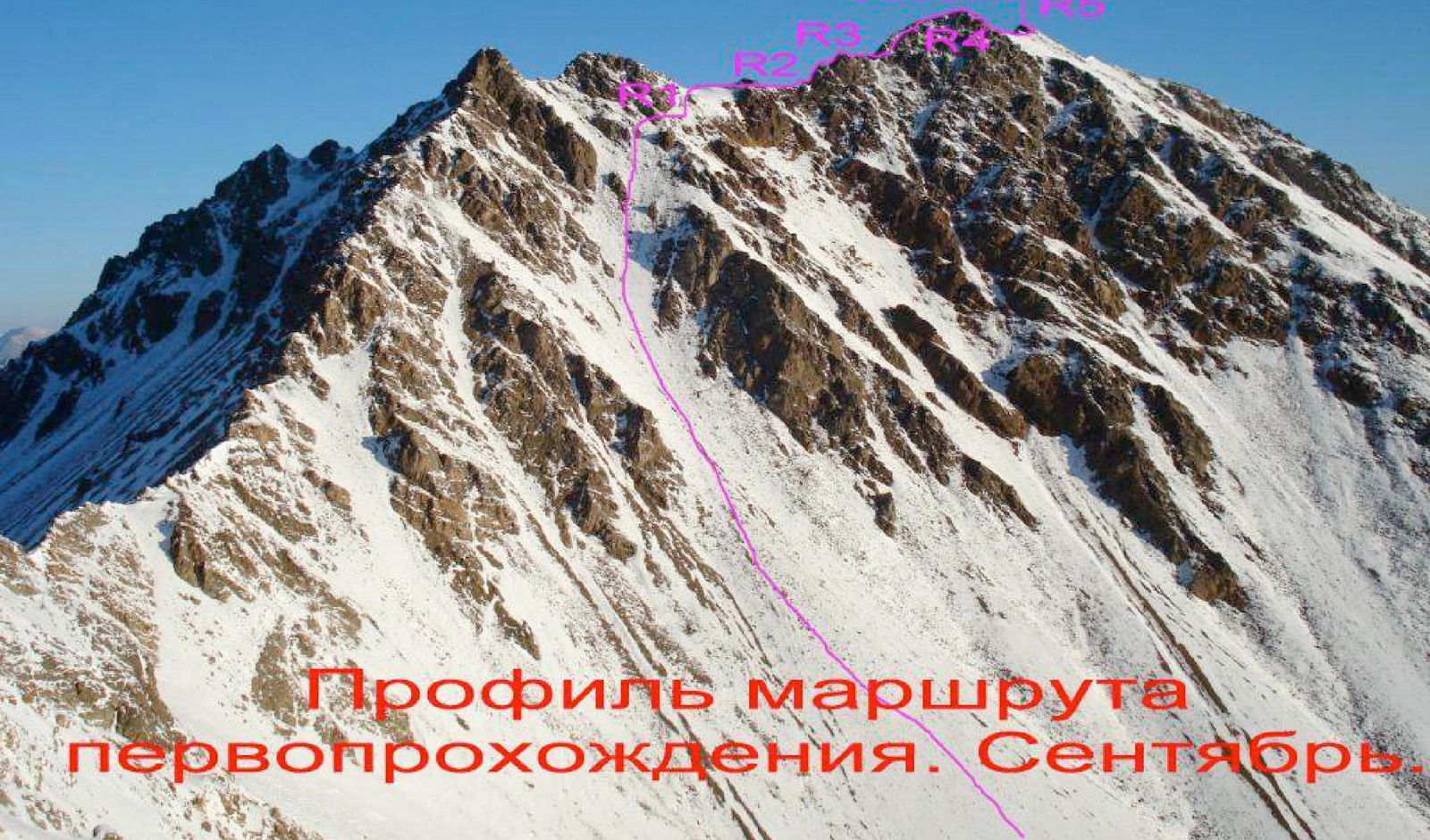
Route Description by Sections.
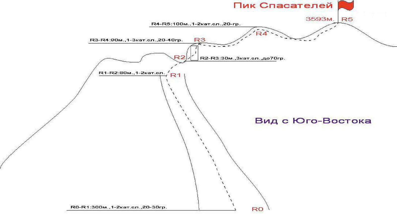
Having descended into the upper Sadon valley for about 300 meters, turn left and head west, towards the base of a long scree-filled couloir that leads to the midpoint of the Southwest Ridge of Peak Spasately.
Section R0–R1:
- Ascend the scree-filled couloir directly upwards; in the upper part, veer right and approach the base of the rock ascent.
- The entire section is about 300 m, category of difficulty 1, 20–30°.
- Crampons may be necessary in the first half of the summer.
Section R1–R2: From the base of the rock ascent, traverse to the right and then exit onto the Southwest Ridge. Along a simple scree ridge, approach the key gendarme of the ridge. The entire section is about 80 m, 1–2 category of difficulty.
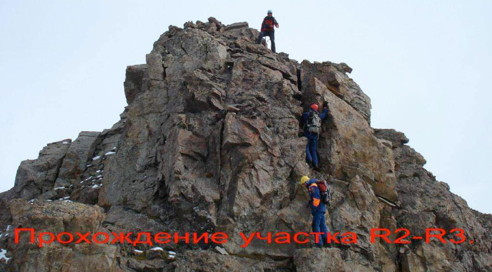
Section R2–R3:
- Through the center of the gendarme, via a wall of 3rd category of difficulty, 5 m, 70°, ascend to the top of the ridge.
- The next ascent is directly along the ridge line — another 25 m, with sections of 2–3 category of difficulty, 30–40°.
Section R3–R4: The Southwest Ridge to the sub-summit is traversed directly along the center. Rocks are of 1–3 category of difficulty, 20–40°. To the sub-summit is 90 m.
Section R4–R5: From the sub-summit, along the right side of the scree ridge, 1–2 category of difficulty, 20°, 100 m, ascend to the summit 3593 m — Peak Spasately.
From the campsite, it takes 5–6 hours. The summit is a good panoramic viewpoint. Descent is via the ascent route.
View from the Southeast
Conclusions and Recommendations for the Route.
The route is recommended for training and educational ascents. The route to Peak Spasately is a ridge route and is potentially safe. In the off-season and winter, with a significant amount of snow, be cautious of avalanches when descending into the cirque and when exiting onto the Southwest Ridge.
Insurance on the route is provided through rock outcrops. The summit is a good panoramic viewpoint. There is cell phone coverage on the route (Megafon).


