Fig. 37
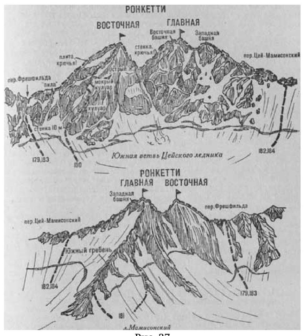
- Ronketti Glavnaya (4080 m) via South Ridge (combined route, 2А cat. dif., fig. 37).
From the CPS of the Tsey region (group of 4–20 people) — along the highway; 1 km before the Mamison Pass, turn right into the last gorge and ascend along the trail along the bank of the Mamison River to the eponymous glacier. Further:
- along the talus and moraine deposits covering the glacier, approach the first lower moraine rising left along the eastern slopes of the South Ridge of the Glavnaya Ronketti peak;
- at the upper part of the moraine under the eastern buttress of the South Ridge — initial bivouac.
From the bivouac, turning left, ascend simple fractured rocks of the eastern buttress of the South Ridge, bypassing difficult sections on the right. Then — right-upwards, crossing numerous steep snow-ice (rockfall) couloirs, to the exit onto the South Ridge of the peak. Further along simple, heavily fractured rocks of the South Ridge with several snow sections (cornices) — ascent to the summit of Glavnaya Ronketti.
From the initial bivouac on the moraine 4–5 hours.
Descent:
- along the South Ridge at first via the ascent route,
- further — to a wide snowy talus couloir descending onto the Mamison Glacier,
- here, turn left and descend along the couloir onto the glacier to the initial bivouac.
Duration of the route is 2 days. Ascent to the summit is safer via the descent route — from the lower col of the South Ridge.
Naumov A. F. Karaugom, Digoria, Tsey (Central Caucasus), M., “Fizkultura i sport”, 1976.