
Pik Oniani
The peak (4200 m) is named after the climber Kyrylyb Oniani, one of the first explorers of the region. It is located in the middle part of the Tsey range between the peaks of Artsishevsky to the southwest and Zolotarev to the northeast. The southern, rugged rocky edge of Pik Oniani turns into a short spur, bounding the Uilpatinsky glacier cirque from the east. The rocky areas on the western side of the spur are named after the climber Taisia Volgina.
To the Songuti glacier, the peak descends with a steep ice-and-snow slope with rare rocky outcrops, and to the southeast, to the Chetyre glacier, towards the Tsey gorge — with rugged rocky counterforts.
- Pik Oniani via the Western ridge, 2A cat. dif. (K. Oniani, A. Vakhrameev, Ya. Moskaltsov, E. Furguf, August 29, 1938).
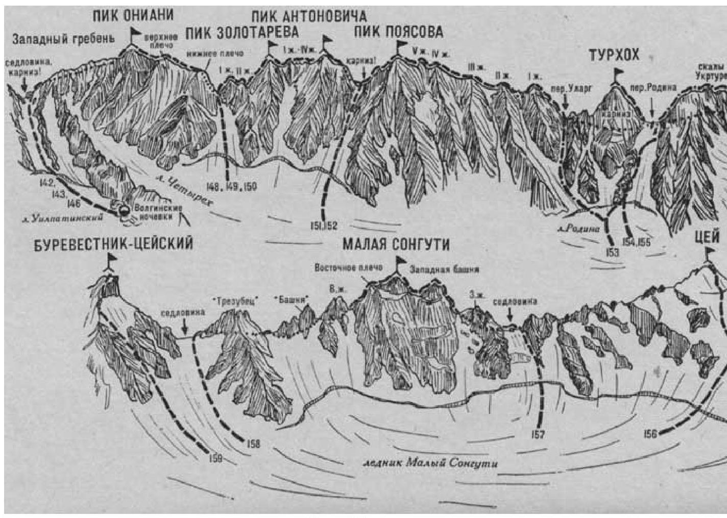
Fig. 33. The path from the Tsey region KSP (group 4–12 people) to the col of the range between Ulargom and Oniani with the initial bivouac at Volgin's overnight stay is described in route 142. At the col, turn right and exit onto the Western ridge of Pik Oniani.
Along the way:
- Along the easy snow-covered 50-meter Western ridge, approach the sharp serration, which is bypassed by a traverse along simple rocks (insurance) on the left.
- Behind the serration, along the narrow snow ridge — a steep ascent to the snow takeoff to the left of the rocks of the Western ridge.
- From the takeoff — a short descent, then 200–250 m upwards along the gentle snow ridge (cornices) or slope to the left of the rocks of the Western ridge.
- Further along the simple, destroyed rocks on the left side of the Western ridge, ascend to Pik Oniani.
From Volgin's overnight stay 3–4 hours.
Descent along the ascent route. The duration of the route is 2 days.
Literature:
- Naumov A. F. Karau gom, Digoria, Tsey (Central Caucasus), M., "Fizkultura i sport", 1976.