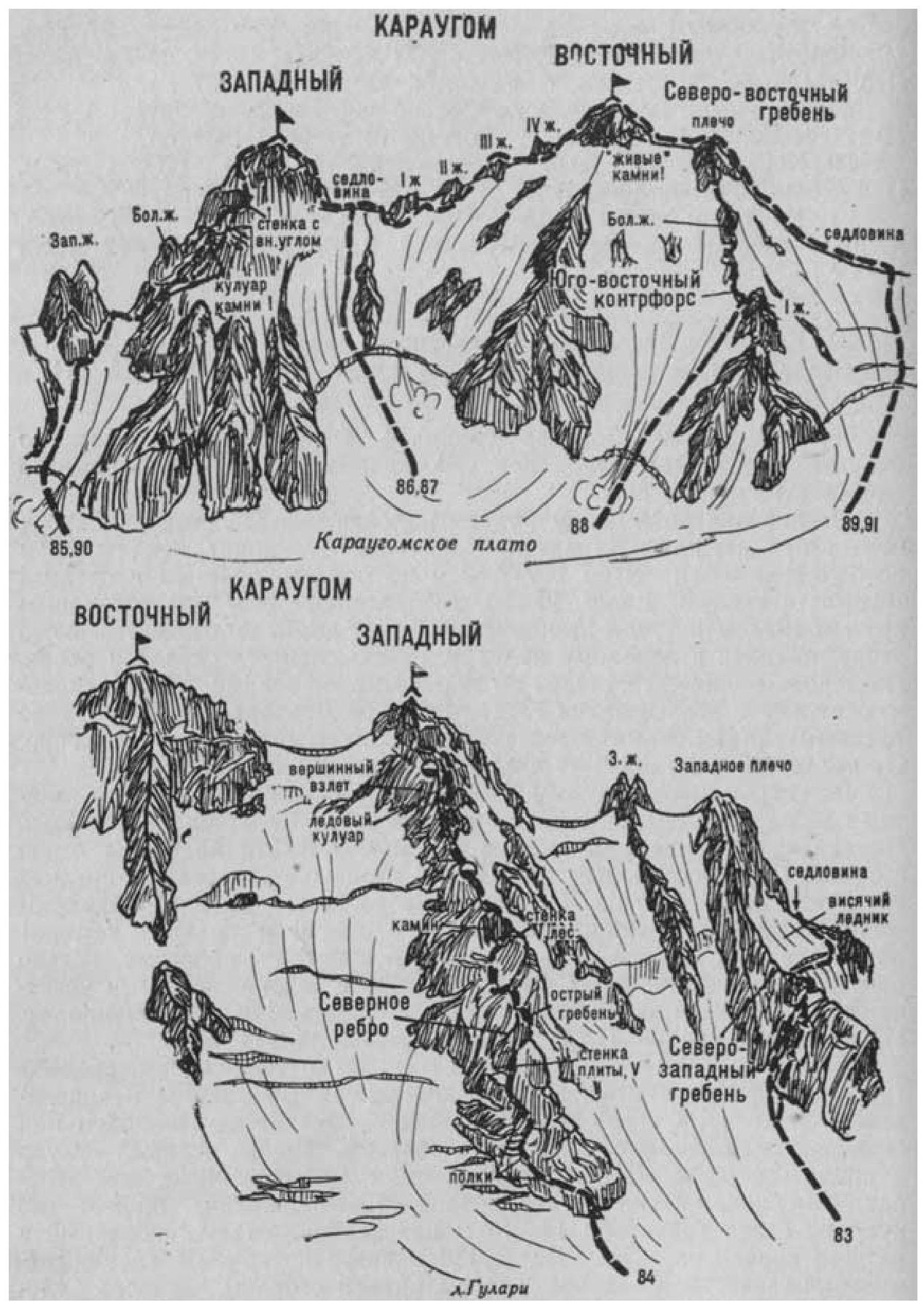
Fig. 21
- Karaugom East (4495 m) via the Southeast Buttress (G. Rebërn's combined route, Category III, Fig. 21). The path from the KSP of the Tsey region or from the village of Dzinaga (group of 4-8 people) to the initial bivouac on the platforms of the Western ridge of Bivouachnaya peak is described in route 83.
From the bivouac, cross northwest across the Karaugom plateau (closed crevasses) and approach the wide southern slope of the Southeast Buttress of Karaugom East.
From the plateau, having passed the bergschrund, ascend a steep 300-400-meter snowy slope (avalanche danger) to the saddle of the Southeast Buttress above the large first pinnacle.
On the saddle, turn left and ascend the sharp snowy ridge (cornice). Further, along simple, partially medium-difficulty snow-covered rocks of the Southeast Buttress, approach the large pinnacle. Bypass the pinnacle on the right along a steep ice-snow slope or overcome it directly via steep rocks of medium difficulty (running belay). Behind the pinnacle, initially along a snowy (cornices), then along a heavily damaged rocky Southeast Buttress with "live" rocks - belay - ascend to the shoulder. Here, turn left and along the simple, gently sloping, damaged, and snow-covered (cornices) Northeastern ridge, ascend to the summit of Karaugom East. From the initial bivouac, 7-8 hours.
Descent follows the ascent route. Naumov A. F. Karaugom, Digoria, Tsey (Central Caucasus), M., "Fizkultura i sport", 1976.