- Kaltberg (4120 m) via the Western slope and the Northern ridge (combined route, category 1B difficulty, Fig. 35).
The path from the CSP of the Tsey region (group of 4-6 people) to the Lower Ice overnight camps is described in route 83.
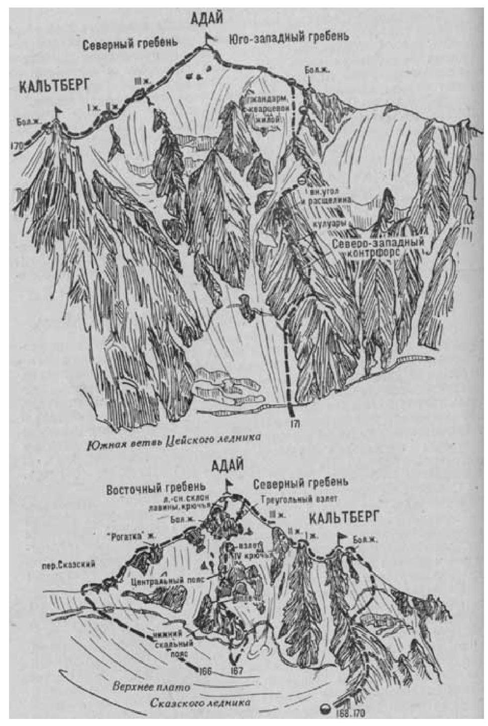
From the Lower Ice overnight camps, cross the Uilpatinka river and, turning left, intersect the right-bank moraine. Descend from it to the Tsey glacier, cross it, then ascend to the left-bank moraine at its lowest part. Leave the moraine and ascend via the middle talus on the right side of the couloir descending from the Northern ridge of Kaltberg peak. Then:
- cross the couloir to the left and upwards,
- reach a grassy slope and move up along it to the Western counterfort.
Further, via simple broken rocks and talus of the Western counterfort, bypassing all gendarmes along simple rocks and talus ledges, ascend to the Northern ridge of Kaltberg.
Here, turn right and, via simple rocks, bypassing difficult wall sections on the left, then along the 100-120-meter wide icy-snowy Northern ridge (with protection), approach the Big Gendarme. Here, exit right onto a talus ledge. Along it, then via steep rocks of the Northern ridge, ascend to the Big Gendarme. From the gendarme, make a 12-15 m sports descent to a snowy saddle. Further:
- via steep rocks of the narrow Northern ridge,
- a 30-meter broken ascent,
- ascend to the summit of Kaltberg.
From the CSP of the Tsey region - 10-12 hours.
Descent is via the ascent route. The route is prone to rockfall.
Source:
- Naumov A. F. Karagom, Digoria, Tsey (Central Caucasus), M., "Fizkultura i sport", 1976.
Adai
Eastern ridge a. 10 к 6 к 20 c plain cross bax. "Rogizy" j. pass Sказский 41 Central sems 111111 Upper plateau of Sказский glacier Northern ridge Ridgecrest couloir 111111 KALTBERG