
- Area: Central Caucasus, Digor district, Tana-Don gorge. Main Caucasian Range. Category according to CMGS - 2.6.
- Tajmazi Glavnaya peak, 3803 m, via SW wall.
- Proposed 5A category of difficulty, first ascent.
- Route character - combined.
- Height difference of the route:
– from the saddle at the start of the route to the ridge - 250 m (by altimeter); – from the ridge - 180 m
Route length along the wall - 579 m.
Section lengths:
– 4th category of difficulty - 54 m, – 5th category of difficulty - 155 m, – total - 209 m.
Average steepness:
– key sections - (75-80) degrees; – main part of the route - 55°; – entire route - 45°.
- Hooks left on the route: total 4; including bolted hooks - 0.
Total used on the route:
– rock hooks - 36, – chocks - 28.
Bolts were not used.
- Team's travel hours: 24.5 hours, 2 travel days, including:
– from camp to the saddle at the start of the route - 8 hours; – from the saddle to the summit ridge - 12.5 hours; – along the summit ridge - 1.5 hours; – descent to "Tajmazinskie nochyovki" - 2.5 hours.
- Leader: Kiselev Alexander Anatolyevich - Candidate Master of Sports; participants: Savelyev Valery Alexandrovich - Candidate Master of Sports, Klushin Alexey Vladimirovich - Candidate Master of Sports, Fedorov Vladislav Vladimirovich - 1st sports category.
- Coach: Kiselev Alexander Anatolyevich - CMS, 1st category instructor, cert. No. 156.
- Route start at 6:00 on July 15, 2000. R0-R0 - 10 m, 30°, 1st category of difficulty; R0-R1 - (20 m + 21 m), 60°, (3-4) category of difficulty; R1-R2 - 17 m, 50°, 2nd category of difficulty; R2-R3 - 40 m, 50°, 3rd category of difficulty, traverse of "sheep's foreheads"; R3-R4 - (10 m + 40 m), 60°, (4-3) category of difficulty; R4-R5 - 68 m, 30°, 1-2 category of difficulty, traverse along an inclined shelf with exit to a platform; R5-R6 - 15 m, 60°, 3rd category of difficulty; R6-R7 - 70 m, 80°, 5th category of difficulty; R7-R8 - 7 m, 4th category of difficulty, traverse along a slab with descent; R8-R9 - 70 m, 80°, 5th category of difficulty; R9-R10 - 45 m, (2-3) category of difficulty, traverse along a steep inclined shelf; R10-R11 - 5 m, 4th category of difficulty, traverse along a narrow shelf; R11-R12 - 90 m, 45°, (2-3) category of difficulty; R12-R13 - 15 m, (70-80)°, 5th category of difficulty; R13-R14 - 25 m, 1-2 category of difficulty, traverse along horizontal shelves and short walls; R14-R15 - ridge, (1-2) category of difficulty - exit to the summit.
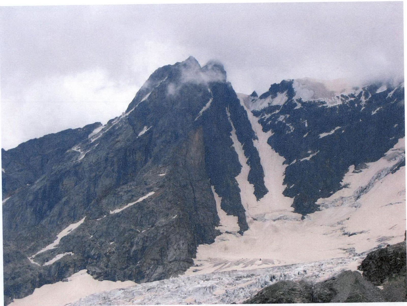
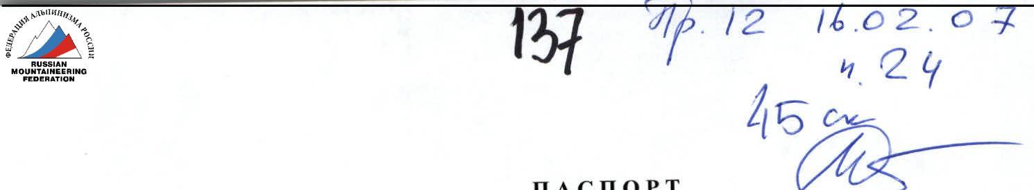
Fig. 1. General view of Tajmazi Glavnaya peak onto the SW wall from the upper part of Tana-Don gorge.
Brief description of the route passage
Departure from "Digoria" camp towards Tana-Don gorge at 6:00. At 7:00, approached the crossing of the Tana-Don river opposite the glacier descending from the saddle in the SW counterfort of Tajmazi Glavnaya peak (see Photo 2). This saddle is the main landmark for further movement. The main wall part of the route starts from it.
The river was crossed where it breaks into (5-6) branches, making it not significantly difficult in the morning hours. The ford took 15 minutes. Then:
– along talus slopes – then along the open tongue of the glacier – simultaneous movement in crampons towards the saddle (see Photo 2).
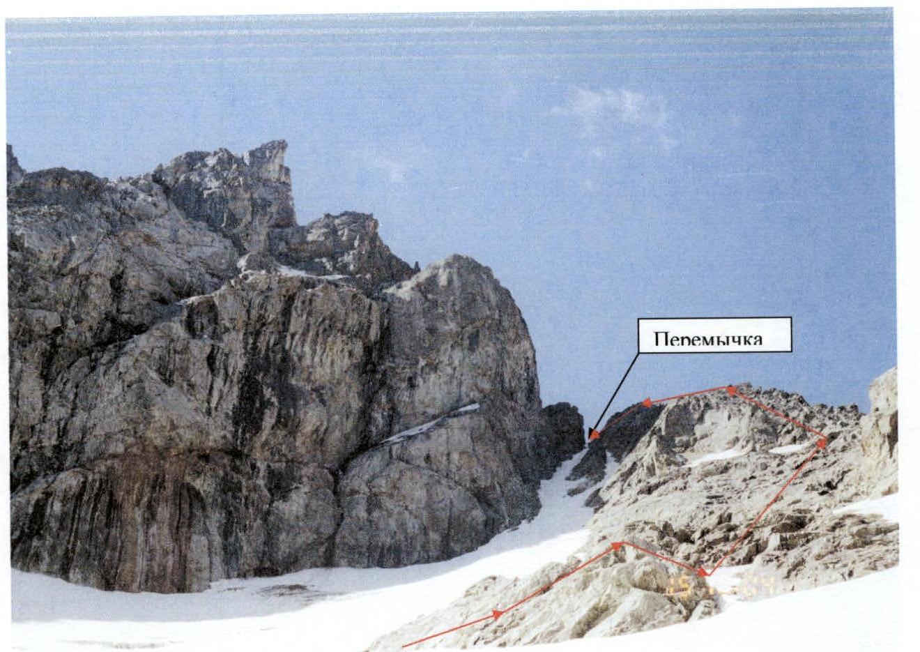
Photo 2. Saddle - a gap in the SW counterfort of Tajmazi Glavnaya. At 10:30, reached the second rock island, from which it is necessary to traverse right to reach the rock ridge at a clear lowering. Then, along shelves and walls of the destroyed rock ridge, staying near its top, reached the saddle at 14:00 (altimeter height - 3420 m).
On the saddle:
– There is a place for a tent – In the couloir - snow, making it convenient for overnight stay if needed – On the right rock wall - 1st control cairn in a suspended can
From this wall, a view opens onto the SW wall of Tajmazi Glavnaya peak (see Photo 3).
Photo 3. Upper part of the SW wall of Tajmazi Glavnaya peak.
After rest and preparation of equipment for rock work, started movement along the main technical part of the route at 15:00.
From the saddle (R0), down 10 m along a simple steep talus shelf (1st category of difficulty) (R0), then traverse (3rd category of difficulty) 20 m along a horizontal shelf on the left (by direction) rock wall and 7 m (4th category of difficulty) steeply up to a pointed ledge (loop). Then, behind the ledge:
– 7 m (4th category of difficulty) down along an inclined slab-shelf (throws off, so recommend leader movement without a backpack), – then up 7 m (4th category of difficulty) along a steep wall to an inclined slab with a good ledge for a belay loop - station (R1).
From the ledge:
– traverse 7 m right behind a protruding rock corner, – 10 m up along simple rocks (2nd category of difficulty) to an inclined shelf, where a convenient station is organized on three channel hooks (R2).
Then, 40 m traverse with a slight ascent along smoothed, partially wet, steep rocks like "sheep's foreheads" (3rd category of difficulty, see Photo 4), leading to a wet, steep black couloir (see Photo 5) going up the wall.
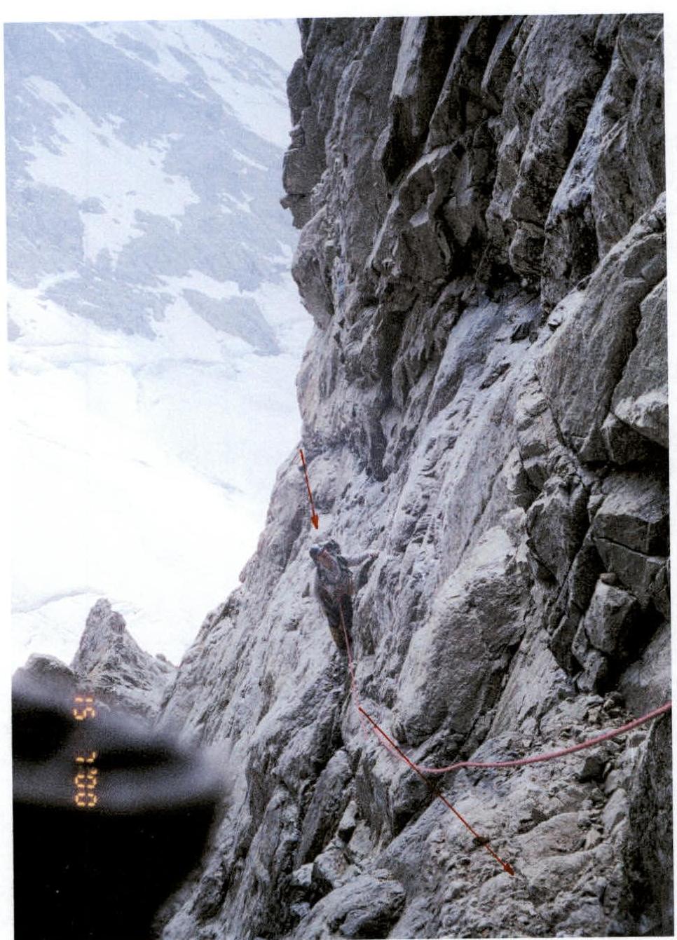
Photo 4. "Sheep's foreheads".
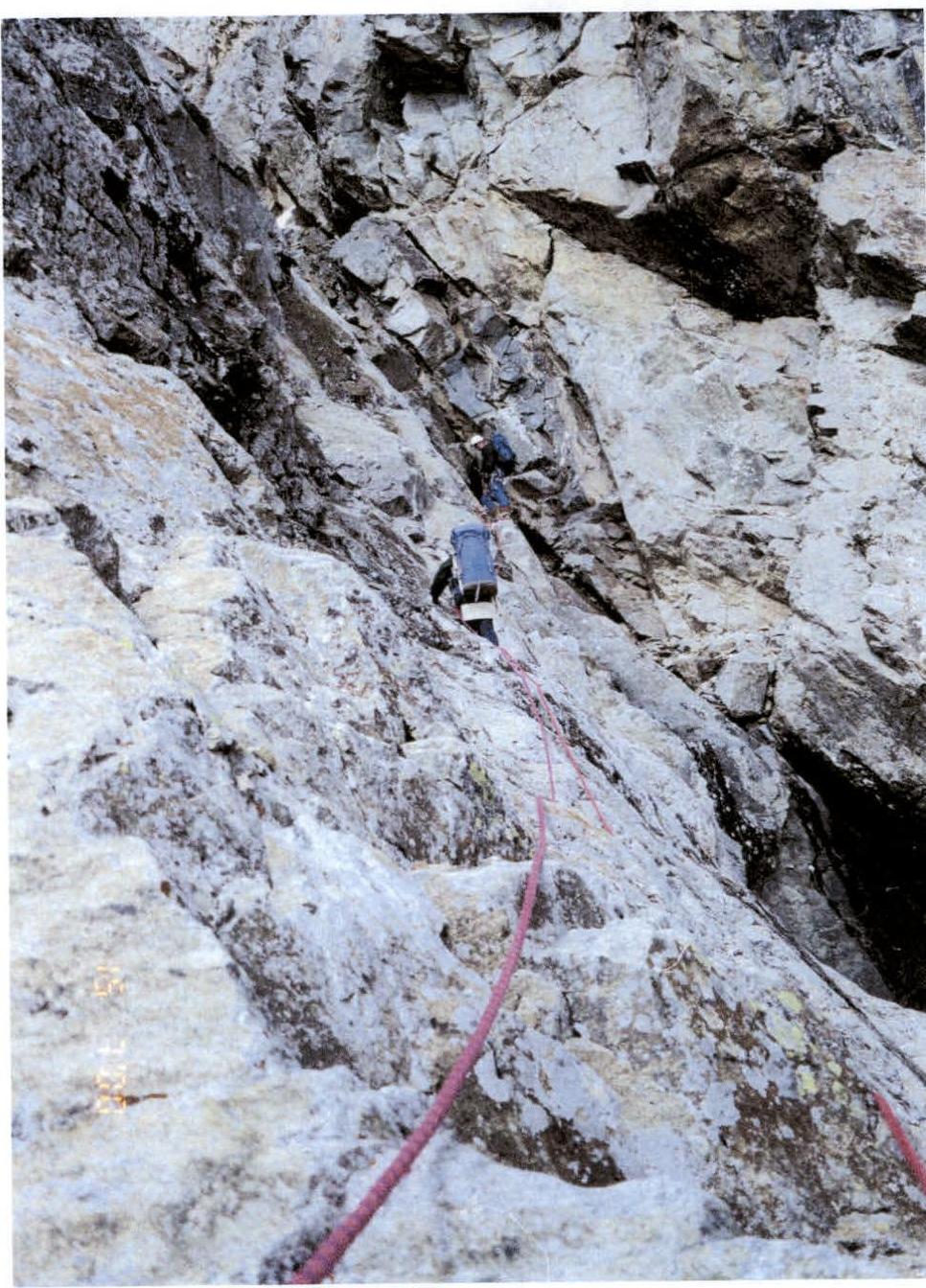
Photo 5. Entrance to the couloir.
Organized a station on a ledge located on the right (by direction) wall of the couloir (R3). The station and people on it are protected by the overhanging wall on the right, which is very relevant for further movement up the couloir from the station. Above, 5 m from the station in the couloir, there is a "plug" in the form of a large "live" stone, which must be passed with great caution. There is no other path here.
Up the couloir, first 15 m (4th category of difficulty) along steep sections with vertical walls and large "live" stones, and then - climbing 40 m (3rd category of difficulty) to a significant widening of the couloir.
At this point, a wide inclined talus shelf goes right from the couloir up the wall. At the start of this shelf, a station is organized (R4) using a ledge and hooks.
NOTE: At the widening of the couloir, it is tempting to exit to its left (by direction) side to a clearly visible rock ledge, which can be used for belay. However, near the ledge, there are many "live" stones on an inclined plane, creating a significant rockfall danger for the rest of the team moving along the couloir.
Then, up 60 m (1B category of difficulty) along an inclined, destroyed shelf to the base of a strongly destroyed ridge going left up to a gray wall. The ridge is bypassed on the right along simple rocks 8 m (2B category of difficulty) to an inclined platform under the gray wall. Under a rock overhang on the right lower part of the wall's base, a platform was leveled for a tent (see Photo 6), and a safe bivouac was organized (R5).
Time - 19:00. Height 3520 m. 2nd control cairn established.
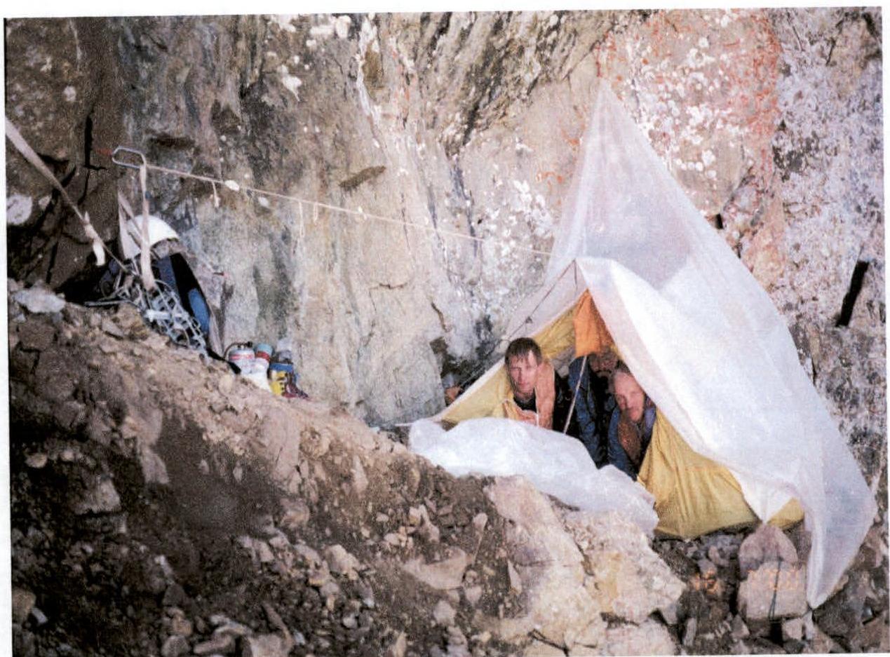
Photo 6. Overnight stay under the gray wall. While one pair arranged the bivouac, the other pair processed the further route and hung 50 m of rope along the wall. From the tent, first 15 m (3rd category of difficulty) up left along rocks of medium difficulty (R6), then up 70 m (5th category of difficulty) along a difficult, smooth wall without clear holds, with a steepness of 70-80° (see Photo 7).
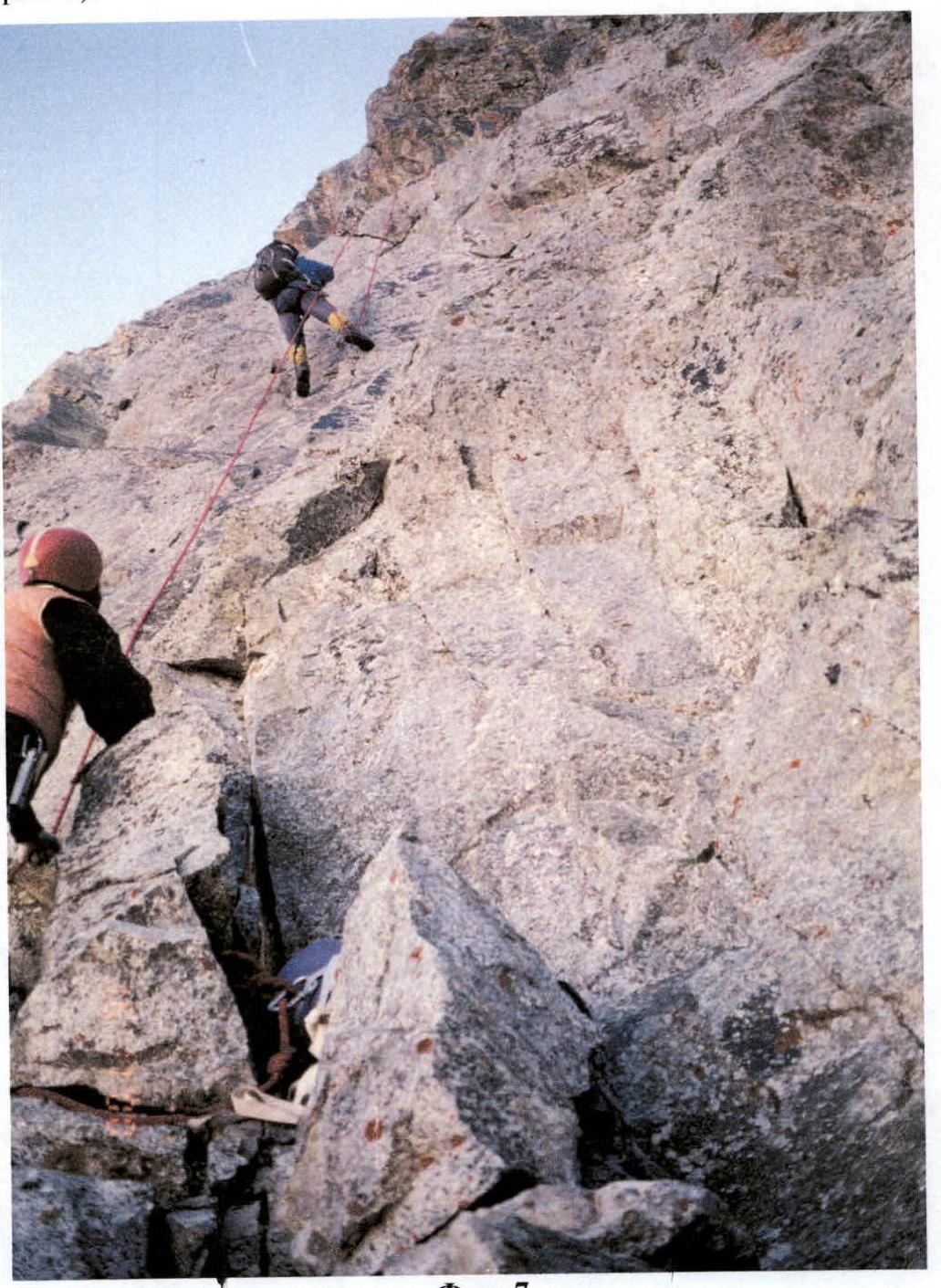
Photo 7.
At the top of the wall, an inner corner leads to an inclined, wide, smooth slab at the base of a steep, pointed shoulder.
On the shoulder - station (R7) (see Photo 8).
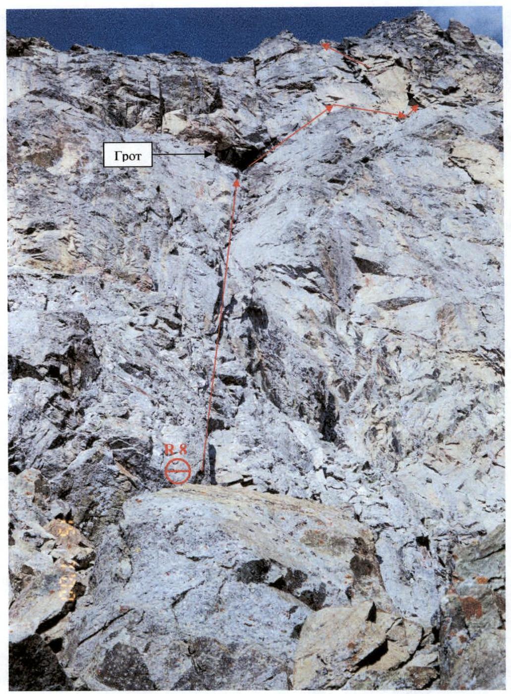
Photo 8. Wall section: R7-R8. Then, along the slab right - down, a descent 10 m (4th category of difficulty). Here, on a ledge, a station is organized (R8). From the station, bypassing two high pillars-ledges and belaying from them, traverse (10 m) (5th category of difficulty), enter a wet, wide inner corner. Then, move up along the right wall of the inner corner (see Photo 9). The wall is 60 m, steepness 80° (5th category of difficulty), smooth, with few holds and places for hooks and chocks. The wall leads to a shelf located in a clearly visible grotto (see Photo 8).
On the shelf - station on three channels (R9).
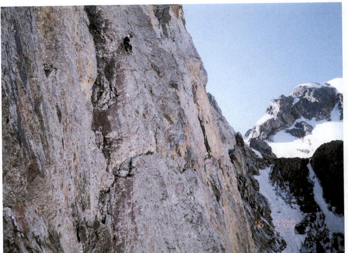
Photo 9. Wall to the right of the couloir.
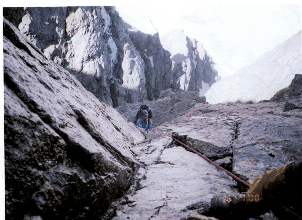
Photo 10. Exit to the shelf in the "grotto".
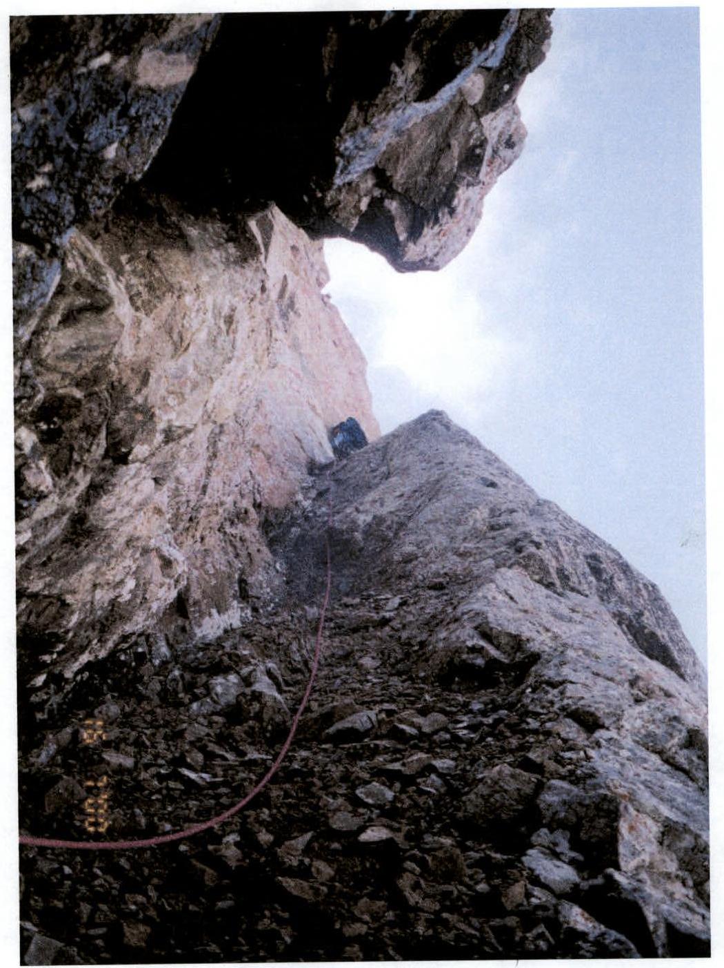
Photo 11. Steep inclined shelf exiting the "grotto".
The shelf (see Photo 11) from the grotto goes steeply up right 45 m (2-3 category of difficulty), (R10). At the end of the shelf, there is a significant narrowing (see Photo 12) under an overhanging wall. This section (8 m) (4th category of difficulty) is passed without backpacks with belay.
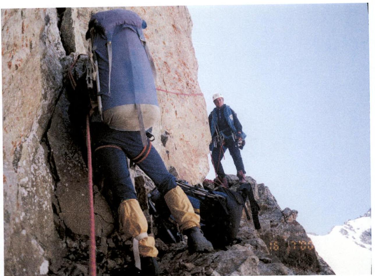
Photo 12. Narrow shelf.
Left behind the corner - station (R11). Then, movement with simultaneous belay through ledges along simple shelves and walls 90 m (2-3 category of difficulty) (see Photo 13) up left to a large rock ledge. The ledge is a wide talus balcony, on which, with some reconstruction, a tent can be placed (R12).
From the balcony, up 15 m, 70° along difficult, partially overhanging rocks (5th category of difficulty) (see Photo 14), or along a vertical, clearly visible crack, exit to a wide platform (R13), from which straight up (25 m) along rocks of medium difficulty, exit to the main SW ridge, or along shelves traverse left (30 m) to the same ridge slightly lower (R14).
Reached the ridge at 14:00. 3rd control cairn established. Height 3670 m. Then, along a simple (1-2 category of difficulty) rock-snow ridge and talus ascents, reached the summit (R15) at 16:00. Altimeter height 3810 m.
Descent along the East ridge, 2B category of difficulty, to "Tajmazinskie nochyovki" at 18:30.

Photo 13.
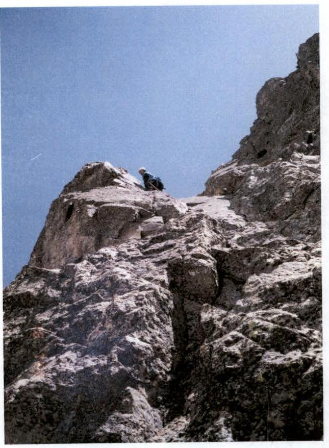
Photo 14.