Fig. 12
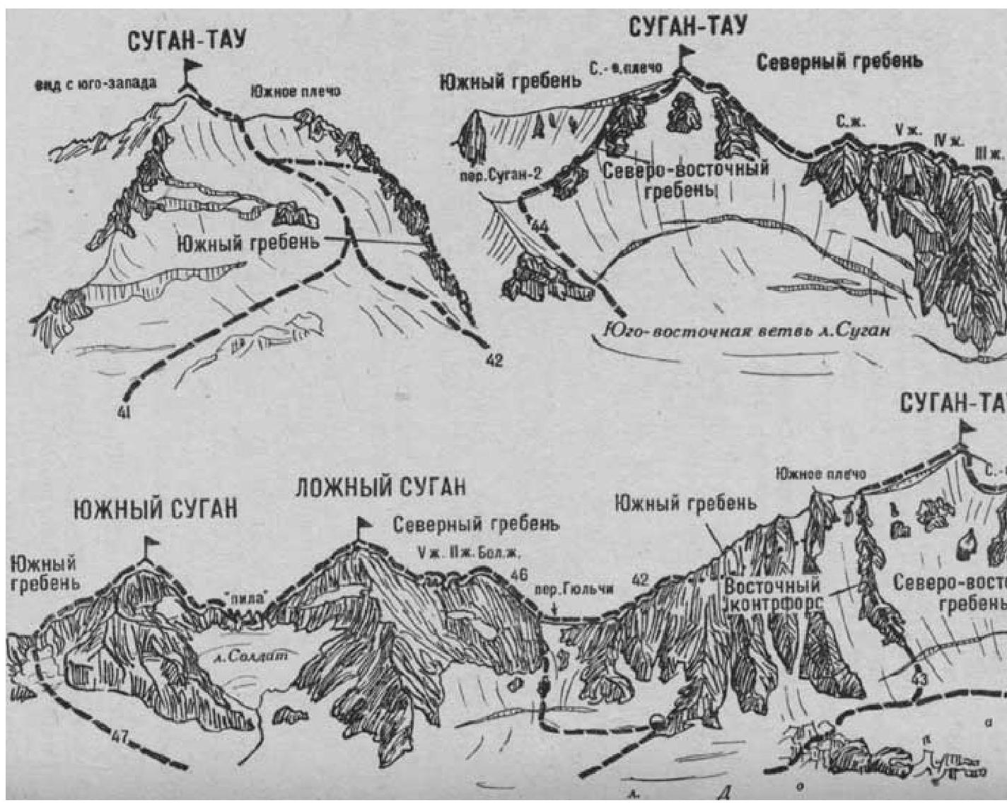
- Sugantau via the North Ridge (combined route by N. Misyura, Category 3B difficulty, Fig. 12).
The path from the base camp (a group of 4–8 people) on the right bank of the Psygansu River, near the tongue of the Nakhashbita Glacier, to the initial bivouac on the snow plateau under the left side of the North Ridge of Sugantau is described in route 48. From the base camp — 3.5–4 hours.
The approach path from the "Nakhashbita" clearing to the Sugan-2 pass is described in routes 46 and 44. From the Sugan-2 pass:
- descend a steep ice-and-snow slope, with a bergschrund in the lower part, to the upper plateau of the Eastern branch of the Sugan Glacier
- approach the initial bivouac under the left (eastern) side of the North Ridge of Sugantau across the plateau.
From the plateau (departure at 3–4 am), bypassing the rocky outcrop at the base of the North Ridge of Sugantau from the left (east), turn right and ascend a gentle 150–160-meter ice-and-snow slope (with protection) to a saddle on the North Ridge. A possible bivouac site is available here.
On the saddle, turn left and ascend:
- a gentle, straightforward, occasionally moderately difficult slope
- a sharp, long, snow-covered rocky North Ridge with numerous small gendarmes.
The first 4 gendarmes are overcome directly on moderately difficult rocks (pitched protection).
The fifth 18–20-meter gendarme with a negative lower section (the key section of the route — pitched protection) is climbed centrally.
Beyond it, a significantly lowered ridge descends to a snowy saddle. From the saddle, ascend the snow-covered, straightforward North Ridge.
Further, bypassing a small gendarme on the right, ascend to the highest North Gendarme of the ridge.
From the Sugan Glacier plateau — 6–8 hours.
From the North Gendarme, descend 60–80 meters (pitched protection) on simple and moderately difficult rocks of the ridge to a snowy col. After traversing the 100-meter col, ascend a steep 100–120-meter ice-and-snow ridge to a rocky outcrop (pitched protection). Then:
- Ascend 40 meters on a steep ice slope,
- Then 150–180 meters on a snowy ridge (cornices) to the summit of Sugantau.
From the North Gendarme — 3–4 hours.
Descend via the South slope (see route 41), returning through the Rtsvashki pass.
Naumov A. F. Karagom, Digoria, Tsey (Central Caucasus), M., "Fizkultura i sport", 1976.