Route Description
to the peak Bezimannyy (3620 m) from the West via the southern ridge (route is combined, 1B category of complexity) Tebi glacier. Conditional name “Peak of the 50th anniversary of Rostselmash”
Chirch Ridge. Peak 3620
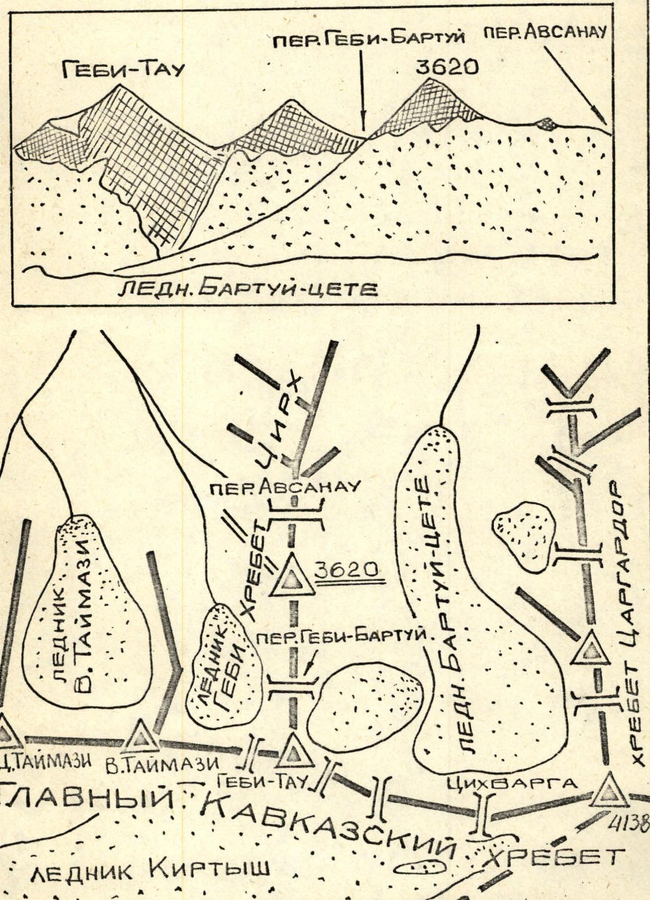 In the long northern ridge-spur (Chirch ridge) of the Gebi-Tau peak, dividing the valleys of the Khares River to the west and Karaugom to the east, near the Gebi-Tau peak to the south, in the upper reaches of the Gebi glacier to the west and Bartuy to the east, there is an unnamed rocky peak with a height of 3620 m.
In July 1979, a team of climbers from the “Planet” club of the Rostselmash factory ascended to this peak from the Gebi glacier via the southern ridge. On the summit:
- a memorial obelisk was erected in honor of the 50th anniversary of the award-bearing Rostselmash factory;
- the peak was named “Bezimannaya”.
The route is approximately 1B category of complexity.
Route Description
From the “Digoria” camp (Taymazhi glade) follow the trail down to the bridge over the Khares River, above the confluence of its right tributary Tanadon. Here, cross the Khares via the bridge.
Continue on the trail:
- to the bridge over Tanadon (500 m);
- cross Tanadon via the bridge;
- traverse the wide valley;
- cross Tebidon via the bridge;
- ascend along the right bank of Cheti to the upper cirque to the lake at the tongue of the Tebi glacier.
At the end of the ridge of the high right-bank moraine of the Gebi glacier are the upper areas. From the Taymazhi glade, it takes 3.5–4 hours. This is a hiking bivouac.
(For a large group, it is recommended to stop earlier, 0.5 hours before, not ascending to the moraine ridge, at the fork in the trails, one of which goes left (in the direction of travel) to the Avsanau pass).
Ascend the Gebi glacier to the snow-ice slope leading to the saddle between the rocky ascent of the southern ridge and the gendarme, south of which is the saddle of the Gebi–Bartuy pass. The slope's steepness is 35°. In the upper part, the slope's steepness increases, the last 1.5–2 ropes pass along the edge of the rocks and require belaying. From the saddle, the steep rocky ascent of the southern ridge is circumvented along pronounced, nearly horizontal ledges on the southern slope (1.5–2 ropes, piton belay!). Further ascent goes along a steep internal corner (10 m) first to a wide (“reddish”) ledge, then left and up from it to the southern ridge. Along the rocky ridge, via ledges on the northern slope, approach the summit and ascend steep, solid rocks of the internal corner, 40 m long, to the
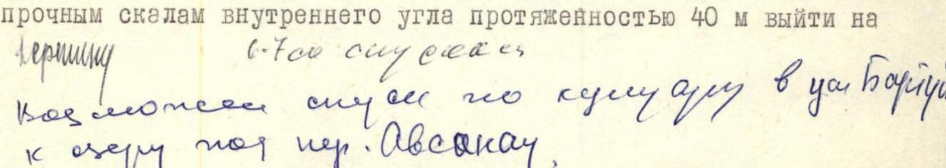 summit (belaying via ledges). From the summit, a beautiful panorama unfolds: to the west, Taymazhi, Tsiteli, Laboda, and the peaks of the Sugansky ridge rise; to the east, Tsagor, Tsikhvarga, and the peaks of the Tsey horseshoe are visible.
Descend via the ascent route. It is possible to descend via a couloir to the north into the Bartuy gorge to the lake below the Avsanau pass. The ascent takes 6–7 hours.