Report
On the ascent (second ascent) to the summit of Meshchena Western via the southern wall and southwestern ridge, presumed to be category 4A, by the MAC "Freeline" mountaineering team from November 16, 2019, to November 17, 2019.
I. Ascent Report
| № | 1. General Information | |
|---|---|---|
| 1.1 | Full name, sports rank of the leader | Klindukhov Maxim Olegovich, 2nd sports rank |
| 1.2 | Full name, sports rank of the participant | Otkidchev Pavel Anatolyevich, 3rd sports rank |
| 1.3 | Full name of the coach | Motienko Nikolai Ilyich, CMS, instructor 1st category |
| 1.4 | Organization | MAC "Freeline" |
| 2. Characteristics of the Ascent Object | ||
| 2.1 | Region | Caucasus, from Gesevcek pass to Gurdzivcek pass |
| 2.2 | Valley | Urukh valley |
| 2.3 | Section number according to the 2013 classification table | 2.6 |
| 2.4 | Name and height of the summit | Meshchene Western 3167¹ m |
| 3. Characteristics of the Route | ||
| 3.1 | Route name | South wall and SW ridge |
| 3.2 | Proposed category of difficulty | 4A |
| 3.3 | Degree of route development | Second ascent |
| 3.4 | Terrain type of the route | Rock |
| 3.5 | Elevation gain of the route (altimeter or GPS data) | 180 m |
| 3.6 | Route length (in meters) | 270 m |
| 3.7 | Technical elements of the route (total length of sections of varying difficulty with terrain type) | I category rocks – 5 m II category rocks – 70 m III category rocks – 100 m IV category rocks – 47 m V category rocks – 45 m VI A1 category rocks – 3 m |
| 3.8 | Descent from the summit | Via the ascent route |
| 3.9 | Additional route characteristics | No water |
| 4. Characteristics of the Team's Actions | ||
| 4.1 | Travel time | 5 hours 30 minutes |
| 4.2 | Overnight stays | At the kosh |
| 4.3 | Start of the route | 8:15 November 17, 2019 |
| 4.4 | Summit attainment | 11:45 November 17, 2019 |
| 4.5 | Return to base camp | 15:30 November 17, 2019 |
| 5. Responsible for the report | ||
| 5.1 | Full name, e-mail | Otkidchev P.A., otkid@list.ru |
II. Ascent Description
1. Characteristics of the Ascent Object
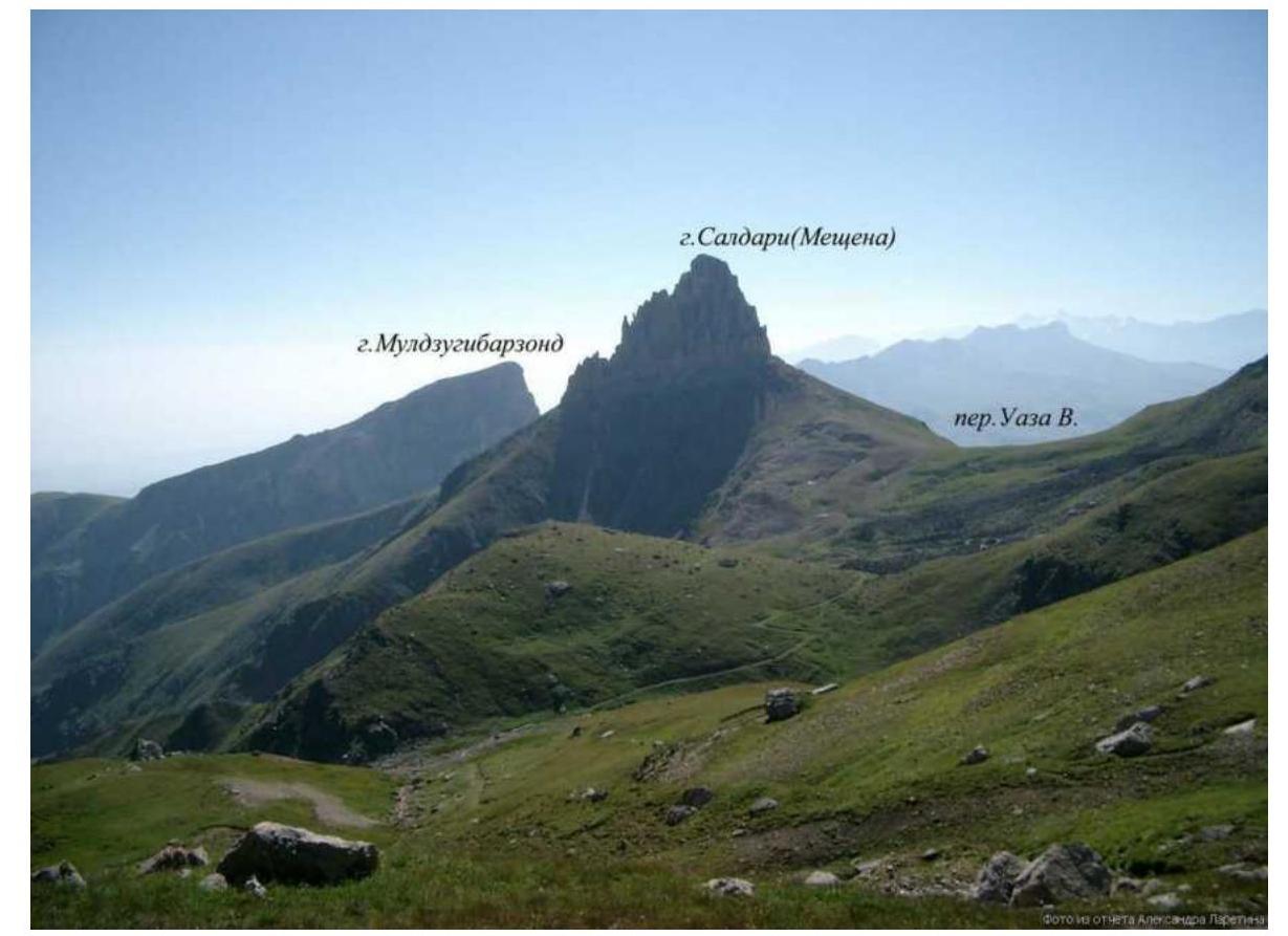
1.1. General photo of the summit and panorama. Taken from the south (caucatalog.narod.ru). The route is marked in red, the approach (descent) in green. Egorin's routes are shown in orange: from left to right 2A (2003), 4A (2000), 2B (2002).

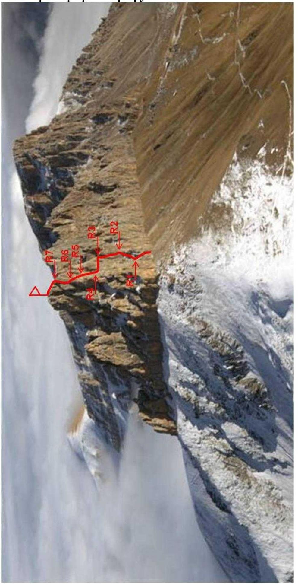
1.2. Photo of the route profile. Taken from the west, location - slopes of Borovcek mountain. Source – caucatalog.narod.ru website.
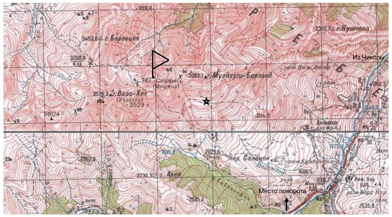
1.3. Map of the area. Source – caucatalog.narod.ru website, author Mikhail Golubev. Grid size — 2 km. The kosh is marked with an asterisk. The road to it is not shown.
Brief Description of the Ascent Area
Map of the ascent object. Meshchene is marked as Saldrikhokh. The kosh is marked with an asterisk. Screenshot taken in the ViewRanger app.

Meshchene belongs to the Rocky Range of the Greater Caucasus (RNO-Alania, Irafsky district). Another name for the summit is Saldrikhokh, under which it is listed in M. Golubev's catalog (caucatalog.narod.ru), as well as in popular tourist navigators ViewRanger and OsmAnd (Android apps). In the FAR classifier, it is recorded as Meshchene. The Meshchene massif consists of three peaks: Western, Central, and Eastern. The path to the summit goes through the Urukh river valley. Turn right 2 km after the village of Matsuta. From the fork to the last (3rd) kosh is 45 minutes by off-road vehicle (or 15 minutes to the estate on the site of the village of Kumbulta by regular car, then 2 hours on foot to the kosh). The kosh is located directly at the foot of the mountain and serves as a base camp. It has four beds, and there are many places for tents nearby. There is a spring, but it's better to bring water from elsewhere. In summer, when the kosh may be occupied by shepherds, an overnight stay can be organized under the southern walls of Meshchene Eastern (see approach description). Mobile communication (Megafon) is available in the area but is unstable. Registration with the EMERCOM is done by phone: 8 928 492–09–62.
No permits are required.
2. Route Characteristics
2.1. Technical photograph of the route.
2.2. Technical characteristics of route sections.
| № photo | Section № | Anchor points | Section length, m | Section steepness, degrees | Section difficulty, UIAA |
|---|---|---|---|---|---|
| R7–R8 | 0 | 40 | 20–30° | II | |
| 7 | R6–R7 | 2 | 16 | 40–70° | III–IV |
| 4 | 90° | IV+ | |||
| 25 | 0–40° | III+ | |||
| 6 | R5–R6 | 4 | 10 | 70° | IV |
| 7 | 80° | V– | |||
| 3 | 90° | IV+ | |||
| 4,5 | R4–R5 | 3 | 5 | 0–10° | I+ |
| 15 | 80° | V | |||
| 2,5 | R3–R4 | 2 | 5 | 80° | V |
| 35 | 0° | III+ | |||
| 2,3 | R2–R3 | 7 | 5 | 80° | IV+ |
| 5 | 90° | V | |||
| 3 | 90° | VI А1 | |||
| 5 | 70° | V | |||
| 5 | 80° | V+ | |||
| 7 | 50–60° | IV | |||
| 2 | R1–R2 | 1 | 25 | 30–50° | III |
| 25 | 10–30° | II | |||
| 1 | R0–R1 | 3 | 15 | 50→15° | III→II |
| 7 | 70° | IV | |||
| 3 | 80° | V– |
3. Characteristics of the Team's Actions
Approach. From the kosh, go up to the left extremity of the rock "fence" going west from Muldzugi-Barzond. In the area of a wide, gentle saddle between the "fence" and the eastern slopes of Meshchene², go left and exit onto a trail. Follow the trail traversing with almost no ascent. After reaching the southern slopes of Meshchene Eastern, in the area of rock remnants (there is a place for tents), overcome the slope "head-on" and approach the southern wall, then continue traversing along the wall. There will be a large niche lined with stones (can be used as an overnight stay spot). 50 meters after it, the start of the route — an internal corner-couloir at a large boulder. From the kosh, it takes 1 hour 30 minutes.
Tactics. The first three sections were processed on November 16, 2019, in the second half of the day, taking about 2 hours. The next day, they were climbed using a Jumark. This tactic is related to:
- the short duration of daylight at this time of year
- the fact that the third section (chimney) is lit by the Sun only by noon
For groups climbing in winter, this tactic is recommended.
R0–R1. Up the internal corner (10 m, 80→70°, V–IV). Then the steepness gradually decreases (15 m, 50→15°, III→II). Reach the wall, station on a ledge. To the right is a large scree cirque.
R1–R2. Traverse right through the cirque to rock steps (25 m, 10–30°, II) and then up the steps to the right of the chimney onto a saddle (25 m, 30–50°, III), station on a ledge.
R2–R3. Traverse left-up under the internal corner (7 m, 50–60°, IV). Then up the internal corner to a crevice (10 m, 70–80°, V–V+). Here is the key point of the route:
- The crevice is climbed using IT with the help of friends (size ≈8, "Vertikal").
- Active holds (even small ones) are absent.
- 3 m, 90°, VI A1.
After the crevice, a very difficult exit onto a small ledge. From it, a chimney begins. Up the chimney to a large shelf before the saddle (10 m, 90→80°, V→IV+). On the shelf is a control cairn. Station on a ledge.
R3–R4. Across the shelf, traverse left to a mini-cirque (35 m, 0°, III+). Be cautious,
insurance is limited, with drops below. In the cirque, a station can be made on anchor points (as we did during descent). We ascended the wall in the left part of the cirque (5 m, 80°, V), made a station on a ledge.
R4–R5. Up the wall, which is a weakly expressed internal corner, straight up towards a characteristic depression to a wide shelf (15 m, 80°, V). At the exit to the shelf, live rock! Across the shelf left to a huge boulder (5 m, 0–10°, I+), station on it.
R5–R6. Ascend the external corner to the wall (3 m, 90°, IV+). Up the wall to the right towards a depression (7 m, 80°, V–), then to the exit onto the southwestern ridge (10 m, 70°, IV). Station on a ledge.
R6–R7. Along the left side of the ridge, transition into a large scree couloir (at the transition, destroyed rock, drops!) and down the couloir to a chimney (25 m, 0–40°, III+). Up the chimney to an inclined scree shelf (4 m, 90°, IV+). Across the shelf, then up live rocks to the ridge (16 m, 40–70°, III–IV). Station on a ledge.
R7–R8. Transition to the right side of the ridge and along the destroyed terrain, proceed to the summit, staying a few meters to the right of the axial part of the ridge. Insurance is simultaneous (40 m, 20–30°, II). On the summit is a control cairn.
From the summit, you can see:
- Koshtantau to the west,
- Dzhimara to the east,
- Uilpata to the south,
- Sugansky ridge to the southwest,
- Rocky ridge from Kion to Uaz.
Descent is via the ascent route. Initially, simultaneous descent to R7. Then short rappels (can be simultaneous) to R6. From here, a long rappel to the mini-cirque. Station on friends. Then traverse to R3. From here, a long rappel to R1 and another to R0. With two 60-meter ropes, it's worth making a rappel from R4 to R1. If rappelling from R3, it's recommended that the last person, standing on the ledge above the crevice, pull the knot as much as possible so that the rope doesn't get stuck in the chimney during retrieval. It's also recommended to make stations directly on the anchor points on:
- R1,
- R3 (or R4, depending on the rope length and rappel tactics),
- R6,
- R7, to then use these stations as rappel anchors.
Exit onto the trail, cutting across the slope diagonally, then follow the approach route.

Fig. 1. Section R0–R1.
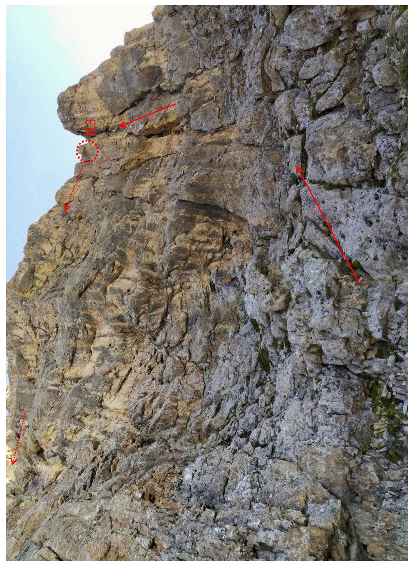
Fig. 2. Sections R1–R4.
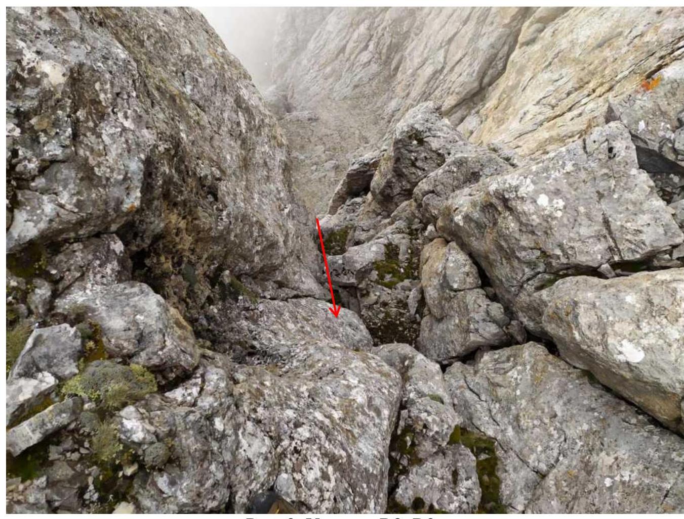
Fig. 3. Section R2–R3.
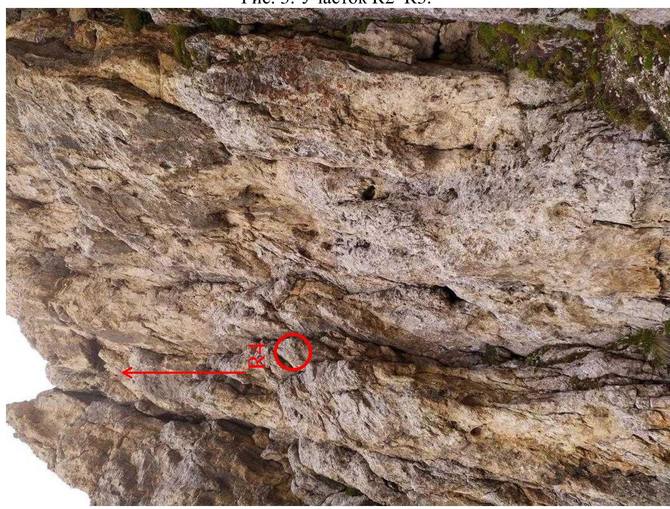
Fig. 4. Section R4–R5.
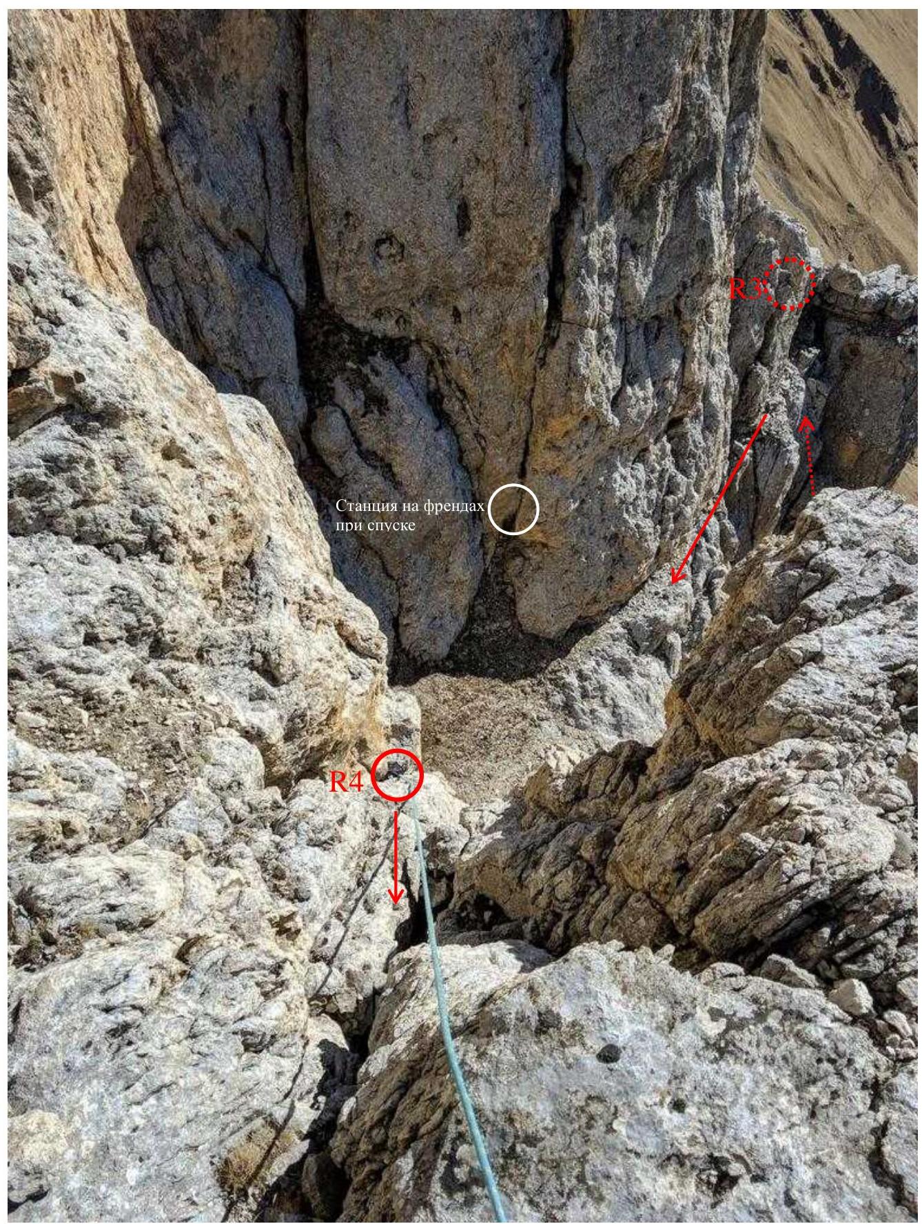
Fig. 5. Sections R3–R5.
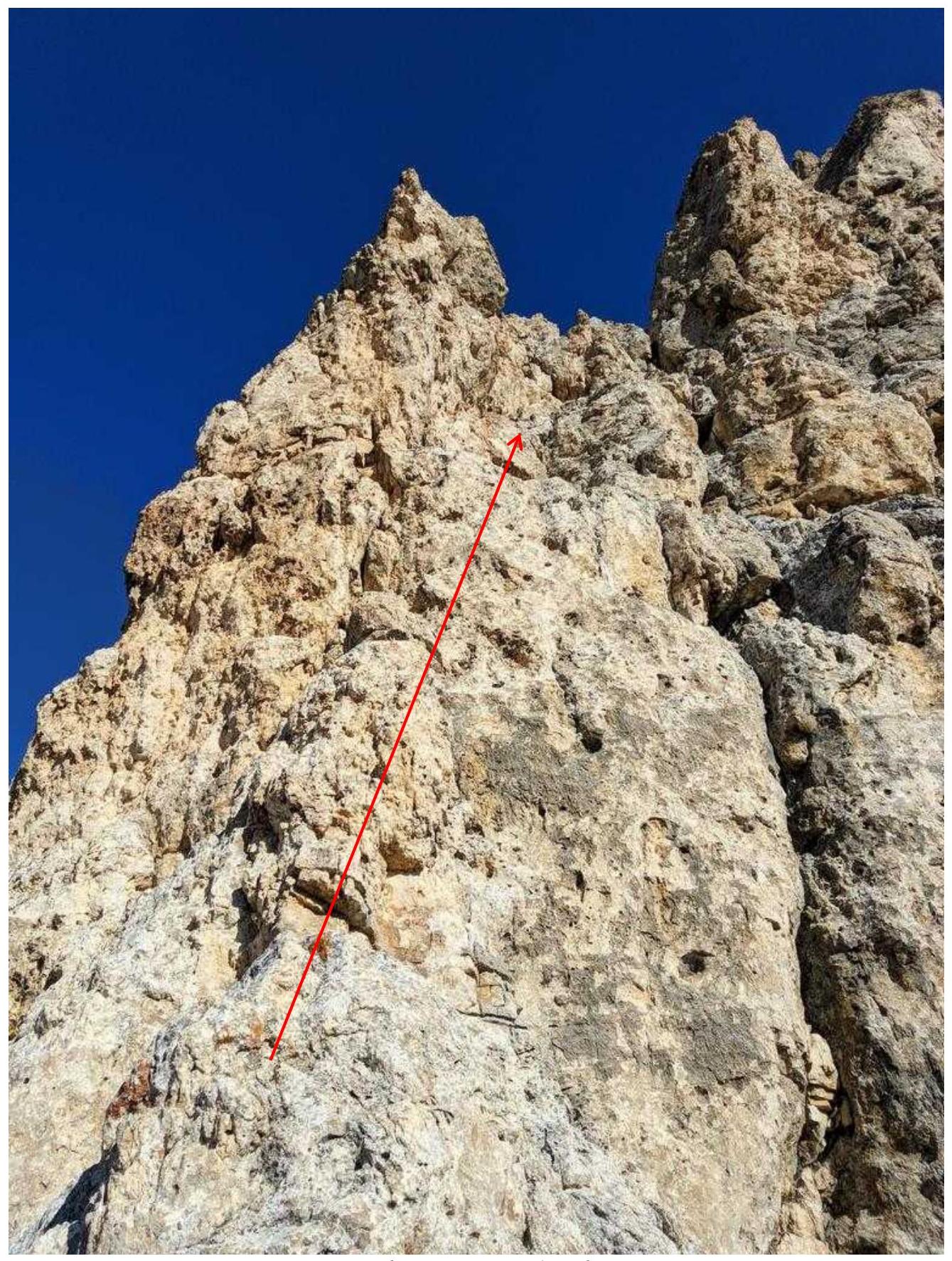
Fig. 6. Section R5–R6.

Fig. 7. Section R6–R7.
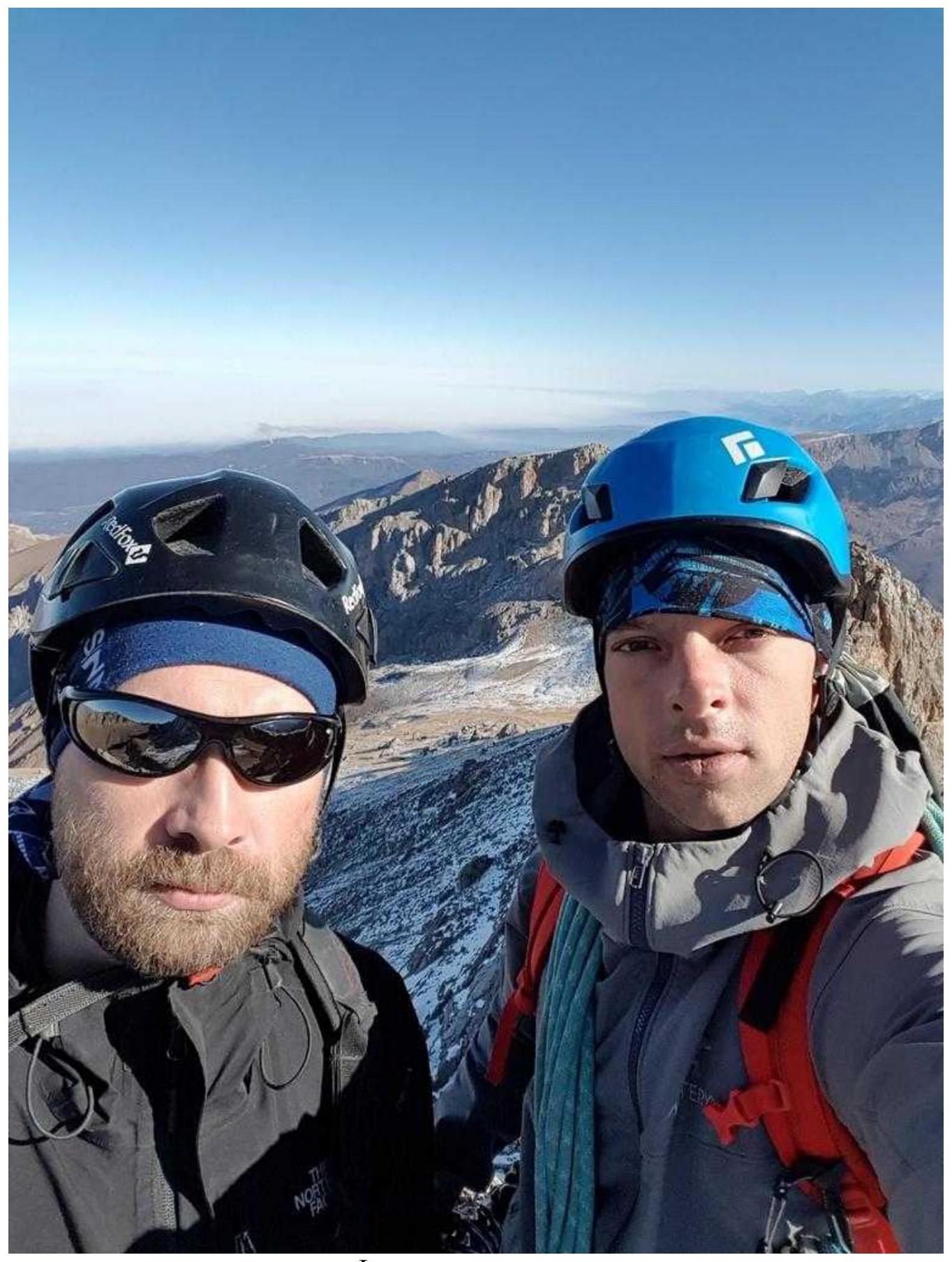
Photo from the summit
Overall Route Assessment
The route is very logical. Most likely, it is the simplest and safest path to the summit. The only place where the leader can drop a stone on the belayer is the R4–R5 section. On difficult sections, the rock is monolithic everywhere. Large relief is present everywhere (except for the crevice), and there are no problems with insurance. Stations are easily organized on ledges. Hook insurance on the route is not required; all intermediate points are made on ledges and anchor elements. The latter used friends from size 2 to 8 ("Vertikal") and large stoppers. It is recommended to have two 60-meter ropes to speed up rappelling. Due to the large relief, it's possible to do without climbing shoes, as the key point is still climbed using IT.
The first ascenders (M. Popov, G. Konstantinov) listed this route as 4A, but it was classified as 3B. In our opinion, this route is indeed a solid 4A. It is more complex than 3B rock routes previously climbed by participants in this ascent:
- Dashtsar via the South wall
- Bukabashi via the right part of the South wall and East ridge
- Belalakaya from the north
Compared to other 4A rock routes previously climbed by participants (Meshchene Eastern via the wall of the South edge, MNR Southwestern via the South edge) - it has the same total length of sections of V category difficulty, while significantly surpassing them in the complexity of the key section (VI A1).