Ascent Passport
- Rock class.
- Caucasus, Digoria, Rocky Ridge.
- Meschena East. (3130 m), via the South Ridge wall.
- Proposed category 4A–4B, first ascent.
- Route height difference is 220 m; route length is 260 meters. Length of sections with 5–6 difficulty category is 55 m. Average steepness is 60°.
- Pitons driven:
- Rock – 9
- Nuts – 17
- Ice – 0
- Bolts – 0 Left on the route: Rock – 2, Nuts – 0, Ice – 0, Bolts – 0.
- Team's working hours on the route – 8 hours, days – 1.
- Overnight stay below the route, comfortable, lying down.
- Leader: Egorin Sergey Vladimirovich, Master of Sports
Participants:
- Abisalov Anatoly Dmitrievich, 2nd sports category
- Akulov Maxim Nikolaevich, 2nd sports category
- Coach: Egorin Sergey Vladimirovich, Master of Sports All from Vladikavkaz.
- Approach to the route (reconnaissance): February 28, 2000. Summit: February 29, 2000. Return to the city: March 1, 2000.
- Organization: SORPSS EMERCOM of Russia.
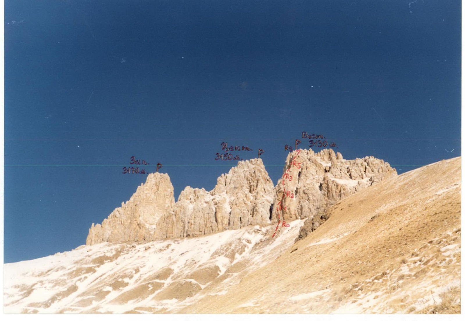
Photo 1. General view of Meschena peaks. Photo from the South. February. The first ascent route to Meschena East. (3130 m) is marked.
Brief Overview of the Climbing Area
The ascent was made in Digoria (western part) in the Rocky Ridge. The western part of the Rocky Ridge of North Ossetia is between the valleys of the Khaznydon and Urukh rivers. The highest point in this area is the Uazakhoh peak (3529 m) — it is also the highest peak of the Rocky Ridge in North Ossetia. The characteristic tower of Uazakhoh is easily recognizable from everywhere — both from the foothill plains and from the slopes of Digoria. The peak itself is a limestone tower-remnant. Its base is on a granite base-pedestal — four ridges radiate from the Uazakhoh tower like rays. The height of the walls on the tower is 100–150 meters.
Our first visit to this area was made in May 1996. Then an ascent was made to Uazakhoh from the Northwest (approximately 1A–1B winter category). On the descent after the ascent, a small glacier was noticed under the slopes of Uazakhoh. This is the only glacier on the slopes of the Rocky Ridge of North Ossetia — remains of former glaciation. Its traces are still visible on the northern slopes of the peaks — rounded boulders, still not overgrown moraines. Meschena West-Central-East peaks are also remnants composed of sedimentary rocks. But here all three towers stand in the same ridge, and the wall height difference is 200–250 meters. From a sporting point of view, these peaks are the most interesting in this area: routes from 2B to 5B category are possible. They are composed of sedimentary rocks — dolomites and limestones, but the rocks are strong. There are practically no scree under the Meschena peaks.
Other peaks in the area worth noting:
- Borhokh ("Yellow Mountain")
- Muldzugi-Barzond ("Ant Mountain" in Ossetian)
The approaches to Borhokh are the longest, and the rocks there are more destroyed, but interesting routes can be climbed. Muldzugi-Barzond looks like a regular dome from the south, resembling an anthill in shape. The approaches to it from Donifars are the shortest. The ascent path goes straight from the mine, from the end of the road once made by geologists. It is possible to drive along this dirt road in spring or autumn.
Also, directly opposite the village of Donifars, the Rocky Ridge drops southward with rocky bastions with a height difference of up to 400 m.
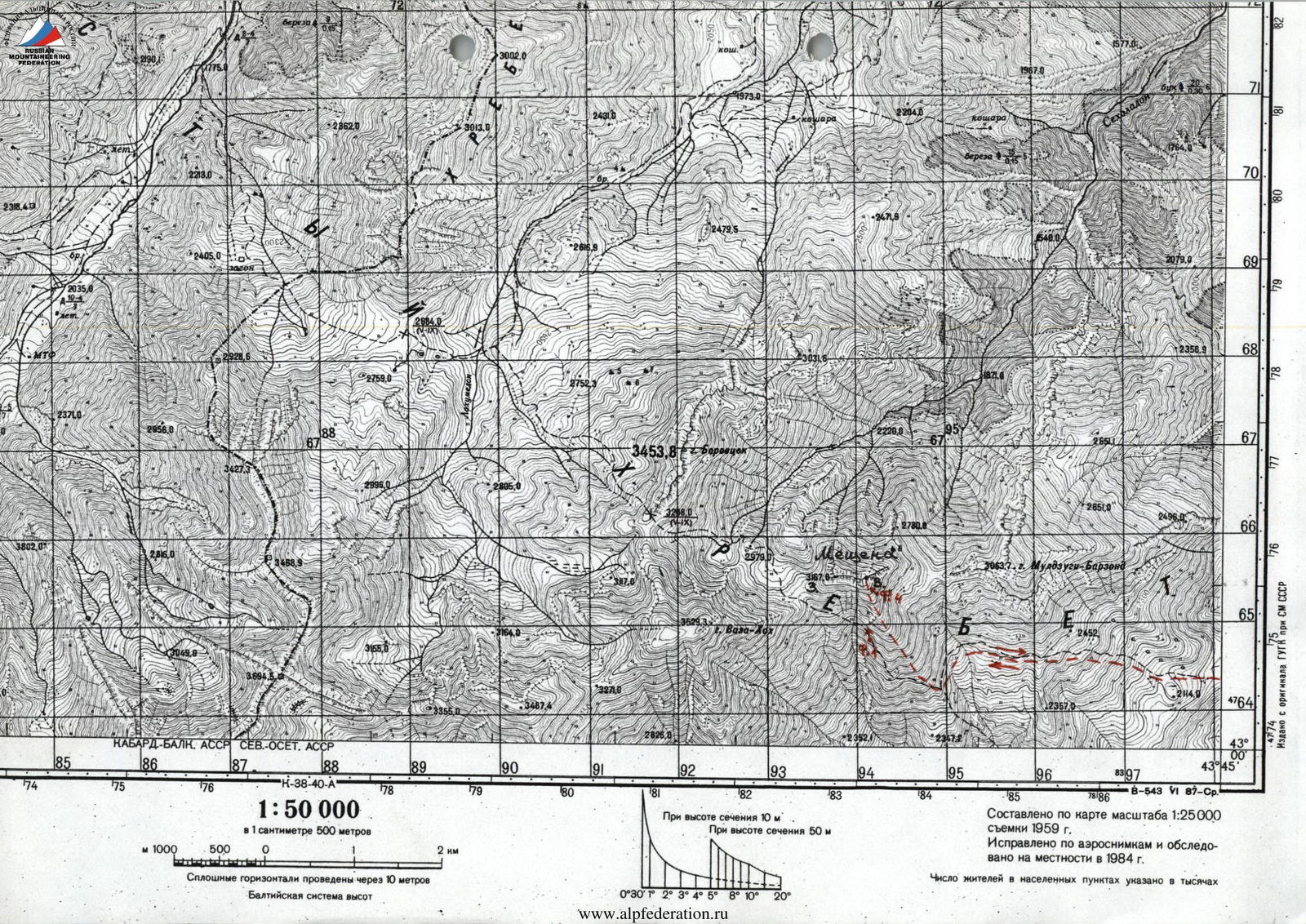
Compiled from a 1:25,000 scale map surveyed in 1959. Corrected from aerial photographs and surveyed on the ground in 1984. The number of inhabitants in settlements is indicated in thousands.
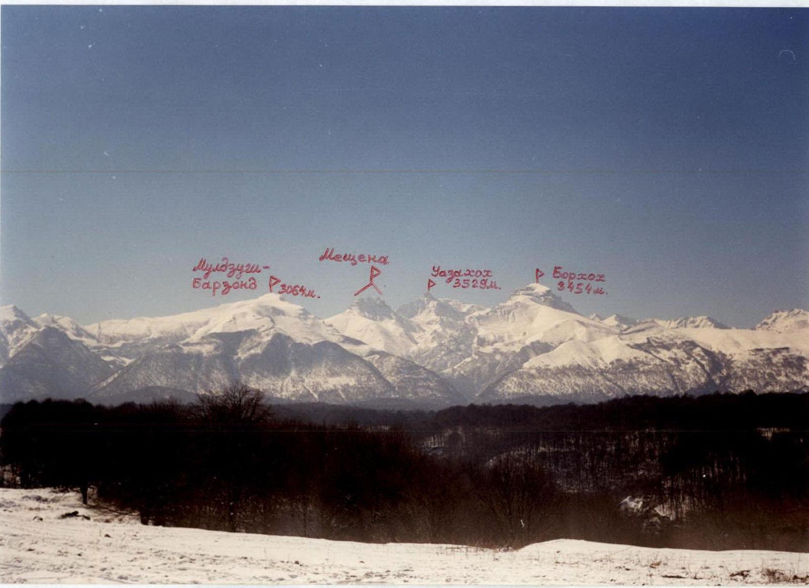
Photo 2. Photopanorama of the ascent area from the North. February. Photo taken near the village of Akhsarisar.
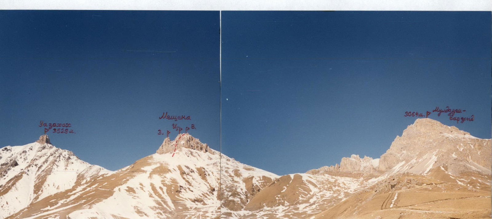
Photo 3. Photopanorama of the ascent area from the Southeast. February. Photo taken from the approaches, above the village of Donifars.
Description of Approaches to the Route
From the city of Vladikavkaz through the village of Chikola to the fork to Donifars by car or bus is about 100 km. From the fork, a dirt road begins, which is sometimes very bad. From the fork, walk along this road towards the village of Donifars — the only inhabited village in the ascent area. After passing through Donifars, continue up the road towards the visible Uazakhoh peak (3529 m). The path goes through numerous ascents and serpentines along grassy slopes. After passing by a shepherd's hut, reach the end of the road at an old geological mine. To the north, Muldzugi-Barzond peak (3064 m) is visible. This is the end of the road. It takes about 6–7 hours from the fork to Donifars on the Chikola-Matsuta-Dzinaga highway.
Ahead, towards Uazakhoh, the path is blocked by a long grassy ridge extending south from Meschena East. (3130 m). Then exit onto it and follow this ridge towards the Meschena peaks. Not reaching the southern walls of Meschena East. near rocky remnants — a bivouac.
The height here is 2850 m. There is no water, snow from November to May. From the mine to the overnight stay is another 2 hours.
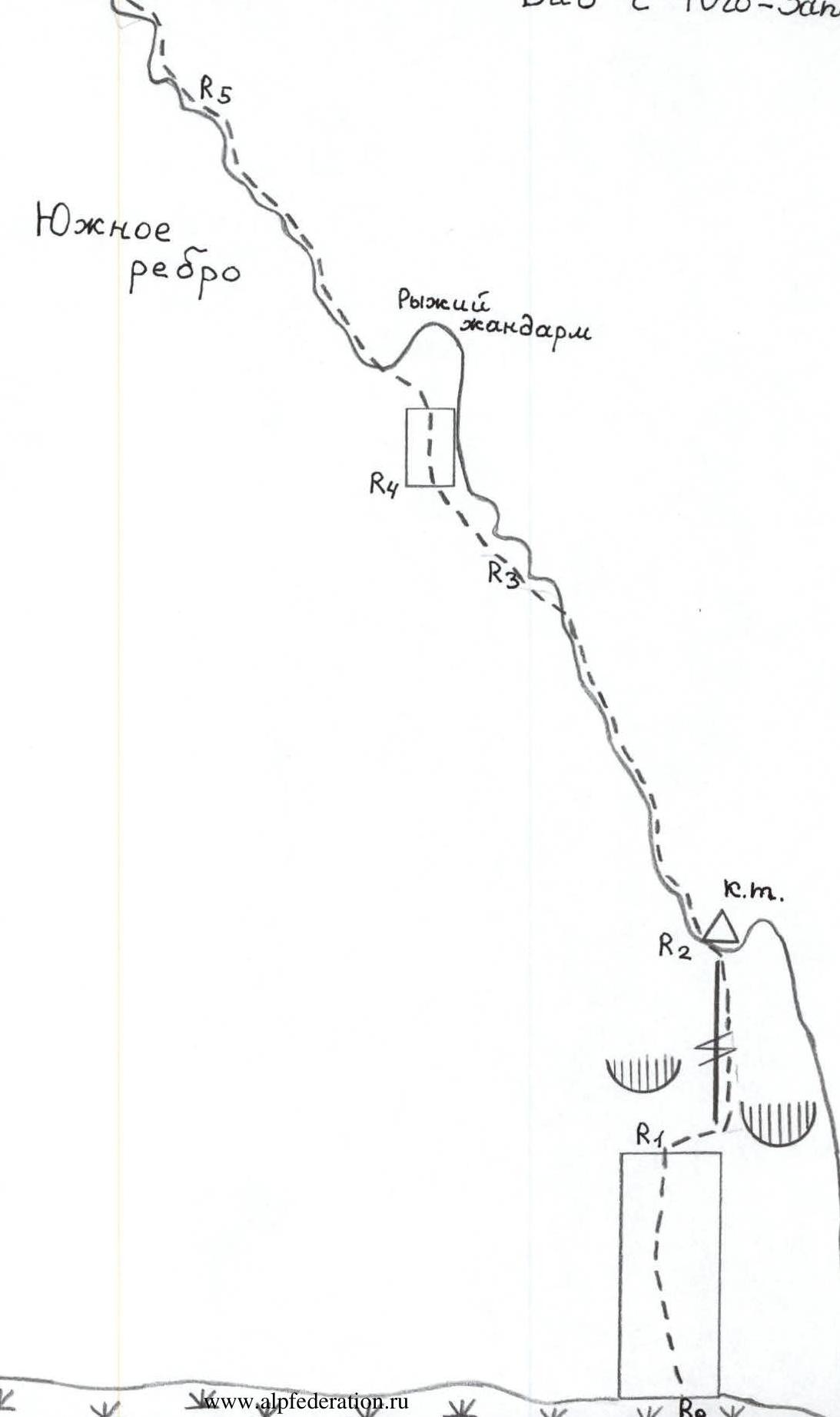
Photo 5. Scheme of the route from the Southwest.
Description of the Route by Sections
From the overnight stay, follow the grassy Southern ridge to approach the walls of Meschena East. (3130 m). Under the walls, move westward and, 20 m before the couloir — a groove separating the Central and East peaks from the south, stop under the wall of the South ridge of Meschena East.
R0–R1: The ascent path goes up the wall through cracks and chimneys towards a small shoulder on the South ridge (point R2). From the beginning of the wall, first left upwards, then straight under a large light-rusty cornice. Section 30 m, 80–90°, 5–5+ category, about 25 m.
R1–R2: Not reaching the light-rusty cornice — traverse 5 m to the right to a narrow chimney-cleft. Straight up through it to a small shoulder of the South ridge. Climbing is tense, snow is possible in the chimney. The entire section is 20 m, 85–90°, 5–5+ category, about 15 m.
R2–R3: On the shoulder, there is a control cairn. Then straight up along the South ridge — straight along the ridge line or to the right. Rocks are strong, have a blocky character. In the upper part of the section, exit left beyond the ridge to a small platform. Section 50 m, 60–70°, 4–4+ category.
R3–R4: Along the rocks to the left of the ridge, approach the second key section — the wall of the Rusty gendarme. Section 15 m, 4 category.
R4–R5: Directly under the wall, organize belay. Up the wall, 5 category with a small number of cracks for belay, exit to a small ledge (5 m). Then climb the rocks 4–4+ category, 60°, to the left of the ridge line for another 45 m.
R5–R6: The last rope to the sub-summit goes along the ridge or to the right of it along the rocks with many ledges, 3–3+ category. Section 50 m, 40–50°.
R6–R7: From the sub-summit, the summit tower is visible. It is located slightly to the west. From point R6 — a small descent to the base of the tower, about 25 m, 2–3 category.
R7–R8: Along the base of the tower on the south side, there is a cornice with an overhang of up to 3 m. Under this cornice — traverse left about 5 m to a chimney. Straight up through it to the ridge. The highest point and summit cairn are slightly to the right. Rappelling from the summit to the east, loops around the highest point. The entire section is 20 m, 4–5 category, 80–90°, 5 category about 10 m. From the start of the route, about 8 hours.
The summit is a good panoramic point. Visible:
- Tsey area,
- Karagom,
- Eastern part of the Sugansky Ridge.
Descent from the summit along the Southern slope (2 category, approximately), it should be examined in advance from the overnight stays.
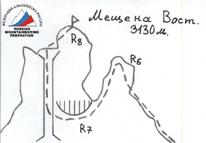
Photo 4. Profile of the route on the right. February. The first ascent path is marked.
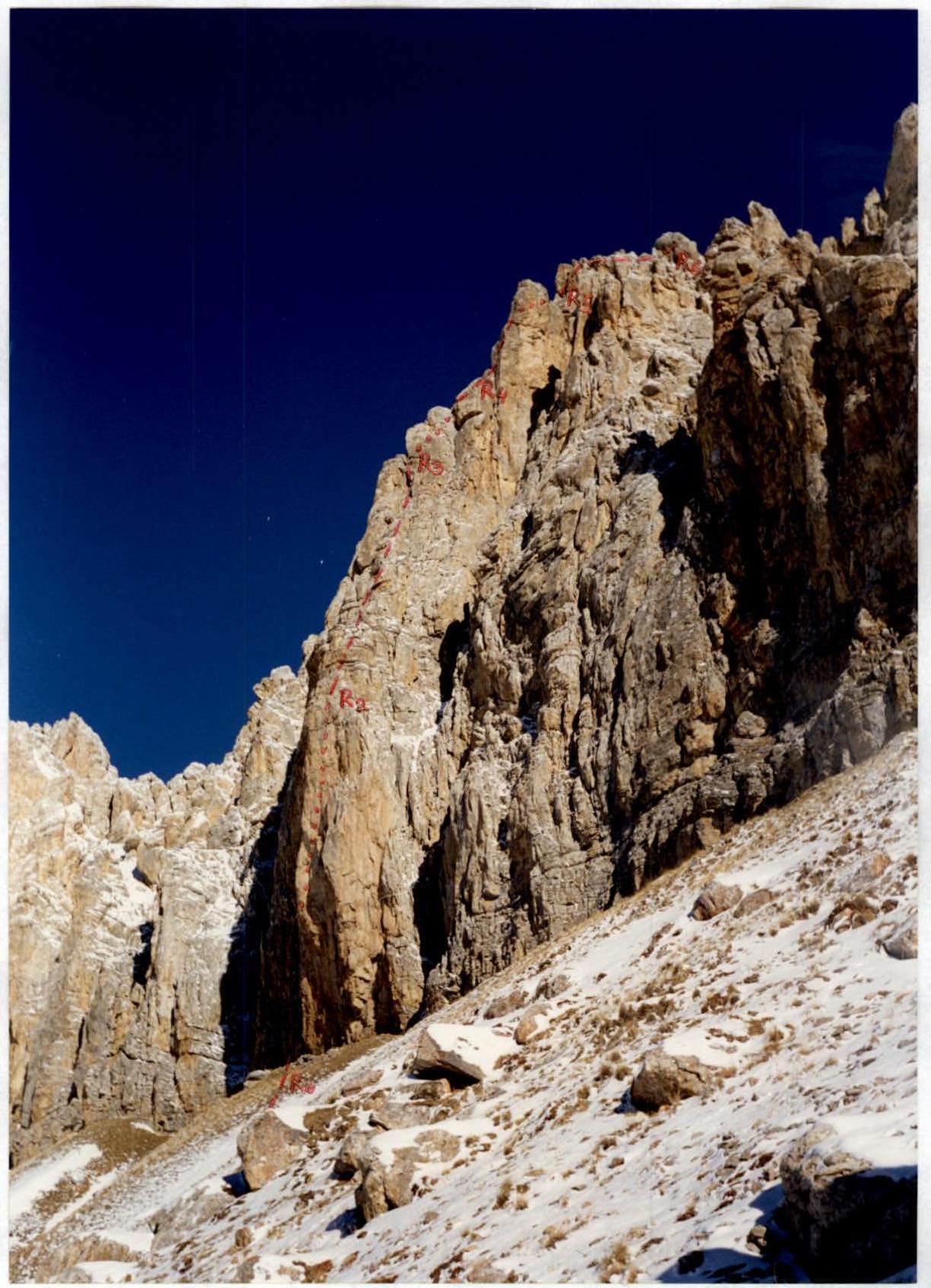
Photo 6. Middle of section R0–R1.
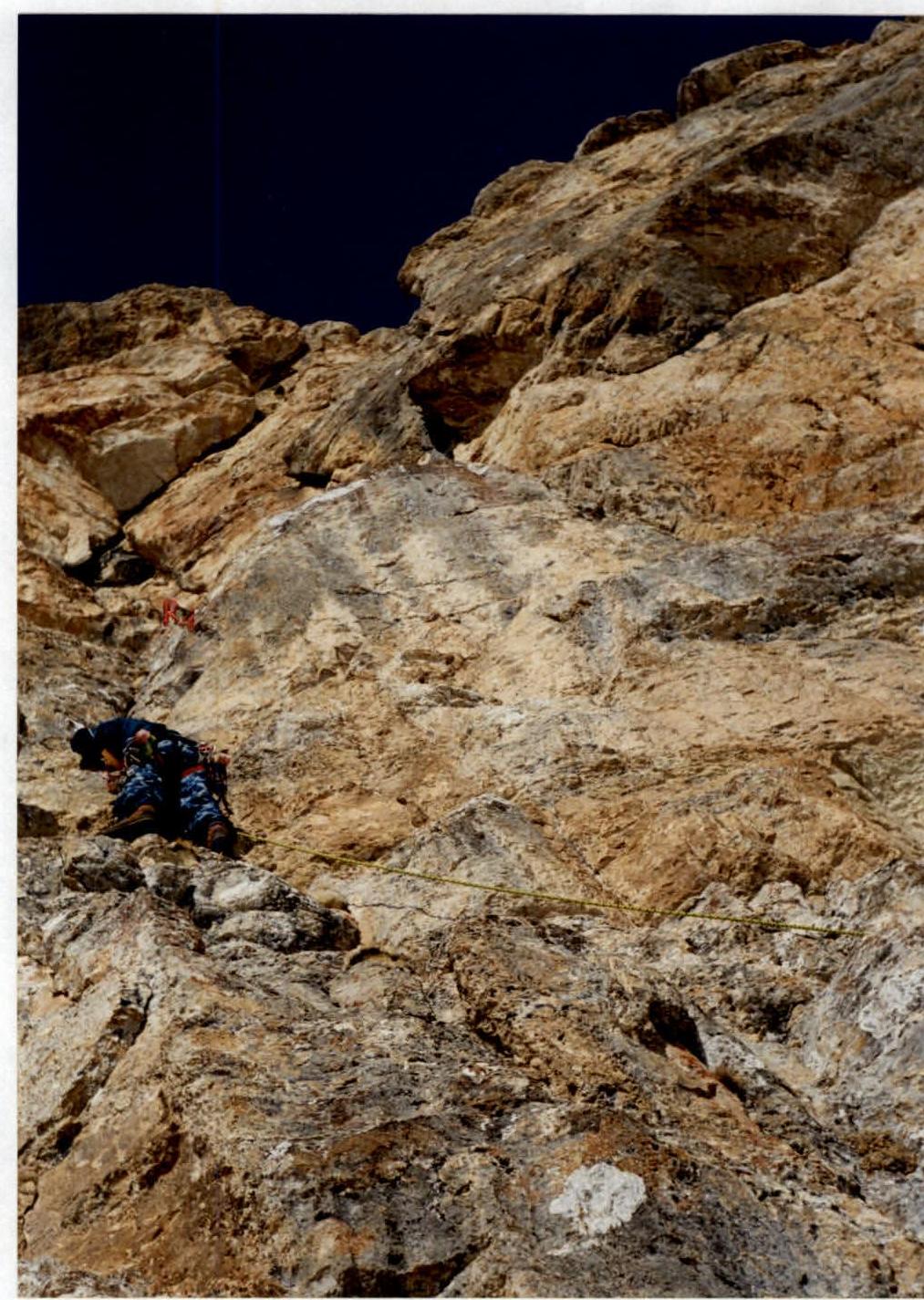
Photo 7. Passing the chimney. Middle of section R1–R2.
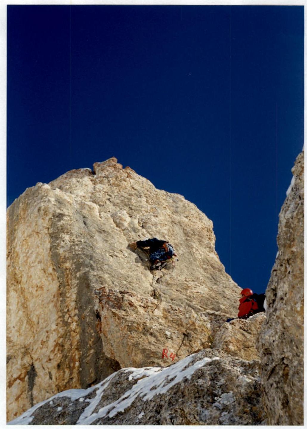
Photo 8. Beginning of section R4–R5. Passing the Rusty gendarme.