Passport
1. Rock Climbing Category
-
Rock Climbing Category.
-
Central Caucasus. Digor Gorge.
-
Main Galdor peak via the Southeast wall.
-
Proposed difficulty category — 5B cat. diff., first ascent.
-
Route height difference — 417 m, length — 490 m.
-
Length of sections with 5–6 cat. diff. — 376 m.
-
Average steepness of sections with 4–6 cat. diff. — 77.
-
Of which 6 cat. diff. — 104 m with a steepness of 90–95°.
-
Pitons hammered:
| rock | bolt | placement elem. | ice |
|---|---|---|---|
| 120/22 | 2/1 | 51/116 | 090 |
- Team's working hours: 20 h, days — 2.
- Overnight stay: sitting on a ledge.
2. Leader
Leader: Pogorelov Alexander Grigorievich — Candidate Master of Sports
Participants:
- Pyatnitsin Alexander Alekseevich — Candidate Master of Sports
- Sokolov Viktor Mikhailovich — Candidate Master of Sports
- Pashchenko Valentin Viktorovich — Candidate Master of Sports
- Coach: Artsishevsky Yuri Yurievich, Honored Master of Sports of the USSR
- Departure to the route: July 3, 1983. Summit: July 4, 1983. Return: July 5, 1983.
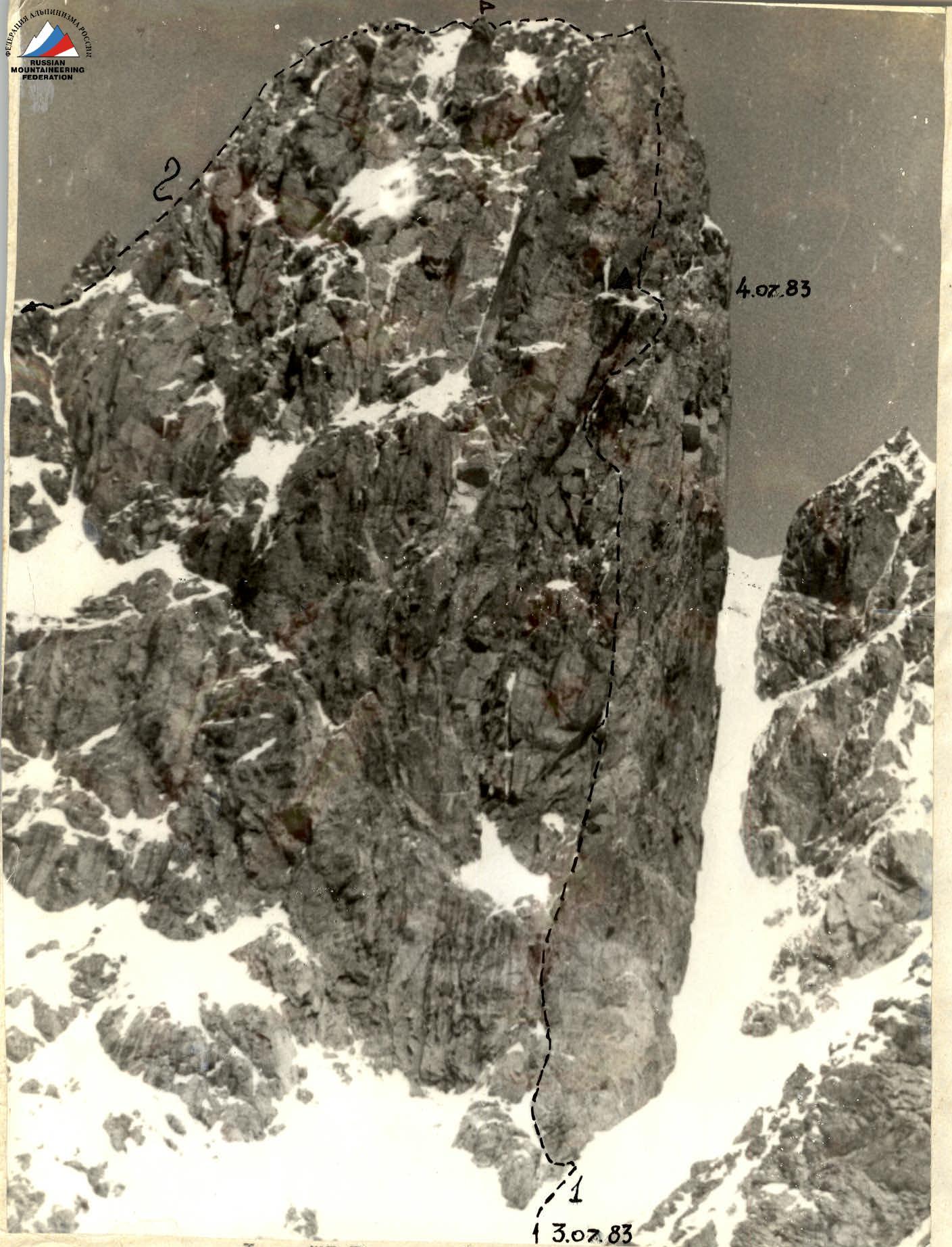
Photo No. 1. Main Galdor peak on July 2, 1983, 10:30. Lens: Yu-37A, F = 135 mm, distance about 1 km, shooting height H = 3300 m.
Legend:
- 1 — team's route
- 2 — route via the South ridge 4A cat. diff.
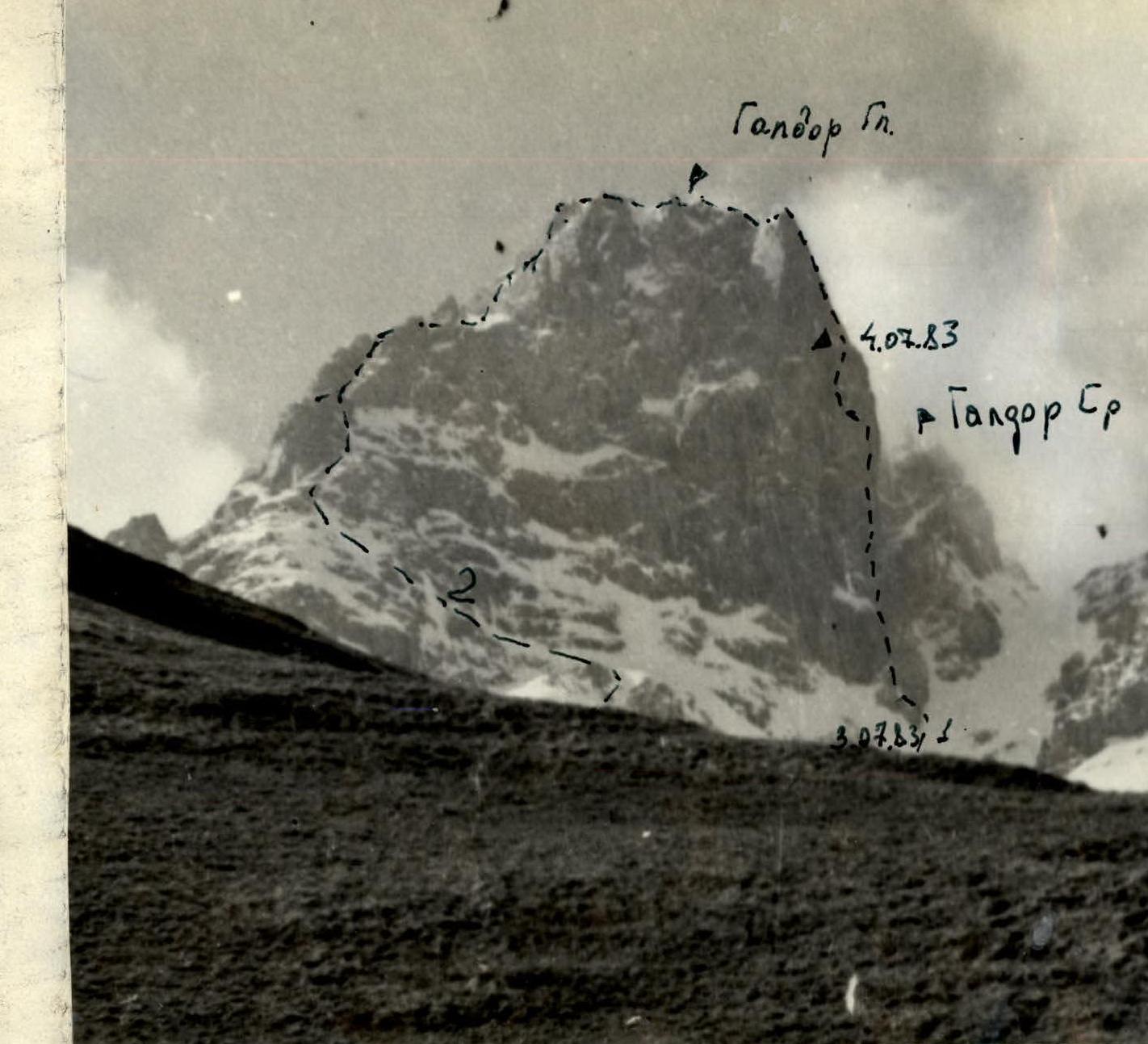
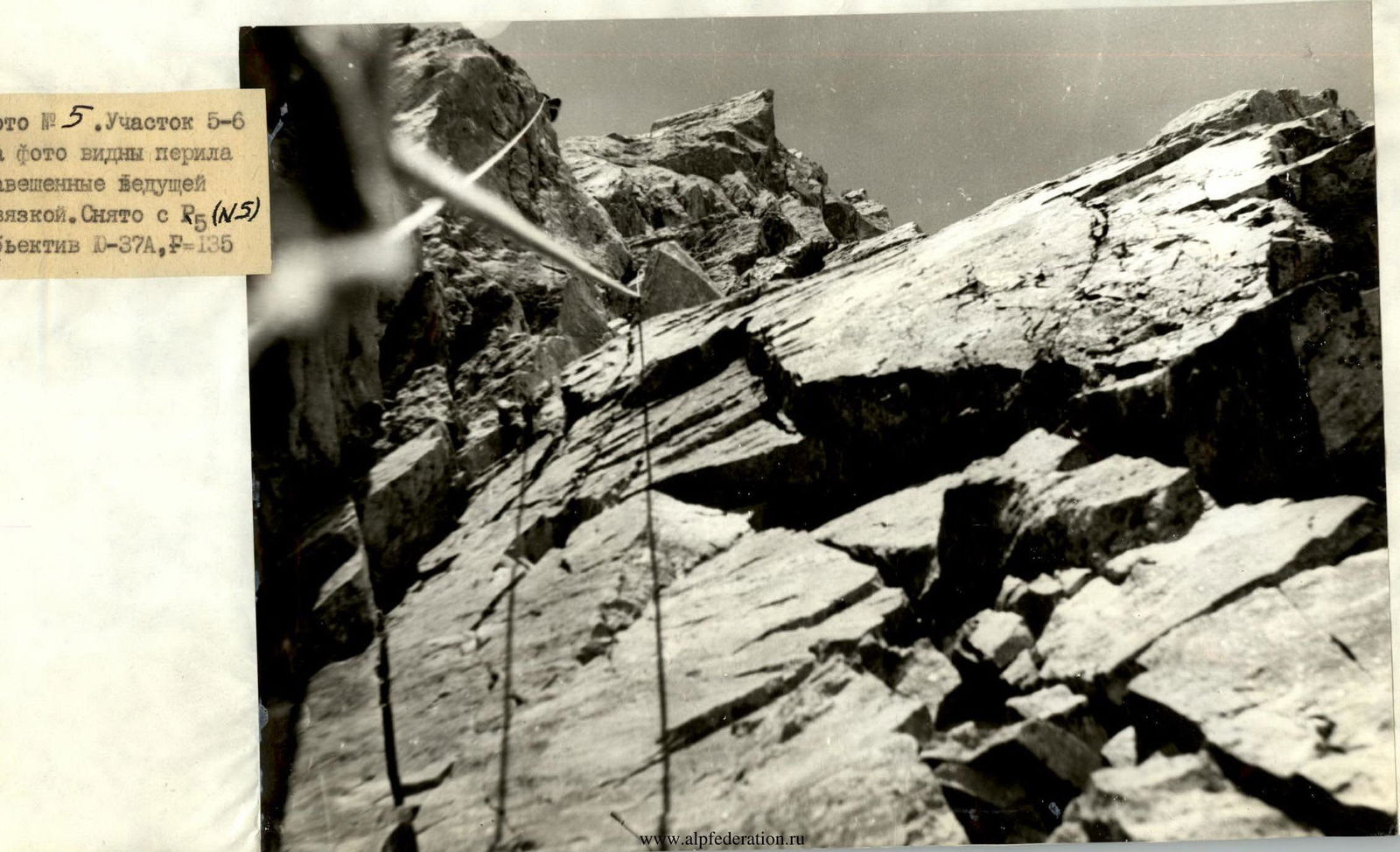
Photo No. 2. Left wall profile. July 1, 1983, 17:00. Lens: O-37A, F = 135 mm, distance about 3 km, shooting height 2910–3000 m. 1 — team's route; 2 — route No.
Pitons by sections (Scheme No. 3)
| Section | Length | Steepness | Category |
|---|---|---|---|
| R13 | 20 m | V | |
| 18 m | 55° | V | |
| 20 m | 70° | V | |
| R12 | 40 m | 70° | V |
| R11 | |||
| R10 | 30 m | 75° | V |
| 10 m | 95° | V A2 | |
| R9 | 20 m | 85° | V A1 |
| 18 m | 75° | V | |
| R8 | 25 m | 90–95° | V A2 |
| 15 m | 90° | V | |
| R7 | 27 m | 85° | V |
| 8 m | 00° | V | |
| 5 m | 95° | V A | |
| R6 | 10 m | 90° | V A. |
| 30 m | 85° | ||
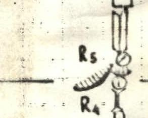
| R5 | 8 m | 95 | A2 |
| R4 | 20 m | 90 | A. |
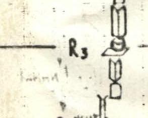
| R3 | 20 m | 70° | V |
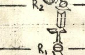
| R2 | 26 m | 80° | V |
| 6 m | 90° | V A,A2 | |
| 8 m | 80° | V | |
| R1 | 18 m | 70° | V |
| 12 m | 75° | V. | |
| R0 | 17 m | 60° |

Route description by sections
R0–R1. Approach to the wall via a steep snow-ice couloir.
R1–R2. Rocks of medium and above medium difficulty with good holds. Piton belay and protection through protrusions.
R2–R3. Up 12 m of difficult climbing on a wet chimney with sections of formed ice, to a small ledge. Then via an internal corner (18 m) — exit to a ledge. Piton belay. Corresponds to the 1st rope in the debriefing report.
R3–R4. Initially up a chimney 8 m, then exit from it to the right and up a smooth wall with a small number of holds and cracks (6 m). After the wall, an internal corner (26 m). Character of the rocks — wet monolithic slabs. Piton belay. Petal pitons were used for ITO on the wall.
R4–R5. Via a vaguely expressed internal corner (20 m), then via a difficult chimney (ITO) — approach under an overhang. The overhang is bypassed on the left via slabs and a wide chimney (8 m). After bypassing, exit to a small ledge. Here is a belay point. The chimney under the overhang is half-filled with ice. In the upper part of the chimney, there are hanging ice icicles. Placement elements, large sector, were used in the chimney.
R5–R6. 30 meters up a wide internal corner, then via a very difficult 10-meter wall — exit to a small, for one person, ledge. Piton belay using placement elements for passage.
R6–R7. At the start of the section, an overhanging wall (5 m, ITO), then an 8-meter wide crack. The crack is climbed via free climbing. After it, 27–30 meters of difficult climbing left-up via slabs. Piton belay.
R7–R8. From R7 also left-up via slabs into a wide wet couloir. Via a chimney, 25 meters of tense climbing, and exit to a ledge. The ledge is small, for one or two people. There is formed ice in the chimney. Piton belay. Bolt pitons. ITO was used.
R8–R9. From the ledge, right-up via slabs 18 m to an internal corner. The beginning of the internal corner represents smooth slabs with a small number of holds. The internal corner leads to a ledge. On the ledge, there is a place for an overnight stay. Piton belay on the section. In the upper part of the corner, stopper placement elements work well.
R9–R10. From the ledge straight-up, left of an ice-filled diagonal crack. The first 10 meters — an overhanging wall (ITO). Then 30 meters via difficult monolithic rocks. Piton belay.
R10–R11. 40 meters up smooth monolithic rocks with a small number of cracks for pitons. Piton belay.
R11–R12. Initially via smooth monolithic slabs (18 m), then via an internal corner with good holds — exit to a ridge.
R12–R13. Via a sharp snow ridge, covered in snow — exit to the summit (80–100 m).