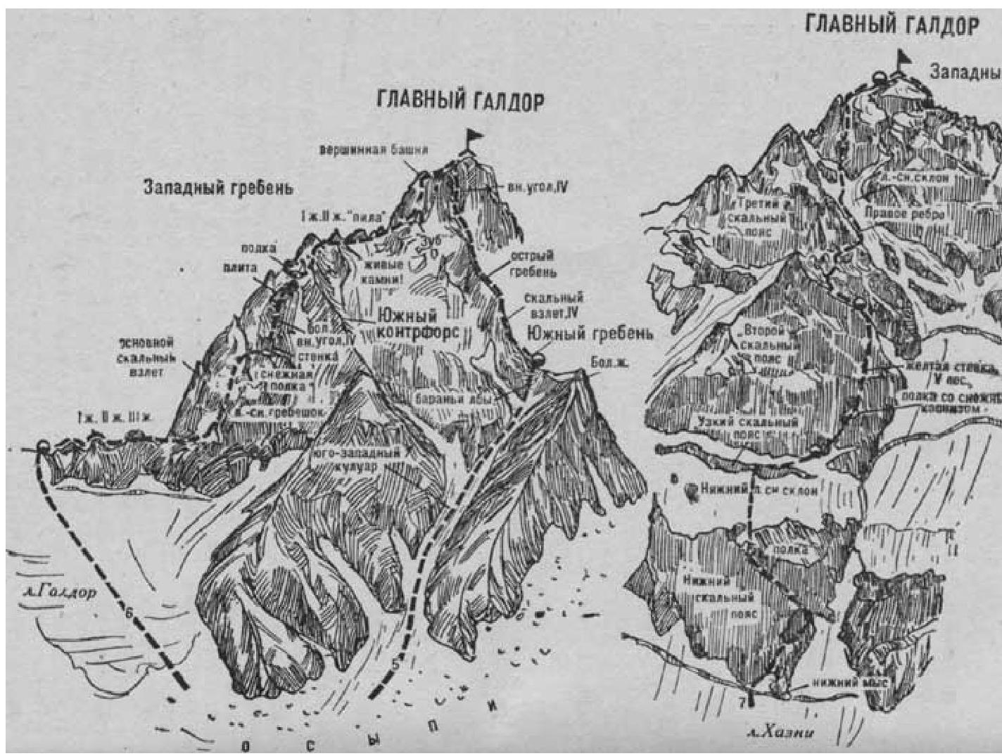
Fig. 3
- Galdor Main via Western Ridge (combined route by I. Suzhaev, category 4B, Fig. 3).
The path from the "Nakhashbita" clearing (group of 4-8 people) to the moraine leading to the Galdor glacier is described in route 1.
From here, ascend the moraines to the Galdor glacier. Then, moving up the steep glacier, overcome a crevasse cutting across it on the left side, and cross over to the right side. Further, staying on the right side (rockfall is possible from the left), approach the saddle of the Sugansky ridge between the peaks of Tsukhgarty on the left and Galdor Main on the right. From the glacier, ascend a steep ice-snow slope, then scree, to the saddle, where a bivouac is set up. From the "Nakhashbita" clearing, it takes 4 hours.
On the saddle, turn right and reach the rocks of the Western ridge of Galdor Main. Along the simple, heavily destroyed Western ridge, approach the first pinnacle. Overcome this and the subsequent second pinnacle head-on via moderately difficult rocks.
Further, along simple rocks, reach the third pinnacle. Overcome it via rocks of above-average difficulty head-on up a 20-meter wall (piton belay), and then bypass the pinnacle's summit on the right via steep rocks.
Beyond the pinnacle:
- first, along a ledge on the right side of the ridge;
- then, along destroyed rocks, approach the main rock ascent of the Western ridge.
From here, traverse 80 meters right-upwards via moderately difficult steep rocks, then via a steep ice-snow couloir to the right onto an ice-snow ridge (bivouac is possible - piton belay).
From the ridge, 80-100 meters straight up (piton belay) via steep, above-average difficulty, smooth rocks ("live" rocks) with ice sections.
Then, right-upwards via an 8-10 meter internal corner and an edge - onto a snow-covered steep ledge.
From the right upper corner of the ledge, straight up via an 8-10 meter wall of above-average difficulty, further 70-80 meters via smooth rocks of a large internal corner, then via a smooth, above-average difficulty steep slab - ascent onto a wide, slanting snow-covered ledge (piton belay).
Along the ledge, bypass the large first pinnacle on the left and via a steep ice-snow slope, then via steep rocks, ascend to the col of the Western ridge under the second pinnacle.
The first pinnacle can also be bypassed via rocks of above-average difficulty (piton belay) on the right, exiting onto the South buttress.
On the right side of the buttress, approach a platform under the large first pinnacle, bypass it on the right, and exit onto the col under the second pinnacle.
From the col, along a wide ledge, bypass the second pinnacle on the right and approach the jagged ridge - "saw".
Bypass the "saw" on the right via:
- destroyed rocks,
- snow-covered ledges,
- then via destroyed rocks, exit to an ice-snow slope.
Via an ice-snow couloir on the left side of the snow slope, under vertical walls of the summit tower, exit onto a platform to the col between the summit tower and the sharp "Tooth".
From the col, straight up via an 8-10 meter wall of above-average difficulty with a small number of holds (piton belay). Then, via simple and moderately difficult rocks of the destroyed 60-meter steep ascent of the summit tower ("live" rocks - piton belay), ascend under a pinnacle. Bypassing the pinnacle on the right via a 45-50 meter traverse along ledges and moderately difficult rocks ("live" rocks), along a wide snow-covered ridge and a 5-meter slab, ascend to Galdor Main. From the initial bivouac on the saddle, it takes 6-8 hours.
Descent from the summit is via the South ridge (see route 5). The duration of the route is 2-3 days.
Naumov A. F. Karaugom, Digoria, Tsey (Central Caucasus), M., "Fizkultura i sport", 1976.