REPORT ON THE FIRST ASCENT TO THE SUMMIT AYKHVA UZLOVAIA, PROPOSED CATEGORY 2A
TEAM MAK "FRILINE" November 3, 2018
I. Ascent Passport
| №№ | 1. General Information | |
|---|---|---|
| 1.1 | Full name, sports rank of the leader | Popov Mikhail Lvovich, Candidate Master of Sports |
| 1.2 | Full name, sports rank of the participants | Donskov Valentin Georgievich 2nd sports rank, Zamarina Victoria Sergeevna 3rd sports rank |
| 1.3 | Full name of the coach | Motienko Nikolai Ilyich |
| 1.4 | Organization | MAK "FRILINE" |
| 2. Characteristics of the Ascent Object | ||
| 2.1 | Region | Caucasus |
| 2.2 | Valley | Uryukh River Valley |
| 2.3 | Section number according to the 2013 Classification Table | 2.6 From Gezevtszek Pass to Gurdzivtszek Pass |
| 2.4 | Name and height of the summit | Aykhva Uzlovaya 3791 m |
| 2.5 | Geographical coordinates of the summit | N42 56.591 E43 34.297 |
| 3. Characteristics of the Route | ||
| 3.1 | Route name | Aykhva Uzlovaya via the South ridge, Southeast ridge |
| 3.2 | Proposed category of difficulty | 2A category |
| 3.3 | Degree of route development | First ascent |
| 3.4 | Nature of the route terrain | Rock |
| 3.5 | Height difference of the route | 400 m |
| 3.6 | Route length | 1100 m |
| 3.7 | Technical elements of the route | I category rocks — 450 m, II category rocks — 490 m, III category rocks — 160 m, IV category — 0 m |
| 3.8 | Descent from the summit | Via the 1B category West ridge |
| 3.9 | Additional route characteristics | |
| 4. Characteristics of the Team's Actions | ||
| 4.1 | Travel time | 5 hours |
| 4.2 | Overnight stays | |
| 4.3 | Start of the route | 7:00 November 3, 2018 |
| 4.4 | Summit ascent | 12:00 November 3, 2018 |
| 4.5 | Return to base camp | 13:00 November 3, 2018 |
| 5. Responsible for the Report | ||
| 5.1 | Full name, e-mail | Popov Mikhail Lvovich alpclubfreeline@gmail.com +79282657130 |
II. Ascent Description
1. Characteristics of the Ascent Object
General Photo of Aykhva Uzlovaya Summit
Yellow line — team's ascent route
Red line — route via the 3rd ridge, 1B category, Yu. Levkovsky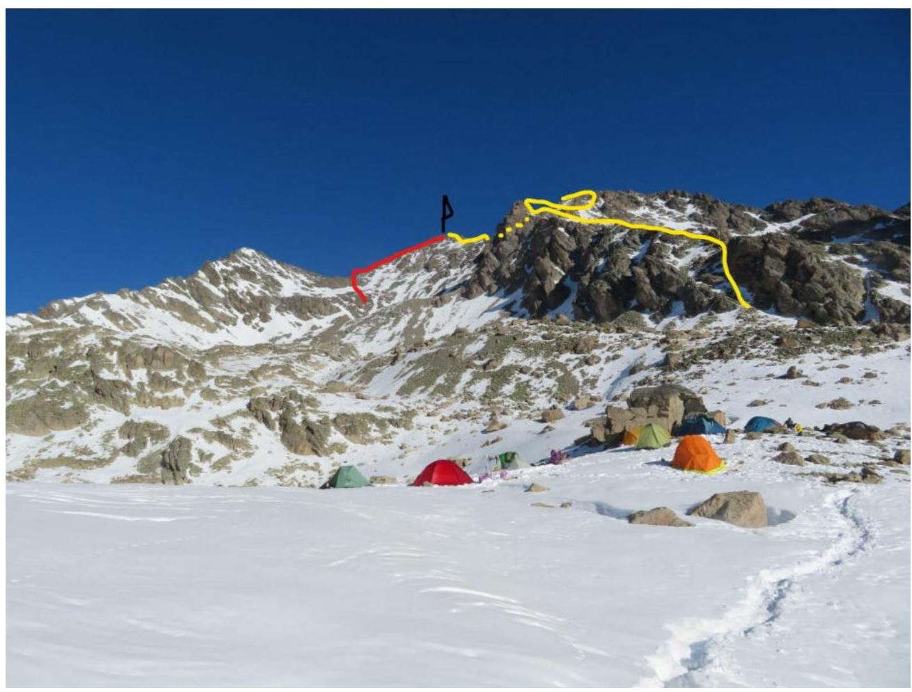
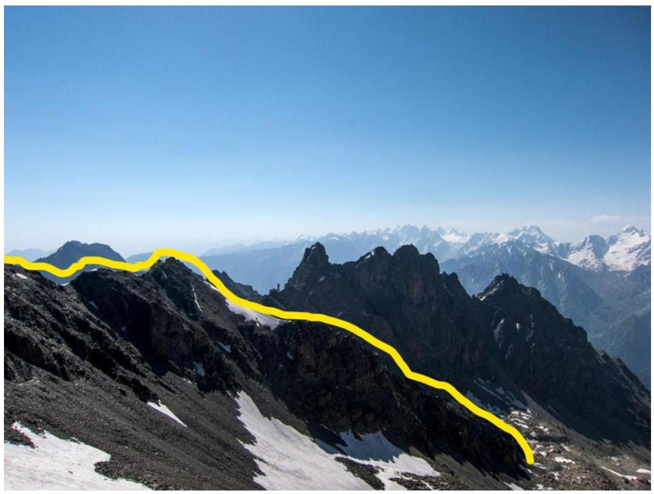
Photo of the Route Profile
Photopanorama of the Area
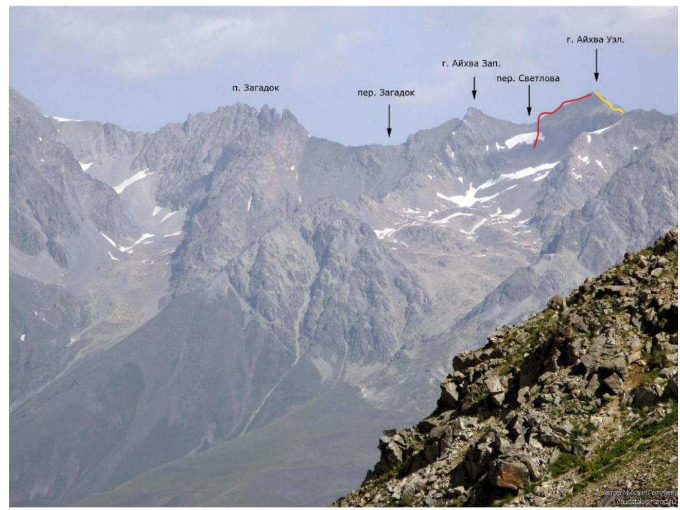
Yellow line — team's route Red line — route via the 3rd ridge, 1B category, Yu. Levkovsky
Brief Overview of the Ascent Area
The Sugansky Ridge is located in the western part of the Republic of North Ossetia. It is bounded by the Karasu and Cherek-Balkarsky rivers to the west and the Ardon River to the east. To the south, the area is separated from Georgia by the Main Caucasus Ridge. From the "Taymaz" meadow, a narrow, extended valley (Khares River) stretches westward. A dirt road from the village of Stur-Digora passes by the villages of Kussu, the "Rostselsmash" base, the "Komy-Art" alpine camp, and ends deep in the valley near a farm.
For beginner climbers and junior climbers, rock routes of 1B–3B categories on the summits of the eastern part of the Sugansky Ridge are suitable:
- Uruimagovoi (3912 m)
- Zagadok (3762 m)
- 3670 m and 3661 m
- Aykhva Uzlovaya (3791 m)
- Aykhva Severnaya (3735 m)
- Aykhva Tsentralnaya (3728 m)
- Aykhva Yuzhnaya (3725 m)
- Aykhva Malaya (3548 m)
Ascents are made from overnight stays under the Zagadok Pass and from Aykhvin camps under the Svetlov Pass. The campsites are convenient, with green areas and water. The journey from the base takes 4–5 hours. These routes, although recently laid, are already well-trodden by climbers from the "Komy-Art" base.
Approach Description
To the Western Aykhvin Cirque
From the "Rostselsmash" alpine camp, you can drive an off-road vehicle to the fork leading to the "Taymaz" alpine camp. From the fork, move straight, then along the serpentine. After the serpentine, the road improves, but after five hundred meters, there's a risky section with crumbling rock. The road leads to two shepherd's huts. From here, a steep trail ascends to the right cirque towards the clearly visible Aykhva massif. The trail rises in a serpentine along a large grassy counterfort between two streams to a flattening with convenient spots for tents. From the huts — 1 hour. Then, along the slopes of Aykhva Yuzhnaya, there's a steep ascent into the cirque to a flattening. Turn left and after 300 m, reach flat areas. From the previous campsite — 2–2.5 hours.
2. Characteristics of the Route
Technical Photograph of the Route
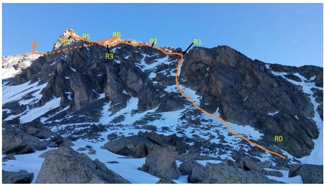
Continuation of the Technical Photograph of the Route

Technical Characteristics of Route Sections
| Section | Terrain Characteristics | Category of Difficulty | Length, m | Type and Number of Pitons |
|---|---|---|---|---|
| R0–R1 | Scree, large-block scree | 2 | 120 | 0 |
| R1–R2 | Destroyed ridge | 1; 2 | 150 | 1 |
| R2–R3 | Narrow ridge | 3 | 50 | 2 |
| R3–R4 | Ridge, right side | 2 | 100 | 0 |
| R4–R5 | Ridge, right side | 3 | 110 | 4 |
| R5–R6 | Wide, scree-covered counterfort | 1 | 250 | 0 |
| R6–R7 | Narrow ridge, pass | 2 | 70 | 0 |
| R7–R8 | Wide ridge | 1; 2 | 250 | 0 |
3. Characteristics of the Team's Actions
| Section | Description | Photo Number |
|---|---|---|
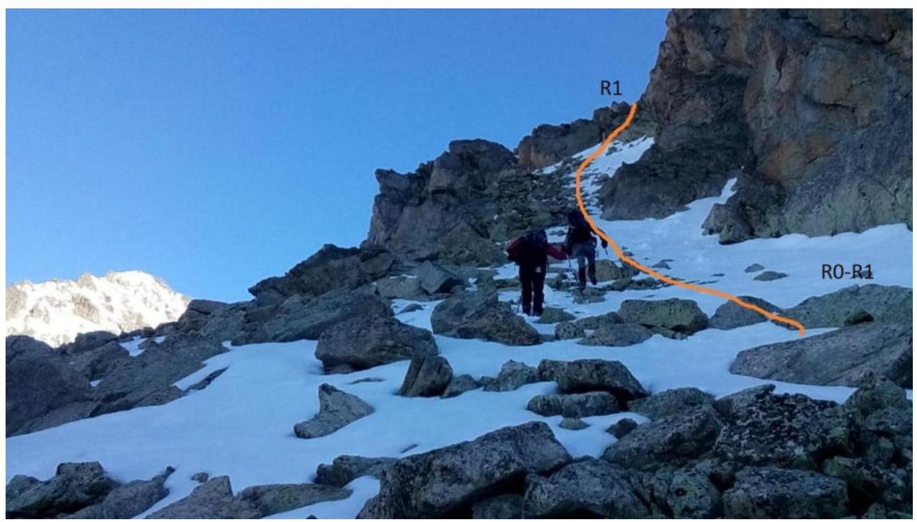
| R0–R1 | From the camp, 200 m along large-block scree towards Aykhva Uzlovaya to the start of the route. The route begins on a wide scree slope at 30–40°. To the ridge crest, 120 m. | 1 |
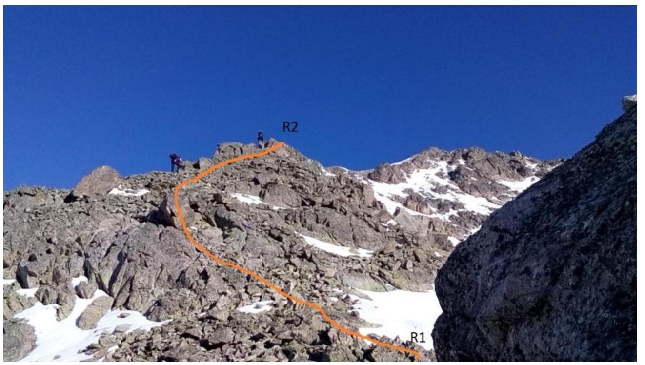
| R1–R2 | Then along the ridge, initially narrow, then wide, to the narrowing of the ridge. | 2 |
| R2–R3 | The complex narrow ridge is overcome mainly from the left side. At the end, a control cairn | 3 |
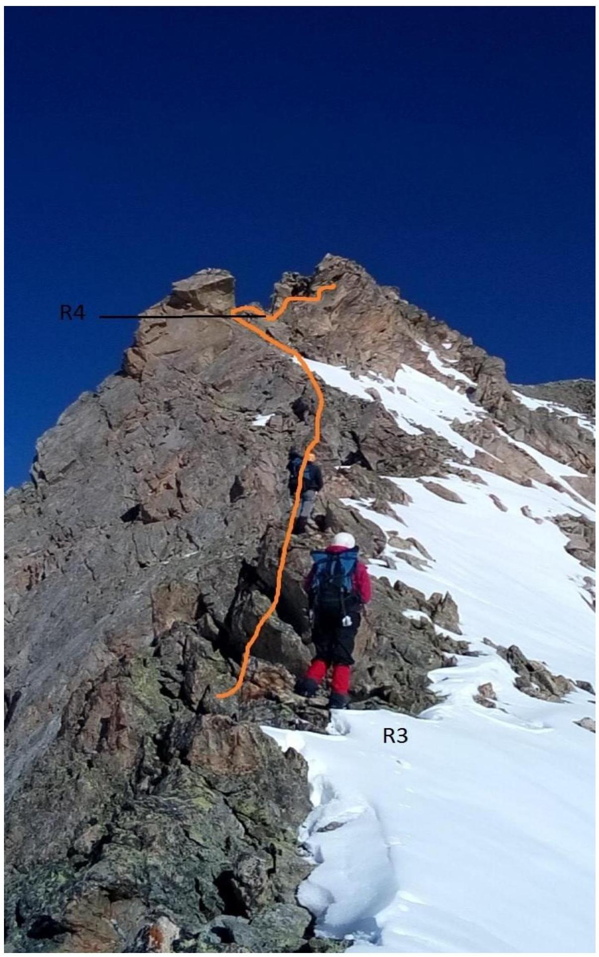
| R3–R4 | Further along the simple right side of the ridge (the left part drops down with steep walls) at 35–40° to a rocky bastion of the ridge. | 4 |
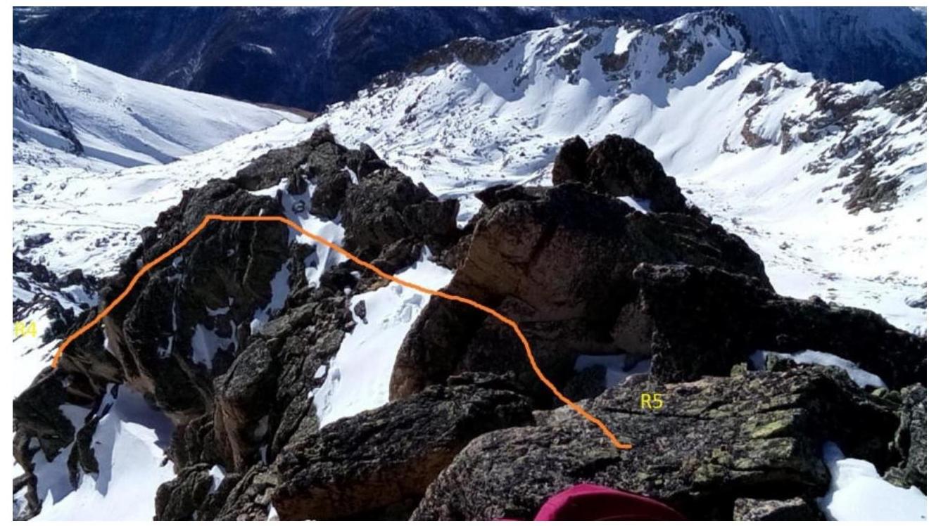
| R4–R5 | This section is bypassed on the right along scree. However, in the off-season, the bypass is avalanche-prone. | 5; 5.1 |
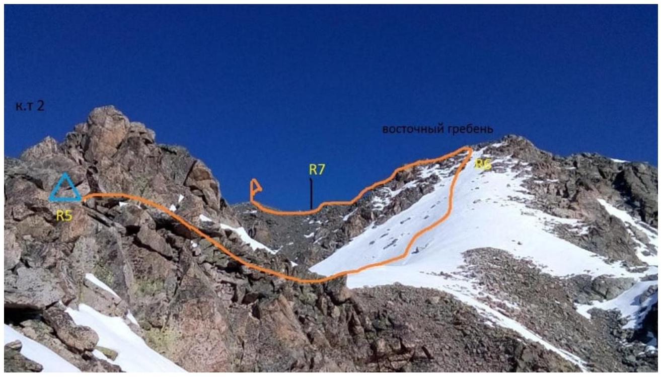
| R5–R6 | Along the rocky bastion and its right side to the flattening of the ridge. At the end of the bastion, control cairn №2. Key section of the route | |
| Ascend simple scree slopes to reach the Southeast ridge of Aykhva Uzlovaya. | 6 | |
| R6–R7 | Descend along the ridge to the Komsomolets Pass. | 7;7.1 |
| R7–R8 | From the pass, ascend simple rocks on the left side of the southeast ridge to the summit | 8 |
Start of the route R0–R1 (Fig. 1)
R1–R2 (Fig. 2)
R2–R3 (Fig. 3)
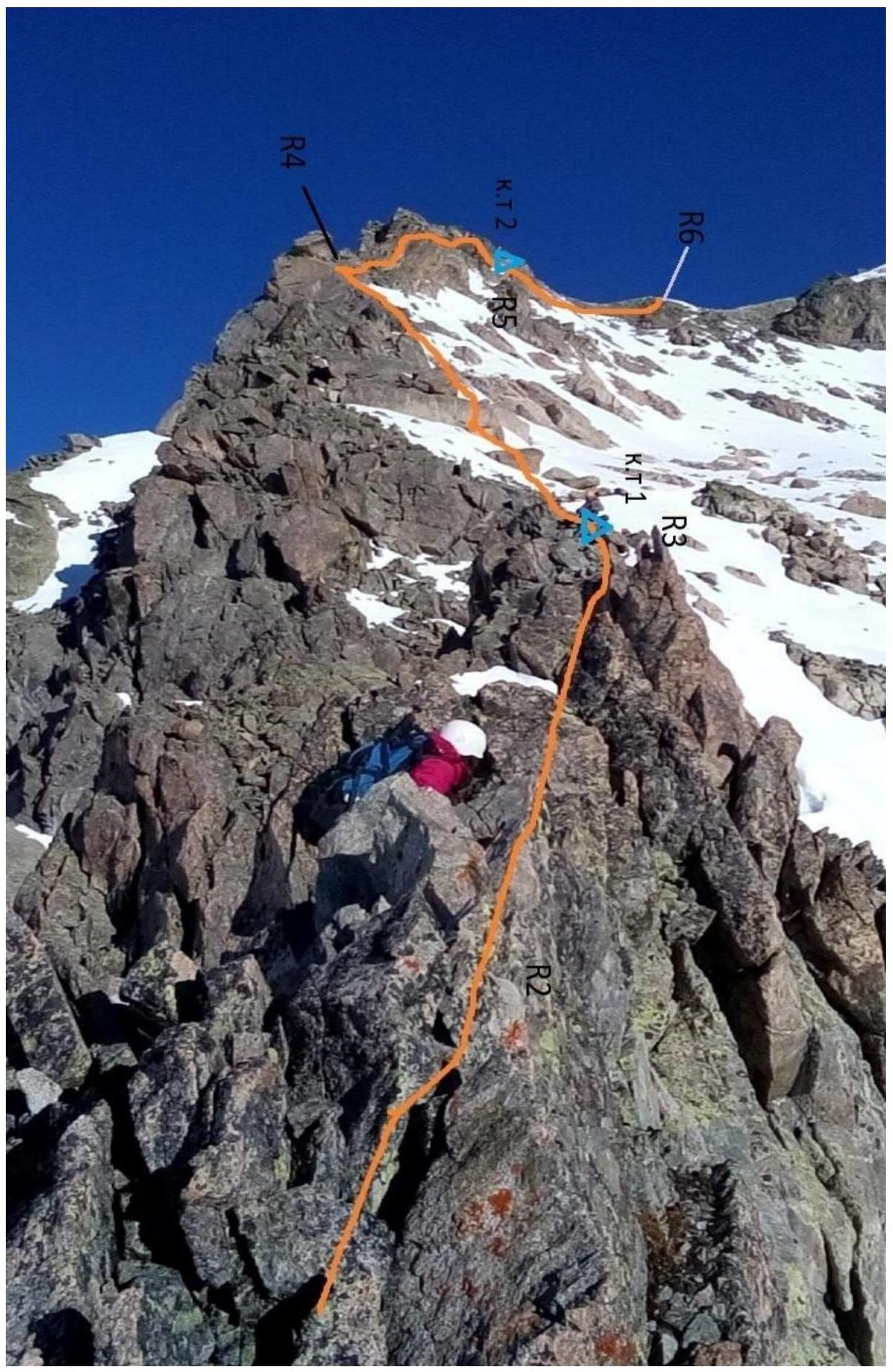
R3–R4 (Fig. 4)
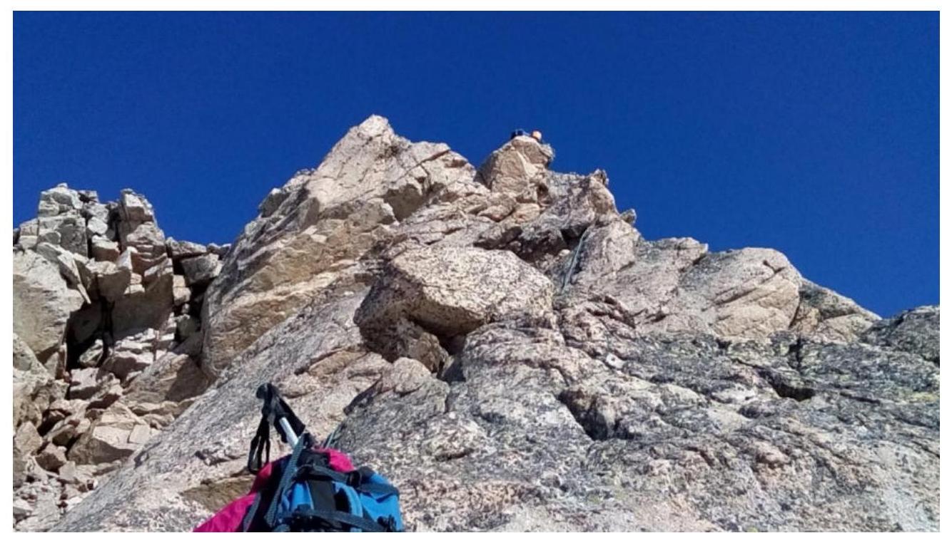
R4–R5 Control cairn №2 (Fig. 5)
Route key (Fig. 5.1)
R5–R6 (Fig. 6)
R6–R7 Komsomolets Pass (Fig. 7)
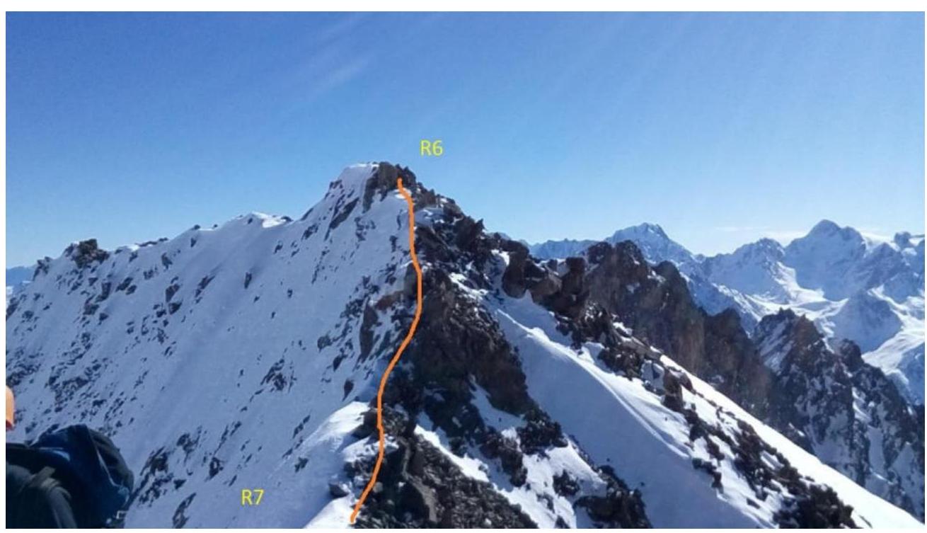
Note on the pass (Fig. 7.1)
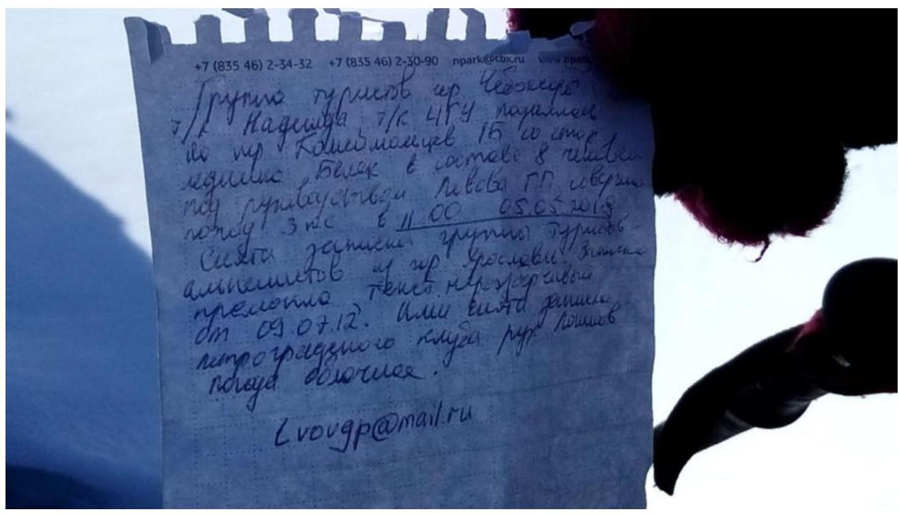
"A group of tourists, 4/R 4GU 'Uralets' from Kopeysk (Chelyabinsk) consisting of: Ledyayev Belyaev, Klimov Kuznetsov, Lebedev. Leader — Lebedev S.V. Ascent completed on 05.05.2018. Text is upside down. Left on 09.08.2012. Found by a group from the 'Ros. Prof. Rest' club, Petrozavodsk, led by Logvinov (Logvinov)"
R7–R8 Summit (Fig. 8)

Fig. 8.1. Note on the summit

Note on the Summit Date: "3" November 2018 at 11:00. Group Members: Motienko Nikolai Ilyich (instructor) Participants: Melkozerov Ivan, Burshevich Roman, Markaryan Amalia, Sviridov Daniil completed an ascent to the summit: Aykhva Uzlovaya via the route: Western ridge, 1B category From a bivouac: no Note taken by: UAL group based at Demavend Weather conditions: sunny Descent route: via the ascent route Started at 11:20. Group Leader: Motienko N.I. (signature, surname)
Conclusions and Recommendations
The route is logical and safe. In our view, it corresponds to the claimed category of difficulty. It is three times longer than the 1B category route to Aykhva Uzlovaya via the Western ridge. The area around Aykhva is very convenient for training camps, especially in the off-season. However, with a large number of classified routes, a 2A category route is noticeably lacking.