
Report on the first ascent of Ural Vostochny Peak (4273 m) via the left part of the SE wall, approximately 5B category of difficulty, by the combined team of CSKA named after Demchenko and KAiS MPEI, from August 19 to August 20, 2020.
Senior coach: Kuznetsova E.V. Team leader: Nilov S.A.
Ural Vostochny (4273 m) via the left part of the SE wall
Climbing details
| 1. General Information | ||
|---|---|---|
| 1.1 | Full name, sports rank of the team leader | Nilov Sergey Alekseyevich, Master of Sports |
| 1.2 | Full names, sports ranks of the team members | Golovchenko Dmitry Nikolayevich, Candidate for Master of Sports; Yablokov Evgeny Alexandrovich, 1st sports rank |
| 1.3 | Full name of the coach | Kuznetsova Elena Valentinovna |
| 1.4 | Organization | CSKA named after Demchenko and KAiS MPEI |
| 2. Characteristics of the climbed object | ||
| 2.1 | Region | Caucasus |
| 2.2 | Valley | From Kitlod pass to Gezewcek pass (north of the Main Caucasian Range) |
| 2.3 | Section number according to the 2013 classification table | 2.5 |
| 2.4 | Name and height of the peak | Ural Vostochnaya (4273 m) |
| 2.5 | Geographical coordinates of the peak (latitude/longitude), GPS coordinates (1) | |
| 3. Route characteristics | ||
| 3.1 | Route name | Via the left part of the SE wall |
| 3.2 | Proposed category of difficulty | 5B |
| 3.3 | Degree of route exploration | First ascent |
| 3.4 | Relief characteristics of the route | Rocky |
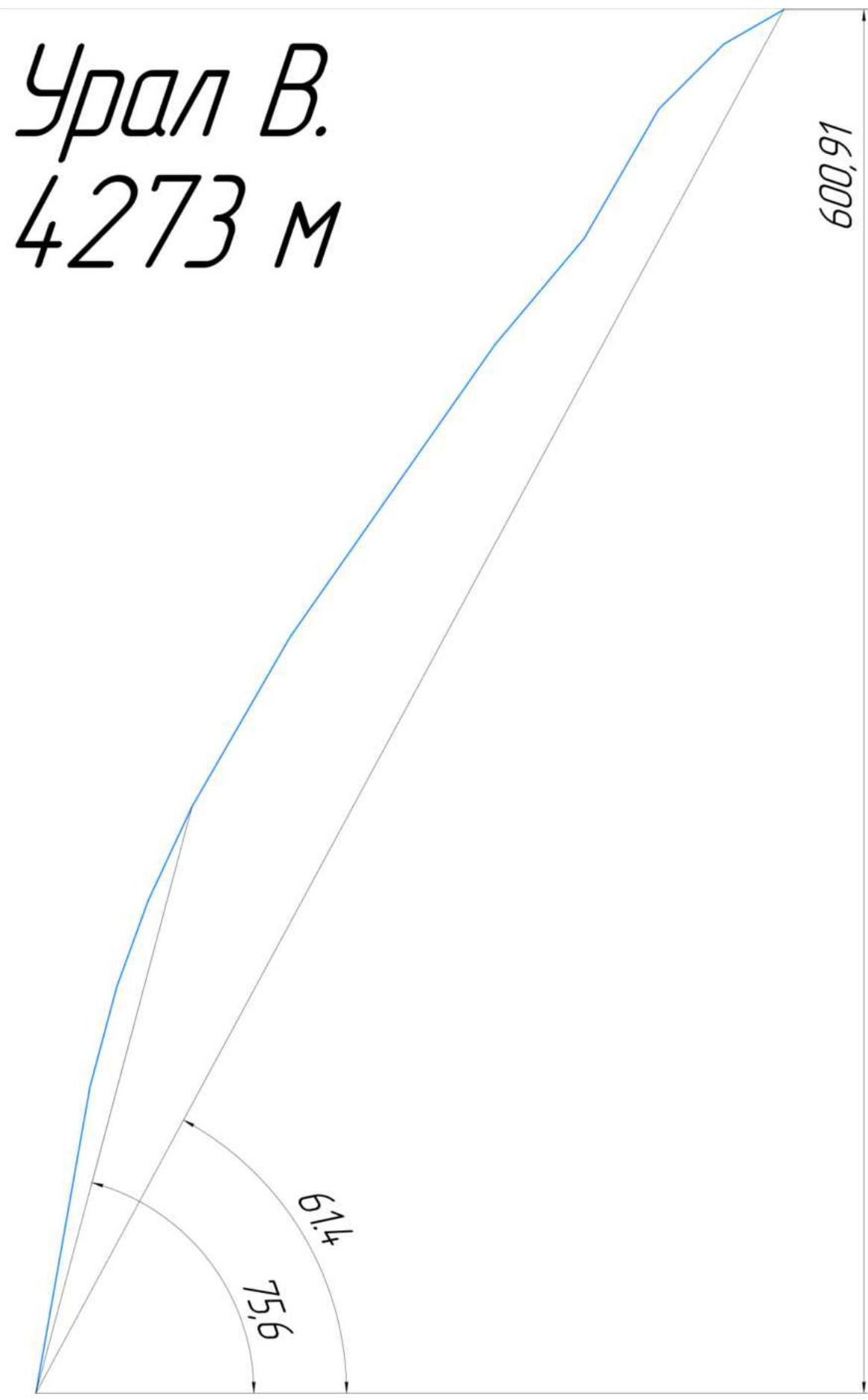
| 3.5 | Height difference of the route (altimeter or GPS data) | 600 m |
| 3.6 | Route length (in meters) | 700 m |
| 3.7 | Technical elements of the route (total length of sections with different categories of difficulty, indicating the relief type: ice-snow, rocky) | I cat. diff. ice/rock/combination — none II cat. diff. ice/rock/combination — none III cat. diff. ice/rock/combination — 30 m IV cat. diff. ice/rock/combination — 100 m V cat. diff. ice/rock/combination — 350 m VI cat. diff. ice/rock/combination — 220 m Rock VI, A3 — none Rock VI, A4 — none |
| 3.8 | Average steepness of the route, (°) | 60° |
| 3.9 | Average steepness of the main part of the route, (°) | 70° |
| 3.10 | Descent from the summit | Via the 3rd wall couloirs |
| 3.11 | Additional route characteristics | No water on the route |
| 4. Team actions | ||
| 4.1 | Time of movement (team's walking hours, in hours and days) | 21 hours, 1 day of preparation and 1 day of ascent + descent |
| 4.2 | Overnight stays | Below the route |
| 4.3 | Route preparation time | 6 hours, 1 day |
| 4.4 | Start of the route | 6:00, August 20, 2020 |
| 4.5 | Reaching the summit | 16:30, August 20, 2020 |
| 4.6 | Return to the base camp | 22:00, August 20, 2020 |
| 5. Weather conditions | ||
| 5.1 | Temperature, °C | Sunny, warm, no wind |
| 5.2 | Wind force, m/s | |
| 5.3 | Precipitation | |
| 5.4 | Visibility, m | |
| 6. Person responsible for the report | ||
| 6.1 | Full name, e-mail | Golovchenko Dmitry Nikolayevich, Mighty83@yandex.ru |
Technical photo with the ascent route thread
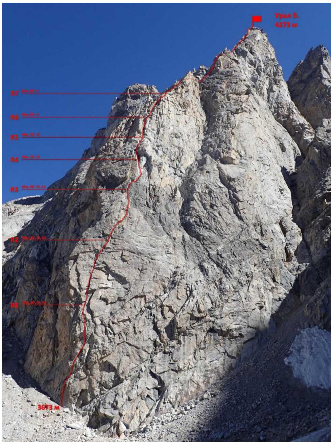
Technical photo of the route. Key sections are marked.
- Area map
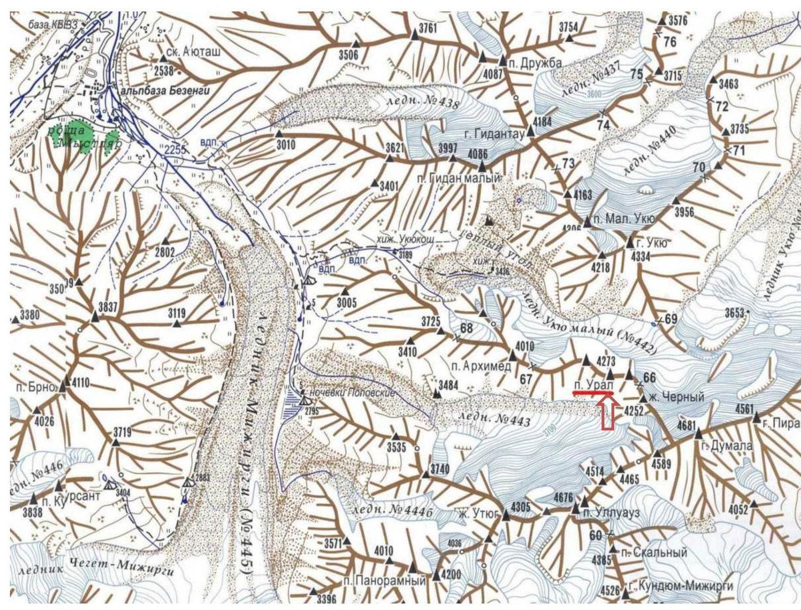
Description of the area
"Bezengi" translates from the Balkar language as "a place where a glacier descended." This is a region of the Caucasus known for its beauty and grandeur, where majestic snow-white peaks stretch towards the sky amidst the grandeur of blue glaciers.
The Bezengi region is home to six peaks above 5000 m, excluding Elbrus and Kazbek. Russian climbers call this region the "Little Himalayas" due to the severity of its peaks and eternal glaciers stretching across large mountain valleys.
The Bezengi alpine camp is located at the intersection of two valleys leading to the Northern Massif and the famous Bezengi Wall — the highest section of the Main Caucasian Range.
The Northern Massif is a giant 15-kilometer horseshoe comprising nine main peaks. From east to west, these are: Koshtantau, 5151 m — Peak Tikhonov, 4670 m — Krumkol, 4676 m — Vostochnaya Mizhirgi, 4927 m — Zapadnaya Mizhirgi, 5025 m — Peak Borovikova, 4888 m — Peak Pushkin, 5100 m — Vostochnaya Dykh-Tau, 5180 m — Main Dykh-Tau, 5204 m. To the south, the Northern Massif drops off with rocky walls, spurs, and ridges.
Within the Northern Massif are the following overnight camps: "3900," "Tëplyy Ugol," and Peak Brno.
The Bezengi Wall, stretching 12 km, includes the following peaks: Shkhara Main, 5068 m — Zapadnaya Shkhara, 5057 m — Peak Shota Rustaveli, 4960 m — Dzhanga-Tau Main, 5085 m — Katyn, 4974 m — Gestola, 4860 m — Lyalver, 4350 m — Peak "4310". From the northern slopes of this highest section of the Main Caucasian Range extends the famous Bezengi Glacier, 9 km long and up to 426 meters thick in some areas.
Before the Bezengi Wall are the following overnight camps: Mises-Kosh, Baran-Kosh, and Dzhangi-Kosh.
The Bezengi alpine camp is situated within the territory of the Kabardino-Balkarian State High-Altitude Reserve, far from civilization's bustle. Currently, it serves as a training and sports base for climbers and a comfortable resort for vacationers, characterized by friendliness and true Balkar hospitality.
Tactical actions of the team
The lower part of the route is key. On the first day, the duo Nilov–Golovchenko fixed 3 ropes.
The next day, at 6:00, the team started along the fixed ropes. At 16:30, the participants reached the summit in full and began their descent to the SW side half an hour later. By 21:00, all three were standing at the base of the route.
The lower 3 ropes are passed with the aid of ITO on fifi hooks. All stations in the key part of the route are bolted. On key sections, there are also bolts for organizing safe belays.
Anchor hooks and cams work well on the route.
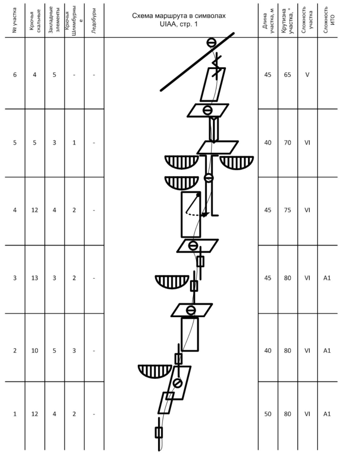
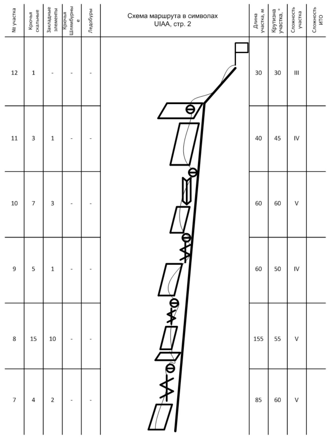
Drawn profile of the route
Brief description of the route by sections
R1 10 m vertically up a crack, then up to the right, and then through a system of slots via a series of small cornices to a semi-comfortable station. The station has a bolt. 50 m, 80°, VI, A1
R2 From the station up to the right through a blind slot under a vertical wall. On the wall, there is nowhere to belay, so 2 bolts are drilled. Further through a system of slots vertically up to a comfortable ledge. The station has a bolt. 40 m, 80°, VI, A1
R3 Move up to the right through a characteristic black slot and further through a system of slots via small overhangs up under a small wall with a bolt. From here, through an expanding crack up to a comfortable ledge. The station has a bolt. 45 m, 80°, VI, A1
R4 From the station, 20 m up under a red wall. Then 5 m traverse to the right onto white rocks. On the traverse, there is a bolt. From here, up into a chimney under overhangs. In the chimney, on a bolt, is a station. 45 m, 75°, VI
R5 Up the chimney 10 m to a large shelf under a cornice. From the shelf up through the left part of an internal corner to a comfortable shelf. The station is on a bolt. 40 m, 70°, VI
R6 From the station, up to the right onto a ridge. 45 m, 65°, V
R7 Along good, solid rocks, sticking to the left side of the ridge up towards the summit. 85 m, 60°, V
R8 Continue moving along the ridge. Periodically, there are small walls and ledges, but all return to the ridge, which is sometimes quite wide. 155 m, 55°, V
R9 Cross the upper part of a couloir from the left side of the ridge and return to the ridge. 60 m, 50°, IV
R10 Up a wall and then through an internal corner. 60 m, 60°, V
R11 Through a wall, exit onto a flattening before the summit. 40 m, 45°, IV
R12 Through simple rocks via a large fault, exit onto the summit. 30 m, 30°, III
Ascent schedule
Photo illustrations
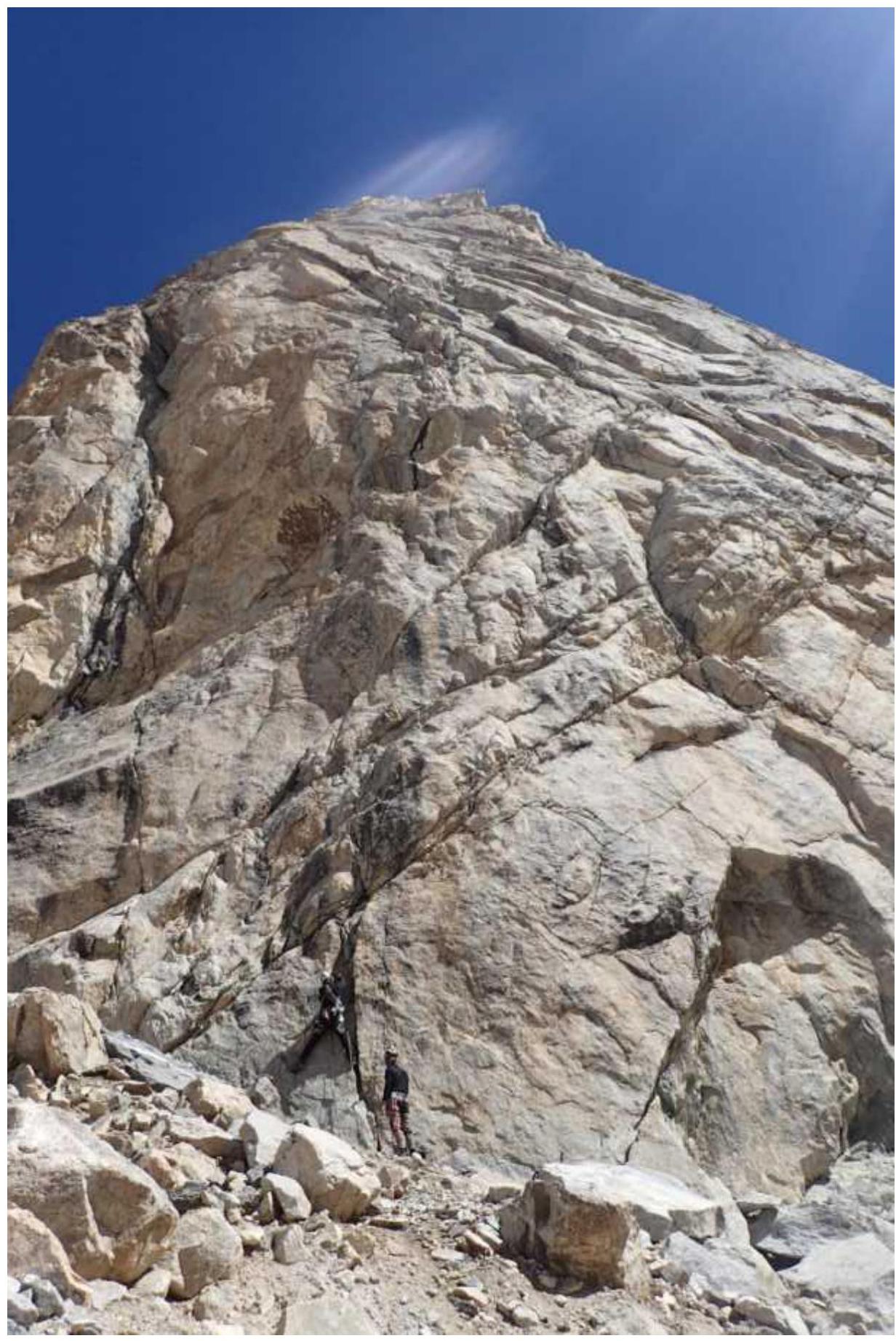
Photo 1. Start of route preparation. Section R1
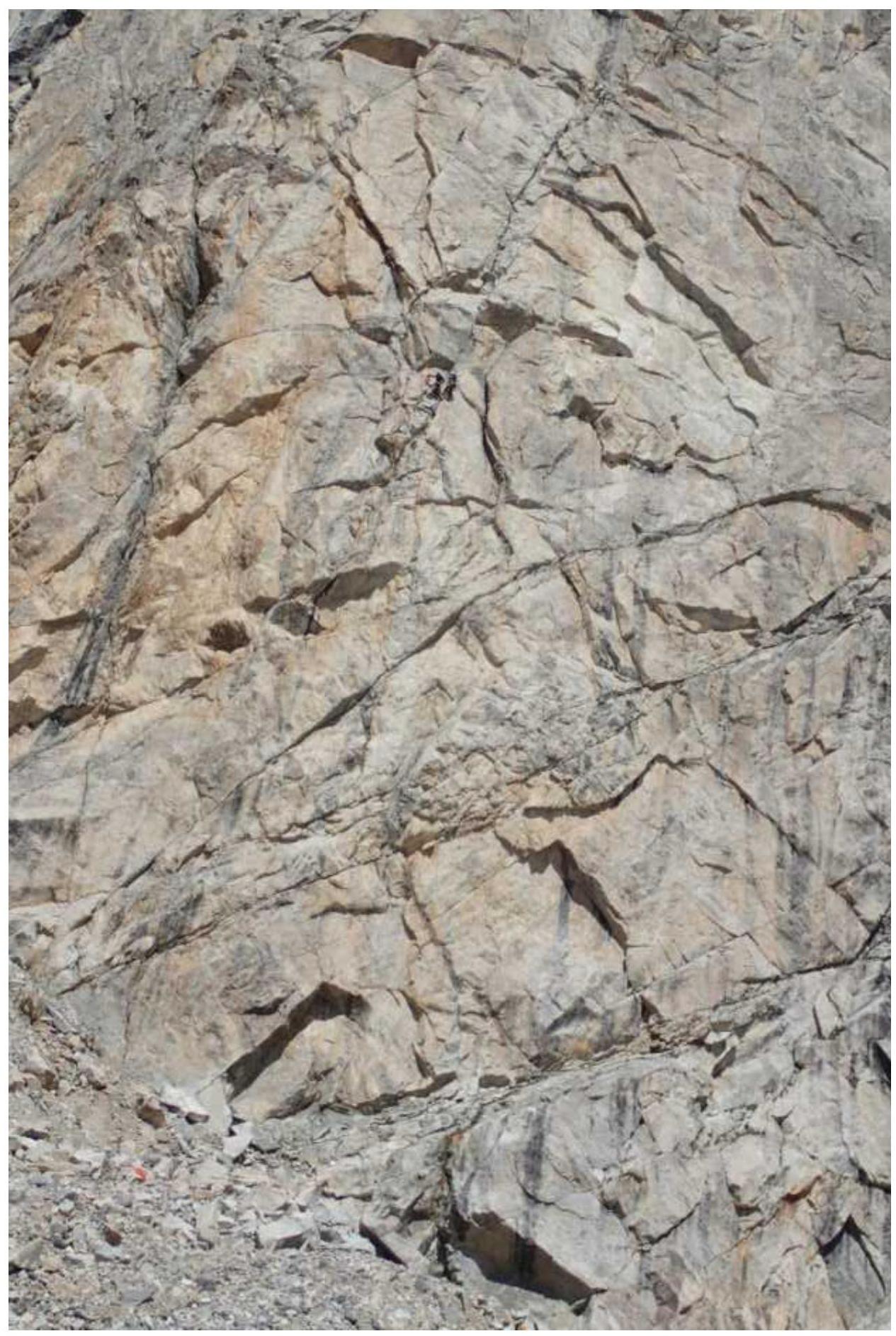
Photo 2. Nilov–Golovchenko duo at the first station

Photo 3. Section R3
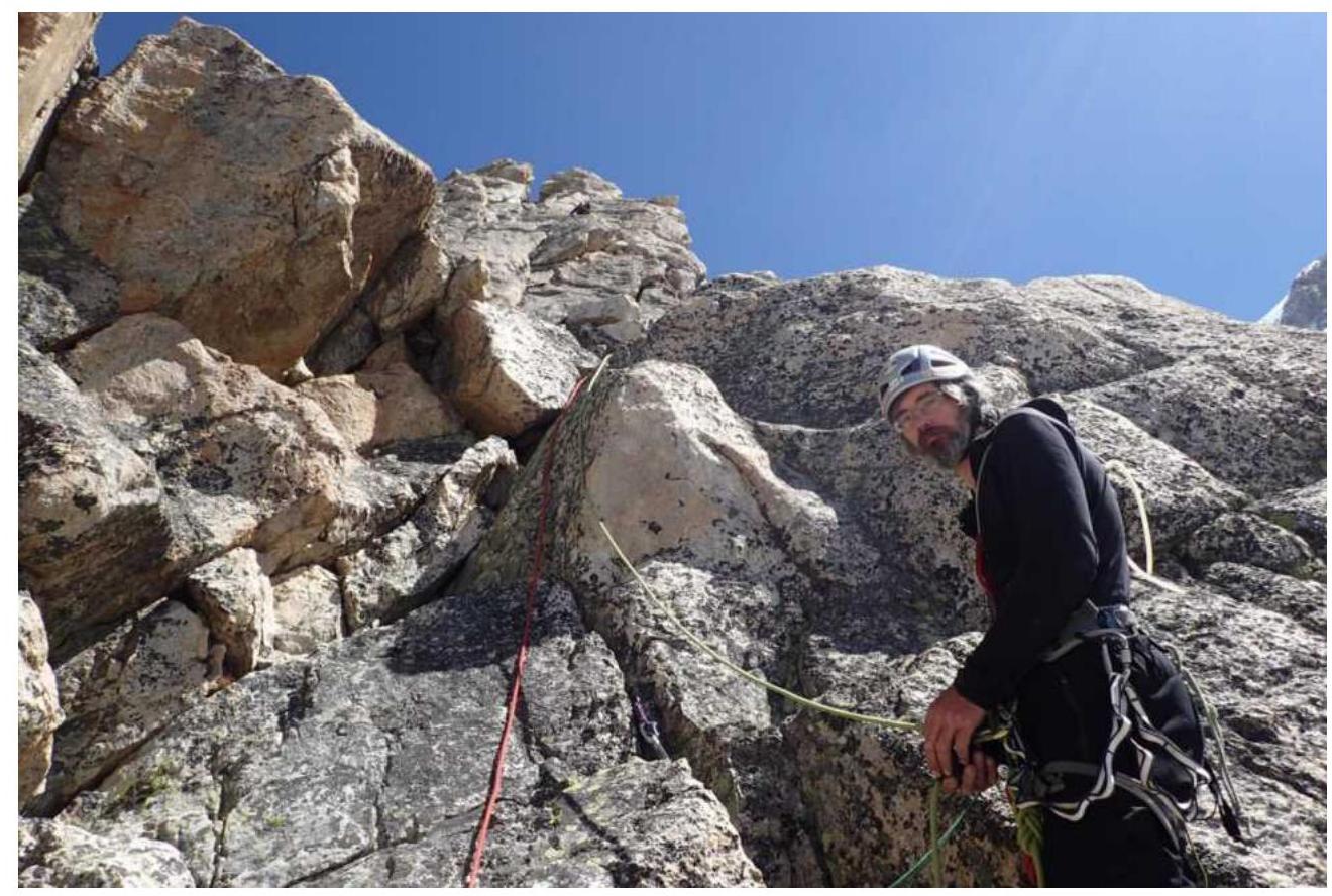
Photo 4. Sergey Nilov. Section R7
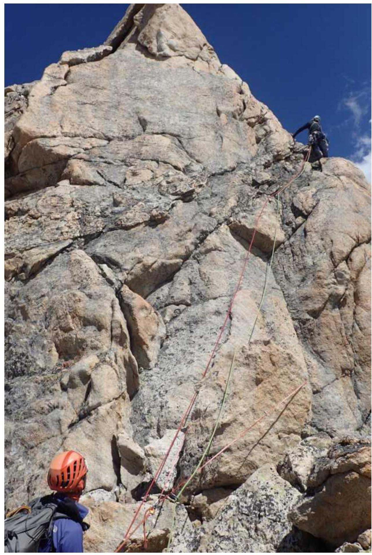
Photo 5. Yablokov–Nilov. Section R8
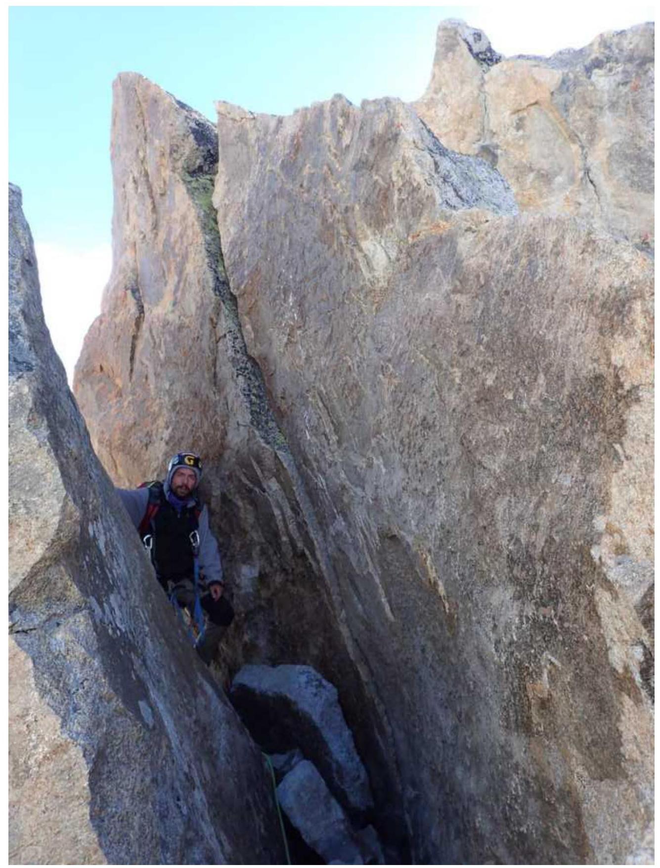
Photo 6. Section R12

Photo 7. Note from the summit
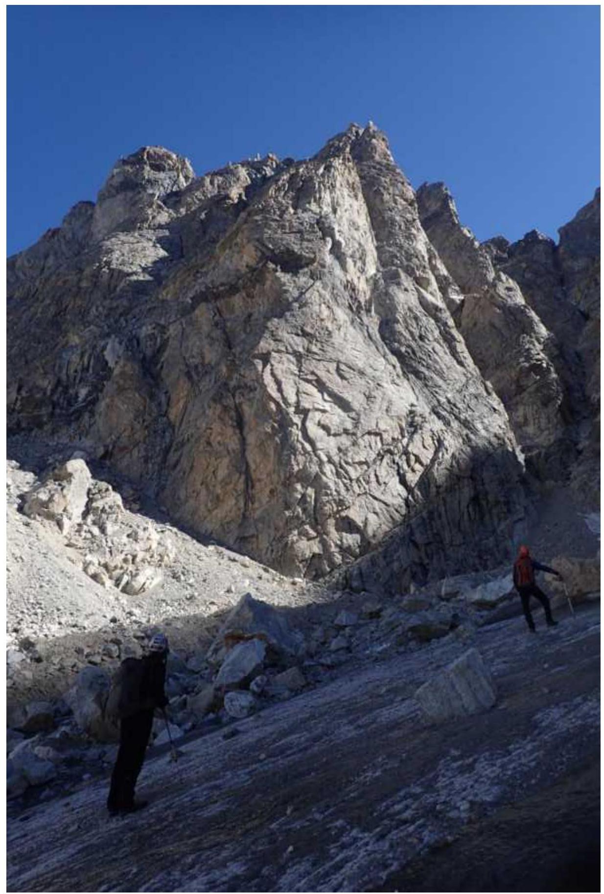
Photo 8. General photo of the summit
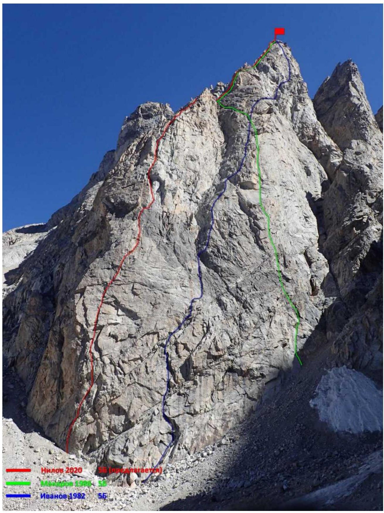
Photo 9. All routes on Ural Vostochny (4273 m) via the SE wall.
Comments
Sign in to leave a comment