Ascent Certificate
-
Ascent class — technical.
-
Ascent area — Central Caucasus, Bezengi gorge.
-
Peak Shkhara Gl., 5068 m, via the N wall of the 3rd ridge (“the bottle”), first ascent.
-
Proposed category of difficulty — 6.
-
Height difference — 1500 m.
- wall — 1450 m
- length — 3880 m
- including wall length — 3130 m
- of which 5–6 cat. diff. — 920 m
- including 6 cat. diff. — 353 m
- of which 5–6 cat. diff. — 920 m
- average steepness of the wall section — approx. 60°
-
Pitons driven:
- rock — 49/2
- chocks — 57/3
- ice screws — 98/4
-
Team's travel hours: 63 (5.5 days).
-
Overnight stays: 3 sitting on narrow ledges, 2 lying in a tent.
-
Team of the Sports Committee of the Administration of St. Petersburg and Red Fox company.
-
Team leader Shamalov Valery Pavlovich — Master of Sports of Russia Team member Krymsky Robert Shamilevich — Candidate for Master of Sports
-
Team coach Chunovkin Gury Alexandrovich, Master of Sports of the USSR, Honored Coach of Russia
-
Departure to the route July 22, 1999. Reaching the ridge July 26, 1999. Reaching the summit July 27, 1999. Return to Bezengi base camp July 28, 1999.
-
Team sponsors: Red Fox company. Information sponsors: EXS magazine, Diagonal World online magazine.
The ascent was made as part of the XVII Russian Championship in mountaineering in the technical class.
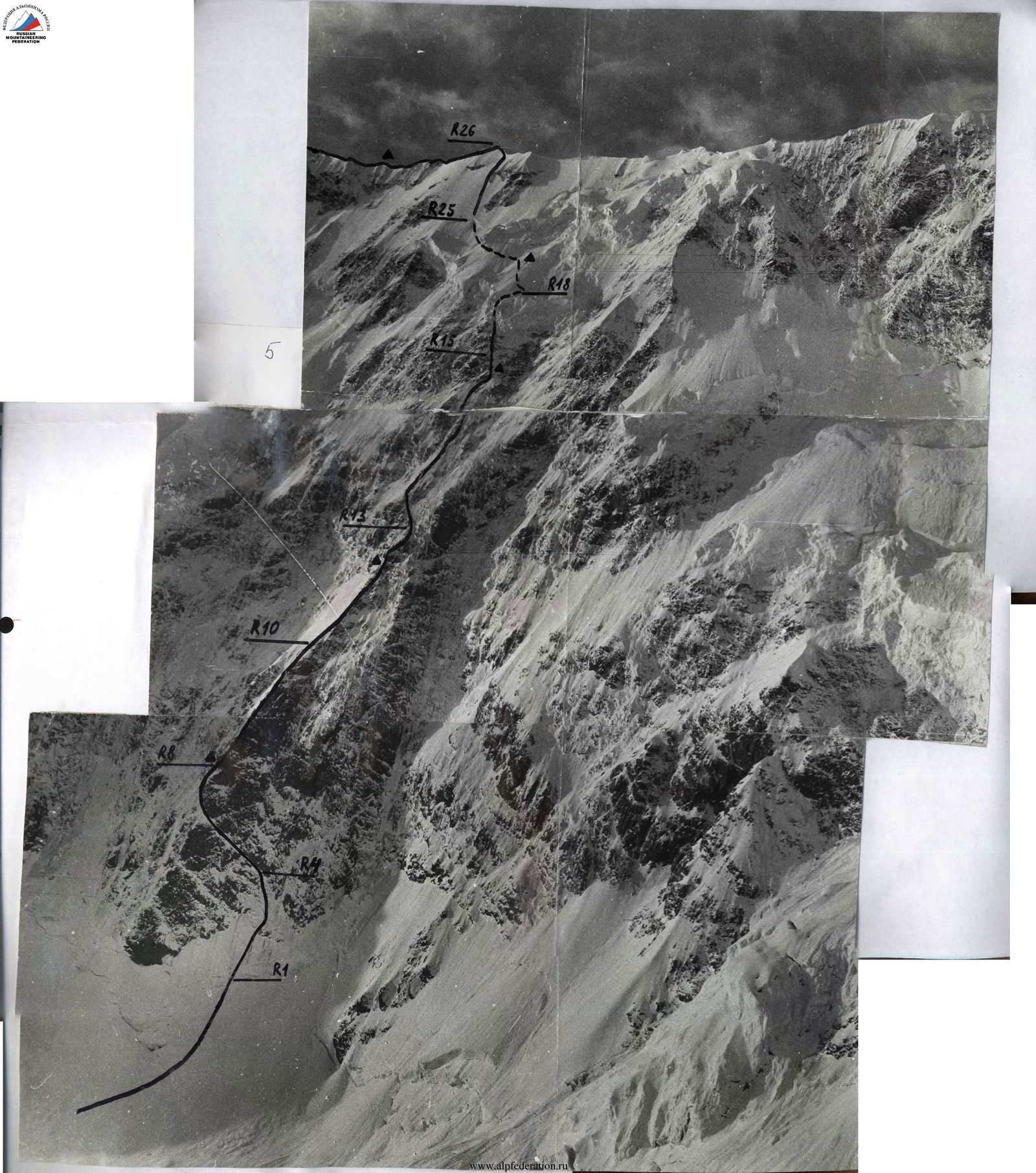
Photo 1. Routes on Shkhara Gl. from the north:
- Route via NE ridge (Kokkin, 1888) 5A cat. diff.
- Route via N edge (Tomashek, 1930) 5B cat. diff.
- Route via N wall (Krainov, 1983) 5B cat. diff.
- Route via N wall of the 3rd ridge (“the bottle”), climbed by the duo V. Shamalov – R. Krymsky, 1999, 6A cat. diff.
Routes on Shkhara West via N wall: 5. Route via N wall of W ridge (Razumov, 1981) 6A cat. diff. 6. Route via the centre of N wall (Blankovsky, 1980) 6A cat. diff.
The photo was taken from the Jangy-Kosh hut, altitude 3250 m.
5068

Photo 2. Route of the duo Shamalov — Krymsky via N wall of the 3rd ridge of Shkhara Gl. (“the bottle”).
Altitude 3250 m. The photo was taken in 1995. Sections of the route marked with a dotted line have undergone significant changes. The Shkhara peak is located in the central part of the Main Caucasus Range, on the border between Russia and Georgia. To the north of it is the Bezengi gorge, to the south are the Georgian valleys. Shkhara is the highest point of Georgia, one of the eight five-thousanders of the Caucasus.
The traditional path to the summit passes through Nalchik, from where you can drive to the Bezengi alpine base in 3–4 hours. From the village of the same name, which can be reached by bus, to the base is about 20 km. It is reasonable to use a car ordered from the base management in Nalchik.
From the base, the trail, passing over the moraine, goes along the glacier, then the gorge turns to the left. Further, after a small ascent, the trail along the moraine ridge leads to the Jangy-Kosh hut (3250 m).
- From the base, it takes 5–6 hours to walk here in the summer
- It takes another 1–2 hours to approach the northern walls of Shkhara
The summit is quite difficult to access. The simplest path — via the NE ridge (“the crab”) — 5A cat. diff., is usually traversed with an overnight stay on the ridge or on the approach. Several routes of 5B cat. diff. lead to Shkhara via the northern slopes, and there are two routes of 6A cat. diff. (Razumov's and Blankovsky's) to the western summit via the northern wall.
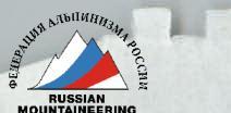
The route to the main summit via the N wall of the 3rd ridge (“the bottle”) is actually located in the centre of the N wall of the Shkhara massif and leads to the ridge approximately midway between the western and main summits. To the right, beyond a huge avalanche couloir, is Razumov's route. The “bottle” has long attracted the attention of many well-known and not-so-well-known climbers. Back in 1967, a group led by G. A. Chunovkin attempted to ascend via this path. The steepest section of the route — a 700-meter bastion, shaped like a bottle — was climbed. At the same time, this is the safest section of the route. Then you need to climb about 500 m under two bands of huge hanging snow and ice cornices, 100 m high, ready to collapse at any moment. Chunovkin's group in 1967 preferred not to take the risk, given the warming and other factors.
Since then, many groups have been declared, released, and approached this bastion, but for various reasons, they refused to climb. And they acted wisely — the northern wall of Shkhara is very dangerous. Icefalls and avalanches are so frequent there that before deciding to climb this wall, you need to:
- very carefully study the snow and ice situation,
- select equipment,
- assess your strength.
Many experienced and well-trained climbers have lost their lives due to various mistakes and miscalculations during ascents on Shkhara.
In addition, the area has a very unstable climate. Sudden snowfalls can cause an active avalanche and complicate the passage of the route. In the technical description, we will try to give a more complete picture of the various unpleasant things that can lead to tragic consequences when climbing the northern wall of Shkhara, and in the description of the team's actions — an example of how the group managed to take them into account and avoid them.
Brief technical description of the route
The route via the N wall of the 3rd ridge on Shkhara Gl. is combined, with a predominance of snow and ice relief. The route begins on the glacier at an altitude of about 3550 m, covered with fallen rocks and ice blocks. Along the wall, numerous avalanche deposits are visible. It is better to set up a tent on the approach about 500 m from the wall.
The first part of the route is a rocky bastion “The Bottle”, covered with rime ice and having a steepness of about 70°. It is most logical and safe to climb it in the middle or left part. To the right, the bastion is often hit by avalanches from a huge “avalanche collection” couloir located above “The Bottle”. To the left of the bastion is a huge avalanche deposit. The bastion is crossed by snow ledges upwards to the left. They are convenient to use when climbing. At the beginning of the route, there is a snowy ascent with deep snow about 100 m long, followed by a fairly large and steep bergschrund, about 30 m of steep firn and loose ice. Then there are two ropes of an ice slope. Here, falling rocks, ice blocks, and avalanches from the right are dangerous, which pass through the centre of “The Bottle” with their edge. It is better to traverse the entire lower part as early as possible in the morning. Then you need to move along a snow-ice ledge to the left and upwards. At the same time, on a clear day, the wall pours down streams of water, ice fragments, and icicles on the group. Backpacks and ropes get wet. The ledges lead to the left edge, where you can find a place for a comfortable sitting overnight stay.
Further, movement is upwards and to the right along simple rocks of the left edge, or along a couloir to the left of the rocks. The latter is more dangerous, as an icefall can occur along the couloir.
The upper part of “The Bottle” is the simplest and safest part of the route. However, after passing it, it turns out to be surprisingly difficult to find a good place to spend the night. There are:
- loose, crumbling rocks,
- problems with belays.
After a small steep rocky bastion — about 50 m — the route leads to snow-covered “ram's foreheads” in the lower part of the “avalanche collection” couloir. This is one of the most dangerous sections. With a constant threat of an avalanche directly on the group, you need to traverse about 100 m with poor belays, securing the rope on ice screws, partially screwed into rime ice. It is highly desirable to use:
- “firn” ice screws (with wide tubes)
- equipment suitable for loose ice
You need to traverse this section extremely quickly and as early as possible in the morning.
Above, you need to move to the left and between rocky outcrops, trying to use them as cover in case of a possible icefall. Under no circumstances should you go to the right along the couloir or move to the left from the indistinct rocky ridge formed by these outcrops (nunataks). About 500 m of the path mostly passes along rocks covered with a thin layer of snow and rime ice. It is advisable to have a full arsenal of belay means to take advantage of any opportunity — to drive a piton into a micro-crack, screw an ice screw into a crack filled with ice, etc. Further, a snow-ice cornice about 100 m high appears above. It is very difficult and dangerous to go around it to the right or left. Due to constant icefalls, the rocks everywhere have the shape of “ram's foreheads” without holds, covered with rime ice. In addition, walking for several hours along couloirs where large avalanches occur several times a day is unjustified risk. It is more reasonable to climb the overhang directly upwards. In the lower part, the wall is icy, and there are also a number of snow drifts forming ledges. To climb steep ice (up to 90°), “fifi” are required. In the upper part, the ice becomes soft and loose, yellow in colour. You need to use branded ice screws. In the last 20–30 m, the ice disappears altogether. Here, the first climber, moving on “fifi” with ice screws, may suddenly find himself in a situation where it is impossible to organize a belay or secure a rope. The steepness of the wall is about 100°. You need to have a hammer and an ice axe with you. Then, by digging a deep hole in the wall, you can drive an ice axe into the firn with a hammer.
After the cornice, there is a snowy slope with a steepness of 35–40°. 5–7 m from the edge, yellow ice appears under the snow. You need to secure the rope for the ascent of the remaining participants. It is easiest to screw in two ice screws. But this should not be done — they can be pulled out with one good jerk by hand. You need to drive an ice axe into the yellow ice using a hammer.
The second band of ice cornices is easily bypassed along the slope to the left. Then, through a steep but not high bergschrund, there is an exit to a long snowy slope, and along it — to the ridge. When moving along the slope:
- Belay through an ice axe.
- The first participant needs to have ice screws (ice appears in the upper part) and an ice hammer, as in many places very dense firn does not allow easy driving of an ice axe for belay.
Further along the ridge, sometimes bypassing cornices — 2–3 hours of walking to the summit.
It is easiest to descend from the main summit of Shkhara via the NE ridge (“the crab”), 5A cat. diff.
Description of the route by sections
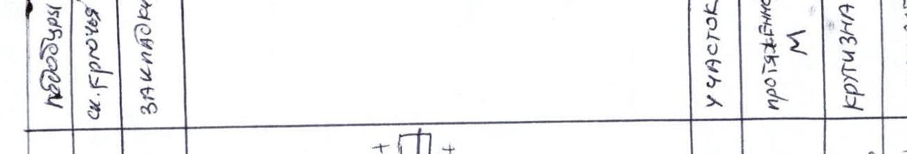
R0. Snowy slope. Movement without belay. 100 m 40° 1 cat. diff. R1. Bergschrund. Snow-ice wall. Loose ice. Belay via ice screws. 30 m from 70 to 90° 5–6 cat. diff. A2. R2. Ice slope covered with snow. Ice screws. 100 m 45° 3 cat. diff. R3. Snow-ice slope with rocky outcrops. Ice screws. 70 m 55–65° 4 cat. diff. R4. Snow-covered rocky ledge leading to the left and upwards. Rock pitons, chocks. 150 m 50–60° 5A cat. diff. R5. Rocky ledge with rime ice to the left and upwards. Rock pitons, chocks, ice screws. 50 m 60° 5B cat. diff. R6. Snowy edge. 30 m 50° 4B cat. diff. R7. Snowy ledge bypassing a rocky wall to the left. 20 m 50° 4B cat. diff. R8. Rocky wall with rime ice. Rock pitons, chocks, ice screws. 50 m 70–80° 6 cat. diff. Sitting overnight stay on a wide (about 1 m), but short rocky ledge. R9. Crumbling rocks. Rock pitons, chocks. 250 m 50–55° 4 cat. diff. A2. R10. Ice slope covered with snow. Ice screws. 300 m 45–50° 4 cat. diff. R11. Ice wall. Ice screws. 50 m 65° 5 cat. diff. Sitting overnight stay on a narrow ledge cut into a rocky slope. R12. Rocky wall with an oblique crack to the right and upwards. Chocks. 20 m 75° 5 cat. diff. R13. Snow-covered rocks with rime ice. Very difficult to organize belays. 120 m 50° 6 cat. diff. One of the most dangerous sections. R14. Rocky slope covered with snow. Difficult to organize belays. Rock pitons, chocks, ice screws (can be screwed into cracks filled with ice). 450 m 45–50° 5 cat. diff. Sitting overnight stay on a rocky ledge. R15. Rocky slope with ice couloirs. Rock pitons, chocks, ice screws. 150 m 50° 5 cat. diff. R16. Ice wall. Ice screws, fifi. 50 m 80–90° 6 cat. diff. R17. Snowy ledge. Firn ice screws. 100 m 60–70° 5 cat. diff. R18. Traverse to the right along a snowy ledge. Belay via an ice axe. 20 m 70° 6 cat. diff. R19. Descent downwards and to the right along a snowy slope (10 m 80°) and ascent to the right and upwards along a firn overhang. Belay via an ice axe. 5 m 95–100° 6 cat. diff. R20. Traverse along a snowy ledge to the right. 15 m 65° 5 cat. diff. R21. Firn wall. Belay via an ice axe. 5 m 90° 6 cat. diff.
The relief on sections R16–R21 changes every year due to icefalls and the movement of the hanging glacier. On sections R2, R10, R14, the movement is alternating, on the remaining sections of the wall, it makes sense to organize fixed ropes. R22. Snowy slope. Simultaneous movement. Lying overnight stay on a snowy ledge. Traverse along the slope to the left. 500 m 35° 1–2 cat. diff. R23. Snowy slope. Alternating movement. Belay via an ice axe. 50 m 50° 4 cat. diff. R24. Bergschrund. Ice screws. 3 m 100° 6 cat. diff. R25. Snowy slope. Belay via an ice axe, in the upper part — ice screws. Alternating movement. 500 m 50° 4–5 cat. diff. R26. Ridge with snowy cornices. Alternating movement. 350 m 4 cat. diff. Lying overnight stay. R27. Snowy ridge. Simultaneous movement. 400 m 2 cat. diff.
Tactical actions of the team
As preparation for this extreme ascent, V. Shamalov, in a duo with A. Chernikov, made an ascent on Shkhara Gl. via “the crab”, NE ridge, 5A cat. diff. R. Krymsky climbed to an overnight stay on the NE ridge at an altitude of about 4700 m.
At the same time, excellent acclimatization was obtained, the descent path was studied, and a small supply of food was made on the summit in case of an unforeseen delay on the route.
Initially, they planned to climb the wall in a team of four. But shortly before the departure, two team members refused to participate for various reasons.
Climbing in a duo along a route that had not yet been climbed, but had already become legendary, and which frightened with its icefalls and rivers of snowy avalanches, seemed like a complete adventure. It was not for nothing that the rescue service of the Bezengi gorge categorically recommended that the group change the route. Moreover, the situation was complicated by the fact that when the group was divided, the ice equipment had to be divided too. At the same time, the duo heading for “the bottle” had the following ice tools:
- an ice axe,
- an ice hammer,
- an ice pick produced by the Leningrad Shipyard, which was used to equip alpine camps of the VTsSPS (All-Union Central Council of Trade Unions) 20 years ago,
- and fifi with rather light (uncomfortable) heads.
July 20. The group left Bezengi base camp at 15:00 and reached the Jangy-Kosh hut in 4 hours and 30 minutes.
July 21. In the morning, the group reached the northern wall of Shkhara in 1 hour and 30 minutes. Snowfall began, and the duo spent the rest of the day in a tent about 500 m from the wall.
July 22. The weather improved. Early in the morning, the duo approached the bastion in its middle part and began the ascent. Robert worked the snowy ascent first, then Valery took over as the lead. On section R2, the group was caught by the edge of a large snowy avalanche coming from the right. They escaped with minor bruises.
When they reached the ledge, the wall began to pour water on the participants. They had to put on poorly waterproof jackets and place waterproof items under the flaps of their backpacks.
Rocks and ice fragments rained down from the wall, but everything flew past their backs.
By evening, they reached the left edge. On sections R2, R5, and R8, and two ropes on section R4, the first climber ascended without a backpack, which was then pulled up on a rope.
July 24. They traversed sections R9–R11. V. Shamalov worked as the lead for most of the time. On section R9, a large rock block (about 1.5 m in size) fell out directly on him. Valery jumped 2 m to the left and immediately dug in with his crampons and two ice tools on the rime ice. The stone flew 2 m past the belayer.
In the evening, they spent 3 hours trying to widen a narrow ledge for an overnight stay. During this time, the pick of the ice pick broke off. July 24. At 6:00, they began to move upwards and traversed the first three ropes in 2 hours, bypassing the most dangerous section. V. Shamalov worked as the lead without a backpack. By evening, they traversed section R14 and cleared a small area from ice under the cover of a rocky outcrop in two hours. Large avalanches occurred several times along the couloir to the right.
July 25. In the morning, they approached the snow-ice cornice and climbed it using “fifi”. By 14:00, they found themselves on a snowy ledge about 10 m from the upper edge of the cornice, before a firn wall with a steepness of about 100°. Here, V. Shamalov, working as the lead, dug a niche the size of a large backpack in the snow and drove an ice axe into it for belay. The upper edge of the cornice lowers to the right, so Valery, using the remaining ice tool, moved to the right along a pendulum trajectory for the entire length of the rope and reached the snow fields approximately at the level of the belay point. This was done because, in case of a fall on such a pendulum, the jerk on the belay point is less than in case of a fall from above (enough for the ice axe to withstand the triple weight of the fallen climber). Having flown 15–20 m down in free fall, it would remain only to hope for the unerring actions of the belayer.
Then Valery returned to the rope to the left, drove an ice pick into the yellow ice using an ice hammer, pulled up the backpacks, and secured the rope for the ascent of the second participant.
On the snowy slope, Robert worked as the lead. They set up an overnight stay under the ice bergschrund, which protected the tent from avalanches and ice fragments.
July 26. They traversed sections R22–R25 and reached the ridge. They traversed part of the ridge (300 m).
July 27. By 12:00, they reached the summit. They began their descent via the NE ridge.
July 28. They returned to Bezengi base camp.
Throughout the ascent, the group was observed from the Jangy-Kosh hut by representatives of the rescue service of the Bezengi gorge, as well as participants of the assembly of the “Shturm” climbing club (St. Petersburg), using binoculars and a spotting scope.
The weather during the wall climb was quite clear, without snowfalls.
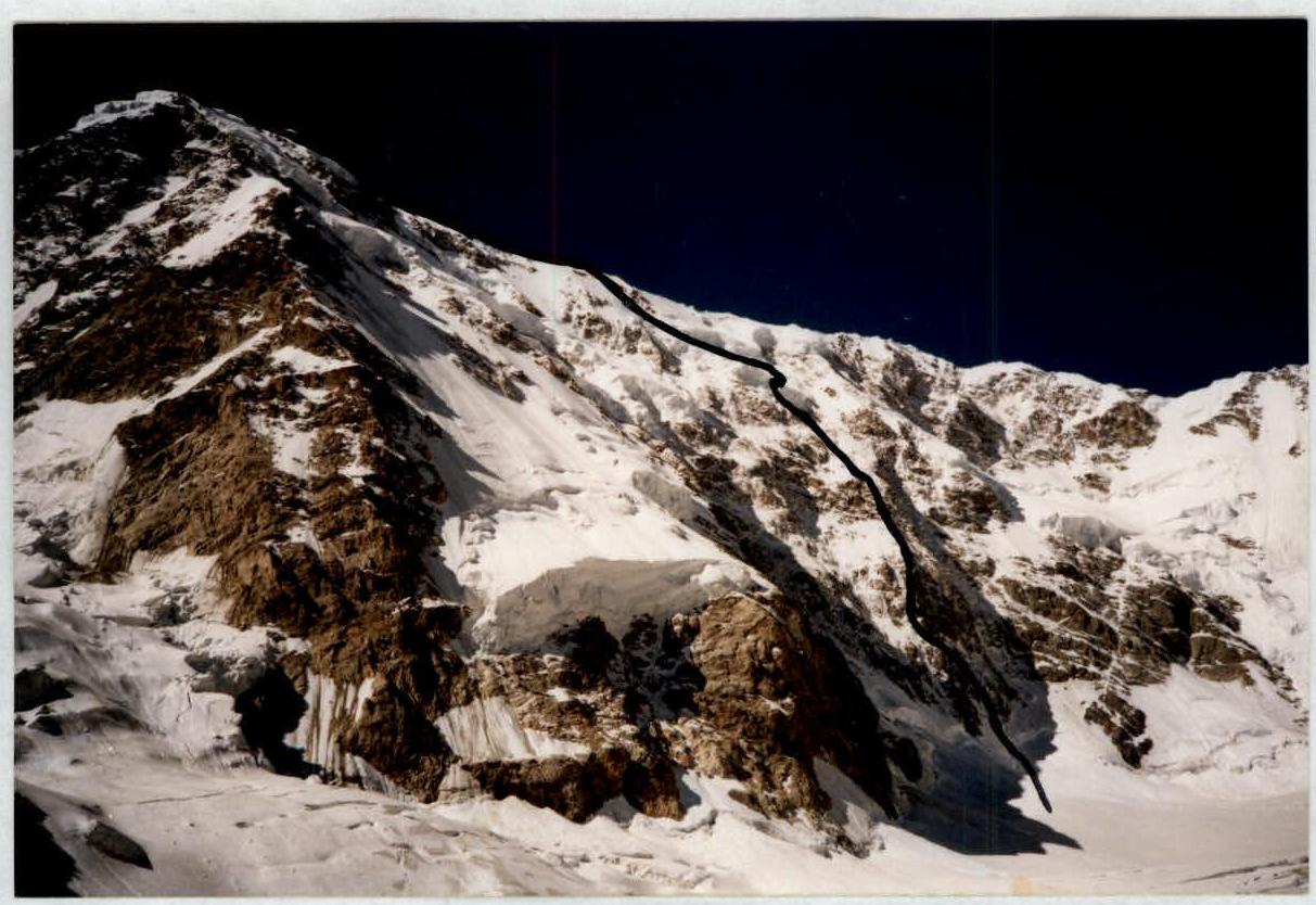
Photo 3. Northern wall of Shkhara and the route “via the bottle”. Photo taken from an altitude of about 3400 m.
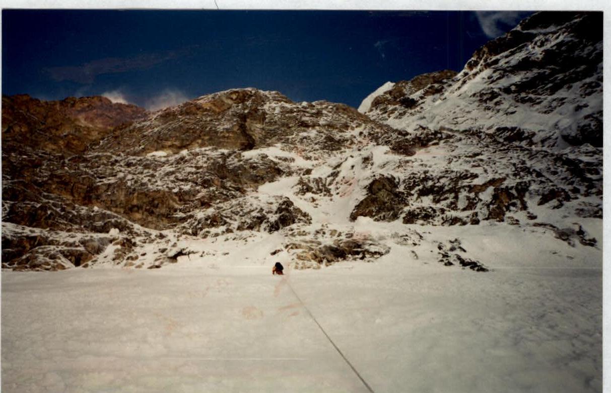
Photo 4. Section R3. Beginning of the ascent to the bastion.
Photo 5. Place of the first overnight stay.
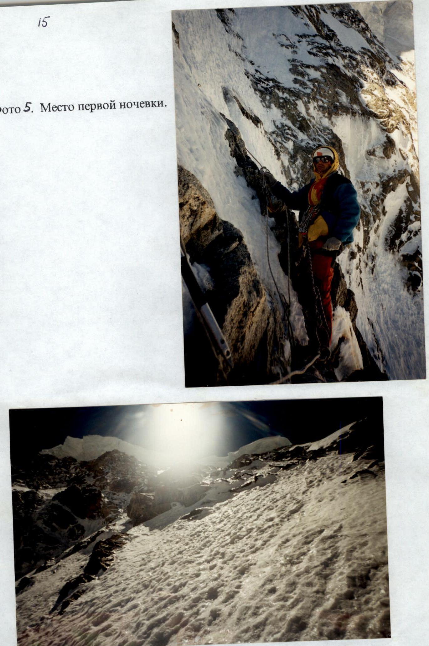
Photo 6. Upper part of the bastion. View upwards.
Photo 7. View downwards from the upper part of the bastion.
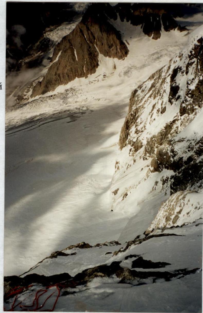
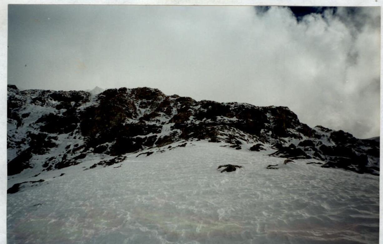
Photo 8. View of section R
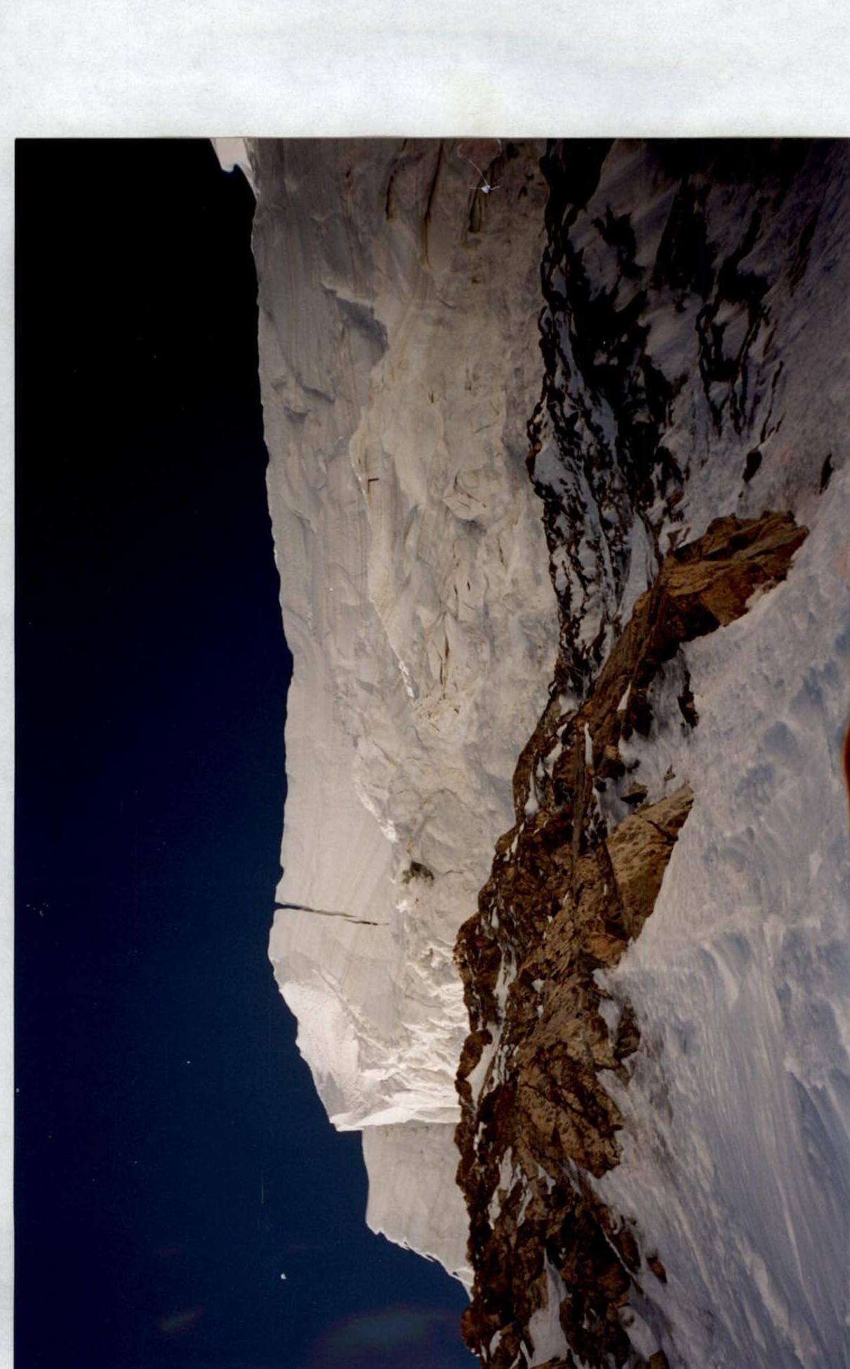
Photo 9. Approaching the hanging glacier.
DIAGRAM
 |  |  |  |  |
|---|---|---|---|---|
| - 3 | 5 | +11+ | 13 | 180 |
| -2 | - | 12 | 20 | |
| 3 | - | +1+1+ | 11 | 50 |
| - | - | 10 | 300 | |
| - 7 | 10 | 9 | 250 | |
| 1 | 3 | 5 | 8 | |
| - | - | - | 7 | 20 |
| - | - | 6 | 30 | |
| - 1 | 2 | 5 | 50 | |
| - | - | - | 4 | 150 |
| - | - | - | 70 | |
| - | - | - | 2 | 100 |
| 3 | - | - | 1 | 30 |
| - | - | - | 100 | |
| :--: | :--: | :--: | :--: | :--: |
| - | - | |||
| 2 | - | |||
| 3 | - | - | ||
| - | - | - | ||
| - | - | - | ||
| - | - | - | ||
| - | - | |||
| 6 | - | - | ||
| 15 | - | - | ||
| 2 | 6 | 9 | ||
| 8 | 9 | 11 |